John Dellenback Dunes
Cape Arago State Park was quiet, and I slept in. I took my time making breakfast, spent a little time writing, then packed up. There was a water connection on the other side of the site, so I filled the tank before heading out. I was on the road around noon.
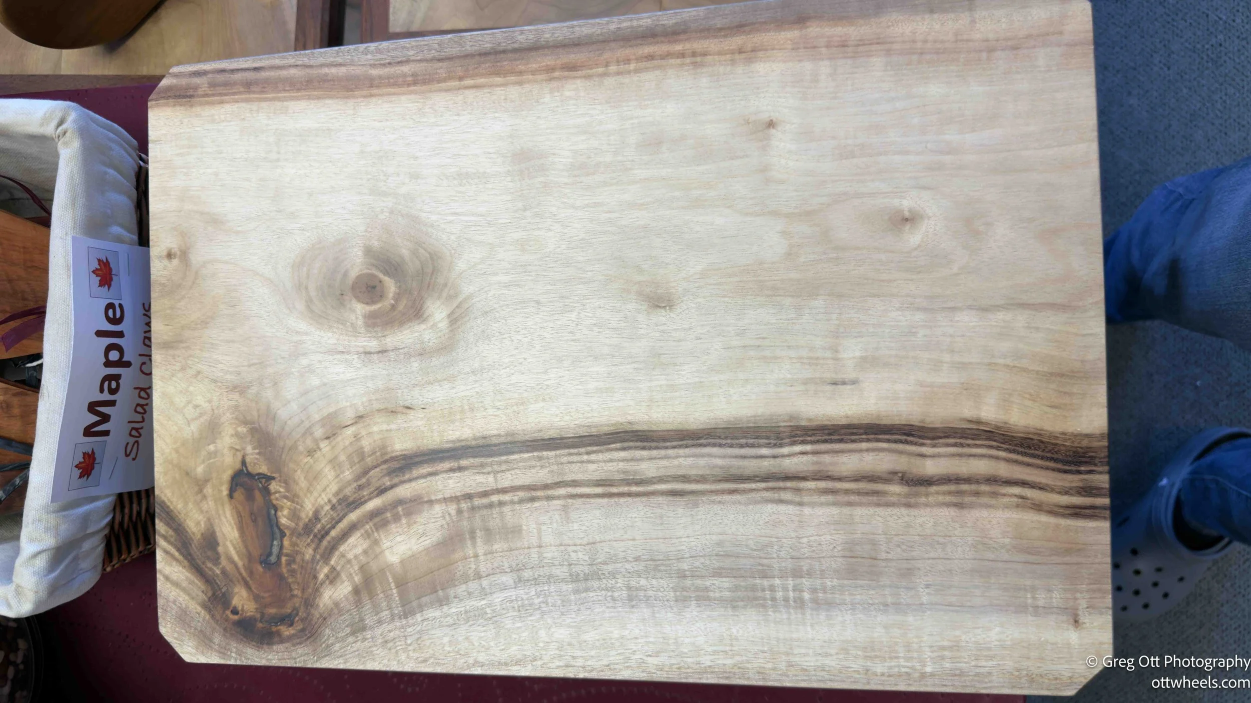
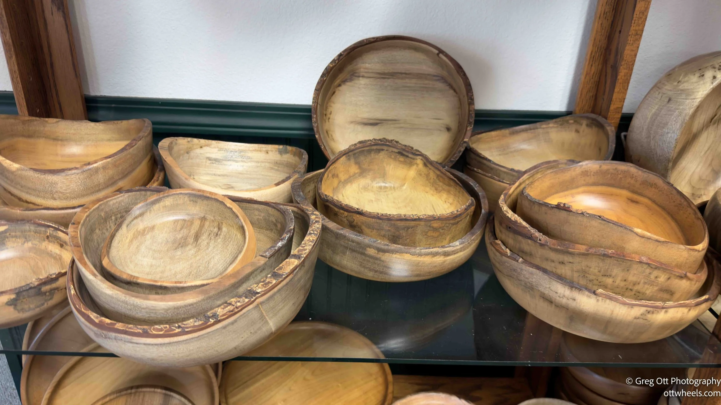
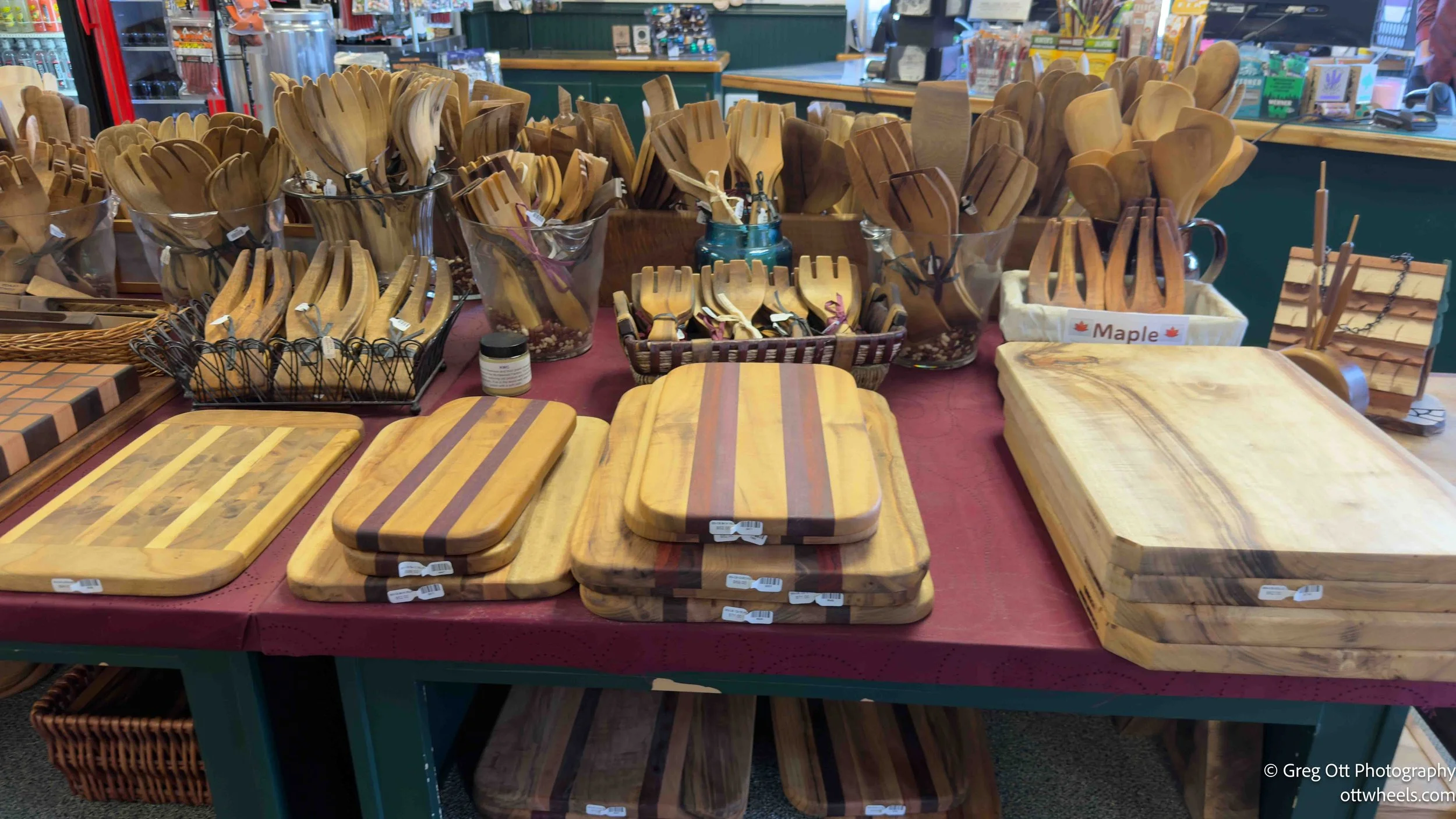
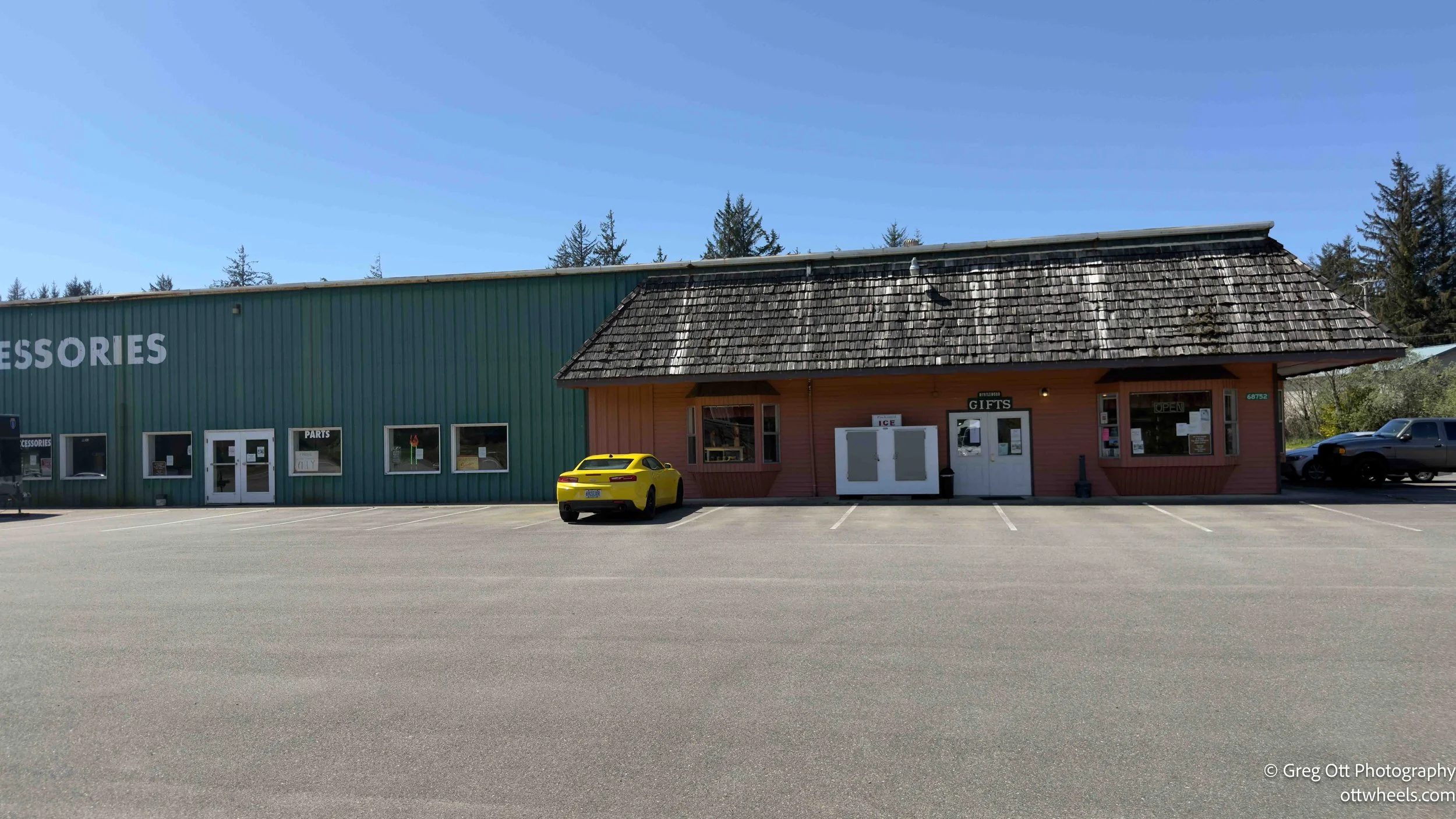
I hadn’t driven very far when I saw a shop with a large sign that read “Myrtlewood Gifts.” After learning about myrtlewood the day before, it caught my attention. A tall guy with a ponytail was at the front and welcomed me in. I told him I’d just discovered myrtlewood and didn’t know anything about it until recently. He handed me a card and explained that myrtlewood comes from the Umbellularia californica, which is actually part of the laurel family. It’s an evergreen, so the leaves stay green year-round, and the trees tend to grow in irregular, twisting shapes. That growth pattern is what gives the wood its wild, swirling grain. It reminded me a lot of olive wood—same kind of movement and contrast that immediately stands out.
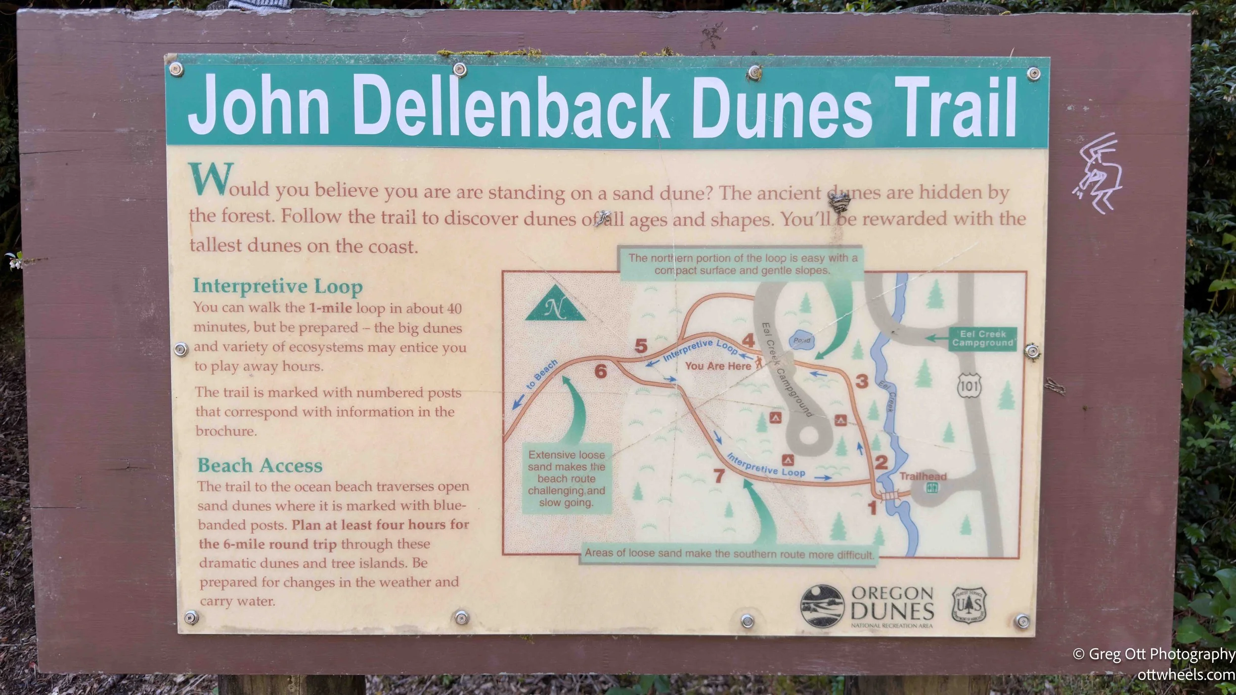
I drove north to the John Dellenback Dunes Trail near Lakeside, Oregon. The trailhead sign said six miles. AllTrails had it at 5.2 and rated it moderate, with an estimated time of two hours. That felt optimistic the moment I saw “sand” attached to the description. Hiking through sand is never fast, and it’s never easy.
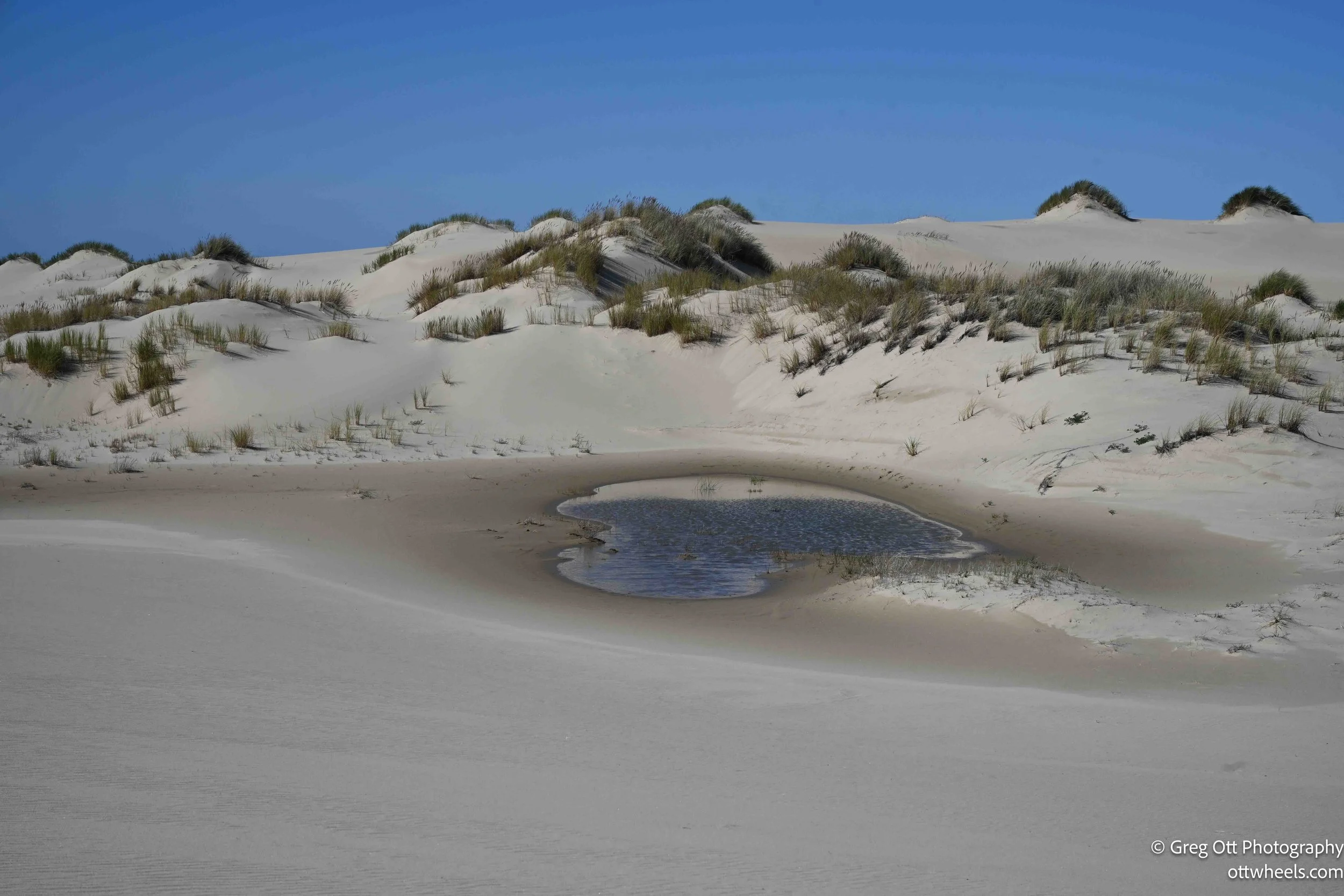
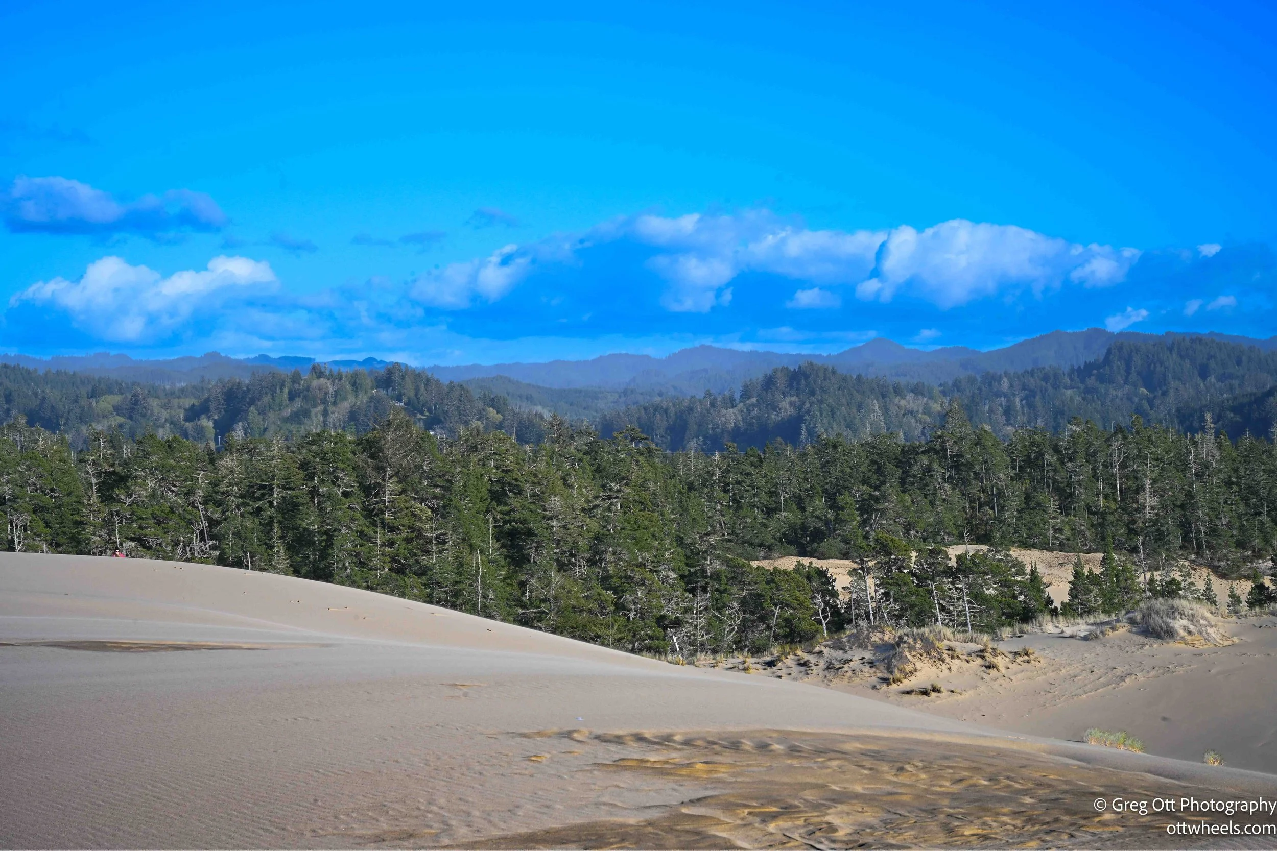
The trail sits within the Oregon Dunes National Recreation Area, part of the Siuslaw National Forest. This stretch of coastline has one of the largest expanses of coastal sand dunes in North America, shaped over thousands of years by wind, ocean currents, and shifting sediment from nearby rivers. What makes this area different is how the forest and dunes interact. The trees don’t just border the sand—they actively hold it back. Without that barrier, the dunes would continue migrating inland, swallowing everything in their path. The result is this constantly shifting edge where dense forest meets open sand, and neither fully wins.
The John Dellenback loop is a good example of that transition. It starts in forest, moves into open dune fields, cuts back through thicker vegetation closer to the coast, and then opens again before reaching the beach. There’s no single defined trail once you hit the sand—just a series of blue-topped poles marking the general route. On the way out, AllTrails follows those poles. On the return, it swings wider, which makes it feel like two completely different hikes stitched together into one loop.
I was excited about the photo potential and, for some reason, decided to bring almost all my gear—including the big tripod. A mile in, I realized that was a mistake. Way too much weight for this kind of terrain. The extra water, though, was the one smart decision.
I had seen a young couple from British Columbia in the parking lot and then again out on the dunes. They had taken the opposite direction on the loop. About a half mile in, I saw them turn back. After that, I had the entire trail to myself.
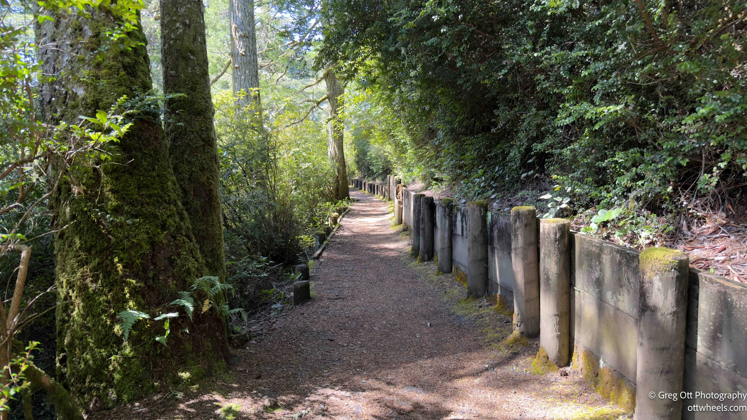
The trail starts in a dense coastal forest that’s grown directly on top of sand. You can feel it underfoot—soft, slightly unstable, nothing like a typical dirt trail. The trees are packed in tight, with low branches and a thick understory of salal, ferns, and moss. This stretch feels protected, almost insulated from the open exposure of the dunes. And that’s exactly what it’s doing—this forest is the line holding the sand in place, slowing its movement inland. Without it, this whole area would look very different.
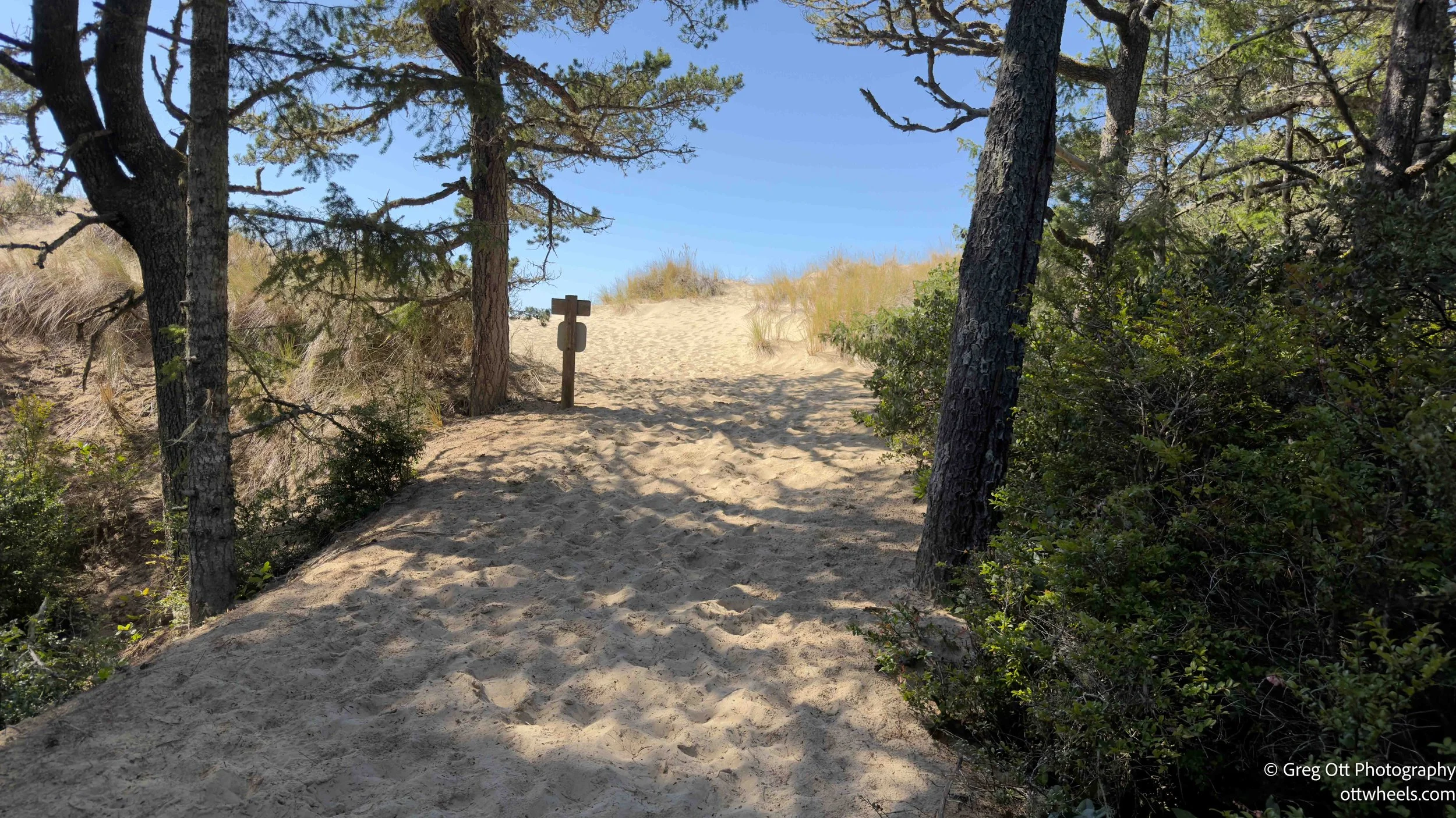
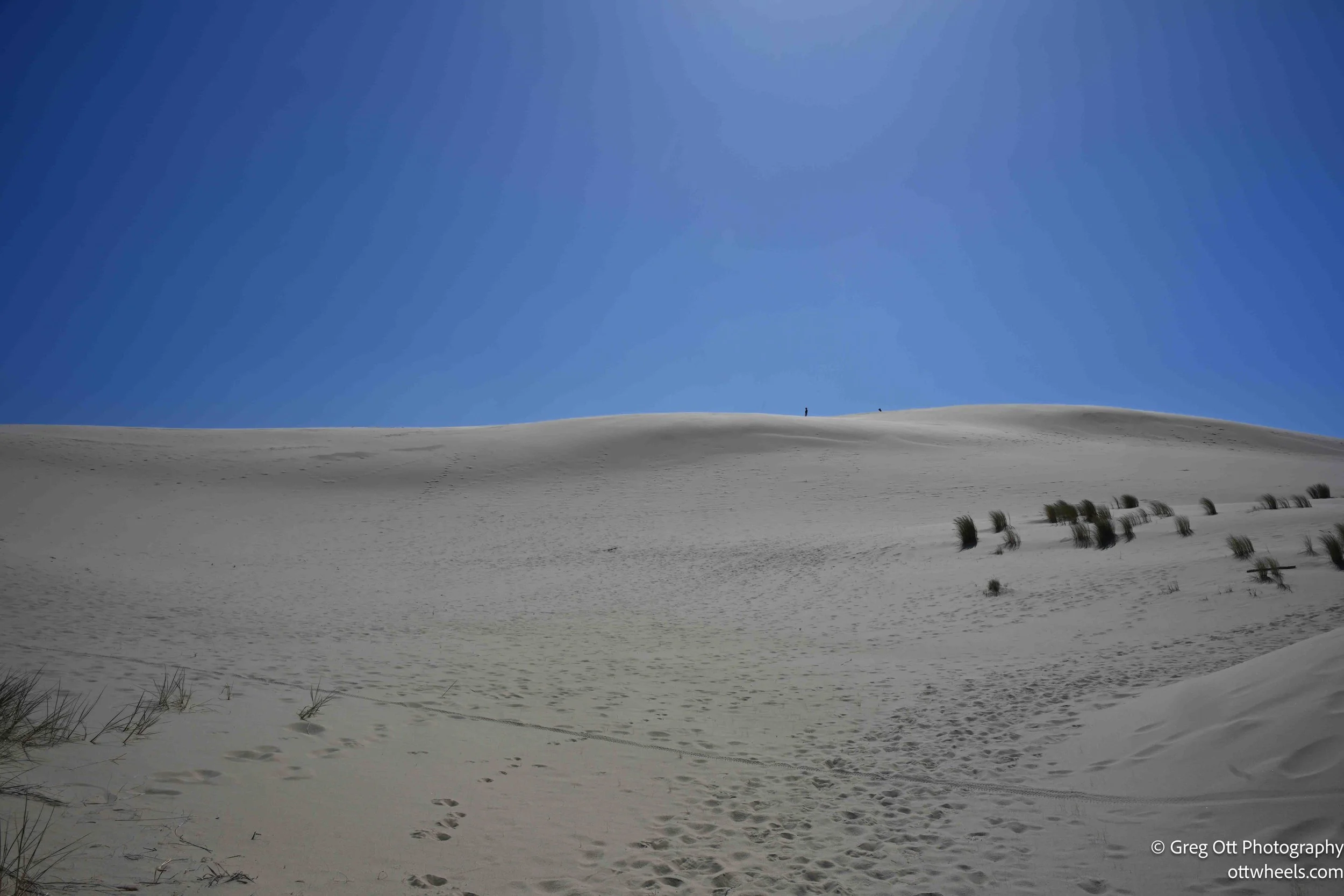
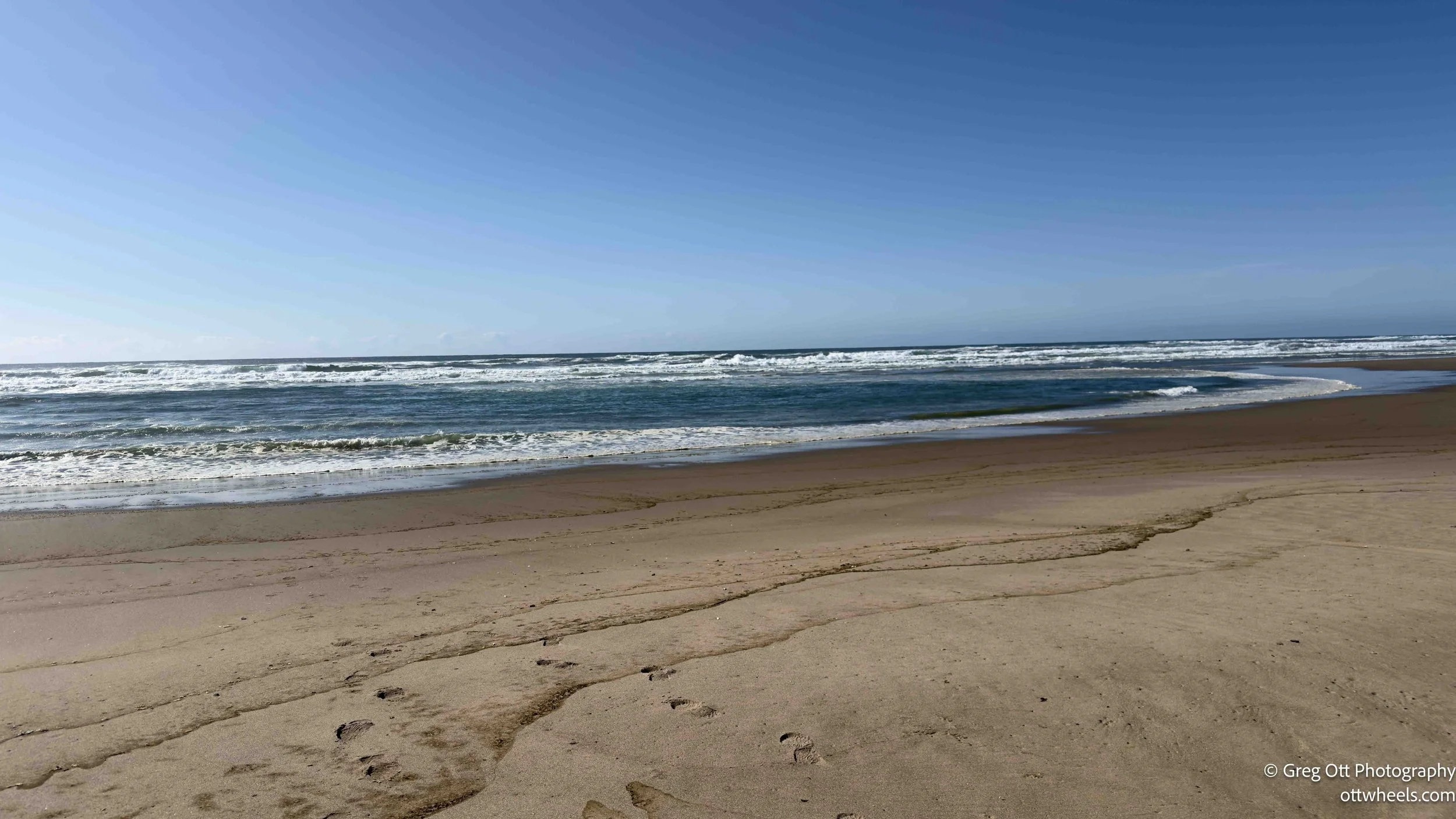
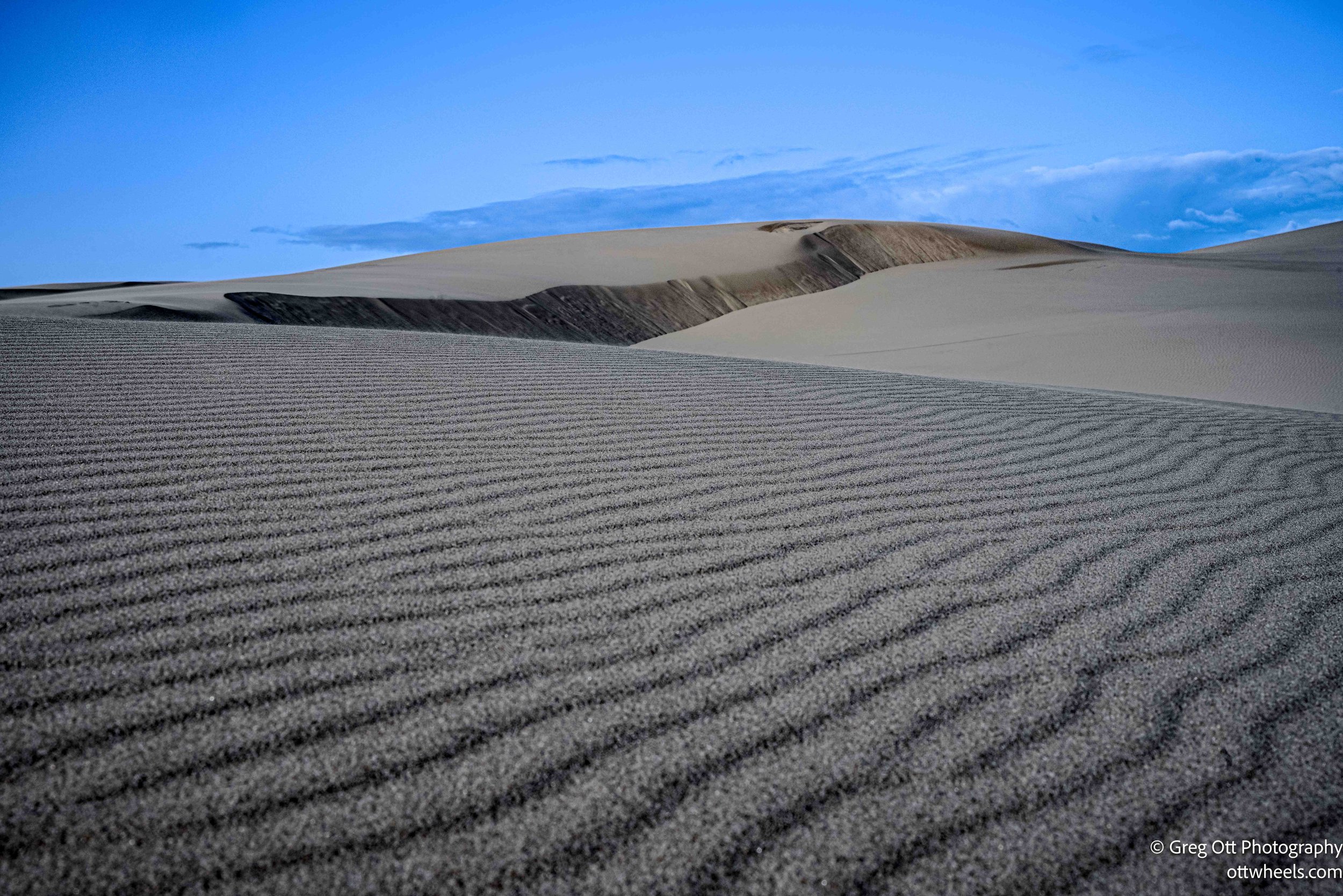
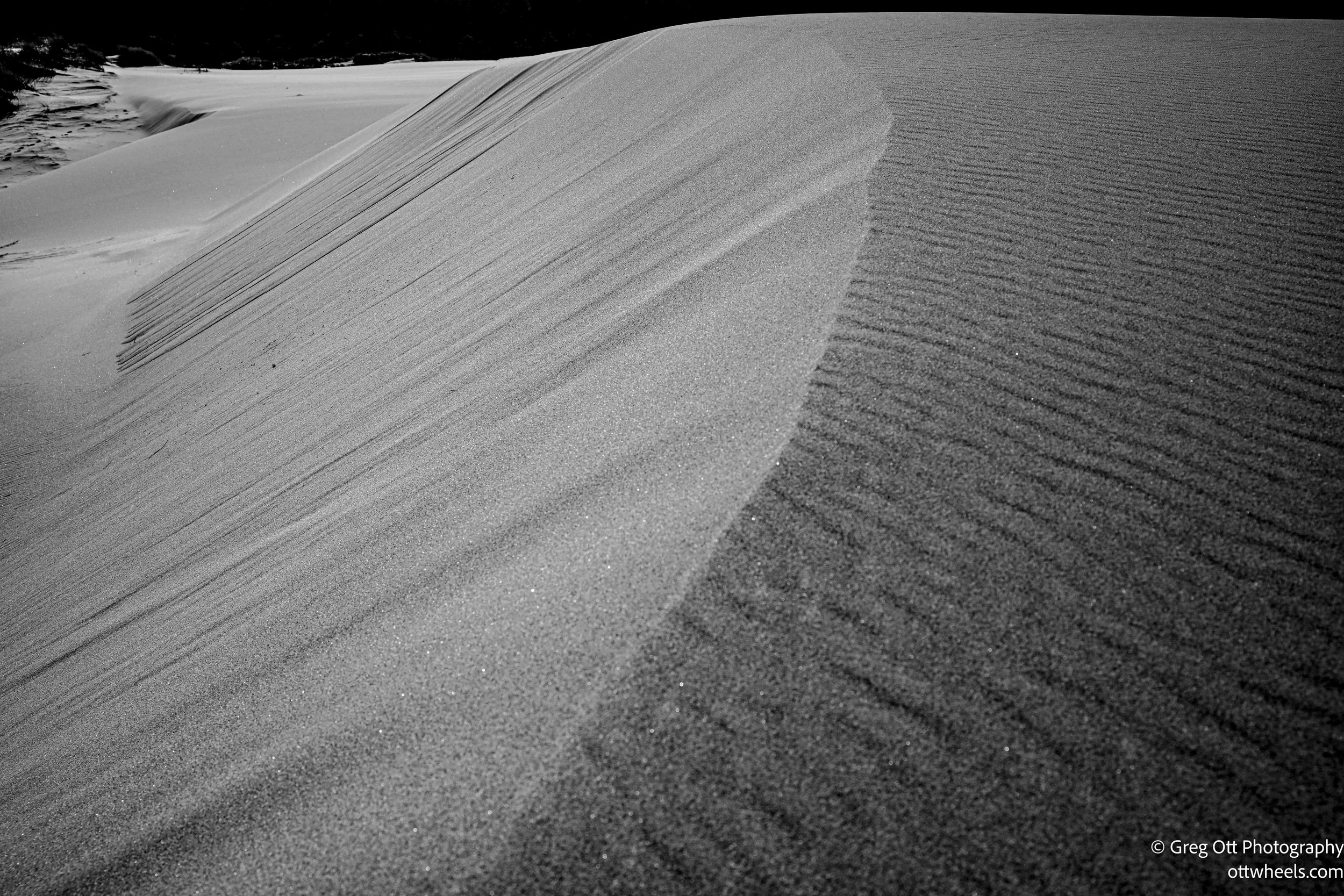
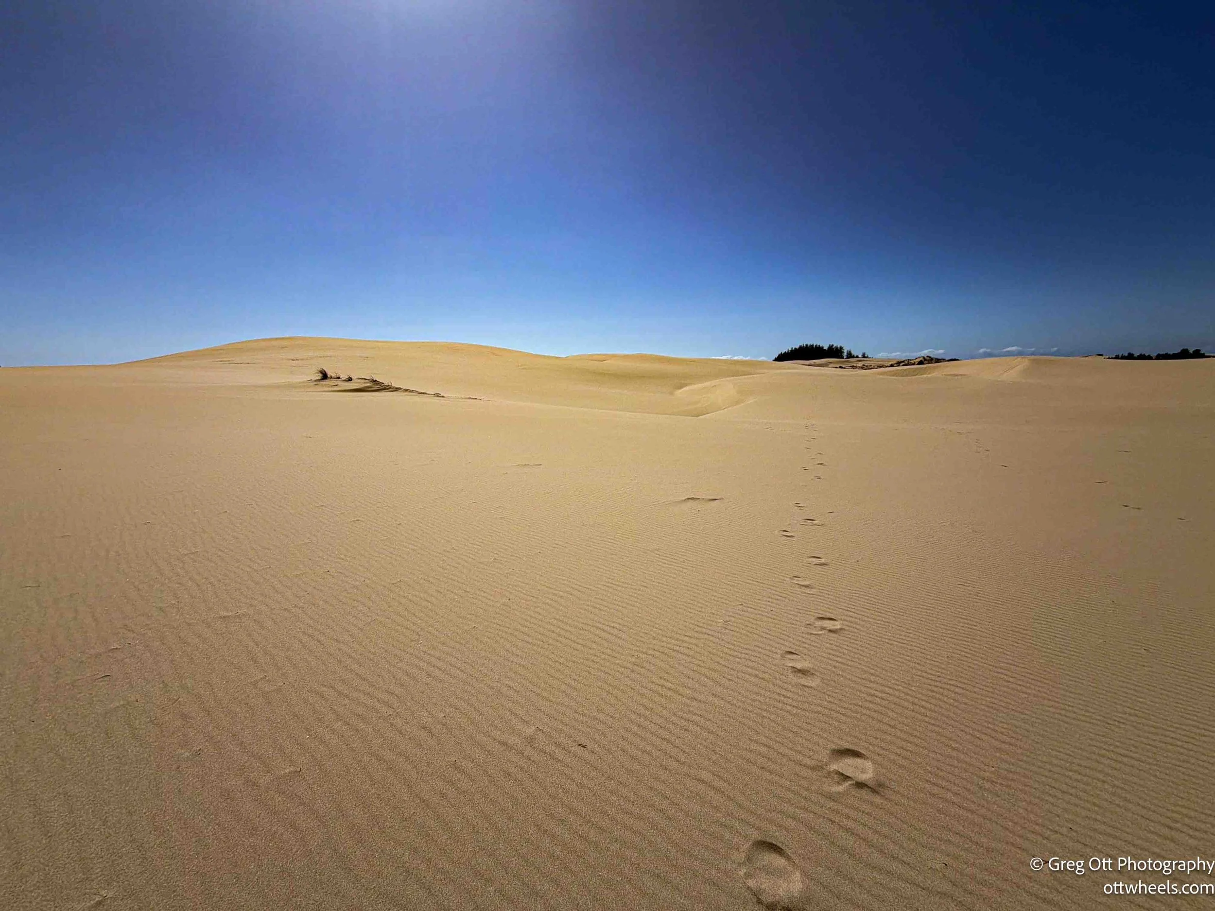
Not long after, the trail gives way to open sand. The trees disappear quickly, and you’re left with rolling dunes in every direction. The blue-topped poles become your only reference point. From there, it’s a steady push toward the coast, with no real shade and no protection from the wind.
I didn’t take many photos on the way out. The light was harsh and flat. The wind was steady—probably in that 11 to 16 mph range the forecast called for—and the temperature sat in the mid-50s. I was glad I had thrown on an extra long-sleeve. There were moments where it felt colder than it should have, especially when the clouds rolled in and darkened the sky. I checked for rain more than once, but it never materialized.
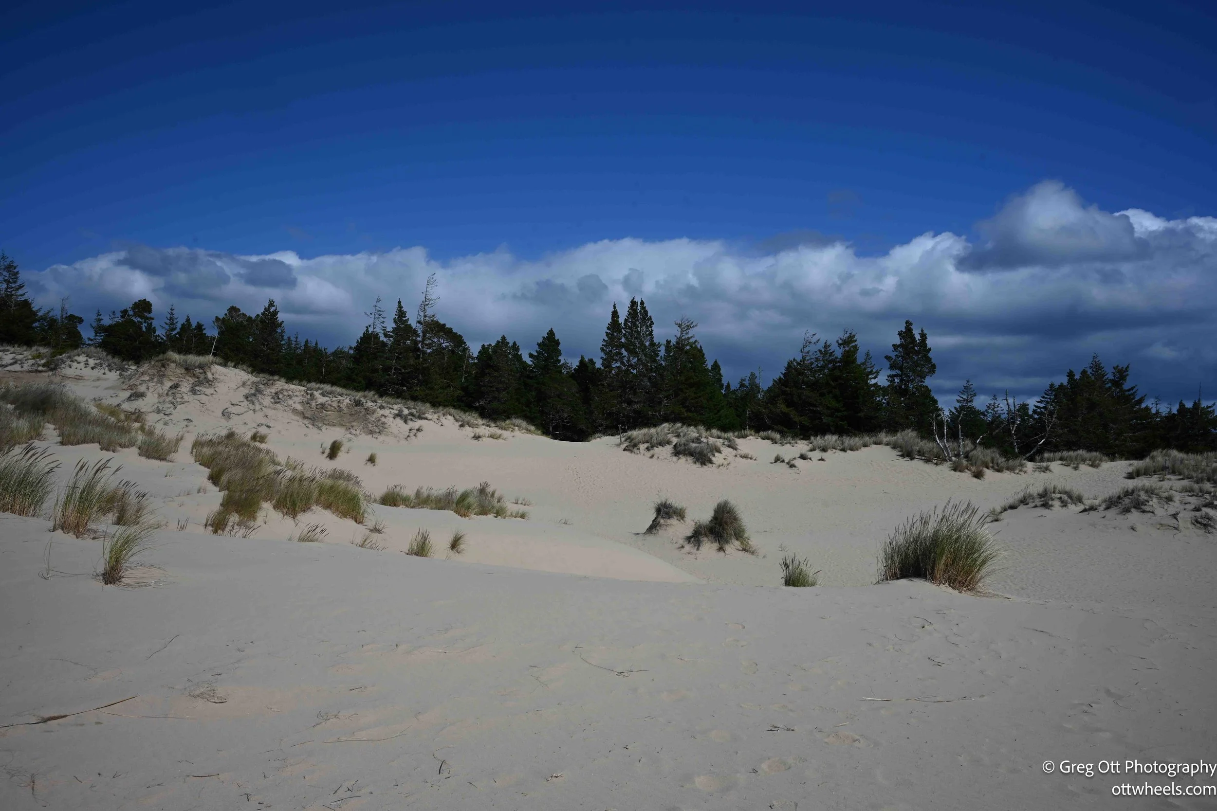
A little more than half a mile from the coast, the sand gives way again—this time to a dense, almost overgrown forest. The Forest Service has cut a narrow path through it, but it feels tight and enclosed compared to the openness of the dunes. I’ll admit, the thought of cougars crossed my mind before stepping in. Being out there alone, I picked up a solid stick and carried it with me. It felt like the right move.
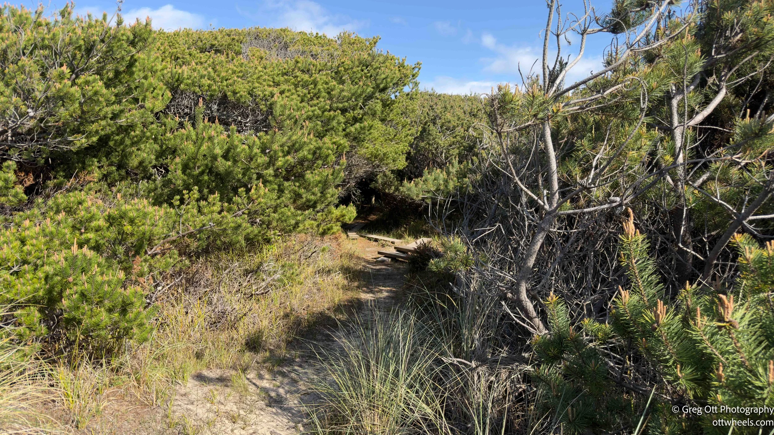

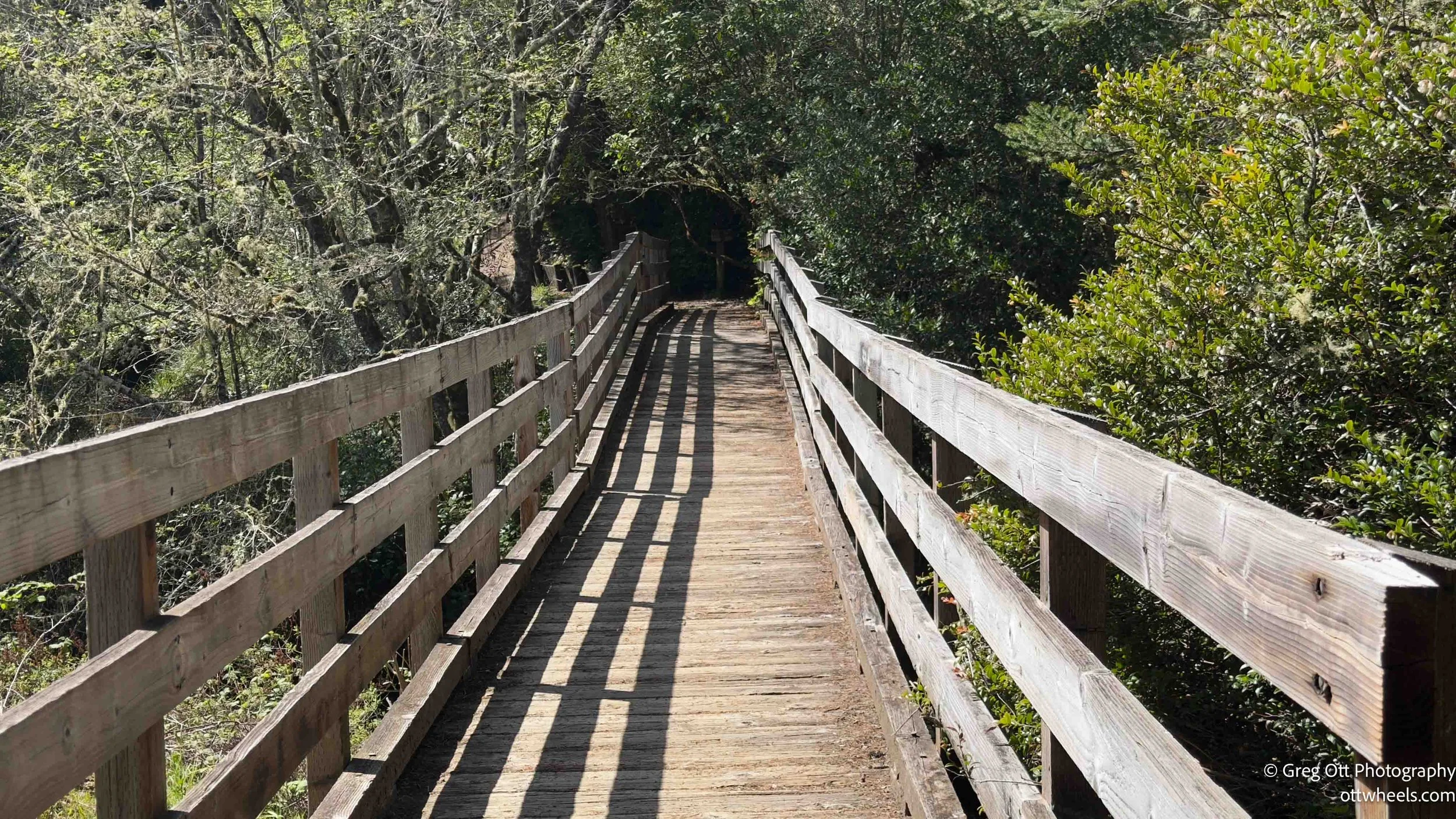
This section was slow going. There were stretches where water had pooled across the trail, forcing me to edge along narrow strips of ground, sometimes only a few feet wide. In places, I had to grab onto branches just to keep my balance. Myrtle branches hung low over the path, and the whole area felt damp and compressed. Toward the end, the Forest Service had installed a plank walkway for about a quarter mile—clearly to deal with the flooding and to keep people from tearing up the ground any further.
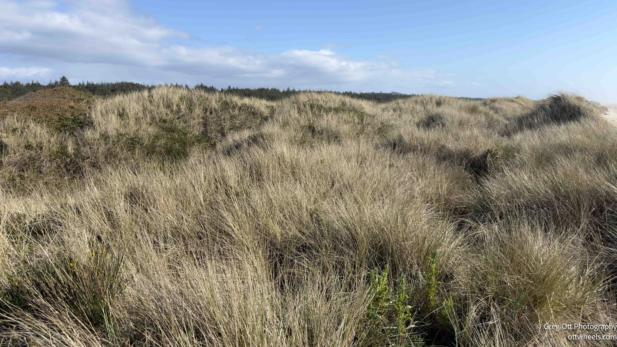
On the other side, the forest opens into a patch of low shrubs and grasses, maybe 300 yards across. There’s a defined path through it, but without that path, you wouldn’t be getting through. It’s dense enough to stop you cold.
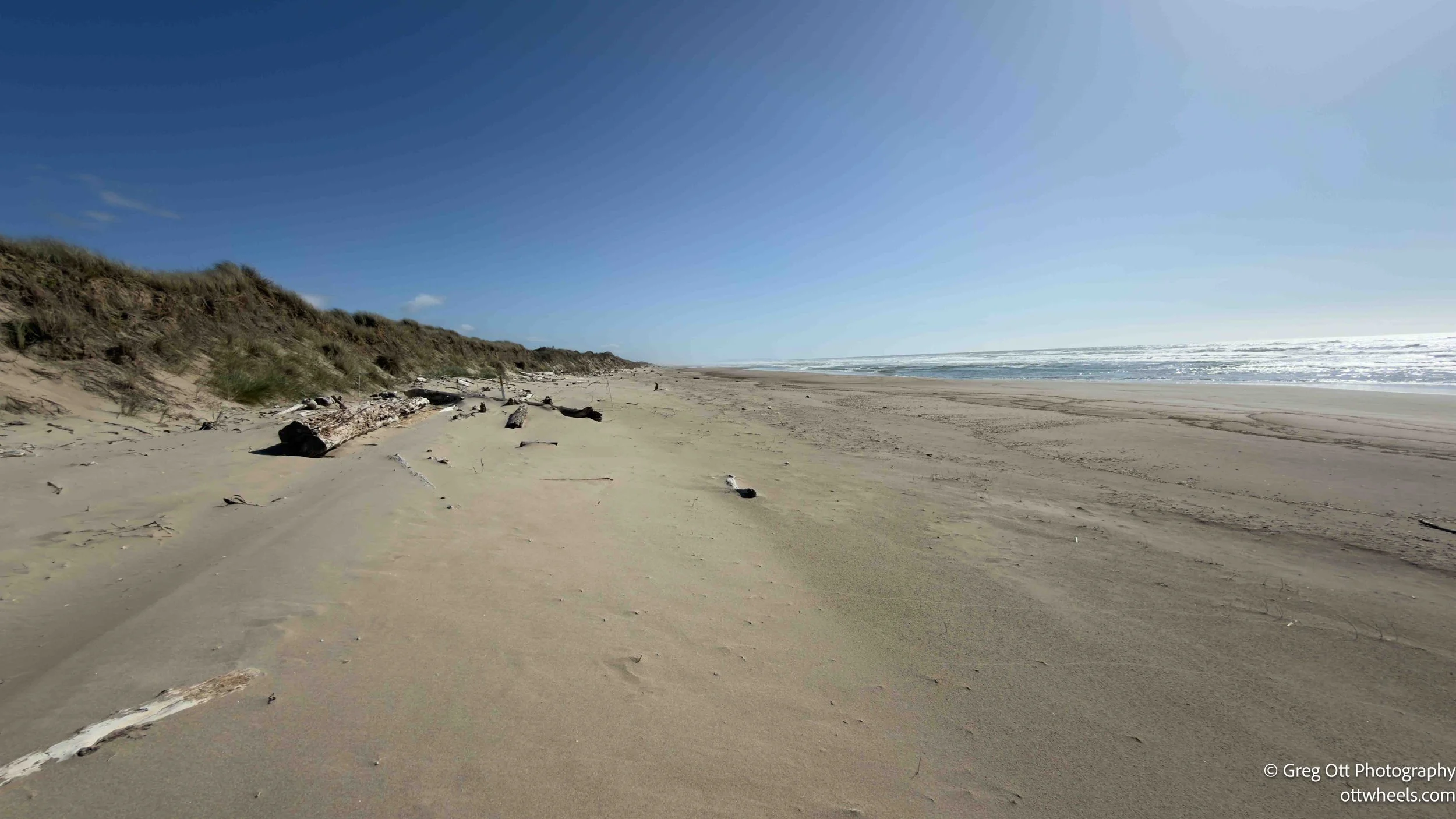
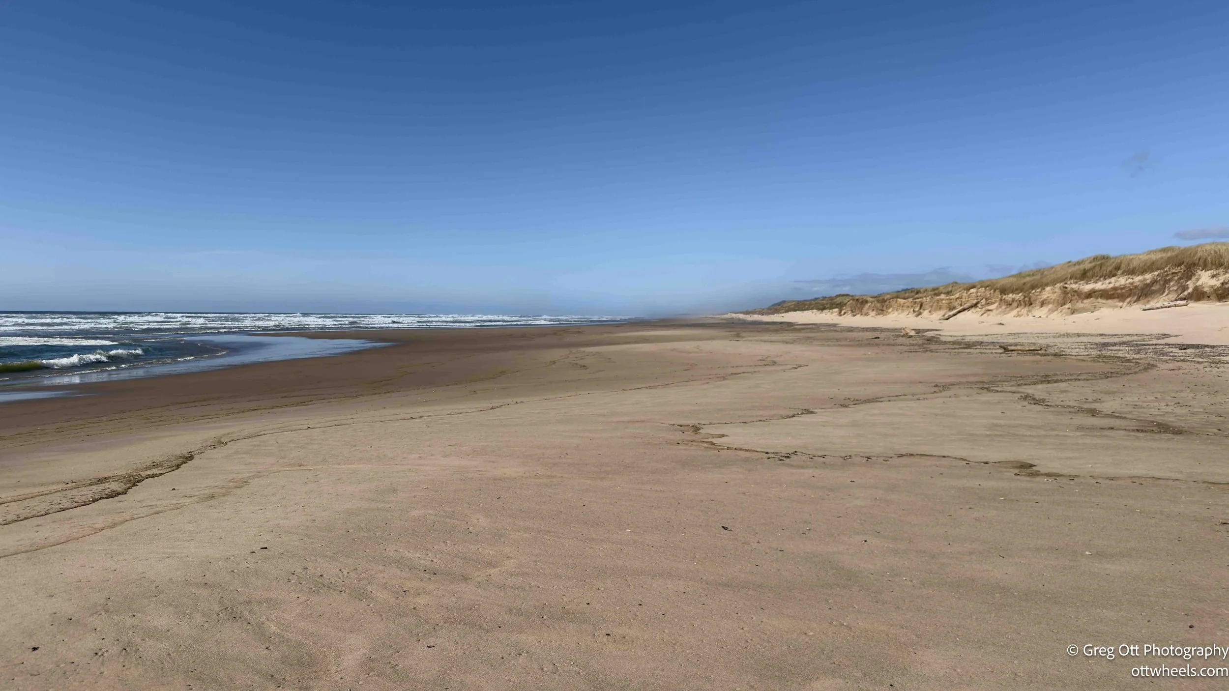
Then the beach.
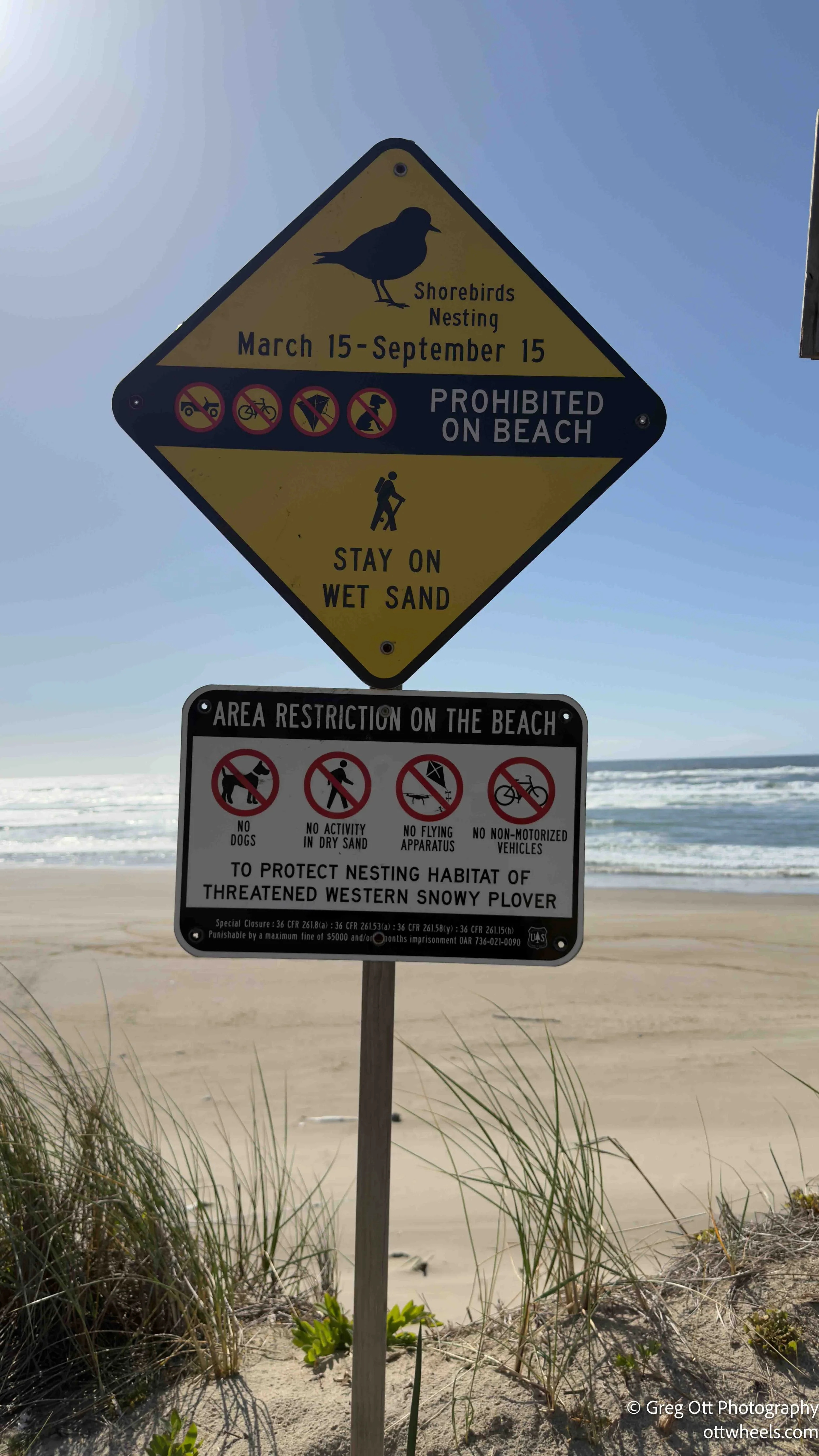
There were signs immediately warning that the dry sand area was part of a Snowy Plover nesting zone. Roped-off sections stretched both north and south, with a narrow corridor leading to the water. I walked out, dipped my shoe in the Pacific, took a few photos of the empty shoreline, and turned back. I didn’t see a single plover.

I grabbed a better walking stick for the return through the forest—lighter, sturdier—and ditched it once I hit the dunes again.
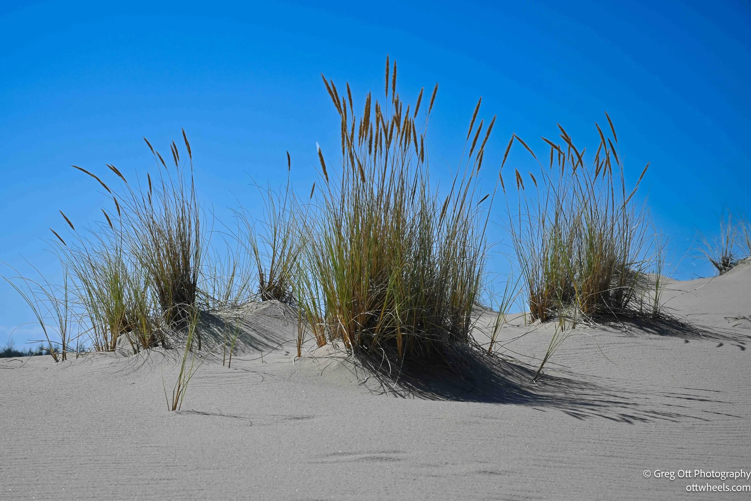
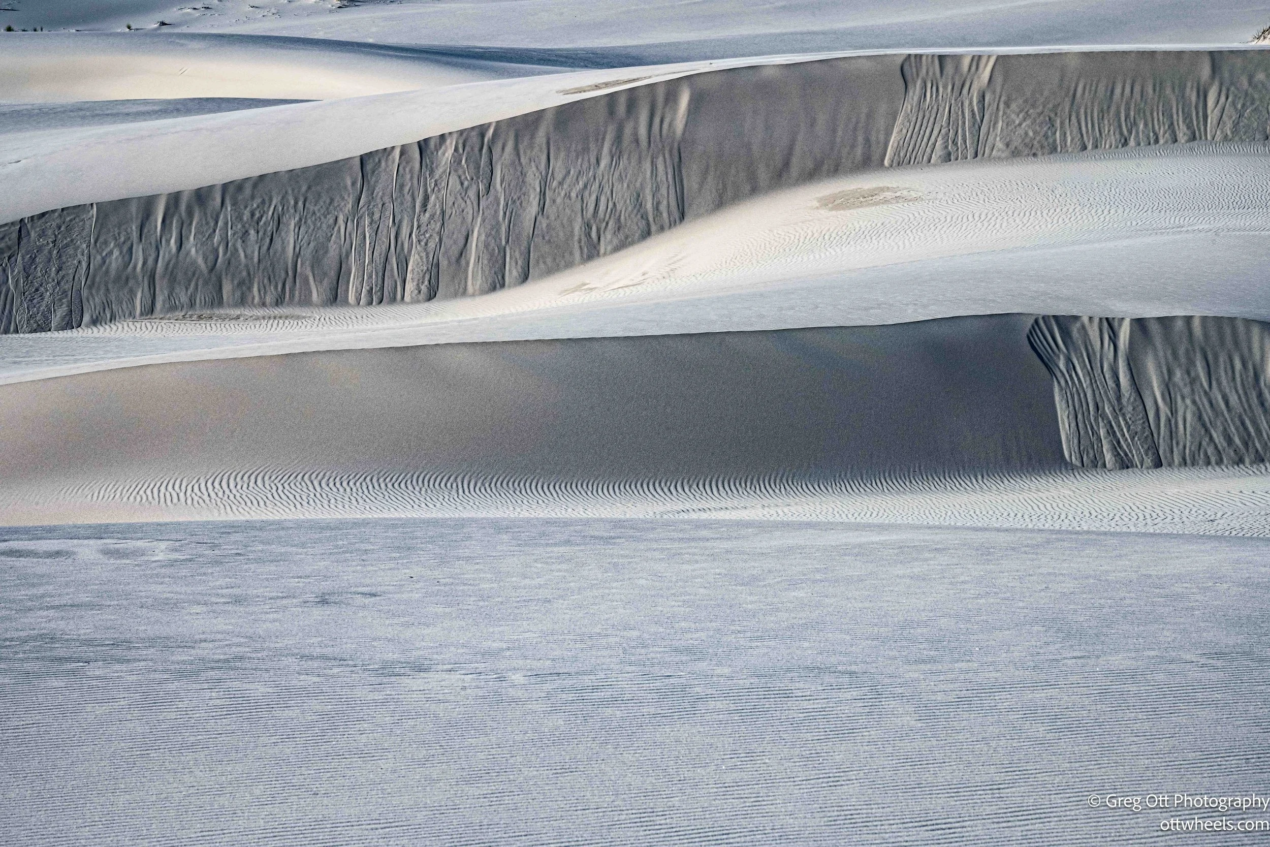
The route back felt completely different. The sun had dropped enough to create long shadows across the sand, and the light finally started working. Without the blue poles guiding the way, I had to check AllTrails more often. The dunes were steeper on this side, with sharper drops and higher ridgelines. By this point, I was trying to conserve energy, picking routes that avoided unnecessary climbs when possible. Sometimes it was faster to go around than straight over.
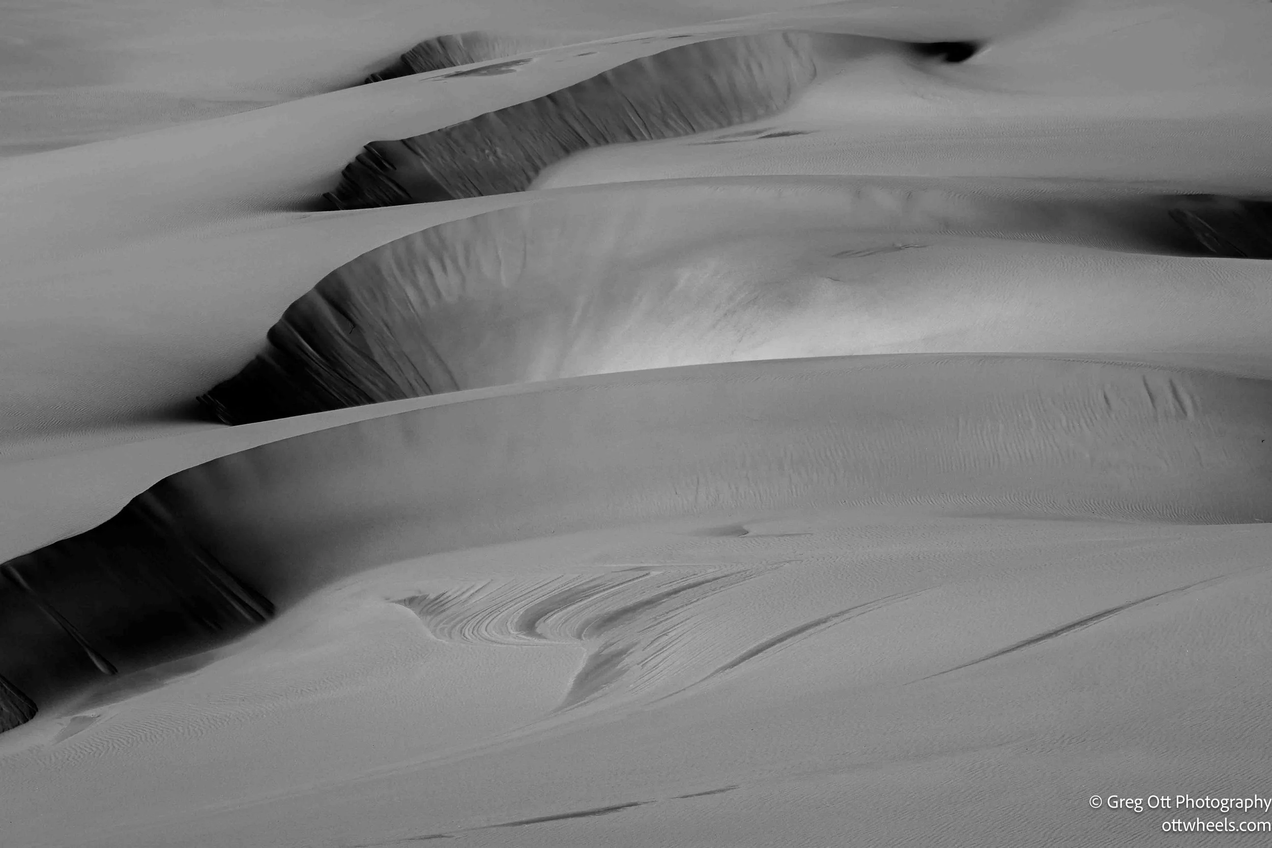
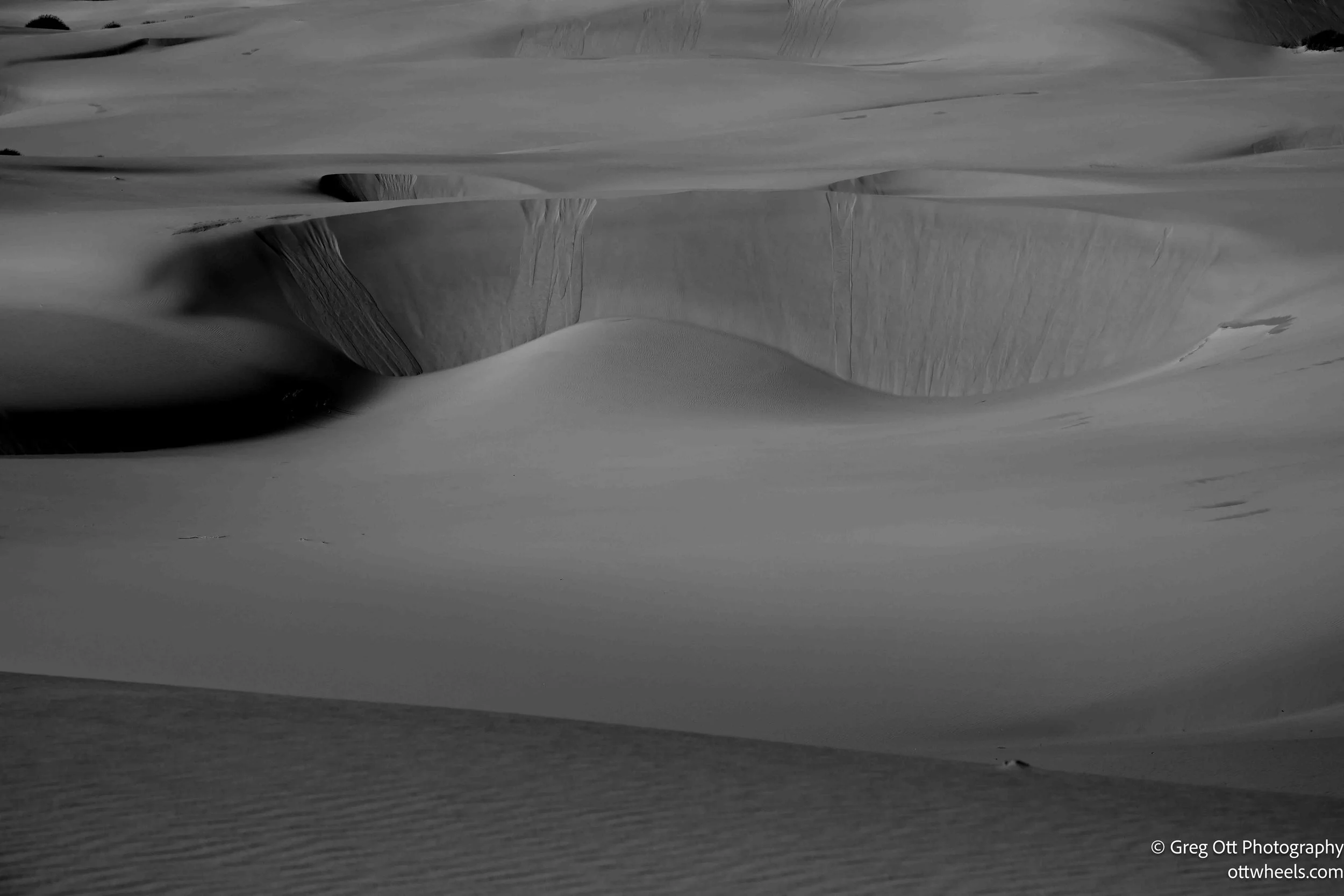
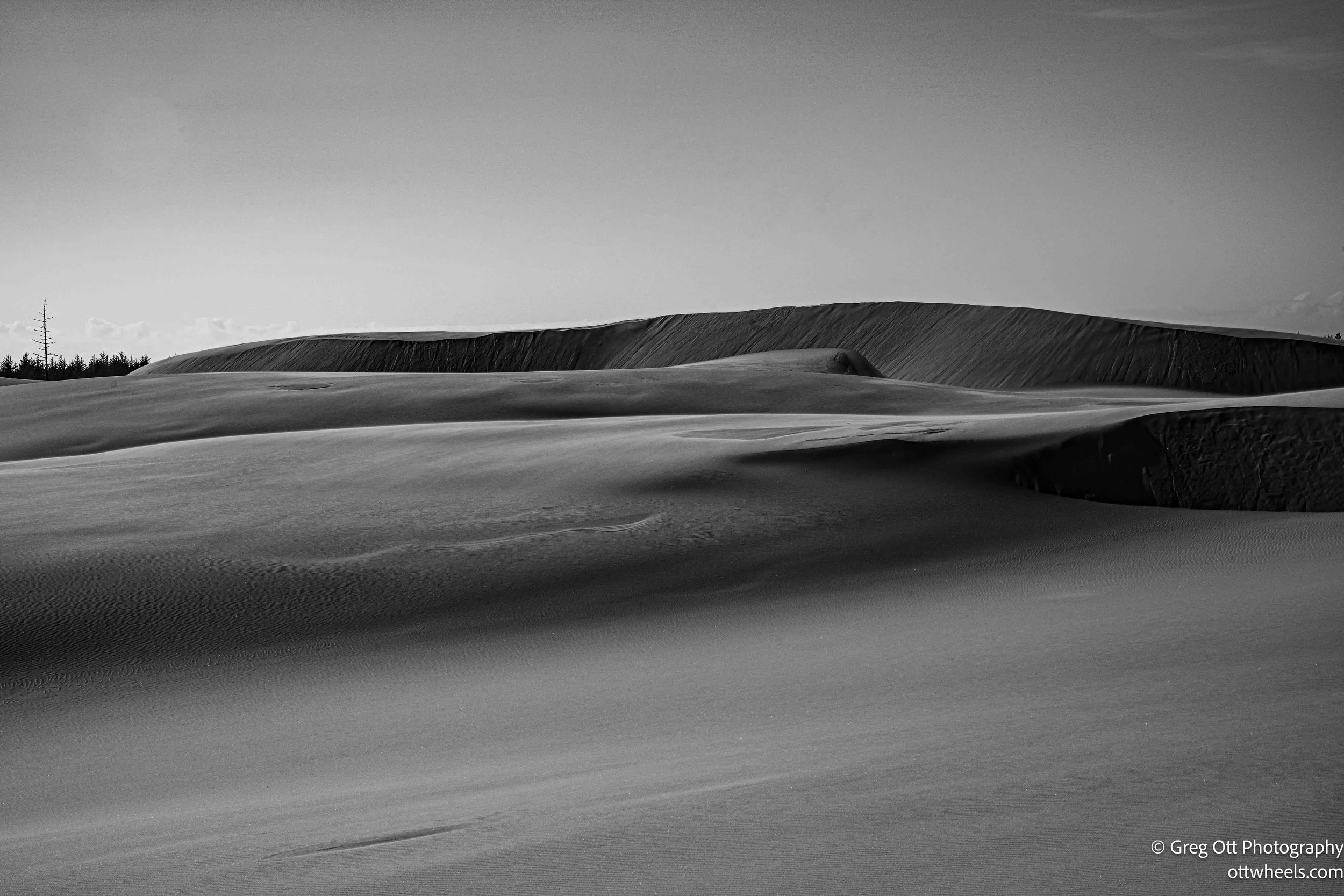
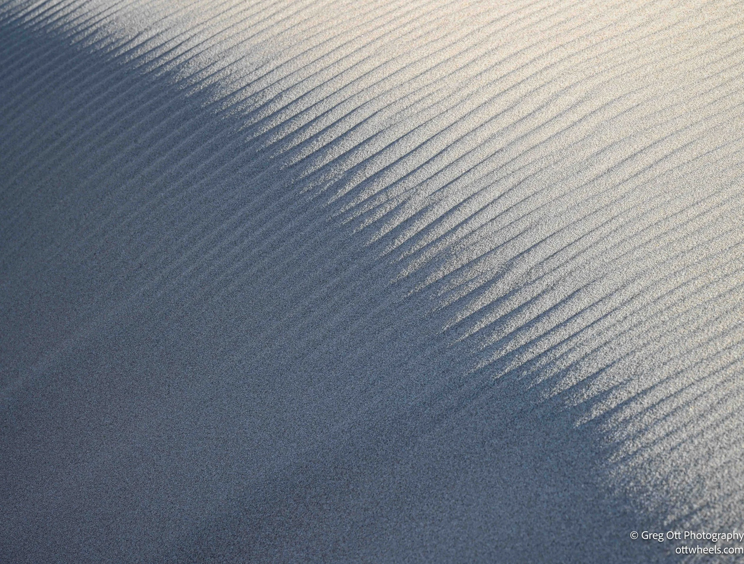
I started stopping more. The edges of the dunes, the ridgelines, the way the shadows stretched—it all started to come together. I found myself drawn to the minimal scenes. Sand, light, shadow. That usually pushes me toward black and white—more contrast, more emphasis on shape and form.
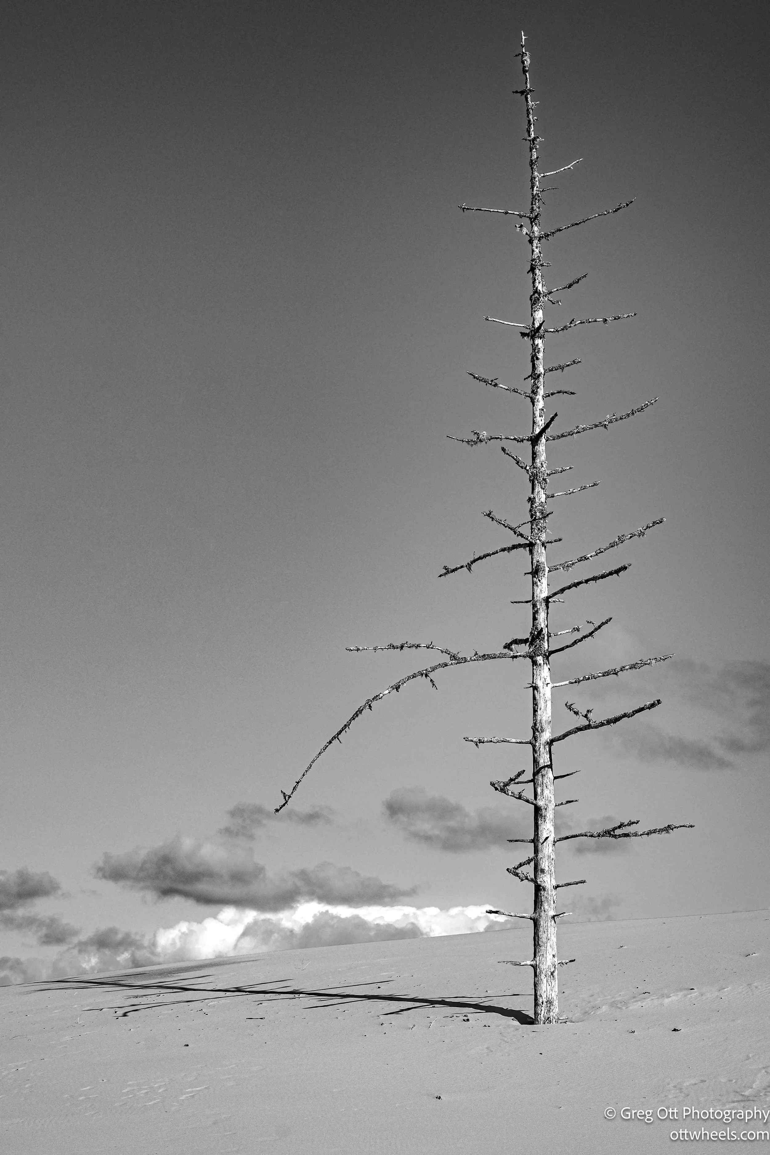
One scene stood out. A lone dead tree, separated from the forest, sitting in the sand. No leaves, just twisted branches. It didn’t survive being isolated out there a metaphor for something. The contrast of that tree against the dunes, with the low sun and heavy shadows, had a mood to it that was hard to ignore.
The entire hike back followed that pattern. Walk, stop, shoot, repeat. I dropped to one knee often, using it to steady gear and keep it out of the sand. At one point, I stood up and forgot a lens cap sitting on my knee. I didn’t realize it until I was about 300 yards away. I went back—nothing. The wind probably carried it off.
Near the end, I could see the top of a knit hat bobbing just over the edge of a dune. It was a strange sight out there after hours alone. When I came around, a woman was sitting quietly, watching the sunset. I didn’t stop. I was hungry and ready to be done. I pushed through the final three-quarters of a mile to the trailhead.
In the end, the 5½-mile hike took about 2½ hours, even with all the stops. That surprised me. My back was starting to complain a bit from carrying too much gear, but overall, it moved faster than I expected.
On the way in, I had noticed a campground sign about half a mile down the road. I drove in, checked Recreation.gov, and saw plenty of open sites. I picked one with fewer trees so I could test Starlink, made the reservation, and got it at half price with the parks pass.
It was quiet. Exactly what I needed. I made dinner and didn’t have any trouble falling asleep.