Mile 0 Alaska Highway
I woke around 4:30 a.m. because the vent above me was glowing with early morning light. I had forgotten to put the insulated vent cover in place, the one that keeps the summer light out and helps hold heat in during winter. People had warned me about Alaska and the far north in summer, how the daylight almost never fully disappears, but now I was starting to experience it myself. Even this far north in British Columbia, darkness barely seemed to settle in before the sky started brightening again. I fell back asleep pretty quickly and woke again around 7:30 in the Walmart parking lot in Dawson Creek.
There was a Starbucks a short drive away, so I went in for my usual latté and spent a couple hours writing and planning. I had a feeling these easy Starbucks stops might become less common the farther north I traveled.
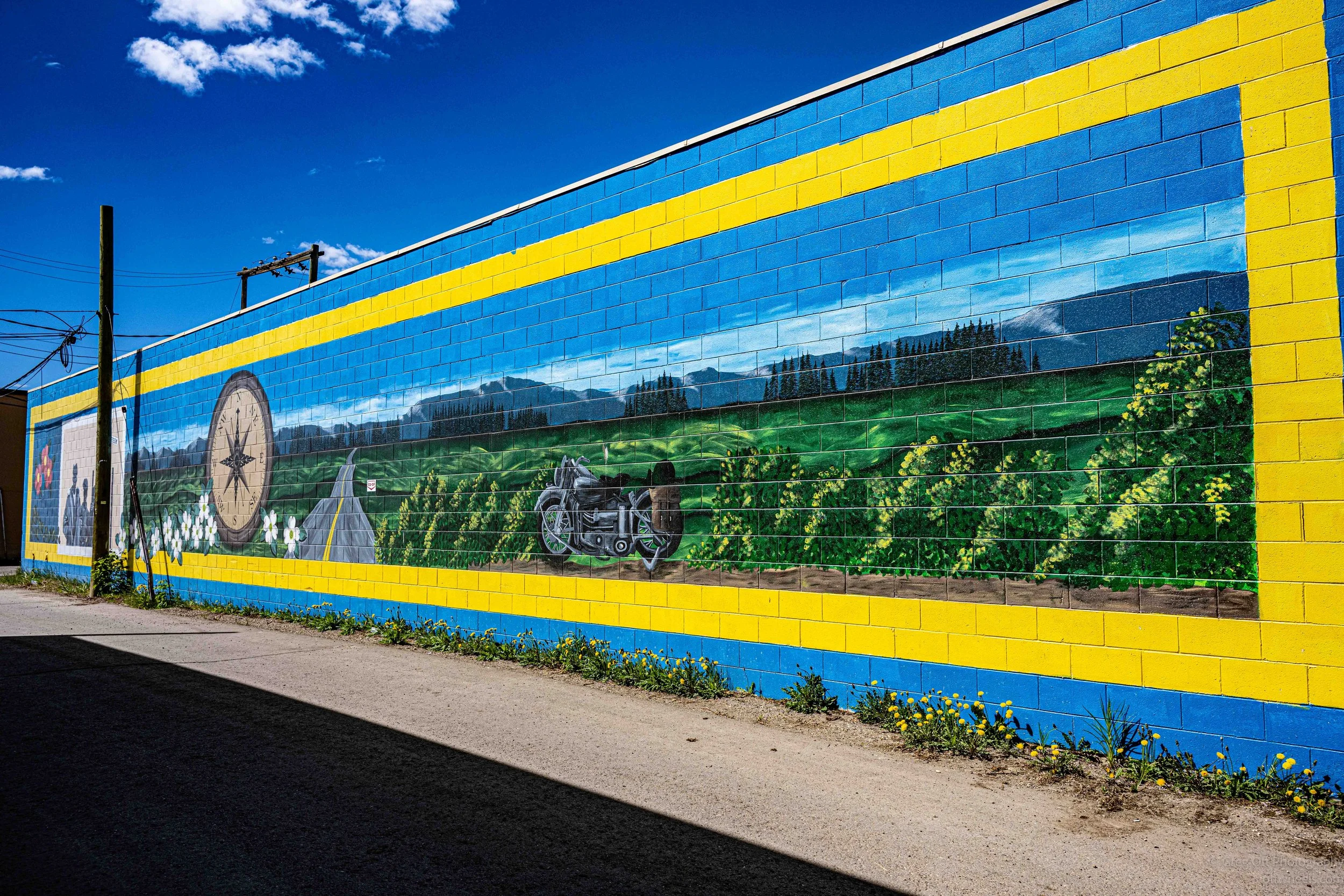
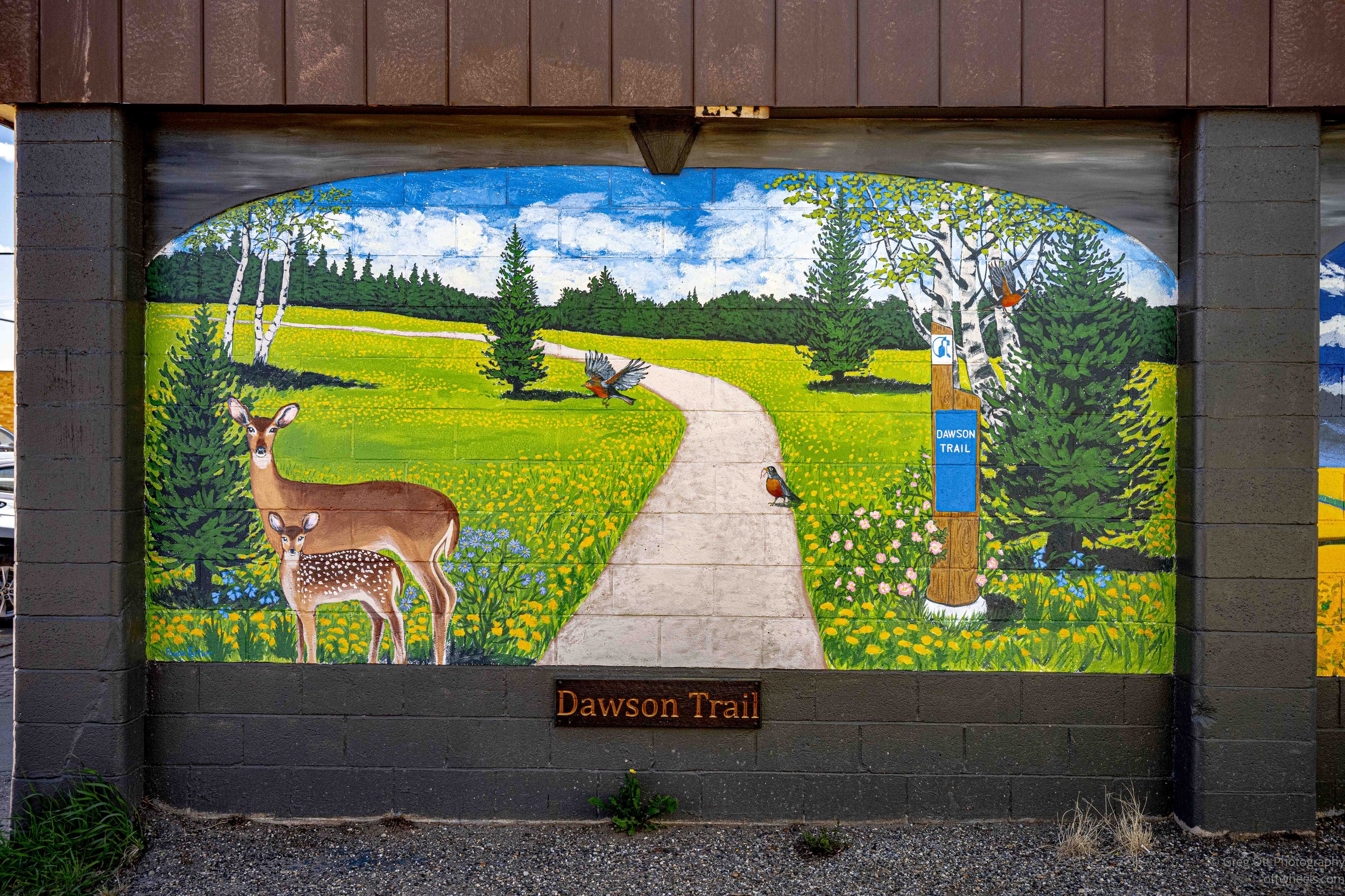
Eventually I headed into downtown Dawson Creek to see the Mile 0 marker of the Alaska Highway. The morning sun was already harsh and bright, the kind of light photographers usually complain about, but it fit the feel of the place. Dawson Creek doesn’t try to hide what it is. It feels practical, built for movement, industry, farming, trucking, and the constant flow of people heading north.
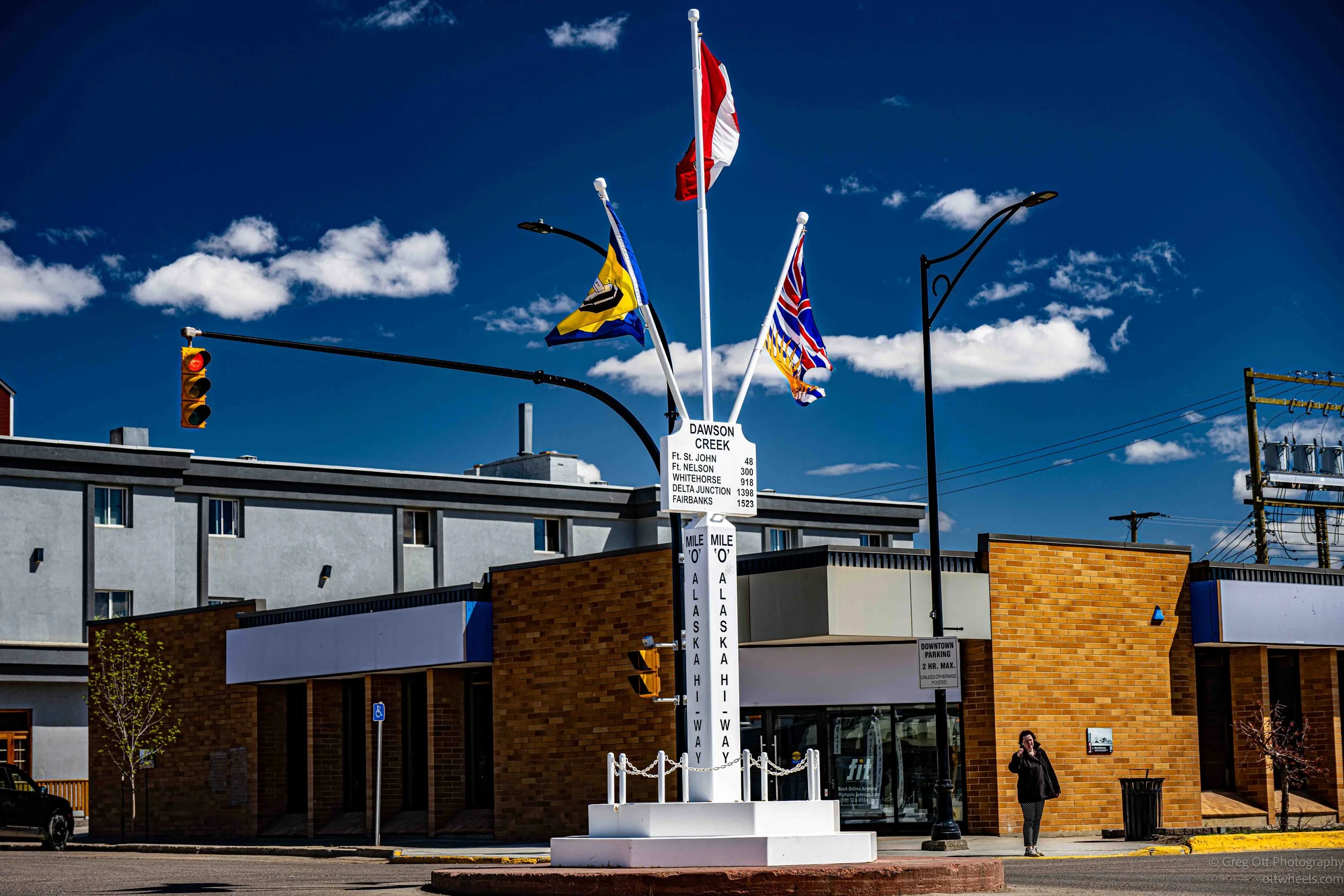
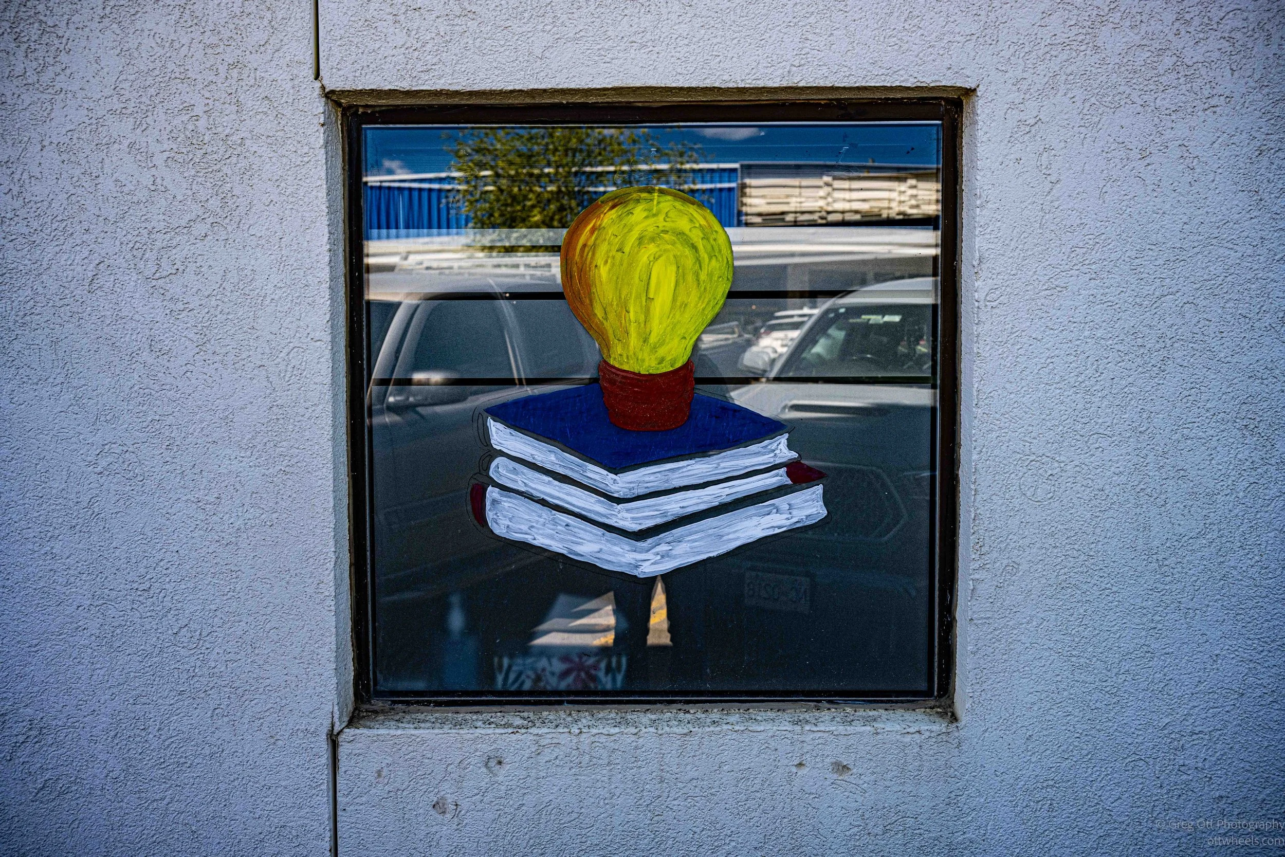
I spent some time walking through downtown reading the historical plaques mounted to buildings around the city. Many of them describe what once stood there and how quickly the town transformed once construction of the Alaska Highway began during World War II. Dawson Creek suddenly became the starting point for one of the largest emergency construction projects in North American history, and the downtown core still carries traces of that era.
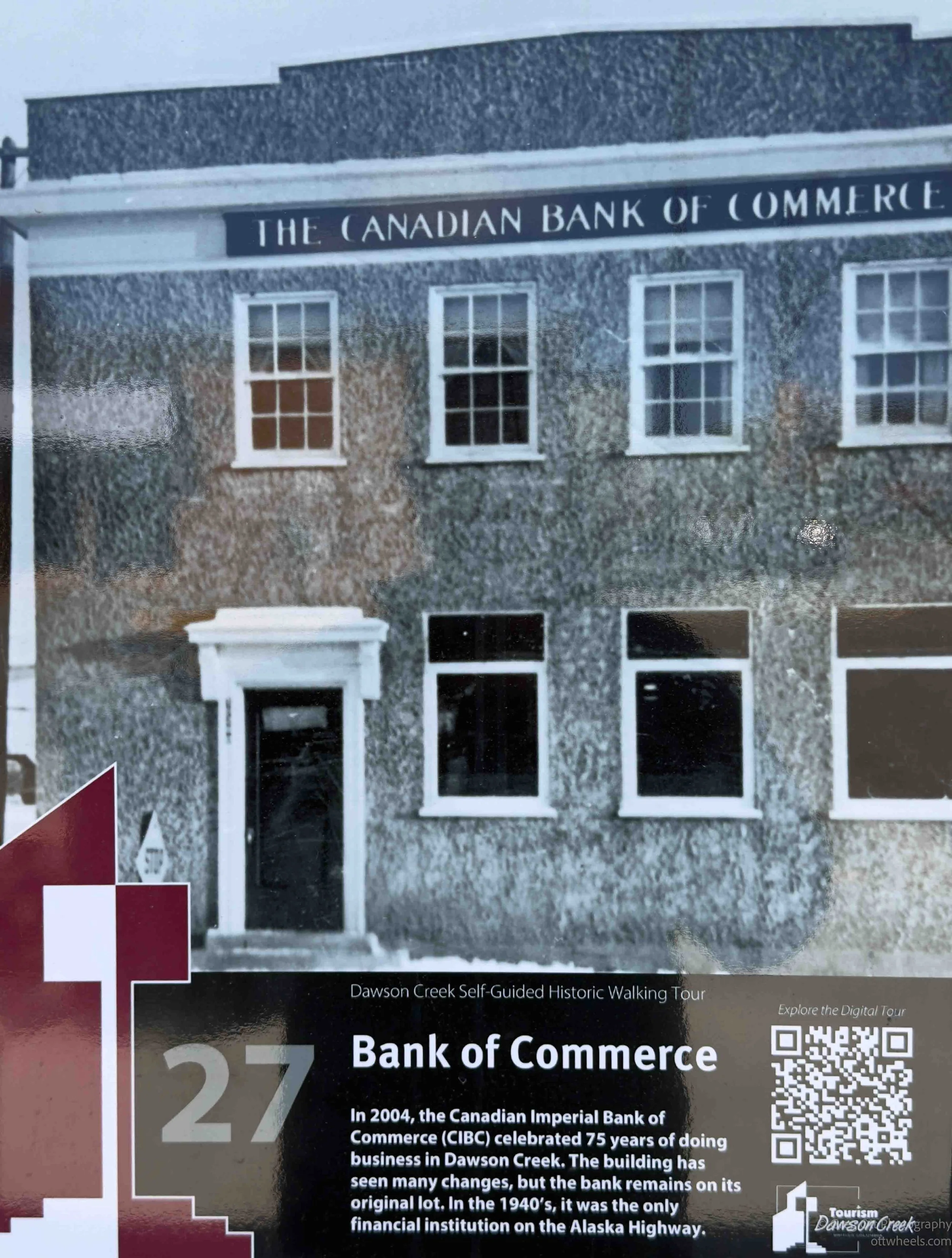
One plaque described the old Canadian Bank of Commerce building. In the 1940s it was reportedly the only financial institution operating along the Alaska Highway. It’s strange to think about now. Today you drive north with debit cards, GPS, satellite internet, and fuel stations every few hours. Back then, this small bank in Dawson Creek was effectively the financial gateway to the north.
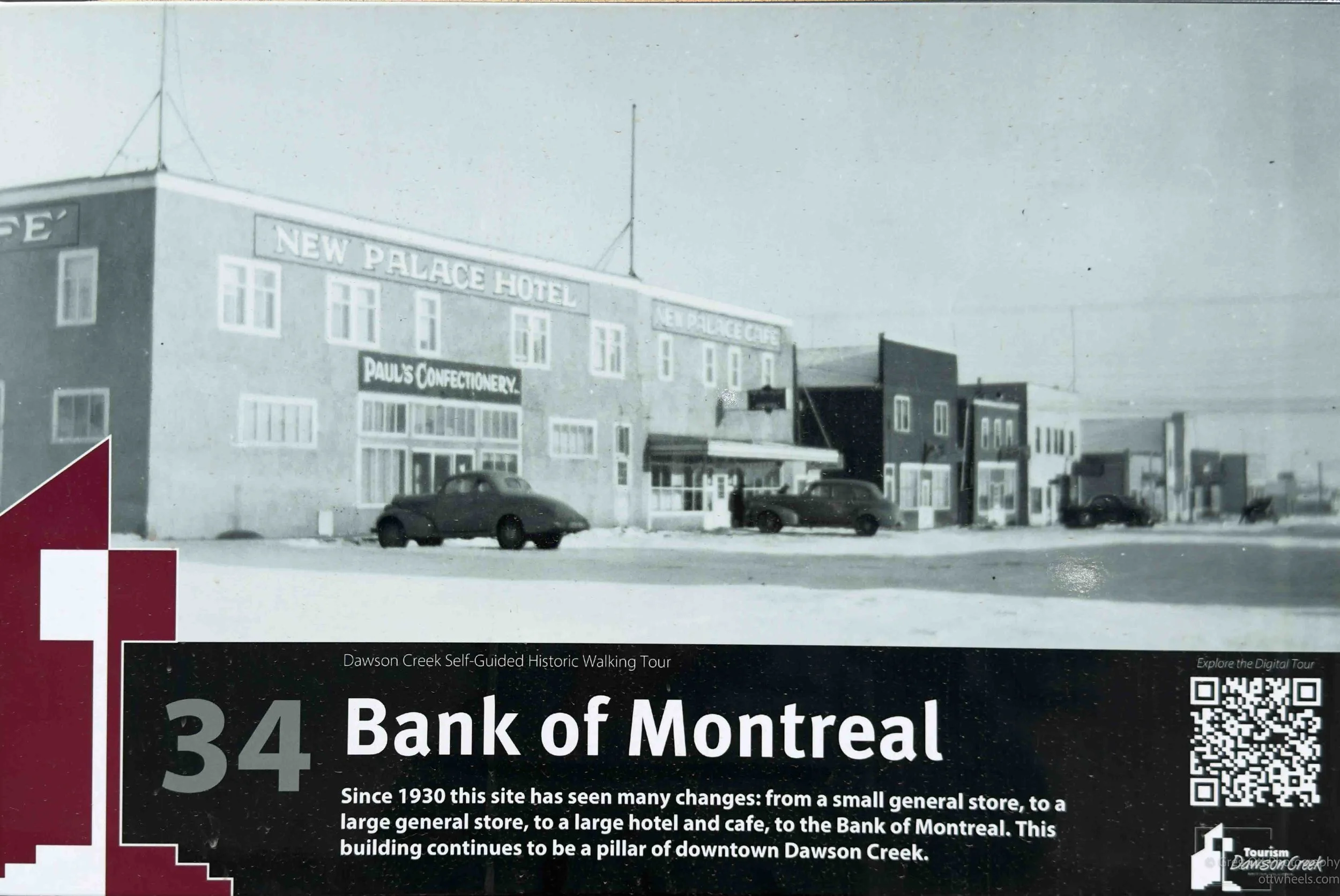
Another plaque showed the old New Palace Hotel and the Bank of Montreal site. The location changed repeatedly over the decades, evolving from a small general store, to a larger store, then a hotel and café before eventually becoming a bank. The black-and-white photo on the plaque showed a downtown that still looked rough around the edges, low buildings, wide streets, old cars parked outside, and the feeling of a place growing faster than it could keep up with itself.
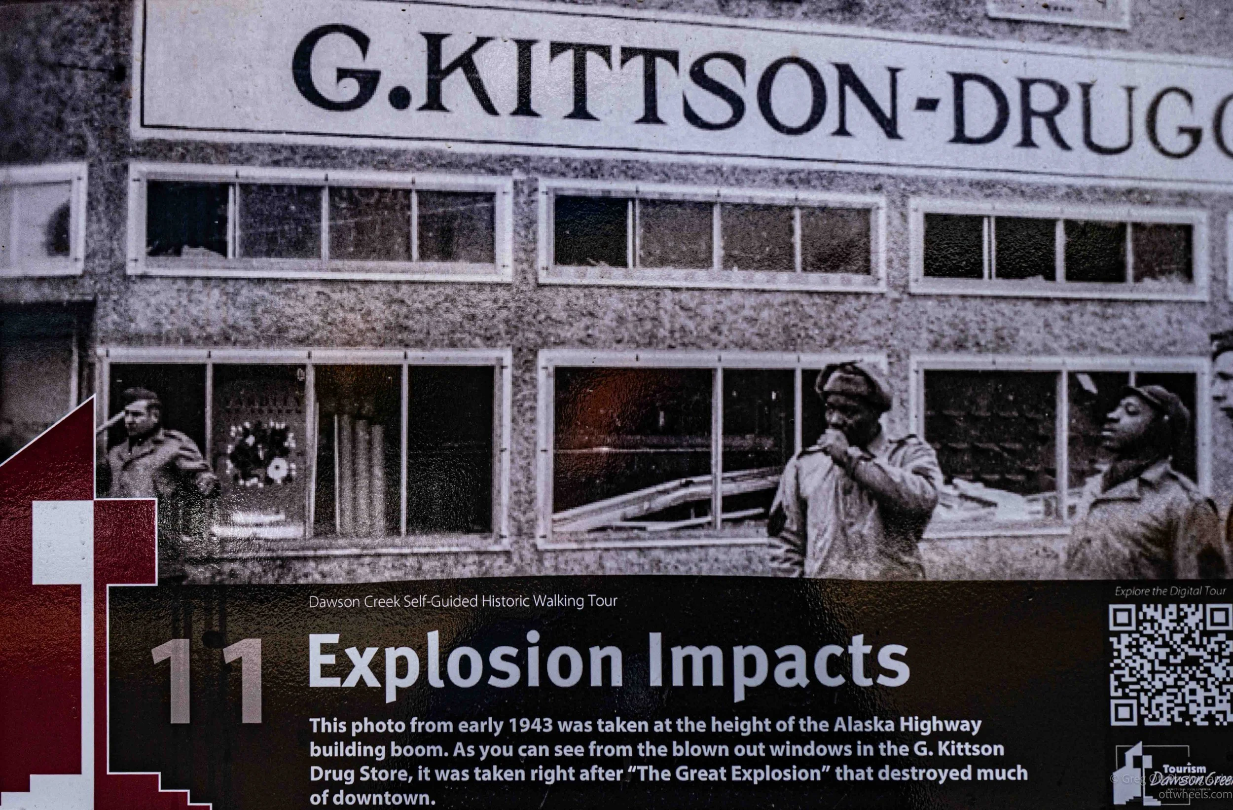
Several plaques also mentioned fires and explosions that destroyed parts of the downtown during those early years. Dawson Creek grew so quickly during the Alaska Highway boom that many buildings were temporary wooden structures crowded tightly together with fuel, machinery, vehicles, and construction supplies everywhere. Entire sections of town could change almost overnight. A hotel might burn down, a business relocate, and another building rise in its place a short time later.
Standing there in the bright northern sunlight, it wasn’t hard to imagine the chaos the town must have experienced in the 1940s. Military convoys, construction crews, heavy equipment, fuel trucks, and travelers all moving through what had recently been a much smaller northern farming town. Even today Dawson Creek still feels like a place in transition, a stopping point where people arrive, reorganize, fuel up, and continue farther north into the Yukon and Alaska.
The drive today was shorter than recent trips. I was headed north to Fort Saint John. I stopped down town at Farmhouse on Main Coffee Bar. There was plenty of street parking. It was about 3 pm and I thought I would edit some photos and update the blog. The coffee was good. It was an interesting shop, the owner was in her 20s and the space was pretty large. There were different sections in the coffee house that sold different things. Tables were nicely space and the wifi was strong. The place closed at 4 pm but I was there at 4:30 when I realized that everyone else had left and someone came by to ask if they could take my empty coffee cup. That was my queue. I asked if they were closed, “yes, we close at 4 sir.” was the reply.
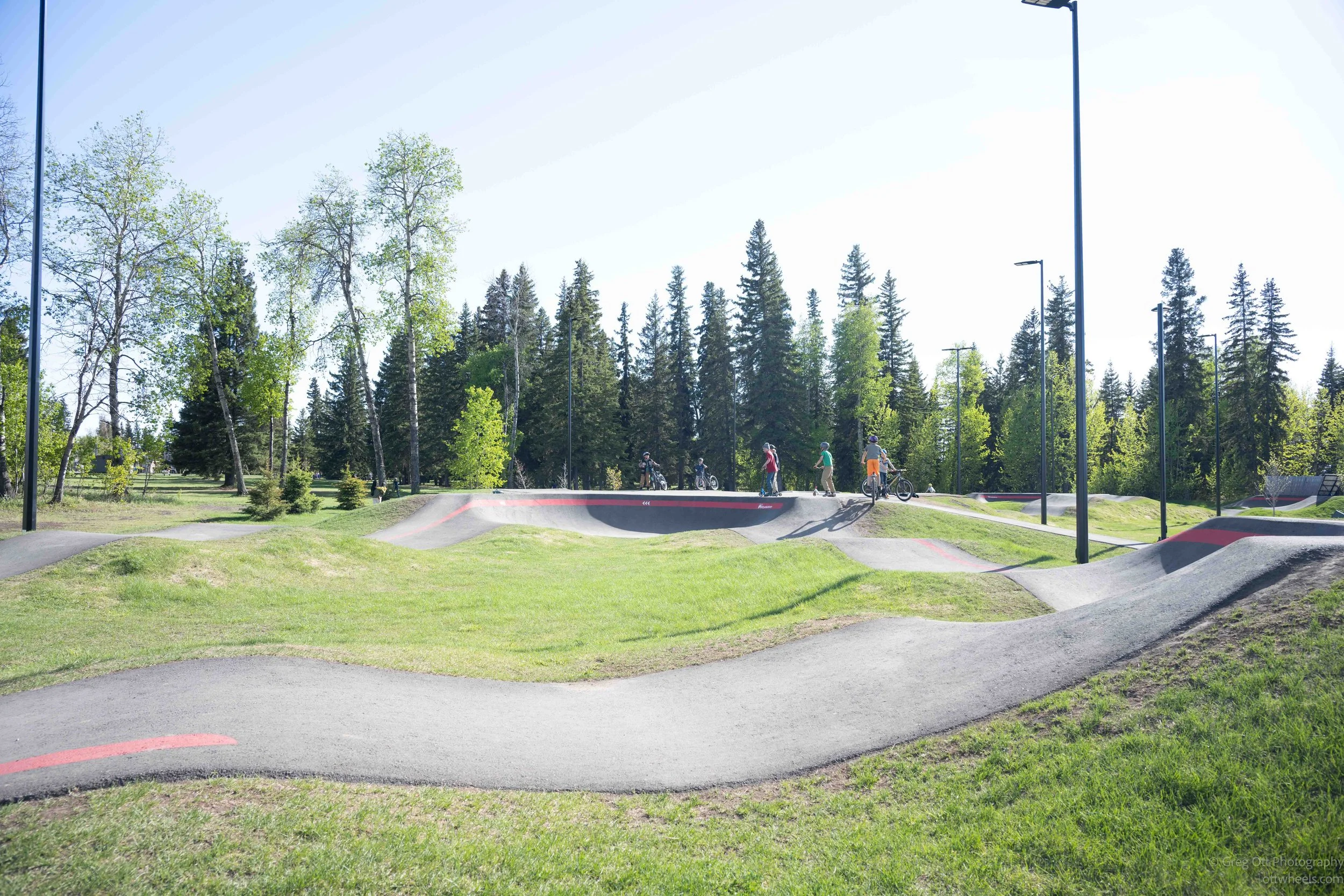
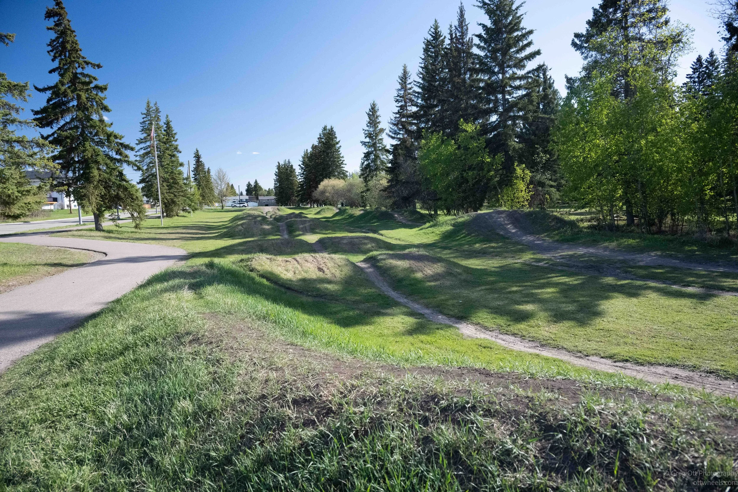
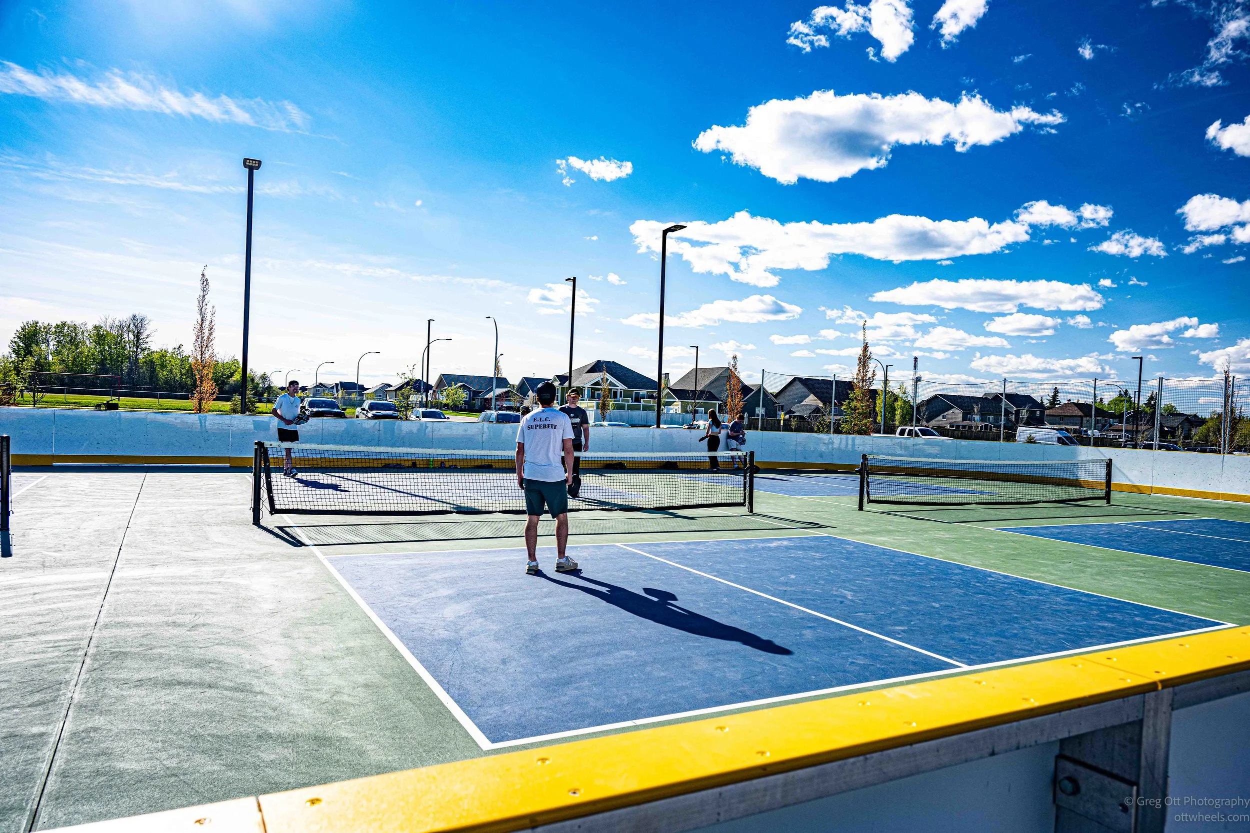
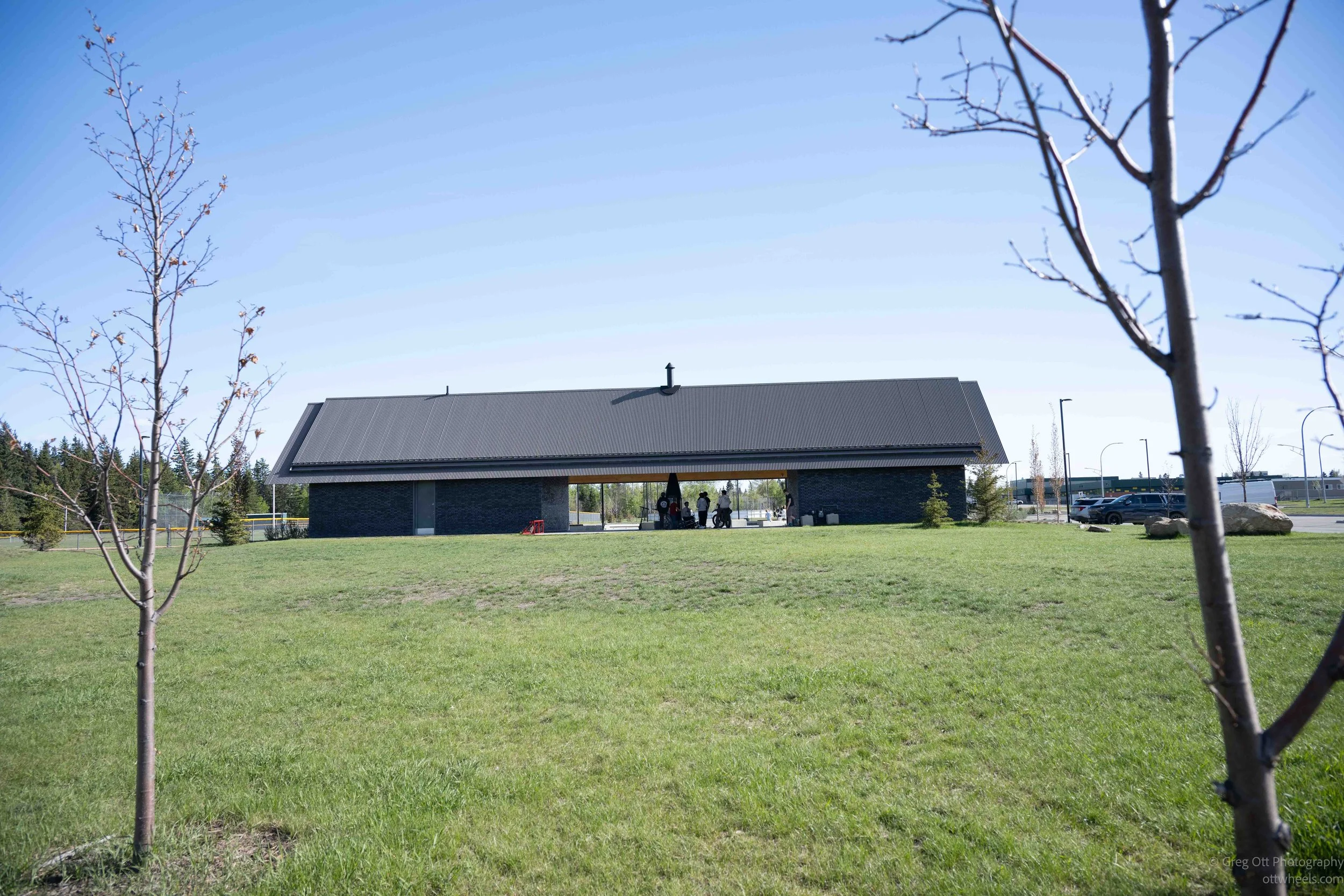
I found Kin Park on the north side of town and headed there for a walk. The park looked brand new. The town must have spent millions on a state-of-the-art park. It was across from the an elementry school. The walking path was paved and about 1.5 miles long. There were a lot of kids. A mom, dropped of three boys (ages 6 to 14) and yelled to them, I want you home at 9. That made sense, given that it didn’t get dark until after 10.
There was a scooter park, a dirt bike area, a skate board section, several play grounds, an area for kick ball, five pickle ball courts (all teenagers), Swings in random areas, garbage and recycling bins scattered over the park. I walked the park and just stopped to watch and smiled a lot. It was nice to see families, and kids outdoors just enjoying playing. There were old people walking their dogs. Everyone was friendly.
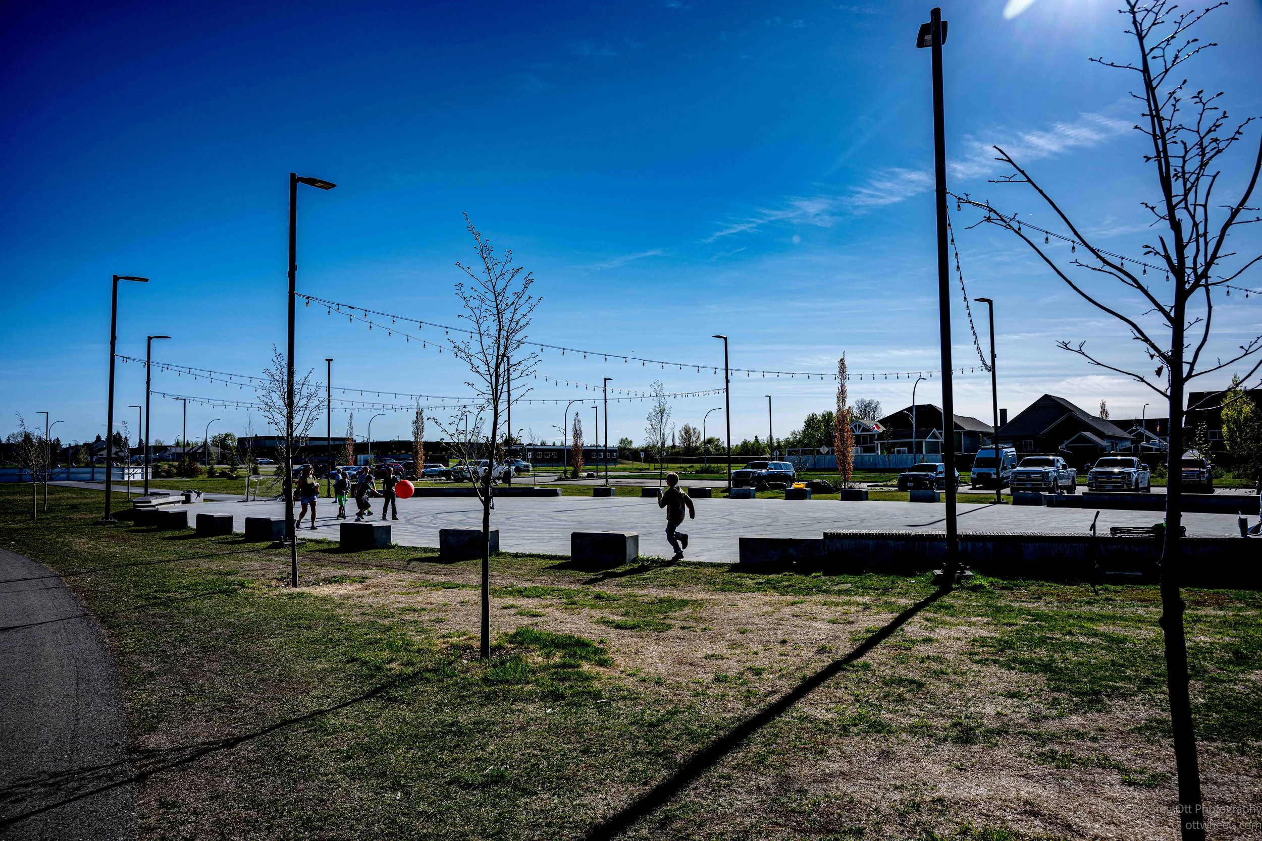
I reflected on the fact that I hadn’t seen any homeless people. The community seemed to be functioning on a different level than some of the places I’d visited recently. There was still poverty and hardship here, I’m sure, but the atmosphere felt different. More stable somehow. More connected to work, industry, farming, and the land around it.
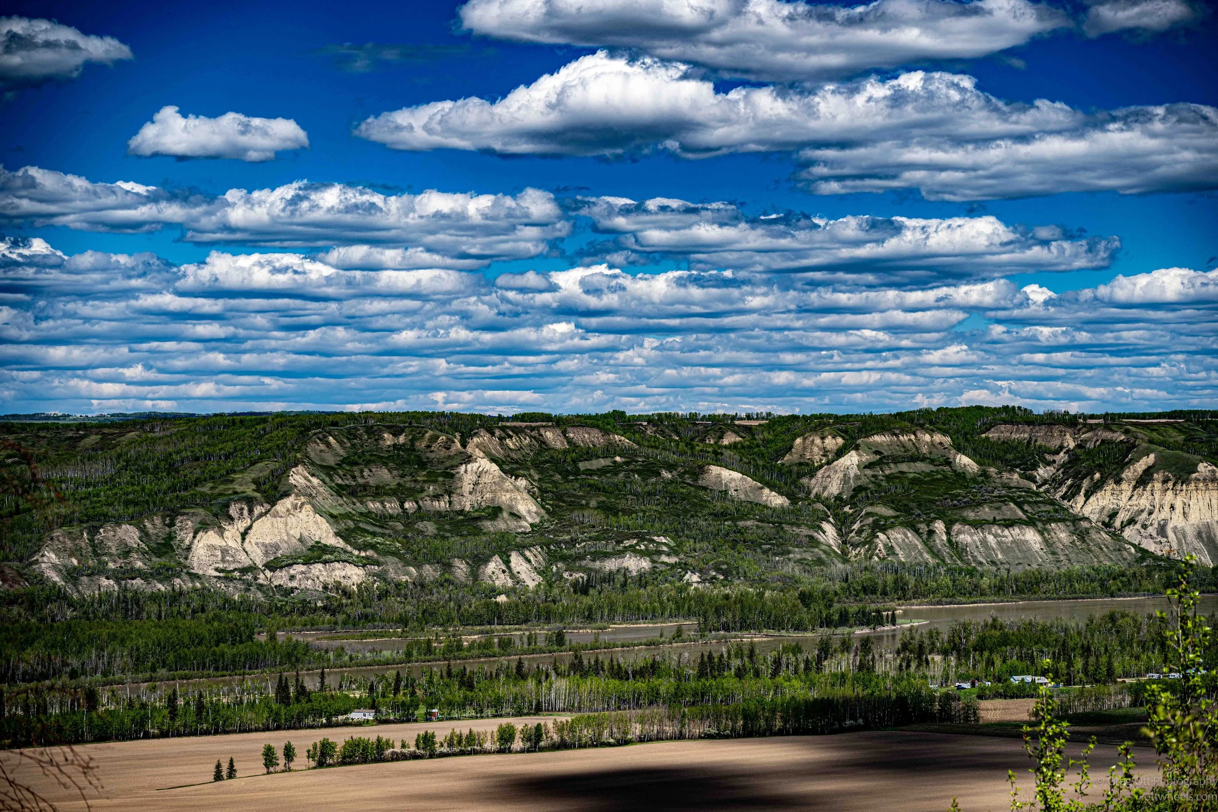
After my walk, I decided to go explore Rose Prairie, about 30 miles north of town. Fort St. John abruptly disappeared behind me and the road quickly transitioned into open country. I found myself driving through rolling fields, down steep hills, and back up the other side again. In several places the road was rough and partially washed out, with warning signs reminding drivers just how harsh northern winters and spring runoff can be on infrastructure.
Rose Prairie is not really a town in the traditional sense with a defined downtown. It’s more a spread-out rural district made up of farms, gravel roads, ranches, industrial yards, oil and gas infrastructure, and patches of boreal forest scattered between open prairie land. The “prairie” part of the name comes from the natural grassland openings in the region. Much of northern British Columbia is heavily forested, so these open rolling fields stood out to early settlers traveling through the area. The “rose” likely comes from the wild roses that grow naturally across parts of northern BC and the Canadian prairie provinces during the summer months.

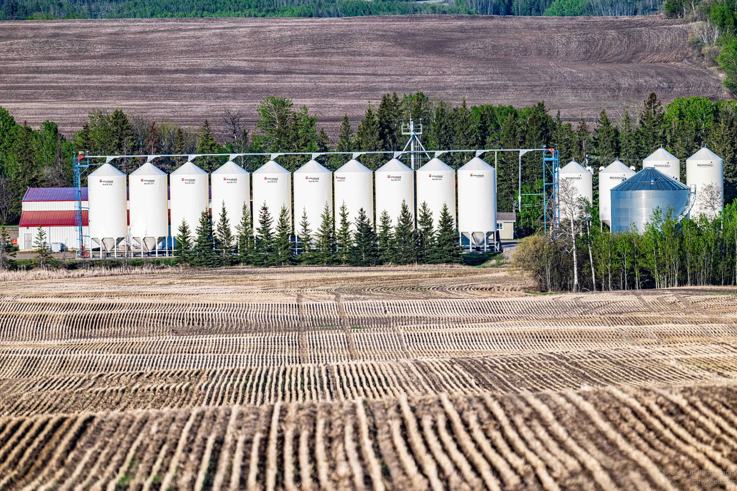
Driving through the area, the landscape constantly shifted between agriculture and industry. Grain fields sat beside muddy access roads leading to drilling operations. Old farm equipment, cattle pastures, storage tanks, and heavy trucks all seemed to exist together in the same environment. It had this feeling of frontier farming mixed with northern resource extraction.
Rose Prairie is also tied to one of the largest wildfires in North American history. In 1950, the Chinchaga Fire began near the Rose Prairie region and eventually burned an estimated 3.5 million acres across British Columbia and Alberta. The smoke from the fire spread so far that it reportedly crossed the Atlantic Ocean and contributed to unusually dark skies over parts of Europe.
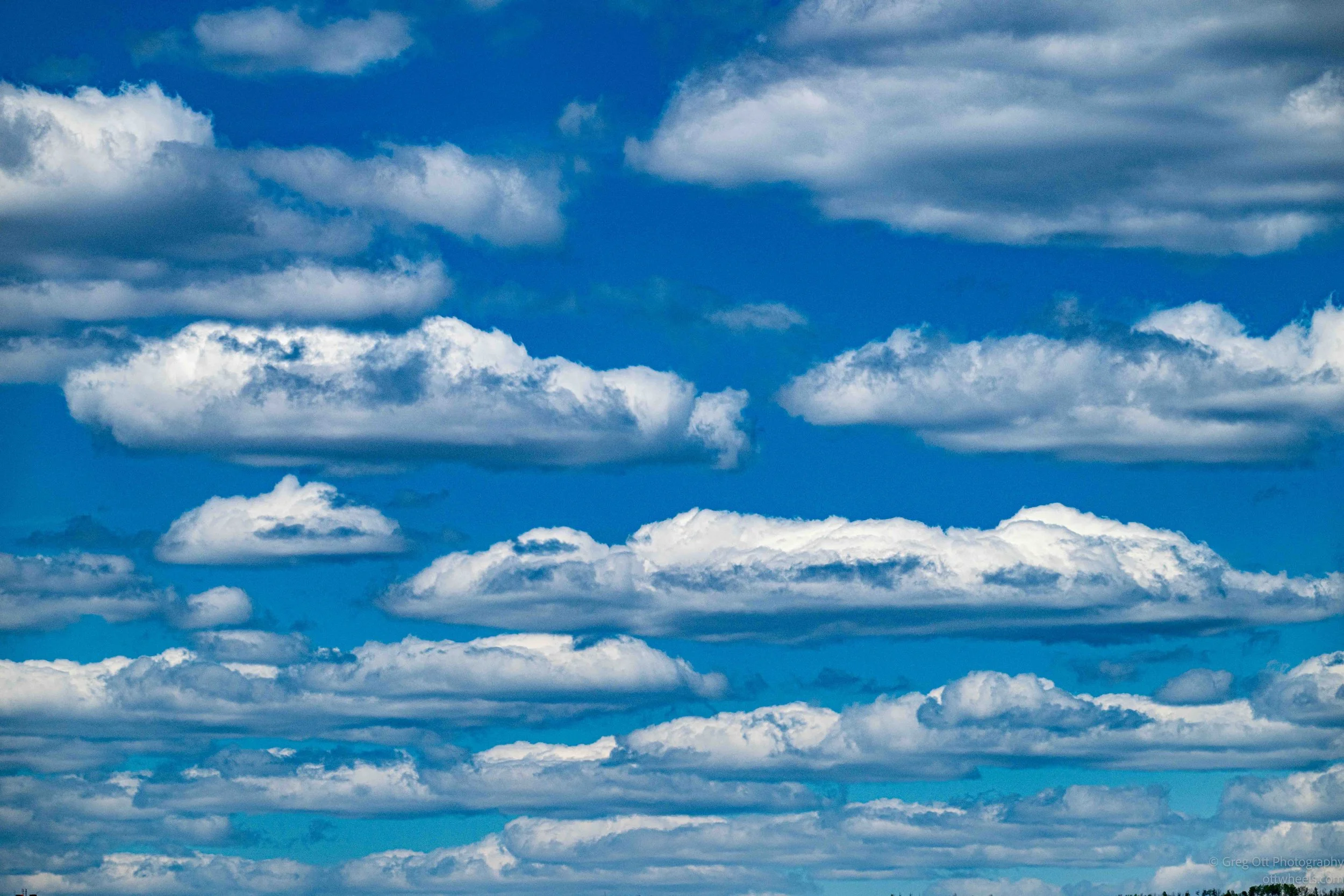
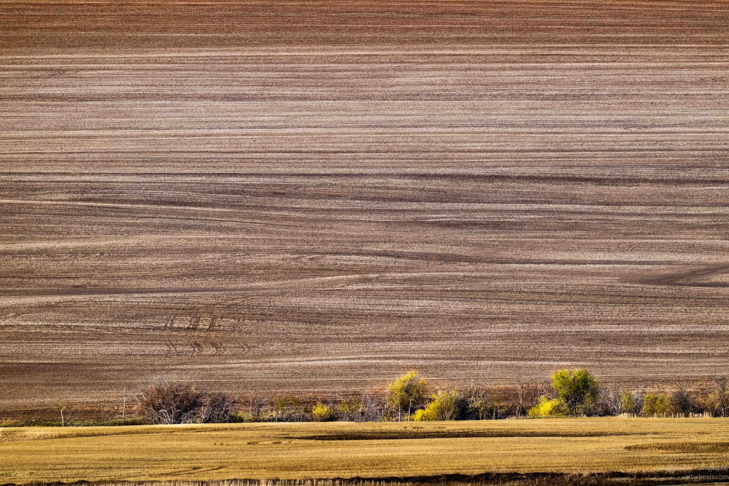
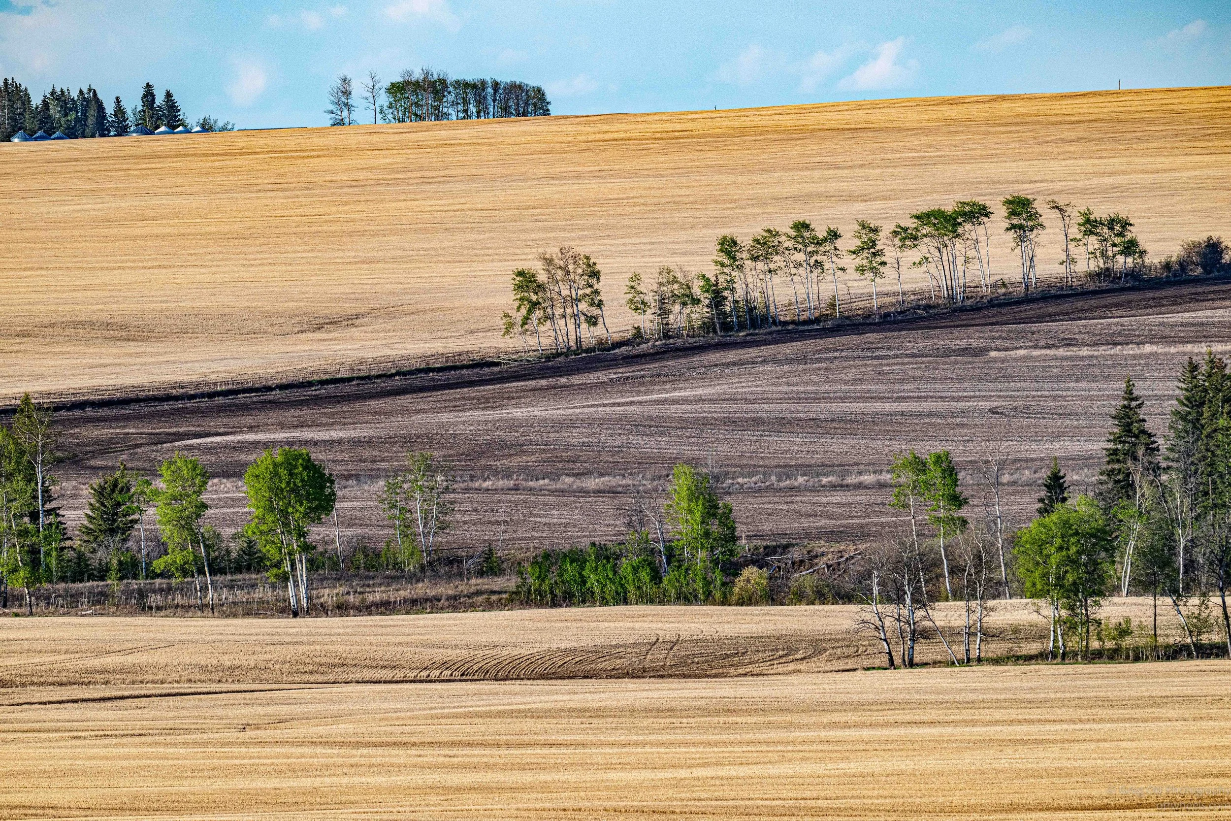
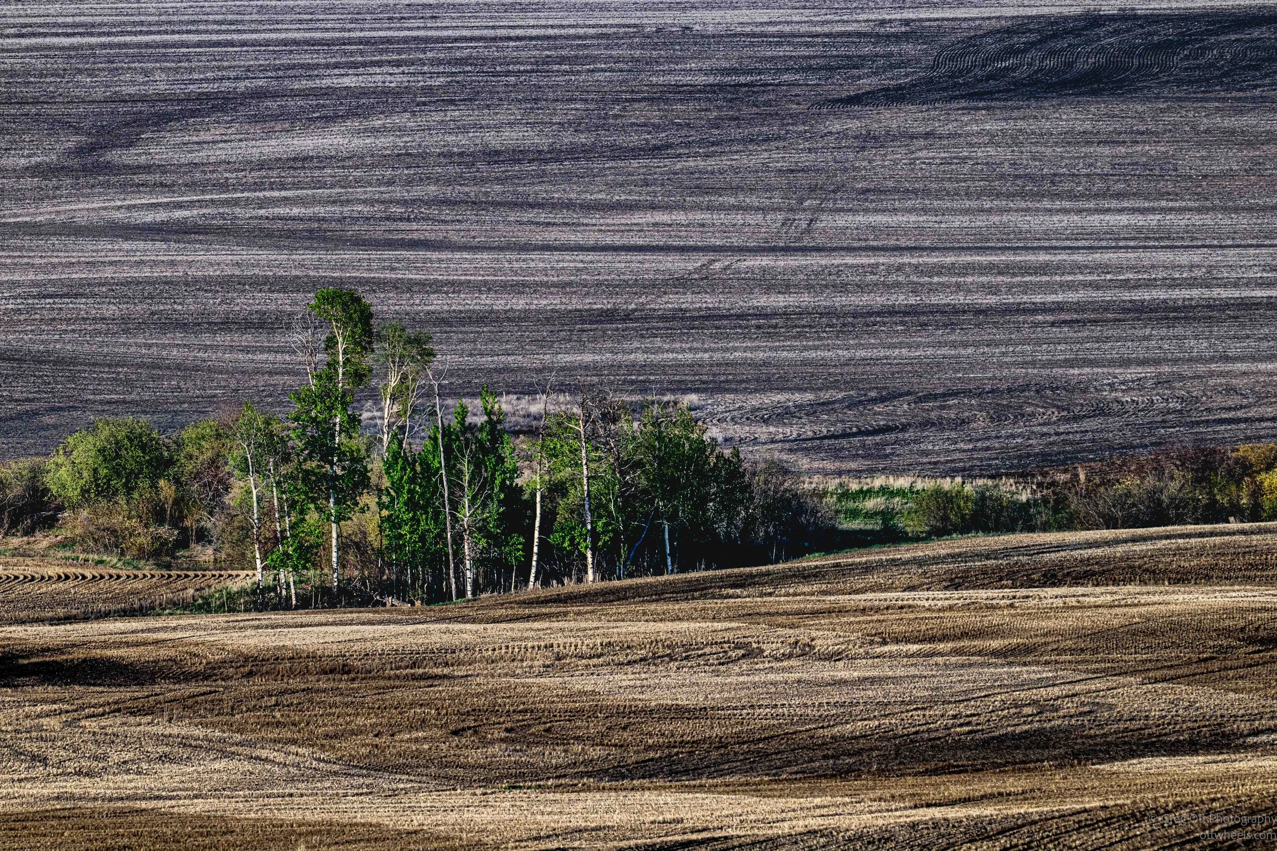
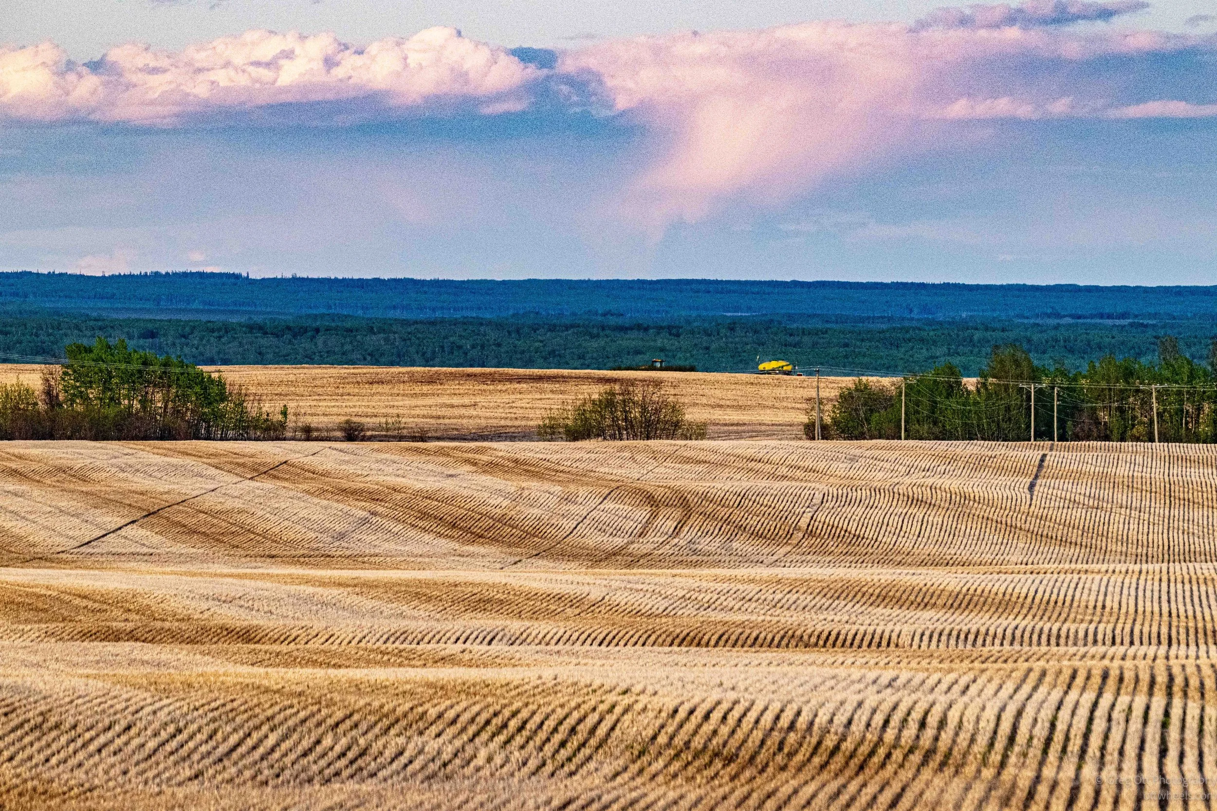
The evening light across the prairie was beautiful. Long shadows stretched across the rolling fields while the low sun cast a golden glow over the landscape. The plowed earth created layered patterns and textures that almost looked abstract at times. Above it all, white clouds drifted through the deep blue northern sky. I found myself stopping repeatedly along the roadside just to watch the changing light move across the land.

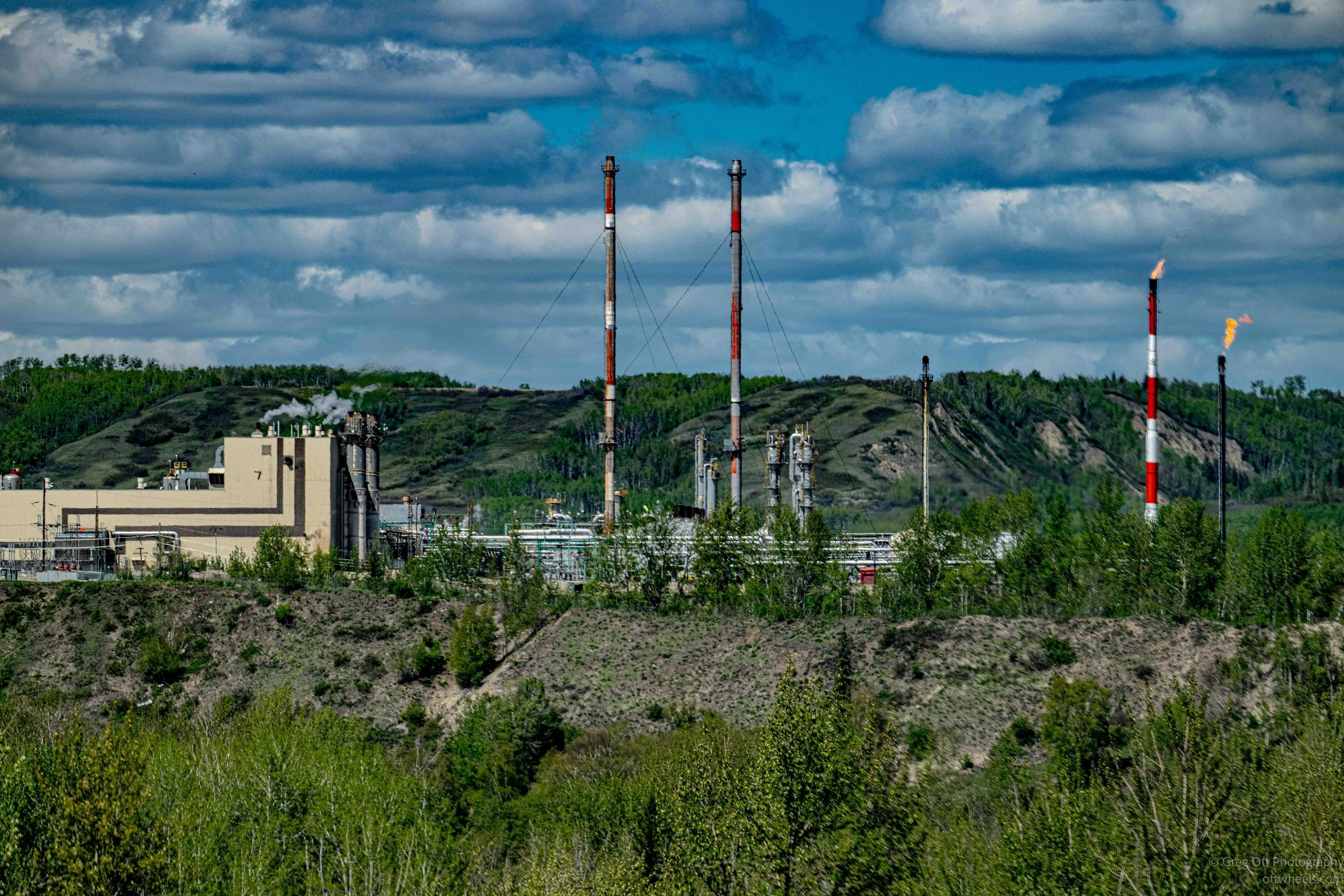
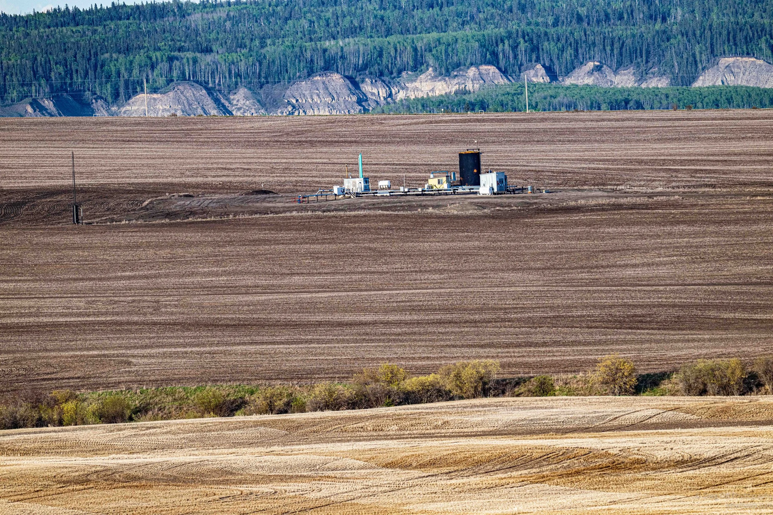
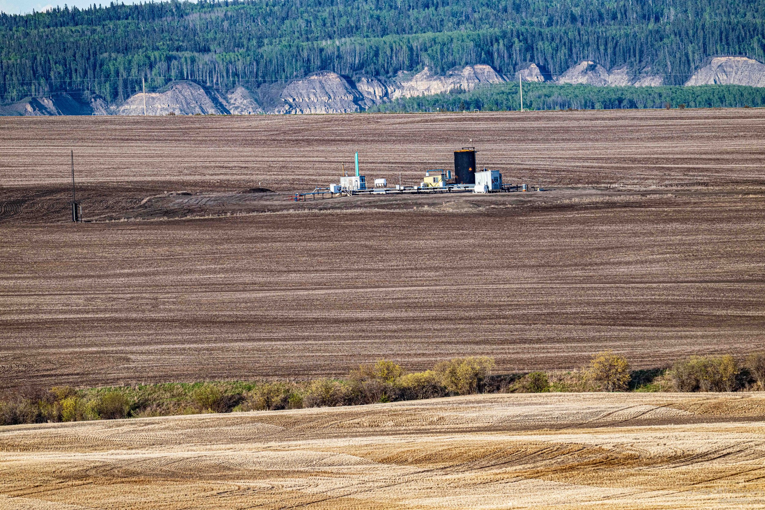
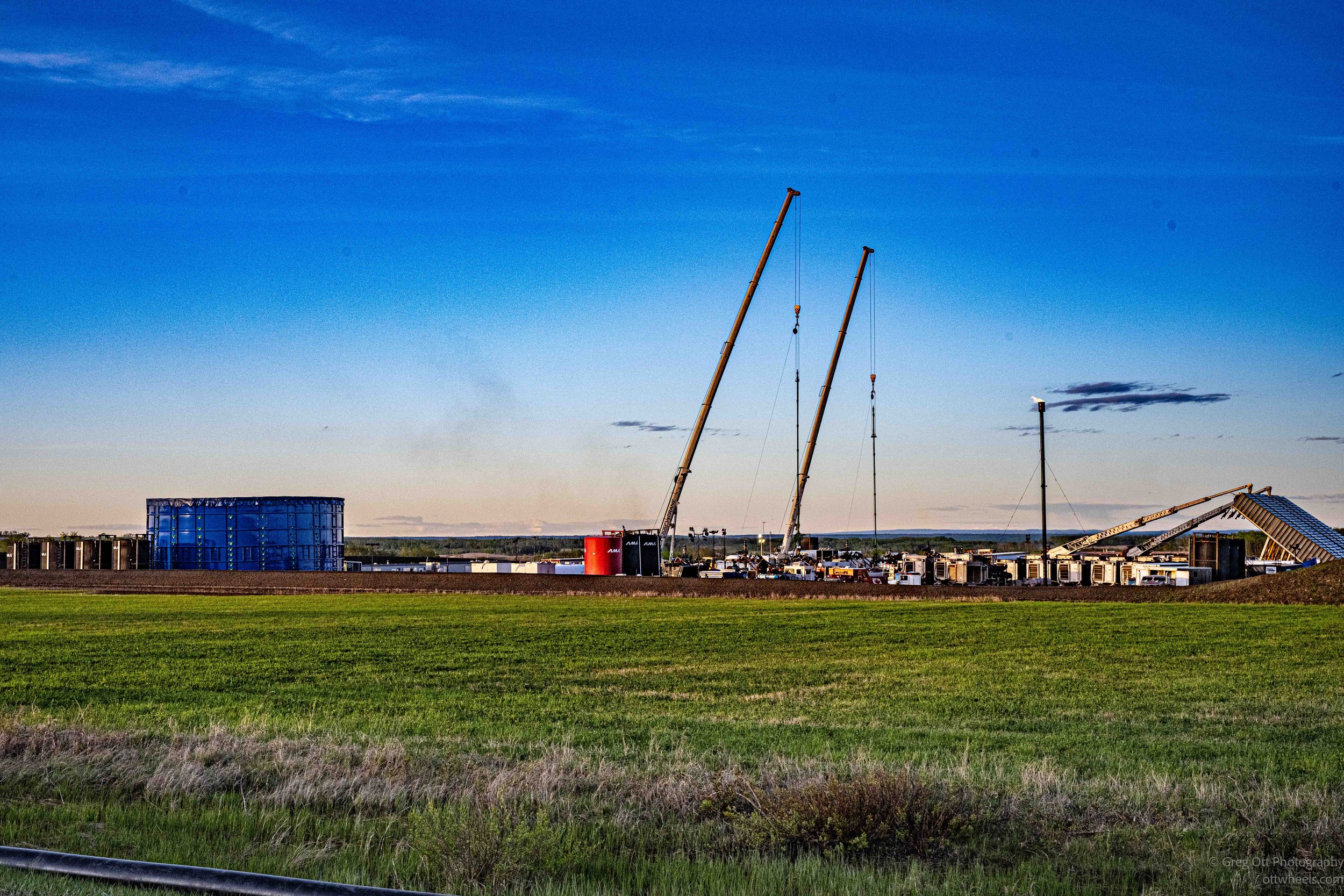
As I continued farther north through British Columbia, the landscape kept shifting between farmland, forest, and heavy industry. Outside one of the small prairie communities I came across a large Strathcona Resources Montney drilling site spread across the fields. Massive cranes, flare stacks, drilling equipment, tanks, and temporary structures stretched across the horizon under the long northern evening light. This region sits over the Montney Formation, one of the largest natural gas and liquids deposits in North America, and the scale of the operation made it clear just how important energy production is to the economy of northern BC. Even in remote areas, the constant movement of trucks, equipment, and industrial construction never seemed far away.

There was a strong smell of fresh soil in the air and eventually I spotted the source, a large tractor slowly working its way across one of the rolling fields. At first it looked strange because the soil was not being completely turned over the way I was used to seeing farther south. Instead, narrow strips of crop residue and stubble were intentionally left behind between the planted rows. I later learned this is a form of conservation tillage commonly used across the prairie regions to reduce erosion and retain moisture. The leftover plant material helps protect the soil from the strong prairie winds while also holding moisture in the ground during dry periods. Watching the tractor move steadily across the open landscape, it struck me how different farming conditions are this far north, where the growing season is shorter, the weather harsher, and protecting the soil becomes just as important as planting the crop itself.
As I was driving back toward town, a low fuel warning suddenly appeared on the dashboard. The van estimated I had about 85 kilometers remaining and I was still roughly 35 kilometers from Fort St. John. It was enough, but just barely enough to make me uncomfortable this far north where services quickly become sparse. It also reminded me that I still had not filled the spare fuel cans I bought months ago.
After filling up, I found an Indian restaurant that stayed open until 10 p.m. and managed to place my order around 9:45. After paying, the woman at the counter smiled and told me it would still be another 25 minutes. Later that night I returned to the Walmart parking lot where part of the lot was being taken over by a traveling carnival setting up for the weekend. Despite the “No Camping” signs, I tried to blend in among the other vehicles. Like most of the northern Walmart lots I’d used so far, it ended up being surprisingly quiet once the evening settled down.