Kluane Lake
I woke north of Haines Junction at a rest stop. A truck had pulled in late last night and was also still here. It was lightly snowing and a building near by had ice on the roof. There was no traffic on the Alaska Highway and I took this to mean it probably wasn’t wise to travel. I then realized that it was Saturday morning and perhaps people were sleeping in later due to the weather. Regardless, I went back to sleep for a couple hours with my heating blanket turned on.
By 9 a.m., I still hadn’t heard any traffic. I made breakfast, wrote some emails, and waited until I heard traffic moving. The truck pulled out a little after 11 a.m. which was my queue to start rolling. I needed to be in Haines, AK to pick up a pump at the post office sometime next week. So, I decided to drive north to Kluane Lake in the opposite direction.
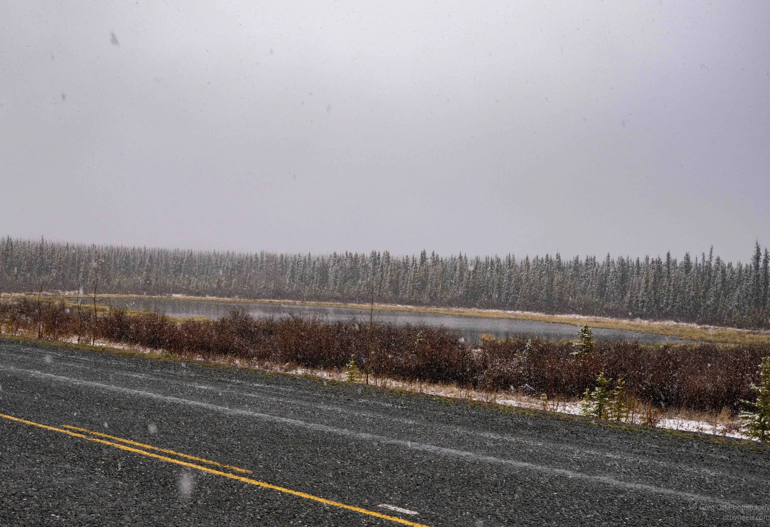
The roads north were fine, but the wind was very strong and periodically it would snow lightly. Traffic was light, but most of it was going north in the same direction.
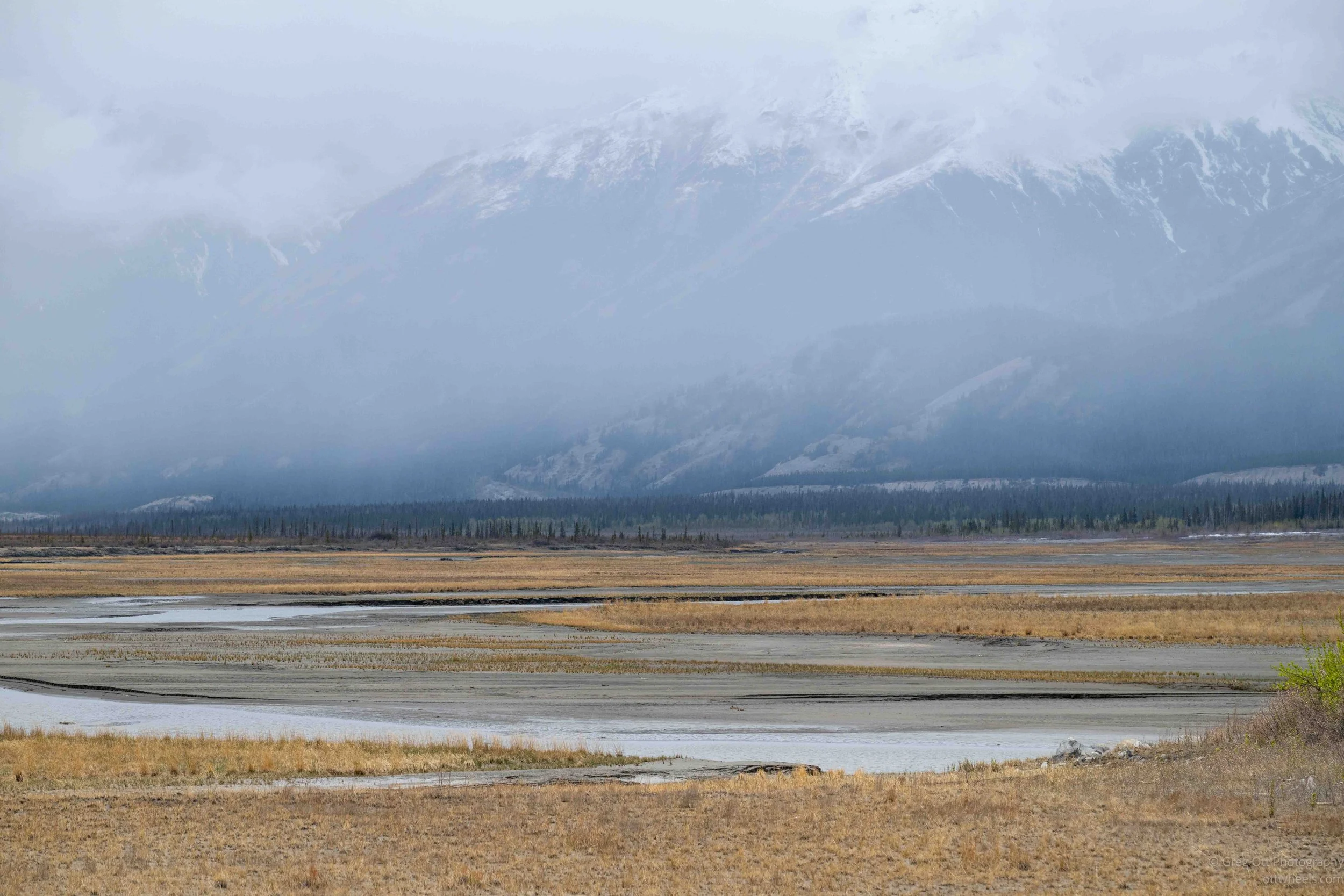
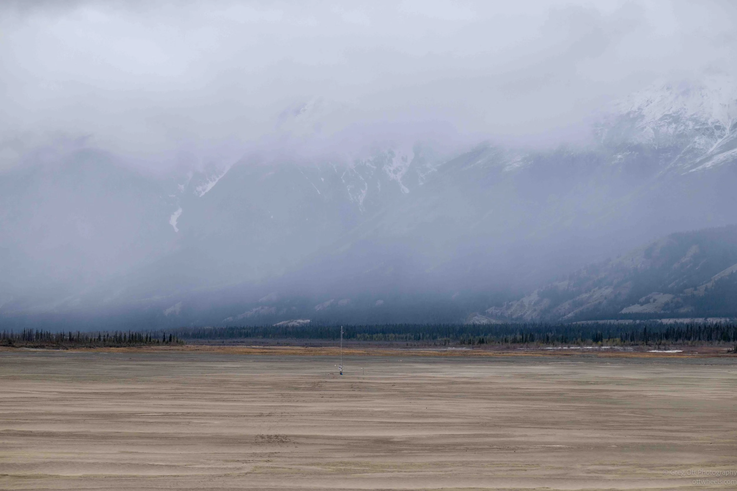
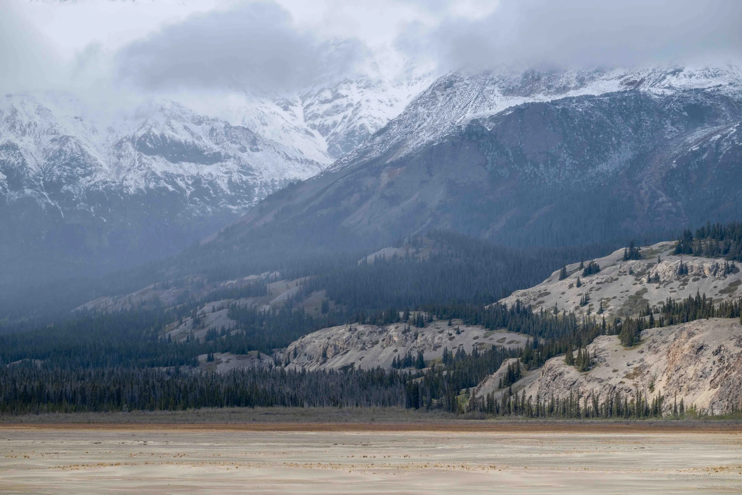
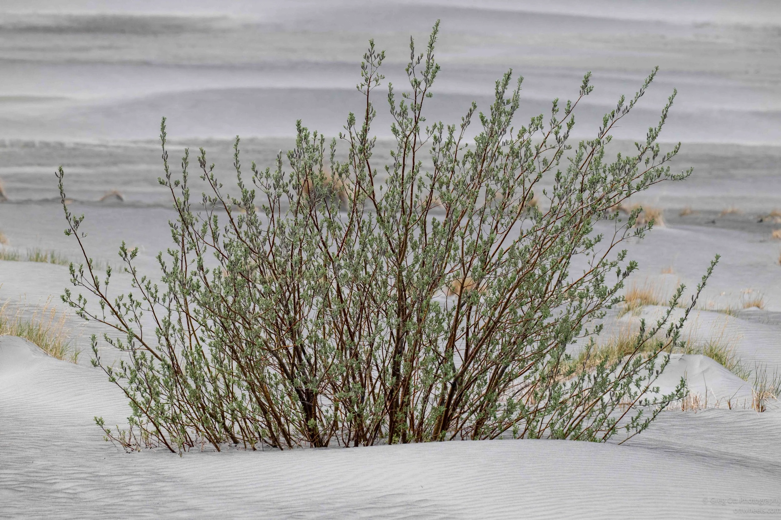
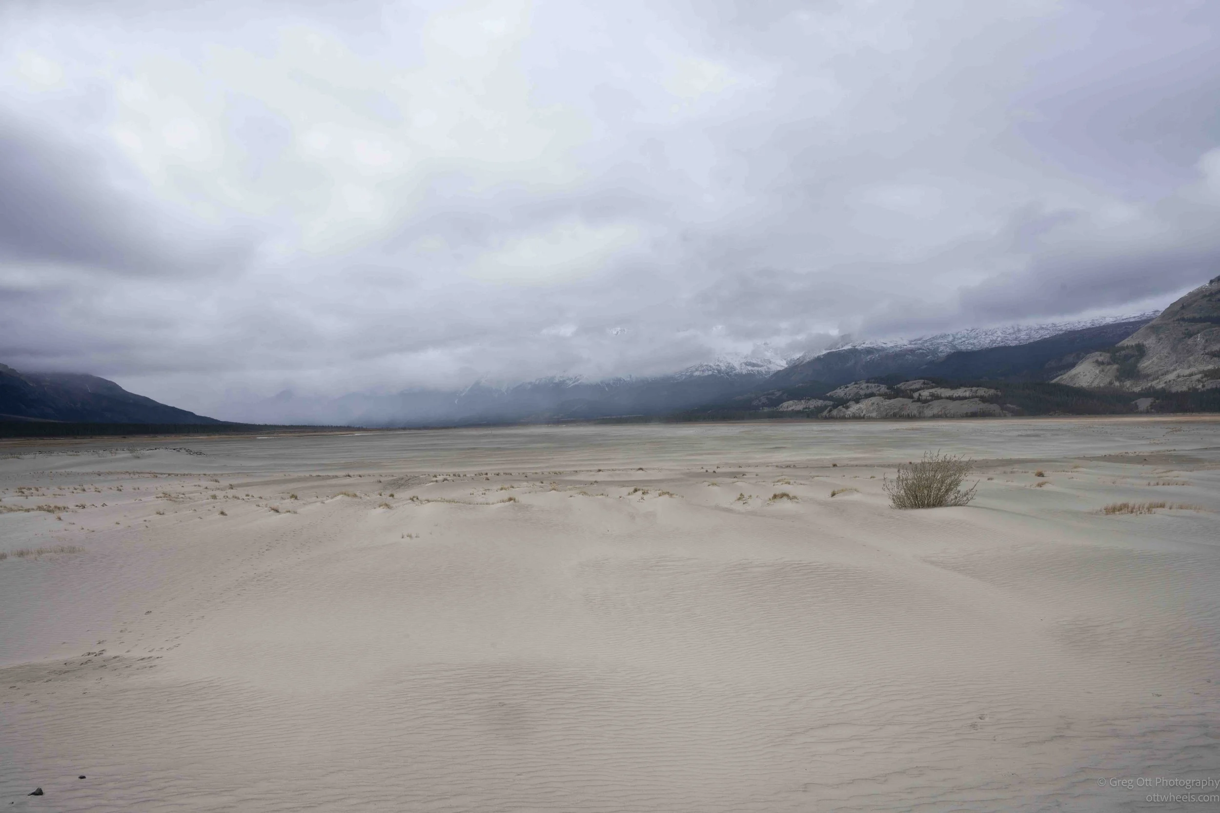
South of the Thechàl Ahâll’ Visitor Centre I stopped to look at the terraine. The Slims River flowed into Kluane Lake at the point. It was a strange mix of river, desert, High mountains, and Lake all coming together at one point.
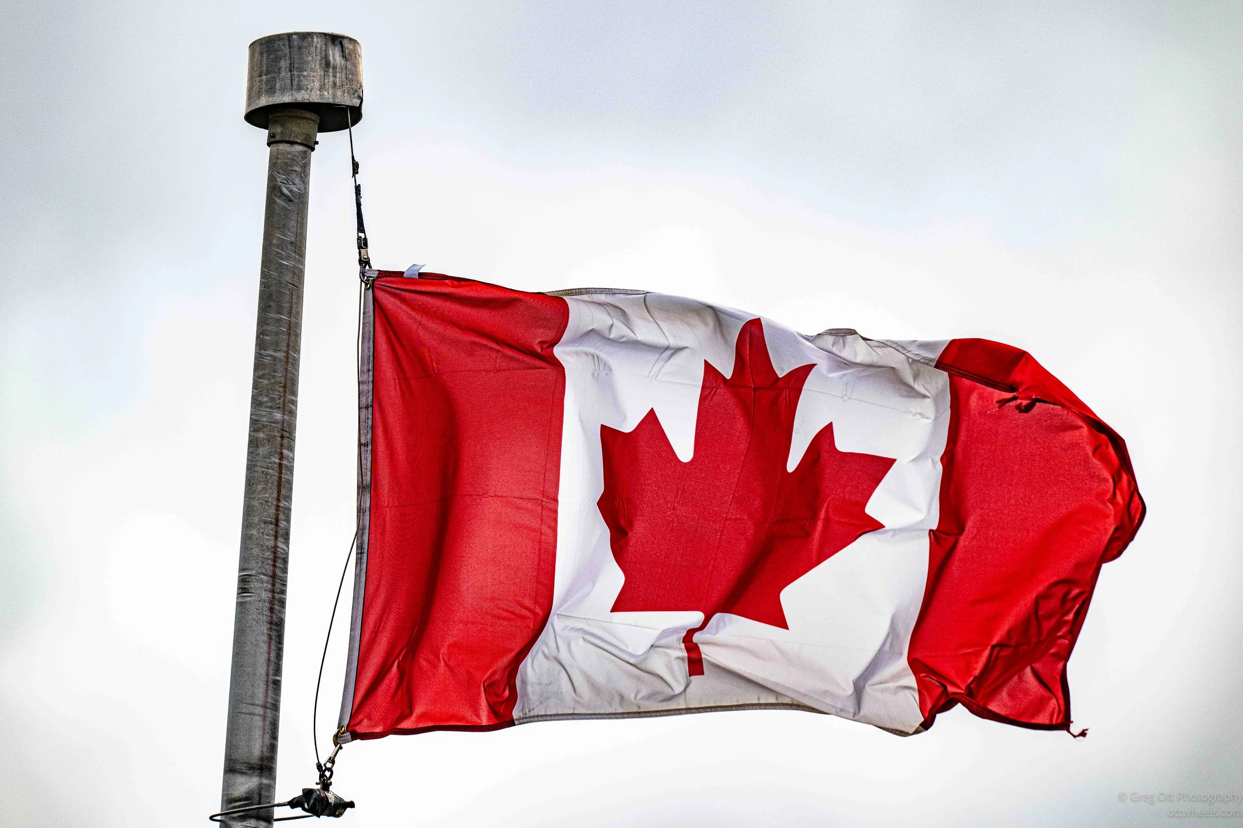
I stopped at the Visitor Centre to get information on the trails. The wind was intense. I noticed the canadian flag being blown heavily and stand straight out. The visitor centre is very small and there were two ranger on staff. A very tall, young handsome ranger greeted me. I talked about hiking and he suggested one trail, Soldier’s Summit. He told me there was bear activity in the area, and that I might want crampons. By the time I made it back to the van, I convinced myself that a hike wasn’t going to be pleasant.
The ranger mentioned a museum near Burwash Landing that he had heard good things about. It was about 40 minutes farther north, which sounded like a good alternative to hiking in the wind. I pointed the van in that direction, stopping in Destruction Bay for gas along the way and staying true to my gas philosophy.
Right before I pulled out, a funeral procession passed by the gas station. They were traveling 60kph and I fell in line behind them. The lead vehicle was some type of large GM Truck and the casket was sticking out the back. I followed them for about 15 minutes and then saw something interesting to the side of the road.
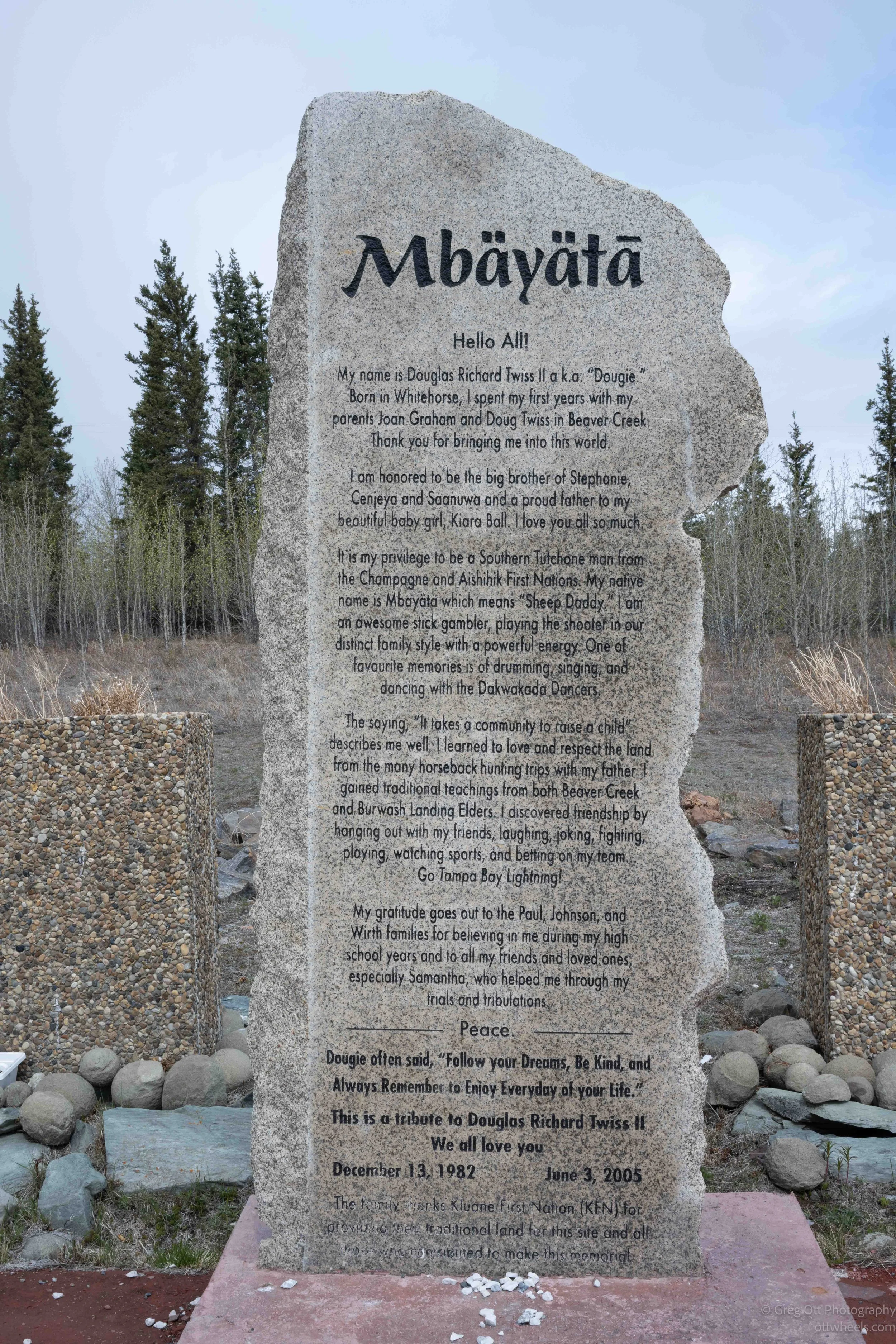
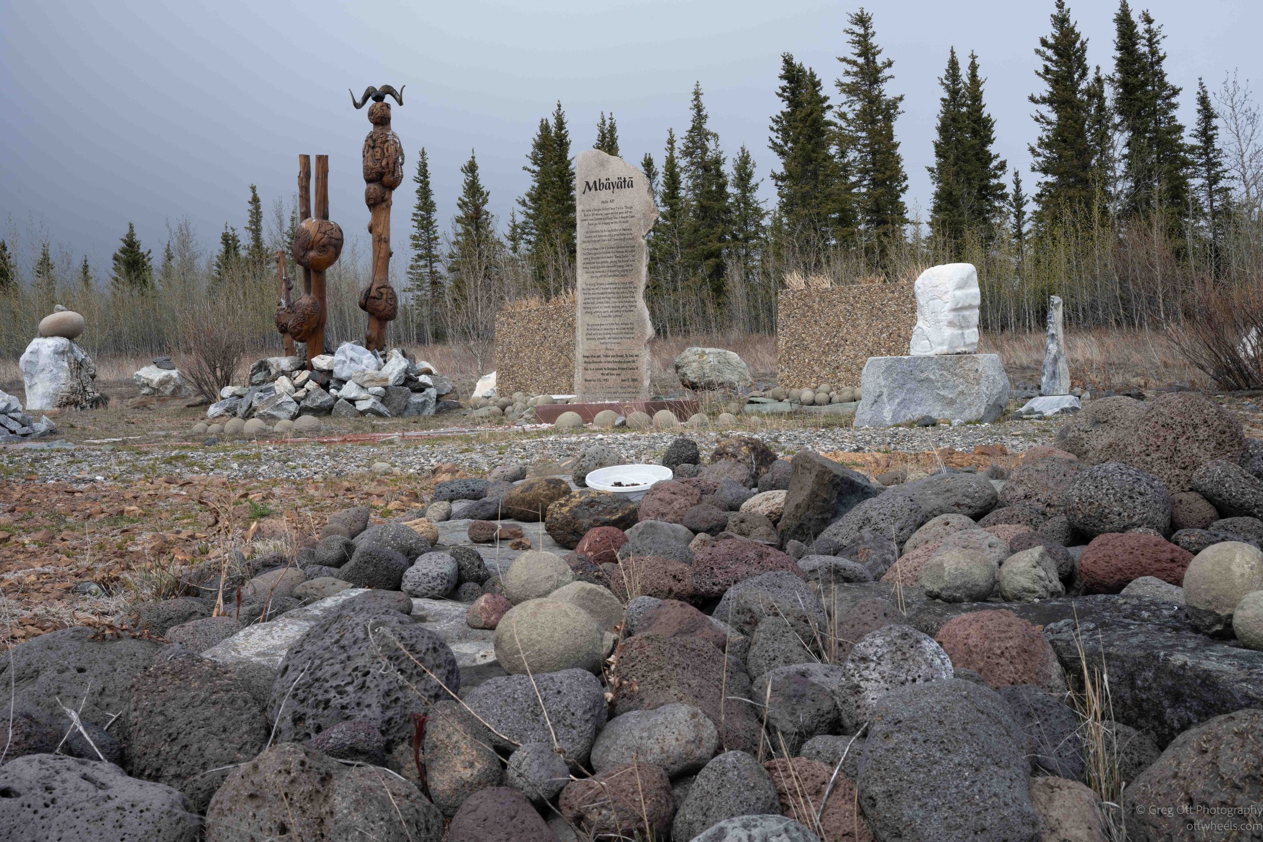
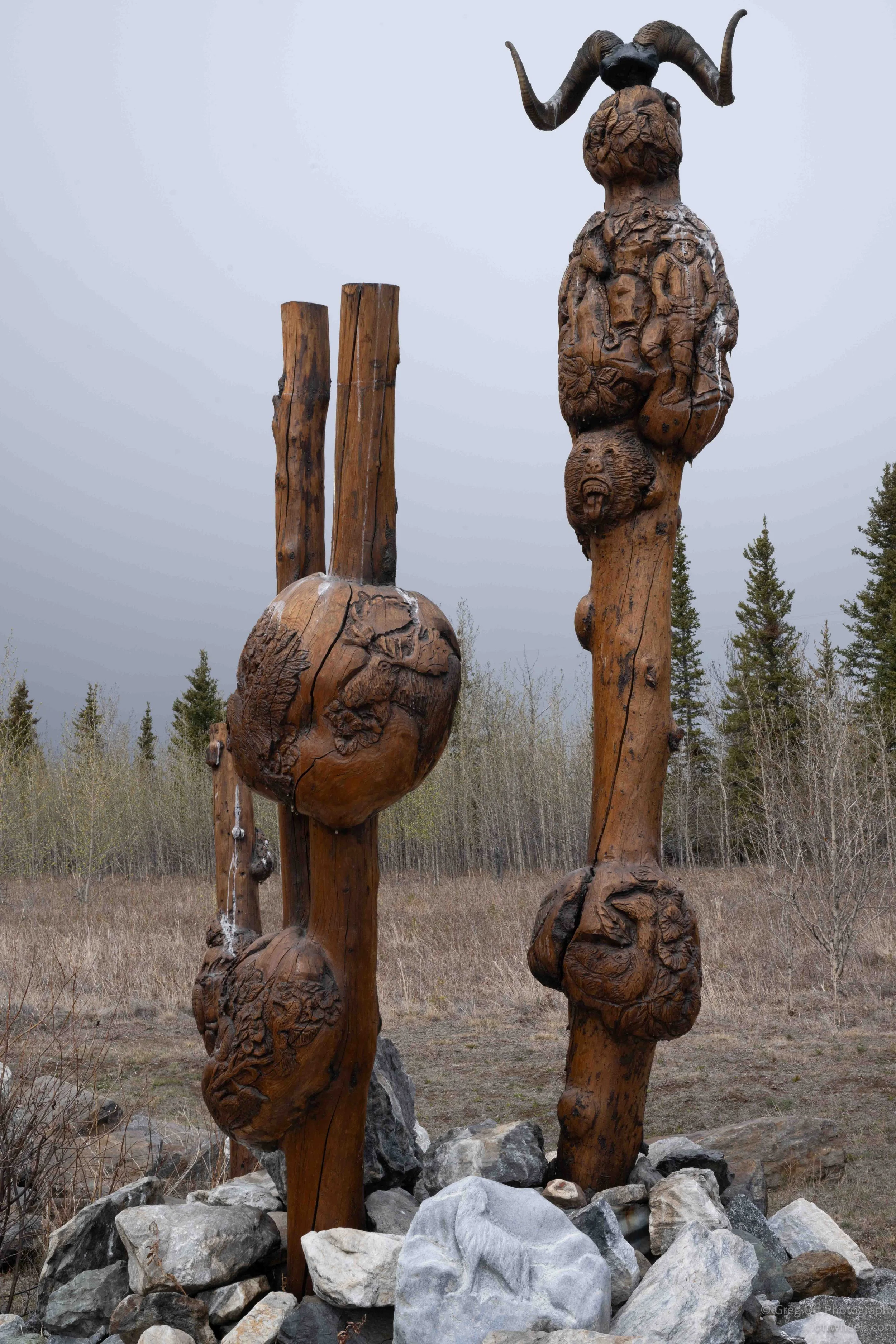
After pulling off the Alaska Highway, I came across a memorial dedicated to Douglas Richard Twiss II (1982–2005). The monument describes him as a Southern Tutchone man from the Champagne and Aishihik First Nations and reflects on the importance of family, community, and respect for the land. One detail that stood out was his traditional name, Mbäyätä, meaning "Sheep Daddy," and his fond memories of drumming, singing, and dancing with the Dakwäkada Dancers. The memorial reads less like a formal plaque and more like a personal tribute from family and friends, offering a glimpse into the close-knit Indigenous communities of the Yukon.
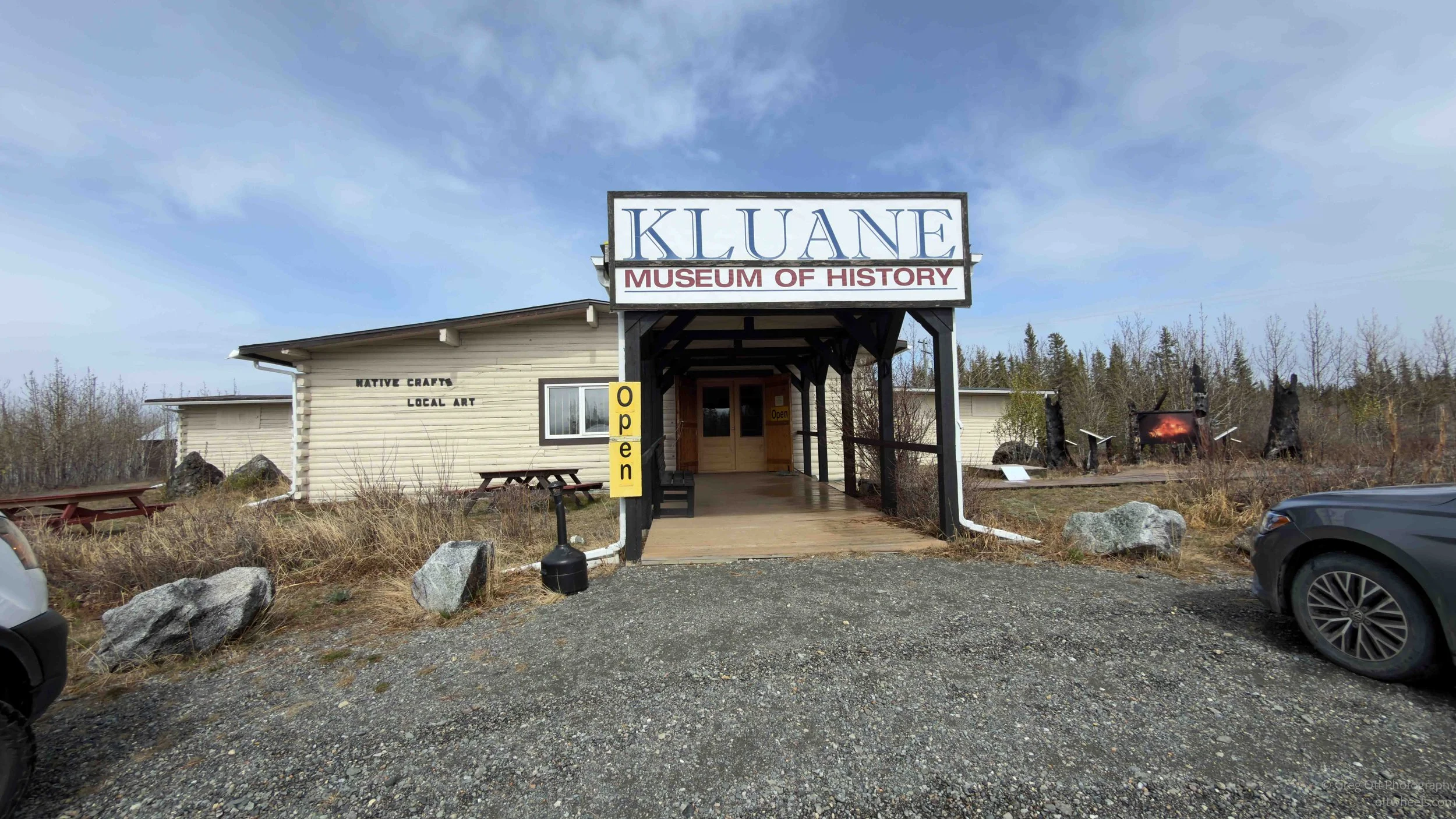
Kluane Museum at Burwash Landing
I stopped at the Kluane Museum of History in Burwash Landing, a small museum that turned out to be much better than I expected. Admission was only C$8, and for that price it packed in a surprising amount of information about the wildlife, natural history, and people of the southwest Yukon.
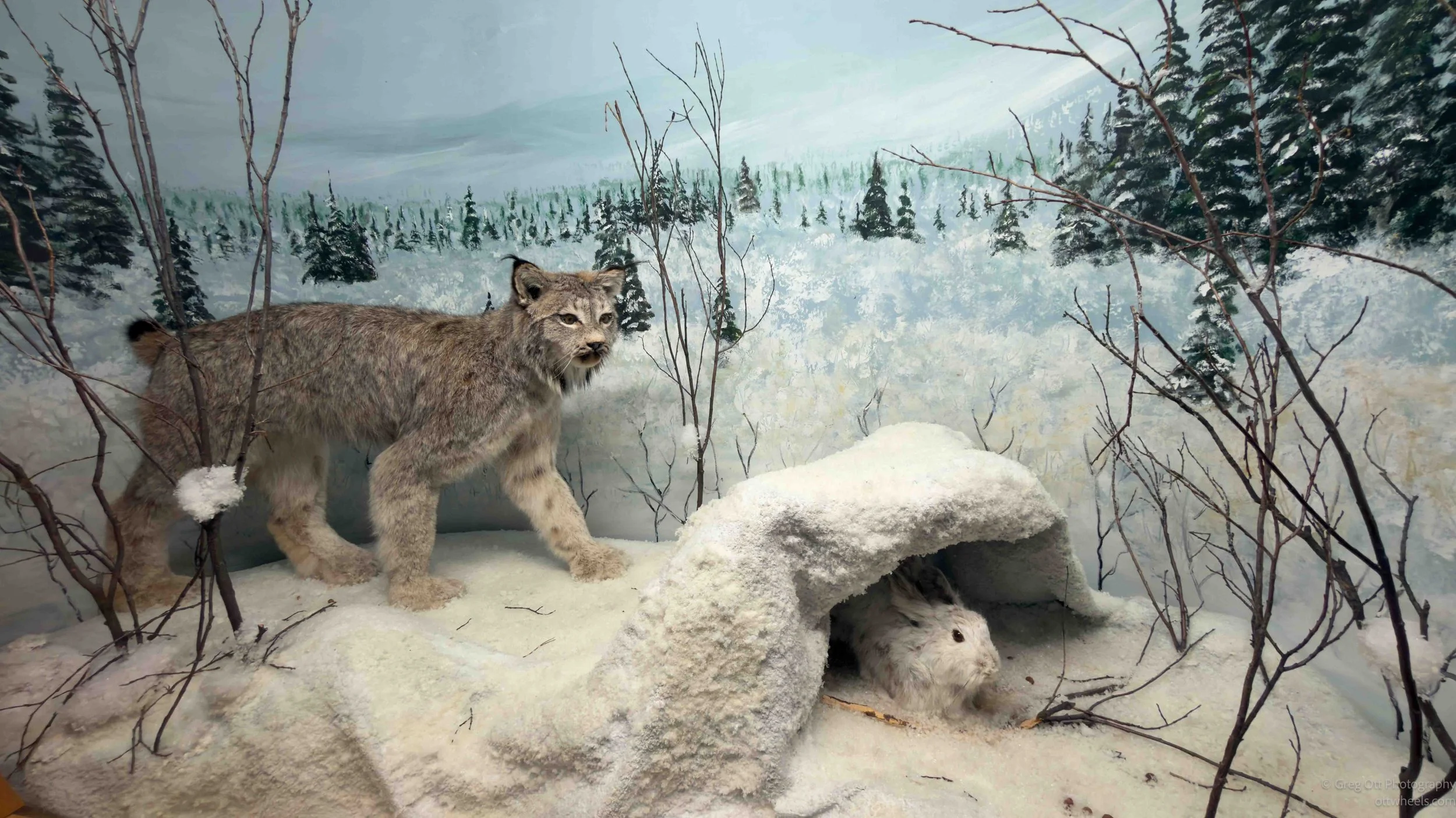
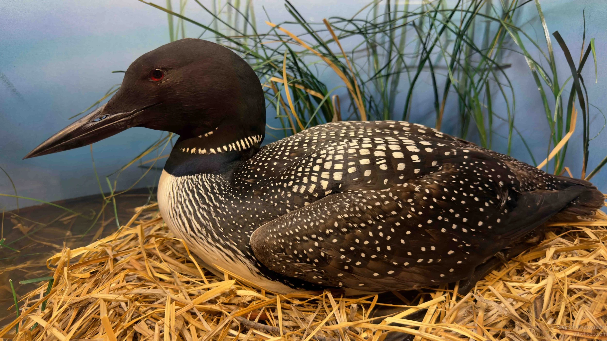
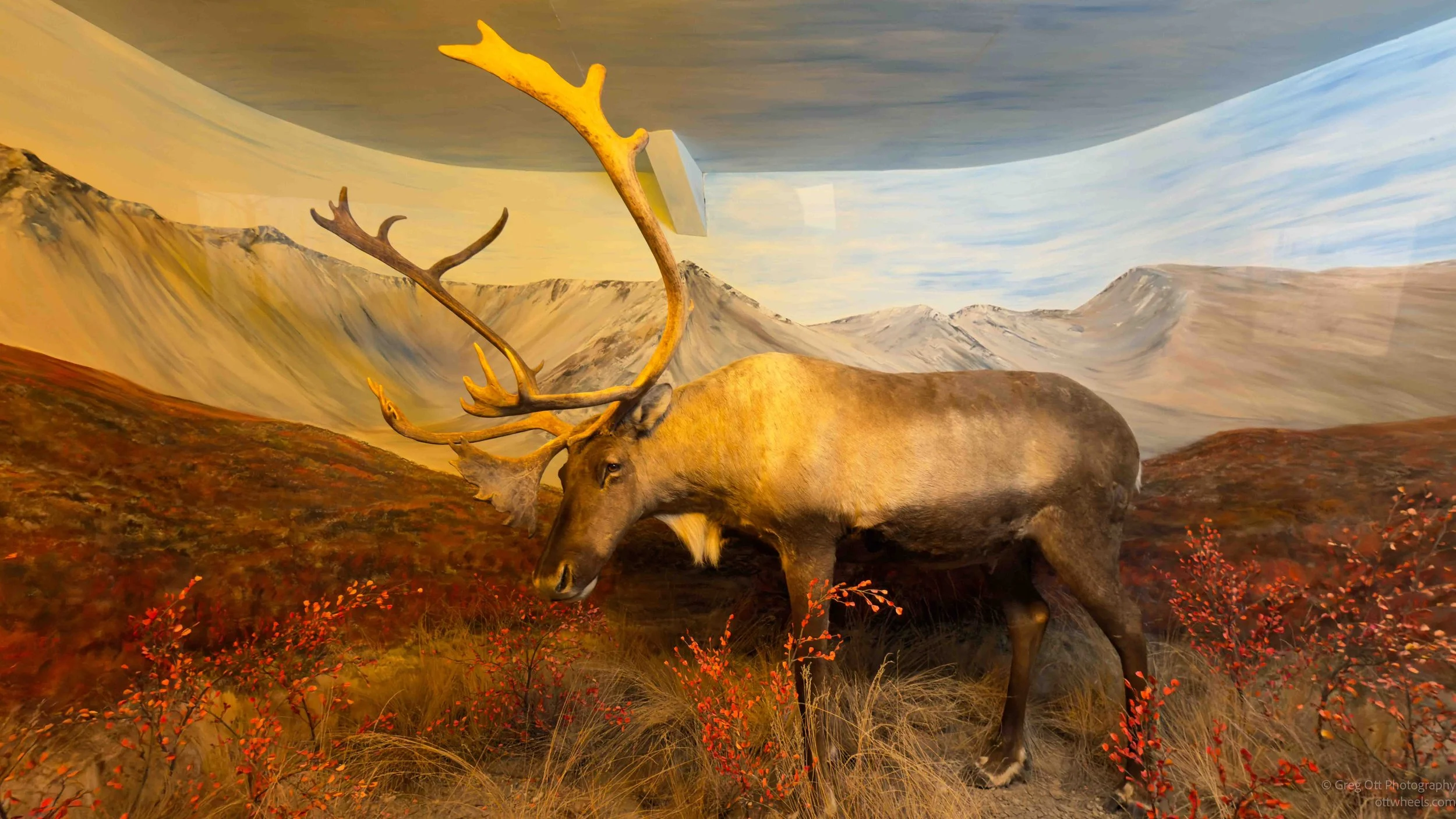
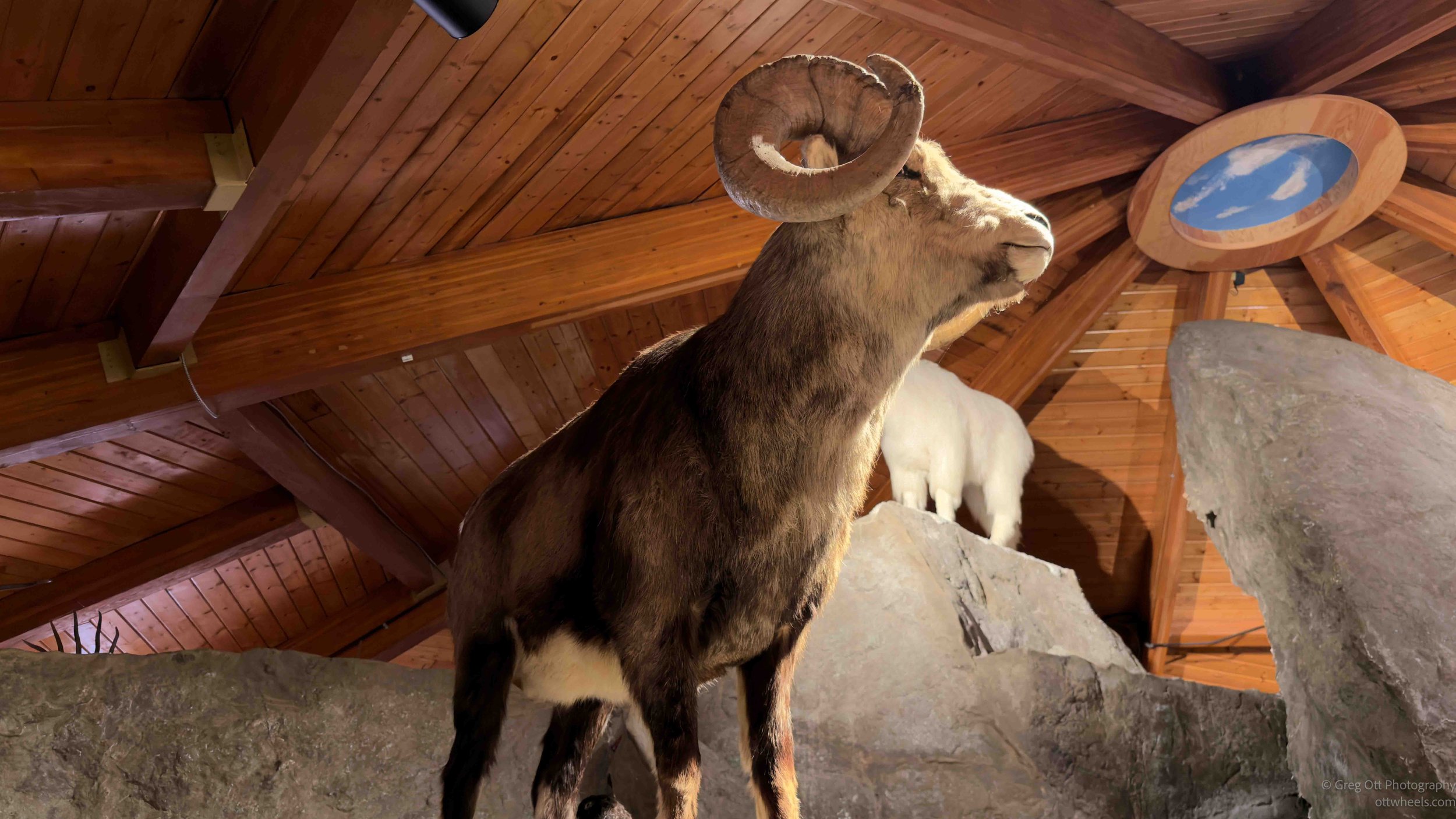
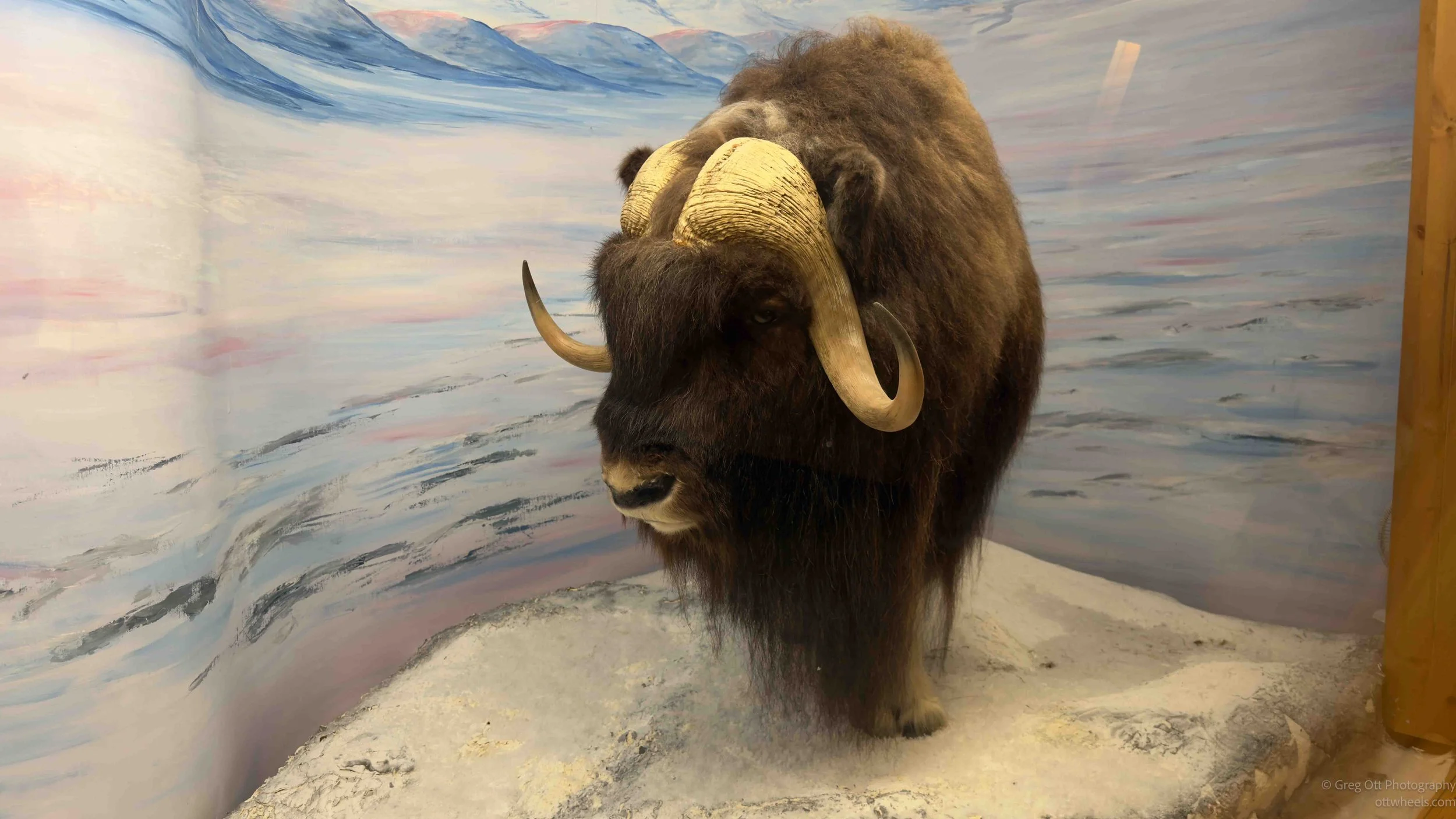
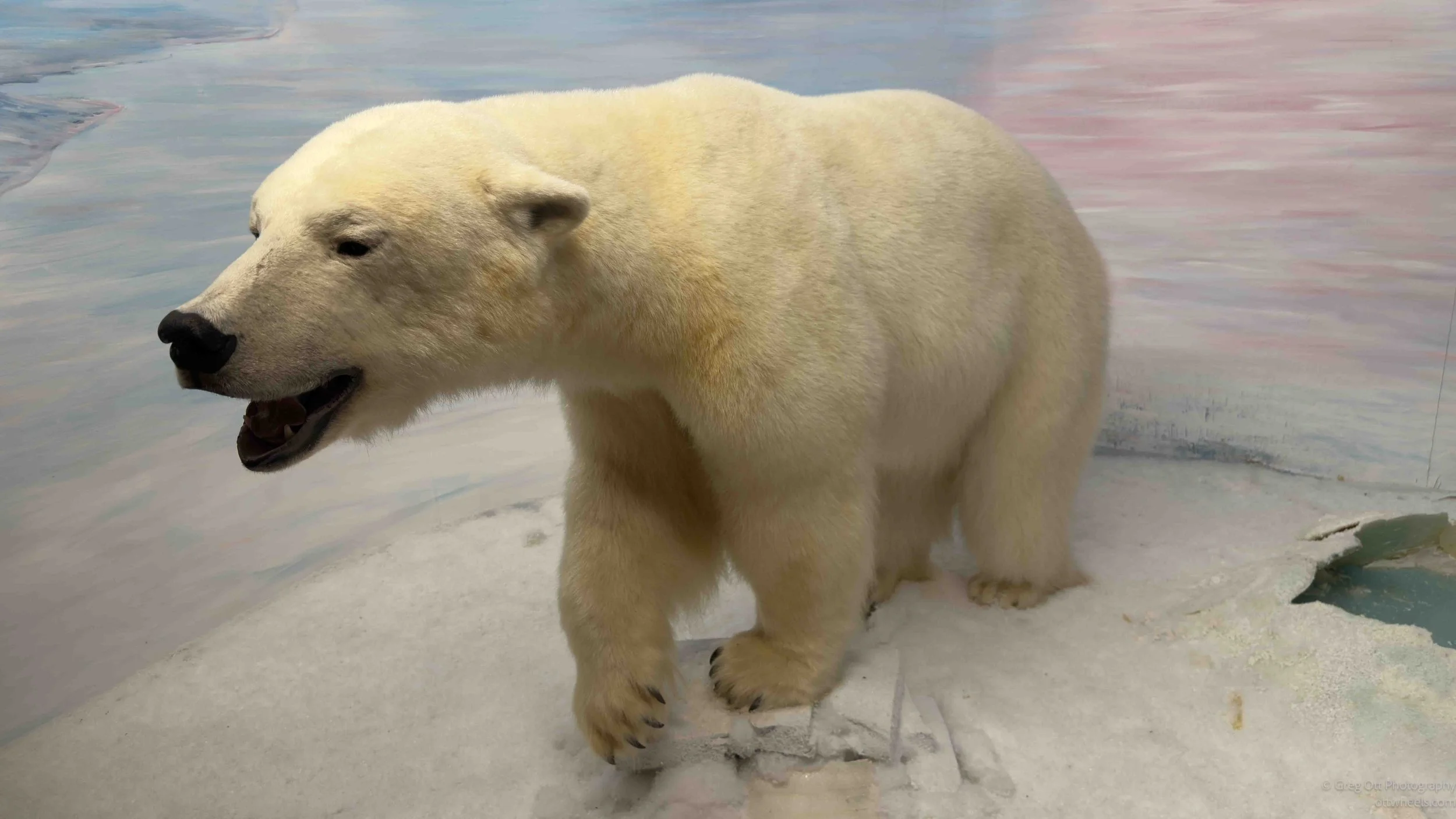
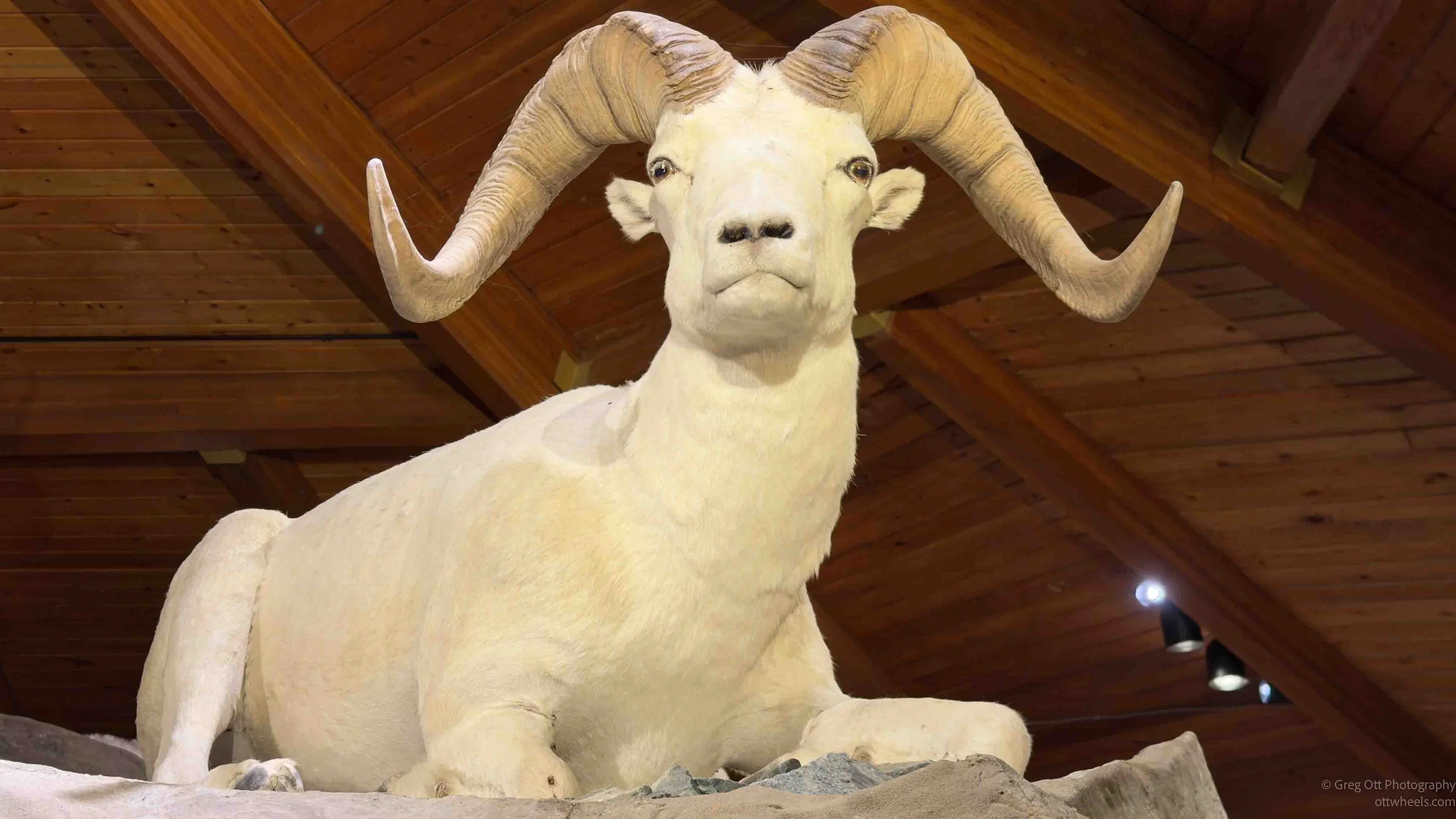
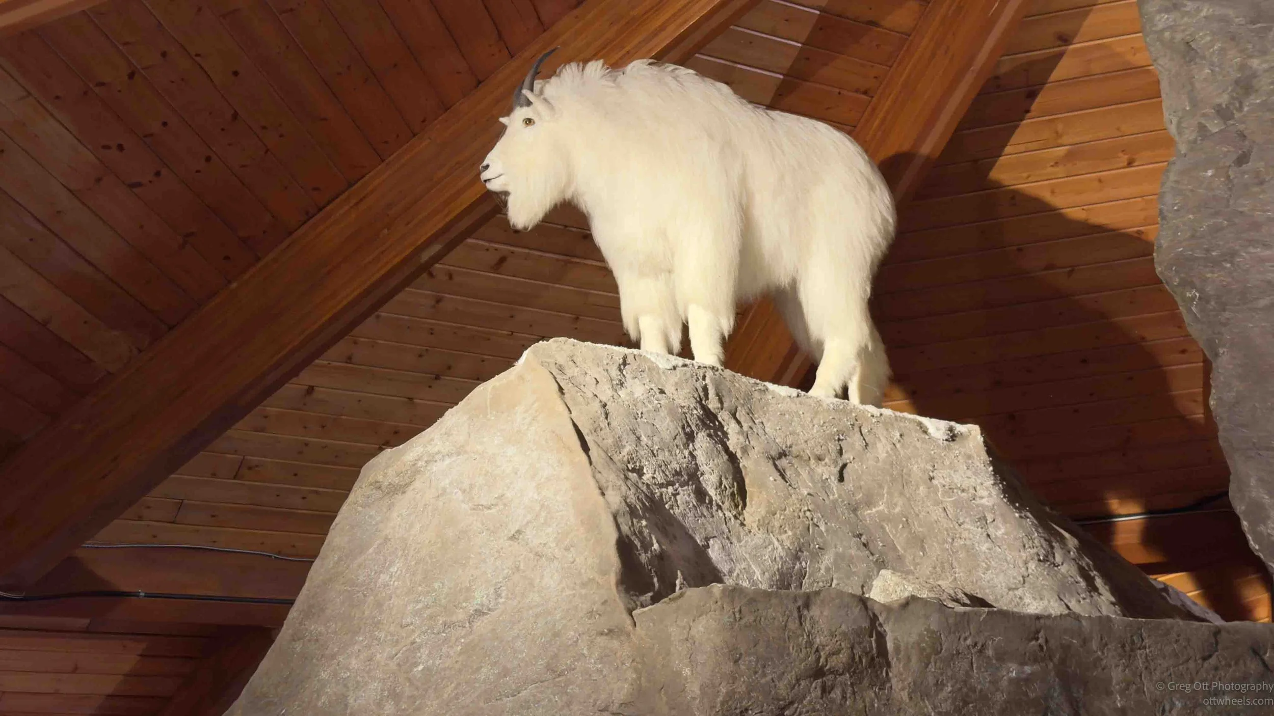
The first thing that caught my attention was the quality of the wildlife exhibits. Many small museums have aging taxidermy displays that look more like old hunting trophies than educational exhibits. These were different. The animals were displayed in realistic scenes that helped explain how they live and survive in the north. There were lynx, Dall sheep, muskox, polar bears, birds, and other species found across the Yukon. The exhibits were well lit, thoughtfully arranged, and looked far more professional than I expected for a museum in a community of only a few hundred people.
A small theater continuously showed a documentary about Yukon wildlife and ecosystems. The film covered the region's vegetation zones, seasonal changes, migration patterns, and the habits of many of the animals featured in the museum. It was informative and clearly intended for visitors who may know little about the north. I watched for about 30 minutes before finally slipping out. By that point I felt like I had learned quite a bit, but the film seemed determined to cover every last animal in the territory and probably could have been trimmed down considerably.
While wandering through the exhibits, I noticed two local guys recording nearly everything with their iPhones. They looked like a father-and-son team documenting their visit. At one point one of them joked about how much he disliked people who post endless videos on YouTube. A few seconds later he was back to filming everything in sight. The irony wasn't lost on either of us.
The gift shop was also worth a stop. Rather than shelves of generic souvenirs, it carried a large selection of locally made and northern-themed items. There was Indigenous artwork, jewelry, handcrafted moccasins, gloves, books, and other items produced in the region. I picked up two books for my granddaughter and spent some time looking through the handmade clothing. One pair of caribou-hide mittens was priced at C$375. Expensive, certainly, but after feeling them it was easy to understand why people living through Yukon winters might consider them a worthwhile investment.
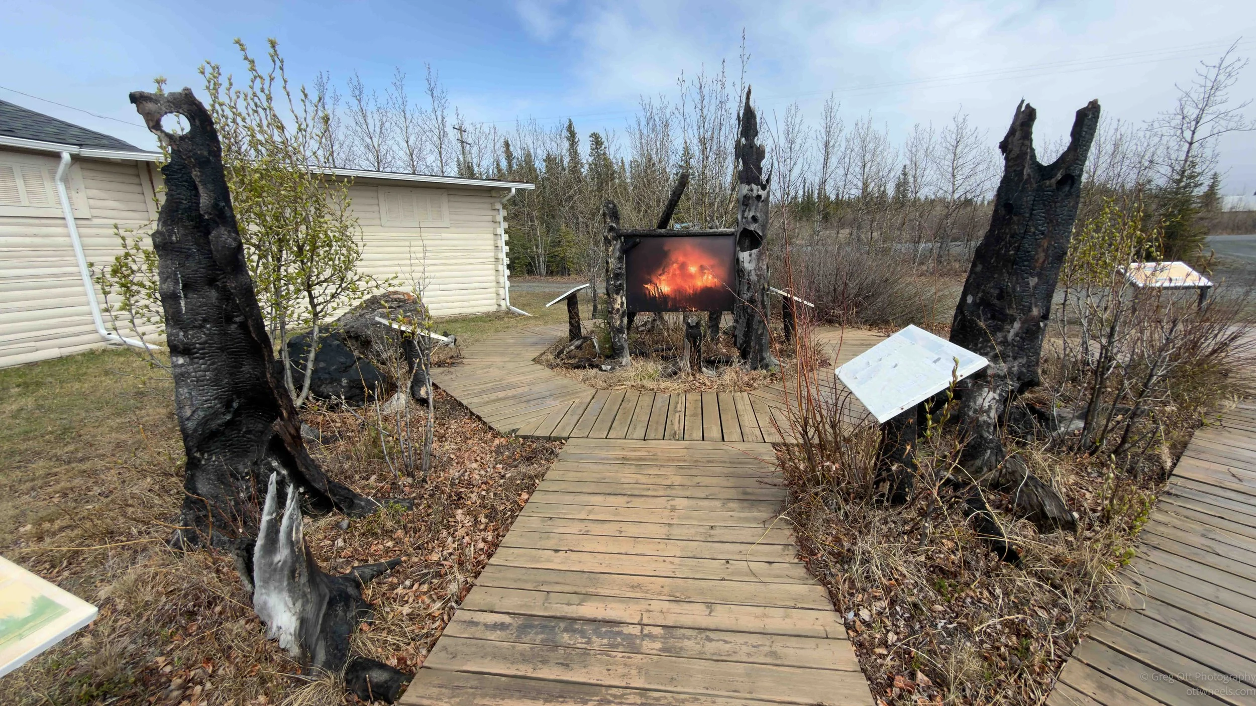
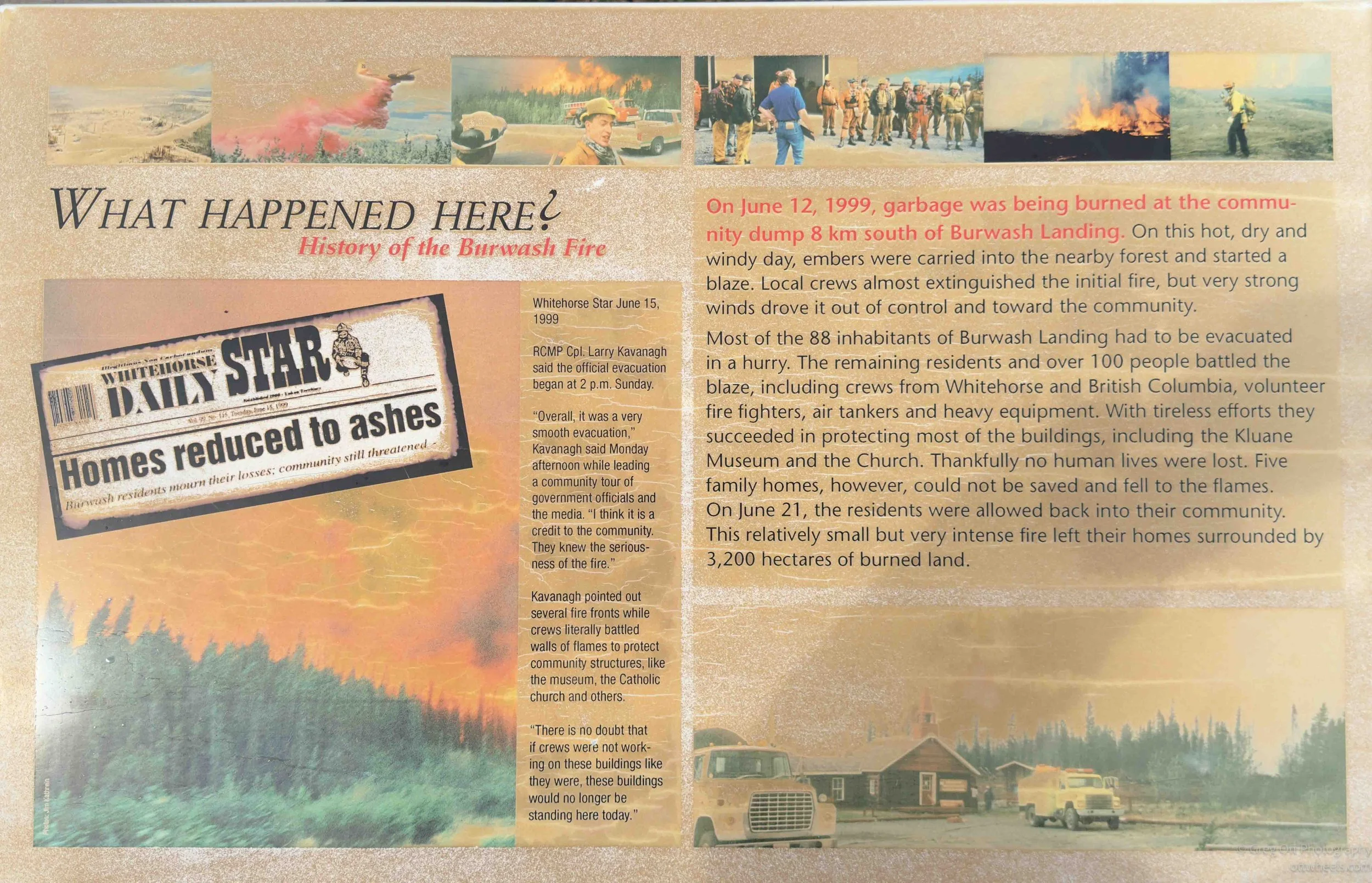
Outside the museum, a small interpretive exhibit told the story of the Burwash Fire of 1999. According to the display, the fire began when burning garbage at the community dump was carried into nearby forest by strong winds. The blaze threatened Burwash Landing, forcing most residents to evacuate while firefighters, volunteers, and aircraft worked to save the community. Five homes were lost, but most of the buildings were protected and no lives were lost. The outdoor exhibit is surrounded by charred tree trunks preserved from the fire, making the story feel far more immediate than simply reading a plaque on a wall.
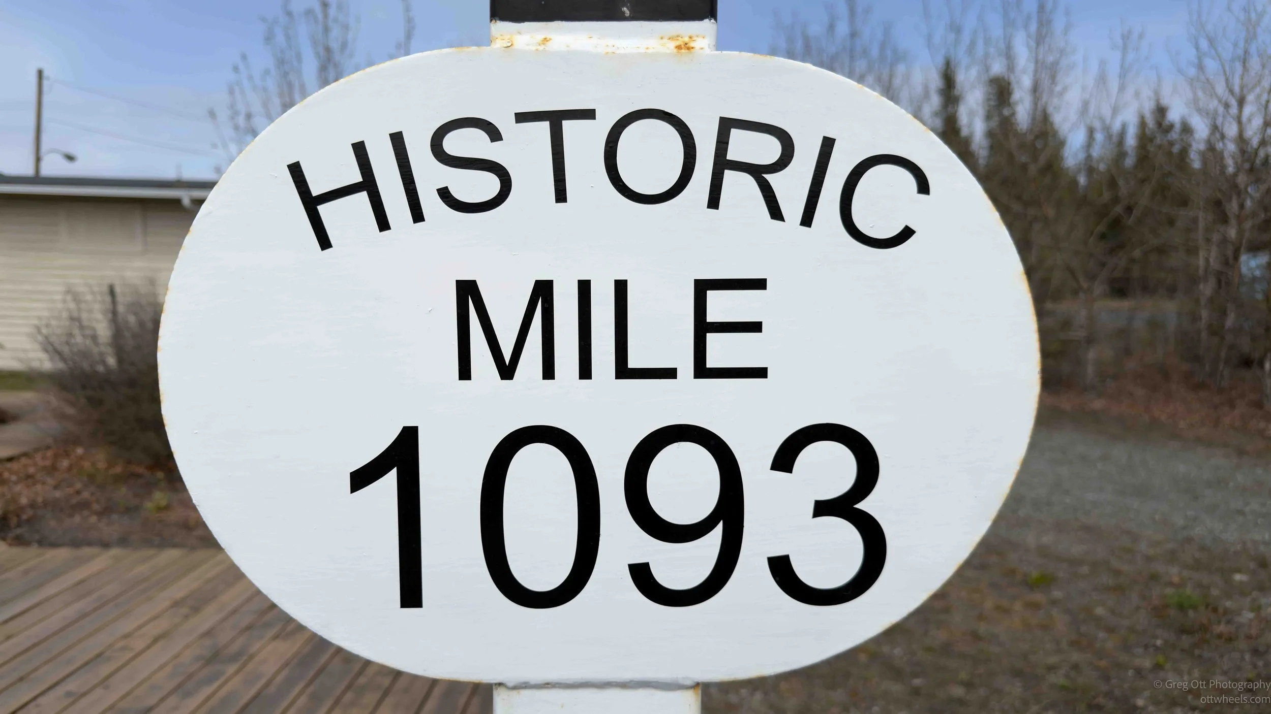
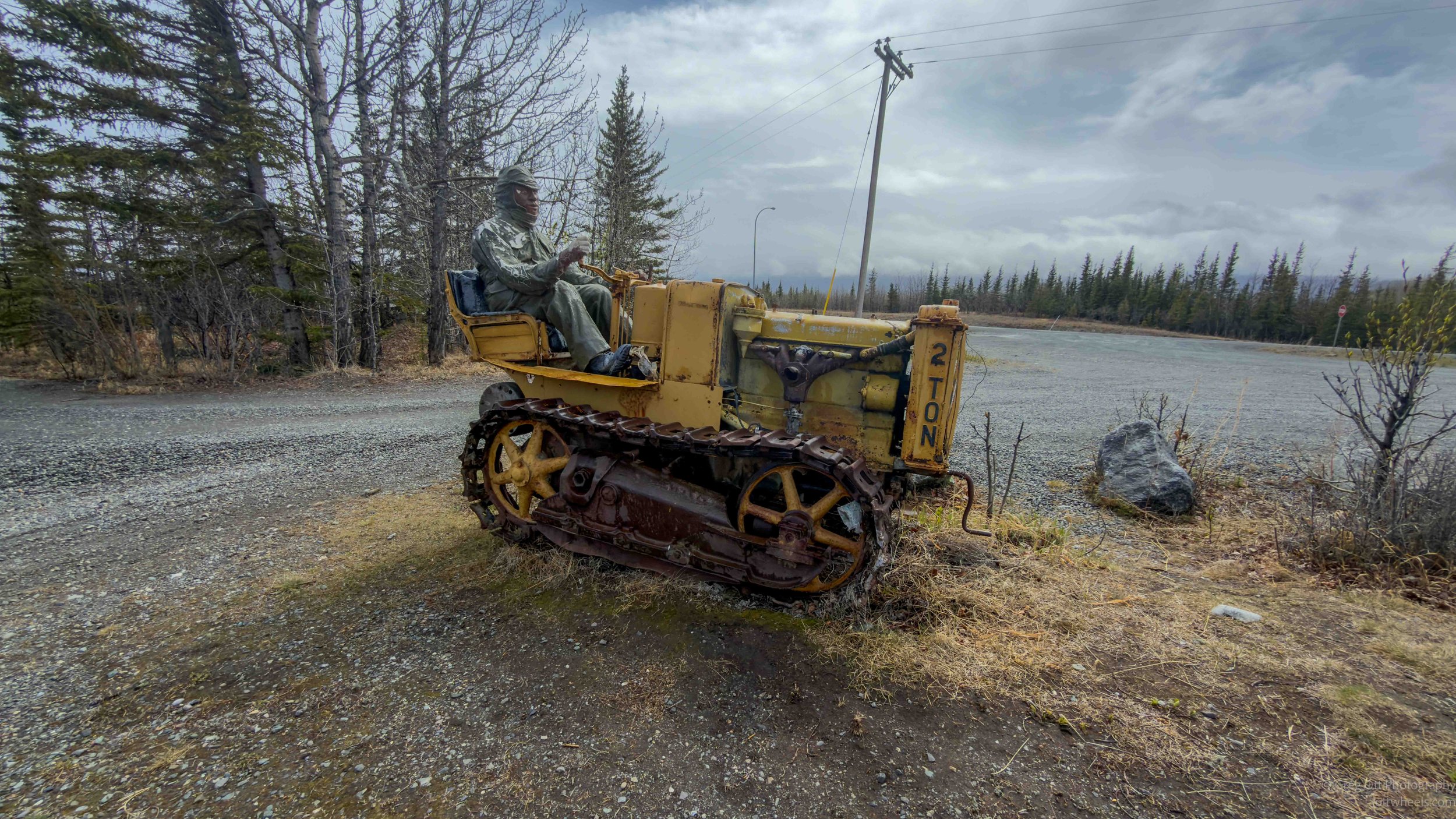
The museum grounds also contain several outdoor displays tied to the Alaska Highway and the history of the region, including a historic Mile 1093 marker and heavy equipment used during the highway era. Combined with the wildlife exhibits, local history, and Indigenous cultural information, the museum provides a surprisingly thorough introduction to this part of the Yukon.
For a small roadside museum that would be easy to drive past without a second thought, the Kluane Museum turned out to be one of the better stops I have made along the Alaska Highway.
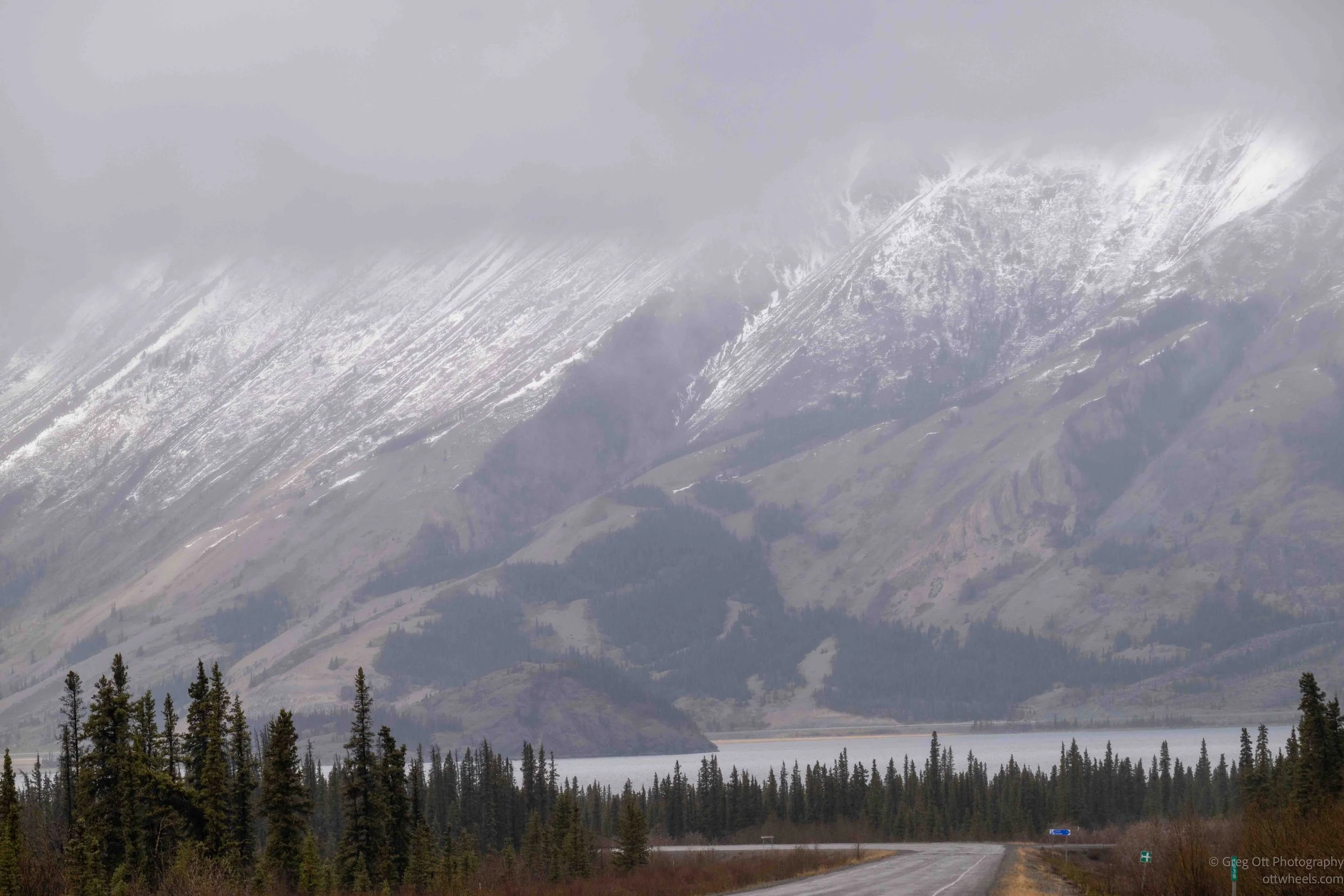
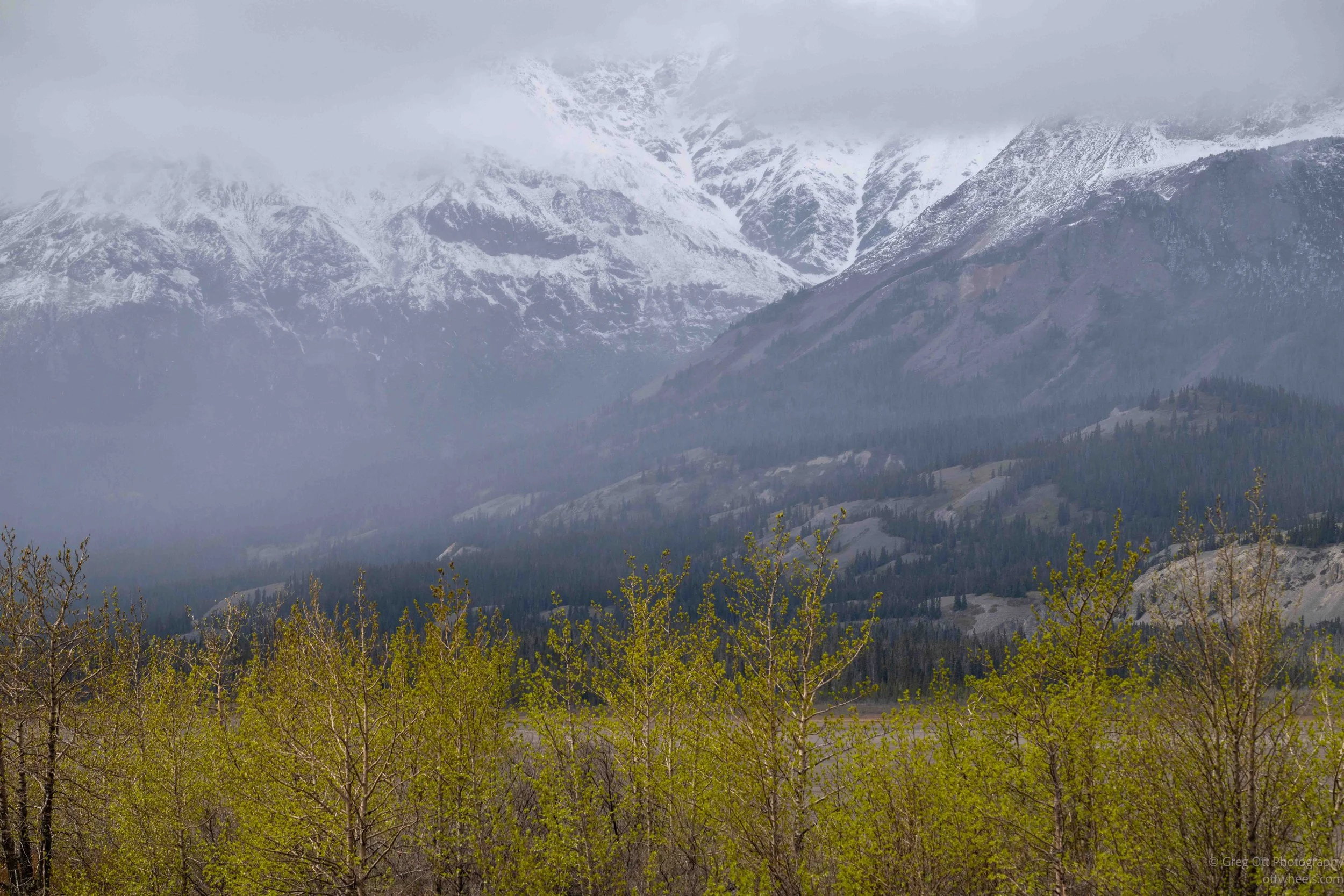
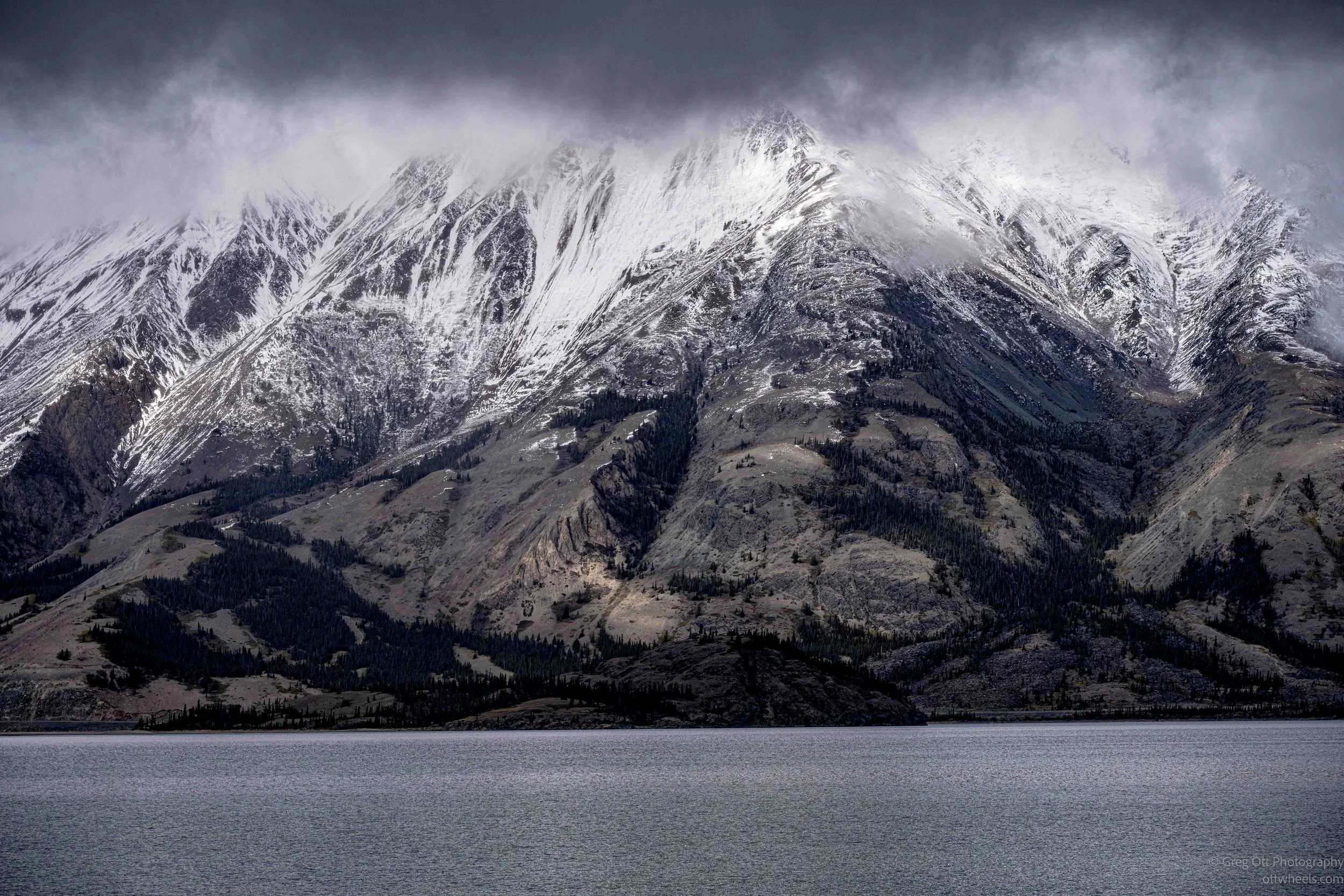
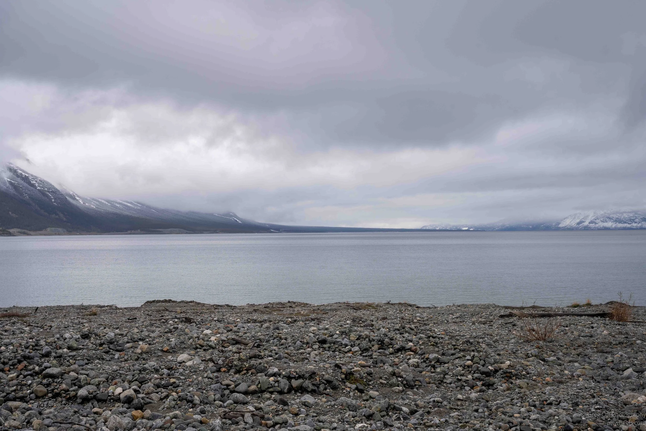
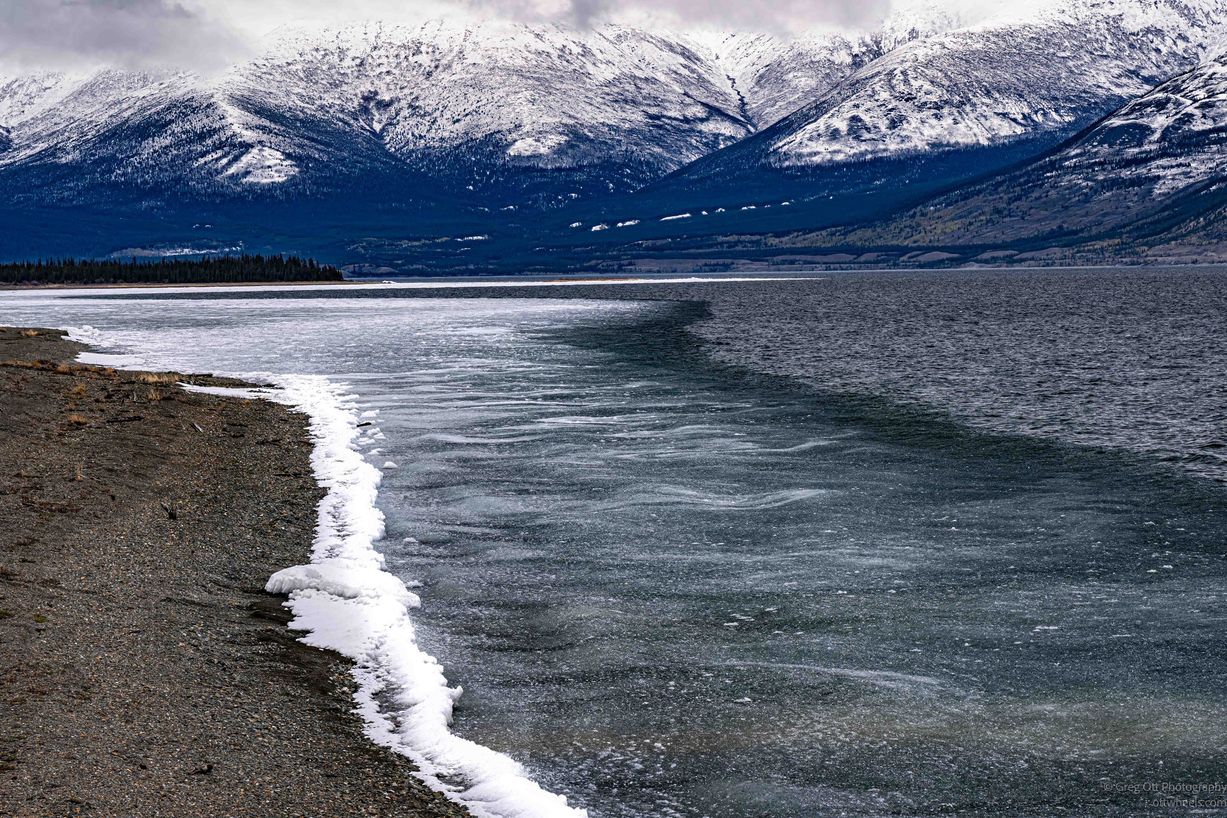
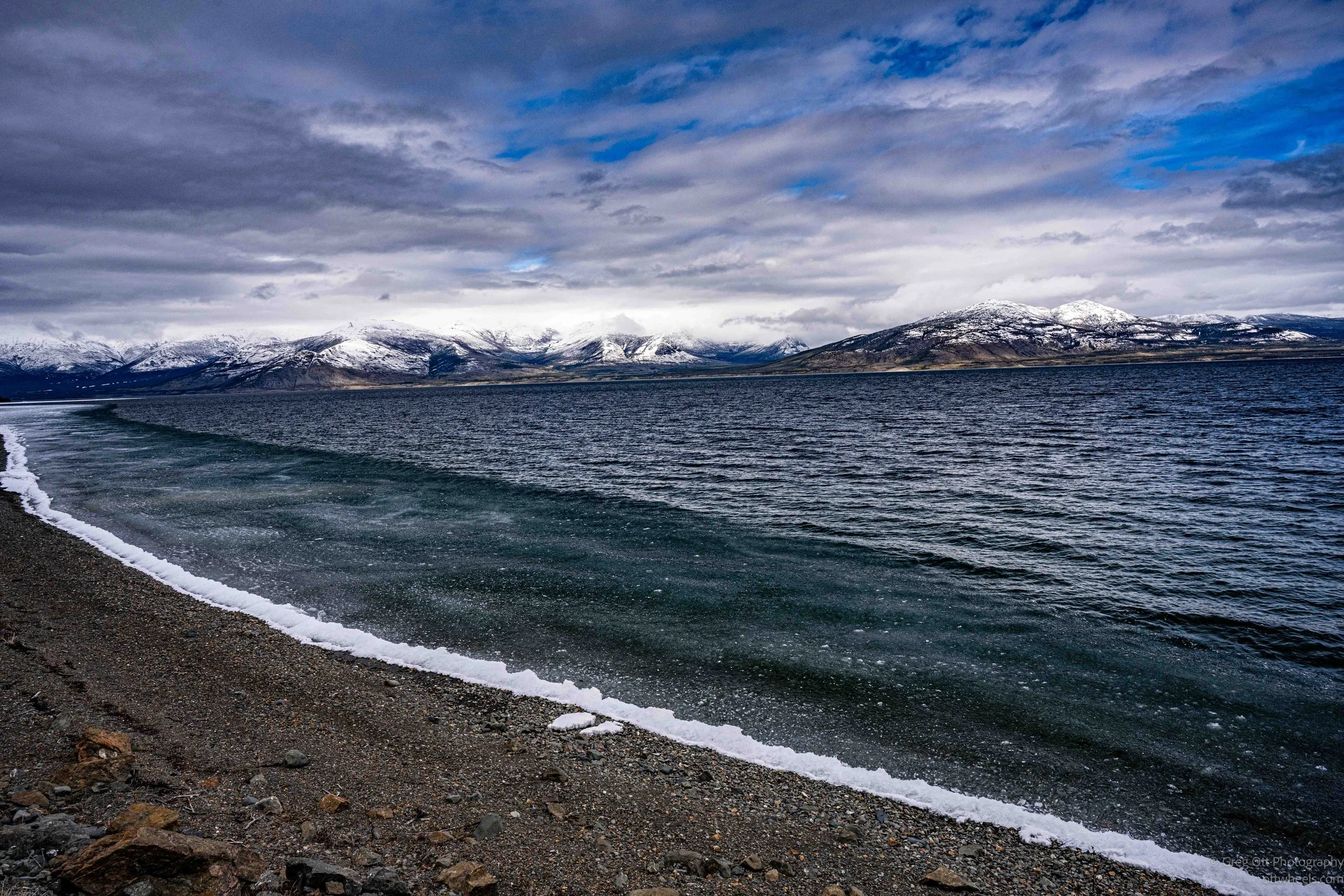
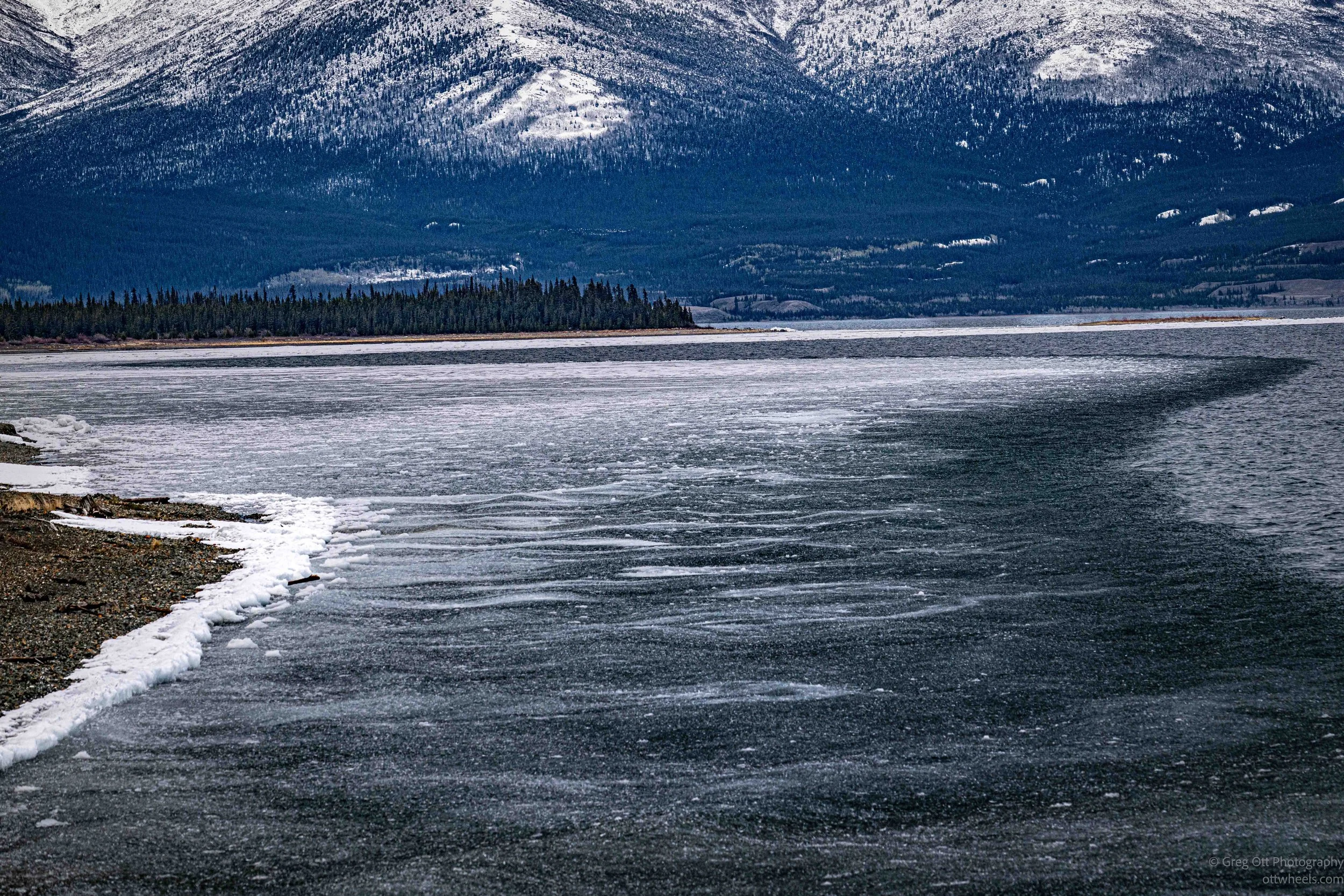
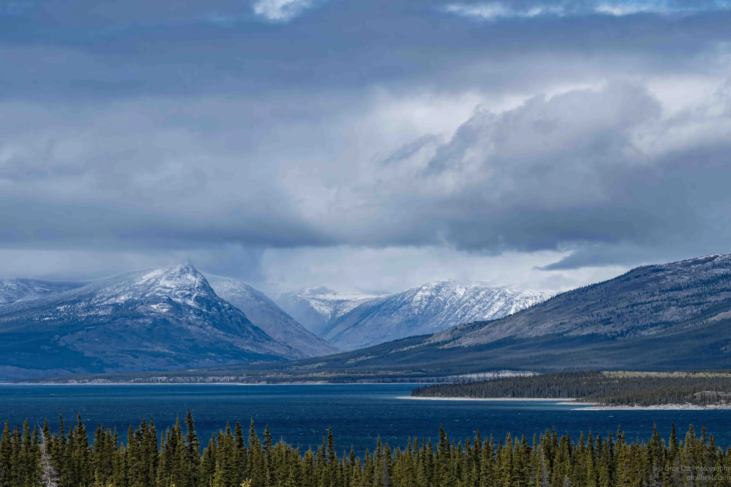
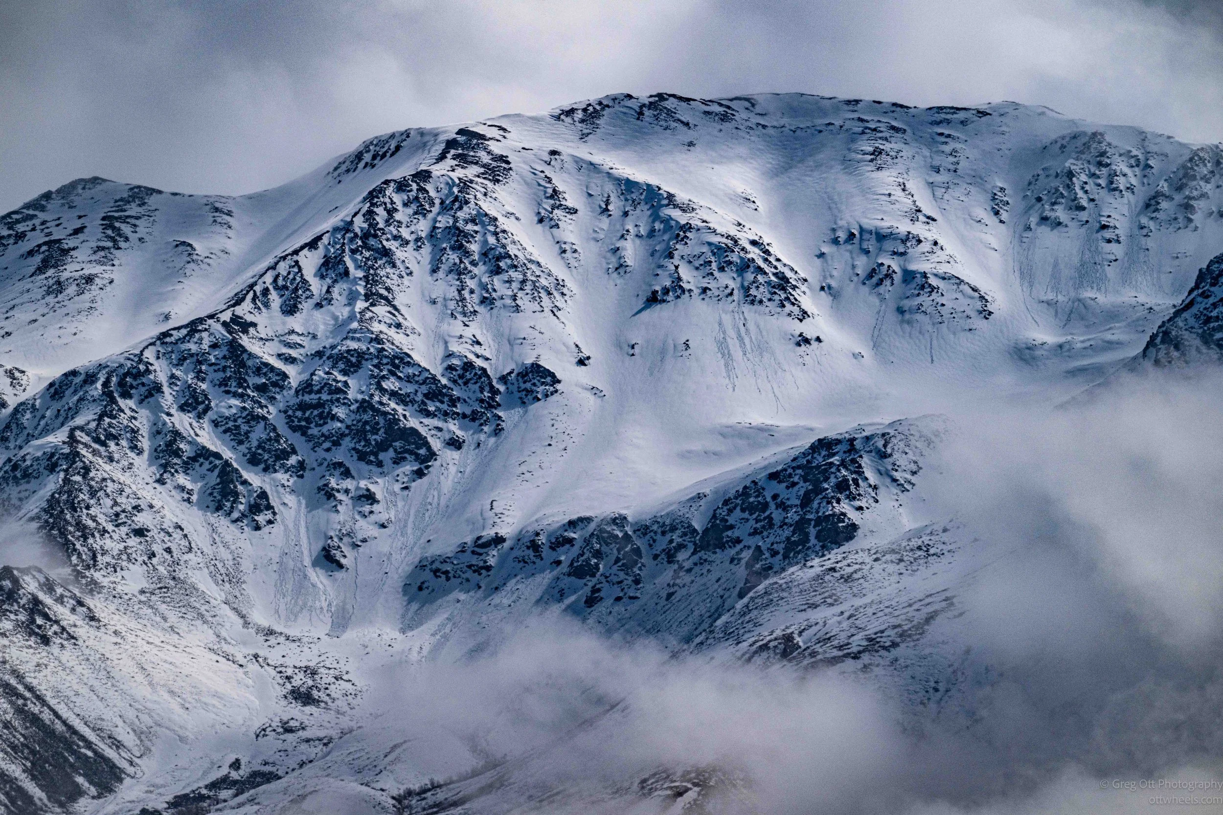
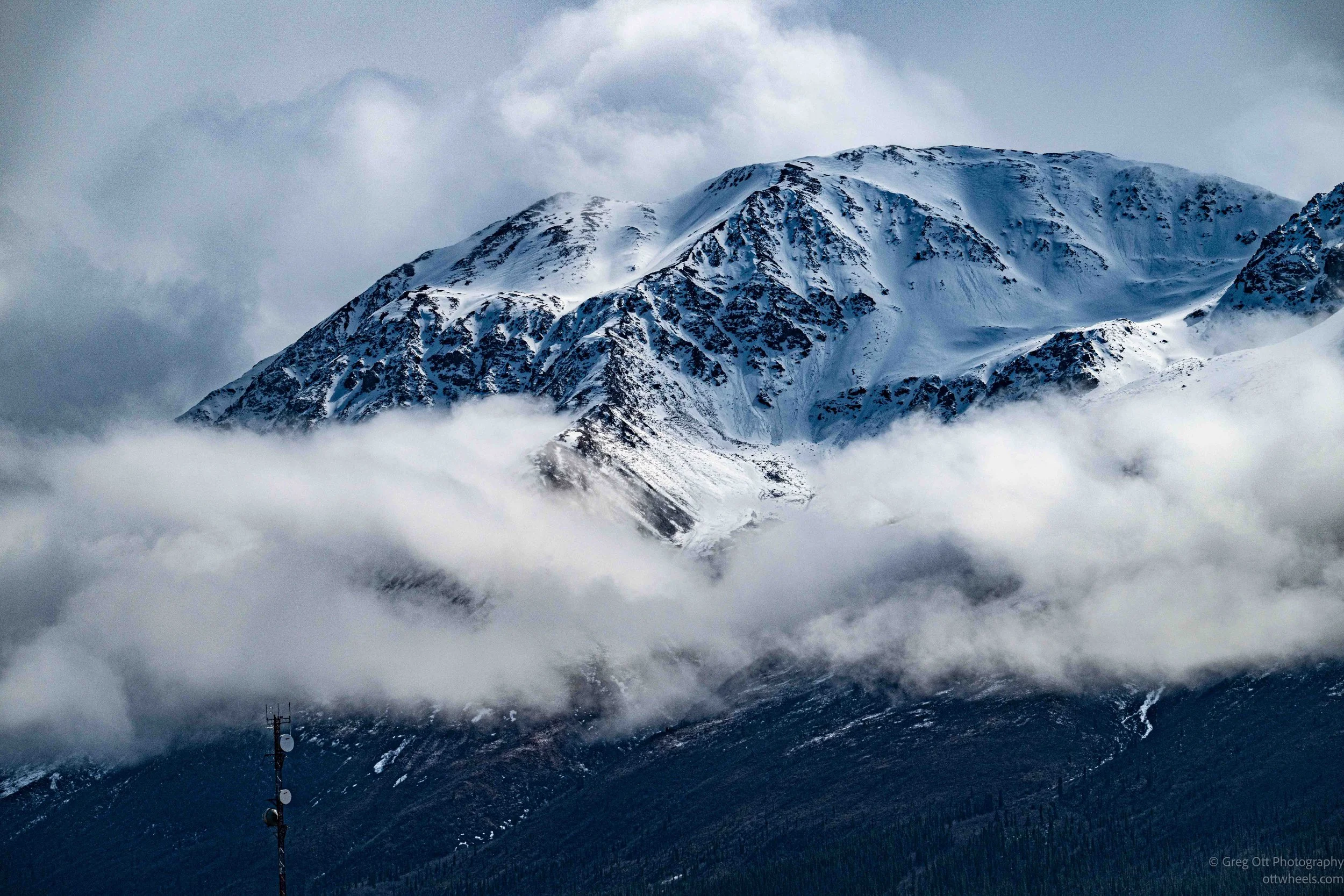
As I drove south from Burwash Landing, the weather finally began to change. The mountains that had spent much of the day hidden behind clouds started appearing in pieces. Sunlight broke through in places, illuminating sections of snow-covered slopes while dark clouds continued to drift across the peaks. The constantly changing light transformed the landscape every few minutes. One moment the mountains were completely obscured, and the next a ridge or bowl would emerge from the clouds before disappearing again. I found myself pulling over repeatedly to photograph the shifting mix of snow, rock, cloud, and light along the shoreline of Kluane Lake.
The strong winds sweeping down the valley had pushed ice northward across the lake. Along the shore, sheets of ice had collected into delicate white edges that traced the shoreline. The contrast between the bluish-gray ice, dark water, and snow-covered mountains immediately caught my attention. In some places the ice looked almost painted onto the lake's surface, creating subtle textures and patterns that were far more interesting than the broad landscape itself. I spent as much time looking at the details along the shoreline as I did photographing the mountains towering above it.
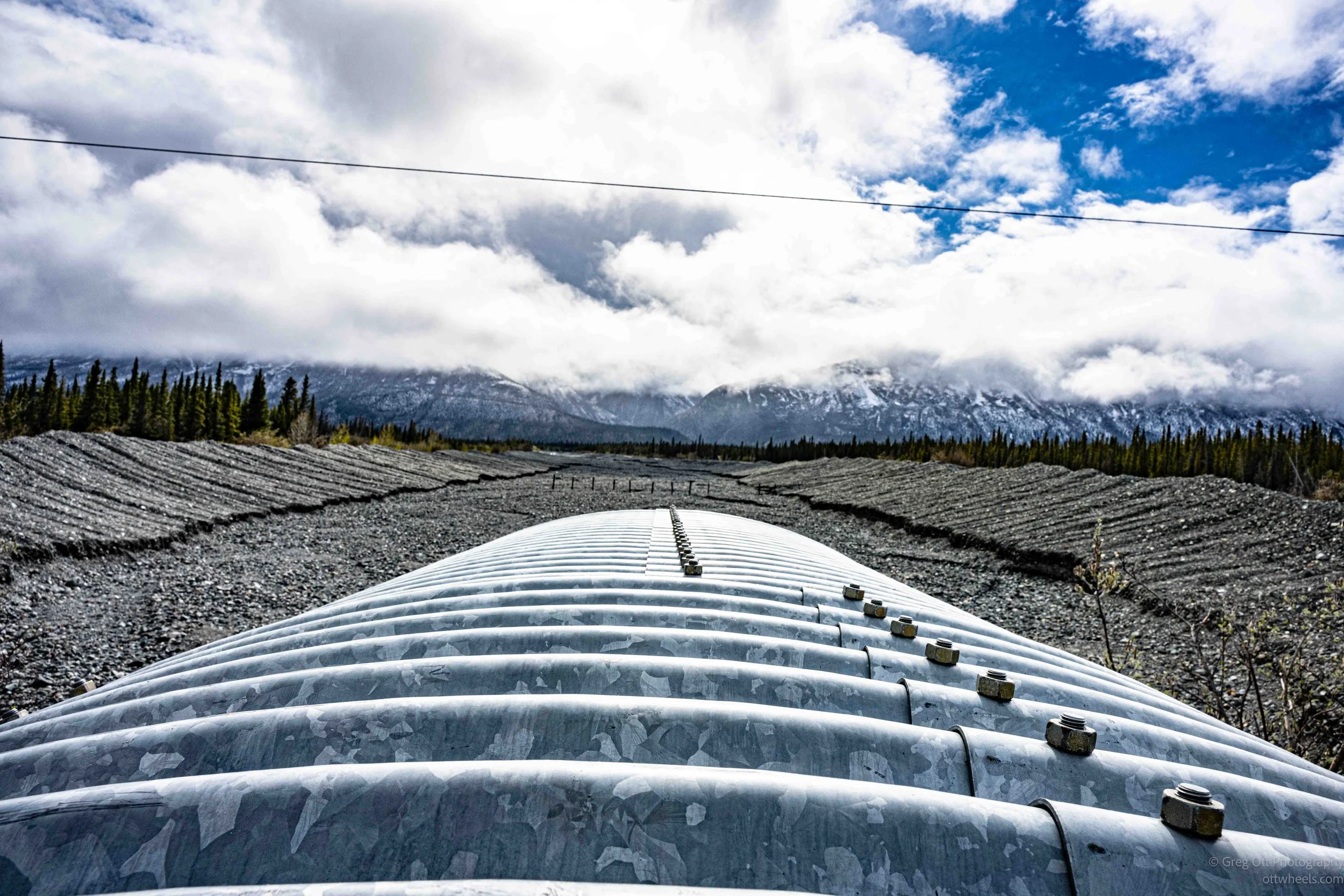
Not everything that made me stop was natural. At one point I noticed a massive corrugated metal conduit running beneath the Alaska Highway. The pipe had to be at least 12 feet in diameter. Seeing something that large immediately raised questions. Most of the time it appeared completely oversized for the small amount of water visible nearby, but it clearly exists to handle enormous seasonal flows when snowmelt and runoff come rushing down from the mountains. The repeating curves of the galvanized steel against the backdrop of clouds and peaks created an image that felt oddly industrial and beautiful at the same time.
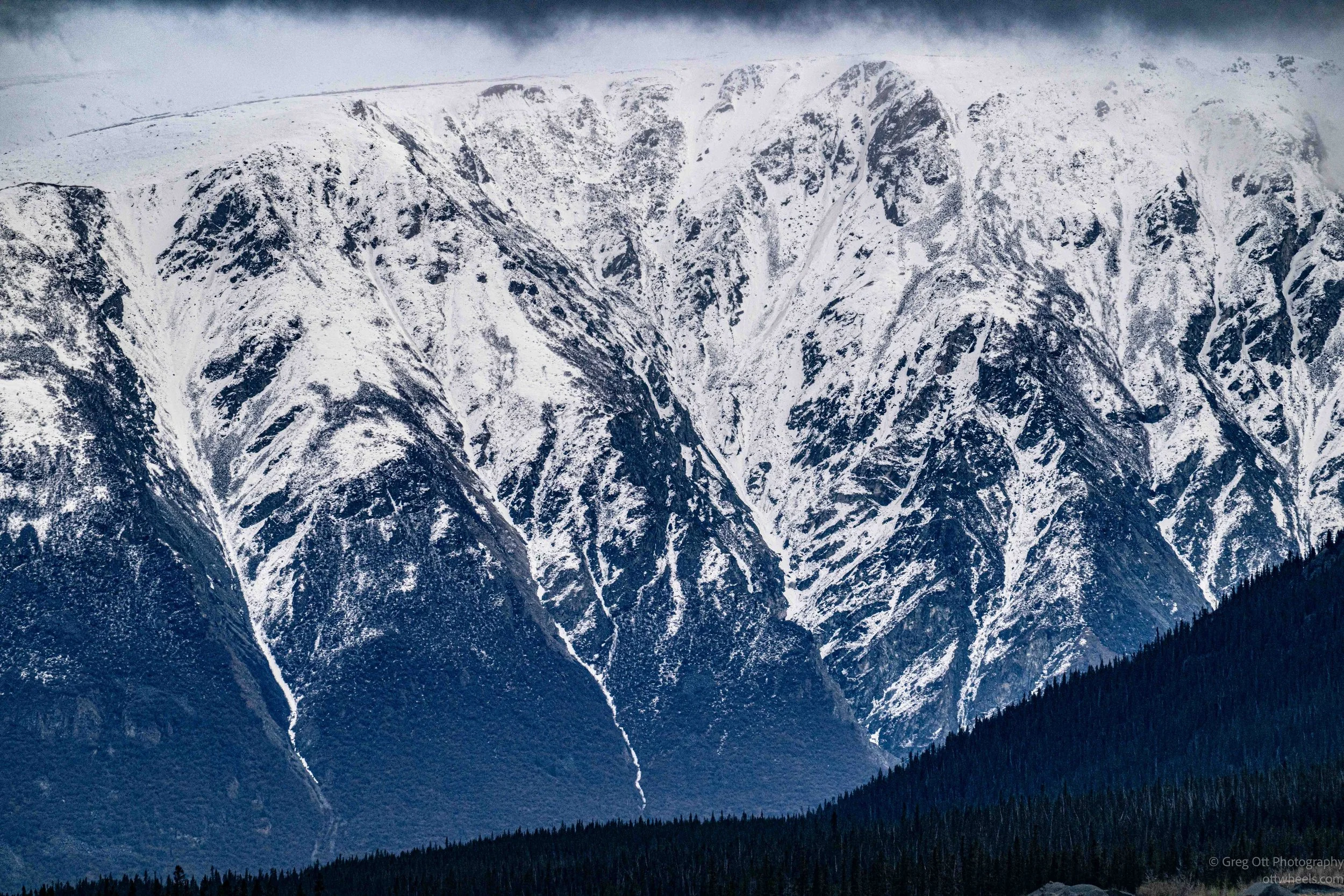
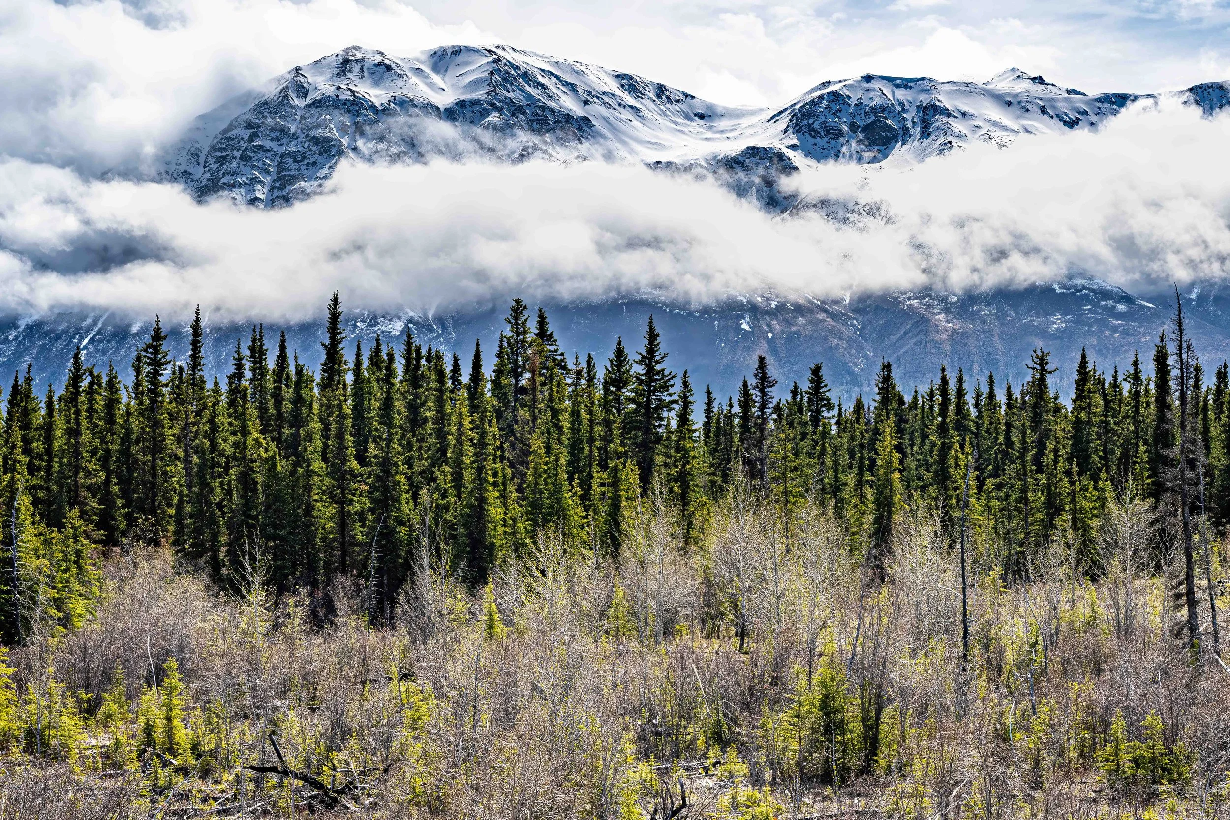
The longer I drove, the more I found myself attracted to patterns rather than grand vistas. The deep greens of the spruce forest, the blue tones in the lake ice, and the layered textures of snow and rock all seemed to compete for attention. Kluane Lake is spectacular from a distance, but what kept pulling me over were the smaller scenes: wind-driven ice collecting along the shore, cloud shadows moving across mountain faces, and subtle variations of blue, green, and white spread across the landscape. The weather may not have cooperated for dramatic postcard views, but it created a mood that was every bit as interesting.
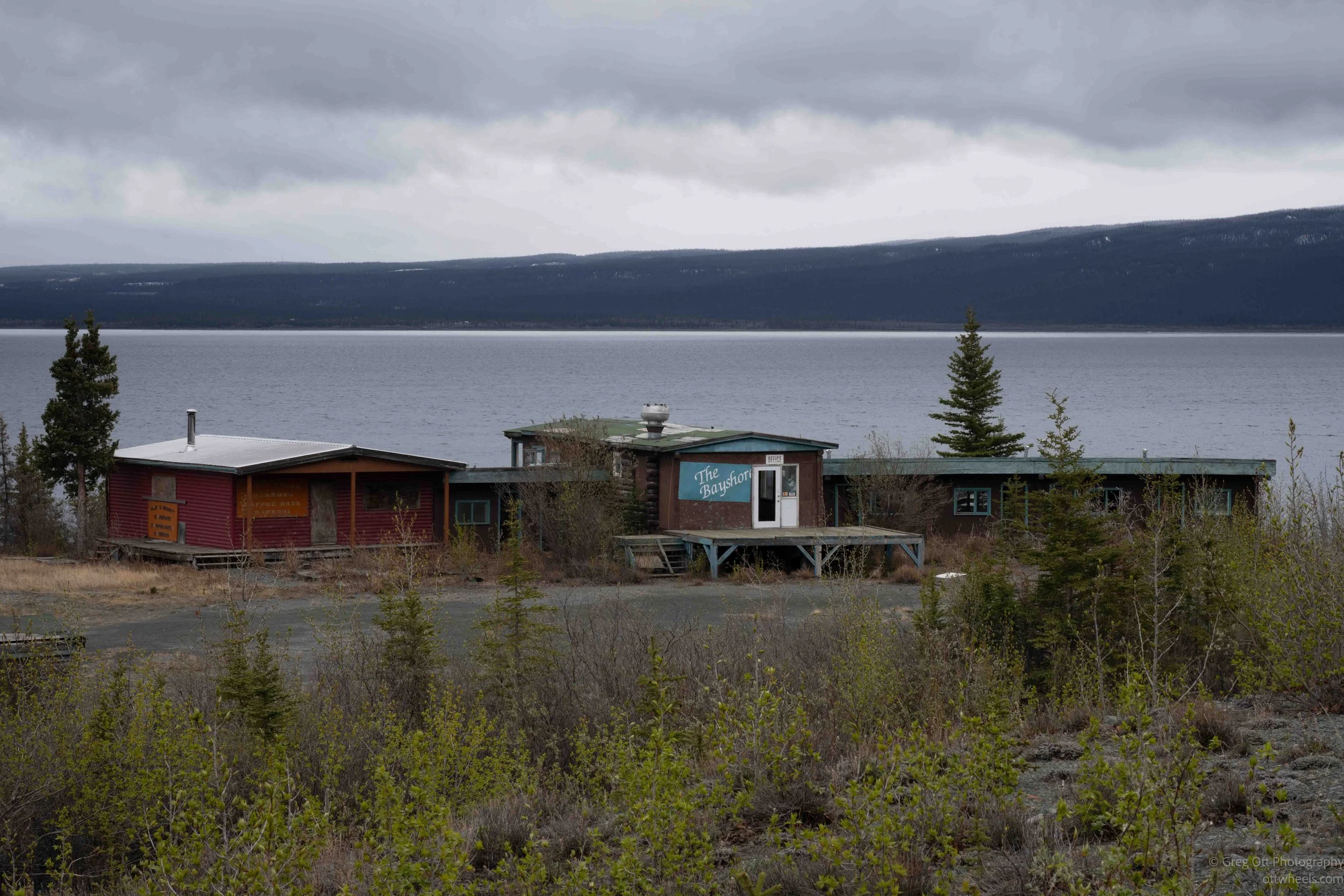
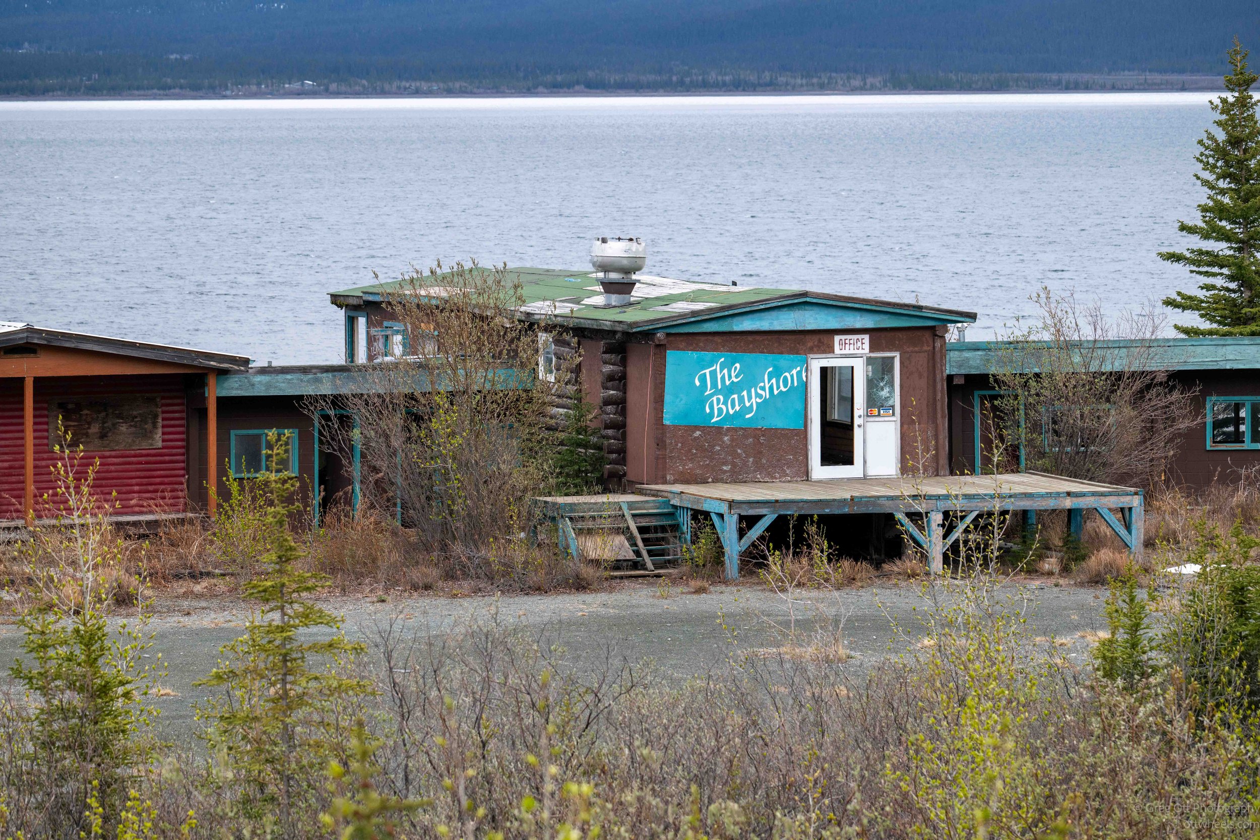
There was an old resort which had been abandoned and some apps suggested to park overnight there. There was a side road along the Alaska Highway that lead to the area. It wasn’t possible to pull in because there was a boat at one entrance and large rocks and chains at the other. The road continued on into the distance so I wasn’t sure if I could park on the road. I turned around and found a level spot off to the side of the dirt road. There hadn’t been much traffic on the highway, so I wasn’t worried about road noise.
I made spaghetti and then relaxed for the evening.