Horseshoe Bend
I started the morning at Bonrue, the small coffee and pastry shop in Hurricane, grabbing a chocolate croissant and a latte with my sister. It felt like a quiet bookend to ten easy days of traveling and coming back and getting the van back in order. I’m so appreciative of all her support in getting the van back in order. There’s always that strange mix at departure — a tug of sadness at saying good-bye, layered over the quiet pull of the road calling again. I’ve learned that both emotions can sit in the same cup of coffee. I was grateful for the pause, and ready to move into the next phase.
This marked the beginning of a shortened Arizona visit. I had already spent many days working my way through Arizona in 2023, almost exactly three years ago. Still, a few items remained unchecked, including a visit to the state Capitol in Phoenix. That unfinished business was enough to pull me south again, even if only briefly.
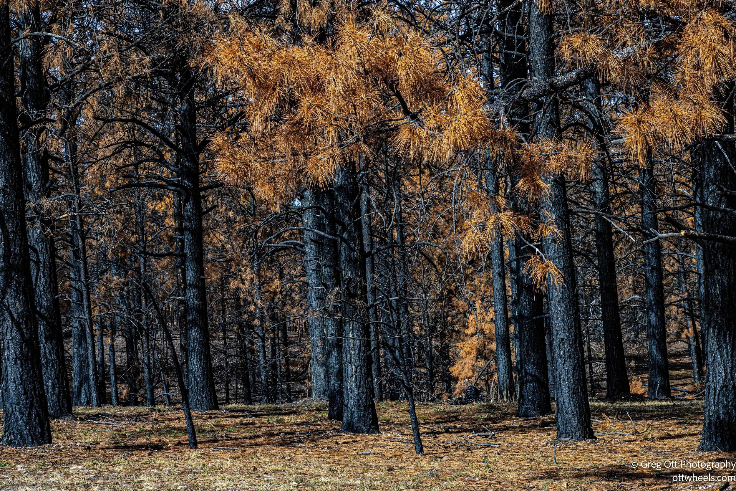
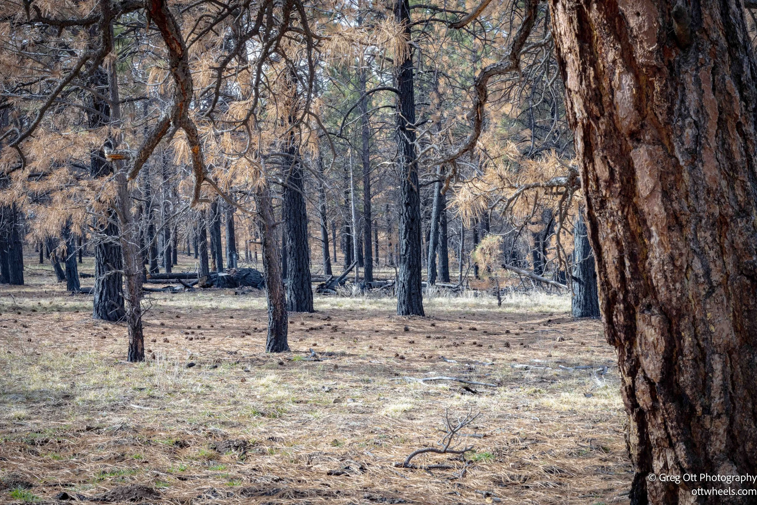
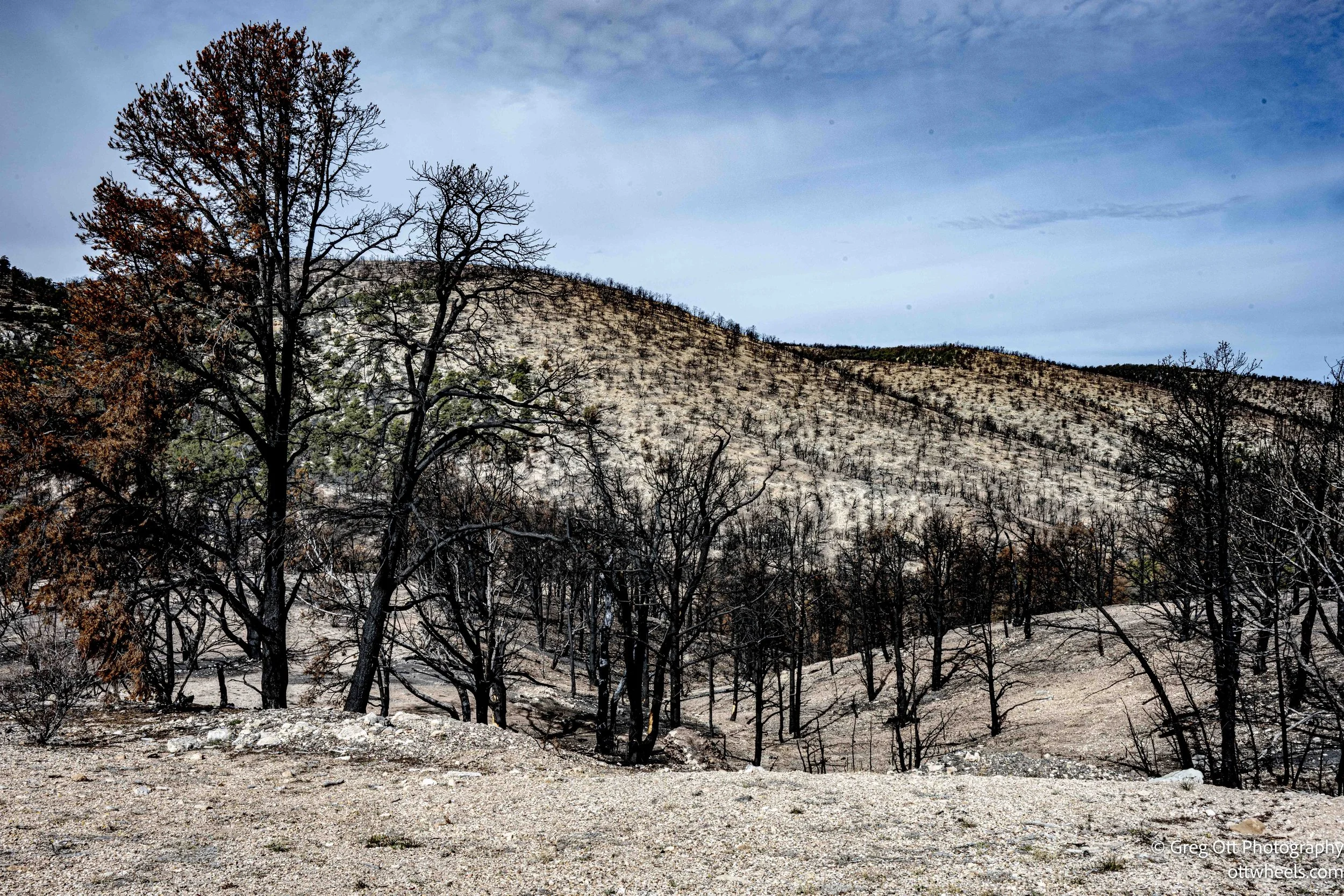
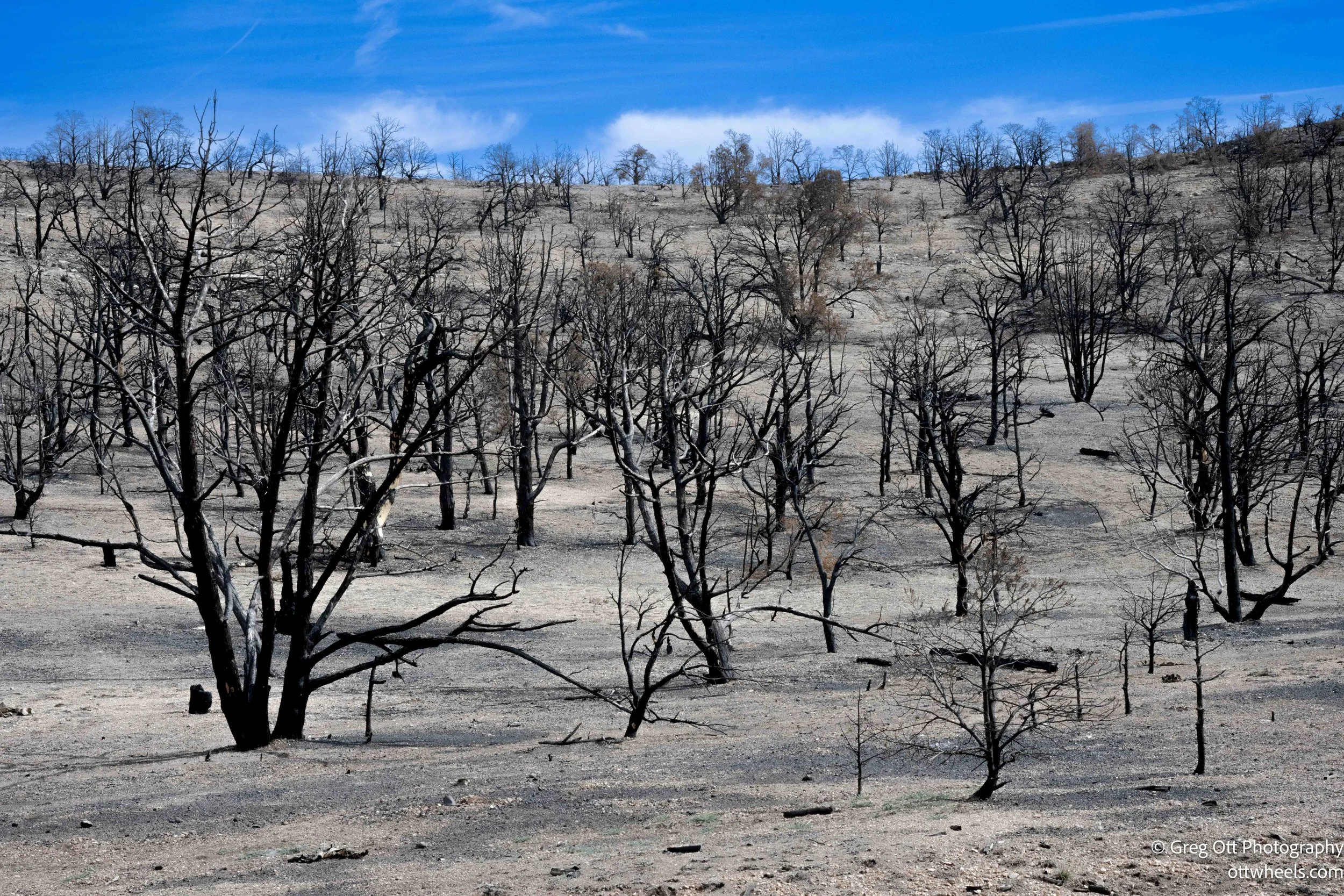
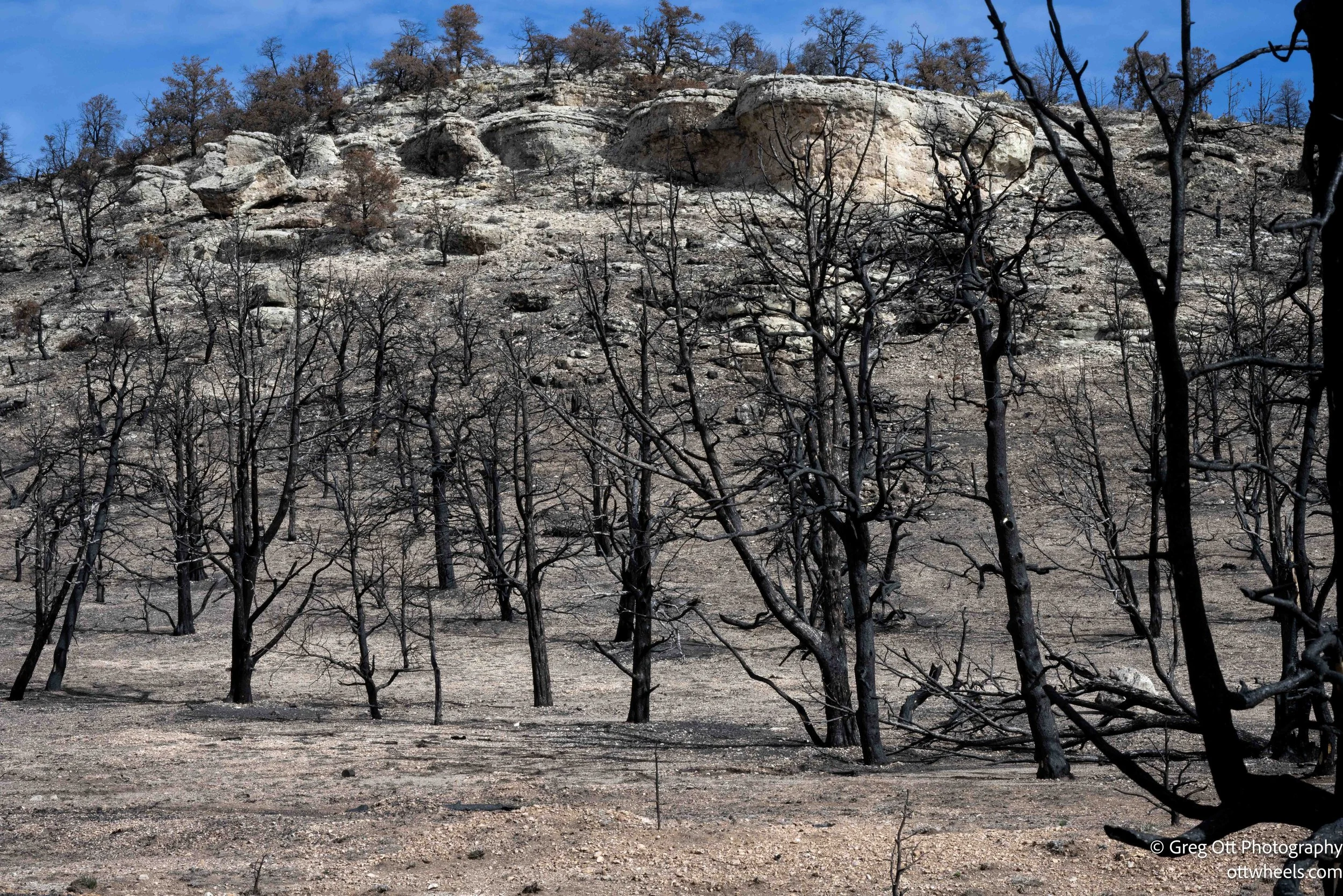
From Hurricane, the road carried me through the high country of the Kaibab Plateau and into the Kaibab National Forest. The landscape shifted into tall ponderosa pine, then into something far more skeletal. Entire hillsides stood blackened and still. In 2020, the Mangum Fire burned roughly 71,000 acres across the North Kaibab Ranger District, including large sections near Jacob Lake. In the most intense areas, flames moved through the canopy and scorched the soil itself, destroying seed sources and damaging the underground systems that allow forests to regenerate. Add high elevation, thin soils, prolonged drought, and short growing seasons, and recovery slows dramatically. As I understand ponderosa pine does not quickly reseed without nearby mature trees. The result is what I was driving through — large fields of charred trunks with only scattered young growth trying to reclaim the space. It felt quiet in a way that was different from peace.
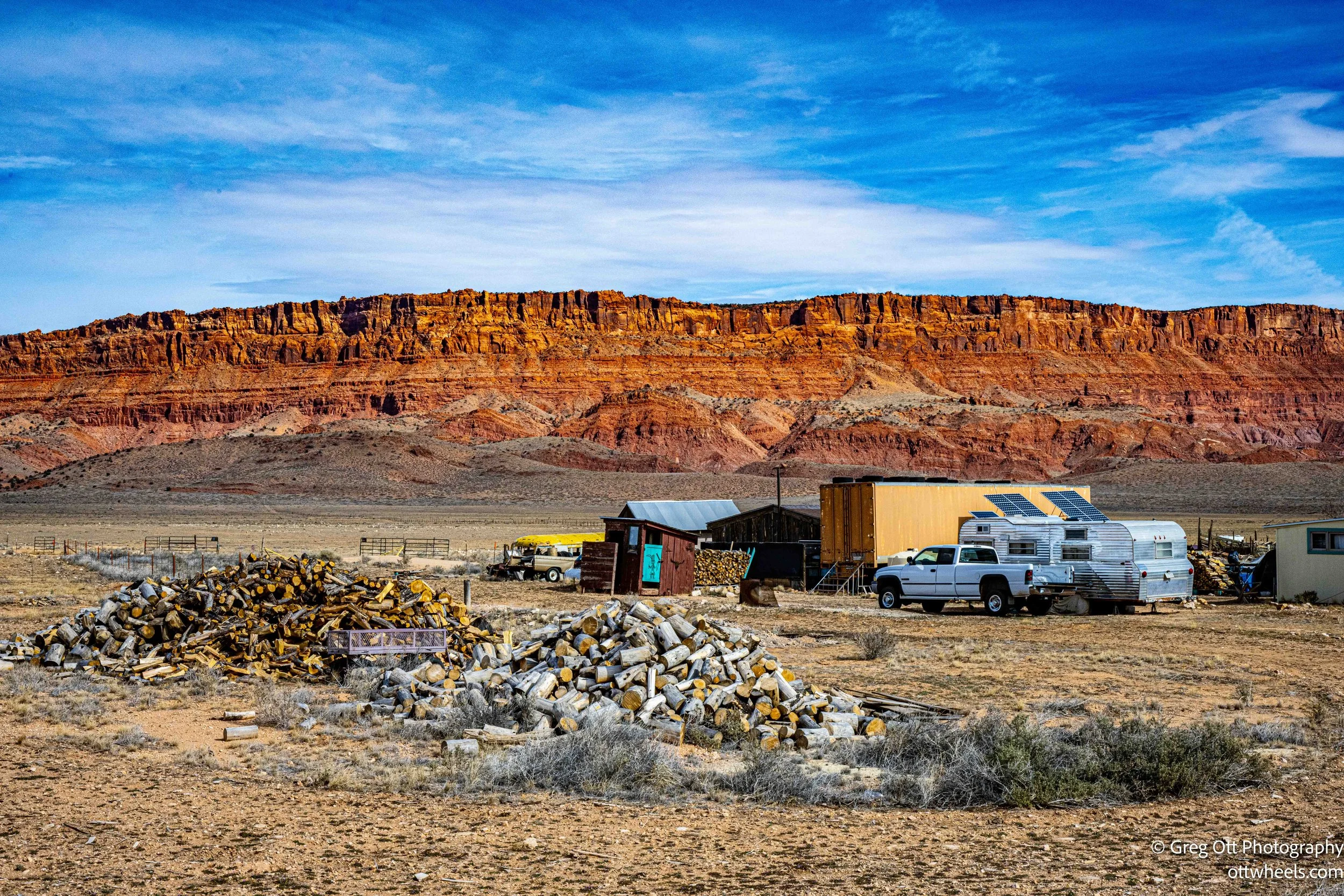
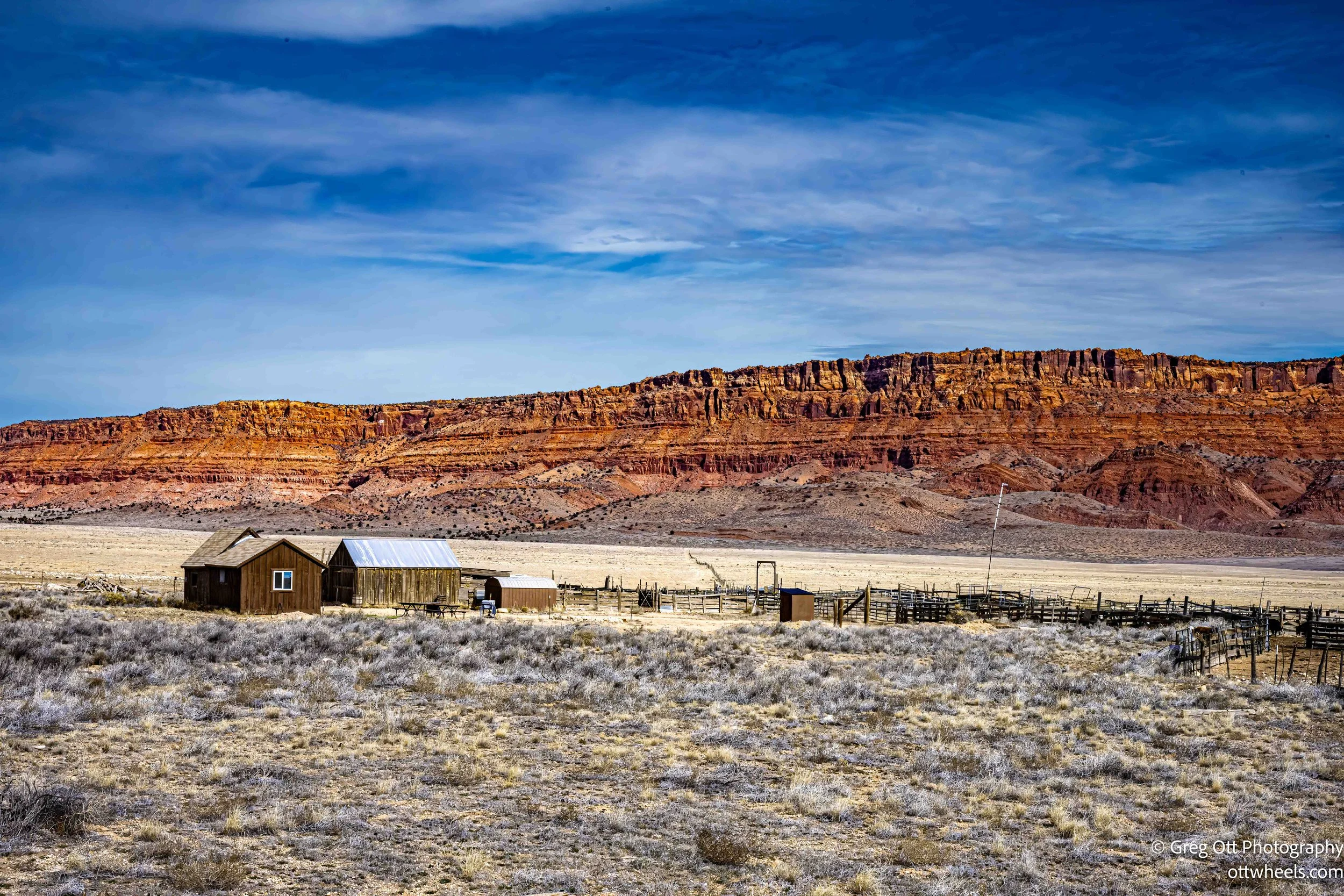
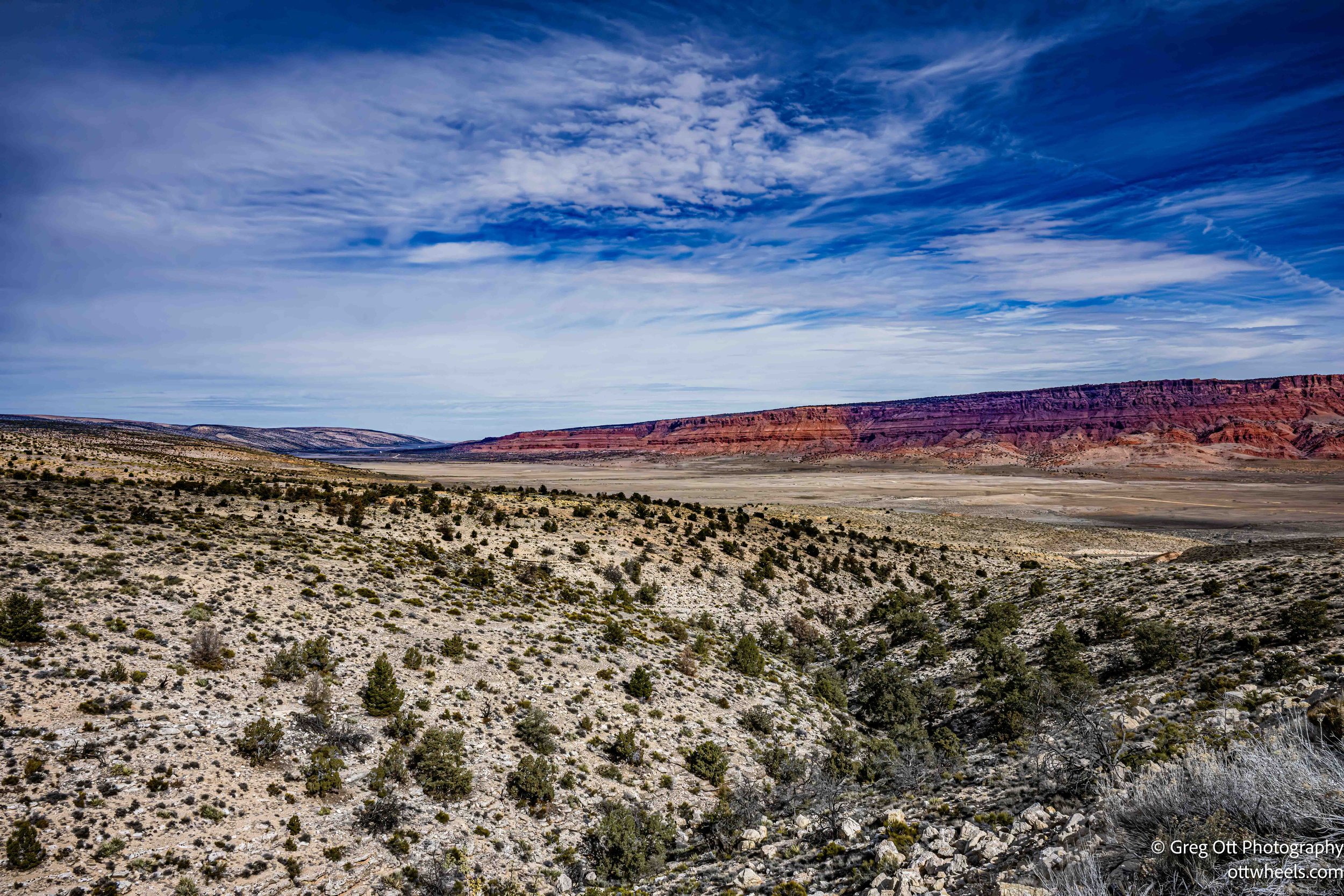
South of the plateau, the trees thinned and stone took over. The road drops into a valley and a few small remote farms appear. The only thing for the next 60 miles.
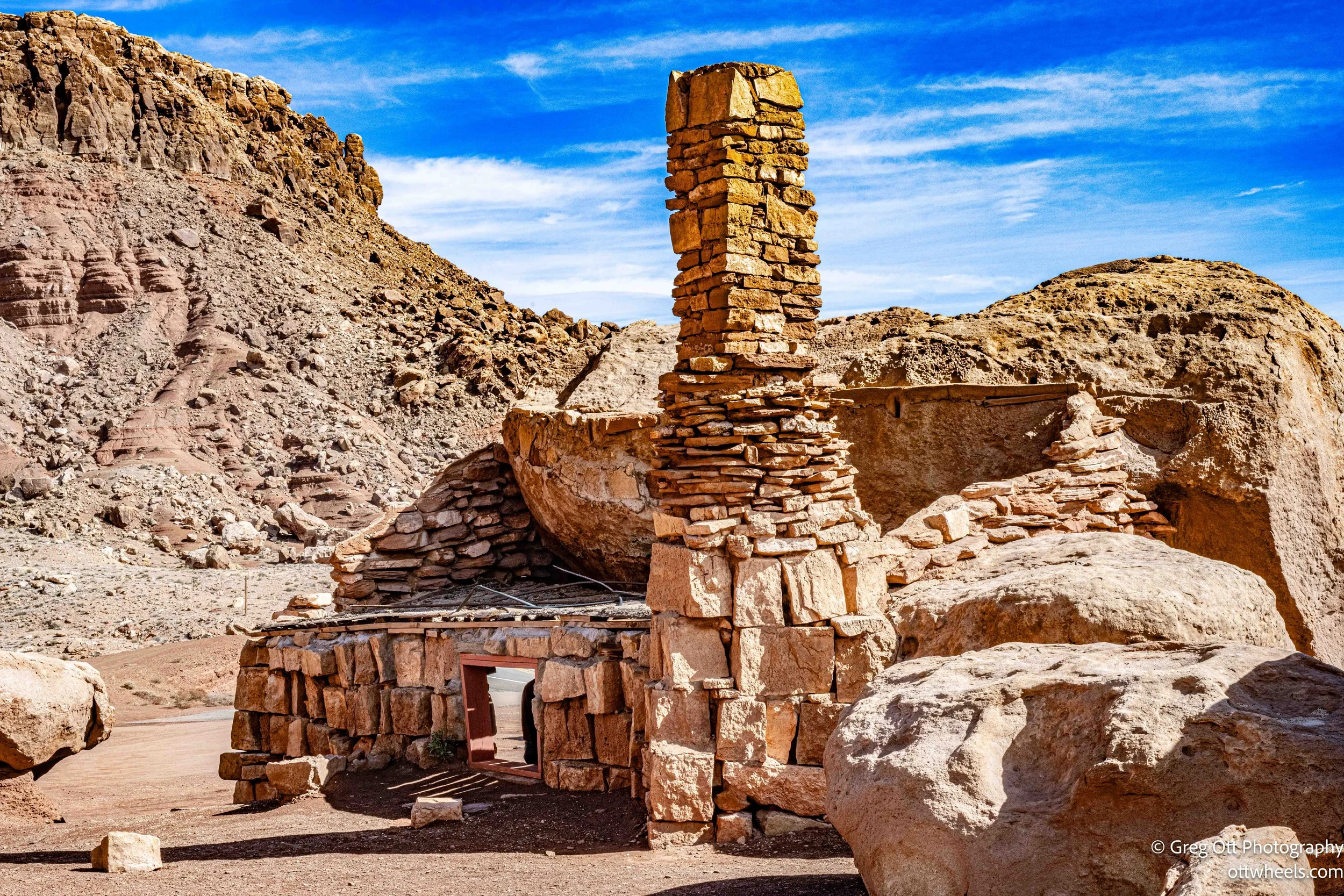
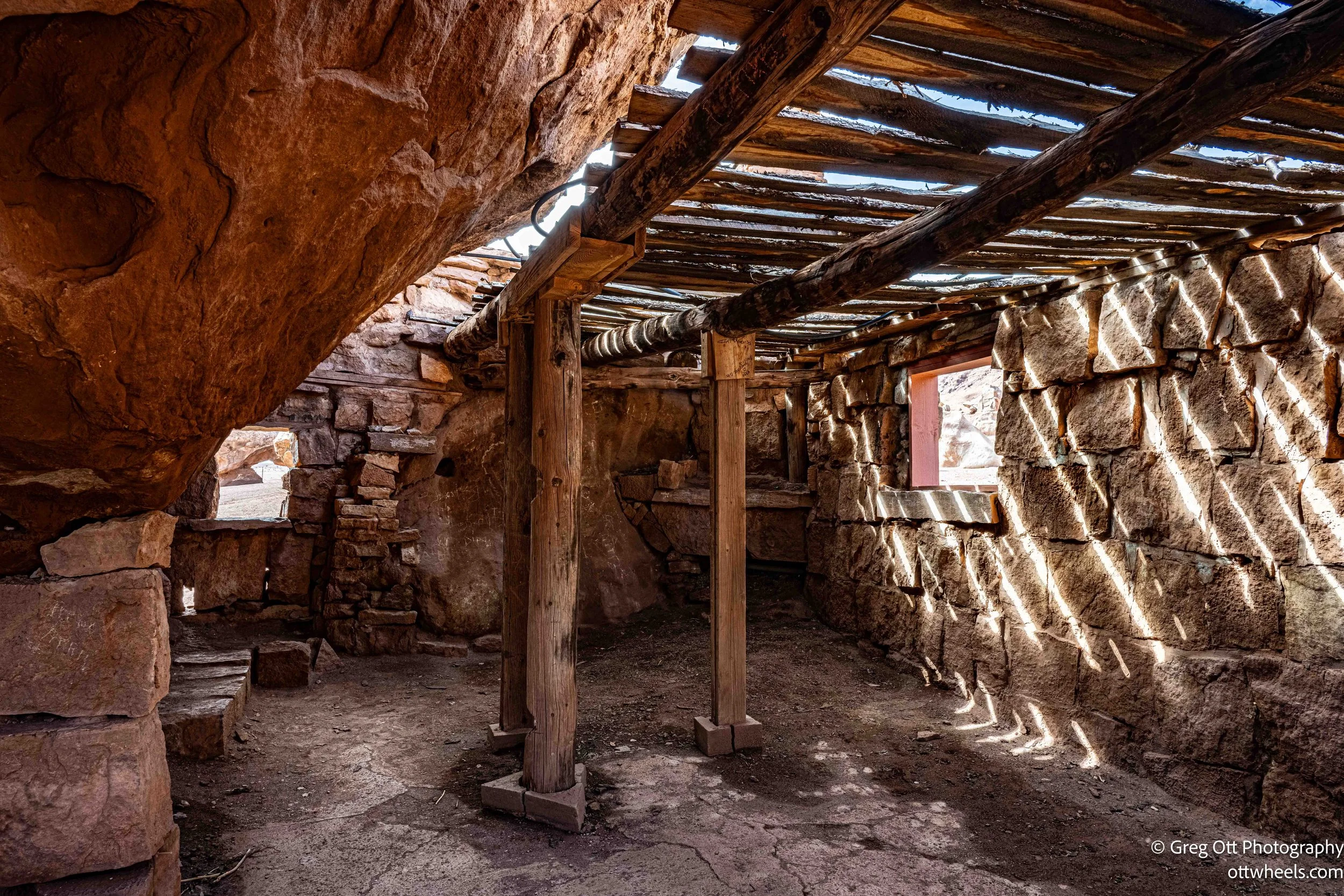
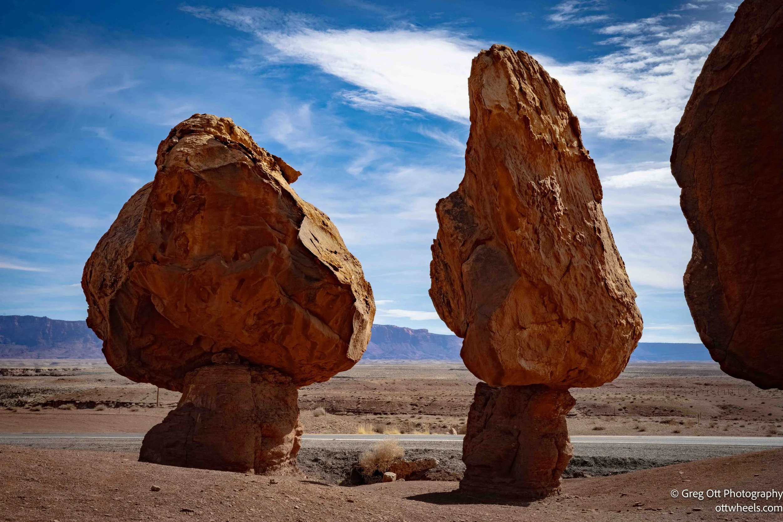
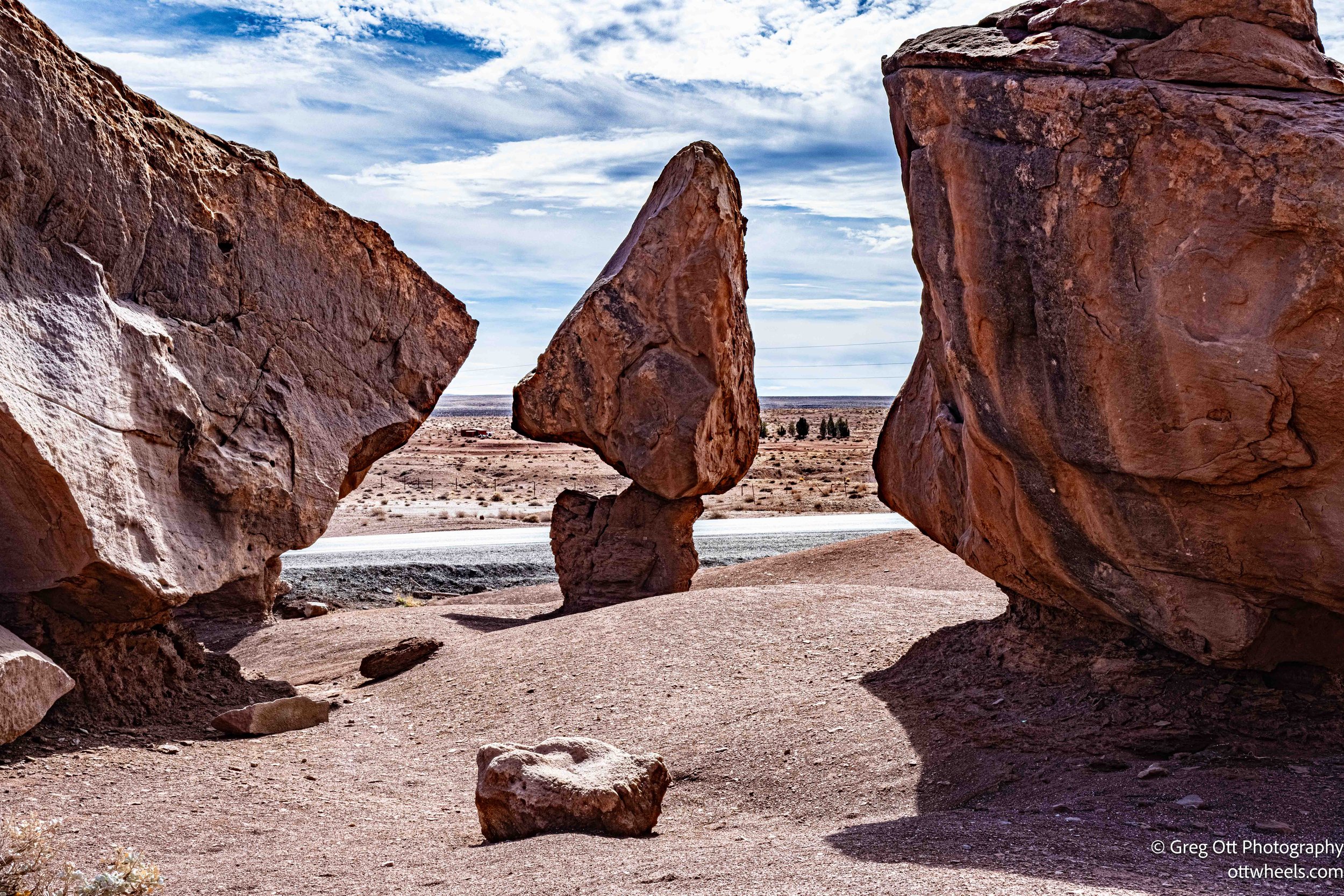
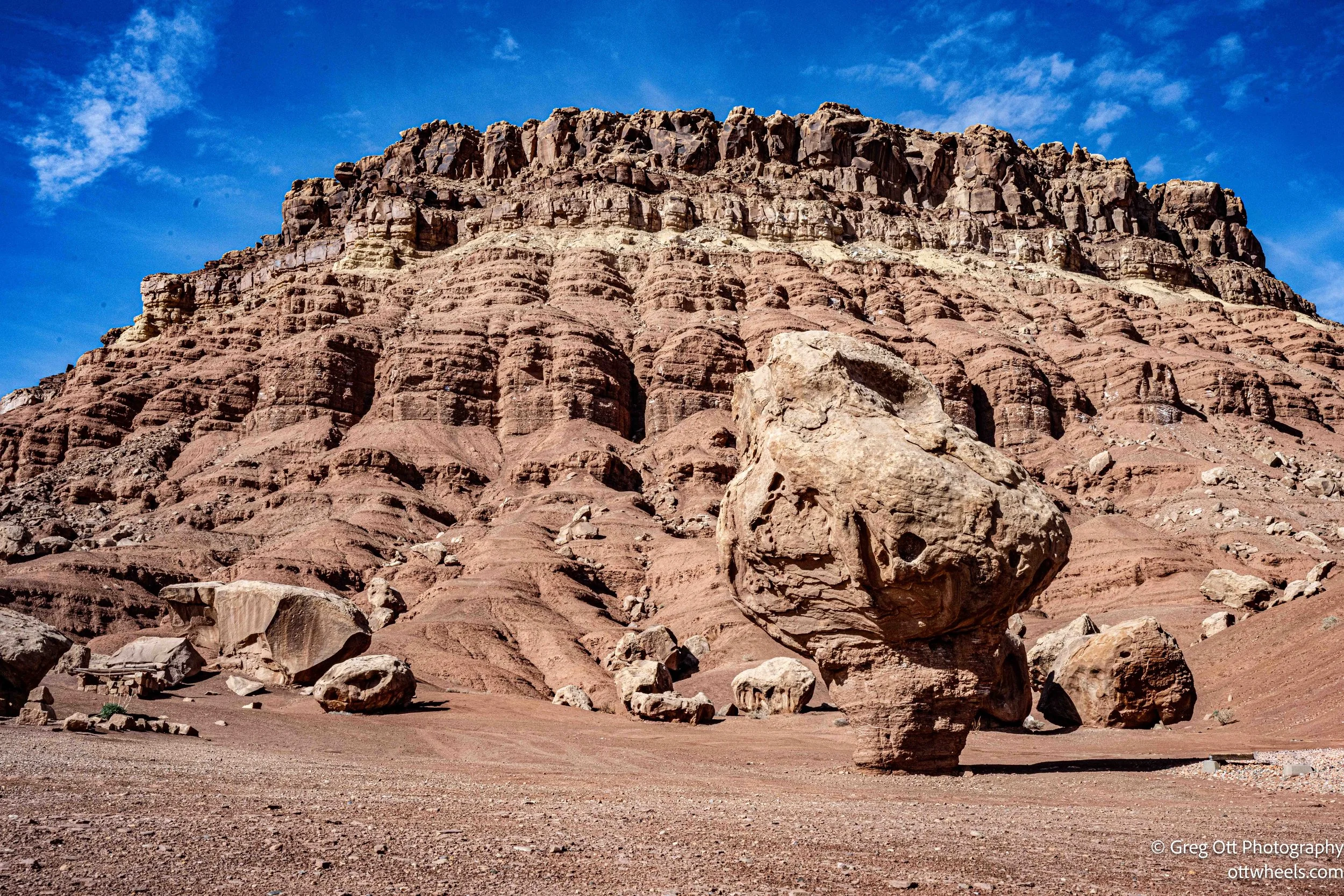
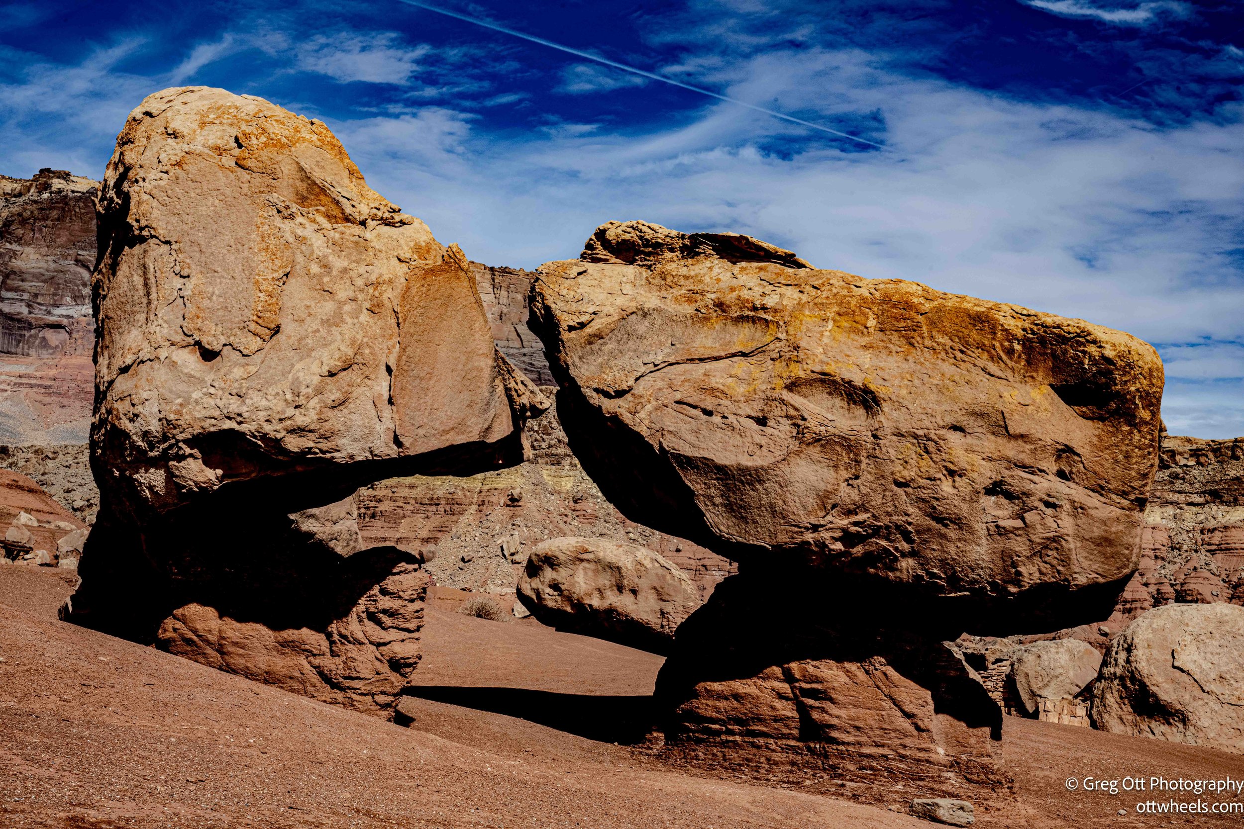
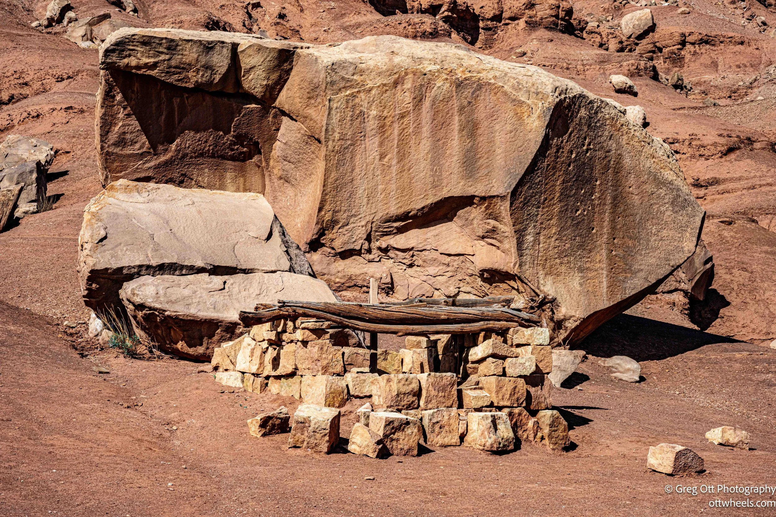
Balanced rocks began appearing along the roadside, perched against red Navajo sandstone cliffs. I pulled over for photographs and, as I walked closer, noticed structures built directly into the base of the rock wall. This was the Cliff Dwellers Stone House, a 1920s roadside trading post constructed to resemble an ancient cliff dwelling. Though less than a century old, the buildings blend so tightly into the sandstone that they seem older than they are. The stone walls rise from the cliff base as if the mountain itself decided to carve out a few rooms for travelers passing through.
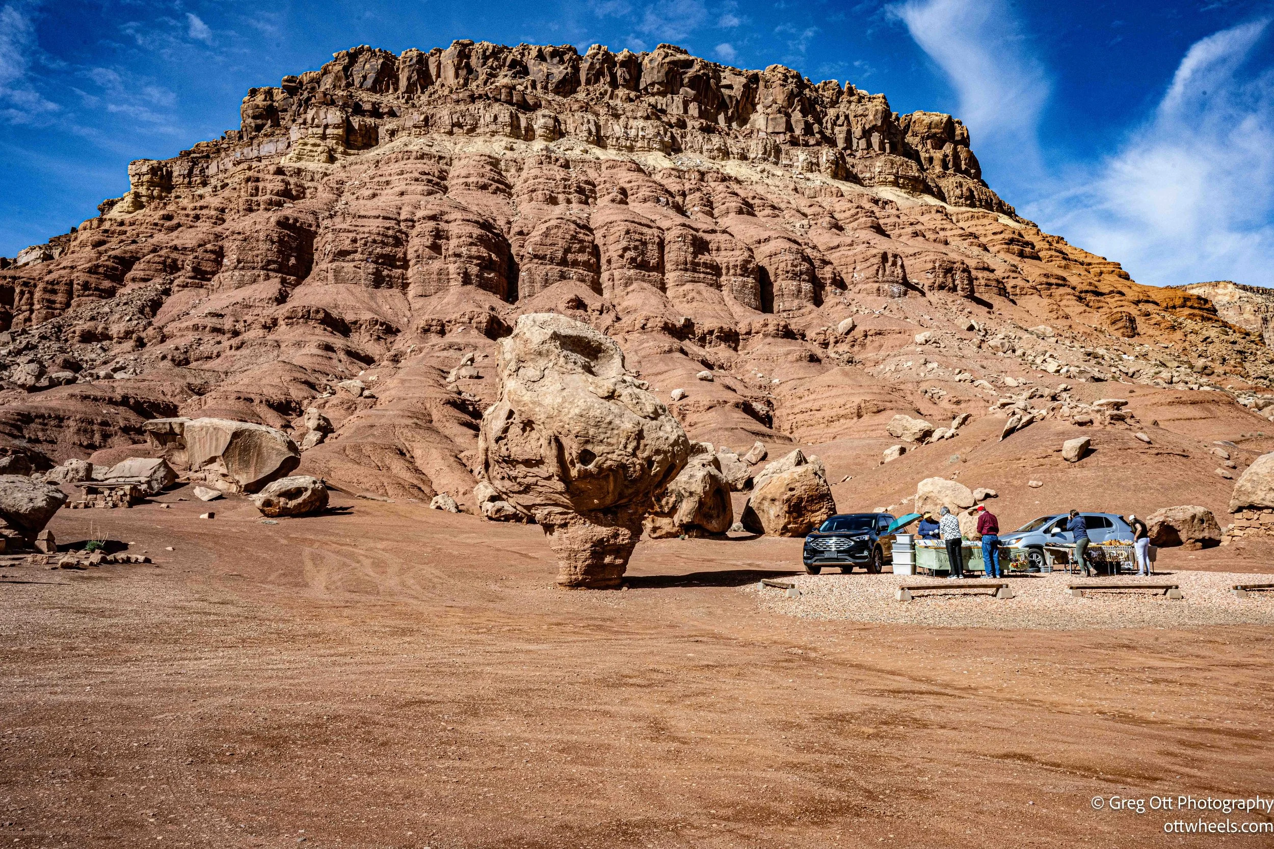
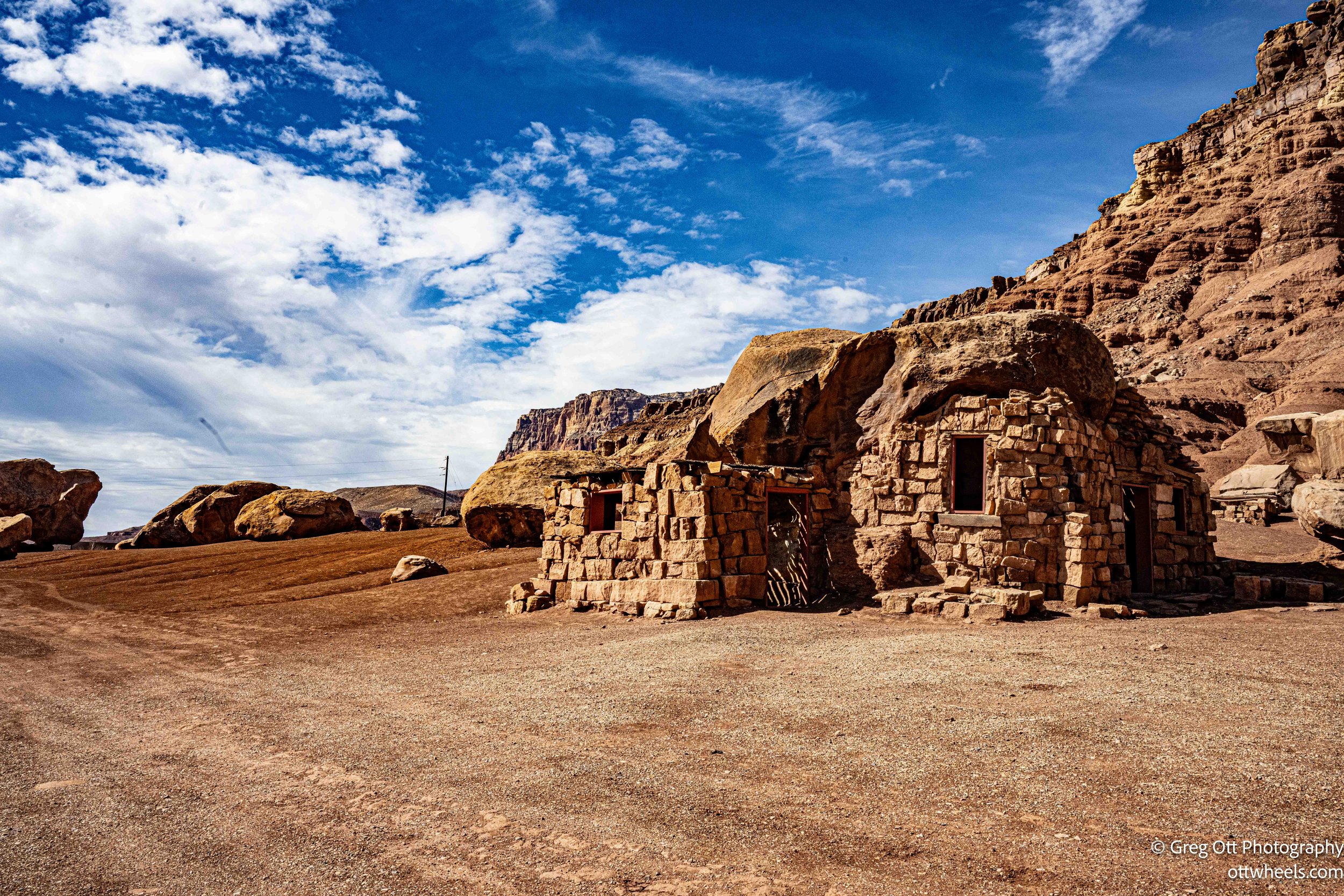
Two Native women were set up to the side, selling silver jewelry that caught the desert light. Behind them, the cliff face rose steep and fractured, massive blocks frozen in place yet appearing ready to fall at any moment. The whole scene felt suspended — balanced rocks, balanced commerce, balanced history. It was part roadside nostalgia, part living present. A short stop, but the kind that reminds me why I rarely rush through a stretch of highway.
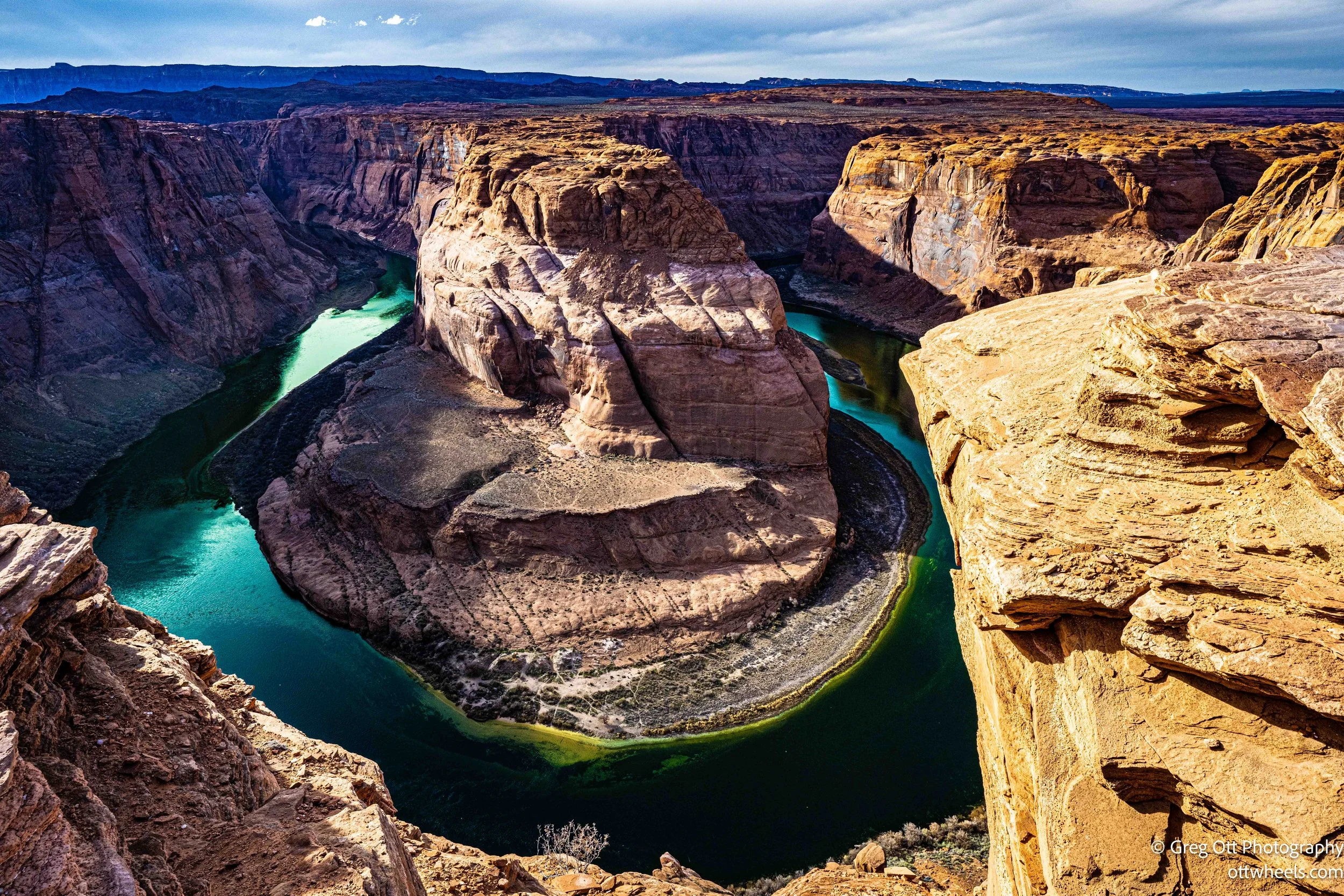
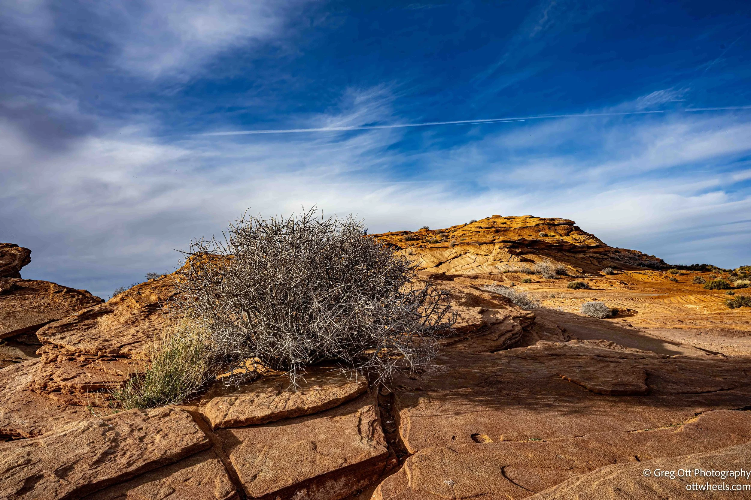
Thirty minutes down the road, I reached Horseshoe Bend. It was close to one p.m., and unlike the last time I passed by, there was no line at the entrance. The fee was ten dollars. No maps. Just simple instructions: follow the marked path about a mile down to the overlook. I parked in the RV-only section, though it was filled mostly with pickup trucks and cars. For a while, I was the only actual RV there. I grabbed the 14–24mm and 24–120mm lenses and started down the wide, sandy trail.
As I walked, I noticed very little English being spoken around me. Most conversations were in Chinese, Indian dialects, Japanese, or Spanish. Tour buses rolled in steadily and released large groups into the flow of foot traffic. This was mid-February. I can only imagine what peak season must feel like. Signs asked visitors to remain on the designated path, but many people cut across the fragile desert crust anyway. Children ran through brush and quickly discovered how sharp desert plants can be. Despite the “Pets must be on a leash” signs, two dogs were running free, and someone was walking a large cat on a leash. There seemed to be as much interest in posing on random boulders along the trail as in reaching the overlook itself.
At the rim, I stopped and let the scene settle. The cliff drops nearly 1,000 feet to the Colorado River, which curves in a near-perfect horseshoe below. The scale resists comprehension. Fifteen teenagers were laughing and edging close to the rim, leaning and jumping for photos. I found myself unable to watch for long. There are no guardrails. That absence is part of the raw power of the place, but it also demands a level of awareness that not everyone seems to bring.
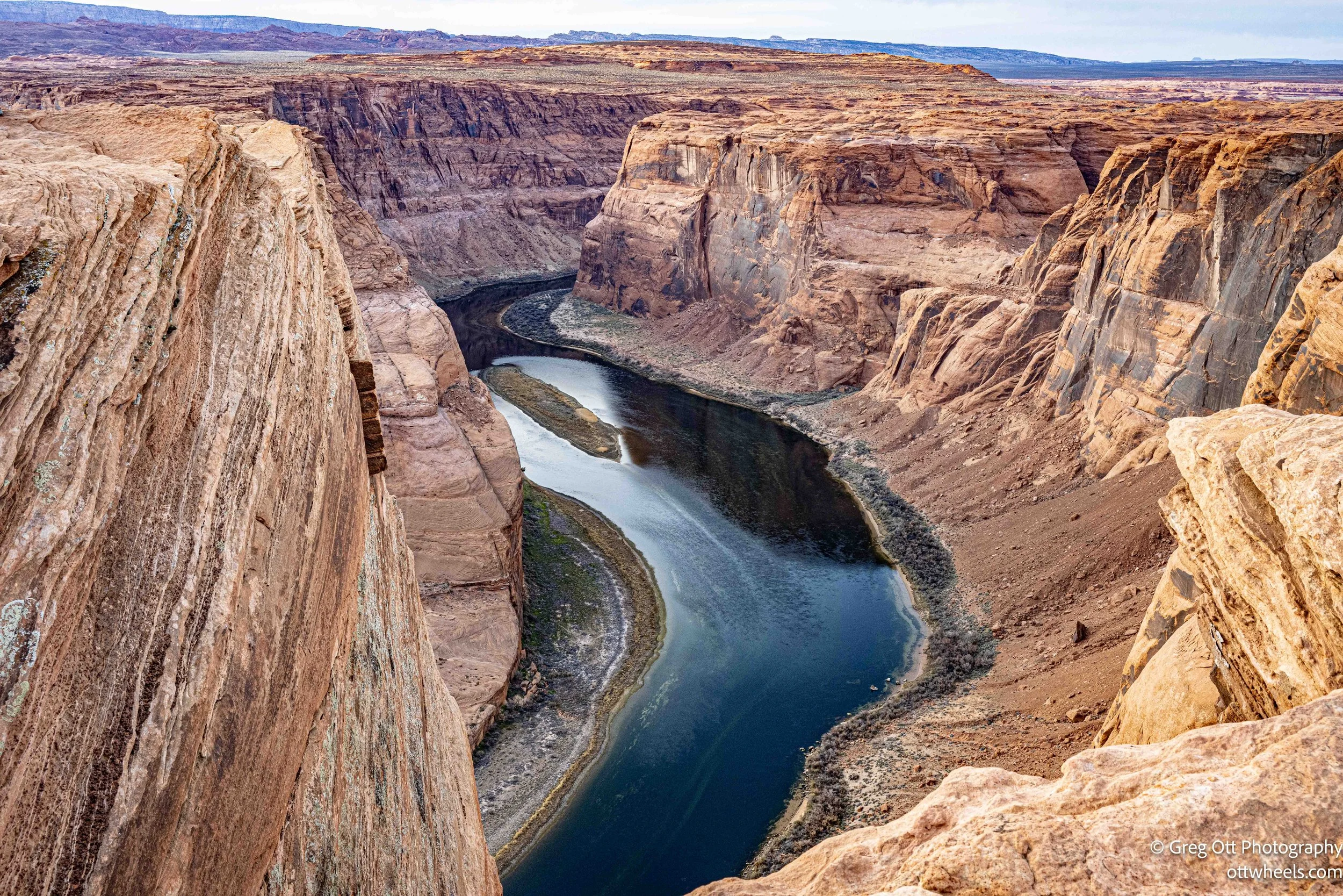
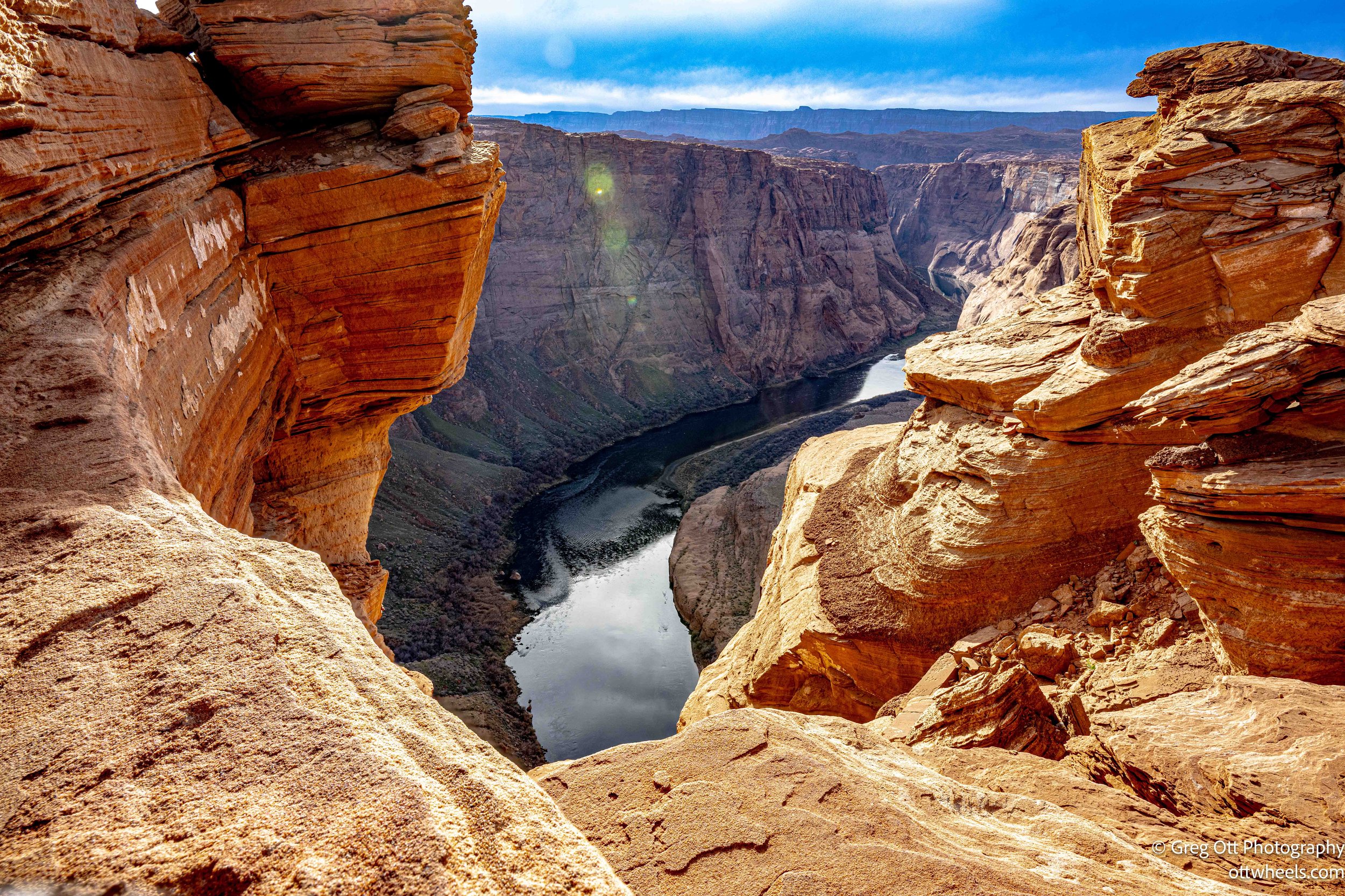
I returned to the van, then came back around four p.m., hoping for golden light on the surrounding formations. Heavy cloud cover muted the scene, and the dramatic glow I had imagined never arrived. I made a few frames anyway. Sometimes you photograph what the day gives you, not what you hoped for. As the area began to close and dusk moved in, I drove the short distance into Page for gas and groceries at Walmart. Several RVs were already settling in for the night. It was not a romantic campsite, but it was practical. Another day on the road completed, and Arizona unfolding again, one stop at a time.