Valley of the Gods to Page, AZ
Valley of the Gods
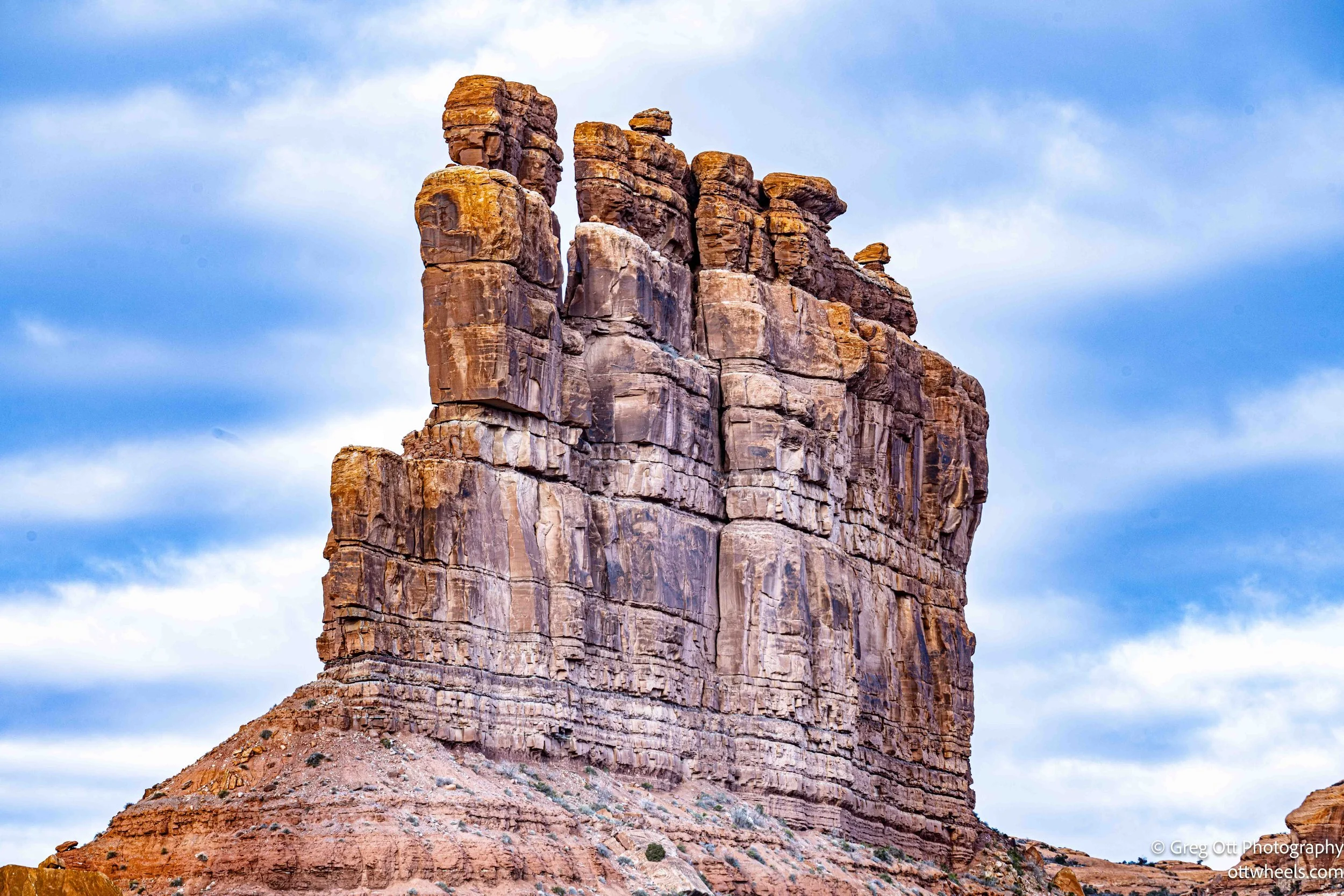
I woke up in the Valley of the Gods, parked beneath a tall rock formation in an open stretch of desert ringed by sandstone towers. It was quiet in a way that’s hard to describe — not just the absence of sound, but the sense that nothing nearby was in a hurry to happen. No engines, no voices, no wind pushing things along. Just space and time sitting still together.
The night before, I’d stayed up late again trying to photograph the stars against the rock formations. I gave star trails another attempt and, once again, failed pretty miserably. At some point, frustration gives way to acceptance. The learning curve is part of the deal, and sometimes the only thing you take away is the reminder that patience isn’t optional out here.
The Valley of the Gods is BLM land, open and undeveloped, sitting within the boundaries of Bear Ears National Monument. There are no services, no gates, no fees — just a rough loop road winding through formations that feel oversized and oddly unprotected. It’s the kind of place that doesn’t need explanation while you’re in it. You don’t analyze it so much as absorb it.
I didn’t really want to leave. The place was both calming and dramatic at the same time, and it felt easy to imagine losing an entire day there without ever noticing the hours slipping by. Still, I rolled out around nine, easing along the road and stopping far too often to take photos I already knew would need sorting through later.
About an hour later — still within the monument — I pulled over near the lone set of porta-potties and found another spot with a completely different view. I was running on too little sleep, so I crawled back into the van and grabbed another hour. After that, I made breakfast, cleaned up a bit, and finally committed to the road ahead.
Escalante was still five hours away.
Mexican Hat
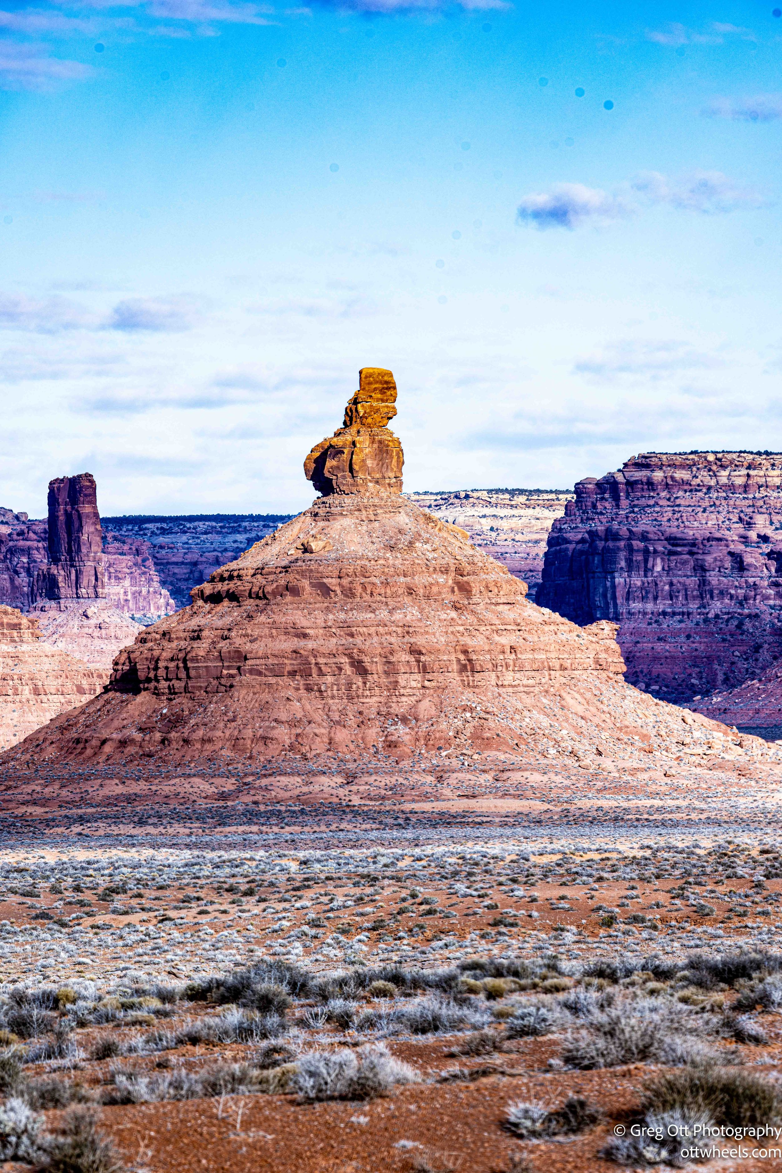
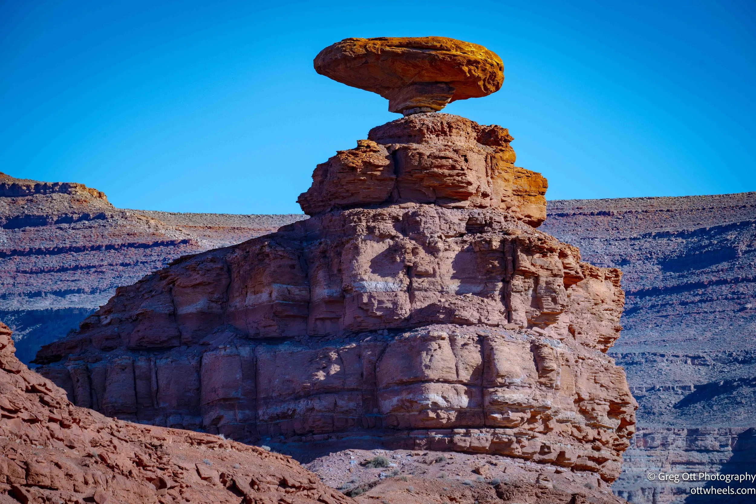
I stopped again to photograph the balanced rock known as Mexican Hat. Even after nearly two hundred years of being documented, it’s hard to believe the thing hasn’t tipped over. The formation looks perpetually on the edge of failure, like a moment frozen just before gravity finally wins. No matter how many times you circle it, the rock refuses to look stable.
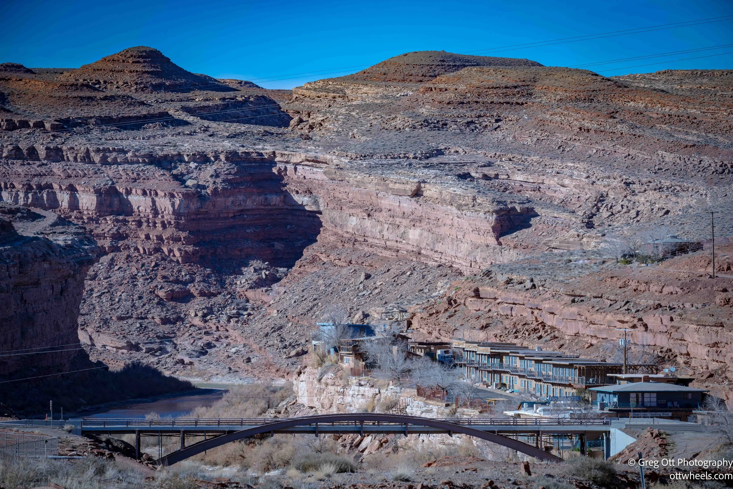
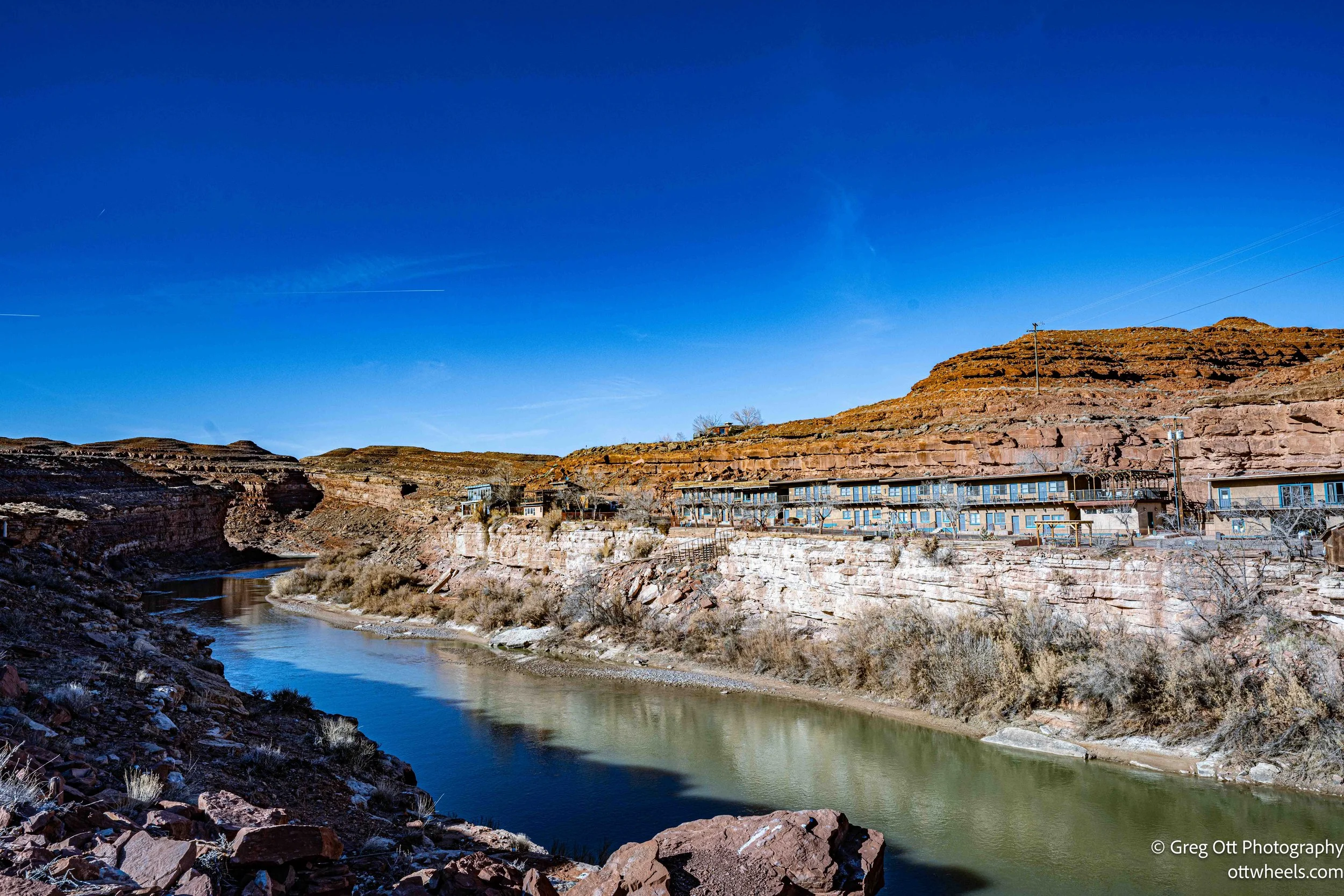
The town of Mexican Hat sits just down the road, tucked along the San Juan River. It’s less a town in the traditional sense and more a small cluster of buildings anchored by the highway — a gas station, a store, and a few motels serving travelers moving between Monument Valley and the rest of southeastern Utah. Its scale matches the landscape: small, exposed, and fully aware of the rock looming above it.
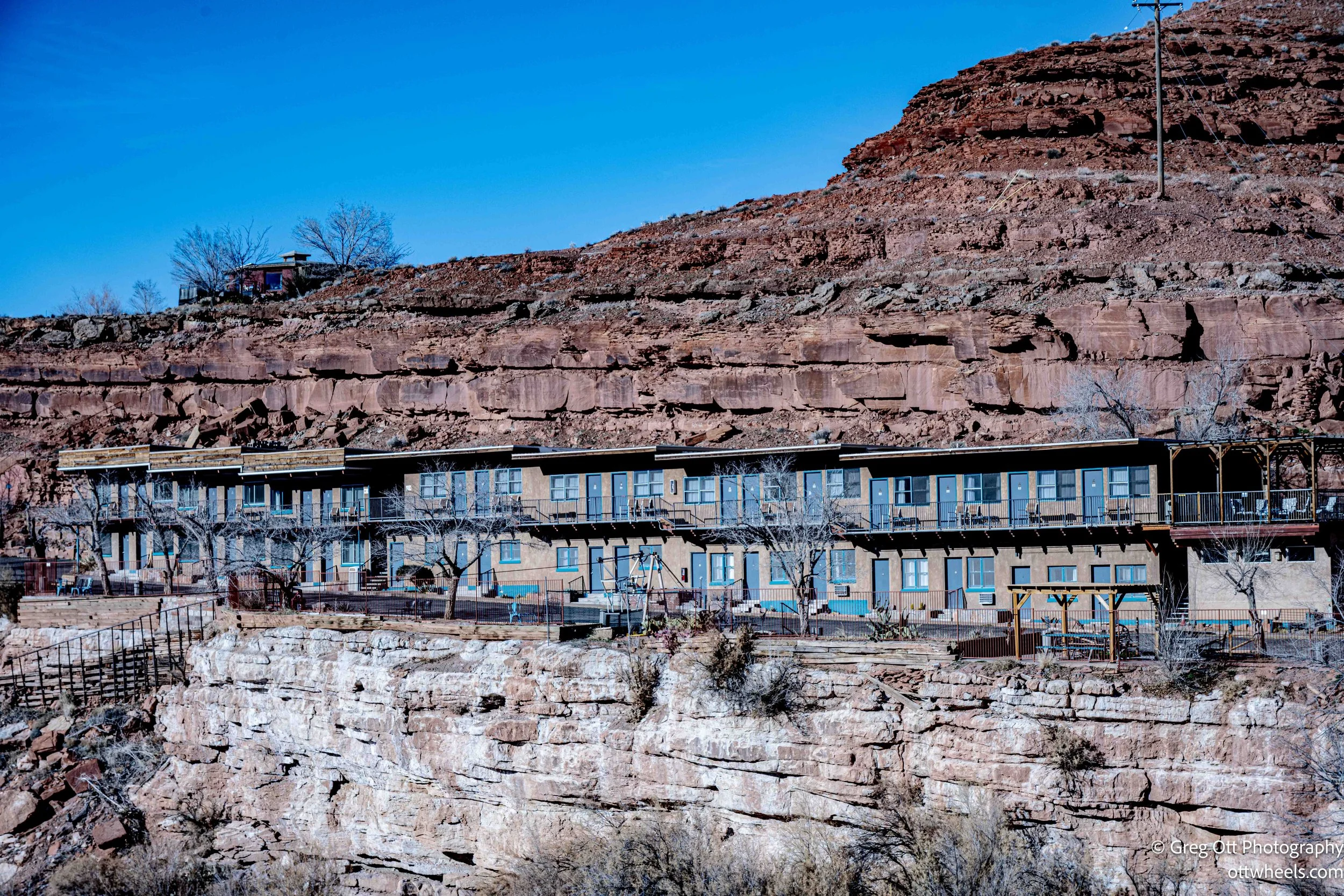
I stopped for gas, then walked around to photograph one of the motels pressed tight against the river, backed by a sheer cliff and a massive rock wall. From certain angles, it looks like the whole place was wedged into the landscape by accident. If anything above were to loosen, it feels like the motel would be the first thing in the way. The photos don’t quite capture the tension of it — that sense that everything is held together by timing and luck — but the feeling stays with you longer than the images do.
Forrest Gump Point
Driving south from Mexican Hat, I stopped at the hill where Forrest Gump decides in the movie to end his long cross-country run. There’s a sign marking the spot, and the speed limit drops to forty-five, though that didn’t seem to matter to at least one local who sped up just as people were stepping into the road trying to frame the long stretch of pavement with Monument Valley in the distance. People scattered. I shook my head.
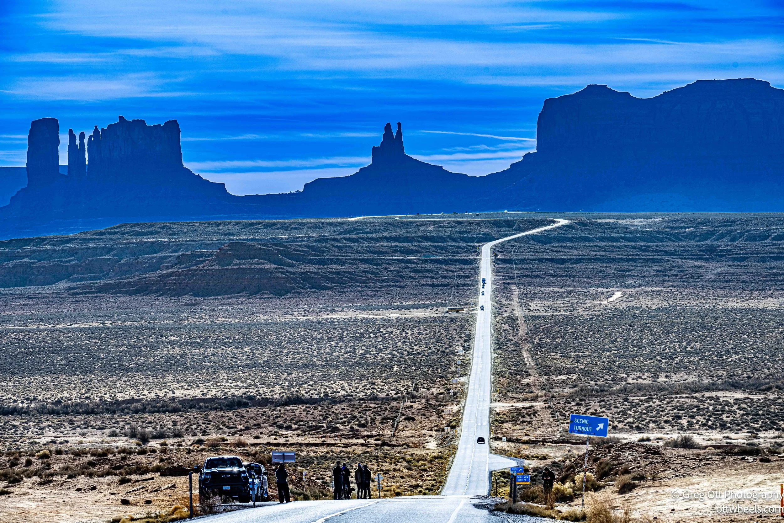
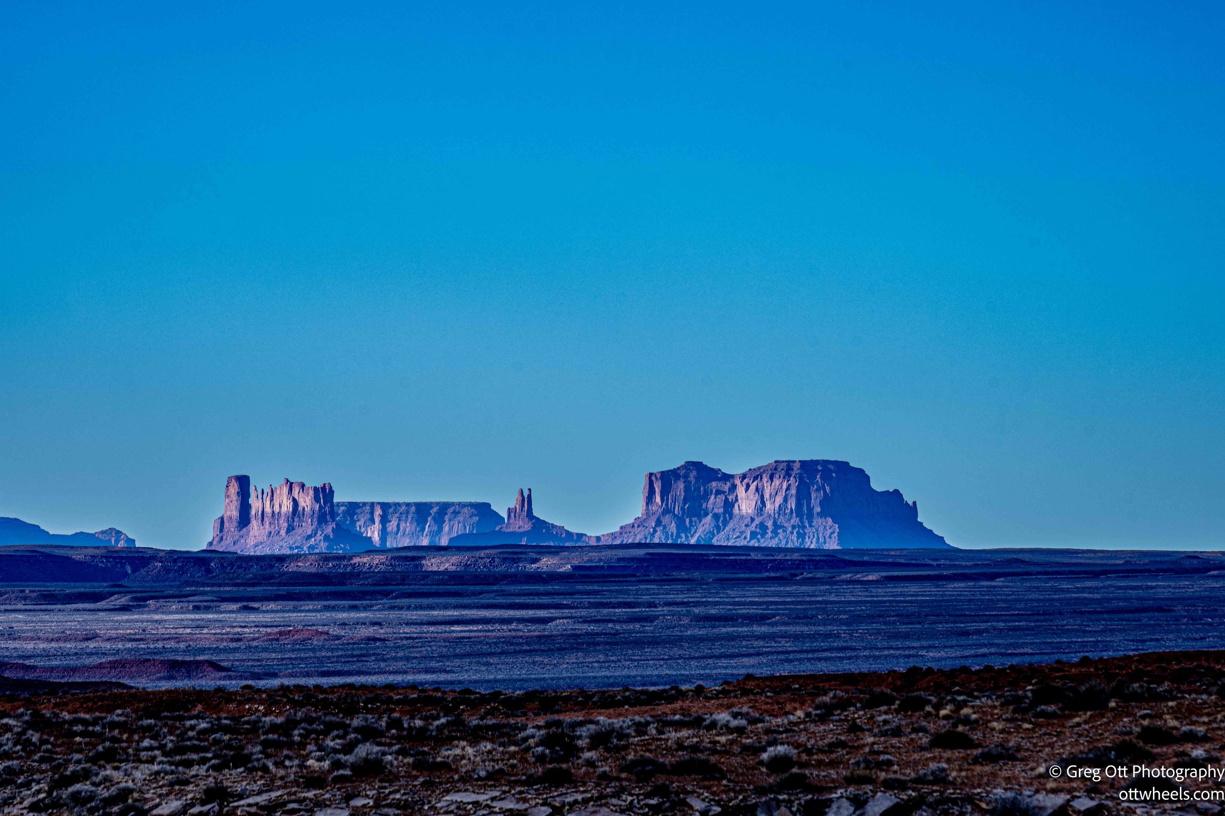
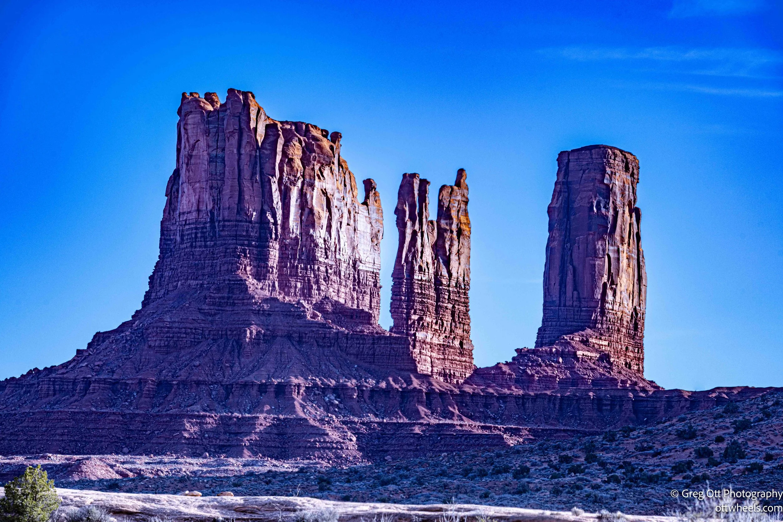
Monument Valley
Even though I’d been through this area before, I slowed down again and pulled off for more photos. I passed the KOA where I’d stayed almost three years earlier and remembered that first trip through Monument Valley — the snowstorm that shut everything down, the quiet, empty restaurant on the hill, and how completely alone the place felt. I also remembered how unusable the internet had been back then, and how different things are now with Starlink quietly doing its job in the background.
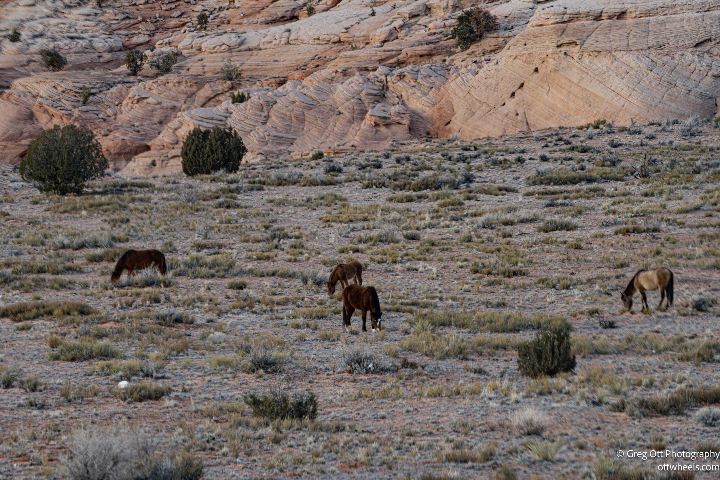
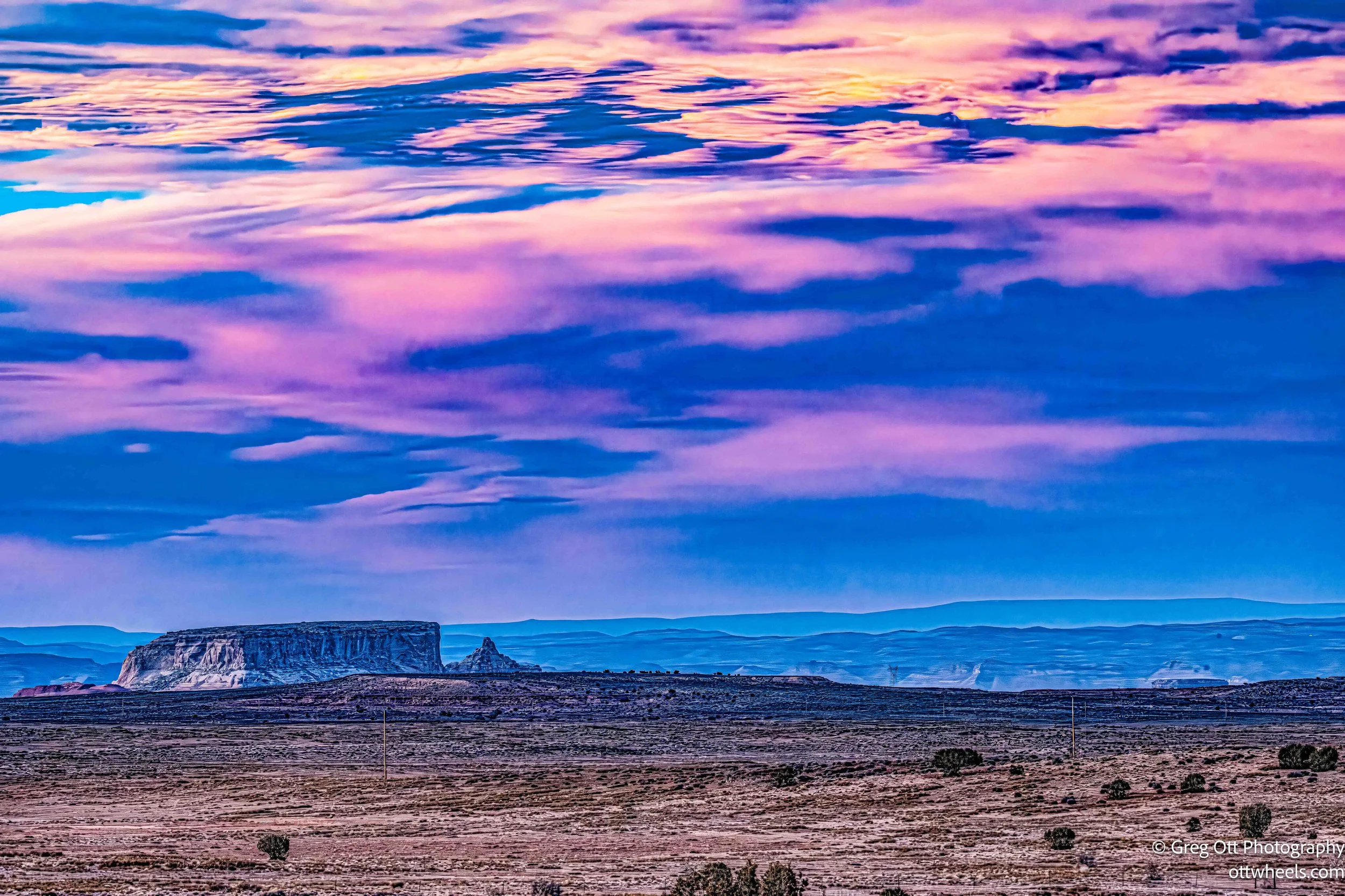
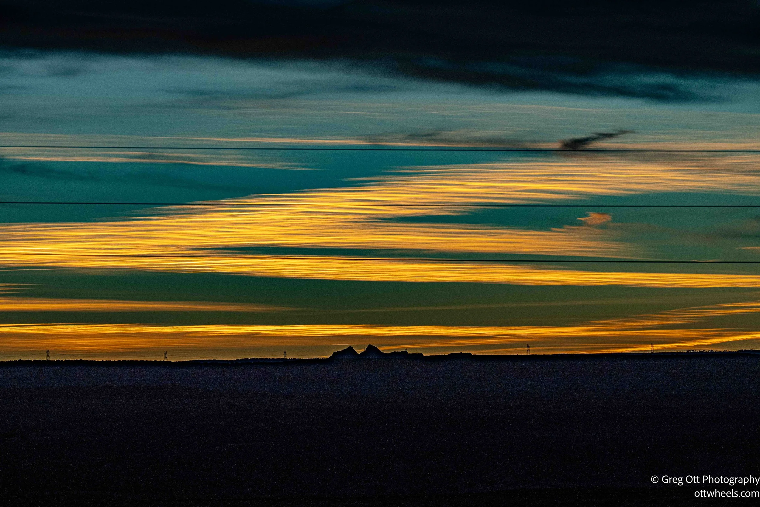
There was no chance I was making it to Escalante today. The sun was already dropping and I was still about twenty minutes from Page, Arizona. I pulled over to photograph a group of horses grazing in the orange light, the landscape glowing as if it had been turned up a notch. I kept driving. Traffic was light, and the sky kept getting more dramatic by the minute — pinks, purples, and yellows layered across the horizon. A school bus passed me with its yellow lights flashing, the color cutting sharply through the evening sky.
I made it to the Walmart in Page just as darkness settled in. I’ve been to this Walmart before and badly needed groceries. When I came back out, the lot was already quiet. I decided to stay for the night and found a spot far out on the edge, well away from the store traffic.
It turned out to be surprisingly quiet.