Saguaro National Park
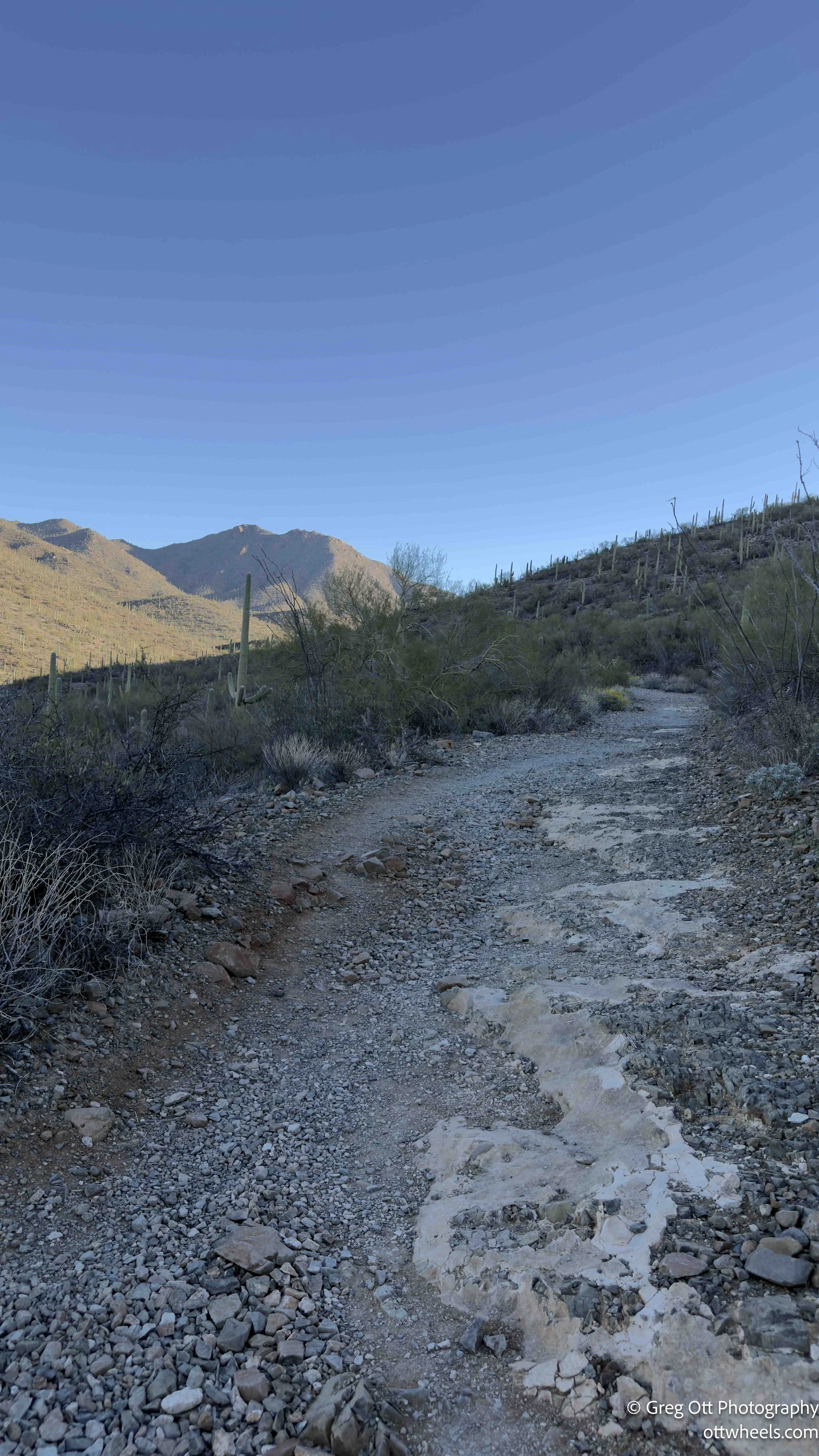
I wanted to see the saguaro cactus up close — not from the highway, not framed through a windshield — but standing beside one. There really isn’t a better place for that than Saguaro National Park. I left my BLM campsite in Ironwood Forest National Monument and drove toward the western district of the park just after sunrise. The visitor center wasn’t open at 7:30, but that was fine. I wasn’t there for brochures. I wanted an early start before the heat and the crowds.
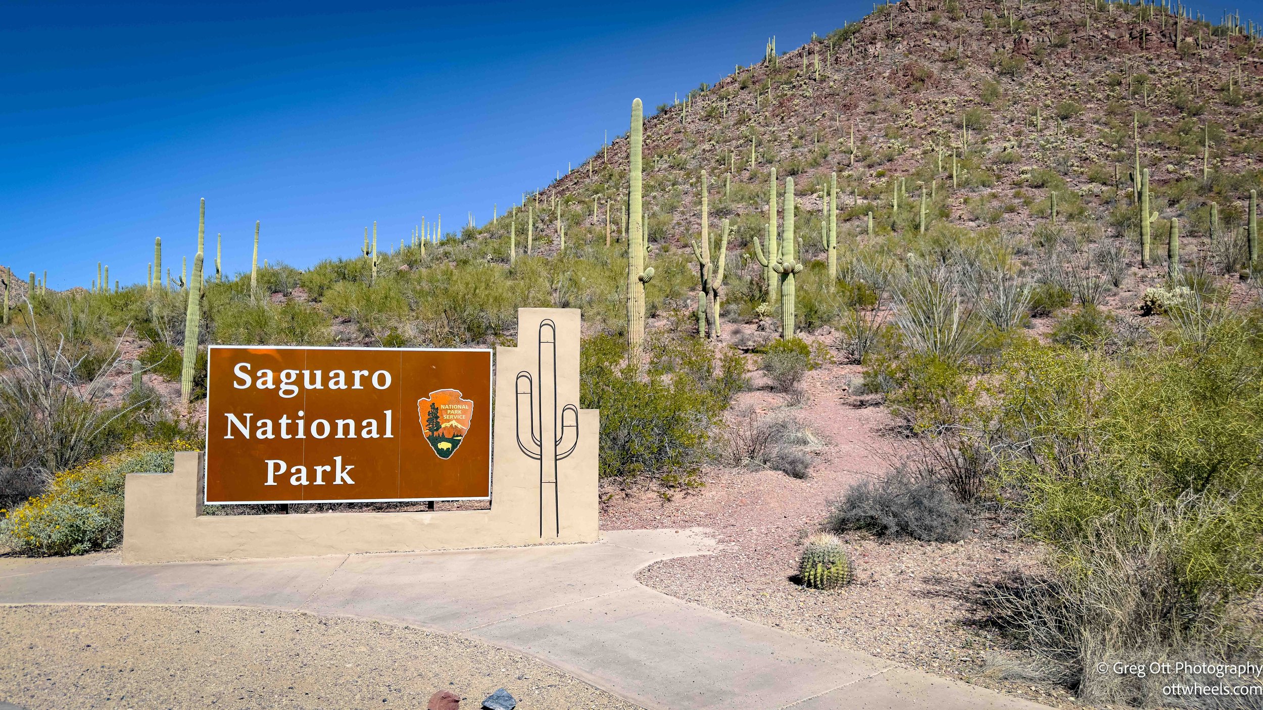
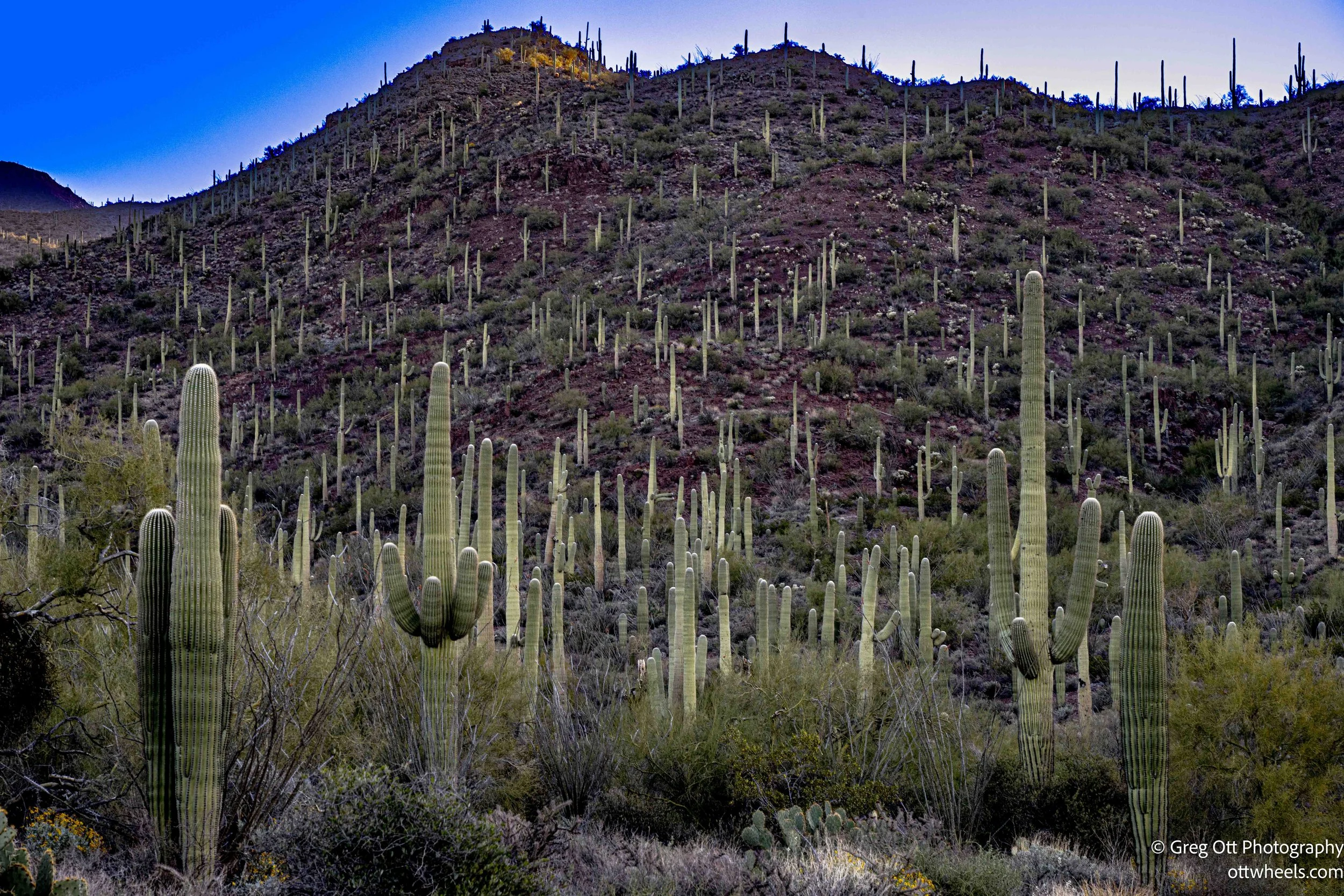
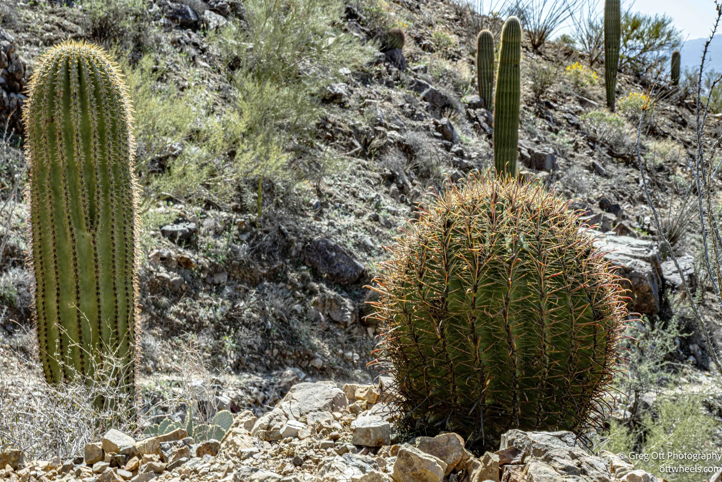
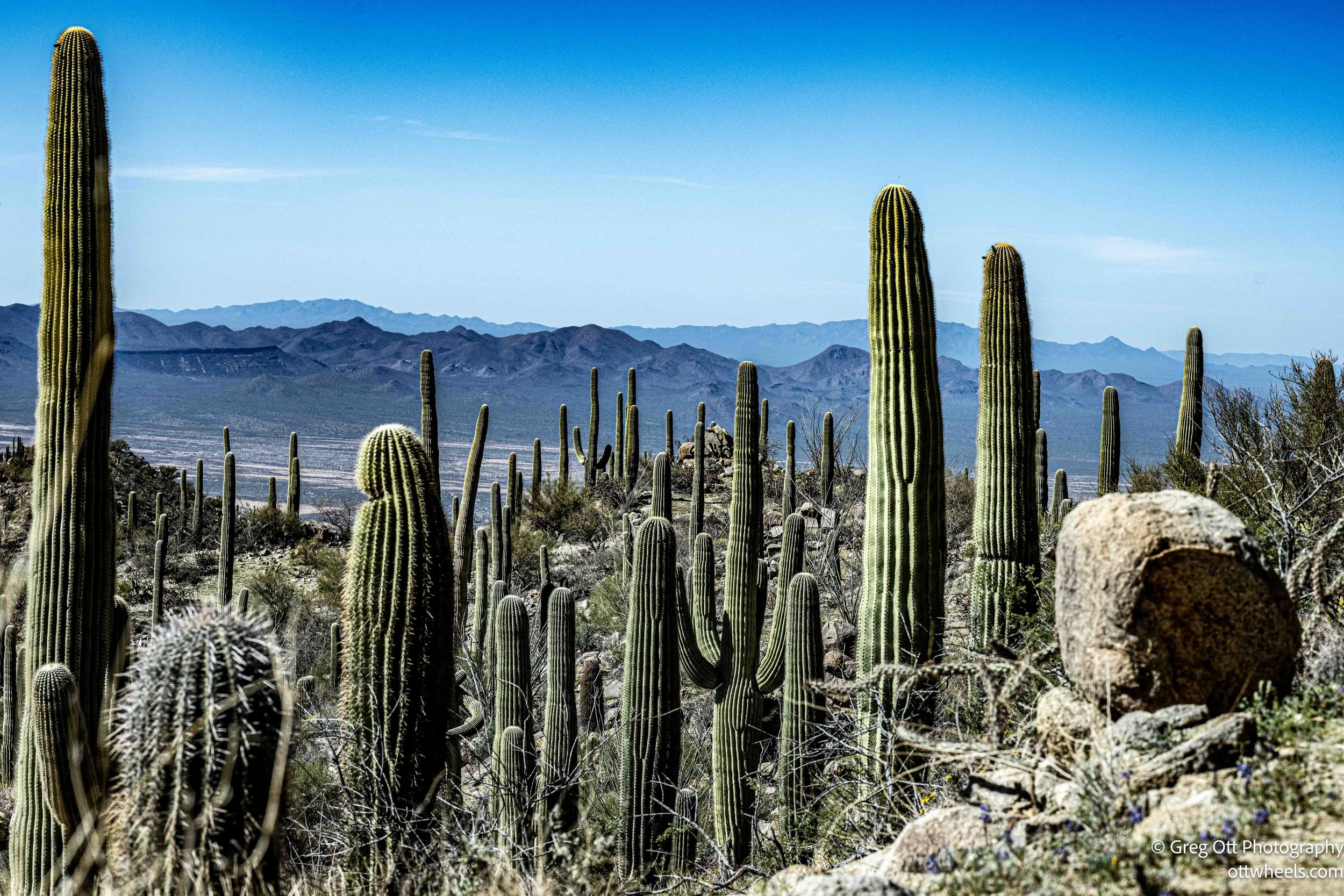
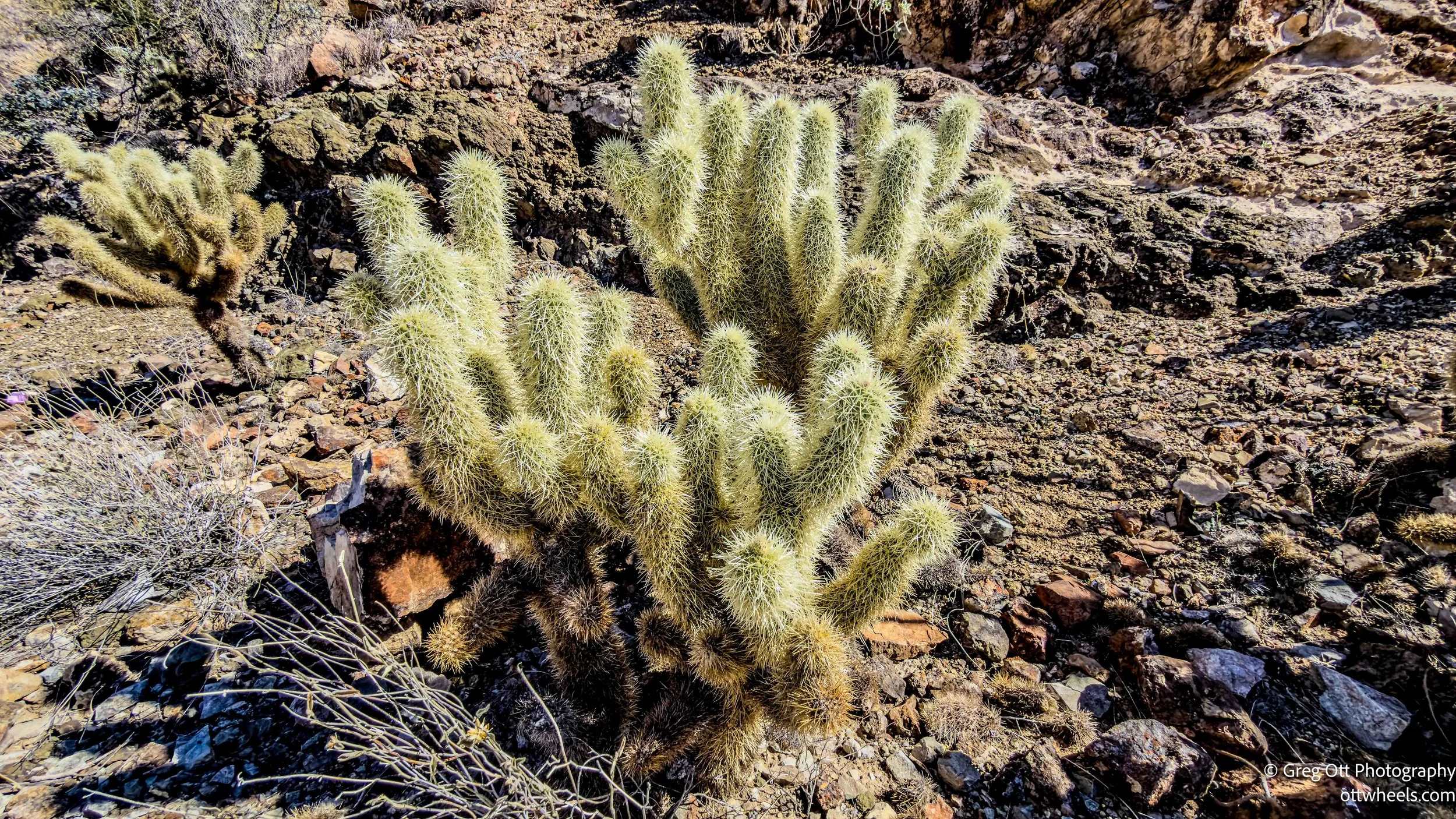
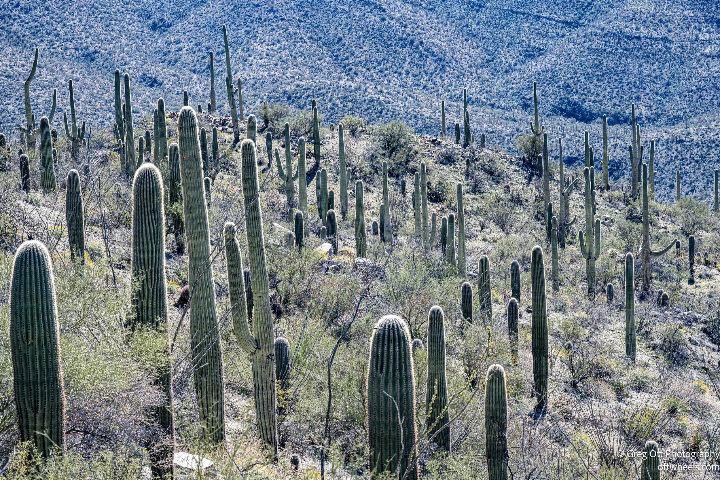
Saguaro National Park exists for one primary reason: to protect the giant saguaro cactus, the plant that has become the symbol of the American Southwest. The area was first protected as a national monument in 1933 and later designated a national park in 1994. The park is split into two districts on either side of Tucson — the Tucson Mountain District (west) and the Rincon Mountain District (east). I was in the western side, where the Tucson Mountains rise abruptly out of the Sonoran Desert. This landscape looks sparse from a distance, but once you step into it, it’s dense with life — saguaros, barrel cactus, cholla, ocotillo, palo verde, and, depending on the season, a surprising number of wildflowers.
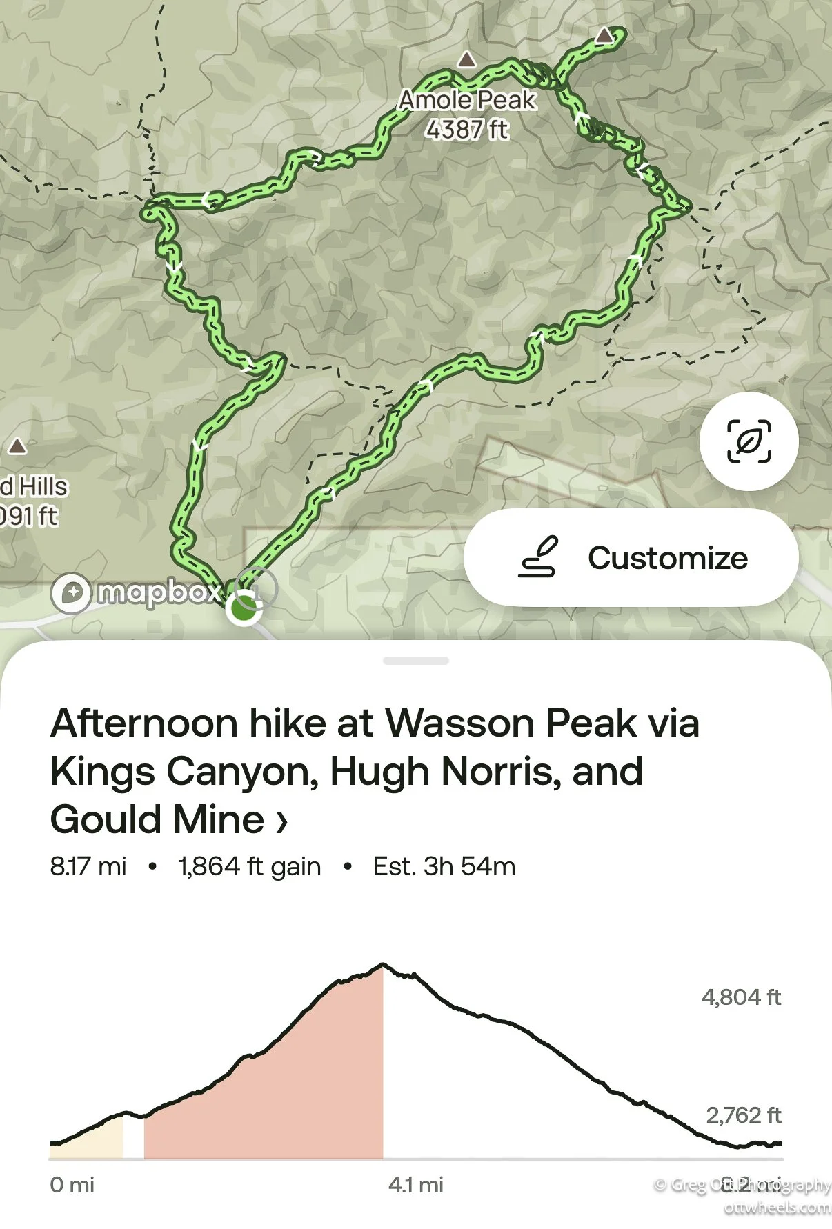
My plan was to hike to Wasson Peak via King Canyon, connect to the Hugh Norris Trail, and return by way of the Gould Mine area. AllTrails rated it “Hard.” Eight miles. Mostly uphill on the way out. That sounded about right.
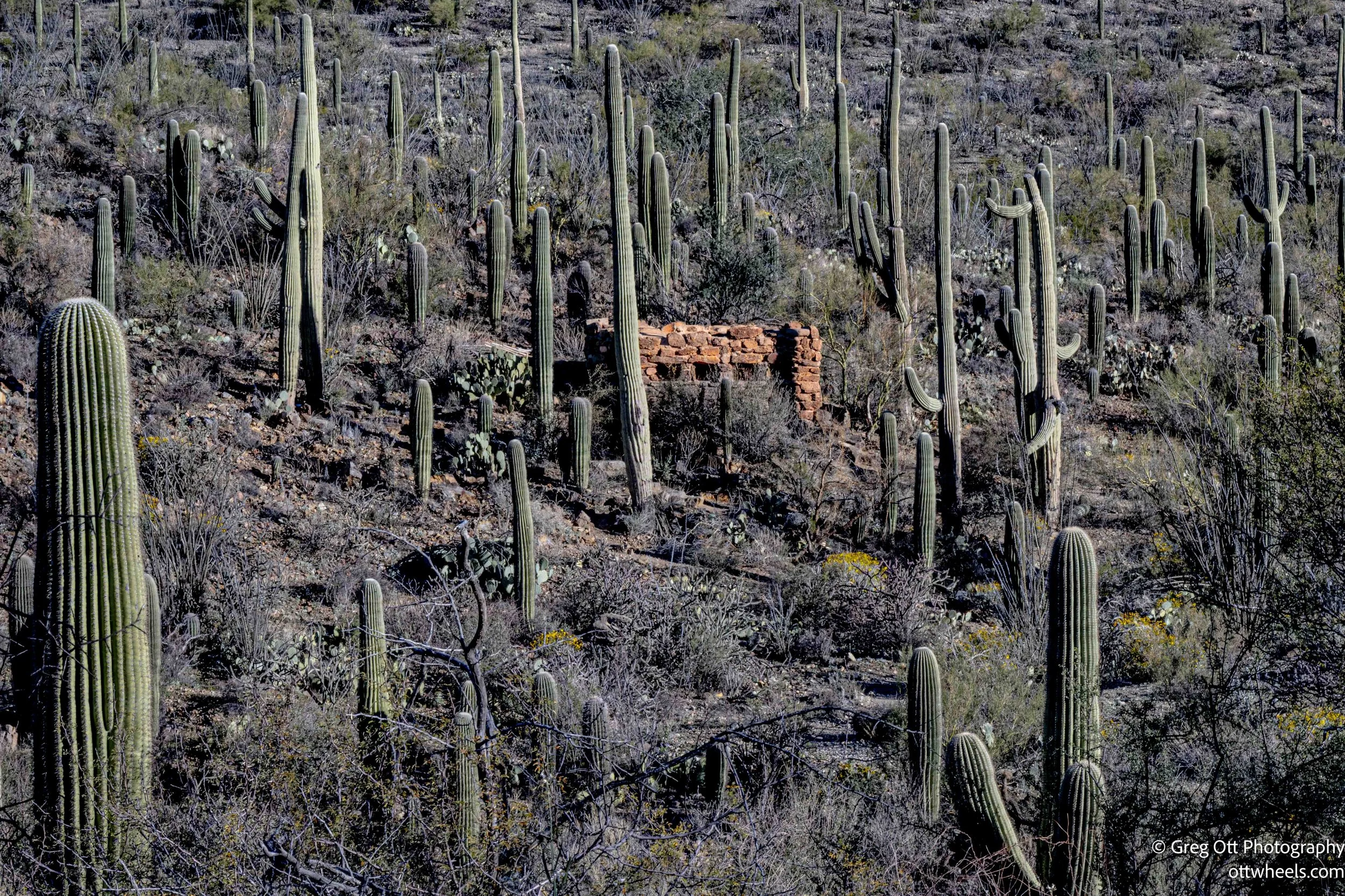
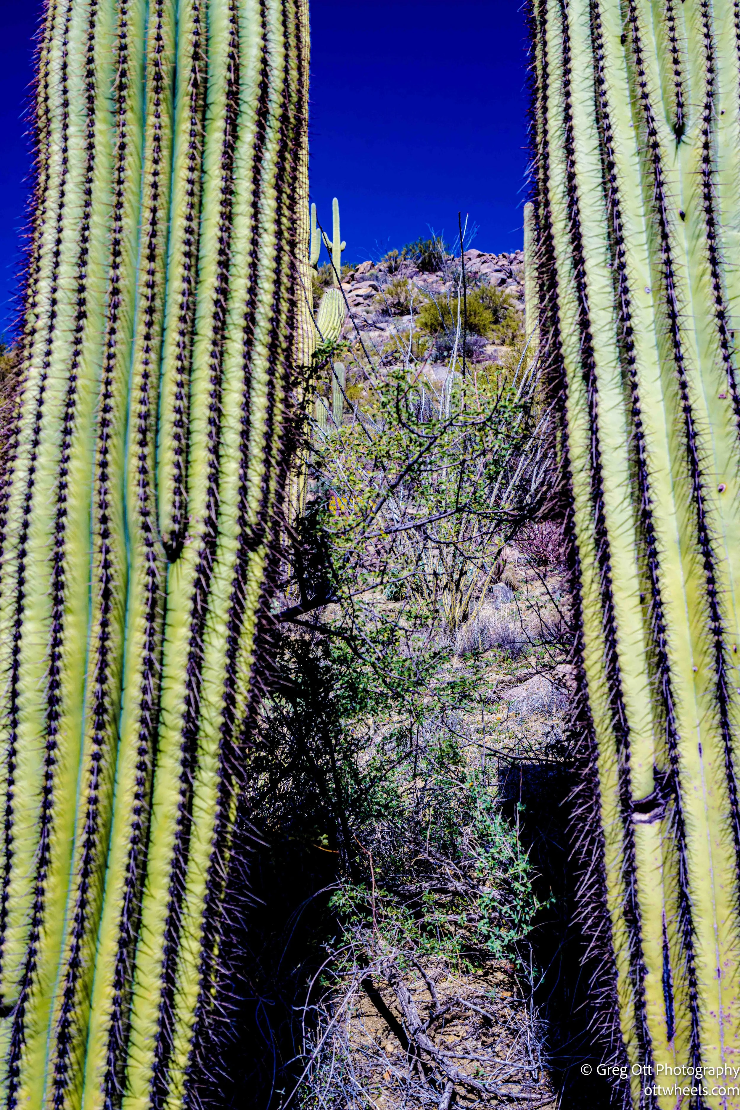
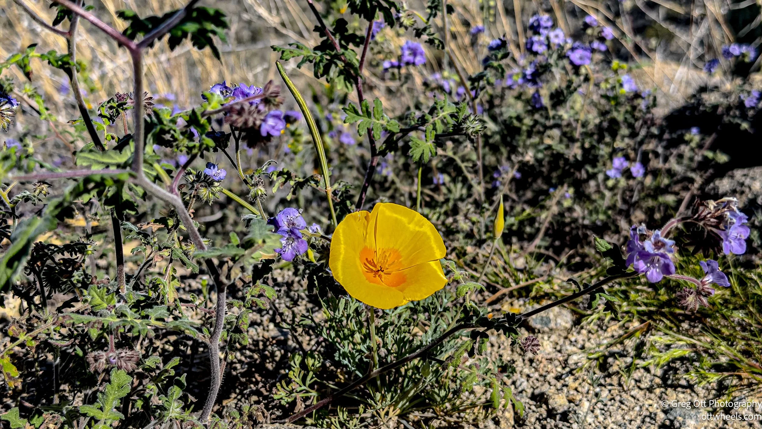
The King Canyon Trail starts gradually, weaving through washes and climbing steadily over rocky terrain. Within the first mile, you pass the remains of an old stone structure — part of the historic Gould Mine operation from the early 1900s. That crumbling building across the way, framed by cactus and early-season flowers, was exactly what I was trying to photograph when a woman called out, “Getting any good shots?” I told her I was trying to create a layered image — ruins in the background, cactus and blooms in the foreground. We started talking and ended up hiking together for about 45 minutes.
Marissa and Matt were from St. George, UT. I mentioned my sister lives in Hurricane, and Marissa said she was from Hurricane. That’s how these desert trails work — you start with photography and end up talking about family and travel. We drifted into Canada and Prince Edward Island. I told them how much I loved PEI. Matt, a cyclist, was interested in the Confederation Trail. They shared that they were planning to elope there this year. Then Alaska came up. I told them I was planning to spend three months there this summer. Later, Marissa would later send me a lot of useful information about places to see. It’s funny how often trail conversations turn into something lasting.
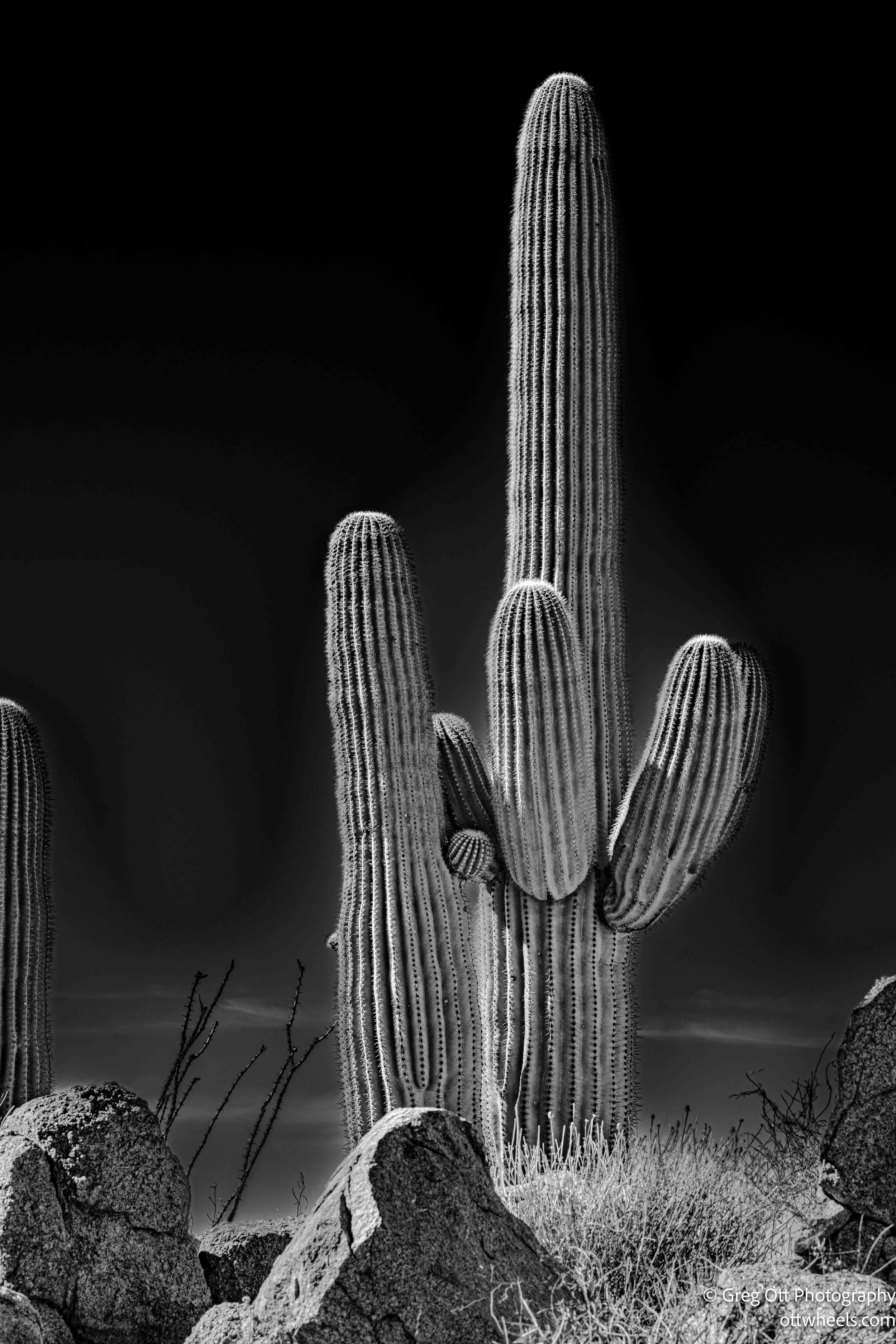
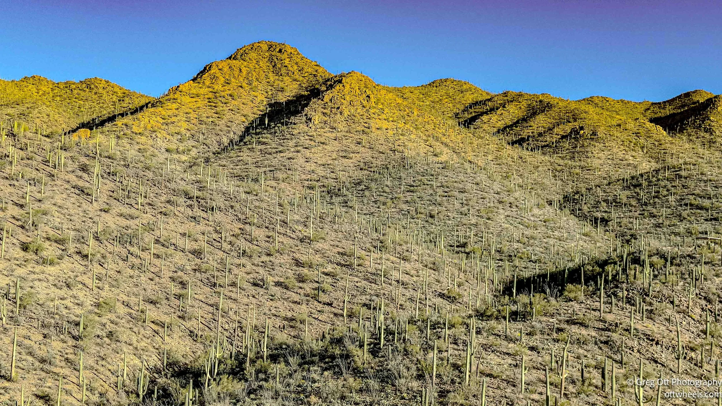
Eventually, I had to slow down. They had youthful energy and light daypacks. I had too many lenses and was still recovering from a lingering throat issue. The Hugh Norris Trail climbs steadily and, at times, steeply along exposed ridges. The footing is rocky. Switchbacks cut through slopes lined with saguaros that stand like silent witnesses. I focused on my breathing and kept a steady pace. It’s humbling when groups of 20-somethings jog past you while you’re measuring each inhale.
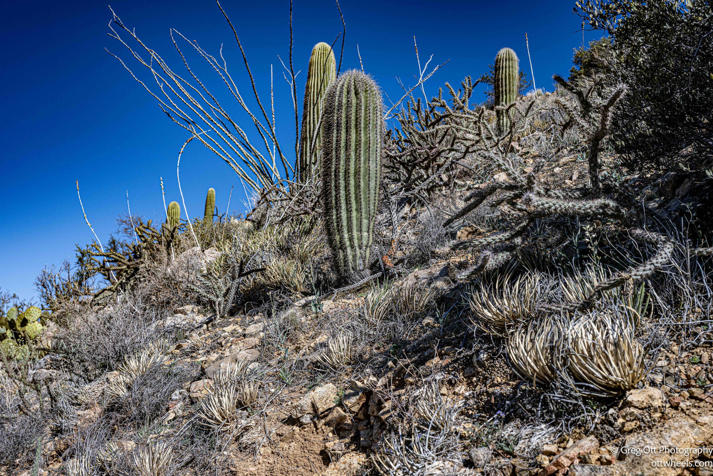
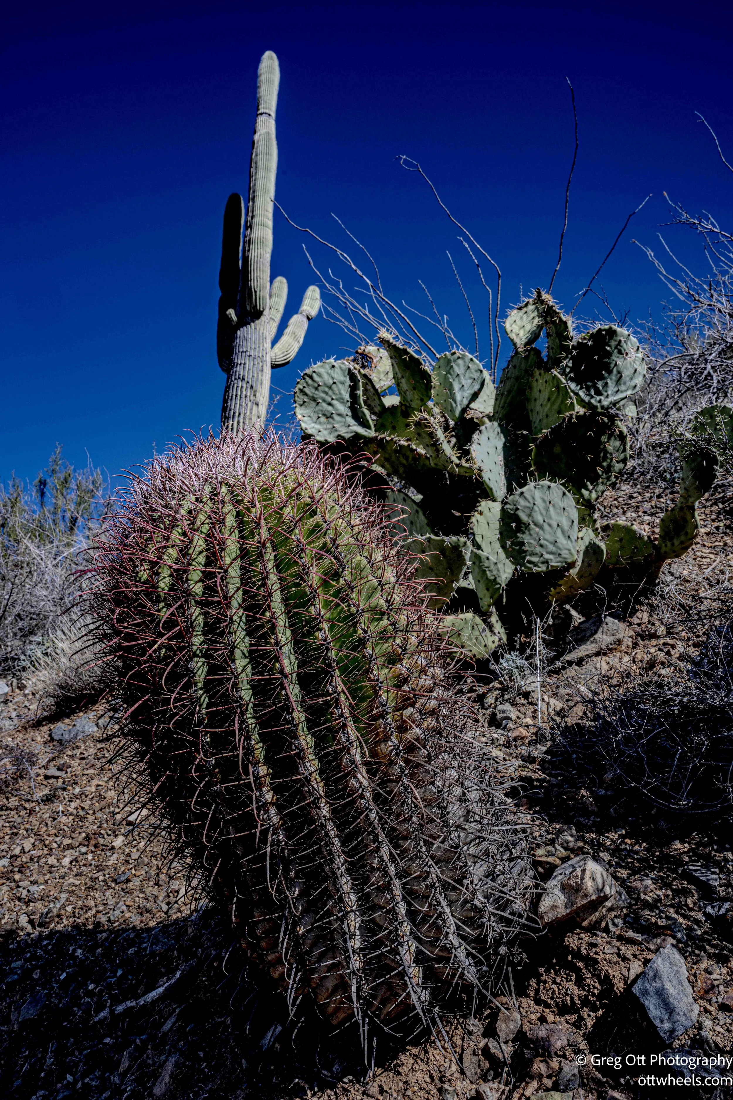
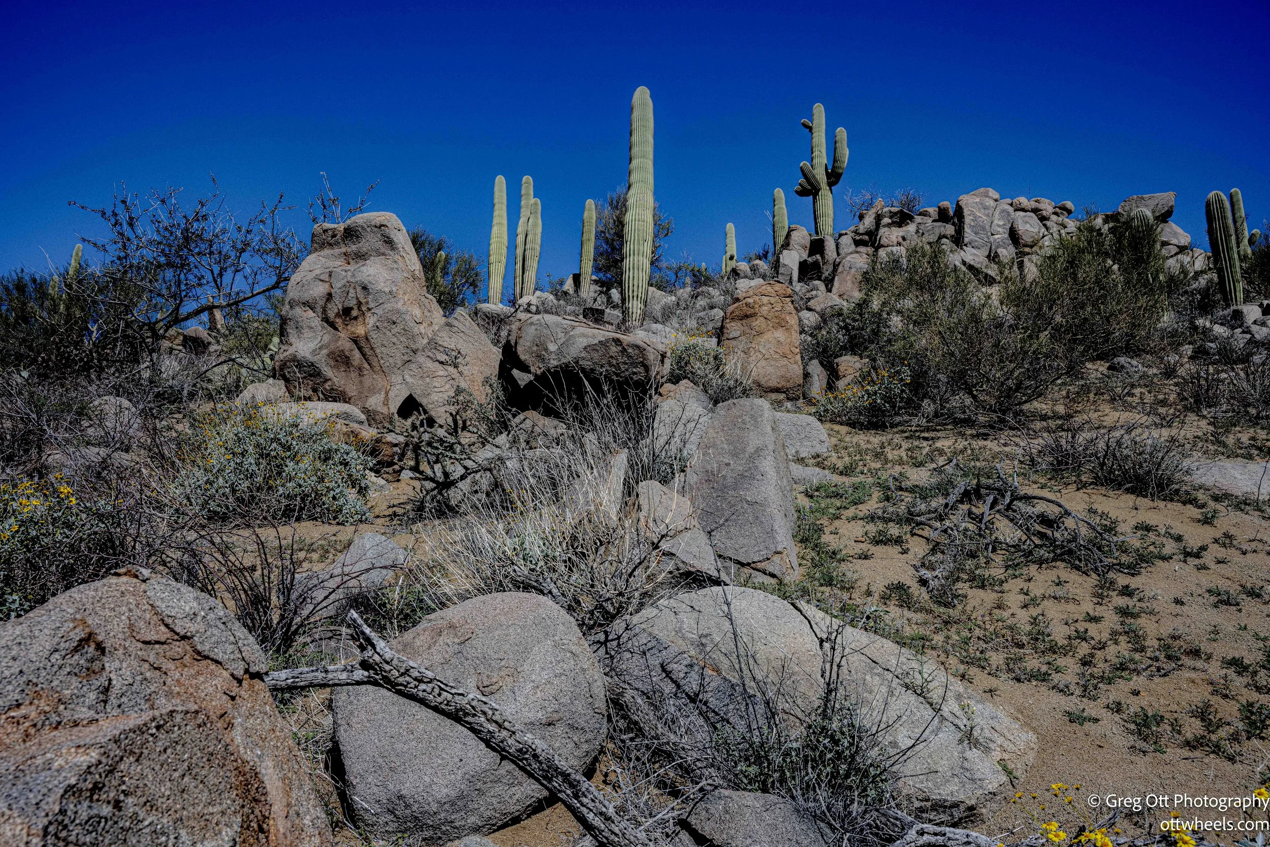
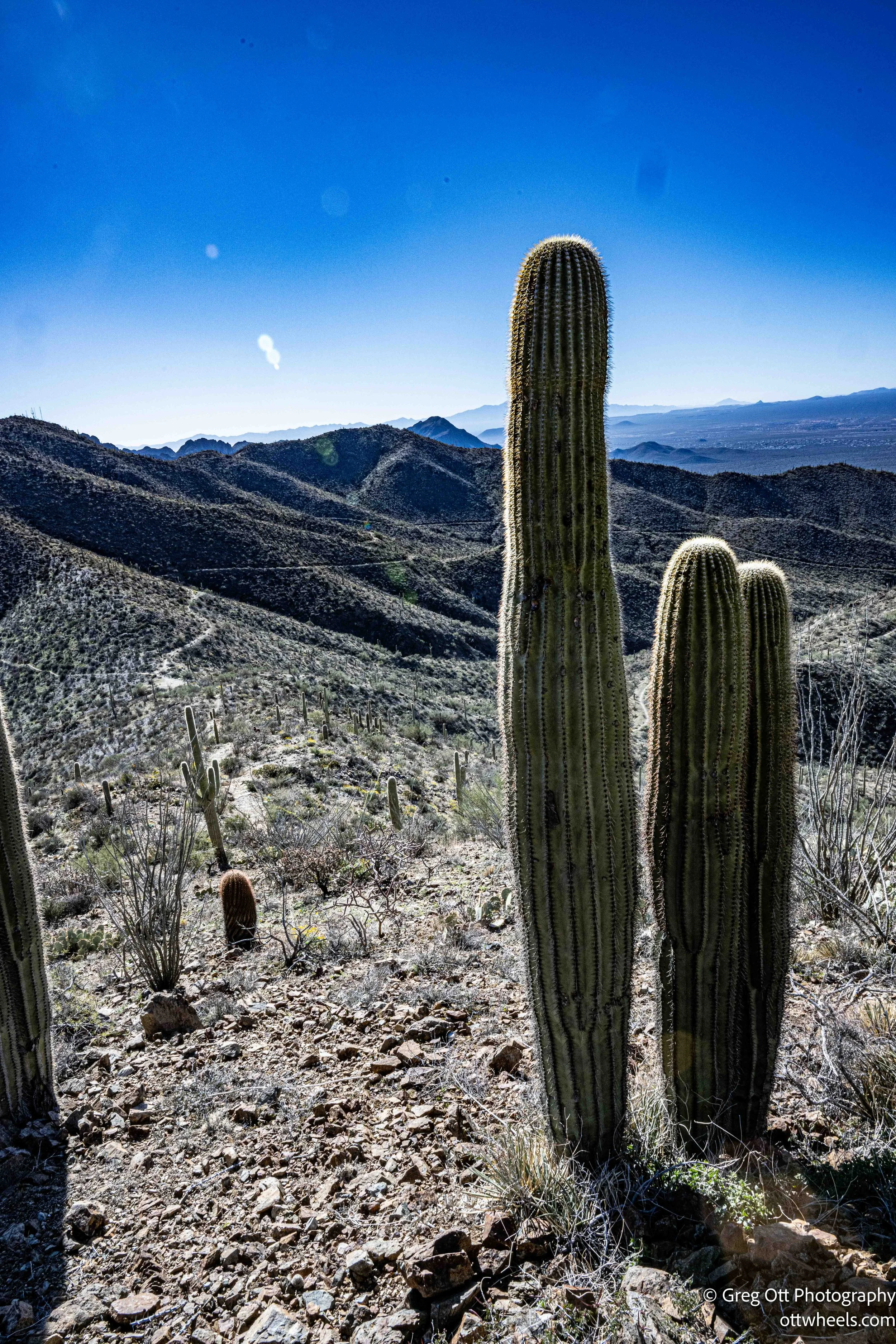
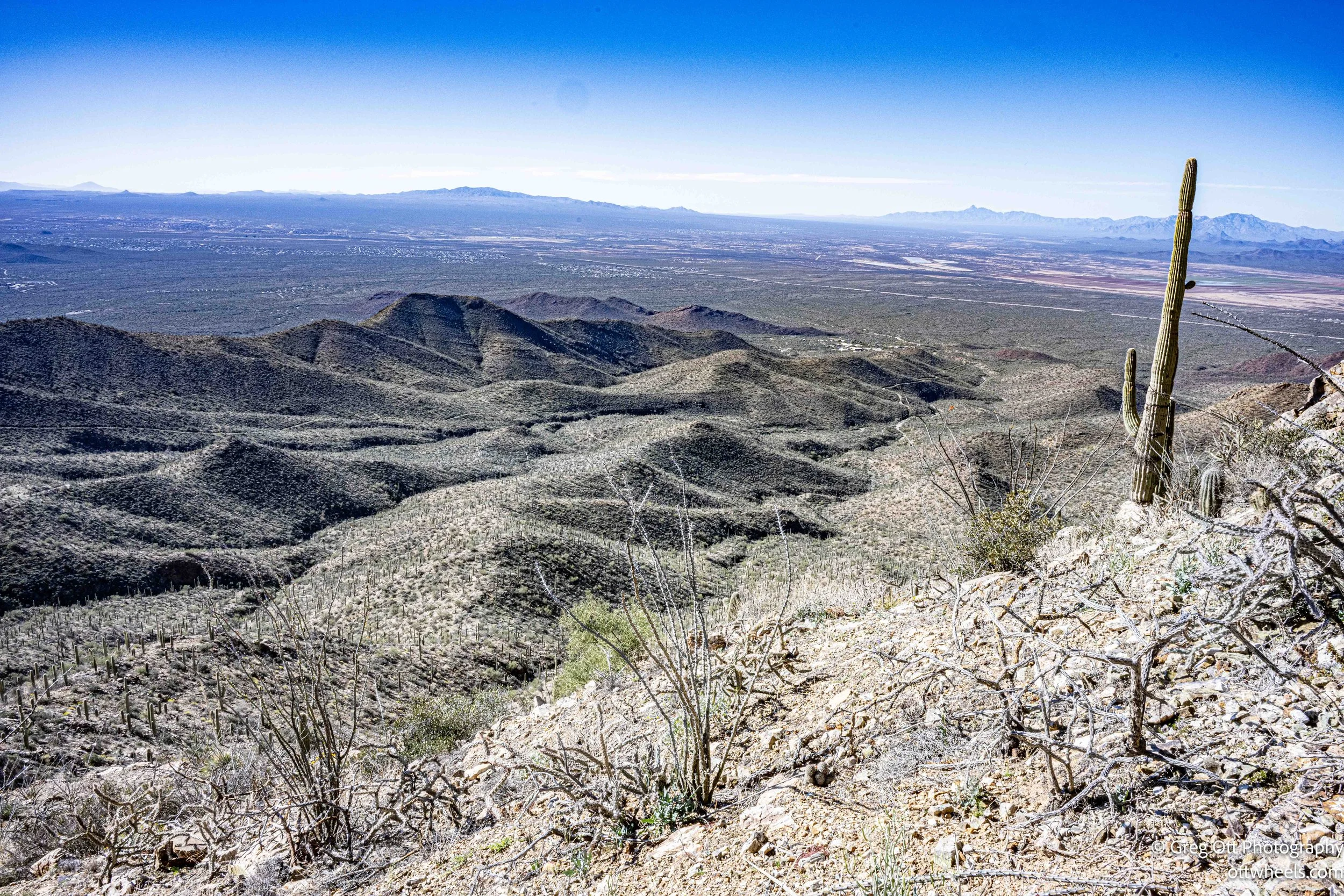
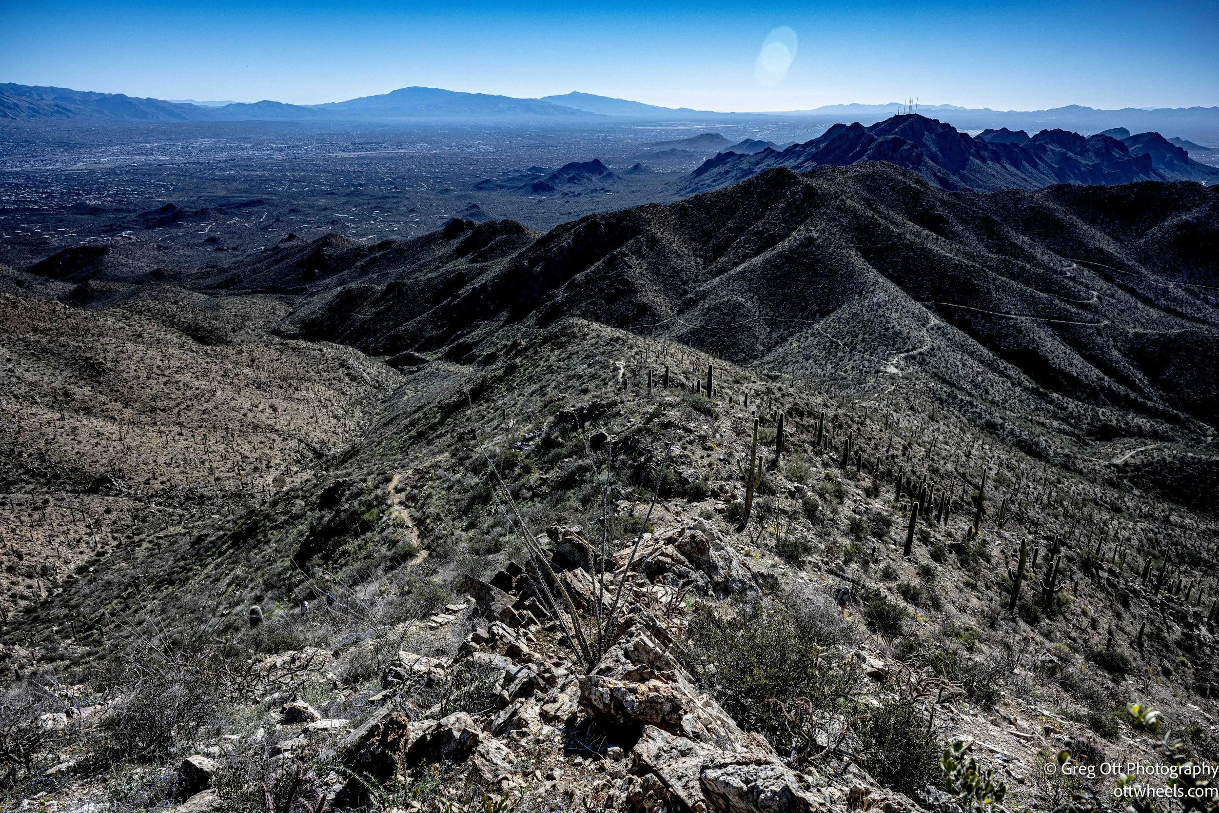
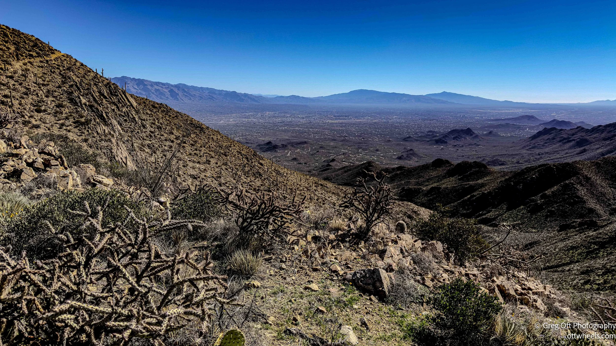
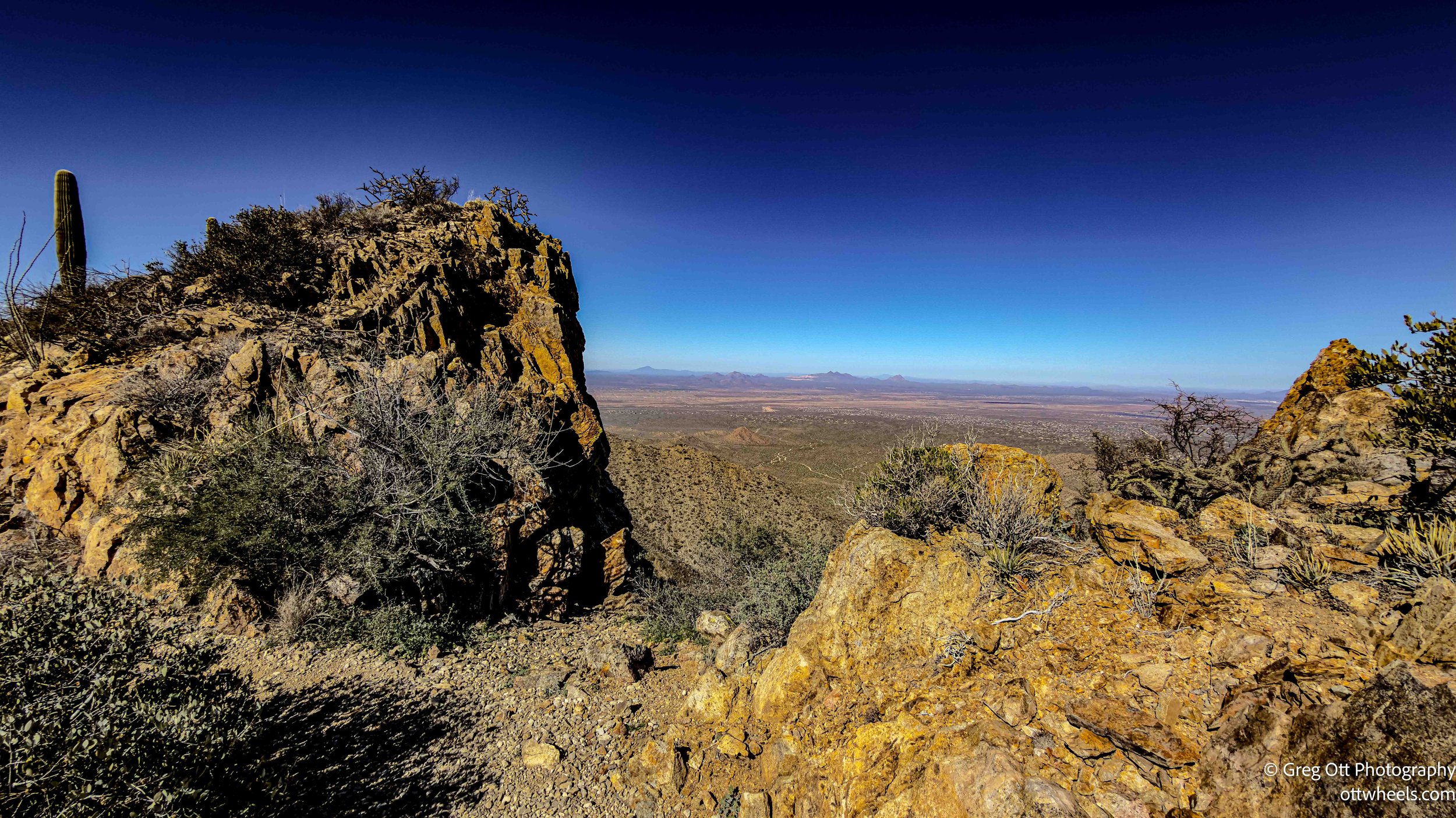
The higher you climb, the more the desert opens up. Saguaros become silhouettes against wider views. The geology shifts — dark volcanic rock from ancient eruptions forms the backbone of the Tucson Mountains. This range is older and lower than many Arizona mountain ranges, worn down over time. You feel that age under your boots.
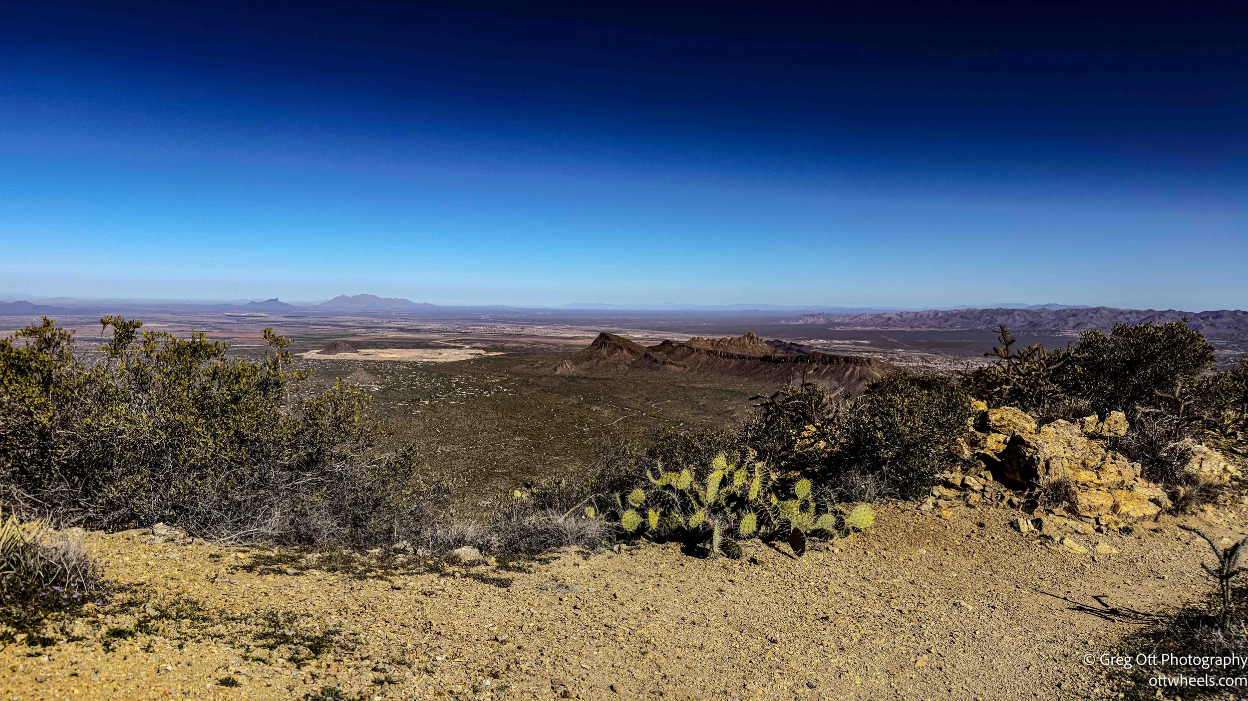
I reached the summit of Wasson Peak at 4,687 feet. The reward is a full 360-degree view — Tucson to the east, layers of desert ridges rolling outward, distant mountain ranges fading into blue. I sat down for a snack. Nearby, one of the joggers was enthusiastically explaining other peaks in the region to a woman who seemed equally impressed by both the view and the fact that he had run up the mountain. Another young guy jumped in, listing sunrise spots he had already photographed that morning. The testosterone was on full display. I smiled and quietly began my descent. A few minutes later, the jogger flew past me again.
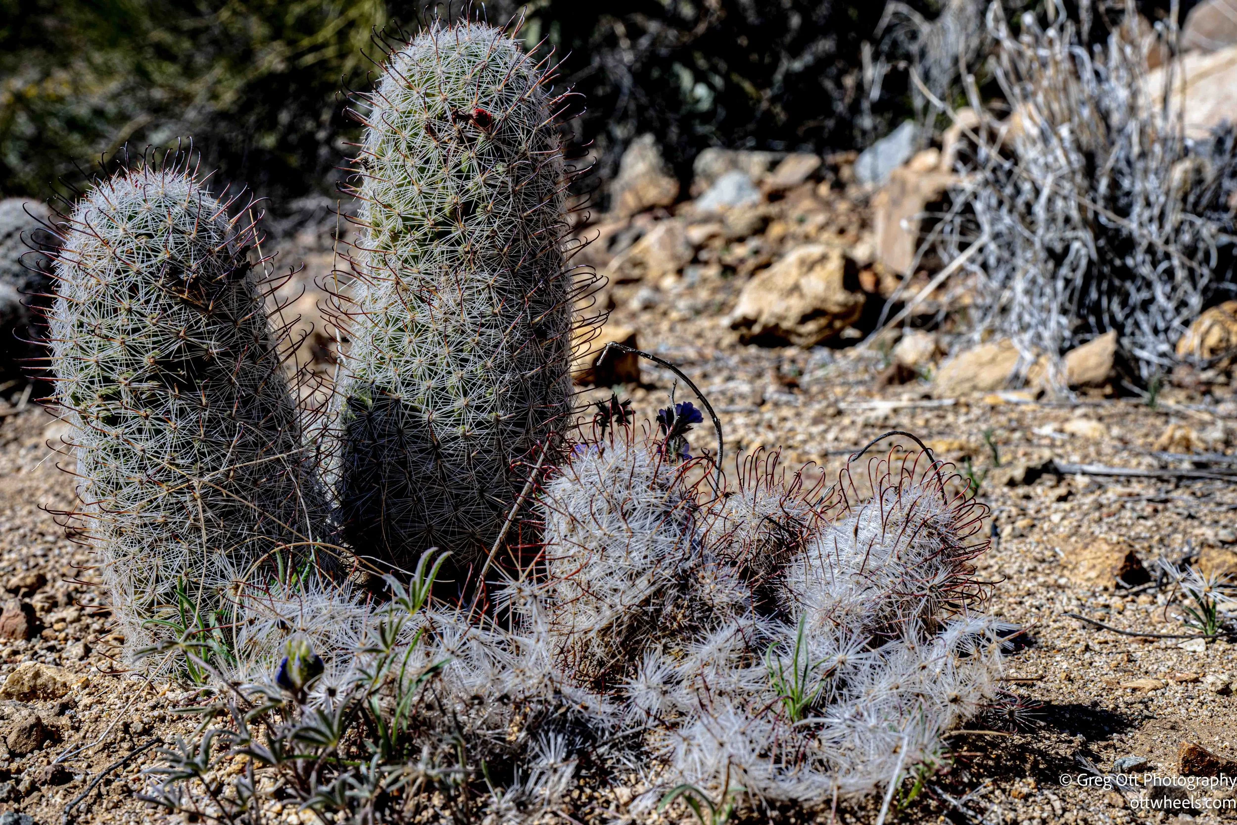
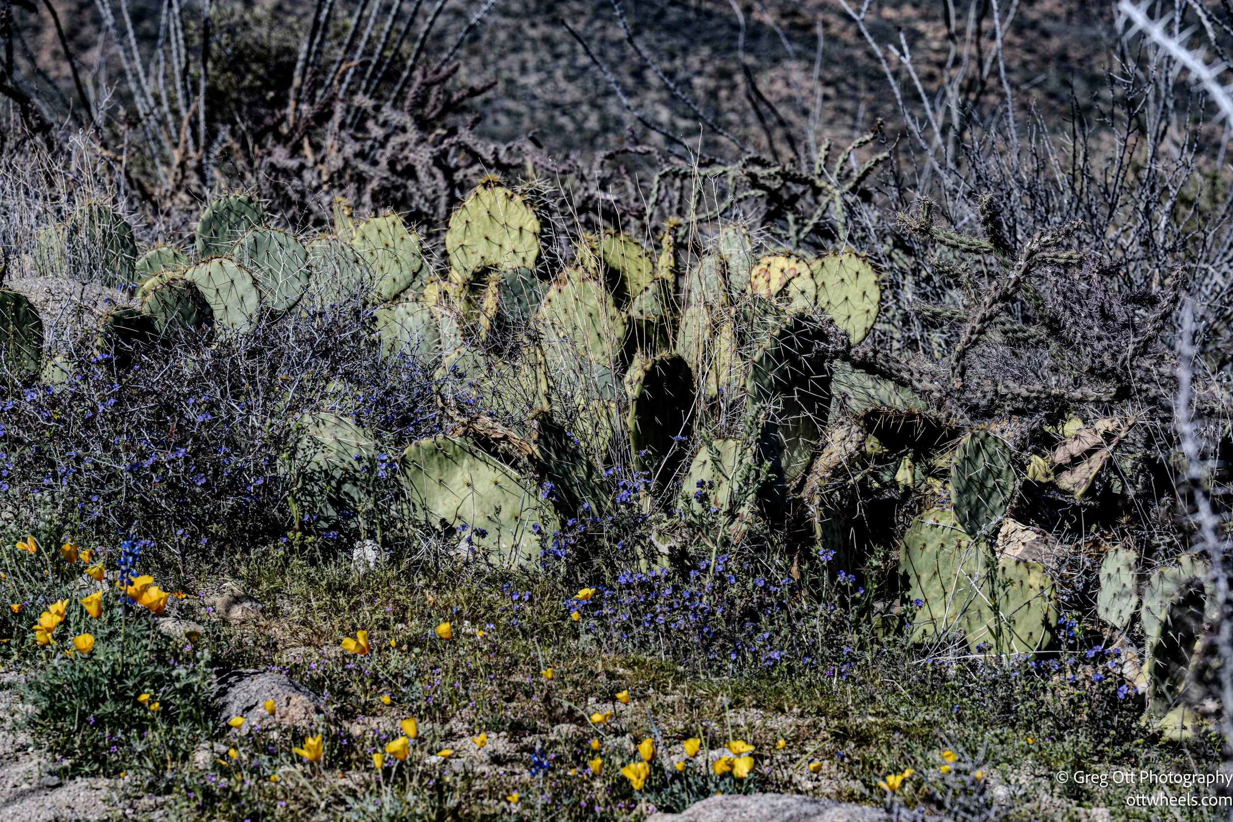
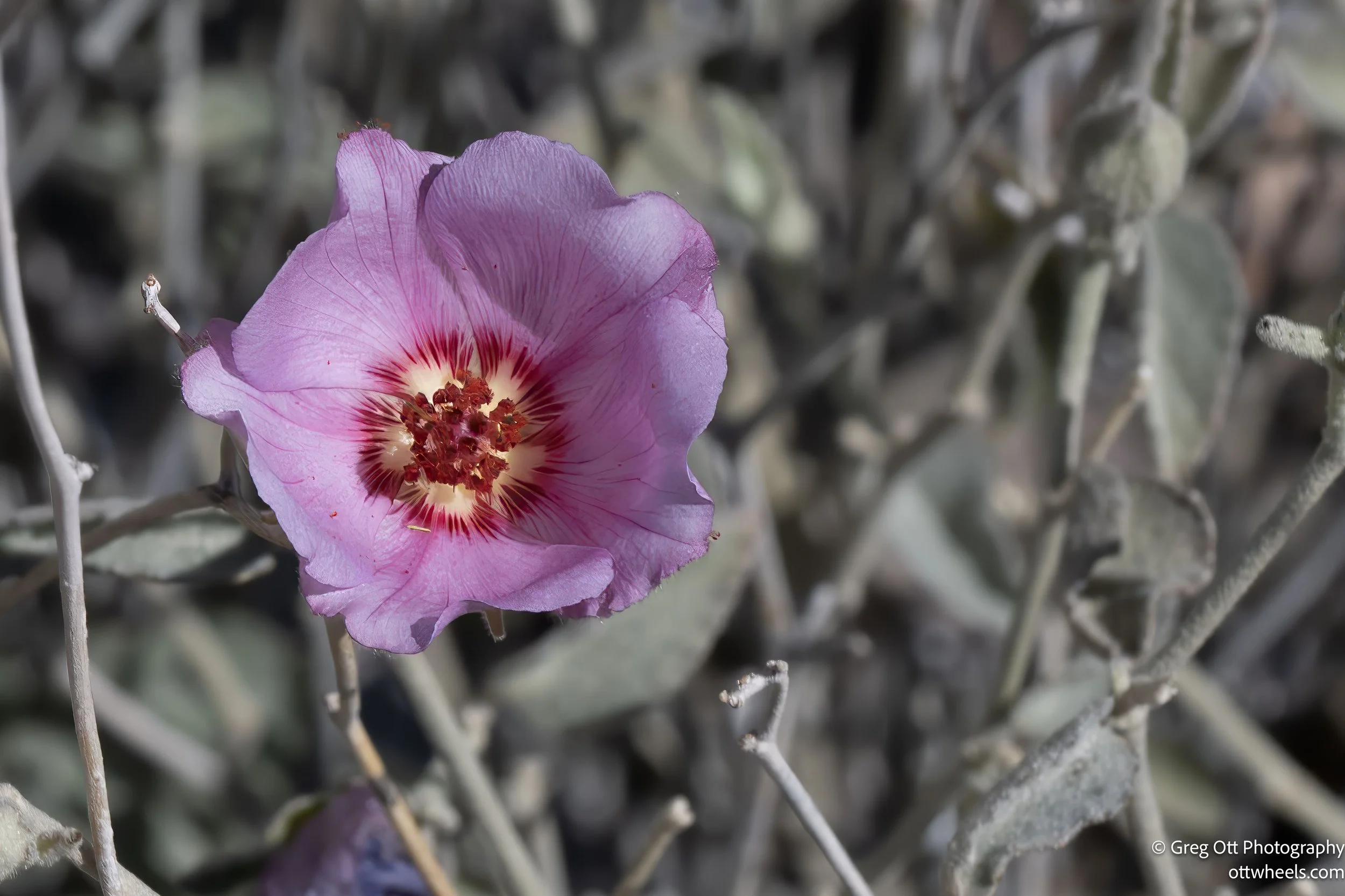
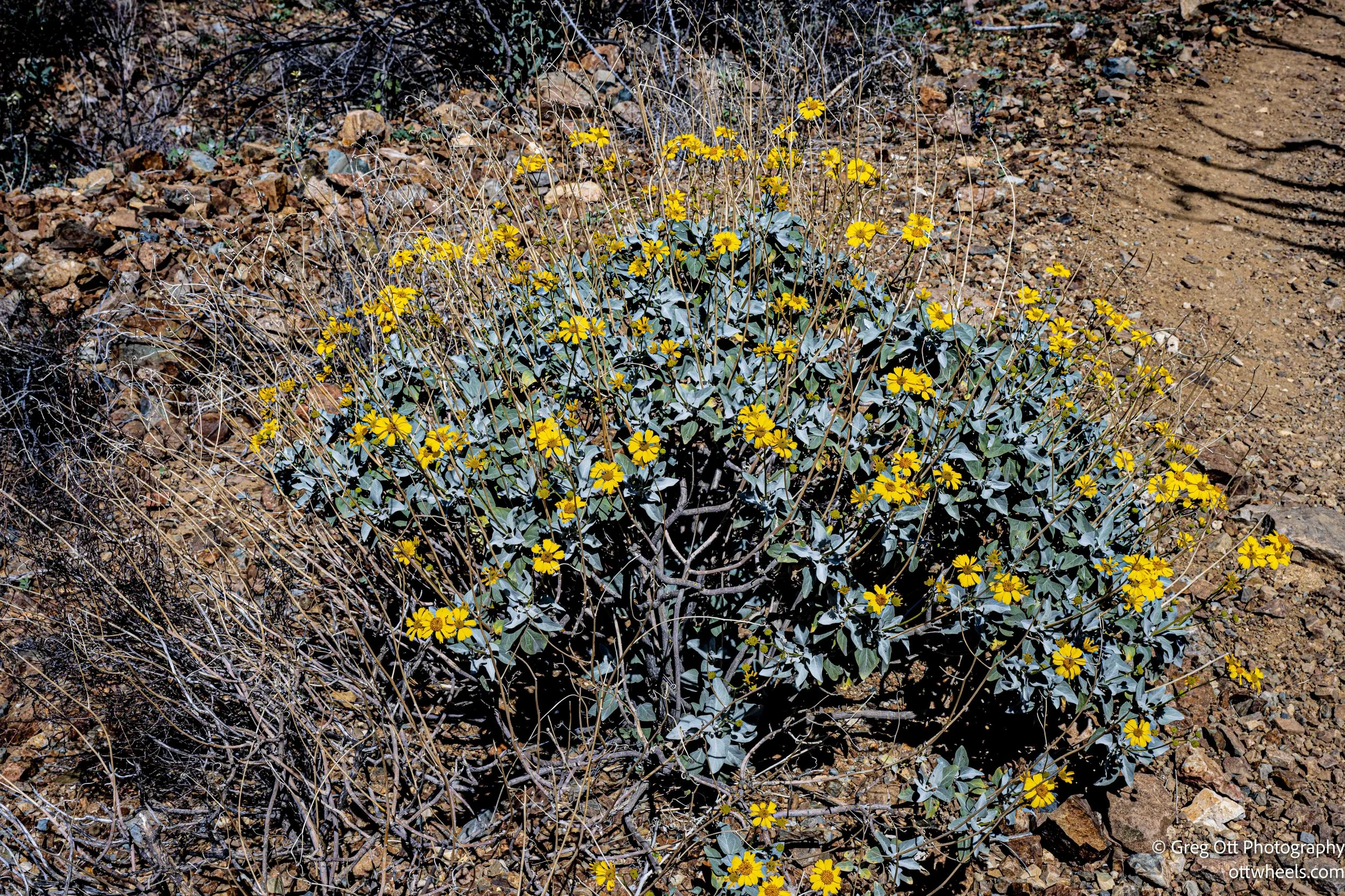
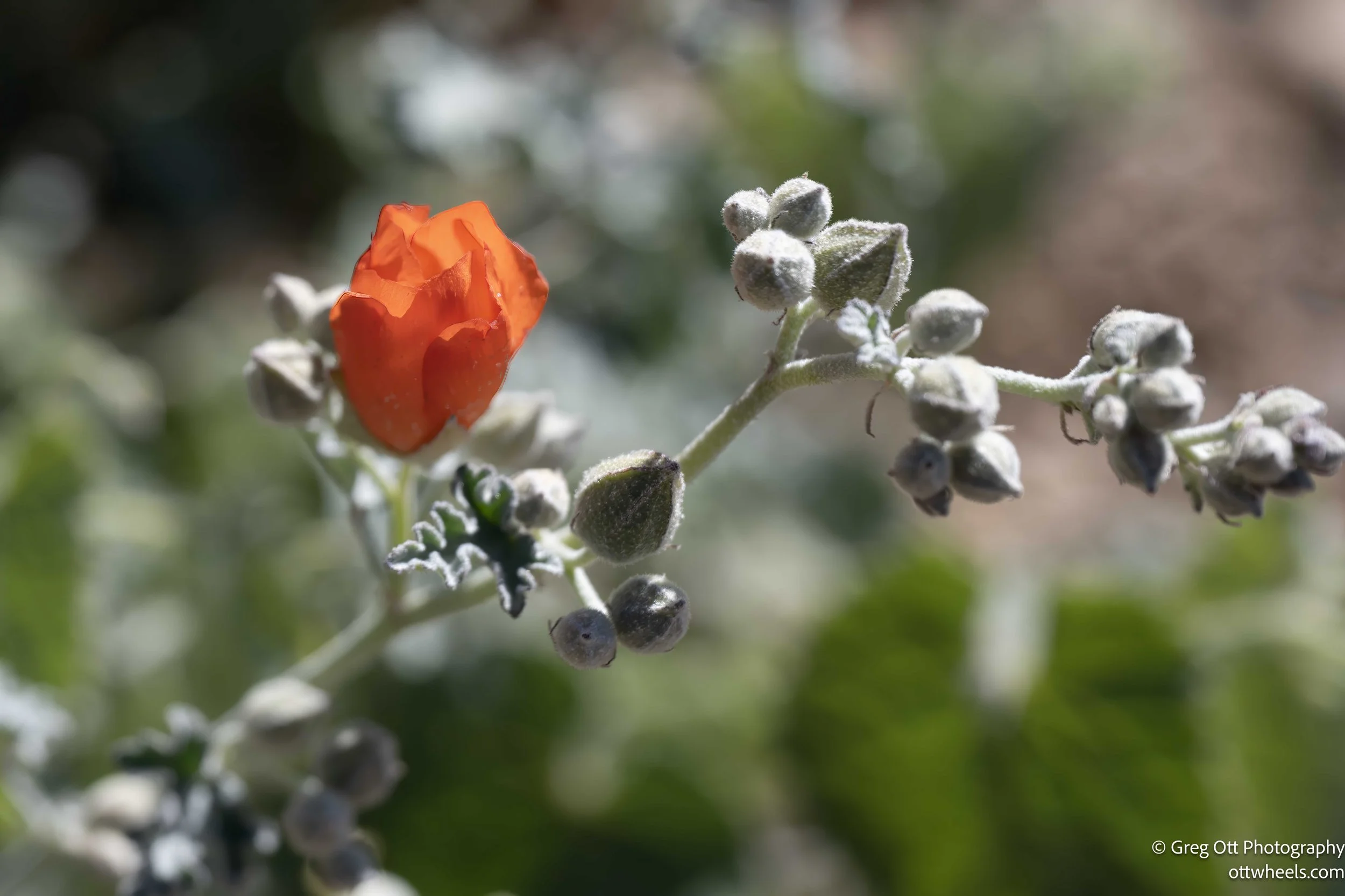
I was surprised by how many flowers were blooming near the top. It felt early. Desert marigold, brittlebrush, and small bursts of color tucked between rocks. A man further down mentioned that blooms have been arriving earlier each year. He said mid-March would be the real show — hillsides turning yellow and purple. It was hard to imagine more color than what I was already seeing.
On the descent, I realized the western approach would have been easier — more gradual, less rocky. By late morning, the sun was strong and high. It flattened the light and made photography more challenging. I tried to keep the camera pointed north to manage glare. I was grateful for the water I had, but I hadn’t brought enough. I rationed the last of it carefully.
People were friendly throughout the hike. Conversations drifted between flowers, cacti, geology, and travel plans. Most of the exchanges happened on the way up. On the way down, no one passed me. One man I passed said he preferred going uphill and struggled with descents. I had never heard that before, but watching him move carefully downhill, I believed him.
When I returned to the parking lot, I knew I had made the right decision to start early. It was noticeably hotter, and cars were circling like vultures looking for open spots. Even the overflow lot across the street was full, with vehicles waiting to get in.
I drove back to the visitor center now that it was opened and got my park stamp. There’s something small but satisfying about adding another ink mark to the passport book.
From there, I headed toward Bisbee. North of Tombstone, I found a BLM pull-off and leveled the van for the night. There was a trailer parked nearby with no vehicle attached — just sitting there in the open desert. The day had started with towering saguaros and a hard climb to a summit. It ended, once again, with quiet space and wide sky.