Explore the journey — one trail, museum, meal, and memory at a time.
Northwest Angle to the Headwaters of the Mississippi
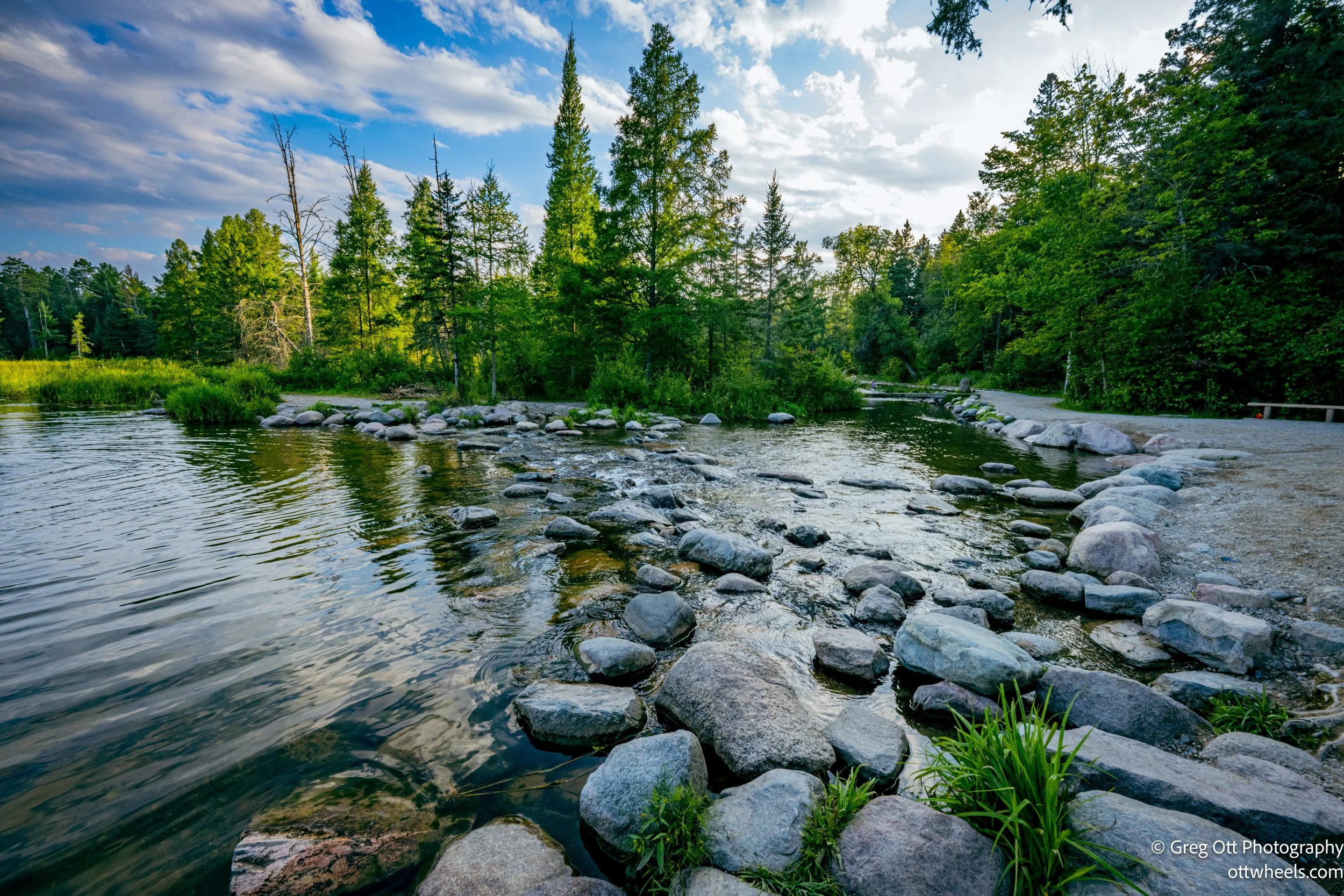
From the quiet sunrise over a mist-covered lake to the winding roads lined with sunflowers, the journey south from the Northwest Angle to Itasca State Park blended small-town charm with sweeping rural scenery. Stops included a visit to the northernmost post office in the lower 48, the quirky border check-in at Jim’s Corner, and photo-worthy relics of farmsteads past. At Itasca, Minnesota’s oldest state park, the 20-mile bike loop revealed a mix of towering pines, shimmering lakes, marshes alive with dragonflies, and rolling hardwood forests. The day ended at the headwaters of the Mississippi, where a modest stream slips quietly from Lake Itasca, beginning its long journey to the Gulf of Mexico.
Journey to the Northwest Angle
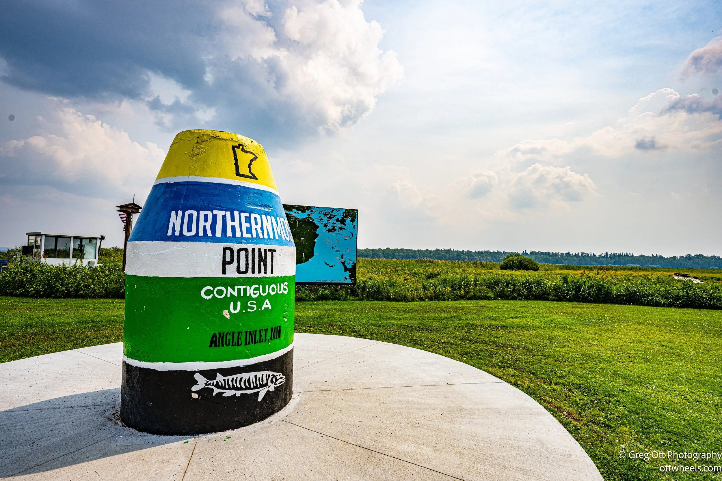
A quirk of history and a cartographer’s mistake led me to the Northwest Angle—the furthest point north in the contiguous United States. Reaching it meant crossing the border twice, mailing a card from the northernmost post office in the lower 48, and stopping at Jim’s Corner to check in with U.S. Border Control. Quiet bays, endless trees, and a haze hanging in the air gave the whole place a muted, dreamlike quality—like stepping into the forgotten margins of the map.

Visit Angle Inlet
Reaching Angle Inlet—the only spot in the contiguous U.S. you have to enter through Canada to visit—meant a long day of driving, a Canadian border inspection, and a dirt-road finale. I stayed at Prothero’s Post Resort on the shores of Lake of the Woods, where a sudden storm gave way to golden evening light. Between helping drenched fishermen dock their boat and swapping political views with another guest, I experienced the quirky charm and rugged beauty of this remote outpost at the far edge of the map.