Ozark National Scenic Riverways
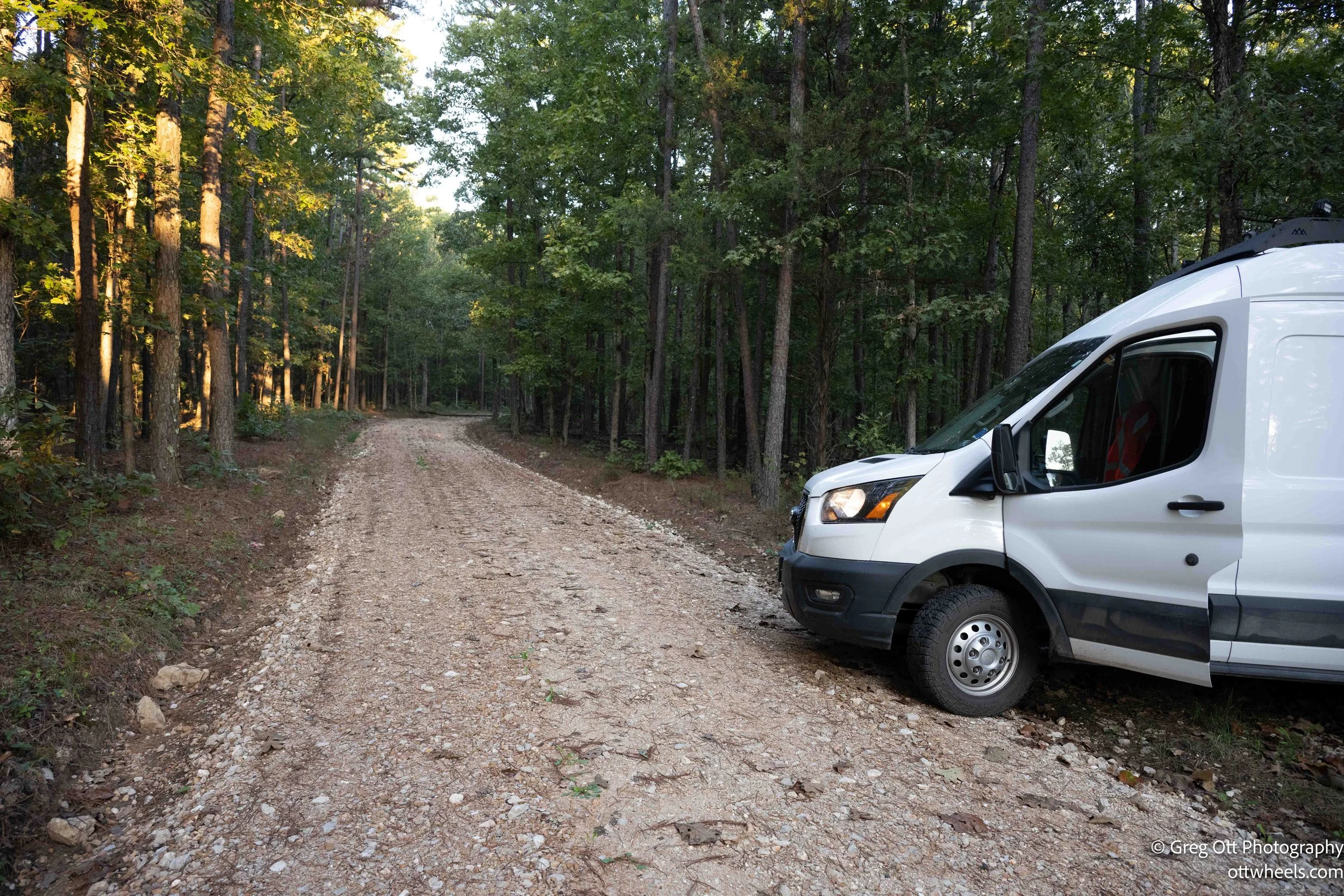
I woke in the Mark Twain National Forest, tucked into a quiet clearing I’d found by chance the night before. It was absolutely still—so quiet that when I heard an owl just before midnight and again around 5 a.m., the sound felt like it belonged to another world. I wanted to catch the early morning light, so I packed up and drove toward the Ozark National Scenic Riverways.
The Riverways Story
When I started reading about the Ozark National Scenic Riverways (ONSR), I realized how special this place really is. Established in 1964, it wasn’t just another national park—it was the first one in the United States created specifically to protect a river system. That caught my attention immediately. The park safeguards the Current and Jacks Fork Rivers, two of the clearest, most pristine spring-fed waterways in the Ozarks. What makes this place remarkable is the original vision behind it: to preserve the free-flowing character of the rivers while allowing people to paddle, fish, hike, and camp alongside them. In an era when most river projects meant dams and reservoirs, this was a radical act of conservation—the choice to keep the rivers wild.
Digging into the history, I learned that the park’s creation was anything but smooth. In the 1950s and early ’60s, the U.S. Army Corps of Engineers had plans to dam the Current and Jacks Fork Rivers, flooding miles of valleys, farms, and forests. That proposal ignited fierce opposition. Local conservationists, outdoor clubs, and national organizations like The Nature Conservancy joined forces to fight for the rivers’ freedom. Missouri Senator Stuart Symington, Congressman Richard Ichord, and Senator Thomas Eagleton eventually helped push legislation through, with strong support from the National Park Service. In August 1964, President Lyndon B. Johnson signed the act creating the Ozark National Scenic Riverways—a landmark decision that replaced the idea of control with preservation.
The aftermath was complicated. The government had to buy land along both rivers, and not everyone was ready to sell. For some, the land had been in their families for generations. Eminent domain was used in a few cases, leaving bitterness that lingered for decades. Even today, the park is a patchwork of public and private land—a living reminder of those early struggles. But over time, tourism brought new life. The same hills and hollows that once supported farms and timber mills now draw paddlers, campers, and photographers like me, eager to experience this raw, unfiltered beauty.
Standing along the banks, it’s easy to forget how close it all came to being buried under a reservoir. More than 130 miles of protected waterways, countless springs, caves, and bluffs exist because people decided this place was worth saving. The Ozark National Scenic Riverways isn’t just a park—it’s a living argument for keeping wild places wild.
Alley Mill and the Jacks Fork River
I pulled into the Alley Mill parking lot around 9 a.m. Mine was the only vehicle there. I opened the van’s side door to let the morning sun pour in while I made blueberry pancakes and brewed a double espresso. The air was crisp and clean, the kind of freshness that only exists in early fall. Leaves drifted down in slow spirals, landing on the roof of my van.
Before long, the scene changed—cars started arriving, dogs barked, couples wandered the paths hand in hand, and friends helped each other navigate the uneven ground. It felt like the park was slowly waking up.
I made several trips back and forth to the mill—once for a filter, again for a lens, and then after my battery died, for the tripod. The red mill reflected beautifully in the turquoise water of the Jacks Fork. Even on a short, one-mile loop, the light changed constantly—deep blues, emerald greens, and flashes of orange and red from the turning leaves. It was one of those places where the simple act of standing still feels like part of the experience.


Round Spring
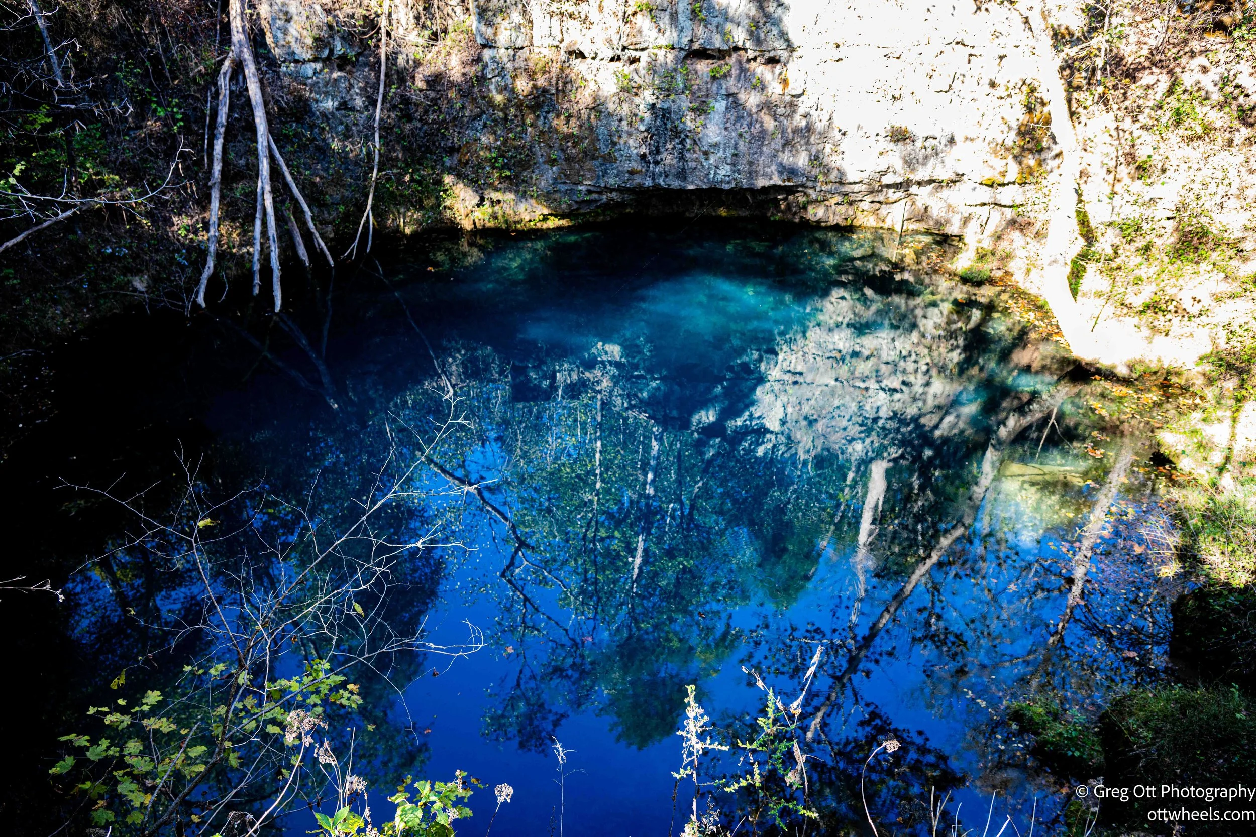
After learning how the Jacks Fork flows into the Current River, I followed the water downstream to Eminence and then north to Round Spring—one of the most fascinating spots within the Riverways. This area became part of the park when it was first established, but people have been drawn here for centuries.
Round Spring is what geologists call a karst spring, formed by water dissolving the limestone beneath the Ozarks. Over time, those underground channels widen into caves until pressure forces the water upward through a single vent. The result is stunning: a perfectly circular basin where 26 million gallons of turquoise water rise from a 55-foot-deep underground pool every day. The surface looks perfectly still, but if you look closely, you can see movement—ripples that catch the light like glass.
When I arrived, I was surprised to find the visitor office closed. The campground was open, but the access road to the spring’s parking lot was blocked, probably because of the resurfacing. The trail was littered with downed trees by the park service—many hollowed out and crumbling, as if they’d been eaten from the inside. I had picked up a brochure earlier titled Round Spring: An Underground Story, which explained how the same water feeding the spring also carved the nearby Round Spring Cave. Tours were closed for the season, but reading about it made me want to come back. The cave stretches thousands of feet below ground, filled with stalactites.
Town of Eminence
By the time I reached Eminence, it was well past lunch. The town, population 650, feels like a step back in time. The speed limit dropped to 25, and as I rolled down Main Street, I saw people on horseback, old storefronts, and signs that looked like they hadn’t changed in decades.
I parked when I spotted a sign that simply said Coffee—the kind of word that can make me pull over instantly. Unfortunately, the café had closed after lunch, but the pie shop next door more than made up for it. I ordered a slice of cherry pie and sat on the front porch. Horses clip-clopped past, some riders heading toward the gas station, others veering off toward the trails. Locals greeted me with “Howdy,” or asked, “How’s the pie?”—small-town hospitality at its finest.


After finishing my slice, I wandered through the nearby shops. The first was a cowboy hat store where customers were having hats steamed and shaped to order—creases, feathers, initials, and custom bands. A woman was buying a $350 hat and another $50 worth of customizations. One of the owners struck up a conversation about photography and told me about the “Ride” that was in progress. Hence, all the horses. Apparently, more than 1,800 people had come to town for the multi-day horse-riding event. She told me there were four of them each year.


I stopped next at the blacksmith’s shop and met Ray, the owner. He said he didn’t bother hauling all his heavy tools down from his workshop for these events anymore—it was too much work. Instead, he pointed me to his neighbor, a woodworker he described as “the real artist,” and to the saddle shop a few doors down.


The saddle shop turned out to be incredible. The owner’s brother-in-law gave me a tour, showing me hand-tooled saddles, leather jewelry, and custom knife sheaths they made for Ray’s knives. They told me the horse rides always brought in a rush of customers. In a town this small, everyone supports each other—it’s a rhythm of craft, friendship, and shared survival.


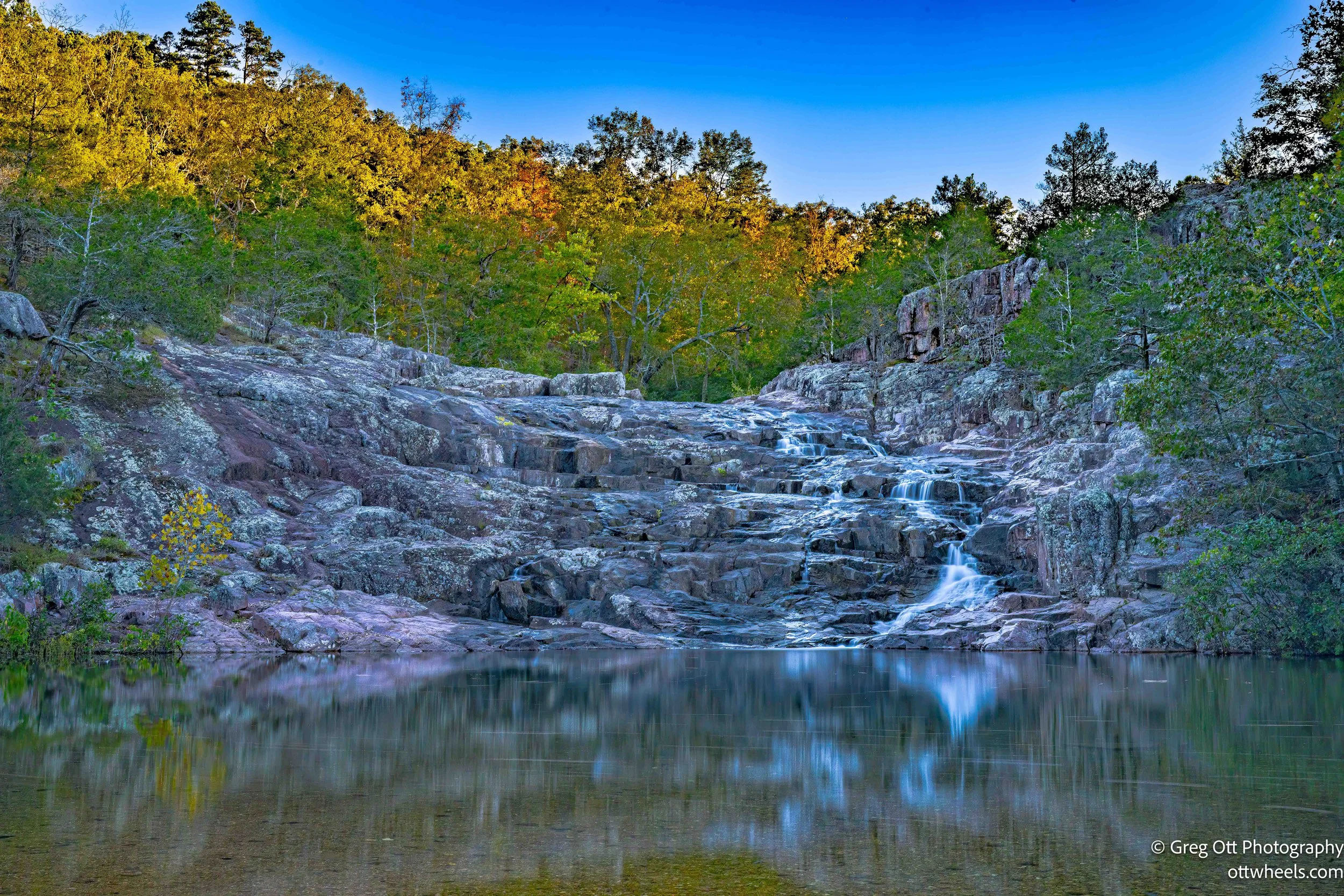
Rocky Falls
My last stop of the day was Rocky Falls, one of the most photographed spots in the park. From the parking lot, it’s only a few hundred yards to the falls. It was about 4:30 p.m., and I brought my tripod since the light was dropping fast.
A man dressed head-to-toe in white, with tattoos and long dreadlocks down his back, was already there taking photos. He said he’d driven down from St. Louis to photograph the Riverways and was disappointed that the water level was so low this year. “Usually it’s much higher,” he told me. “And the trees—these days they mostly go from green to brown. You don’t see that bright red much anymore.” We talked for a few minutes, wished each other luck with our photos, and then he headed out.
I stayed another hour, waiting for the soft light to hit the rock just right. The water was low, but the scene was still peaceful and beautiful. The sound of water sliding over the smooth rock echoed through the hollow.
Running low on gas, I headed back to Eminence and filled up at the Sinclair station. Dinner was at Dos Rios Mexican Grill, right next to the saddle shop I’d visited earlier. The place was packed. My order got lost somewhere between the kitchen and my table, but I didn’t mind much—I had my laptop and plenty to catch up on. When my food finally arrived, the beer was wrong but the meal hit the spot.
Before leaving, I booked a site at Alley Spring Campground for the night. The park is divided into nine loops, but most campers clustered in one area, so I picked a spot far away for some quiet. Finding the site wasn’t easy—signs were missing and maps were nonexistent—but I finally located it using the Missouri State Parks website. It was pitch black when I arrived. I backed in, set up the bed, and fell asleep almost instantly, the sound of the river whispering through the dark trees.