Lamoille Canyon and Wells Nevada
I spent yesterday in Elko, Nevada. It was raining and sleeting heavily, so I decided to stay put. I spent a little time at Starbucks, did some grocery shopping at a small Smith’s, and then went to the Elko Library until it closed at 7 p.m. After that I drove around town for a while and eventually headed to Walmart. I could have driven 20 miles and stayed at the same place I had the night before, but I simply didn’t feel like driving anymore.
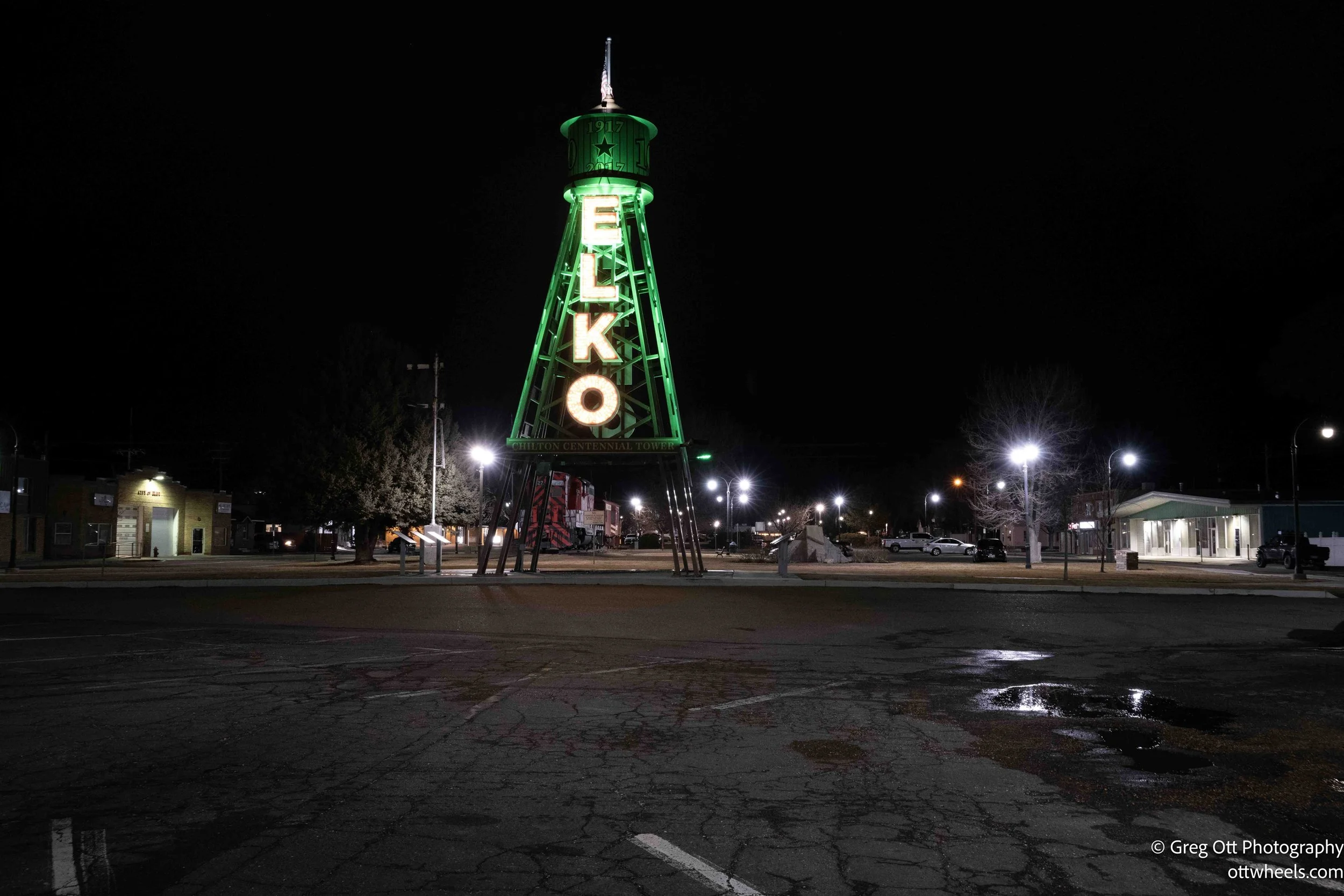
When I pulled into the Walmart lot, there were signs everywhere saying no overnight parking or camping. All the apps indicated that this Walmart allowed overnight camping. I went to customer service and asked about it. The woman behind the counter said they don’t really like people camping there anymore. Apparently during Burning Man season the place turns into a circus. She said people leave the parking lot a mess and there are too many drunk and high campers passing through town. I asked if she minded if I stayed just for the night and told her I’d be gone early in the morning. She said that would be fine and added that no one would bother me unless I stayed longer than 24 hours.
Lamoille Canyon
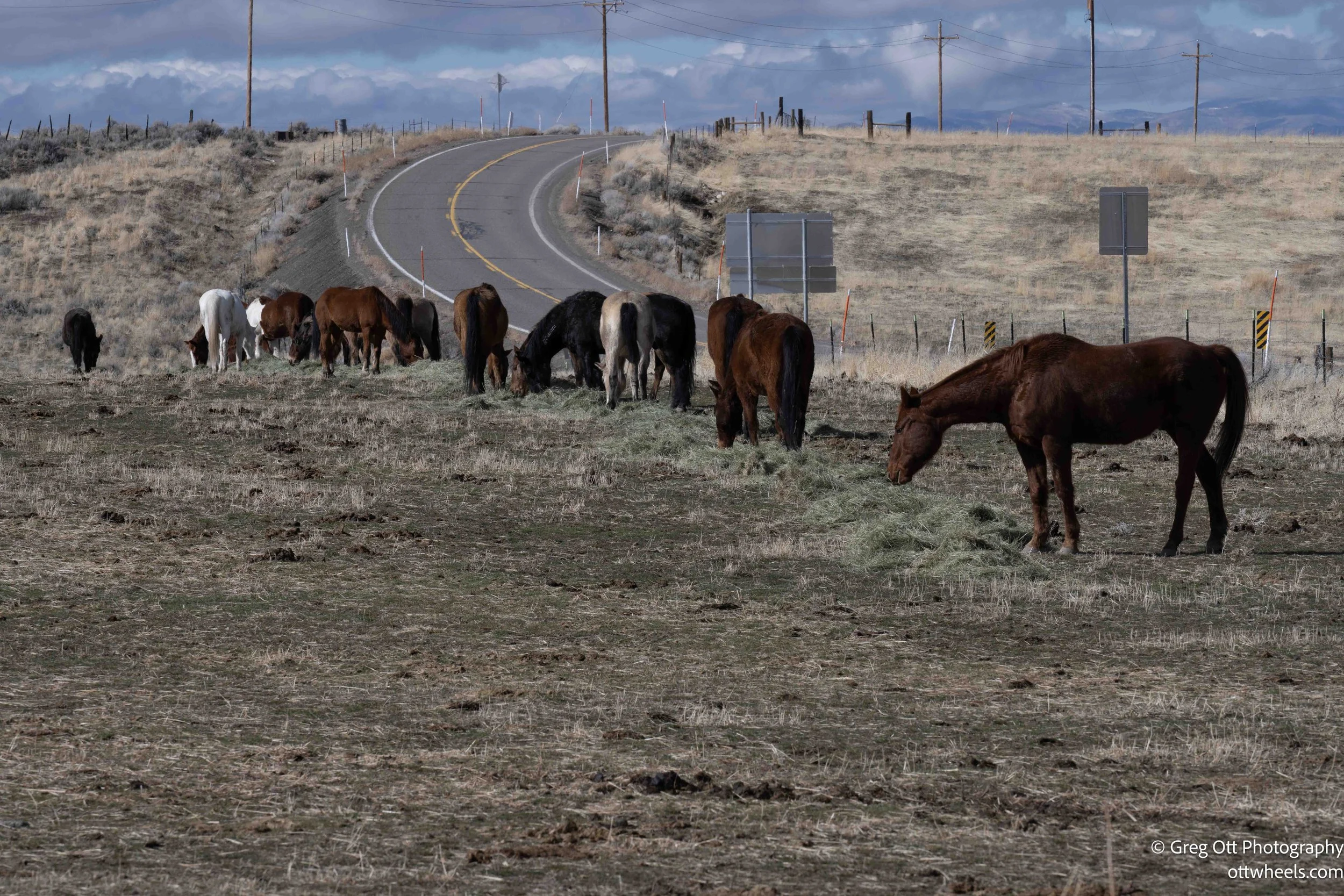
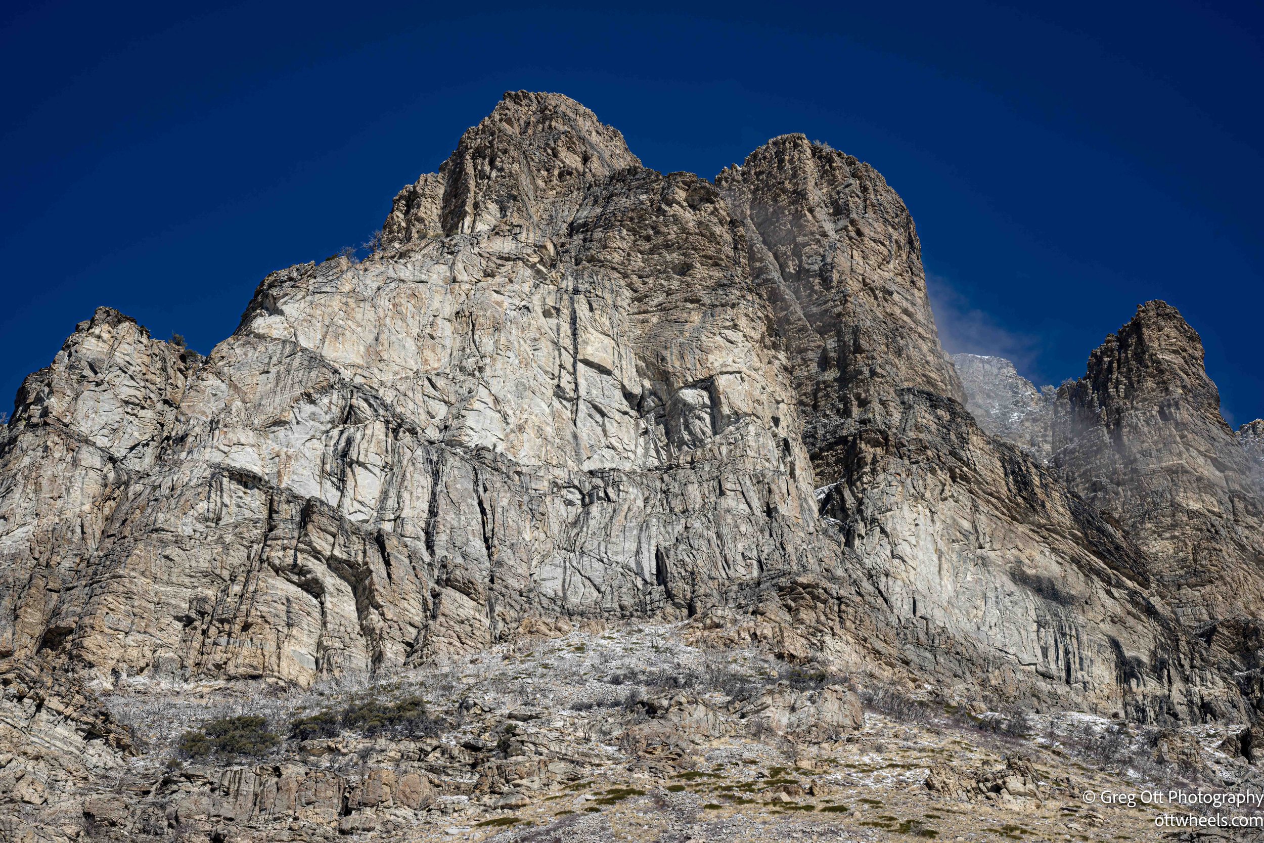
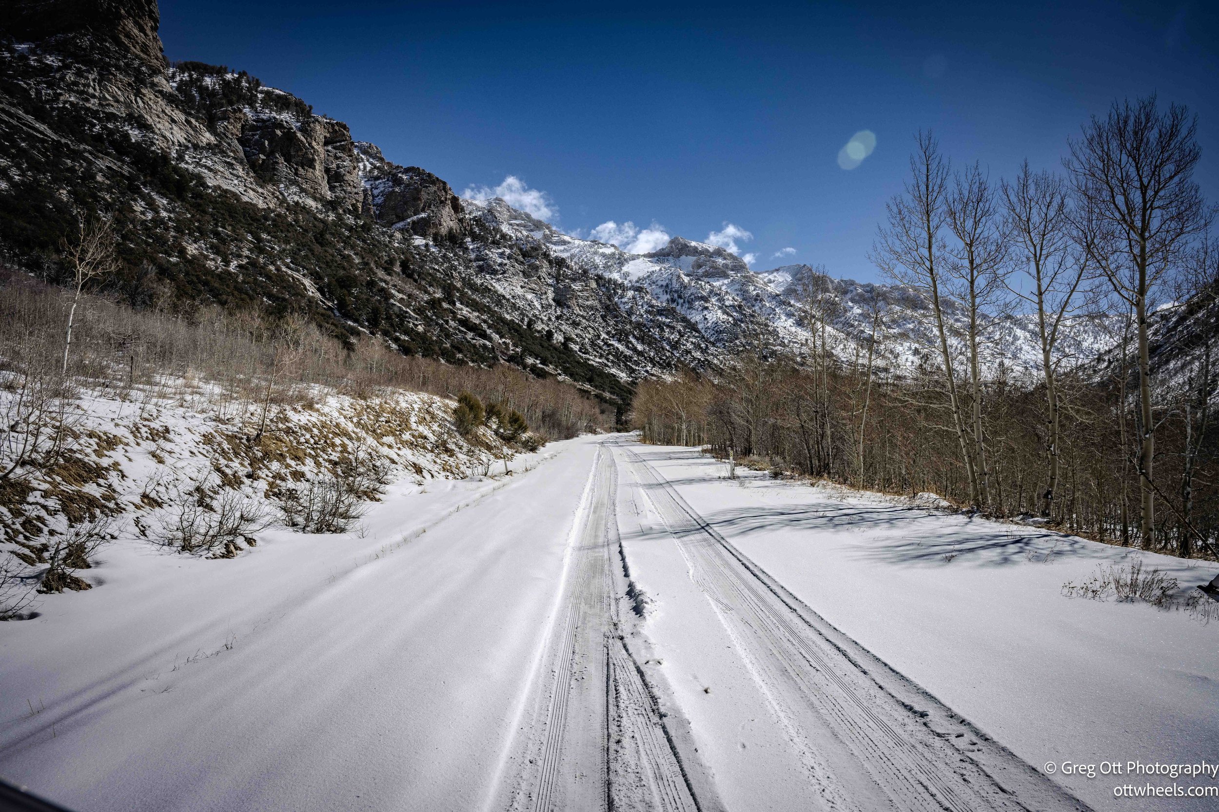
Today, the sky cleared and I could see fresh snow on the mountains in the distance. I made breakfast in the van, then drove toward Lamoille Canyon. My plan was simple: climb the road to the top at more than 8,000 feet and explore. The air was crisp as I approached the mouth of the canyon and the Ruby Mountains rose sharply ahead. The road winds steadily upward from the valley floor, climbing through long sweeping turns with occasional pullouts that give you views back down the canyon.
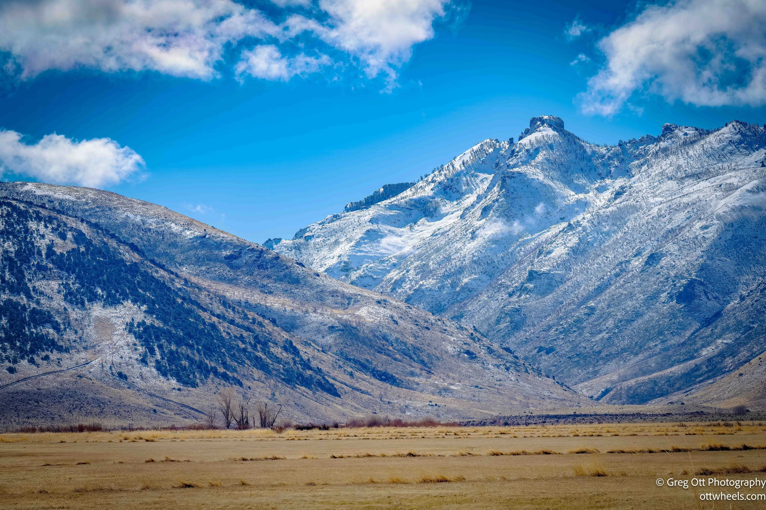
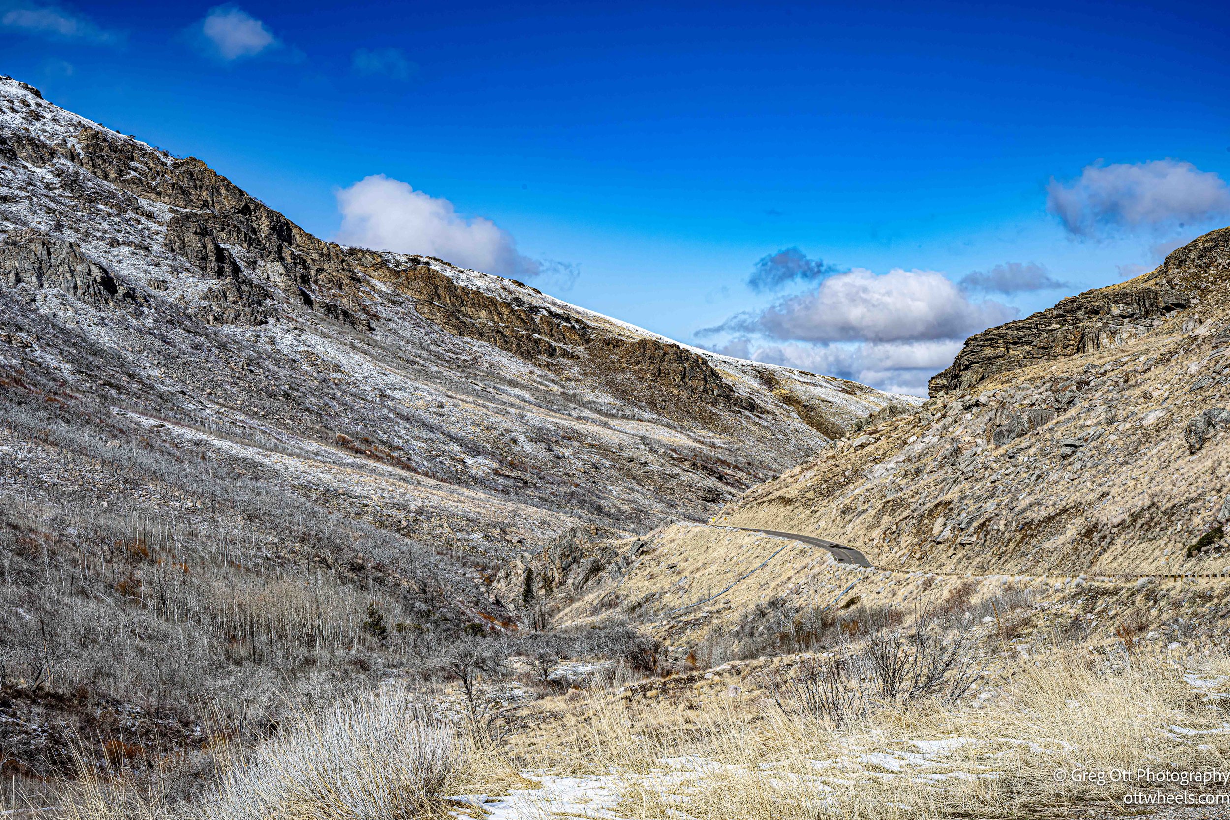
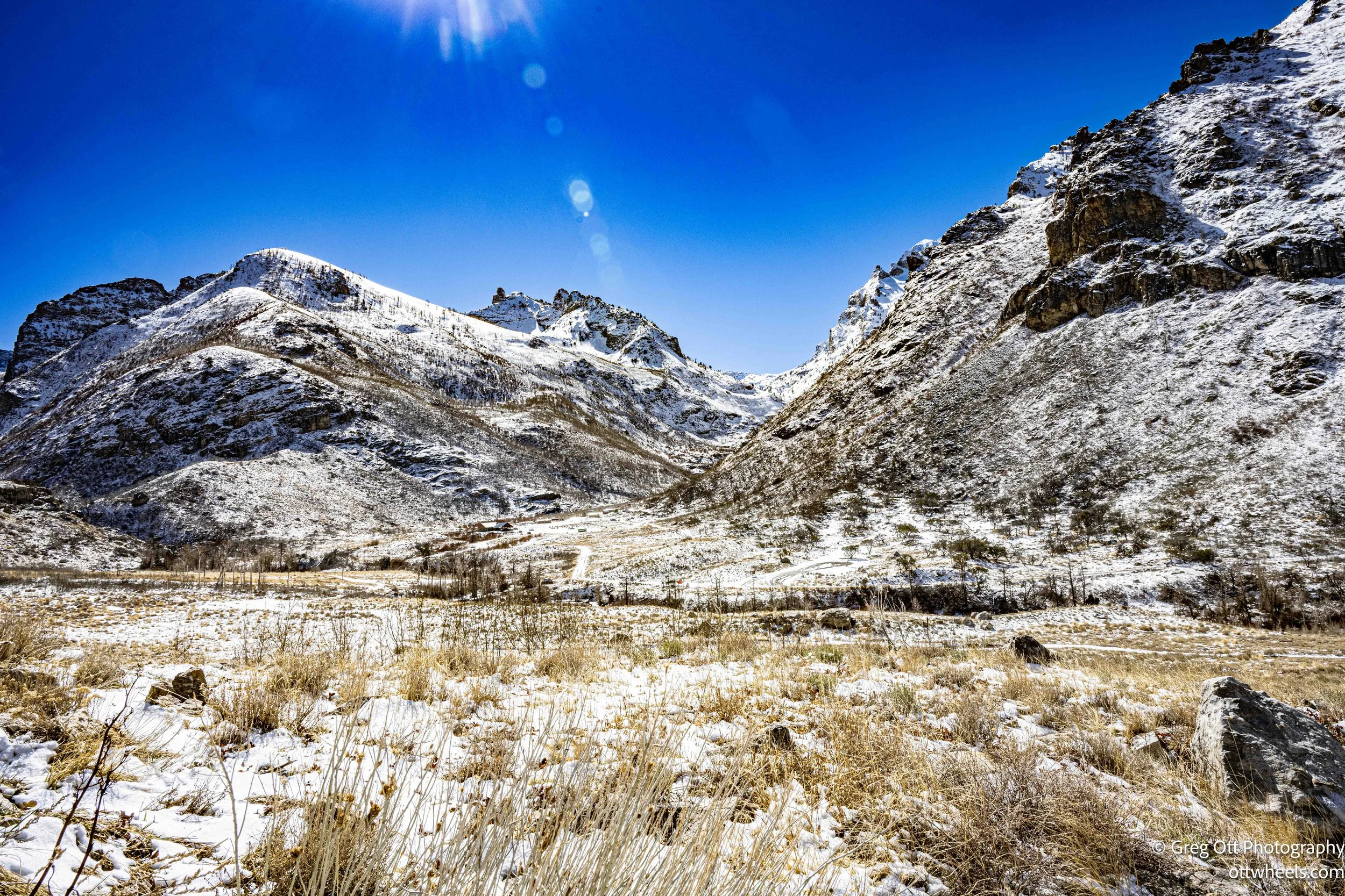
It felt like winter still had a solid hold on the place. About halfway up, the snowpack had crept onto the road and a sign asked passenger vehicles not to continue so the snow wouldn’t be crushed and compacted by tires. Beyond that point the pavement disappears into a white corridor that climbs toward the high cirques and the views at the top. I could see where the road was headed, but that morning the upper canyon was still locked in snow. I turned around there, knowing that once the snow finally lets go, the drive to the top must be spectacular.
I was disappointed that I couldn’t get to the top of the canyon. For a moment I thought about pulling over, strapping on snowshoes, and continuing up the road on foot. But I knew that once I started that, the day would disappear on me. The snow would get deeper and the distance to the top was still long. I turned the van around, dropped back down the canyon, and set Google Maps for Wells, Nevada. Wells was already on my itinerary as a place to stop and rest, although it sat in the opposite direction from where I ultimately needed to go. Since I was nearby, I figured it was worth a look.
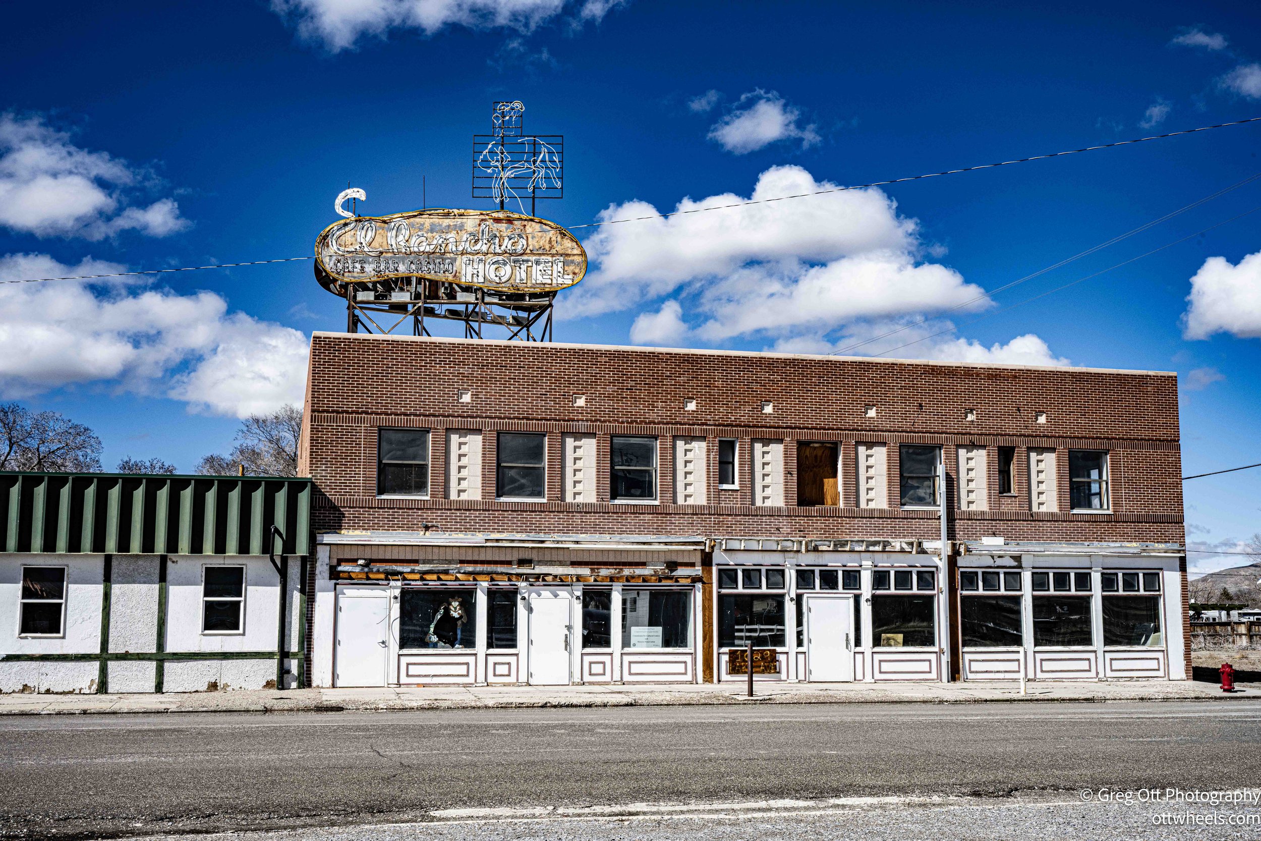
Wells, Nevada
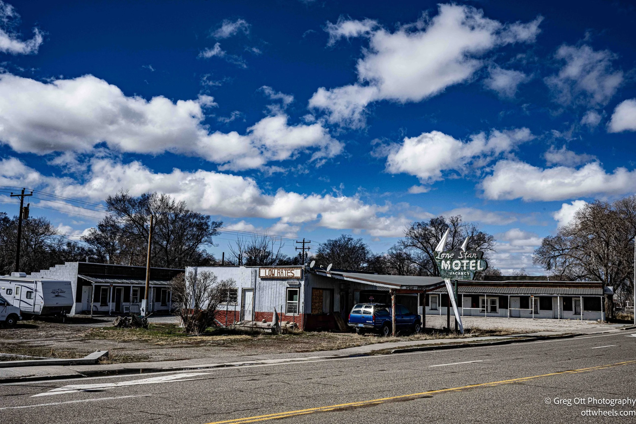
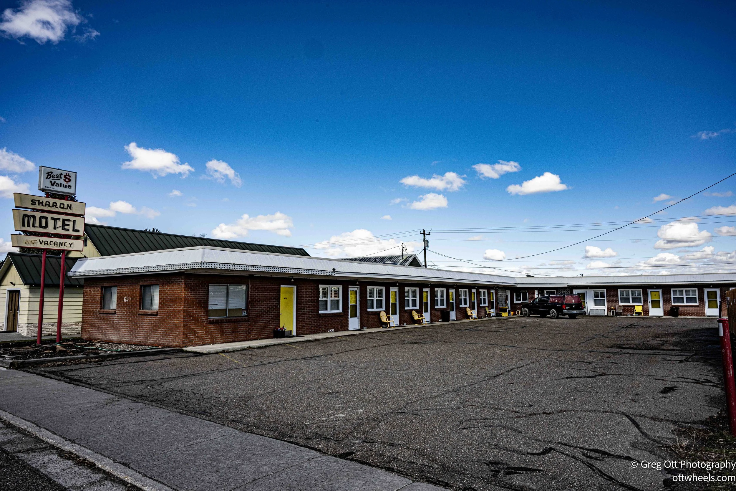
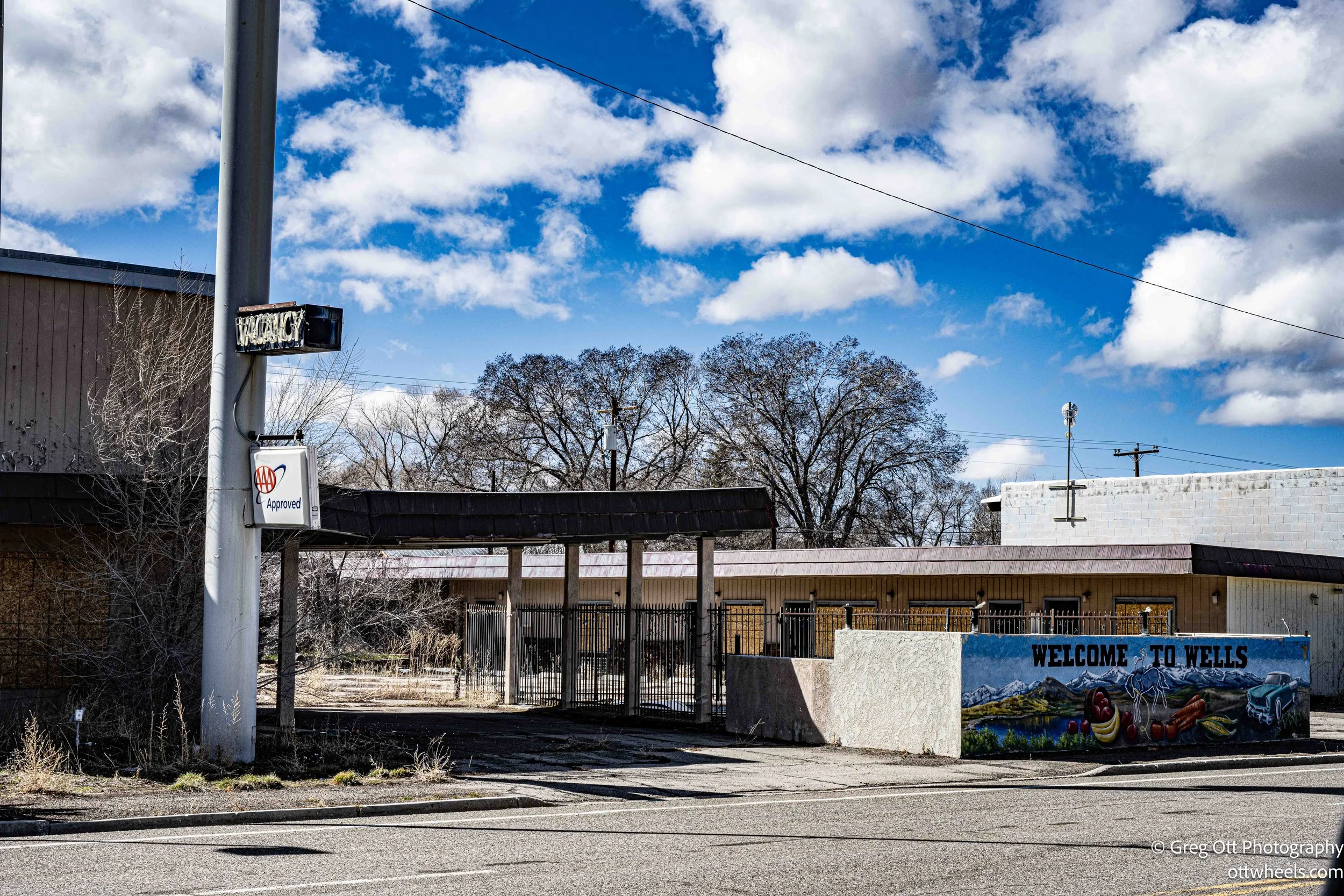
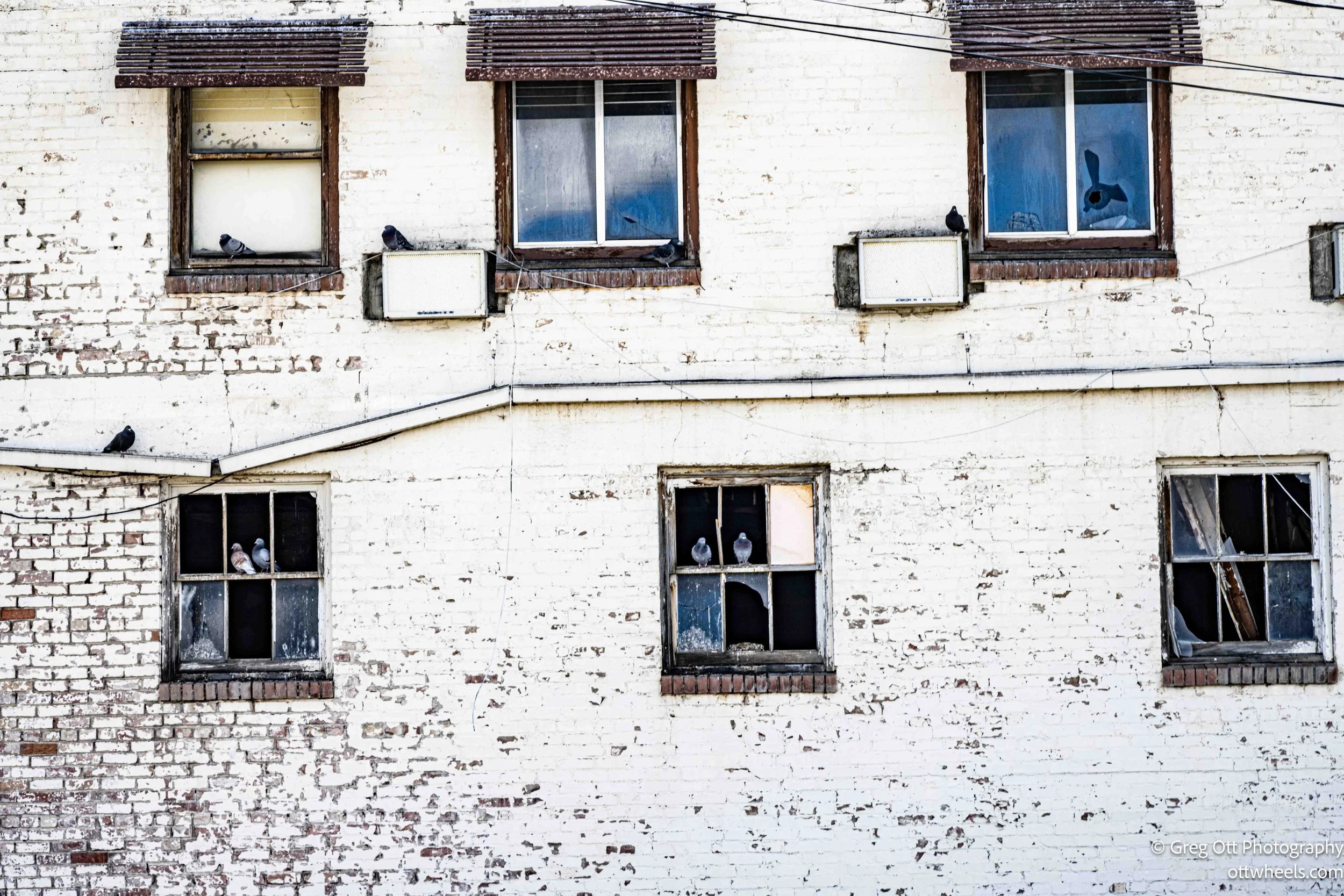
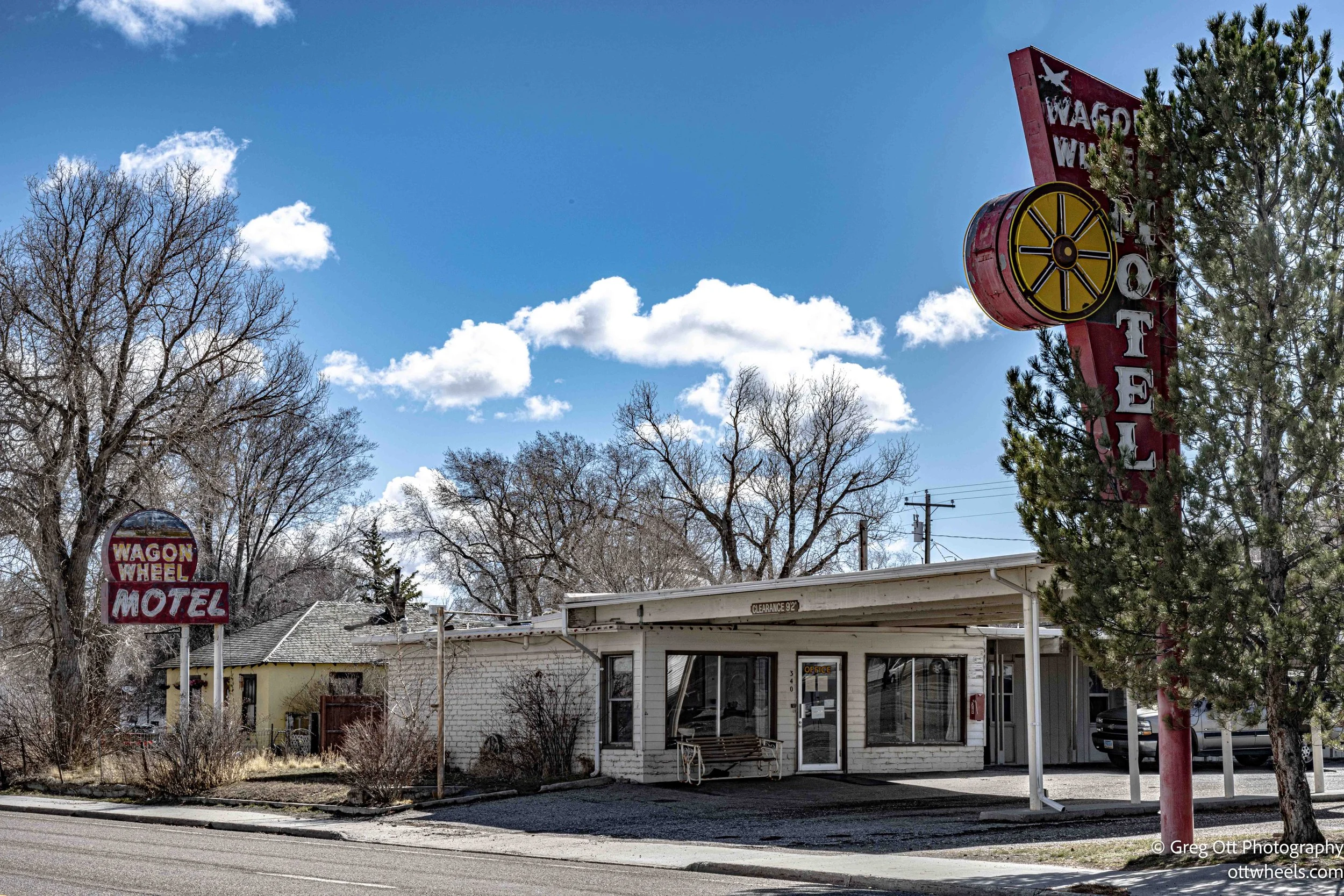
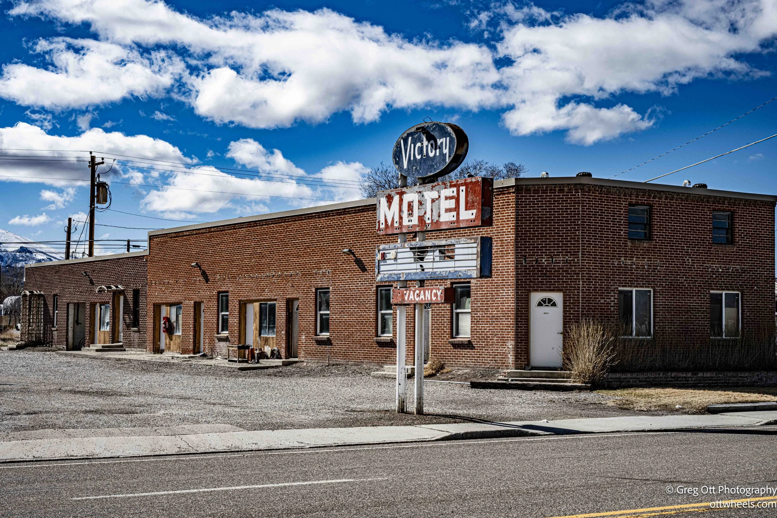
I drove slowly around most of the town. Wells must have been a much busier place before Interstate 80 diverted the traffic away from the main street. The road through town is lined with small roadside motels that clearly served travelers at one time. Today most of them look like they have seen better decades. Many were closed and boarded up, with weeds pushing through the pavement and empty parking lots out front. One of the buildings looked like it had been converted into low-rent apartments. Another had all the windows broken on the lower level, with pigeons sitting in the empty frames.
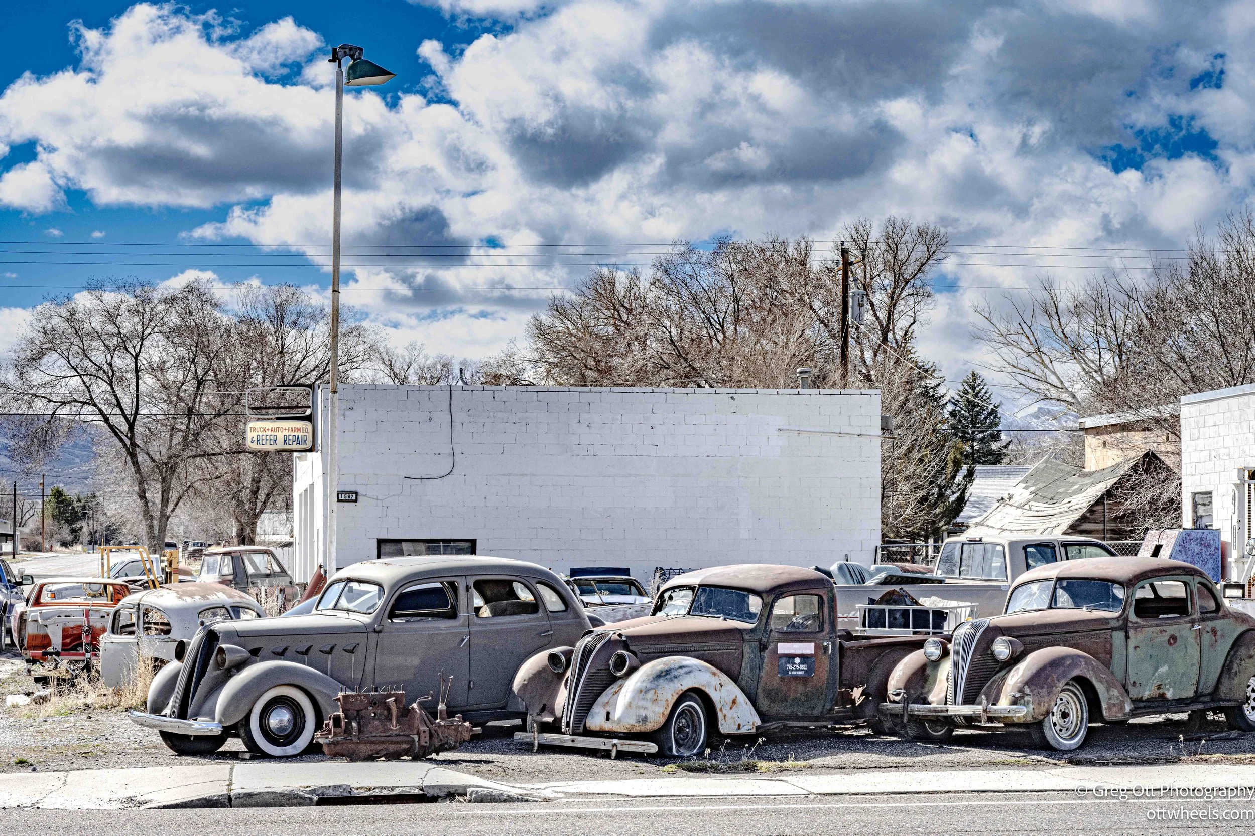
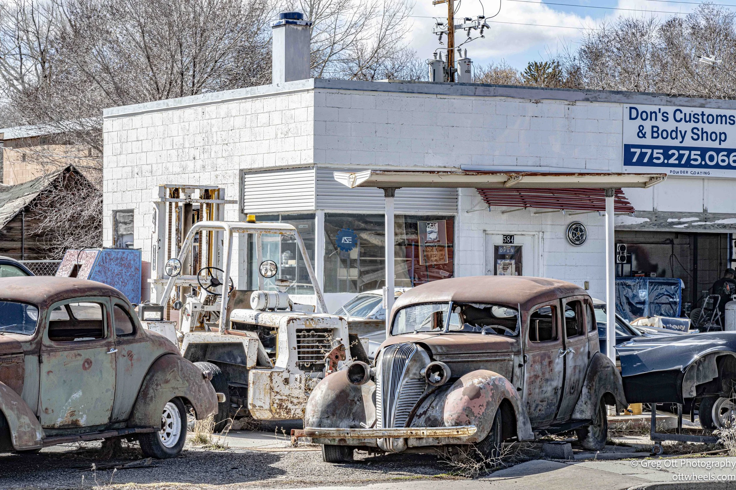
I passed a few old gas stations as well—one converted into a home, others simply abandoned with faded “for sale” signs out front. I stopped at a station that had been turned into a custom body shop. Out front sat several old coupes slowly rusting away, lined up like relics from another era.

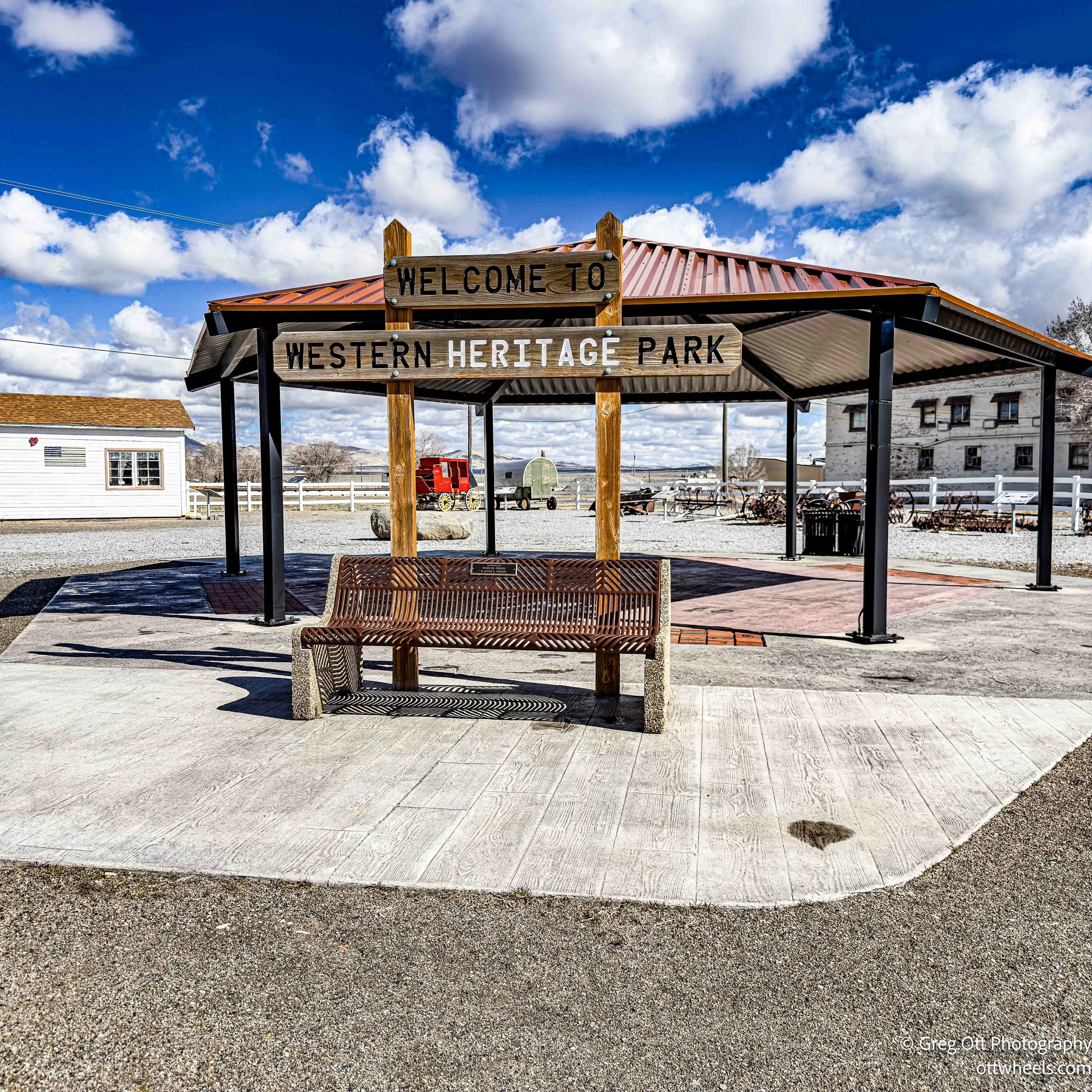
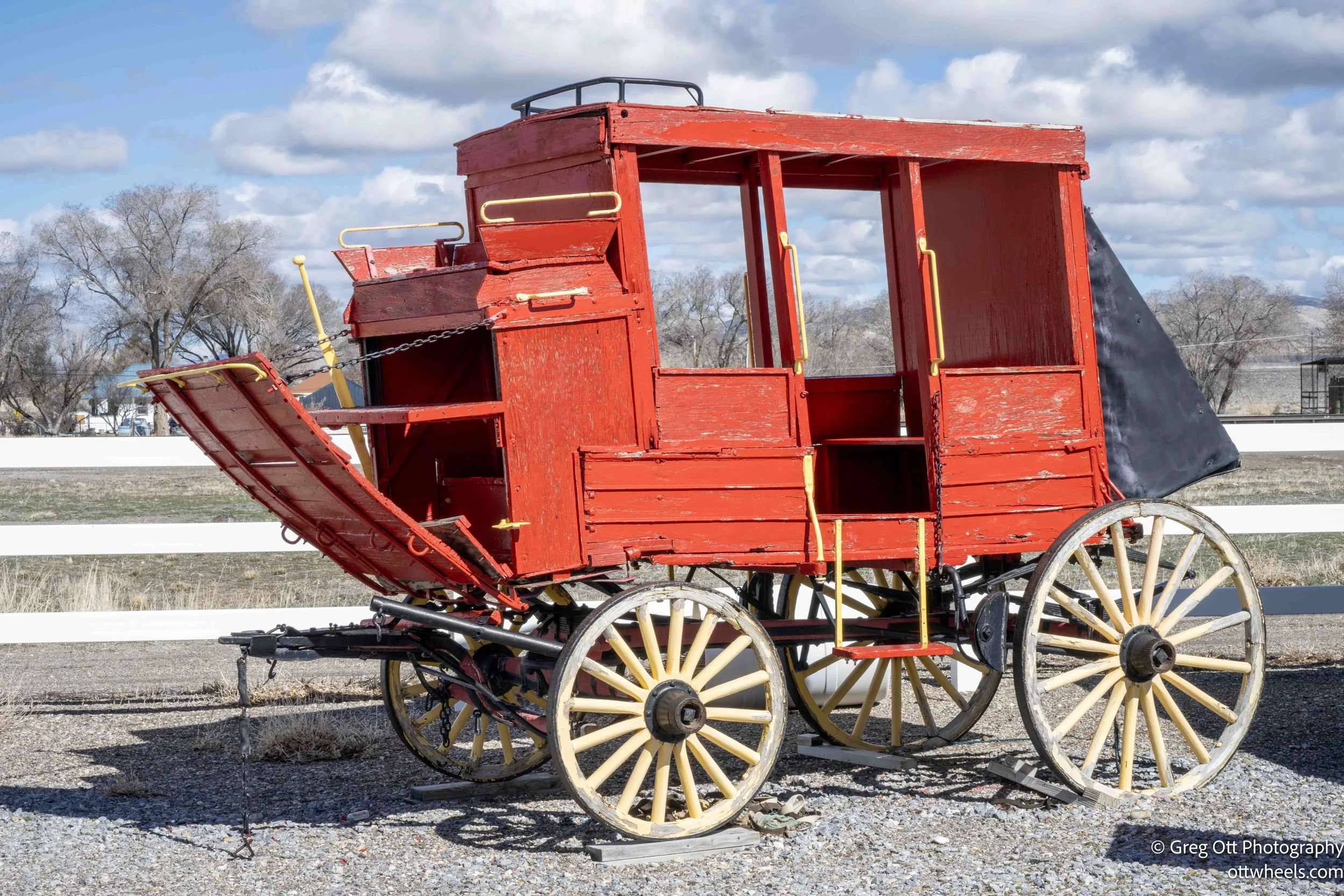
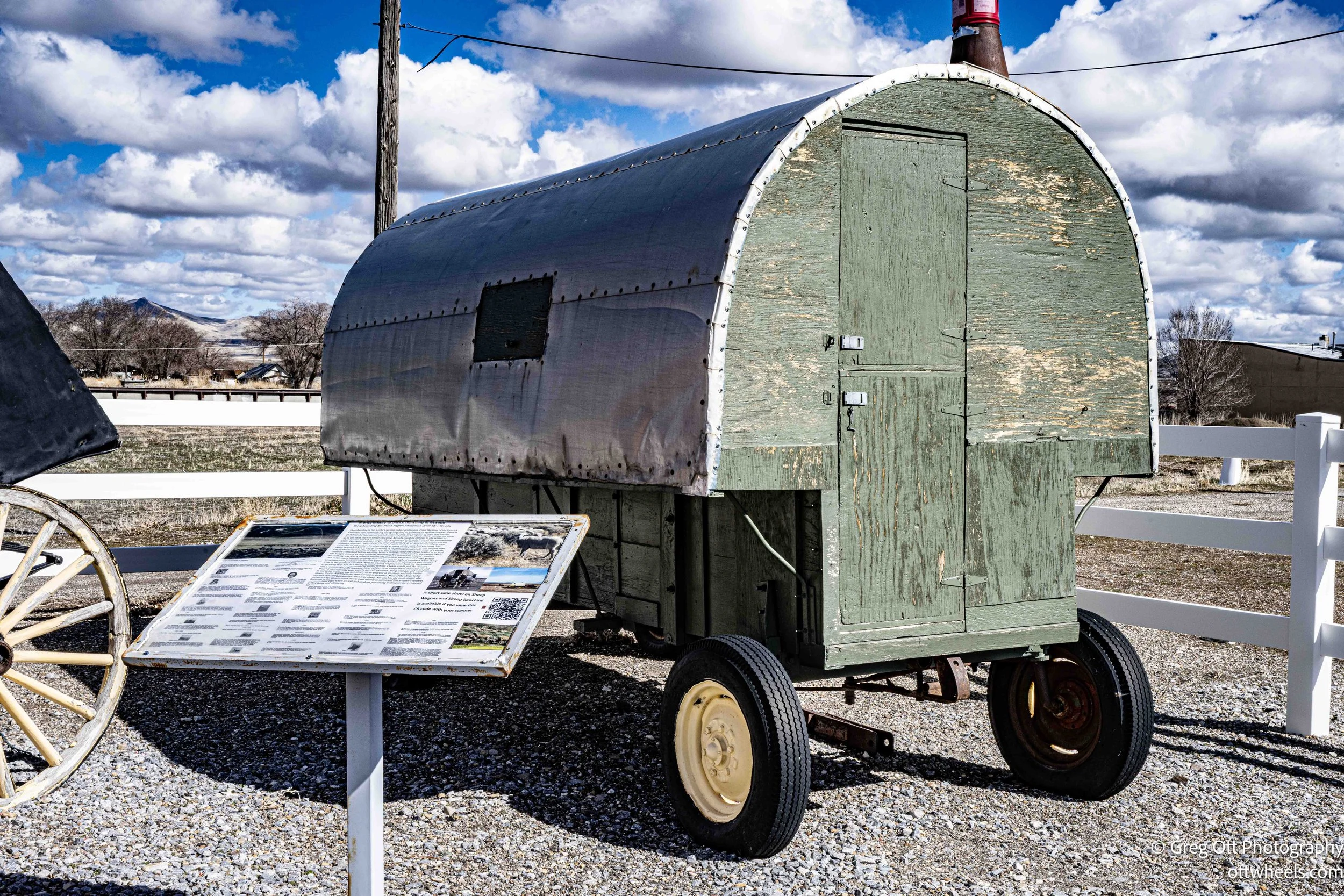
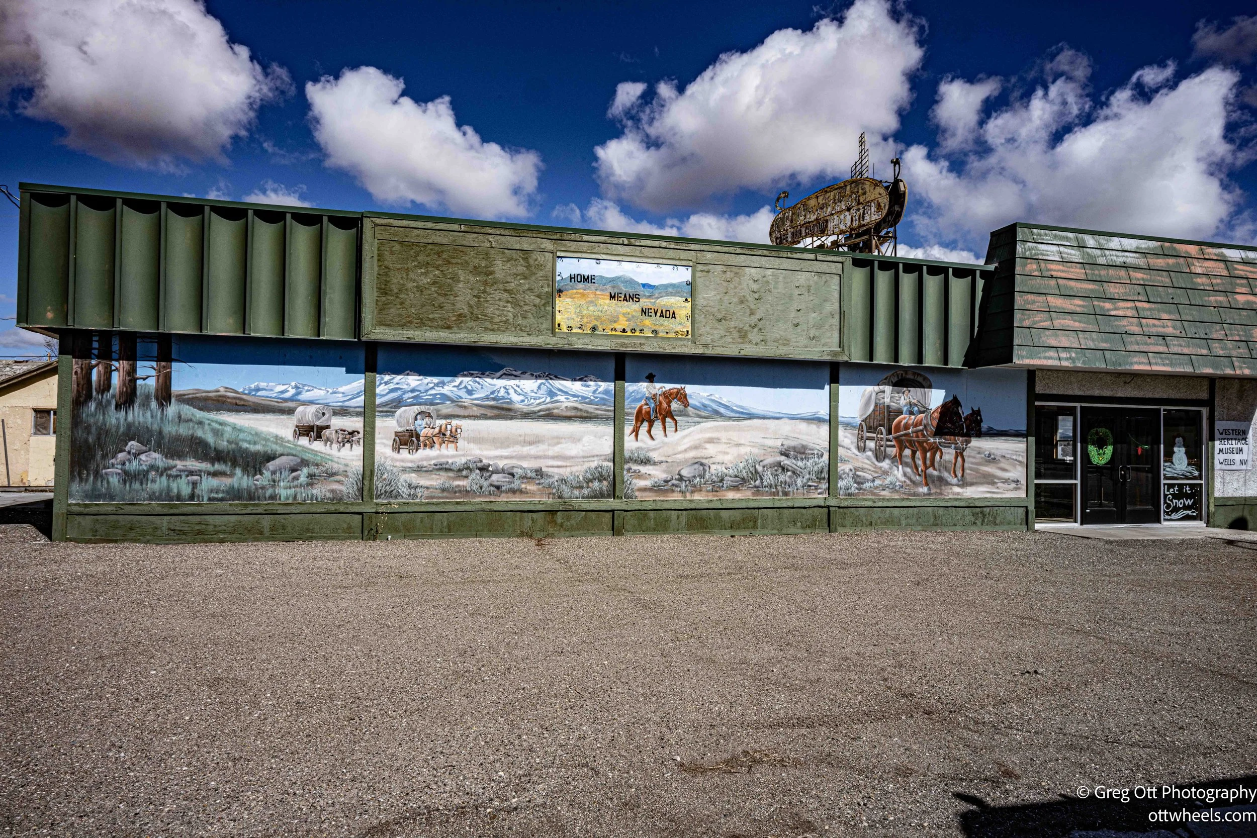
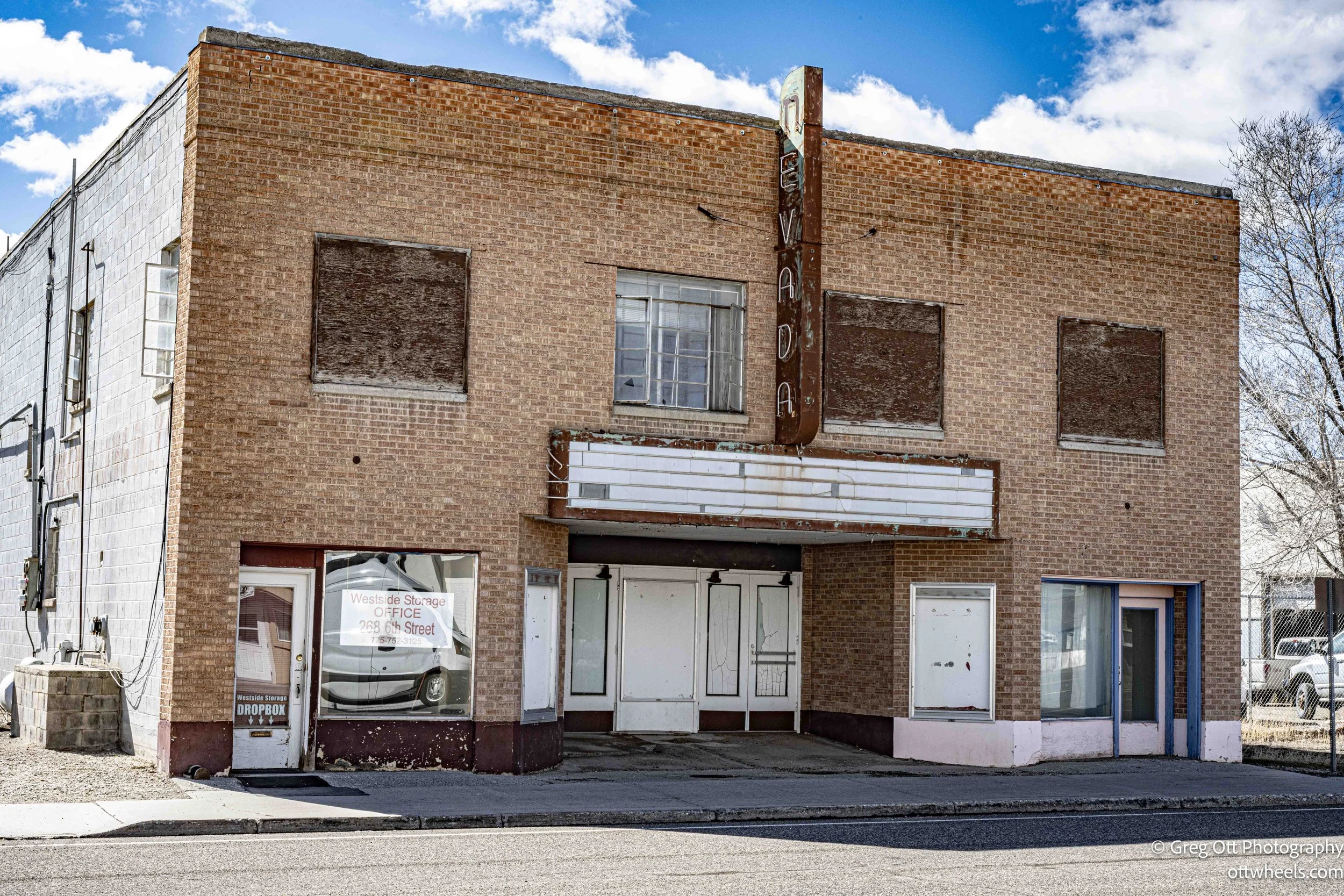
There was one restaurant that appeared to be open, but I didn’t stop in. I did pull over at a place called Western Heritage Park, which looked fairly new compared to the rest of the town. Standing there, I found myself wondering where the money had come from to build it and what the goal was. Wells didn’t strike me as the kind of place drawing many tourists off the interstate. Further down the street was the old Nevada theater that has seen better days.
After driving around for about an hour, I decided to leave. The place felt a little too depressing, like so many towns that were bypassed when the interstate came through. When the traffic moved away, the lifeblood of the community seemed to move with it.
California Trail
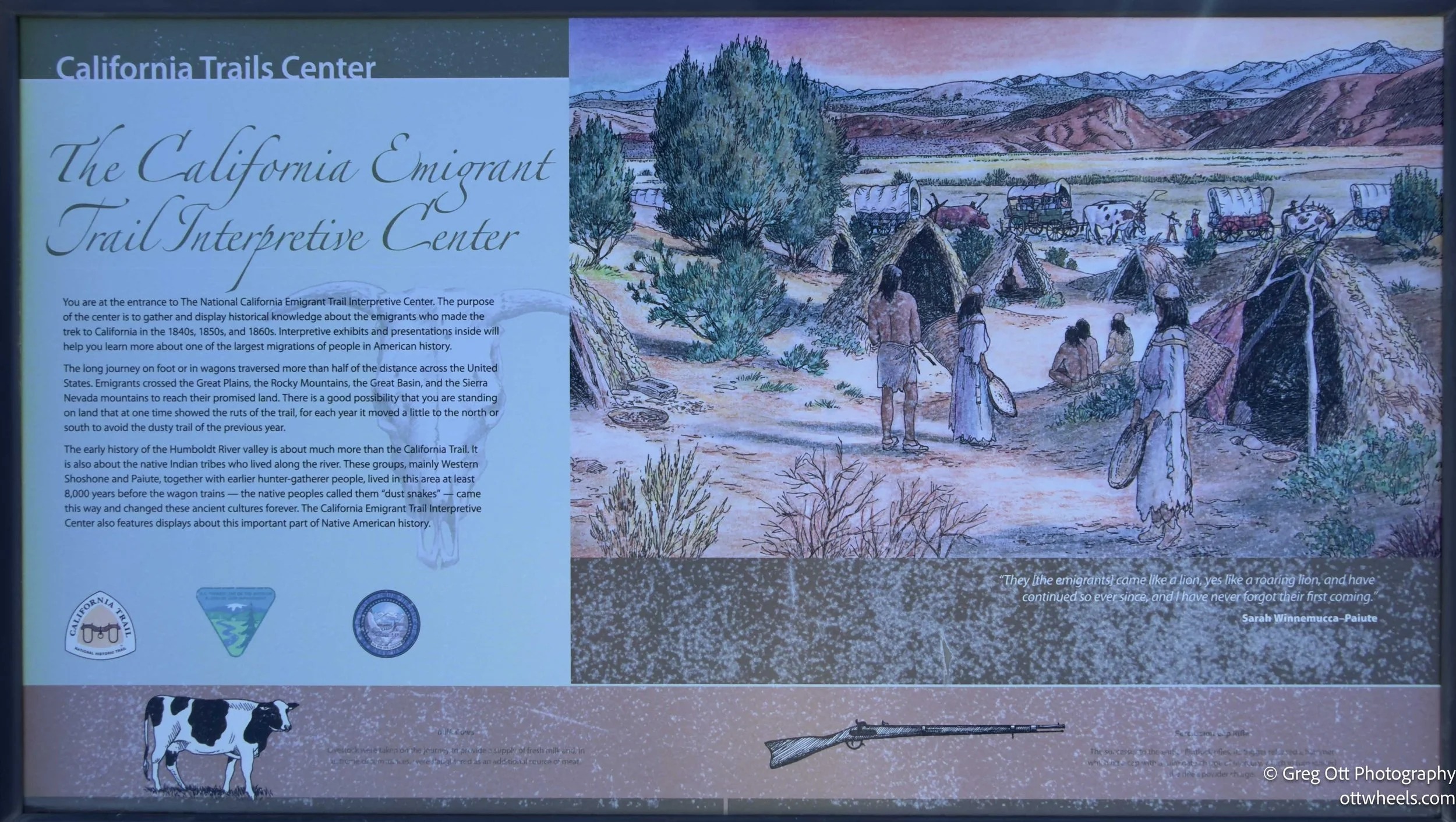
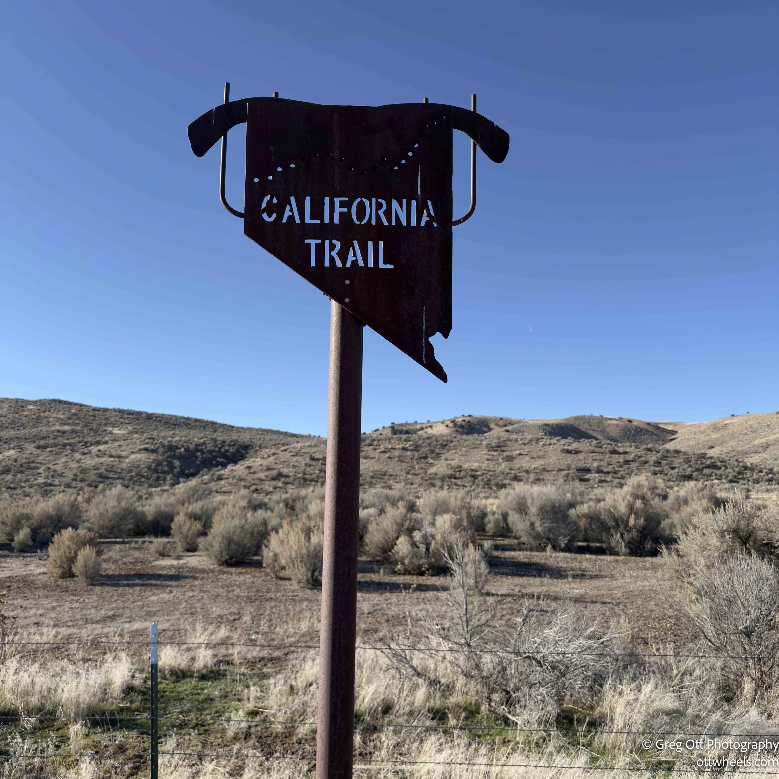
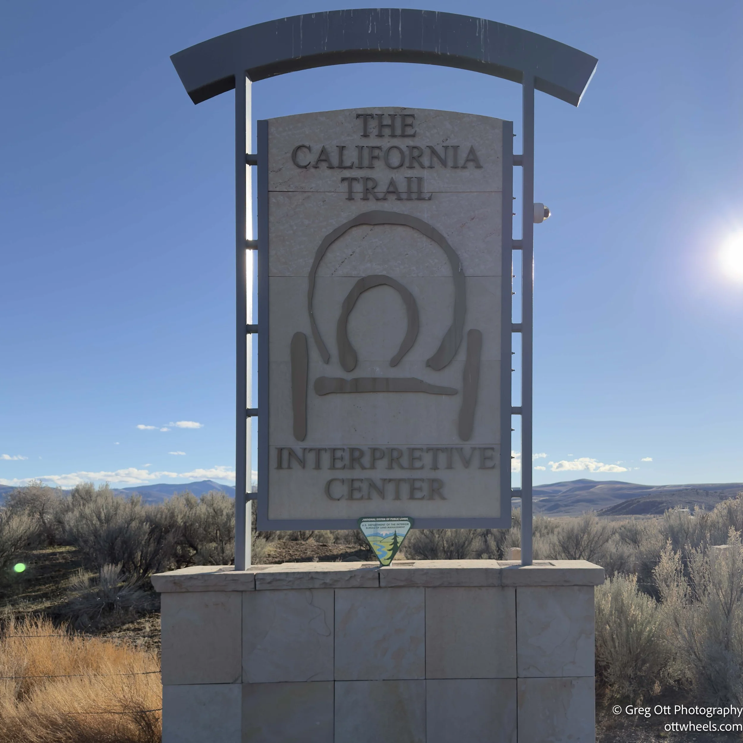
I headed west on Interstate 80 toward Battle Mountain. Along the way I saw a sign for the California Trail Interpretive Center and decided to pull off the interstate. I wanted to learn more about the route the emigrants took across this part of Nevada. Unfortunately, the center was closed on Tuesdays. I stood outside reading the brochures posted near the entrance, which turned out to be surprisingly interesting.
The information described the California Trail as one of the major overland routes used during the mid-1800s by emigrants heading to California during the Gold Rush. Beginning near the Missouri River, the trail stretched more than 2,000 miles across plains, deserts, and mountain ranges before reaching the Sierra Nevada. By the time wagon trains reached northeastern Nevada they had already been on the road for months.
This section of Nevada was often one of the hardest parts of the journey. Travelers had to cross long stretches of dry desert, ration water carefully, and keep their animals alive when grass and fresh water were scarce. The Humboldt River became a lifeline for many wagon trains, guiding them west across northern Nevada, but even that river could shrink to muddy pools by late summer.
The brochures also described what life was like in the wagon trains themselves. Most families traveled in simple wooden wagons pulled by oxen or mules, carrying everything they needed for the journey. A typical wagon train might include dozens of wagons traveling together for safety and cooperation. The daily routine was demanding—starting early in the morning, traveling 10 to 15 miles in a day if conditions were good, and forming a loose camp at night. Disease, broken wagons, lost animals, and accidents were constant problems.
One section described the evidence that still remains along the trail today. In places where wagons repeatedly crossed soft ground, the wheels carved deep ruts that can still be seen more than 150 years later. Graves also line portions of the route, simple reminders of how dangerous the journey could be. Standing there reading about it, it was easy to imagine those long wagon trains slowly working their way across this same landscape, hoping that the Sierra Nevada and California were finally within reach.
Battle Mountain
This would be another town that would serve as a quick stopover. I made it to Battle Mountain, a small Nevada town sitting along the Humboldt River and the Union Pacific rail line. The town got its name from a conflict that reportedly took place in 1865 between local Shoshone warriors and a group of miners and settlers. The fight occurred on a rocky hill just outside of town. Whether it was truly a “battle” or more of a brief skirmish has been debated by historians, but the name stuck and eventually became the name of the town itself.
Like many places along Interstate 80, Battle Mountain feels like a crossroads town. There are a few motels, gas stations, and casinos serving highway traffic, along with the mining operations that still drive much of the local economy. Gold mining in the surrounding hills has kept the town alive long after many other small Nevada communities faded away.
I found a BLM turnoff west of town on Nevada 305. Google Maps tried to take me there through someone’s driveway, but I was able to find my way around. It was a big open space at the foot of a mountain range.
When I pulled in, a man was trying to get his dog into the car. The dog had absolutely no intention of leaving. My arrival didn’t help matters because I was one more interesting distraction. I stopped, turned off the engine, and waited. The dog eventually lost interest in me and wandered back toward the car. It still took another 15 minutes before the owner finally managed to coax it inside. Watching the whole scene unfold, I couldn’t help thinking that the dog needed a little training—and possibly the owner too.
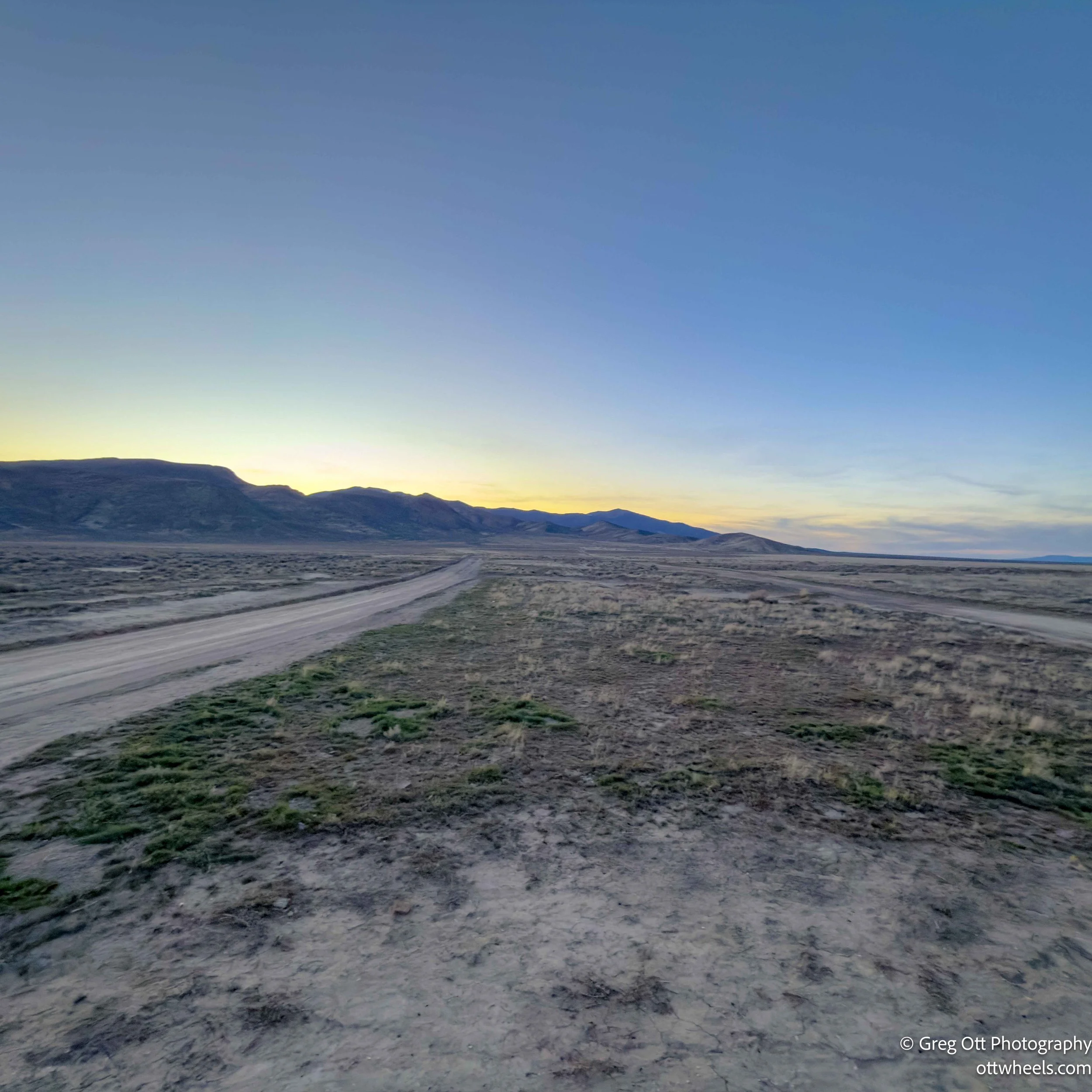
This was a quiet spot, and after dark there was very little traffic on Highway 305. It turned out to be a peaceful place to spend the night.