Kennecott Copper Mill, Root Glacier, McCarthy, AK
I took yesterday off to catch up on everything: blogs, photographs, bills, and all the small things that pile up when every day becomes another place, another road, another story. I parked at the rest stop beside the Kuskulana Bridge, which felt more like a quiet private campground than a roadside pullout. I opened the side door to let in fresh air, and somehow only one mosquito figured out how to get through the no-see-um screen. For Alaska, that felt like a small miracle. Only a few cars stopped all evening. Some used the restroom. Others parked long enough to walk back to the bridge for photos.
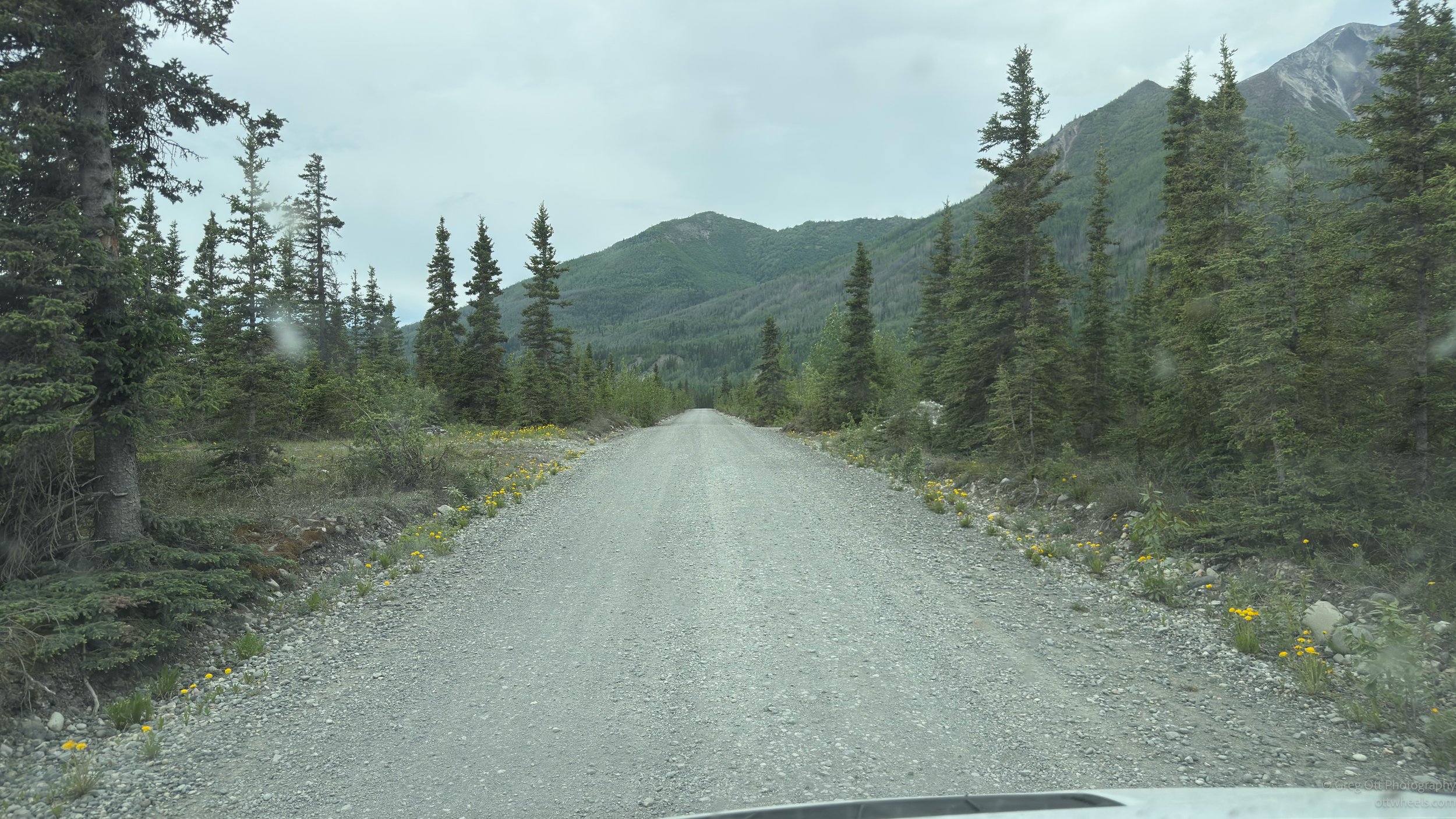
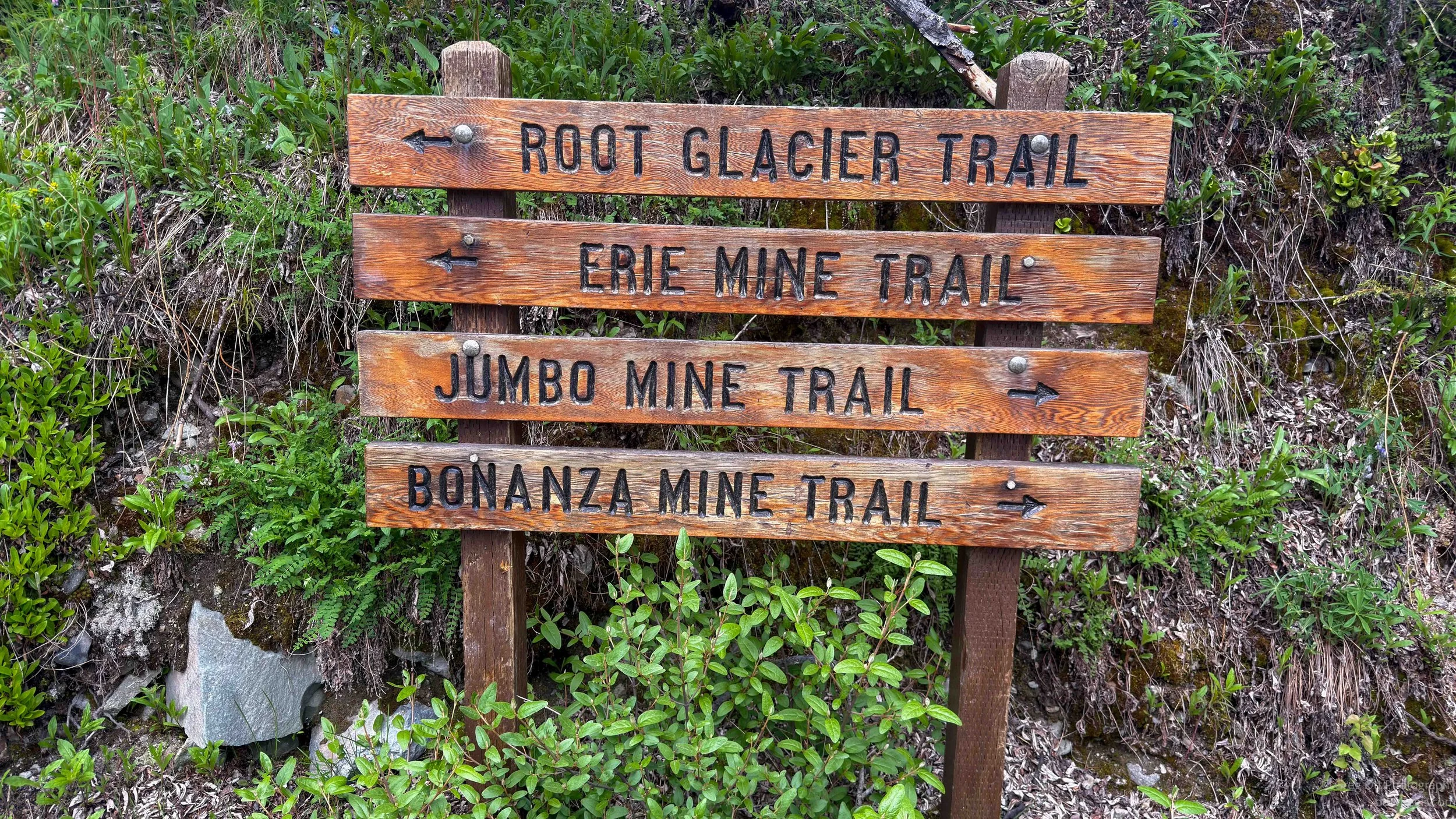
After visiting McCarthy, I understood why there is as little traffic on that road as there is. It is 60 miles each way on mostly unpaved road, and the last 30 miles are four-inch-deep washboard that rattles everything in the van. I now understand why many people take shuttles from Chitina and stay for several days in McCarthy, either in small hotels or campgrounds. This is not a place you casually “run into town.”
I left my makeshift campsite at the Kuskulana Bridge, entered McCarthy into Google Maps, and started driving. Google suggested it would take 90 minutes. Making it in 90 minutes would be dangerous, as I would understand even better by the end of the day. It took me well over two hours just to reach parking.
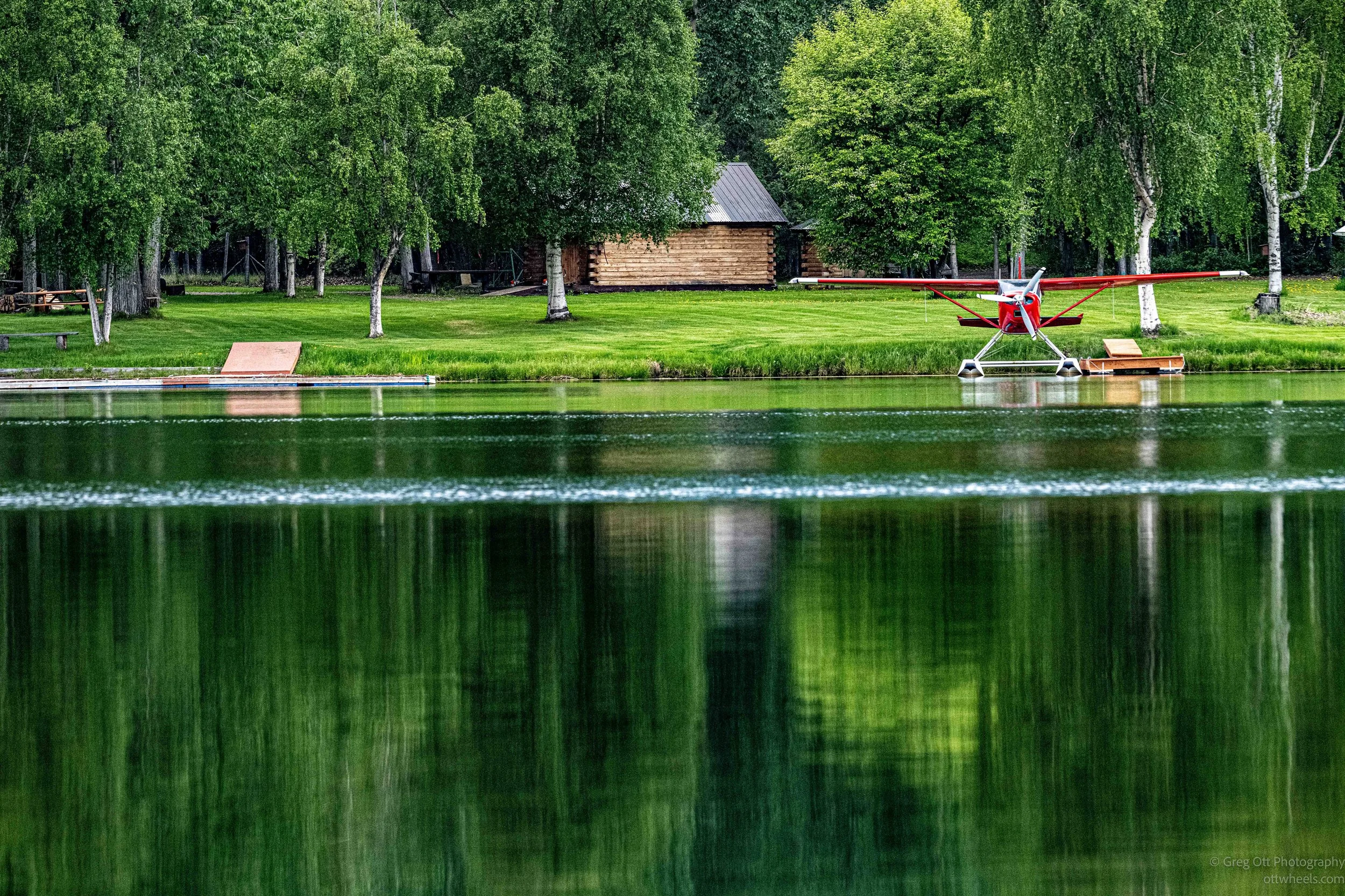
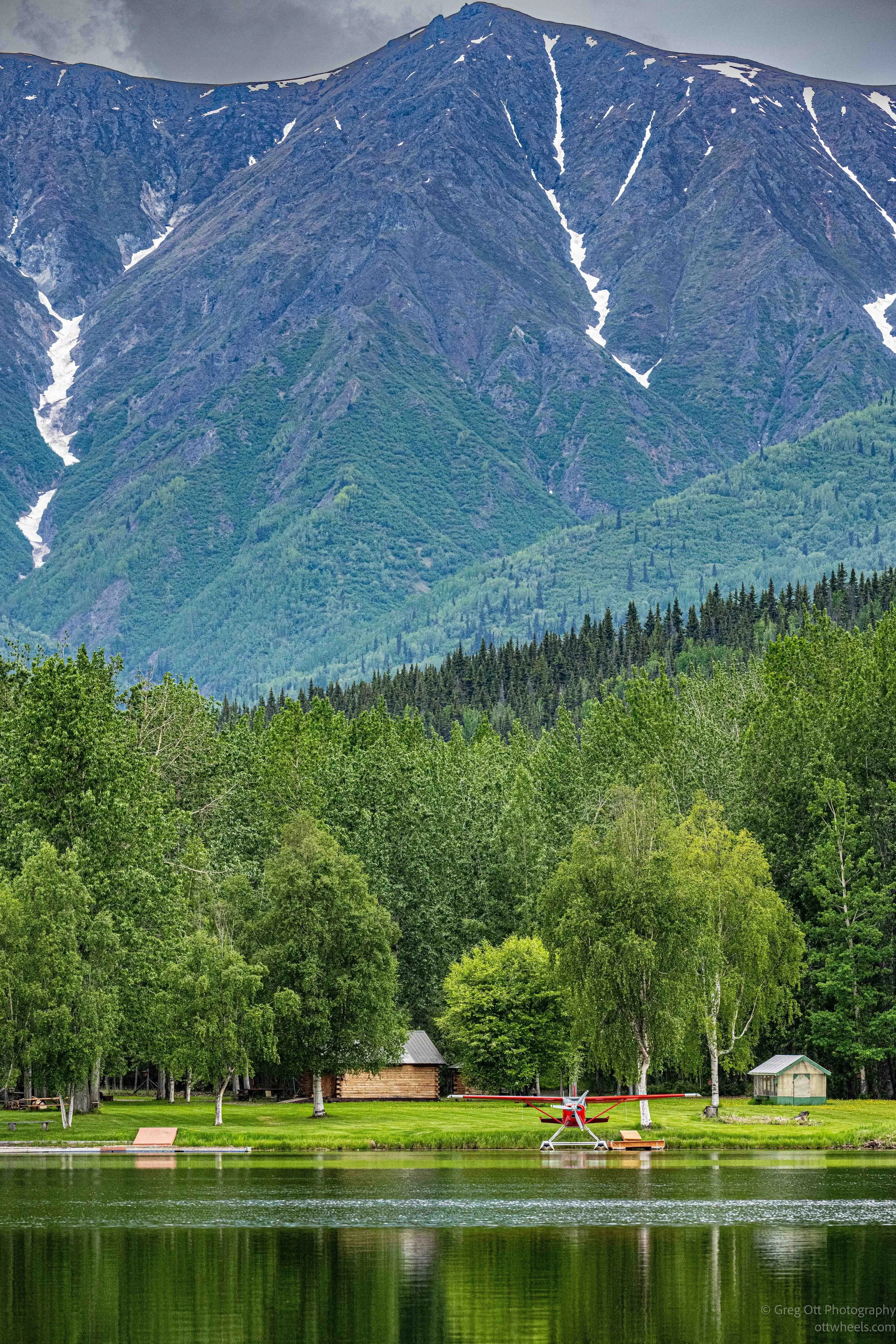
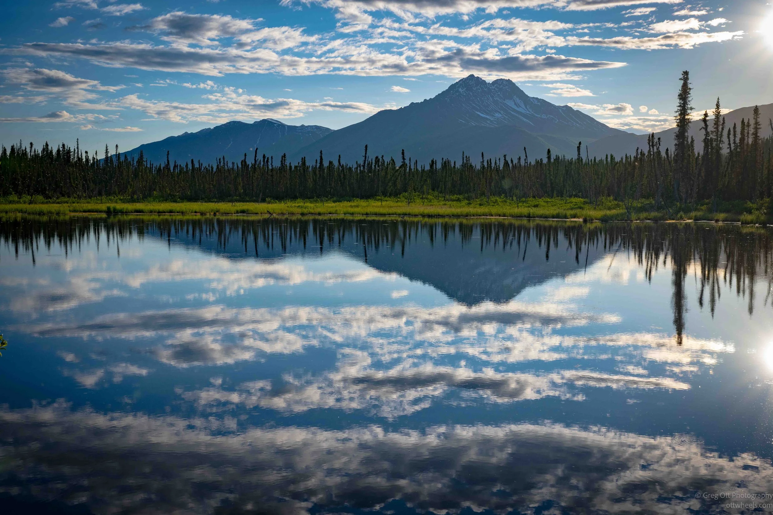
I stopped along the way to photograph a lake that seemed to be reflecting the blue sky and saw a water plane at the other end of the lake. There was almost no breeze, so it looked like a mirror.

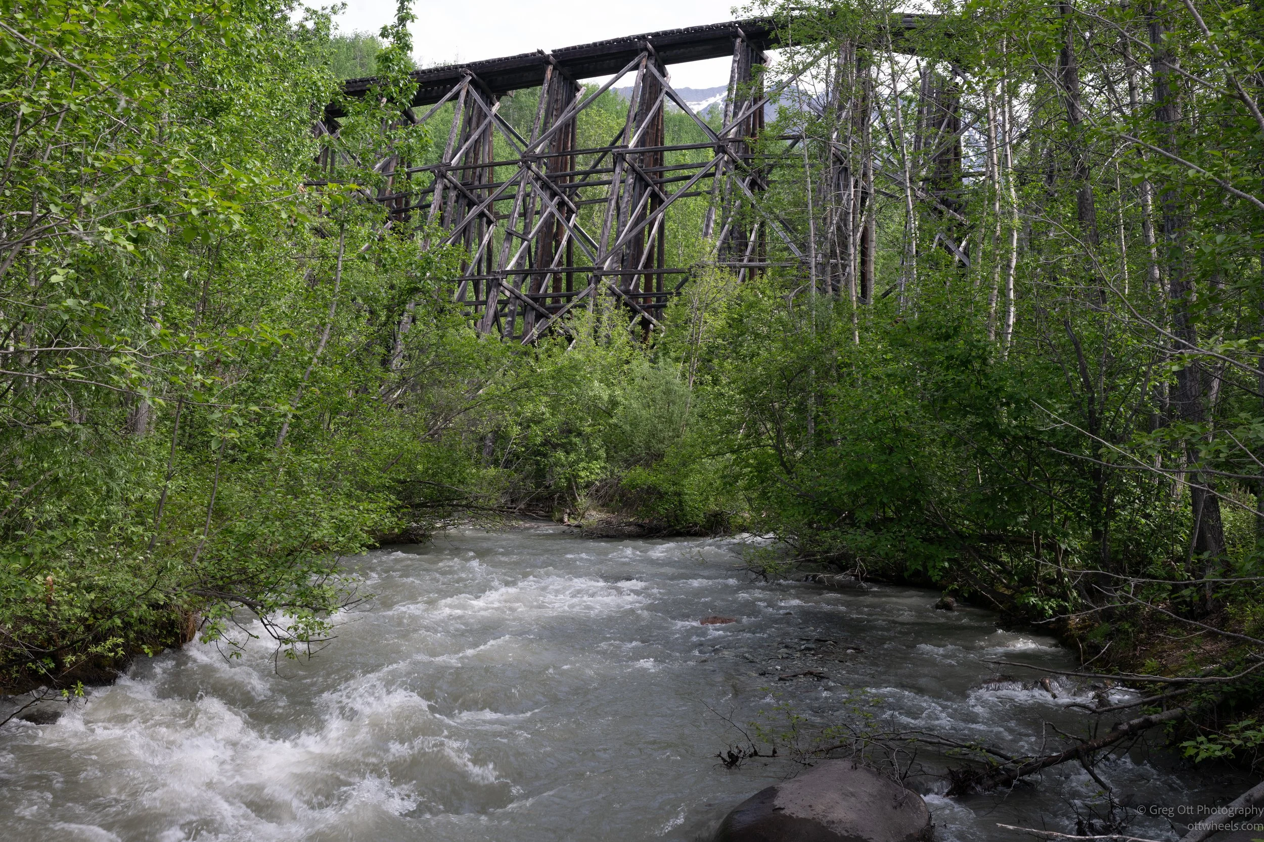
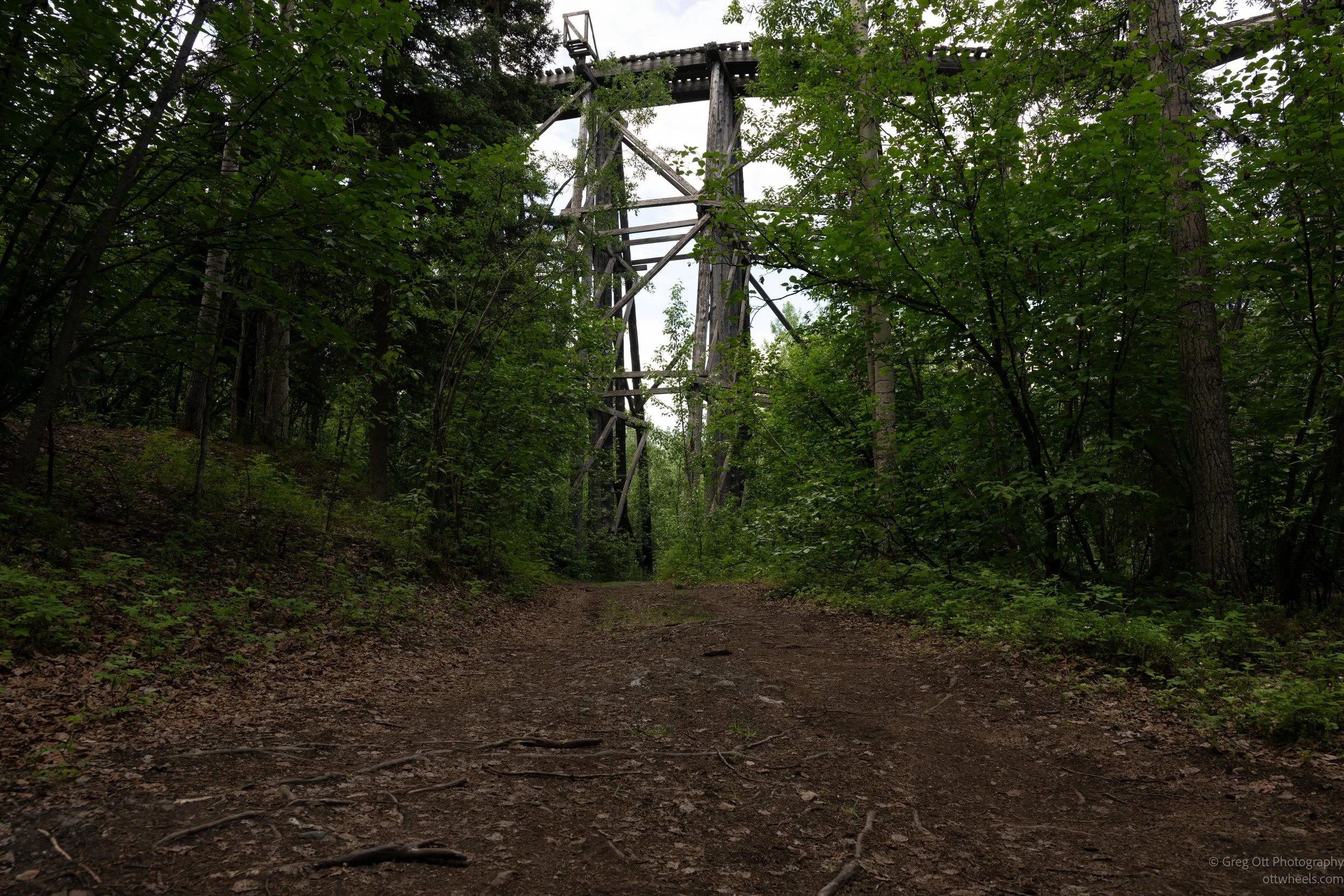
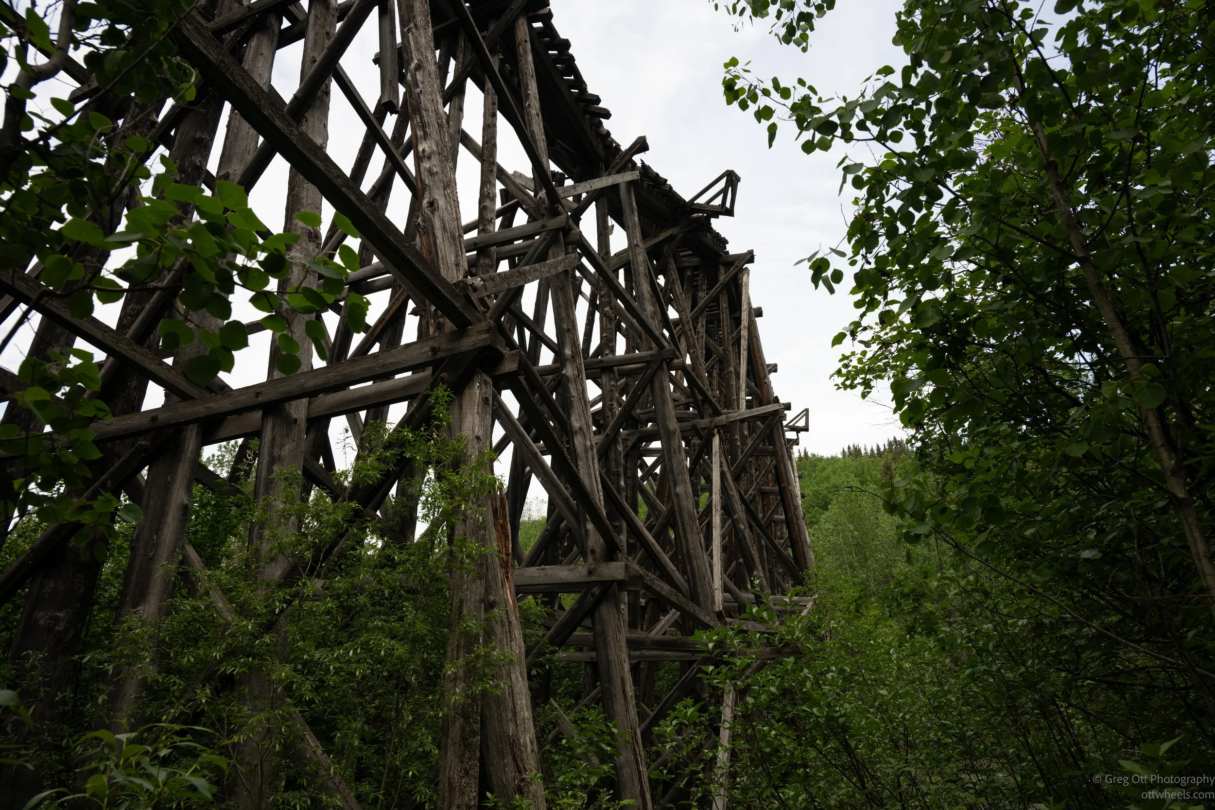
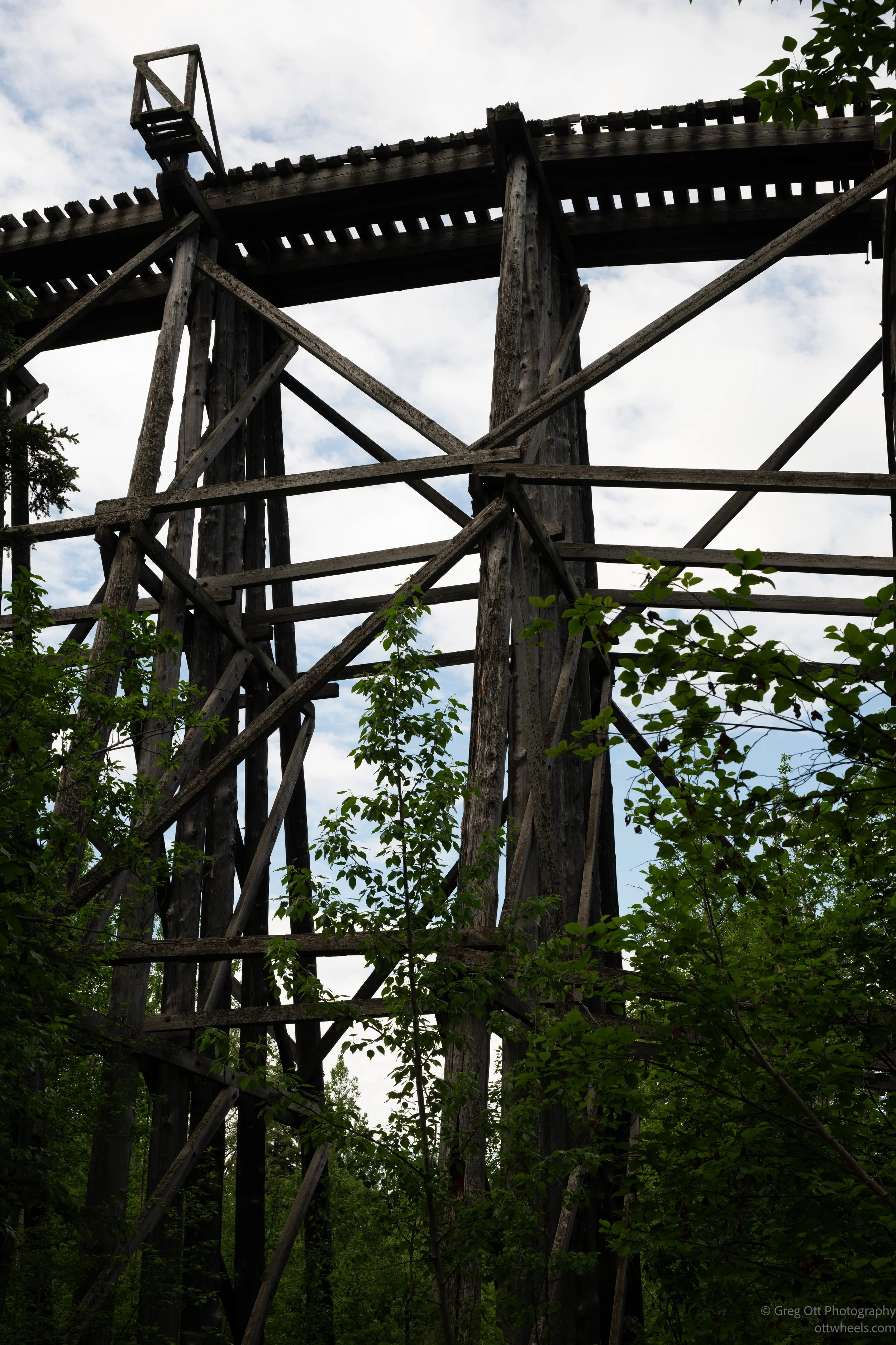
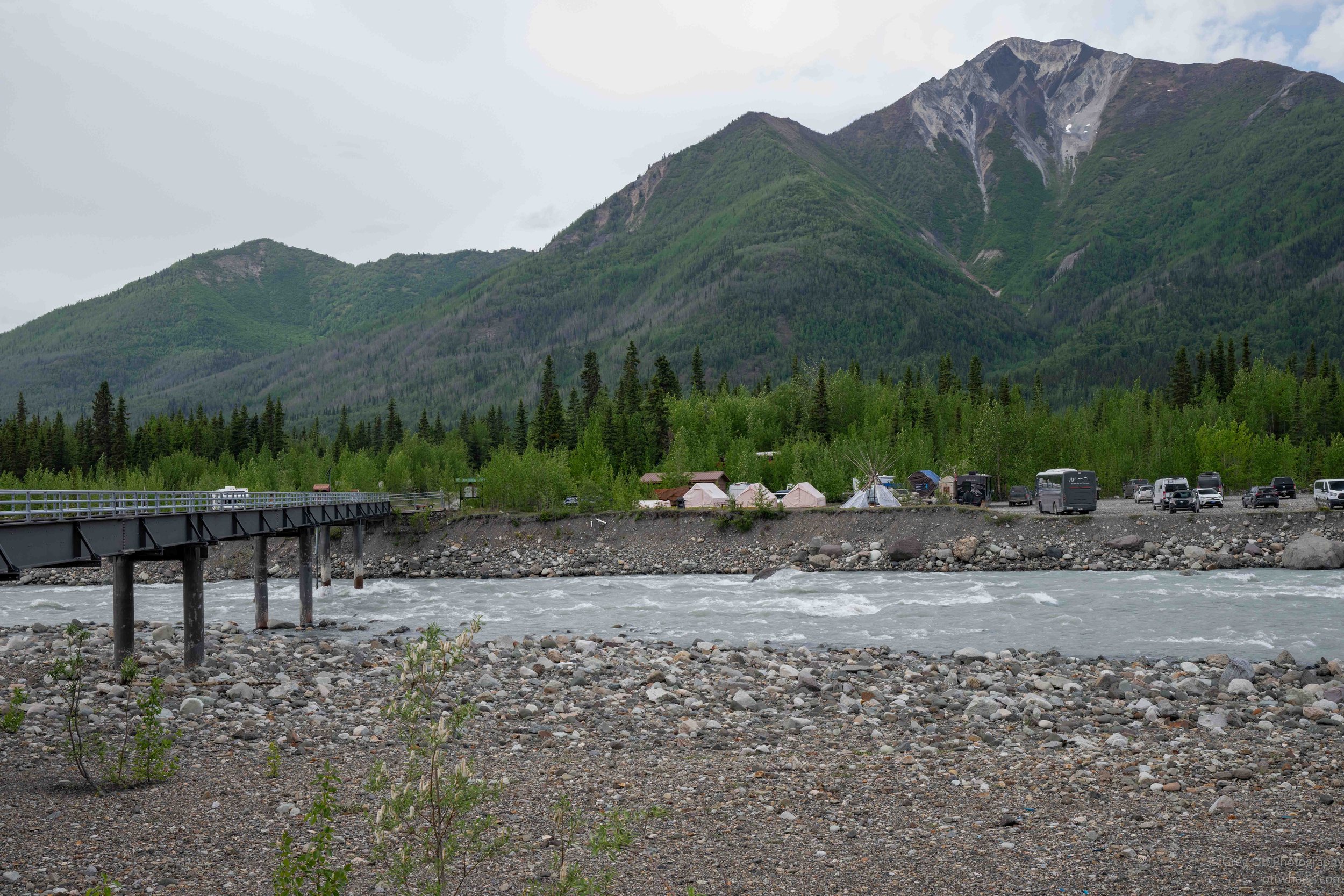
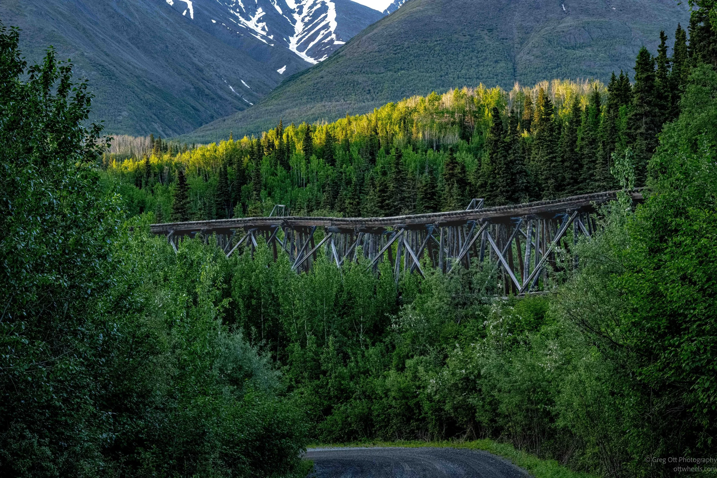
About ten miles down the road, there was a small bridge with a rest stop. There were three people on the bridge and nowhere for me to go. They weren’t budging from whatever it was they were photographing. I waited patiently, and the wife tugged on her husband arm and they moved off the bridge. Others followed. They were in the tour bus that had stopped before the bridge. As I crossed I saw the tressels from the old copper mine train.
I pulled over at a scenic spot where a guy and his girlfriend were camped in a tent. He told me there was an even better view about 200 yards down the river. As I headed off, I briefly wondered if I should grab my bear spray, but decided not to. When I came back, I stopped to talk with him again, and in the middle of our conversation a brown bear walked in front of my van. "There's a bear," I said. He looked up, immediately started waving his arms and shouting. The bear took one look at us and ran the other way. I said, "I guess I should always carry bear spray." "Yes, you should," he replied. Then he turned slightly and showed me the can of bear spray hanging from his hip.
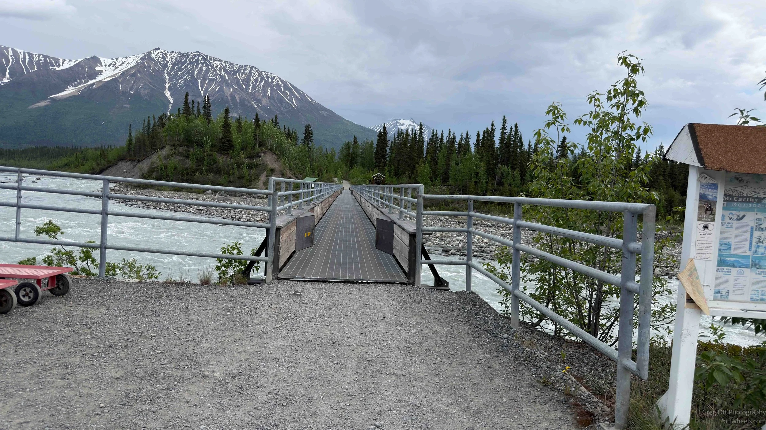
My plan had been simple: drive to McCarthy, drive to the mine, hike to Root Glacier, and return. I executed the plan, but not the way I had envisioned. Near McCarthy, the road became so bad I was driving less than 10 mph. Eventually I came to a gate just as someone in a van was crossing a narrow bridge. A rugged-looking guy on a quad bike was locking the gate. I told him Google was sending me this way to get to McCarthy.
“You need a special pass to drive to McCarthy,” he said. “We’ve been fighting with Google for five years to stop routing people through here.” He explained that I needed to park, walk across the footbridge, and take a shuttle into town. Then he wished me a nice visit and was gone before I could properly thank him.
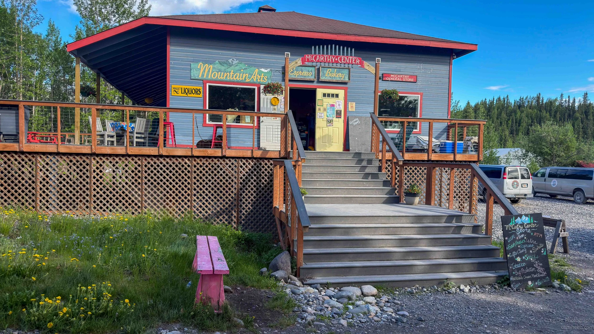
I had not read any of this in the brochures about visiting McCarthy. I finally found the parking area. There was a small hut with a sign for parking and camping. When I walked in, the place smelled like incense, a throwback to the seventies. I said it smelled nice, and the woman explained that the incense helped keep the mosquitoes out. Everything seemed slightly negotiable. I told her I did not need camping, just parking. The half-day rate was six dollars, and I could park next to the building.
She explained that I had to walk across the bridge and a shuttle would pick me up on the other side. The parking lot and the shuttle were not related companies. I asked how I paid for the shuttle and where. “They’ll explain on the other side,” she said.
I parked and grabbed everything I thought I would need for the rest of the day: water, bear spray, first-aid kit, camera, not enough batteries, raincoat, and bear-proof snacks. Eight other people were waiting for the shuttle, which arrived moments later. Everyone seemed to have a different theory about how payment worked. The shuttle driver, who was from Venezuela, clarified everything. We would be taken to the Country Store, and we could pay there. And yes, they took Apple Pay.
In my head, I was trying to reset the day and figure out how to do everything. Shortly into the ride, Gregg, with two g’s as he introduced himself later, called out from the back of the bus, “Did you all know that it doesn’t matter if a bear wears socks and shoes, he still has bear feet?”
Chuckles and sighs erupted behind me. I am not sure the driver understood the joke. I was sitting up front for the 20-minute ride to the Country Store, and it turned out that her husband also works in McCarthy. They spend the summers here, then go to Anchorage for work. Most of the other people on the bus had the same kind of logistics questions I had. We were all, literally and figuratively, along for the ride.
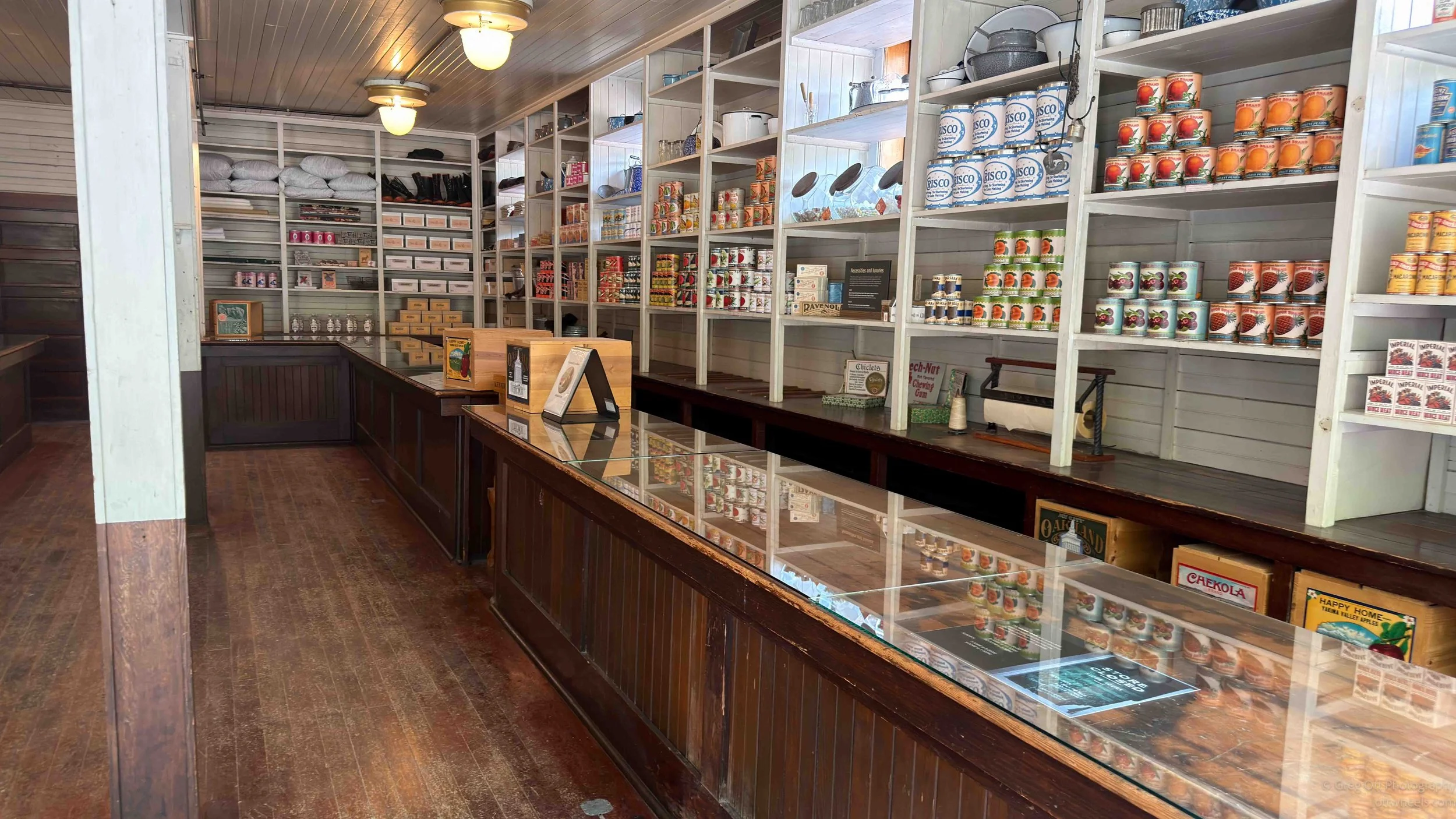
At the Country Store, the line formed to pay for the shuttle. We could have stayed in McCarthy, but most of us were headed for the Kennecott Copper Mill tour. Others were buying souvenirs or groceries. I ordered a scoop of moose tracs, which is how it was spelled. Ice cream makes me happy. Not that I wasn’t already happy, but I was just making sure.
The ride from McCarthy to Kennecott probably took 15 minutes. The driver talked about the people who live here and the park. Wrangell-St. Elias National Park and Preserve was created long after people had been living, mining, and scraping out a life here. She told us about a woman she had met who was in her late eighties and had lived here her entire life. There is little access to McCarthy in winter. The driver wasn’t sure how medical care comes in, or food for that matter. She said it must be tough to live here through the winter.
She slowed to 5 mph near a small cluster of houses. There was a handwritten sign asking drivers to slow down. She said the residents get upset when people drive too fast through this area. Then she pointed to the house where the older woman lived. The house was falling apart.
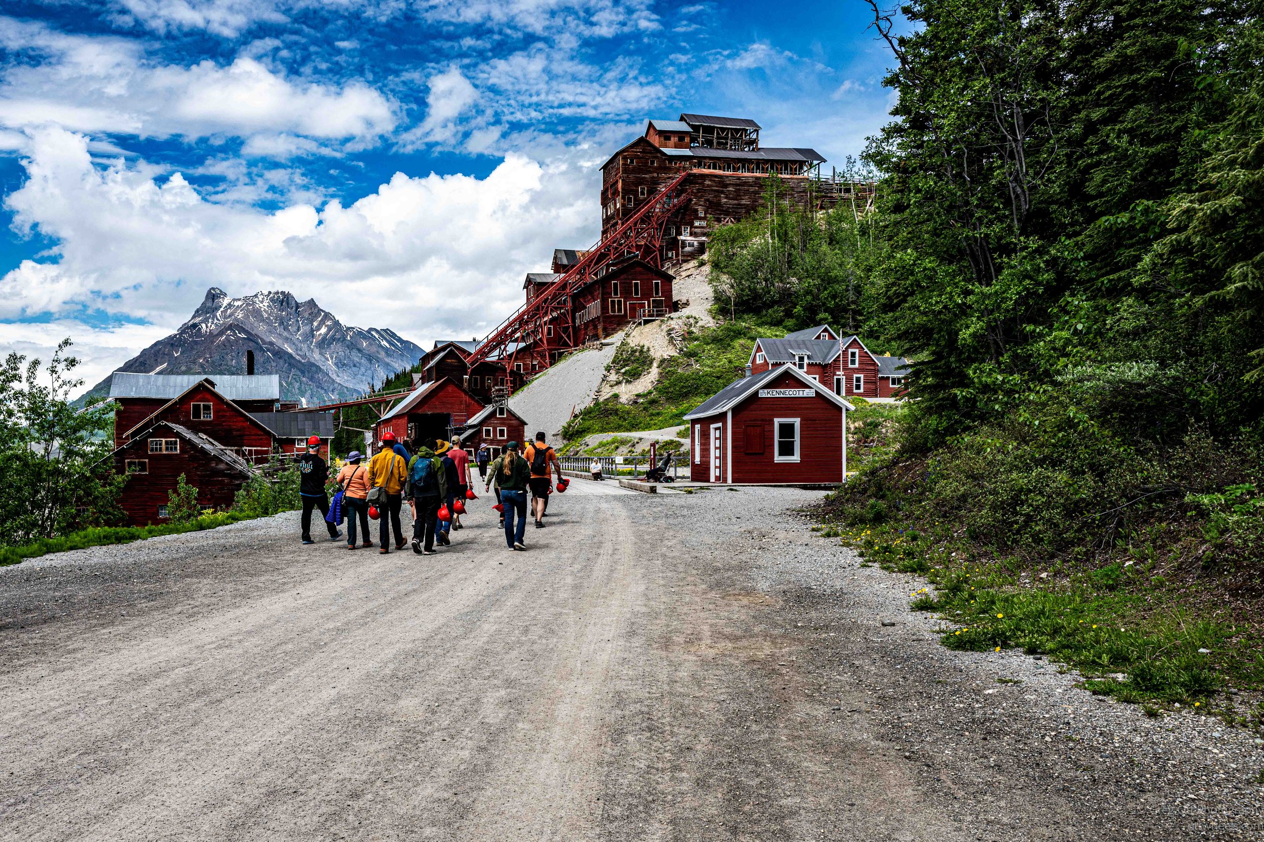
We were dropped off near the visitor center and moved toward the building where the copper mill tours begin. I knew I could not tour the mill on my own. There seemed to be a kind of collective osmosis guiding us toward the correct building. A group was already waiting outside. The tour was starting soon, and I had the sense they knew we were coming and had held the group until the shuttle passengers could be processed. I signed the liability waiver and was handed a red helmet. We were divided into groups, assigned a guide, and our group was the first to proceed.
Kennecott Copper Mill
The tour began down the street near the National Park Service office. Our guide had been trained to lead the tour and was doing this as a summer job. Her degree was in environmental studies, and she told me that the federal job she had been studying for had been canceled. Now she was looking for other work. It was an odd, very modern conversation to have in a place built around a very old form of exploitation: pull the resource out of the ground, extract as much value as possible, and leave the mess and the people behind.
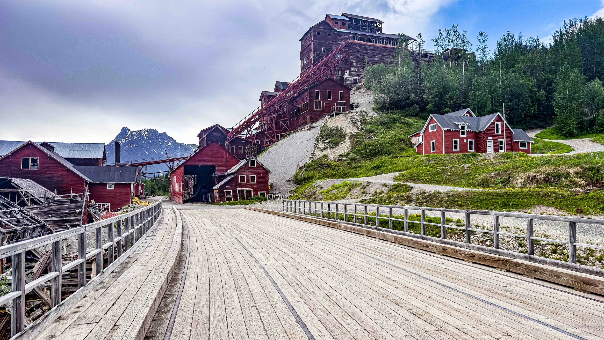
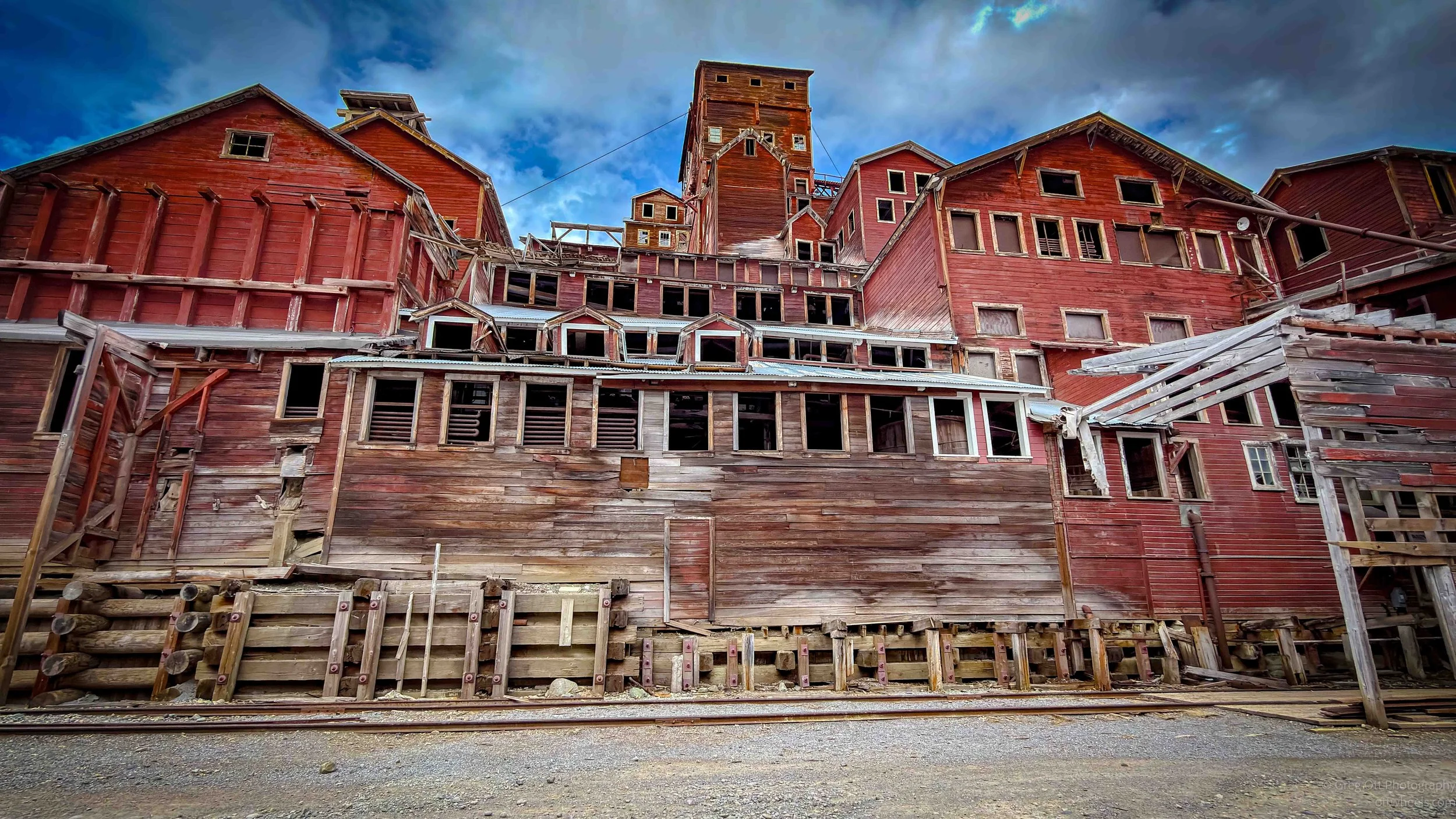
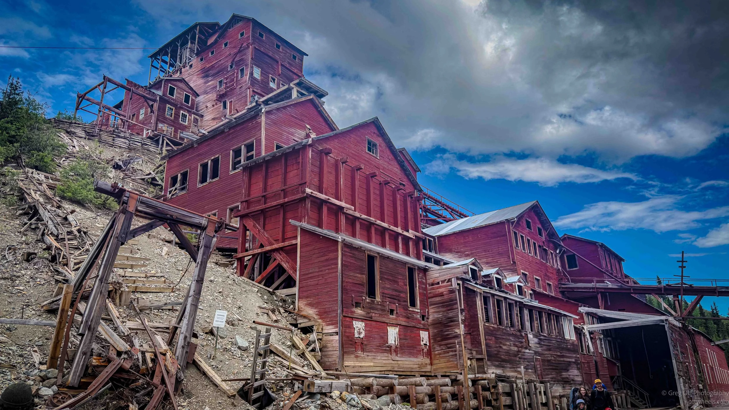
Kennecott operated from 1911 to 1938, and the scale of it is hard to understand until you stand there. This was not a little mining camp with a few wooden buildings. It was a company town, a mill, a transportation system, a hospital, a power system, bunkhouses, offices, stores, and a railroad tied to the outside world by force of money and engineering. The copper ore discovered here was astonishingly rich, in some cases far richer than normal copper ore. That wealth justified building a 196-mile railroad from Cordova through mountains, rivers, glaciers, and impossible weather. It also justified, at least in the minds of the owners, working men hard, paying them in ways that kept them trapped, and squeezing every ounce of value from the place.

We stopped at the community center, where the guide explained that dances, basketball games, and other community events were held. It was one of the few moments on the tour that felt almost normal. People worked here, but they also tried to live here. They played games, gathered in buildings, wrote letters, bought supplies, and tried to make some version of a life in an isolated company town surrounded by mountains and ice.
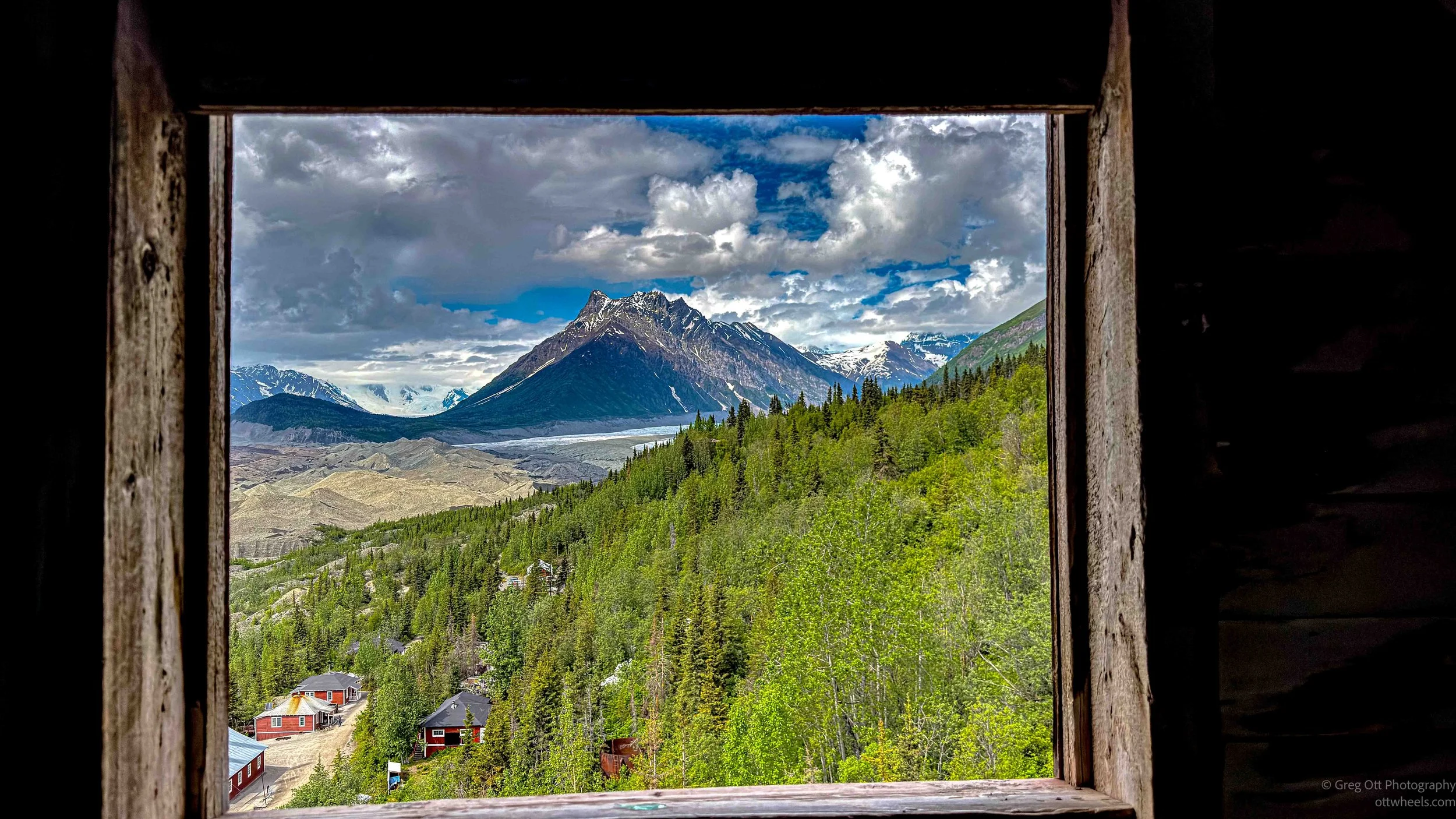
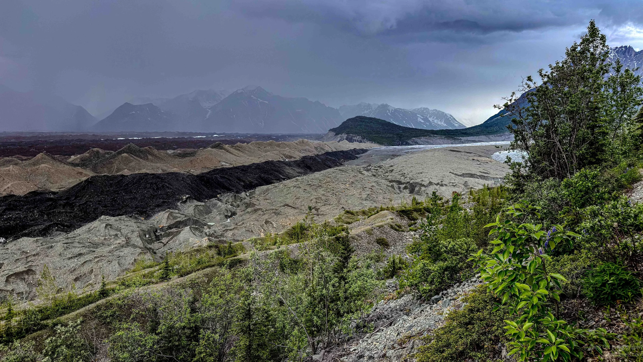
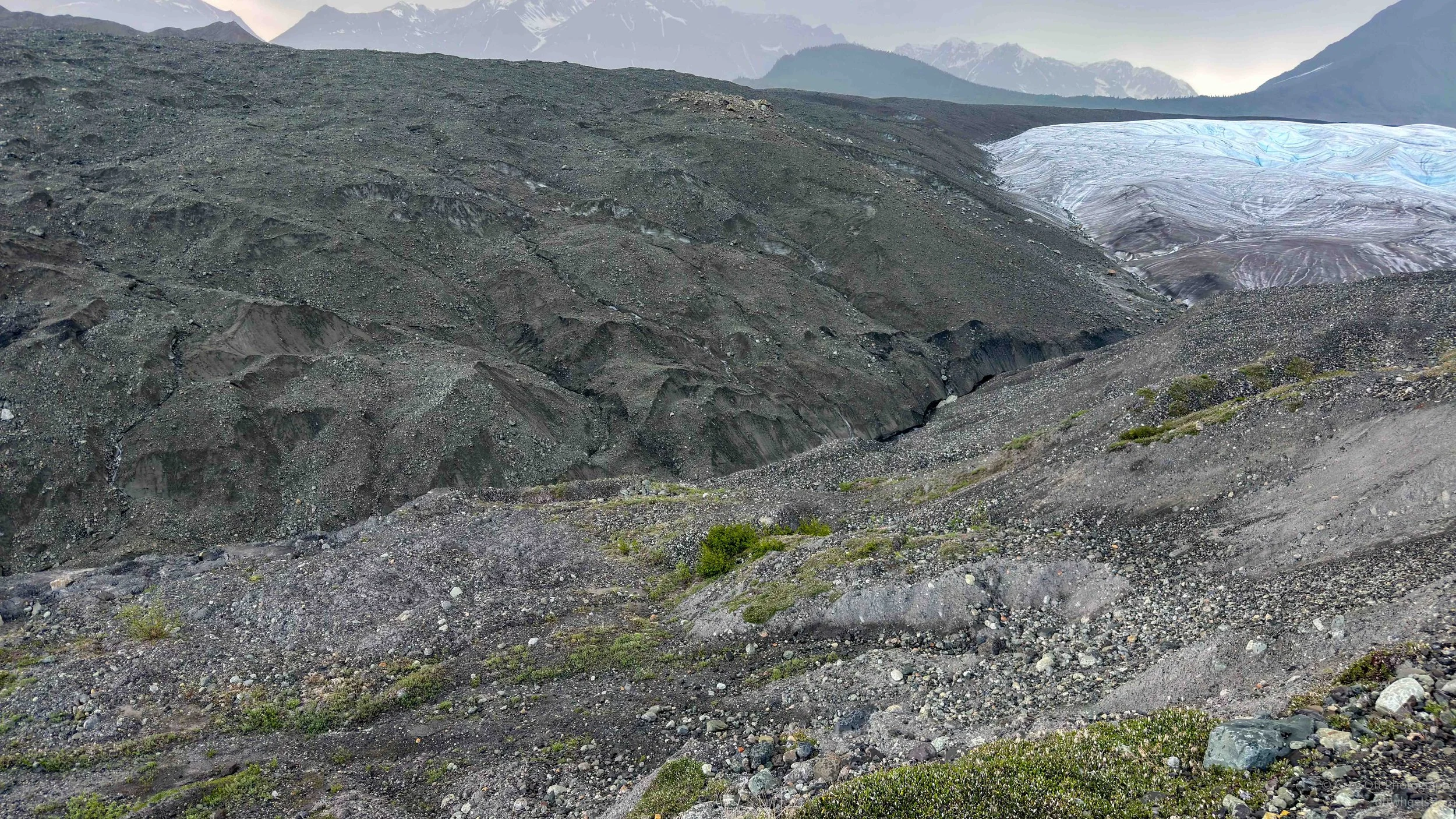
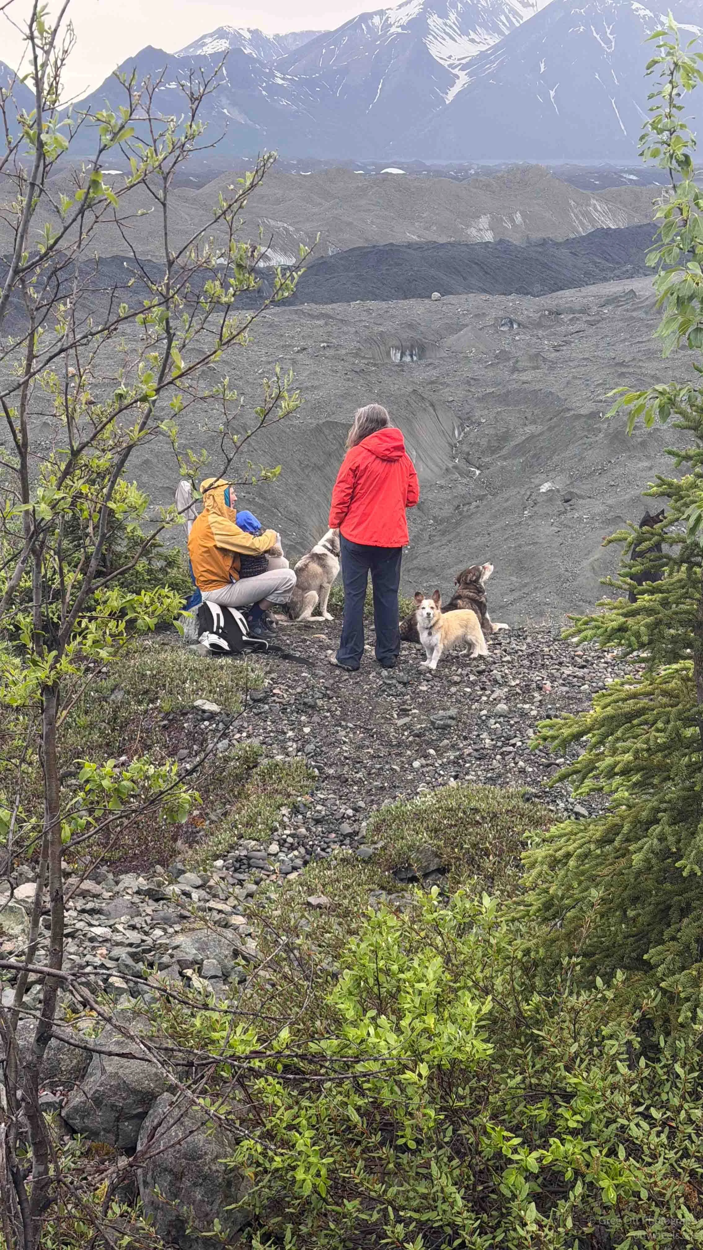
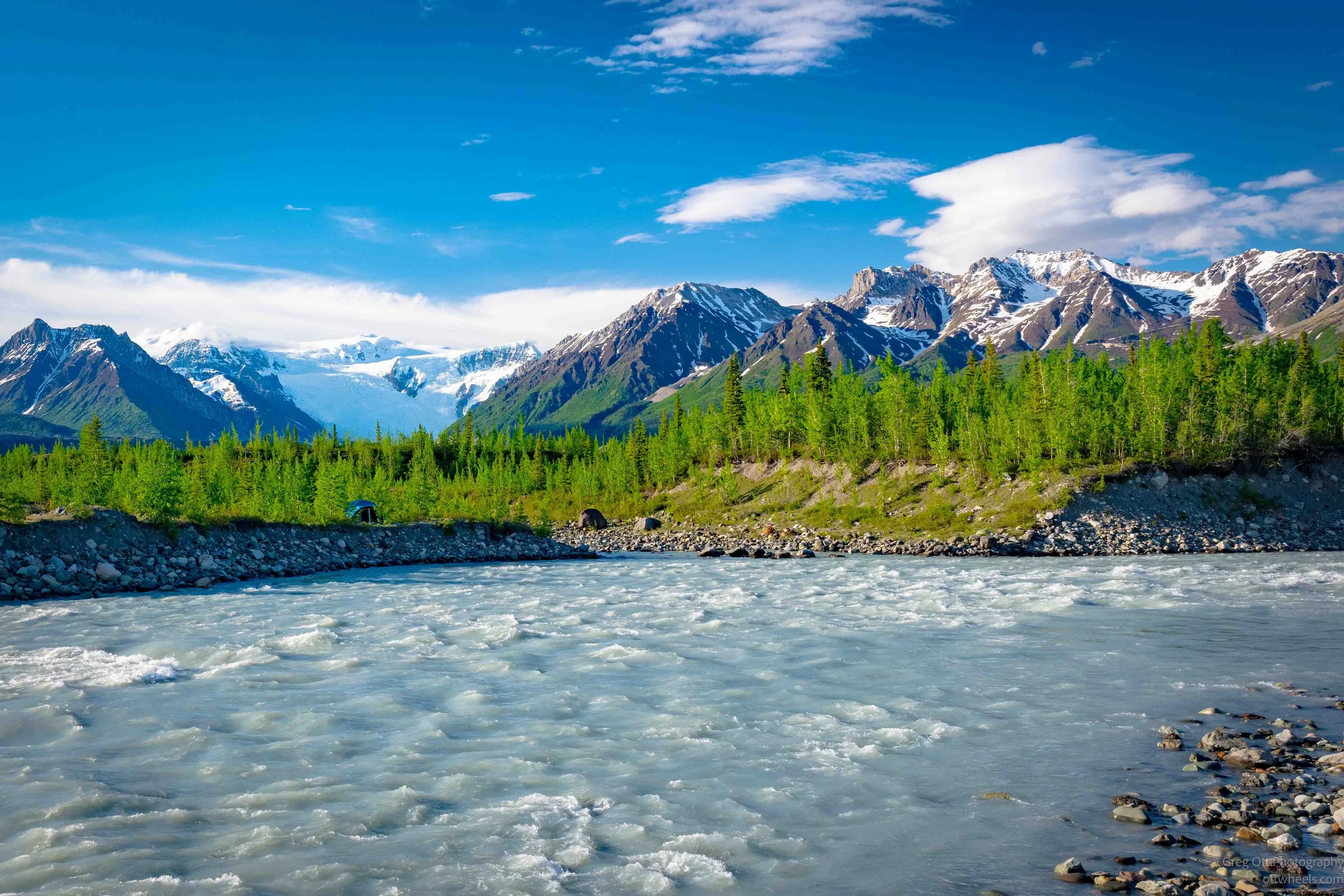
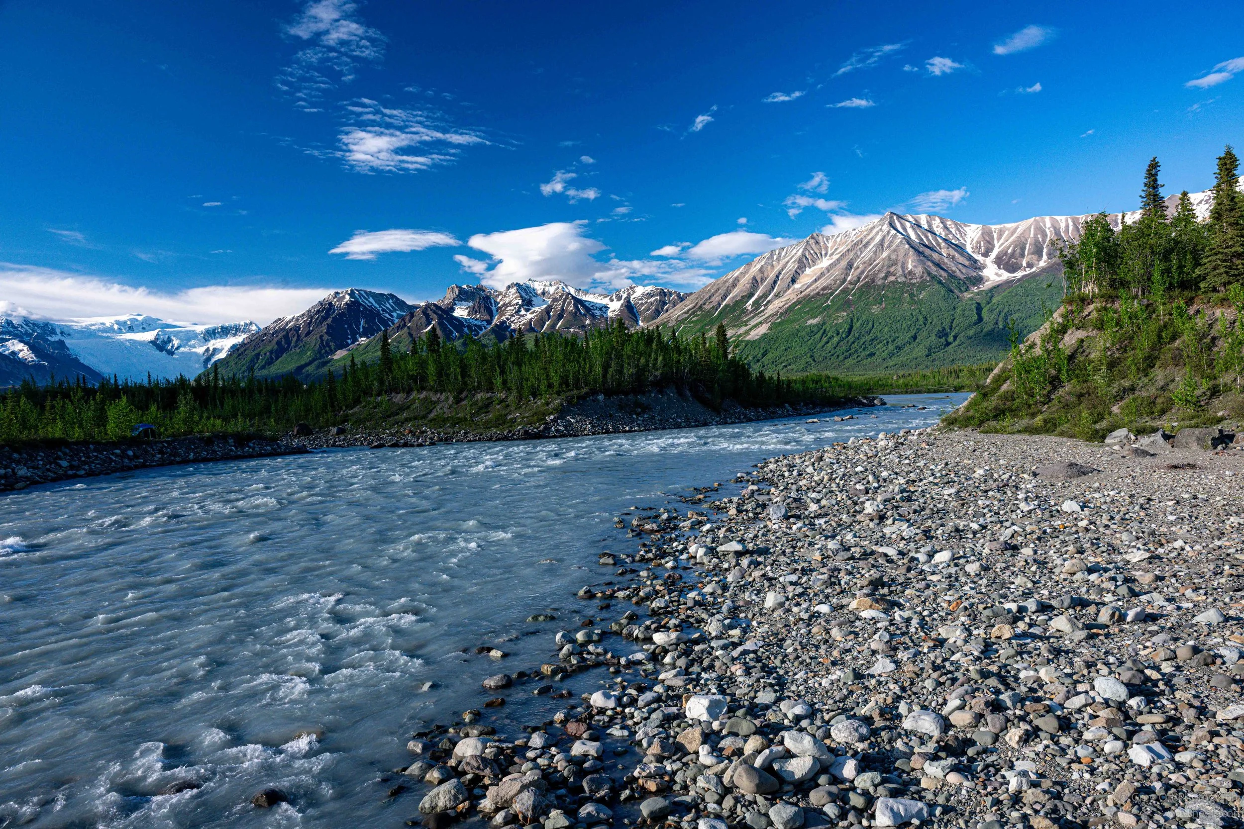
A little farther on, the guide stopped between buildings and pointed toward the valley behind them. At first it looked like mounds of windblown dirt. She explained that it was ice. The dirty surface was moraine sitting on top of the glacier. That moraine could be only a few millimeters thick in places and up to a meter thick in others. If you looked closely, you could see white ice showing through. Apparently, at one time, the ice and debris were high enough that workers did not know there were mountains behind it.
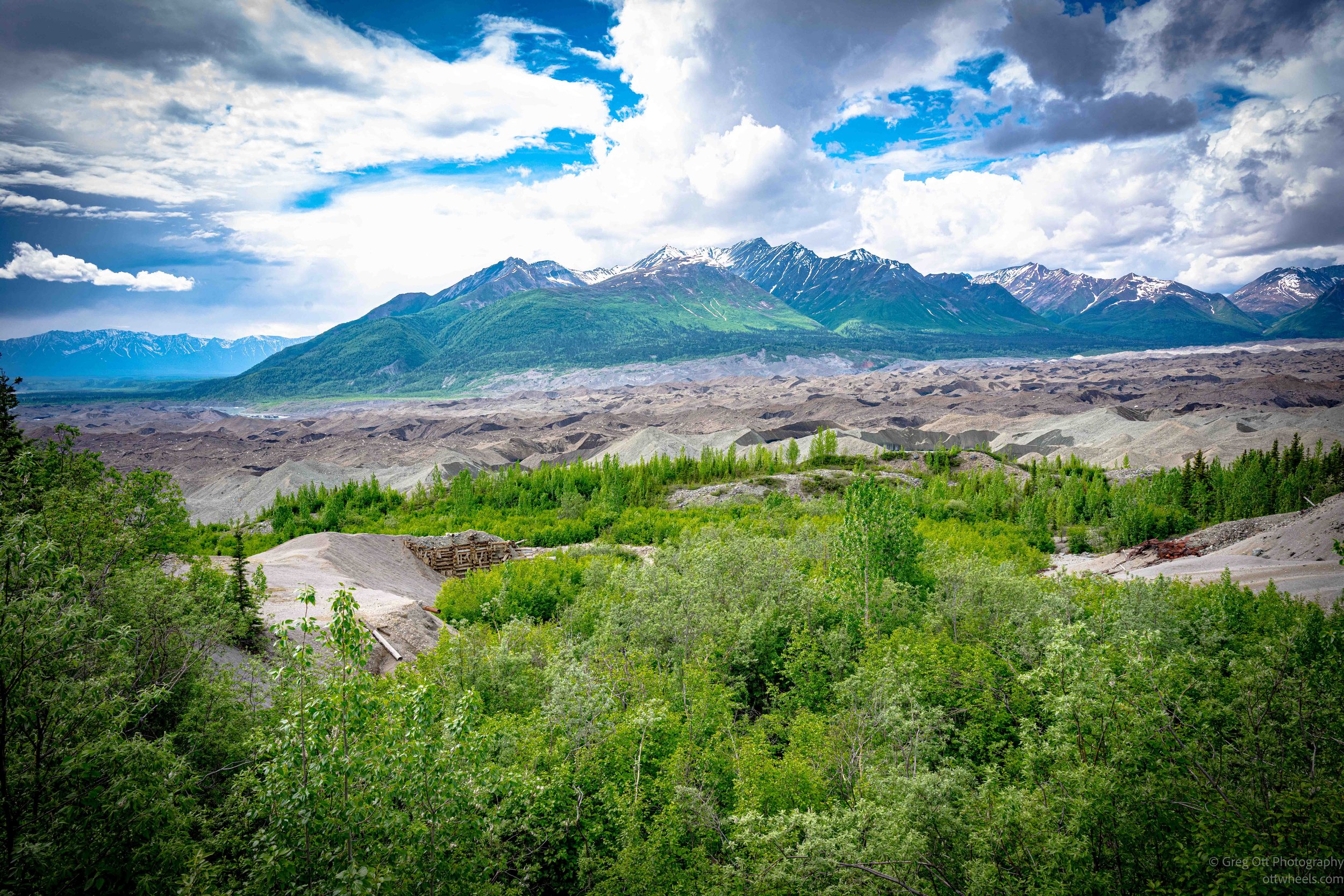
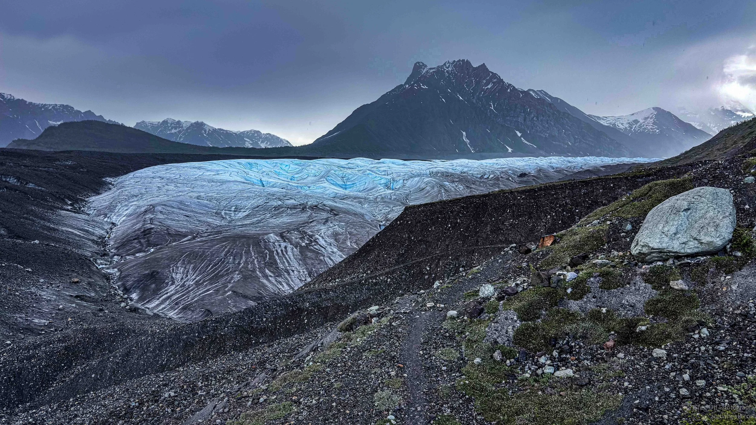
That changed the way I looked at the valley. What appeared at first to be dead gravel was really ice in disguise. Glaciers grind mountains into powder, carry rocks inside them, drag debris along their edges, and leave piles of moraine as they move and melt. Root Glacier and Kennicott Glacier are part of the huge glacial system in Wrangell-St. Elias, where ice has shaped almost everything. It carved the valleys, carried the rocks, buried the ice under dirt, and continues to change the landscape even when it looks still. In some places the glacier is obvious and blue-white. In others, it is hidden under rock, moving and melting quietly beneath what looks like solid ground.
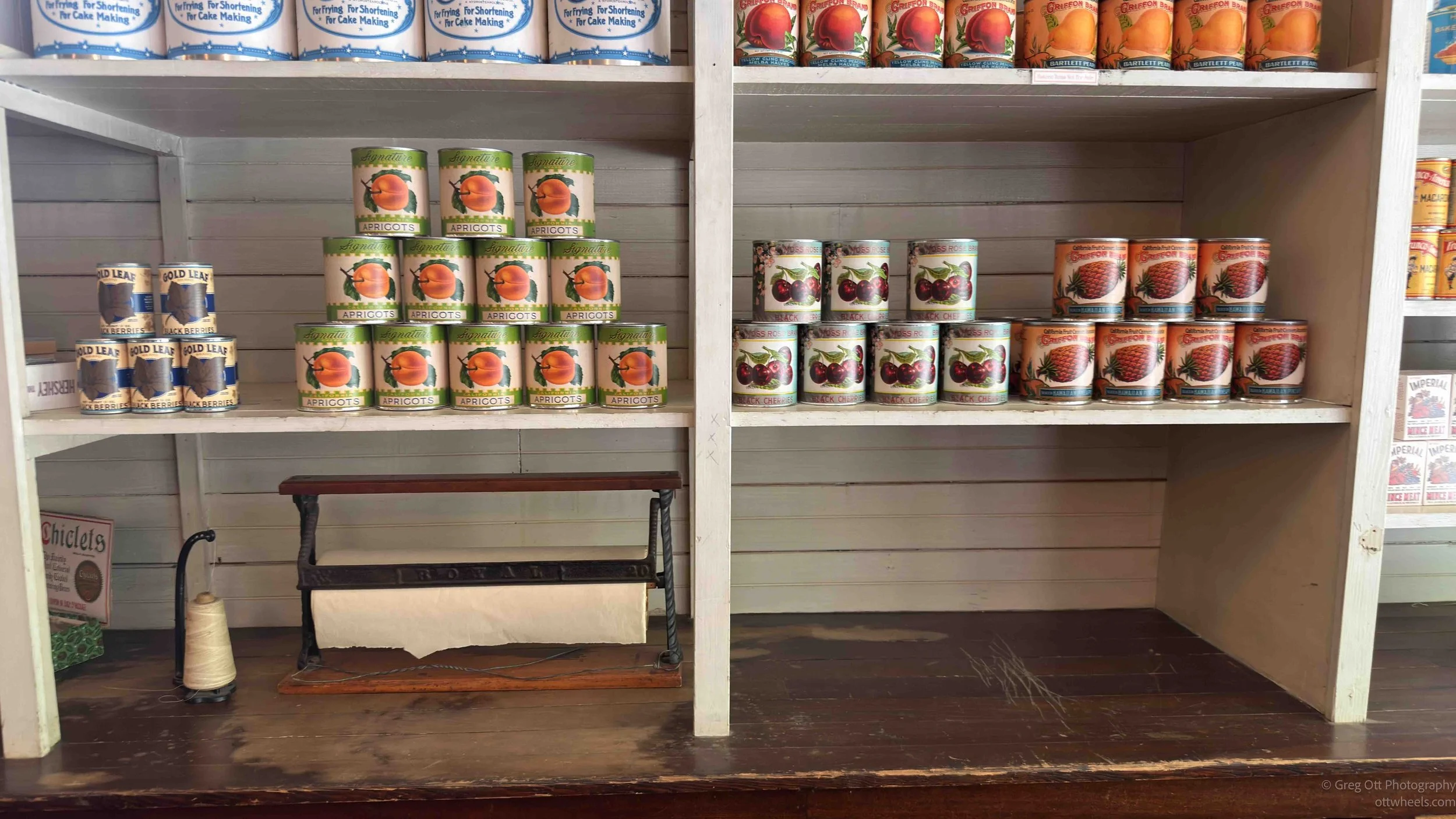
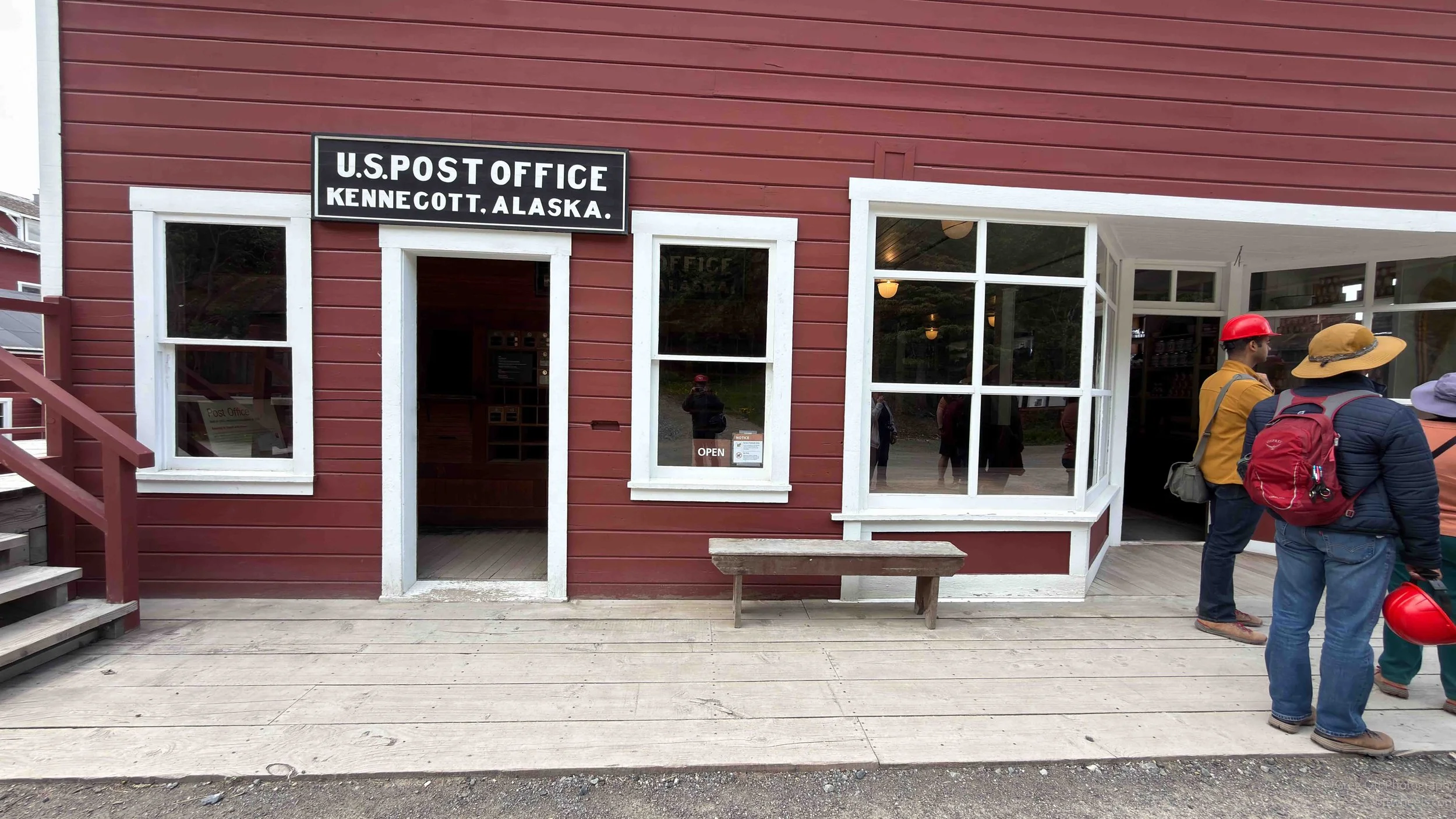
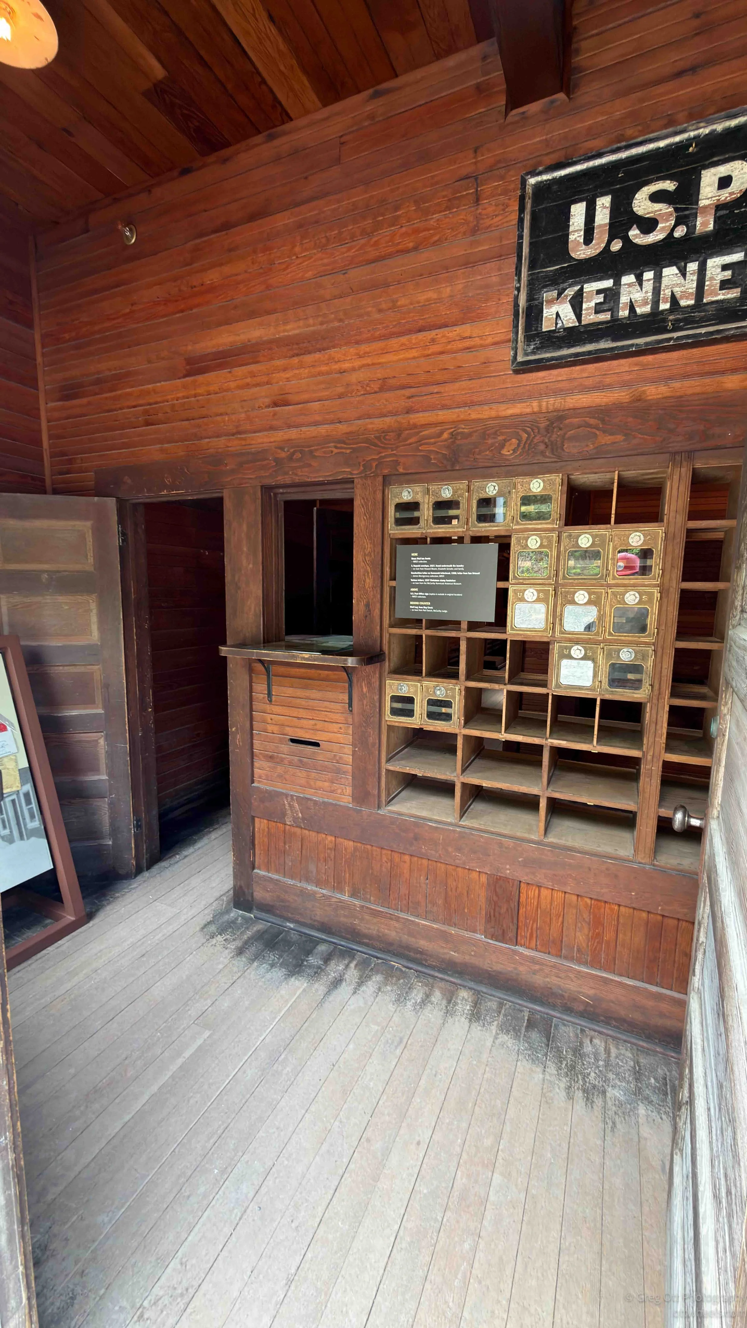
We stopped at the post office and supply store. Like other mining towns I have visited from this period, Kennecott had its own company money. That made it harder to take your earnings and leave. Converting it to dollars was difficult, and the exchange rate was prohibitive. Workers had to pay for room and supplies, and leaving by train could cost more than half a year’s wages. Men were paid, but not in a way that gave them much freedom. It was not technically slavery, but it had the same familiar smell: a system designed so the people doing the hard work could never quite get out.

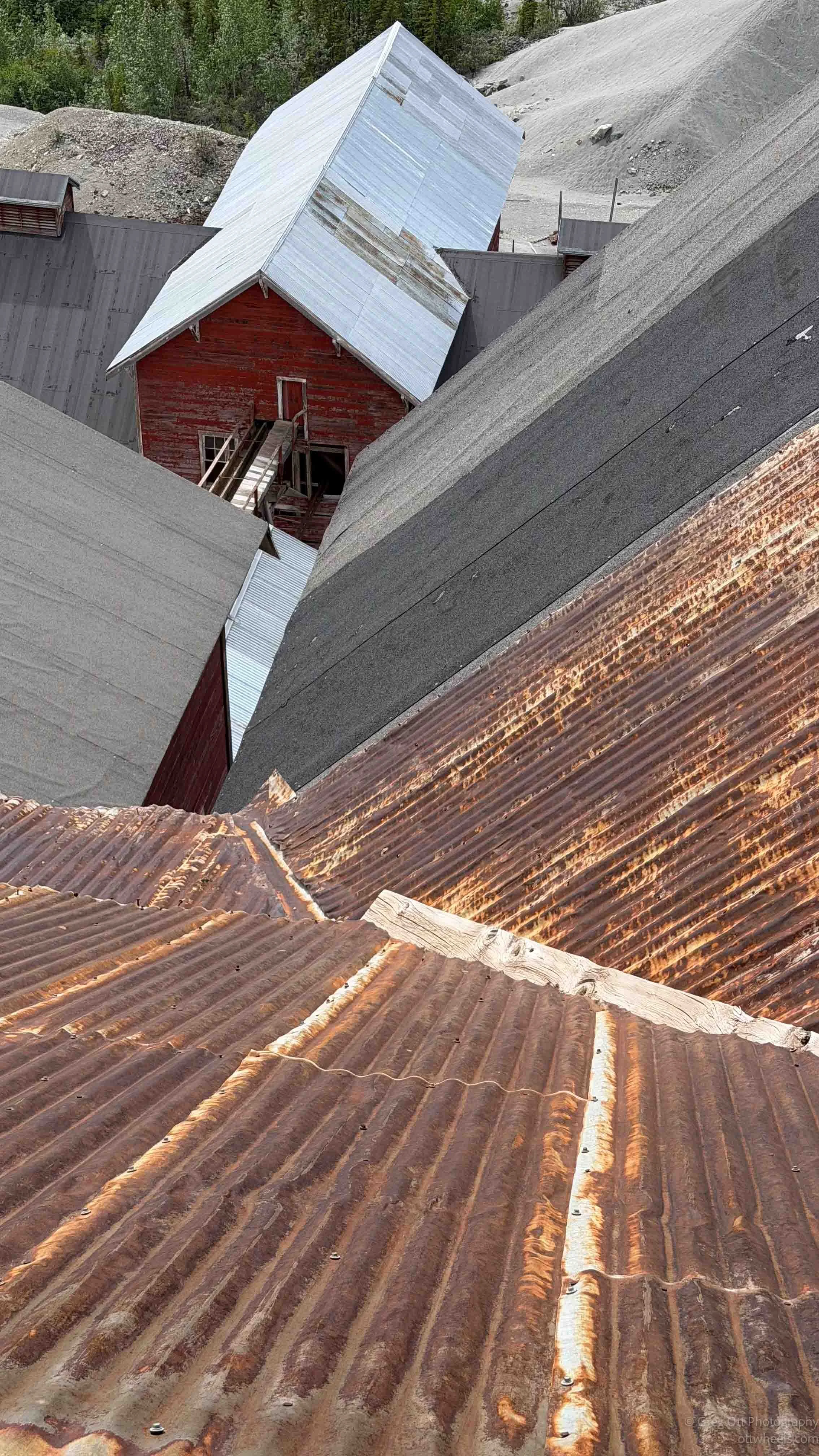
Most of the buildings were painted red because red paint was the cheapest. That detail tells you almost everything. Even in a place that generated enormous wealth, the buildings were painted the cheapest color because everything here was about reducing costs. If a decision saved money, that was usually the decision.
A little farther on, we began crossing the bridge toward the mill. To our right were two buildings separated by National Creek. One was red, and workers were allowed in red buildings. The other was white, and workers were generally not allowed in white buildings, except this white building was the hospital. It had been one of the best hospitals in Alaska at the time, even equipped with an X-ray machine. Workers were taken there when things got bad, but not necessarily because the company cared deeply about their well-being. Injured workers needed to be repaired and returned to work. That was the business case for a good hospital.
Locals eventually learned about the hospital and began coming there for treatment. That created a dilemma for the company. On the one hand, helping local people cost money and brought outsiders into a company-controlled space. On the other hand, refusing care in a remote place like this would have been hard to defend, even then. So the hospital became one of the strange contradictions of Kennecott: a white building separated from the workers, built for efficiency and control, but also providing real medical care in a region where options were limited.
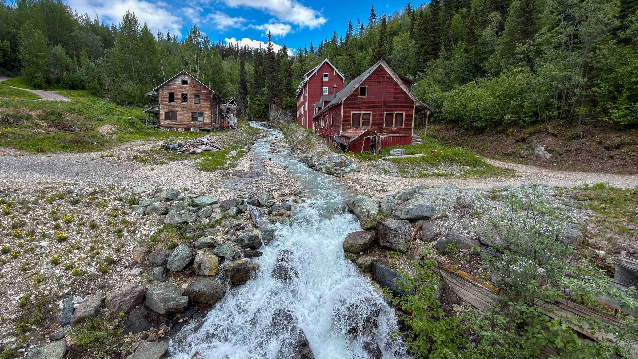
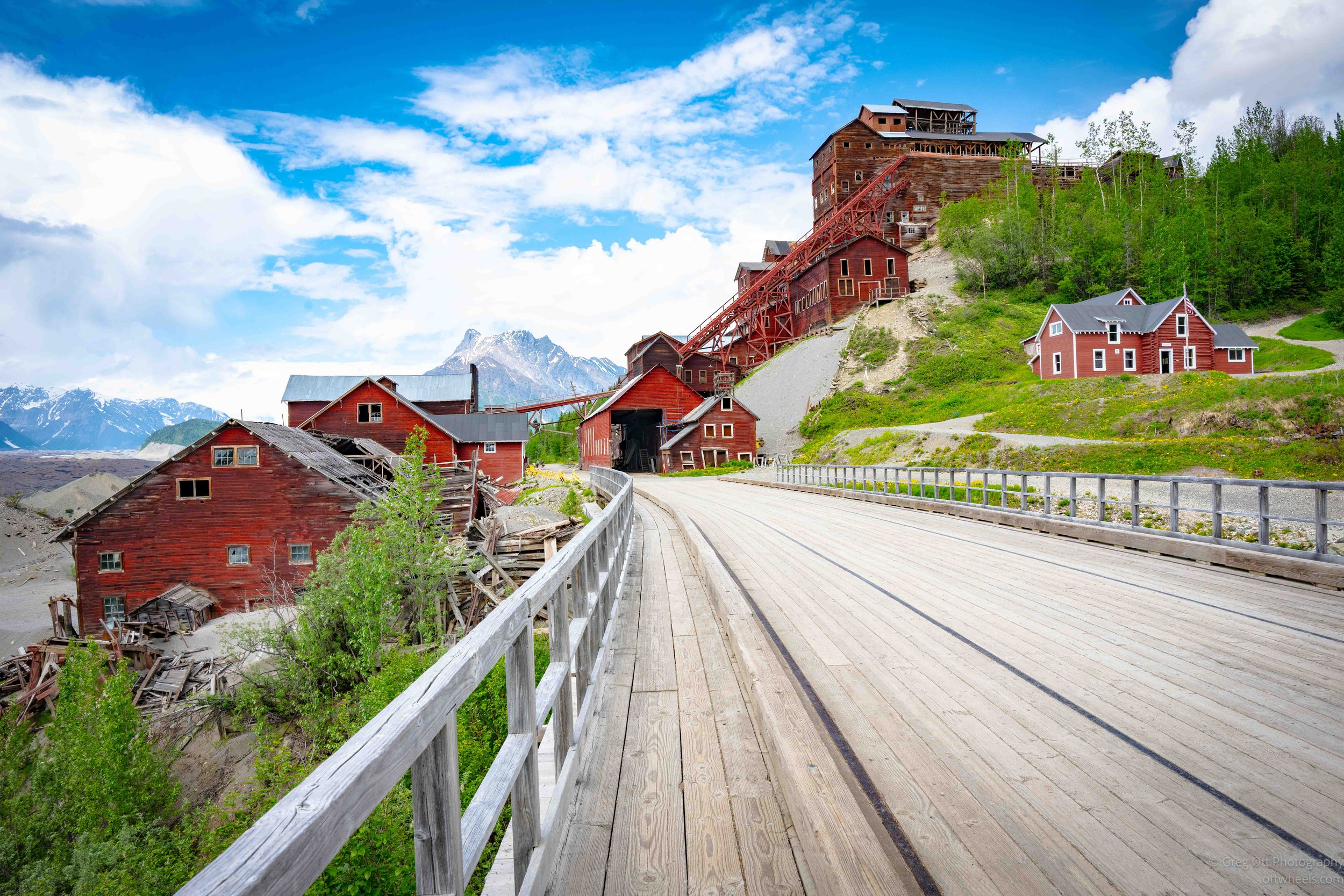
National Creek looks small now, but it has been one of the most powerful forces shaping what visitors see today. In October 2006, a major Pacific storm dropped more than four inches of rain on an already saturated area. National Creek jumped its banks, shifted its channel, destroyed the historic Assay Office, heavily damaged the hospital and bunkhouses, and damaged the railroad trestle so badly it had to be demolished. The trestle visitors cross today is a reconstruction, completed by the National Park Service in 2009. That creek is not just scenery. It changed the historic district.
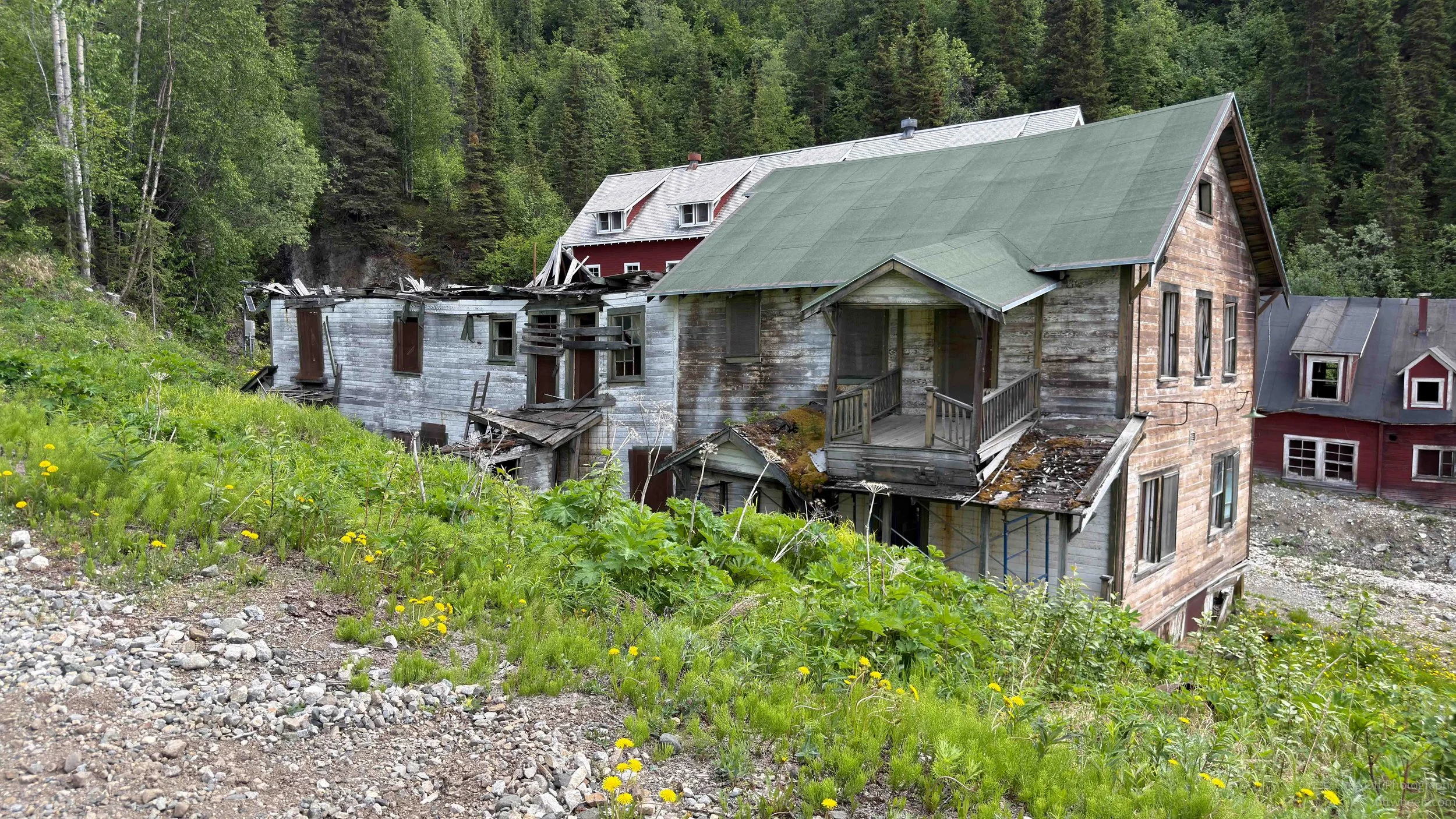
The problem had been building for a long time. During mining operations, a log dam impounded water for the mill. After Kennecott was abandoned in 1938, no one maintained the dam. Rock and gravel from above filled it, and eventually the creek shifted north toward the buildings. When the dam failed, all that material moved downstream. The National Park Service later worked with engineers, architects, and local crews to stabilize the channel with rock and timber cribbing, using methods that fit the historic character of the site. Some buildings have been repaired. Others, including the hospital and National Creek Bunkhouse, are being preserved as ruins. That seemed right. Not everything can be restored, and some places tell the truth better as ruins.
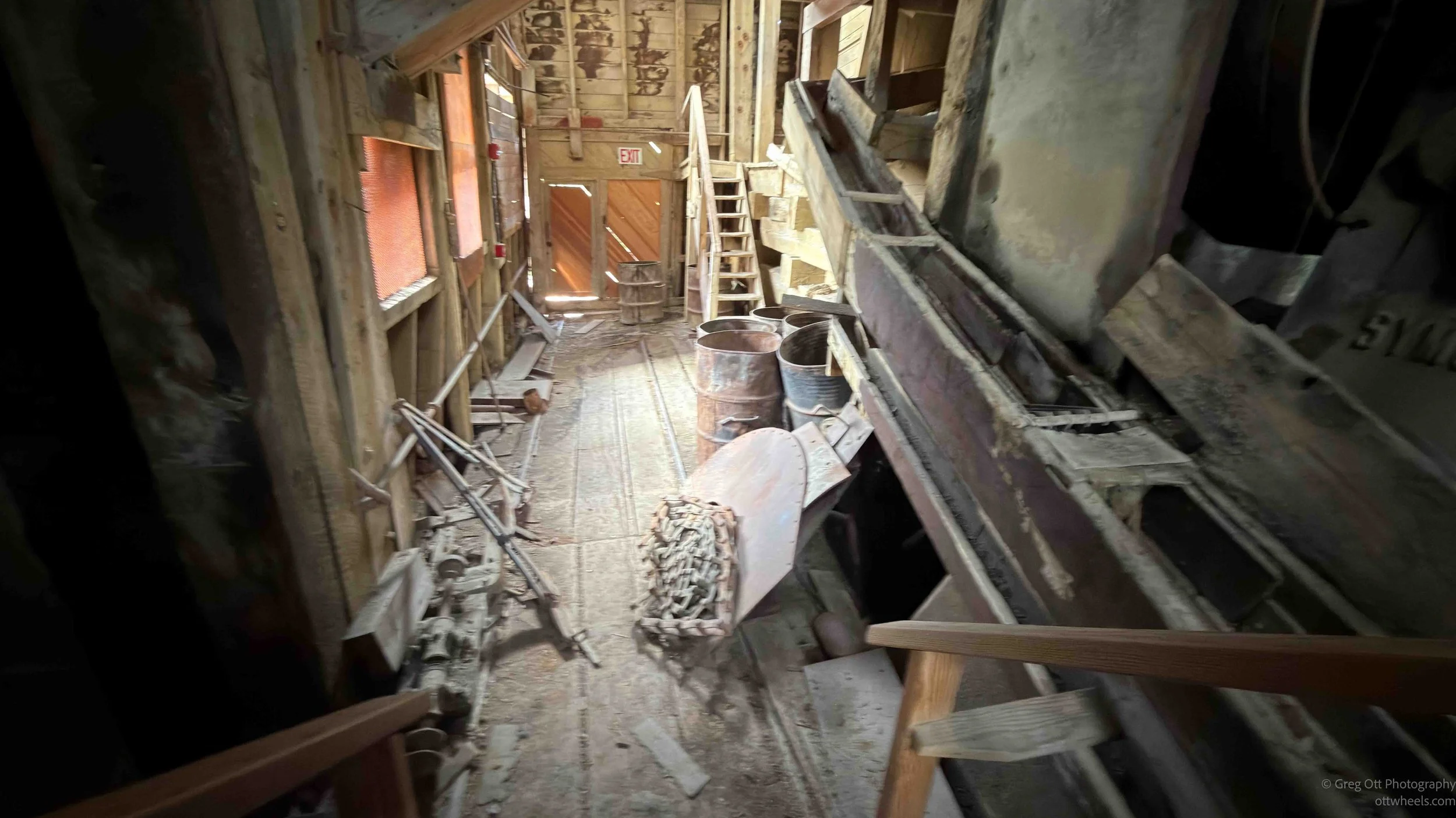
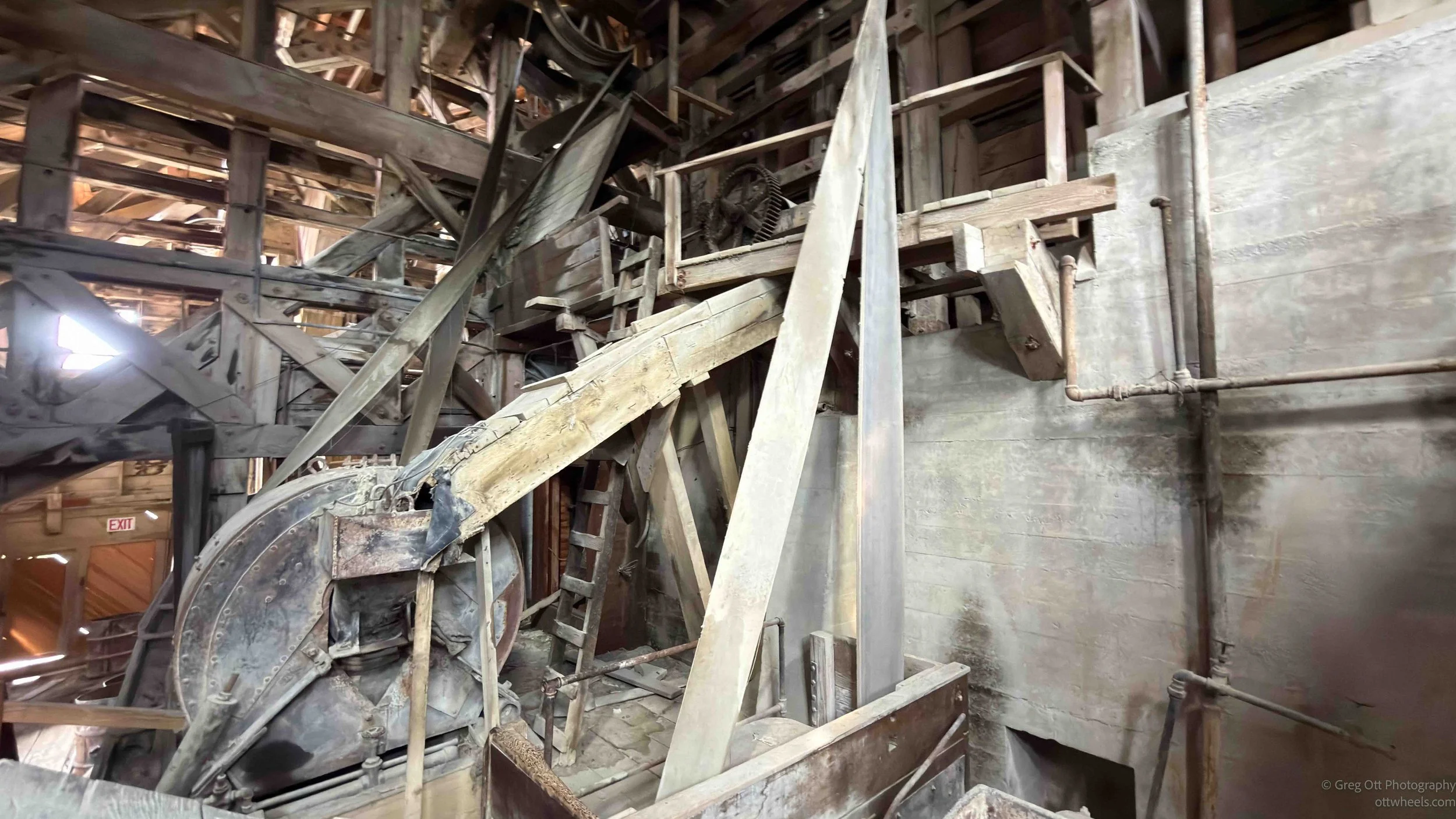
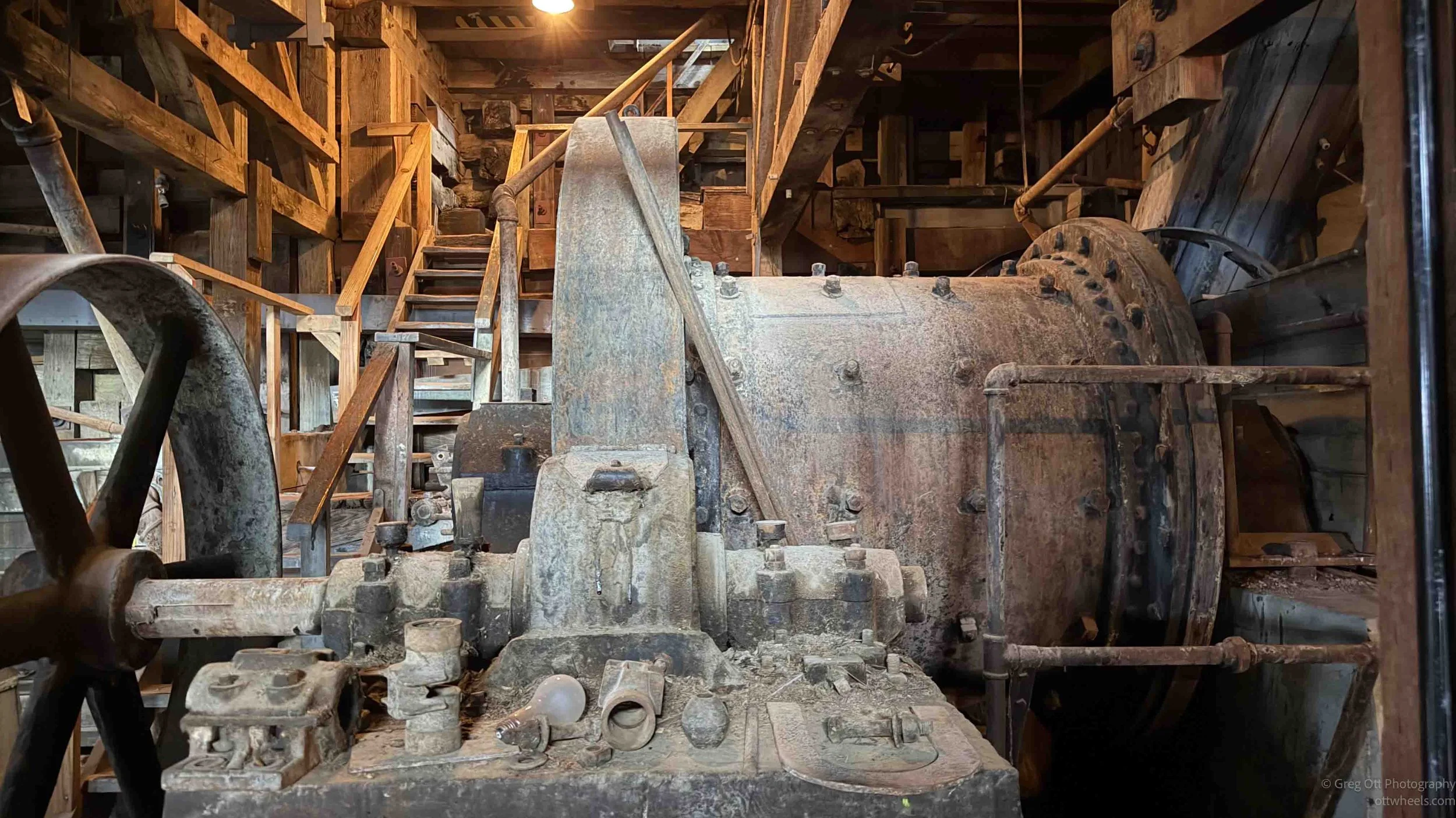
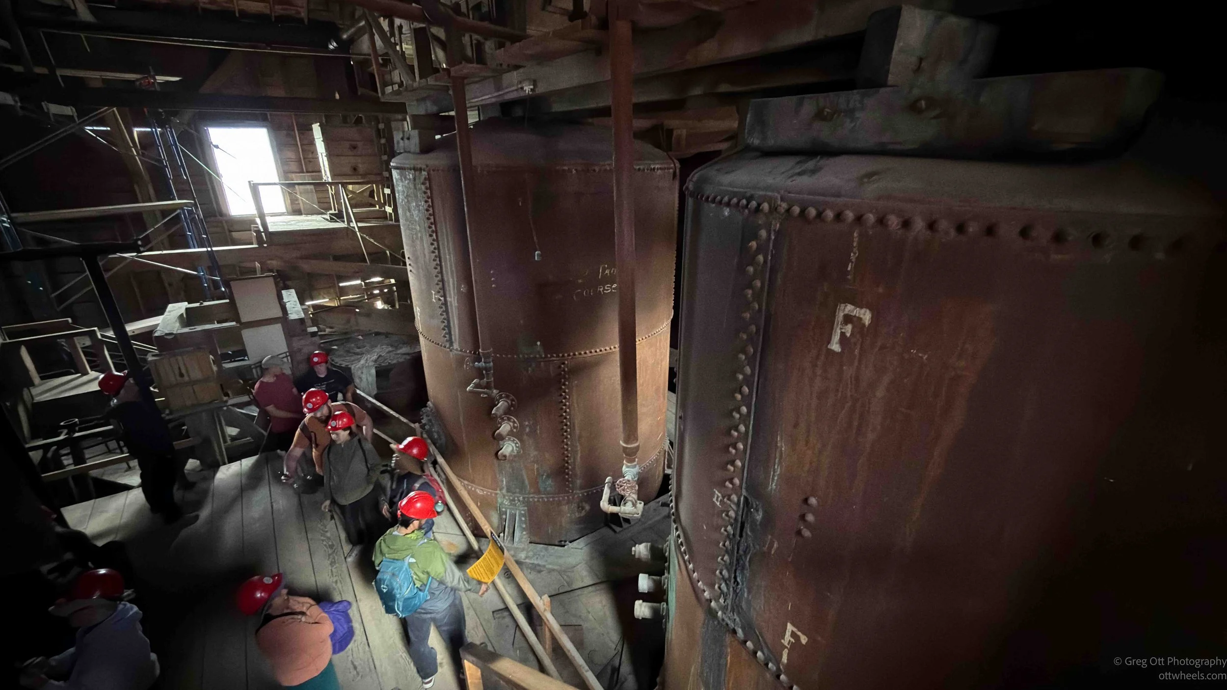
We hiked to the top of the mill. Several people commented that they were glad certain family members had not joined the tour because they never would have made it up the hill. At the top, we saw the cables that once brought ore down from the mines five miles away. The tram system was above us, and the whole operation was designed around gravity. Loaded ore buckets came down from the mines, and the weight of that ore helped pull the empty buckets back up. There were no motors doing all the work. The load had to be maintained or the system would stop. The mine and mill had to function continuously, every day, all day.
One of the most fascinating parts of the tour was seeing how the National Park Service stabilized the mill building for tours. This is a structure that had been abandoned, falling apart, and dismantled by locals who needed building supplies for decades. It was structurally unsafe. From certain angles it still looks as if it might implode. Yet inside, the supports added during preservation work have stabilized the building while still allowing it to feel like the original place. It does not feel polished or fake. It feels held together just enough to let you walk through the story.


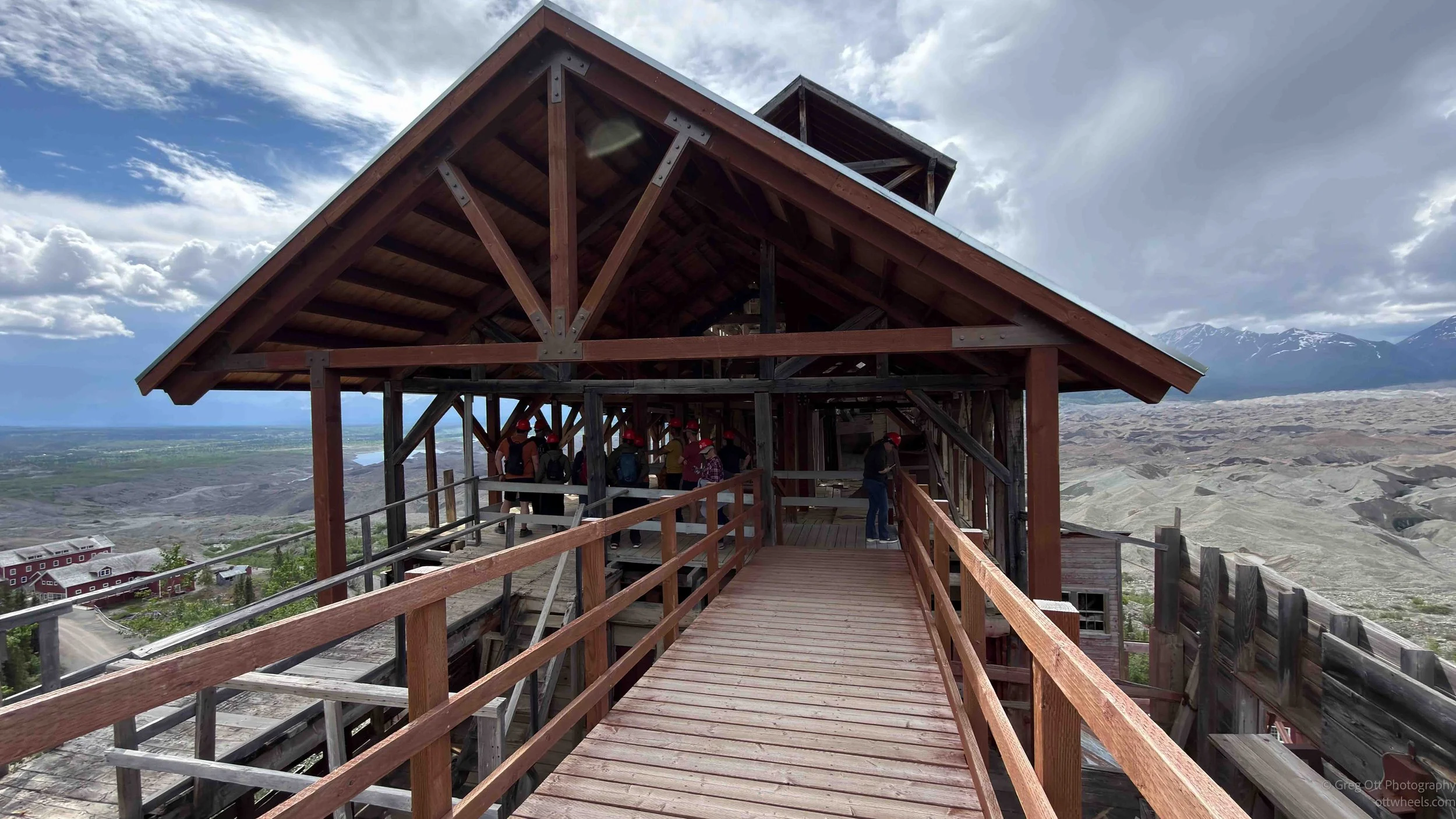
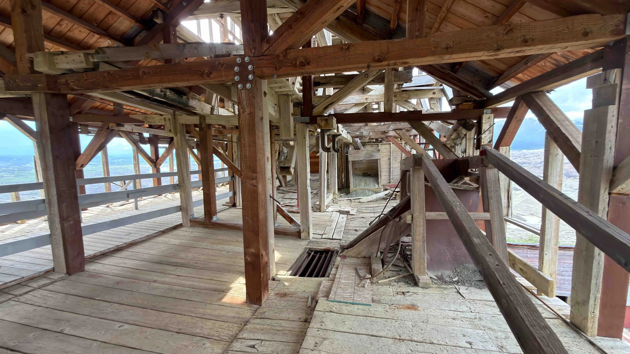
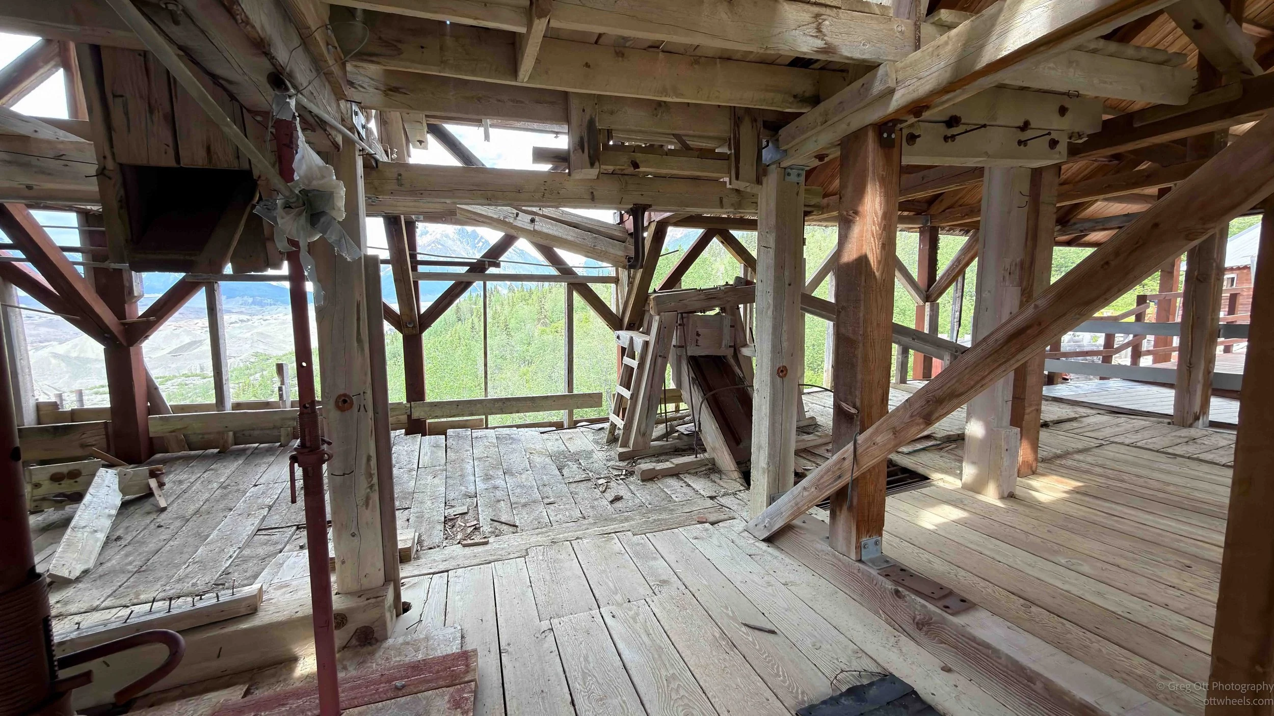
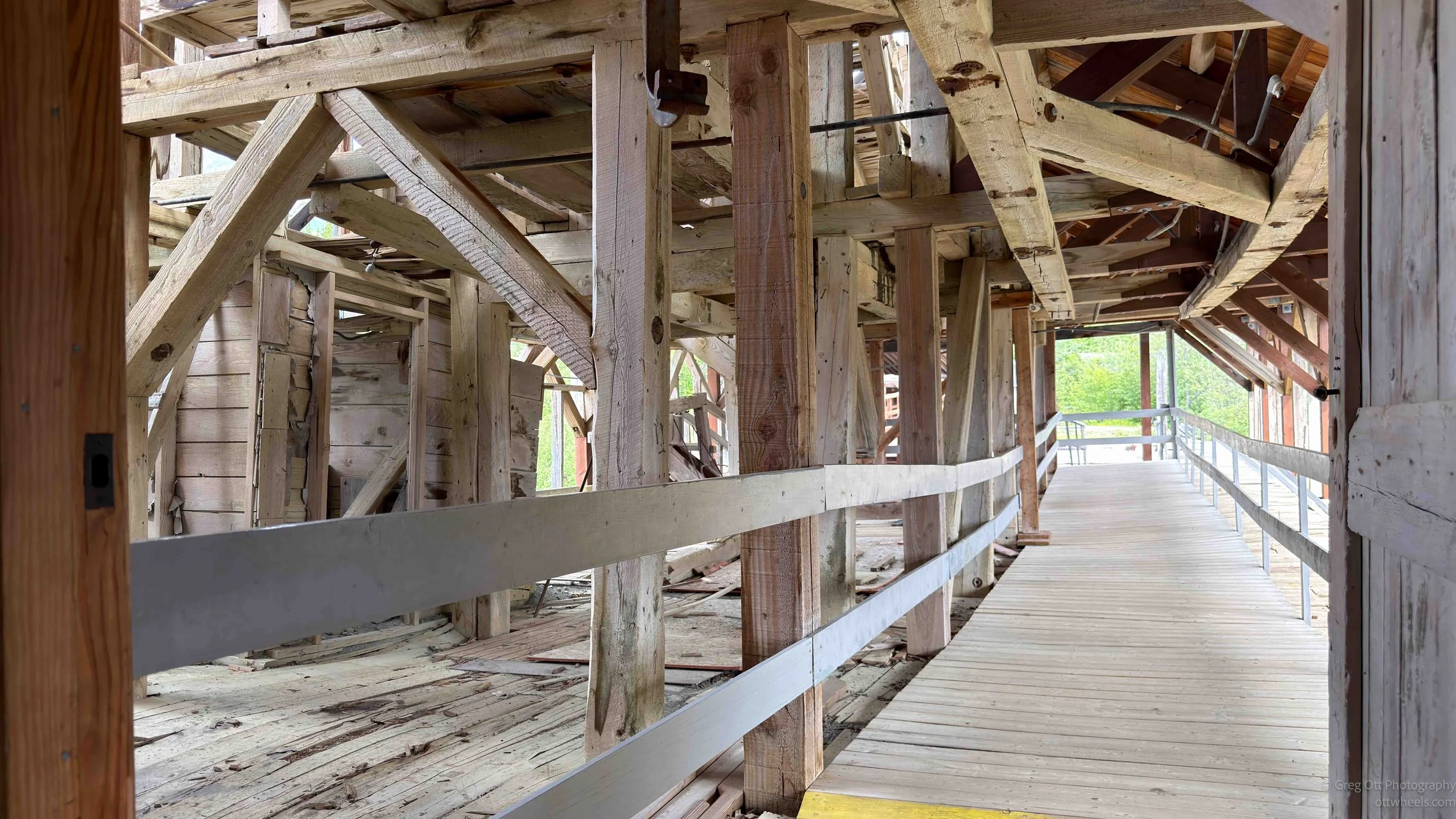
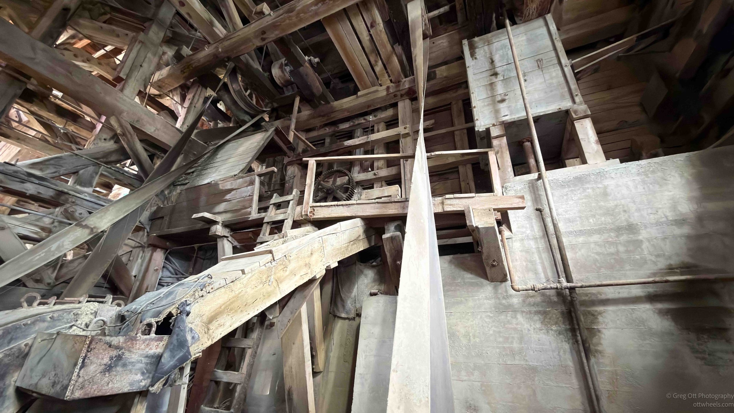
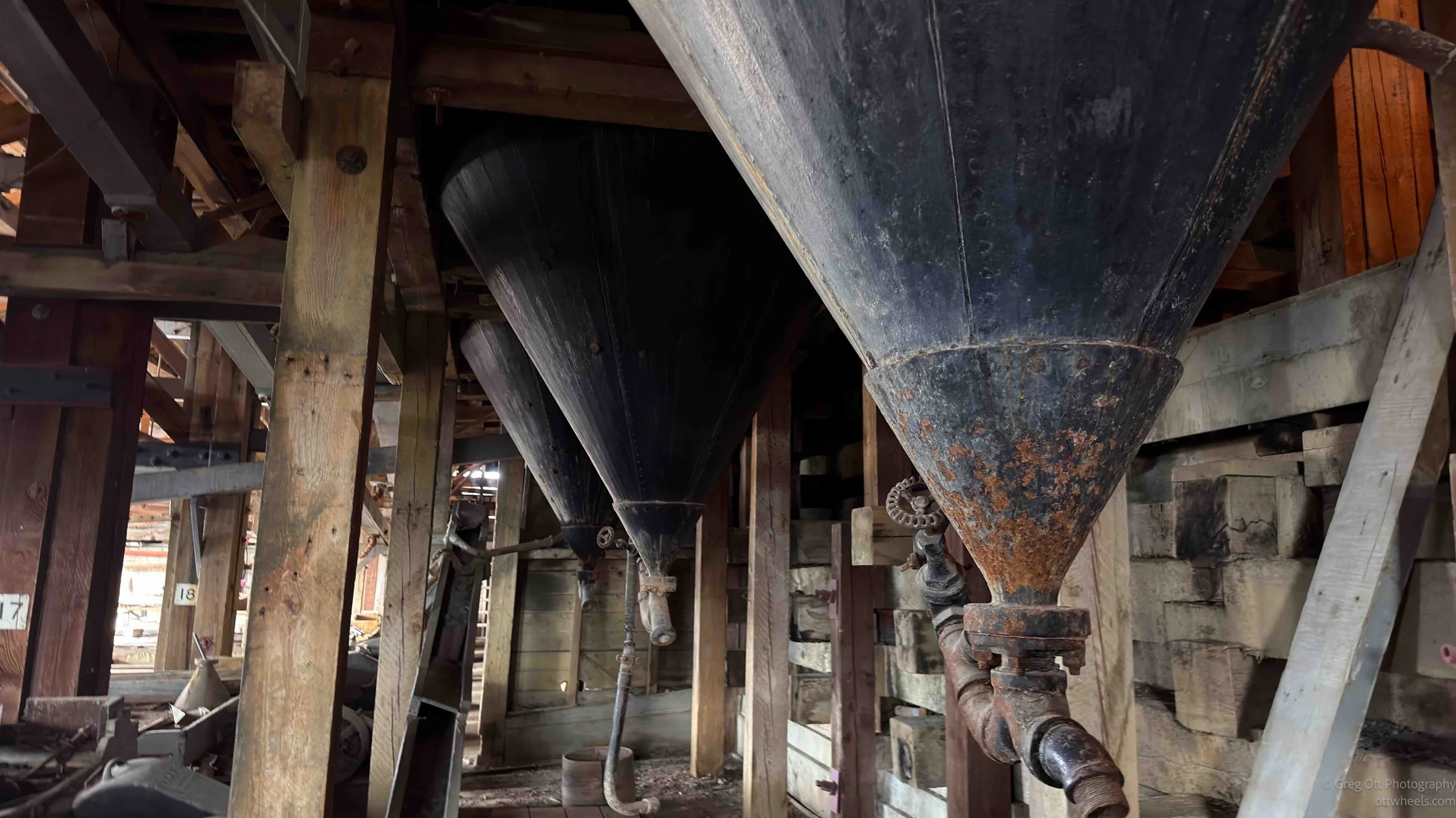
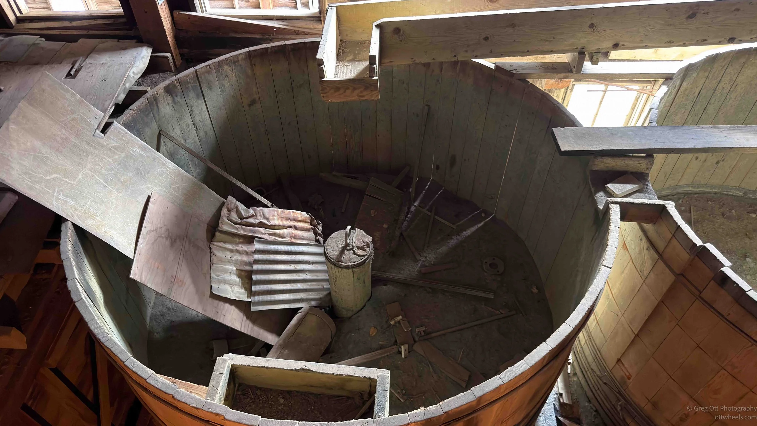
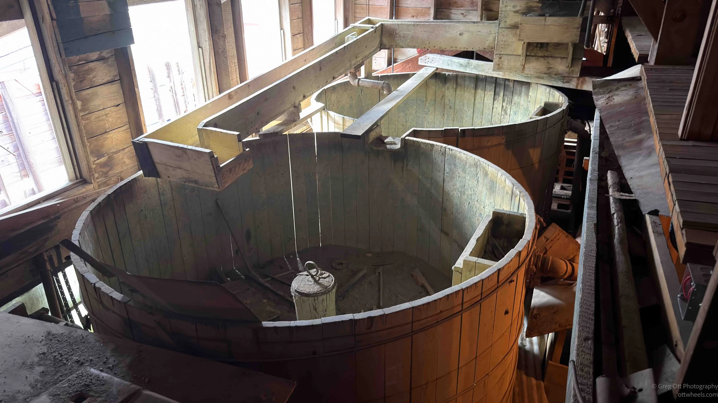
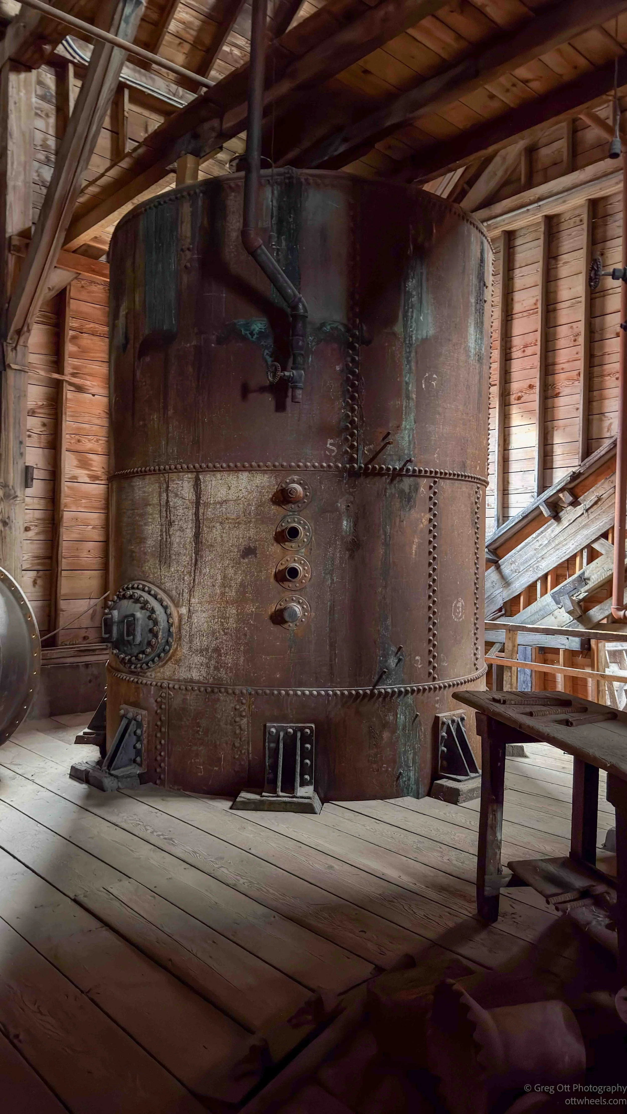
The mill itself is a 14-story wooden machine built into the mountainside. Ore entered near the top and moved downward through crushers, chutes, bins, separators, leaching tanks, and flotation equipment. Gravity did much of the moving. Water carried the crushed ore. Machines shook, sorted, crushed, and separated. When the mill was operating, it must have been brutally loud. The sound of rock breaking, machinery running, water moving, and men working in confined spaces would have filled the building. Today it creaks and echoes under tour groups. Back then it was a giant wooden industrial animal.

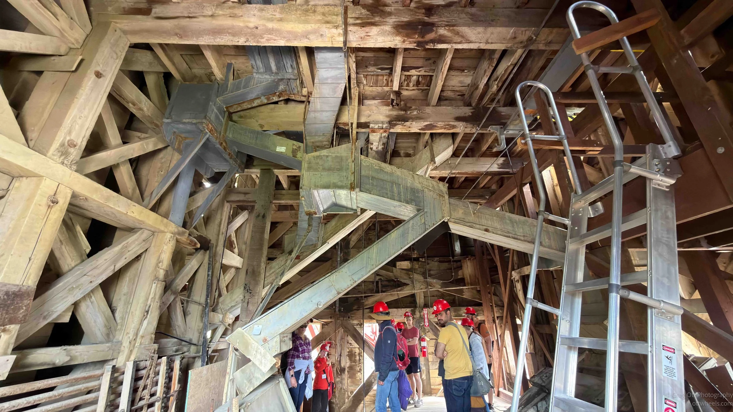
The guide explained the crushers and separators as we moved down through the building. One of the machines was a Symons Disc Crusher, and she told us she has to slow down and articulate the name carefully because more than once she has accidentally said Symons Dick Crusher. Everyone laughed the woman more so. It was one of those moments that made the place feel human again. You are standing in a building connected to greed, danger, engineering, and environmental damage, and then someone has to carefully say “disc crusher” in front of a tour group.
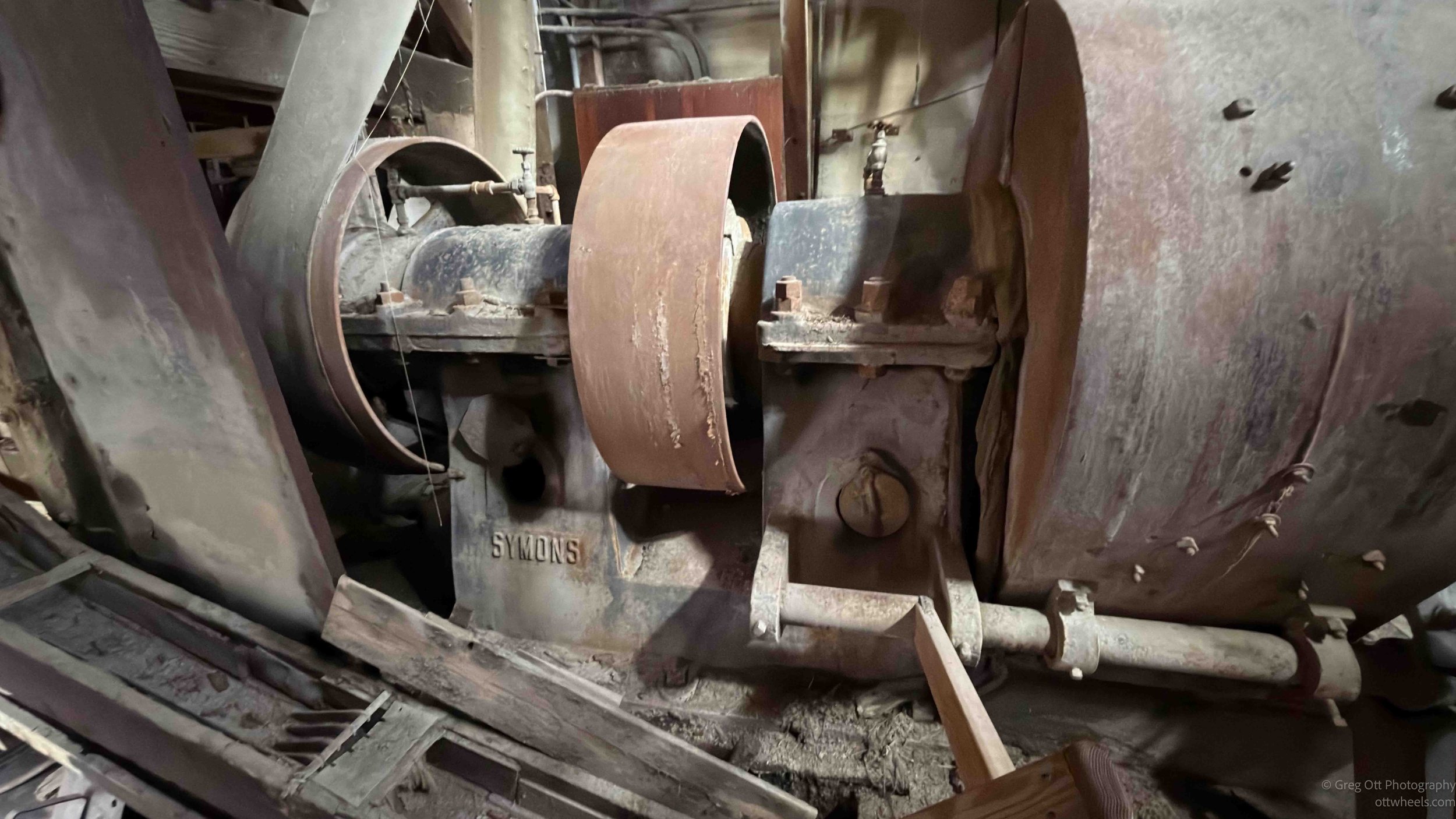

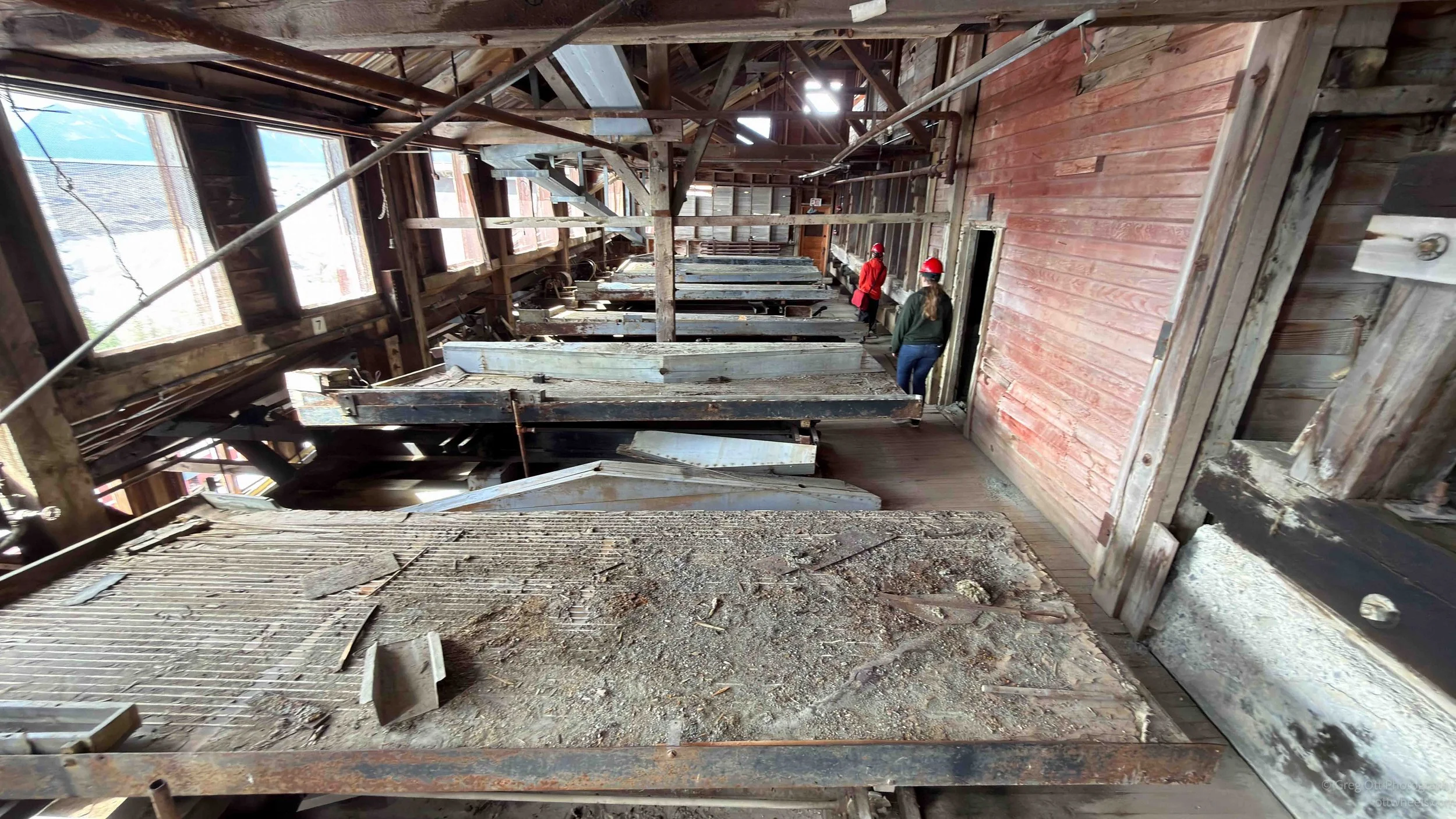
The mill used several methods to extract copper from the rock. Larger pieces were crushed and sorted. The heavier copper-bearing material could be separated from waste rock using gravity tables and water. Finer material went through chemical and flotation processes. Near the end of the tour, the guide explained that tanks using ammonia helped pull remaining copper from the ore. Flotation also allowed tiny particles of copper to attach to bubbles and be collected. The mill was extraordinarily efficient. We were told it recovered about 95 percent of the copper from the ore, which is remarkable for the time.
They also discovered that some of the waste rock still contained valuable silver. The guide said eucalyptus oil was used in the process to recover it. Workers had to haul rock back up so it could be reprocessed, and the company made millions from that discovery. Even the leftovers had leftovers worth extracting. Kennecott was not just a mine. It was a system for finding value in every scrap of material and then turning that value into money for people far away from the men doing the lifting.
The mill closed in 1938 because the richest ore was gone and the operation was no longer worth running. Once the profit disappeared, so did the company. The buildings were left behind. The workers moved on or were forced to move on. The town emptied out, and the weather took over. Decades later, the National Park Service acquired many of the significant buildings and lands in 1998 and began the long process of preserving what remained.
From a certain angle, the mill has a sinister look to it, and that may be why I found it so compelling to photograph. It captures the tortured labor that went on here. The owner class did not care about the people in any meaningful sense. The point was copper, efficiency, profit, and more profit. Standing at the base of the Kennecott Mill, I was struck by how little sky remained visible. The structure seemed to rise in every direction, a maze of buildings, conveyors, chutes, and workspaces stacked onto the mountainside.
Historic photographs often show the mill from a distance against the Wrangell Mountains. That version can look almost beautiful, a red building in a dramatic landscape. Standing beneath it is different. From below, the mill blocks the sky and feels heavy. I kept thinking about the workers who spent their days inside this enormous machine, surrounded by noise, dust, vibration, and danger, in a place they could not easily leave.
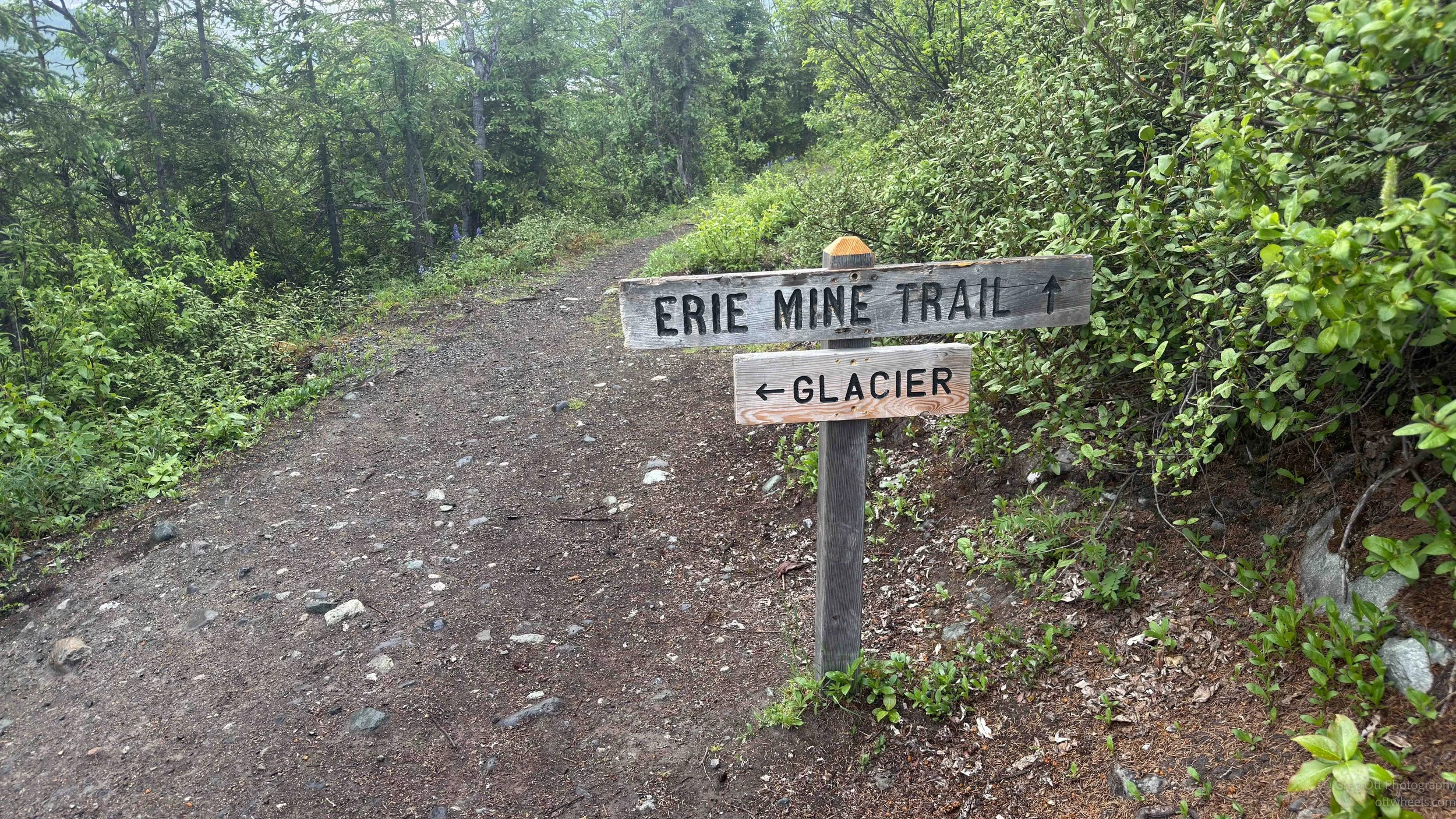
After the mill tour, I wanted to hike toward Root Glacier. Depending on how far you go, it is between one and two hours out. The trail is fairly level by Alaska standards, which is to say it is not flat, but it does not immediately try to kill you. Many people were coming the opposite direction. Some stopped to talk. One couple told me how difficult the trail was. “We’re from Indiana,” they said. “We don’t have anything like this.” Others, including families with kids, said it was easy.
I was surprised to see one family with three young boys who were not wearing shirts. I said I would be covered in mosquito bites. Their mother said, “I’m sure they’ve been bitten.”
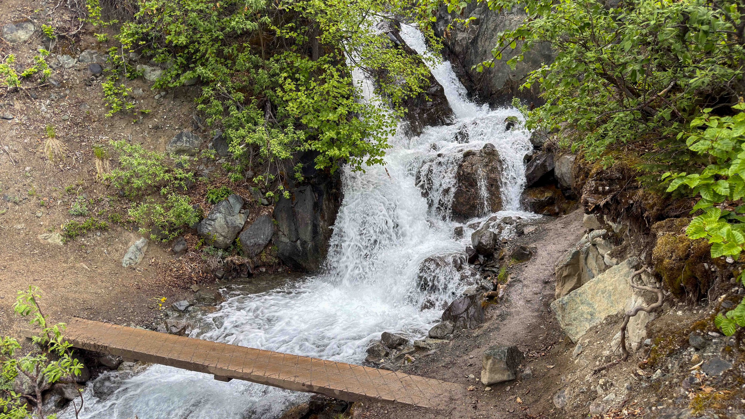
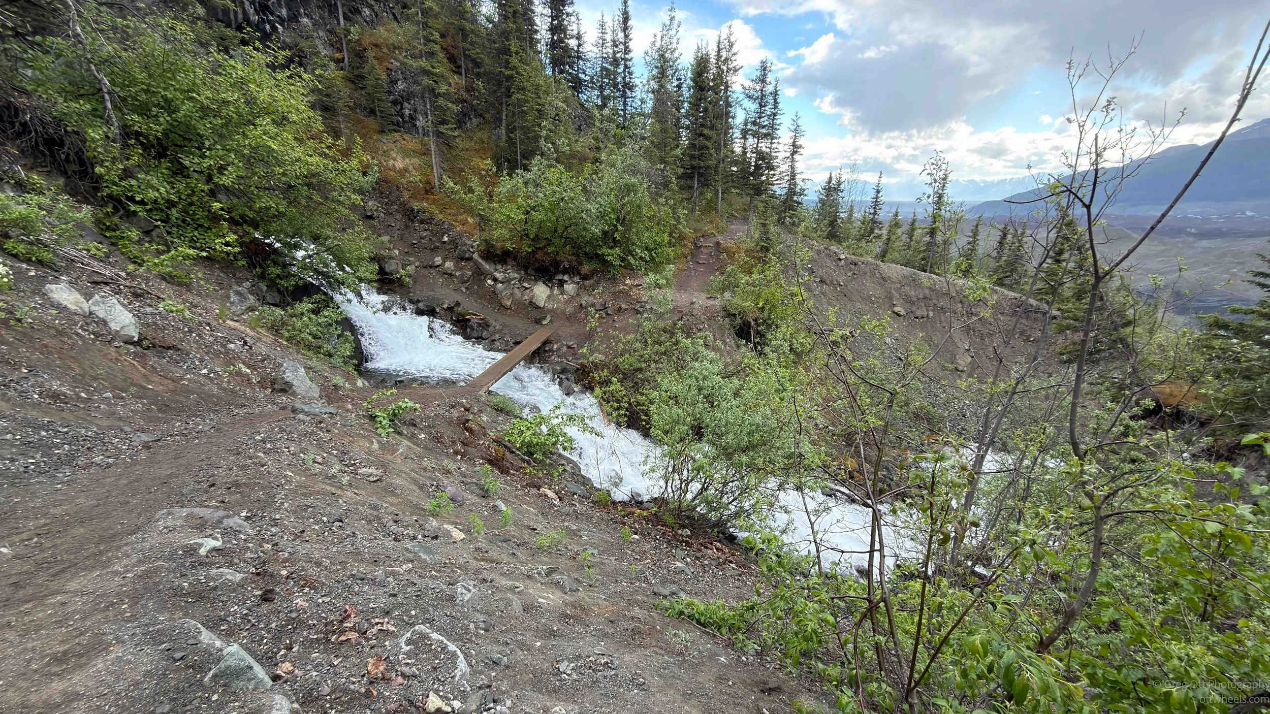
There was thunder and a light sprinkle as I hiked. I stopped and put on my raincoat just as two teenagers holding hands walked by and said hello. At the next waterfall, they were lying near the edge, drinking and splashing water.
About an hour in, I could see the glacier. I was standing on a ridge where a couple from Anchorage was setting up their tent for the night. The woman said there is almost never lightning in this area and she did not know what was going on. She was holding up the aluminum frame for the tent. I said, “You don’t want to hold that too high.” She laughed and said, “You’re right.” There were five tents set up along the ridge.
As I continued toward the glacier, I started wondering why the apps said it was two hours one way. Then I descended two switchbacks and the rain picked up. Ahead of me was another half mile of steep switchbacks dropping toward the glacier. I stopped, took it all in, and said to myself there was no benefit in going farther. I had already seen what I came to see, and the weather was not improving.
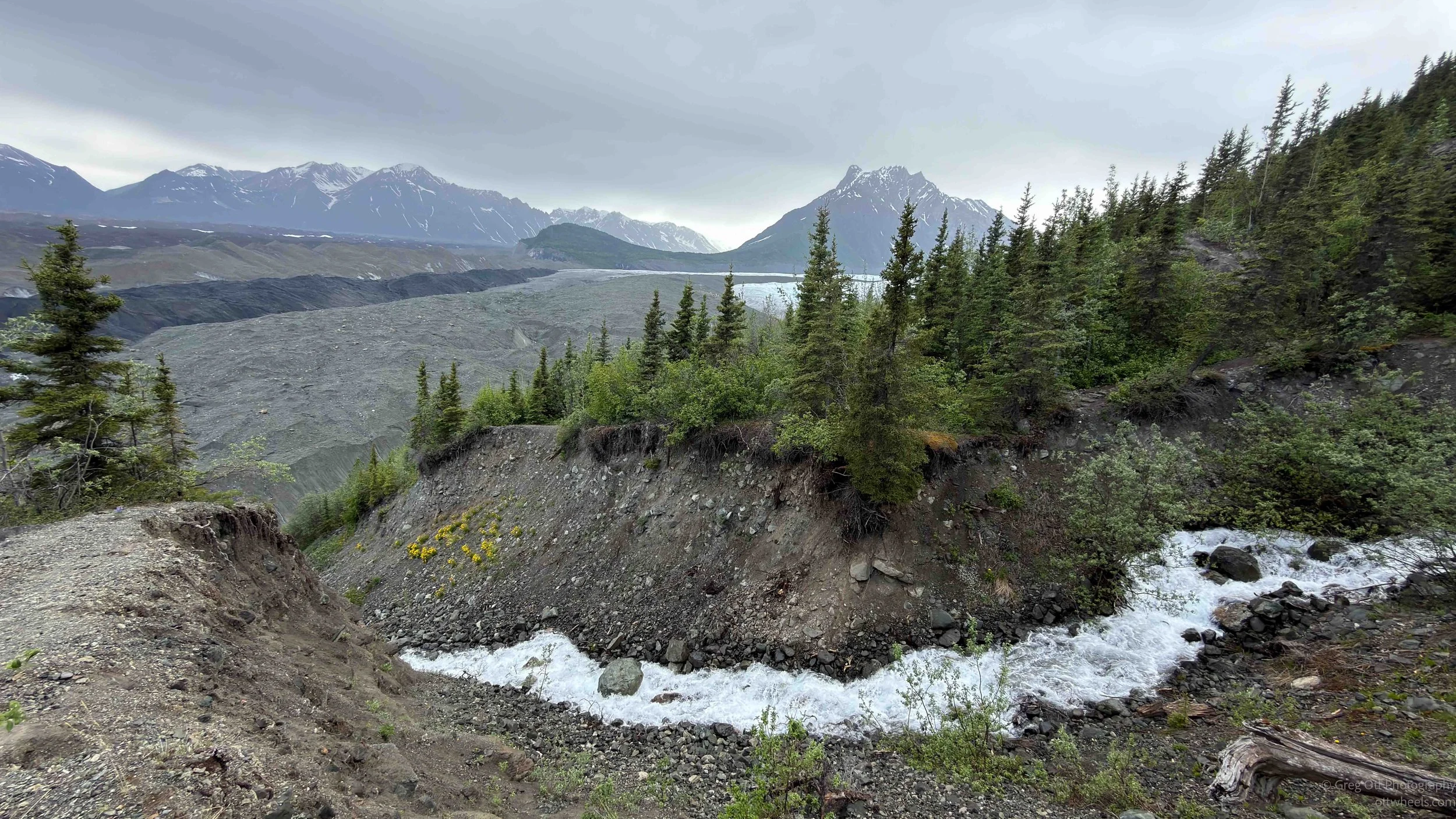
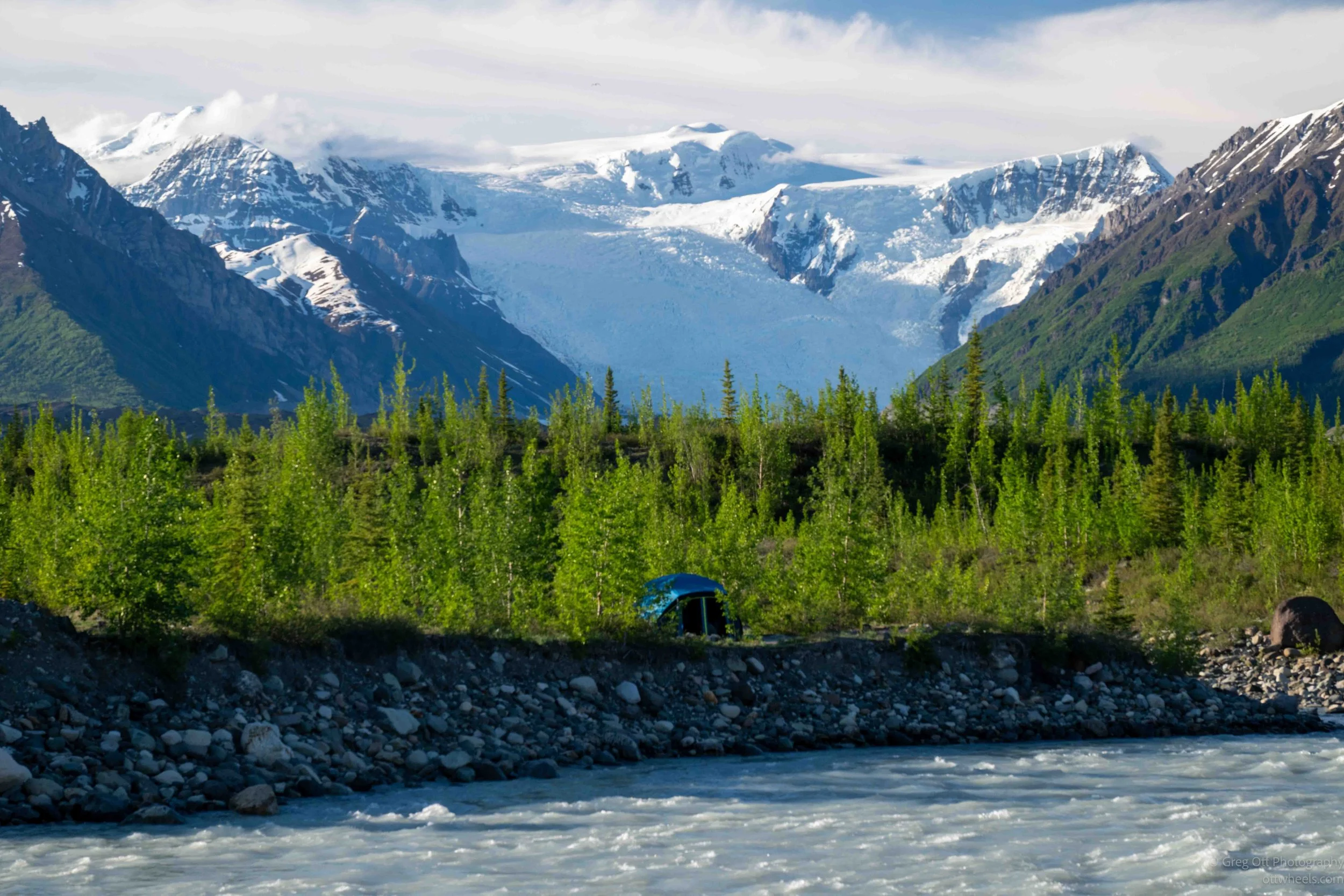
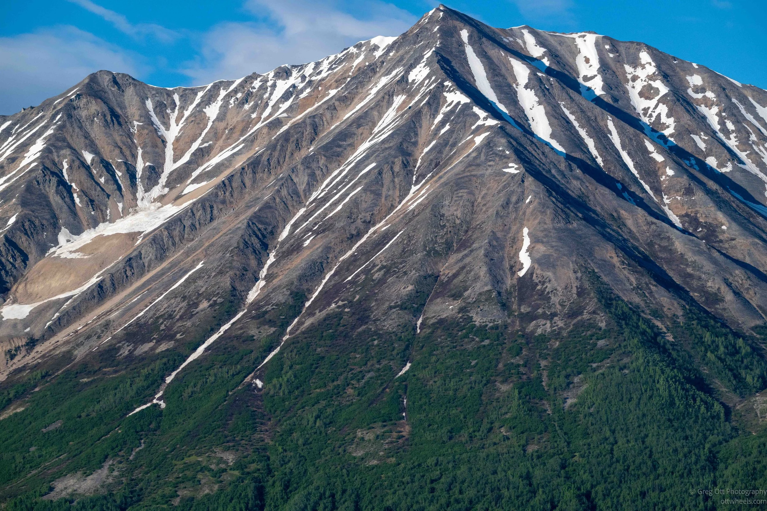
The glacier from that ridge was immense. It was not just a white tongue of ice. It was a whole landscape of ice, rock, water, and scale. Glaciers are strange because they can look frozen and dead from a distance, but they are constantly changing. Snow accumulates high in the mountains, compresses into ice, and begins to move under its own weight. As it moves, it grinds rock, carries debris, opens crevasses, melts, refreezes, and reshapes everything around it. The dirty ice and moraine can make parts of the glacier almost disappear into the landscape, but the white ice showing through gives it away.
Just as I was about to turn back, two backpackers came around the switchback below me, and I grabbed the camera. They were moving very slowly, but so was I, and I almost missed the shot. They were tiny against the glacier and the mountains, and that was what made the photograph work. The image showed just how massive everything is here. It would be another ten minutes before they reached me. I wanted to ask if they had stayed on the glacier the night before, but I never got the chance.

I headed back as the rain got heavier. The thunder and lightning had stopped, and I could see blue sky farther up the trail. By the time I reached the tents again, the rain had stopped there too and was moving down the valley in the opposite direction.
I picked up my pace on the way back but still stopped for a few photos. I made it back at 5:45 for the 6 p.m. shuttle. A group of people was sitting near the tour office, and I asked if they were waiting for the bus. They were. We talked about the hike to the glacier, though I did not remember seeing any of them on the trail. It was the usual travel conversation: where are you from, oh I know Boulder, what do you do, how long have you been here.

A few minutes before six, the guide came out and asked if I had done a tour with them. I had. I gave her my name and followed her inside. Yes, I had done the mill tour, but not the glacier tour. Then I showed her my van ride band, and she told me my van was on the other side of the NPS building. It was now 6:05, and I ran to the van. It was completely full, with no seats left, but the driver said I could stand in the back. Did I mind standing? Not at all.
There were two young women already standing in the back. We had talked earlier on the trail. One was carrying several nice cameras. One worked for the Alaska government in Anchorage on curriculum throughout the state. The other was an engineer with an electrical cooperative in central Alaska. They were fun to talk with and had plenty of travel stories.
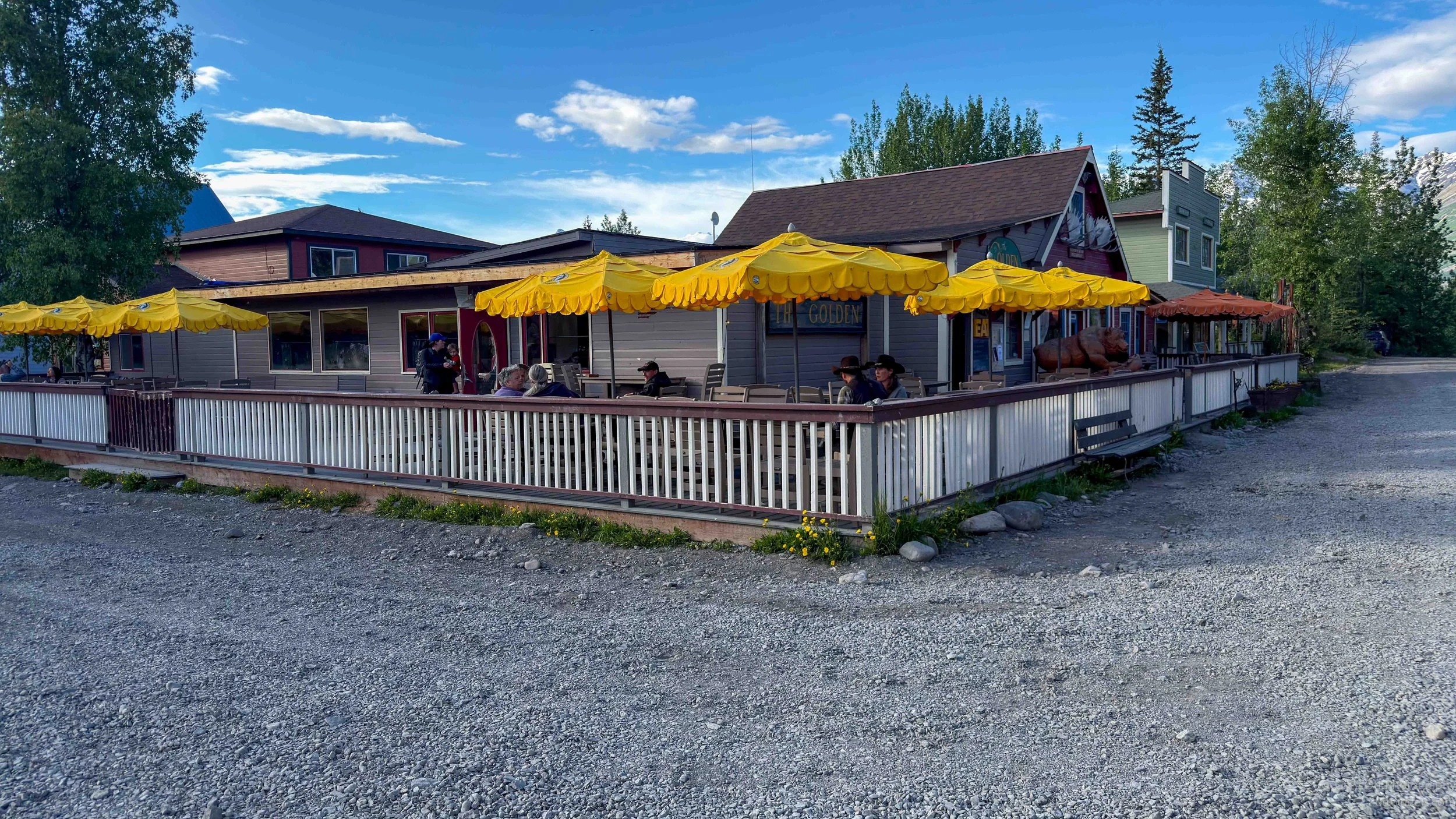
Back at the general store, I asked the driver about eating. She gave me the restaurant options and recommended The Golden Saloon. I was seated by a man with a South American accent and asked if he was related to the woman driving the bus. He said yes, she was his wife. I told him she was very nice and helpful. He said, “Yes, and she is pretty too.” Then he added, “She’s a special person. That’s why I married her.”
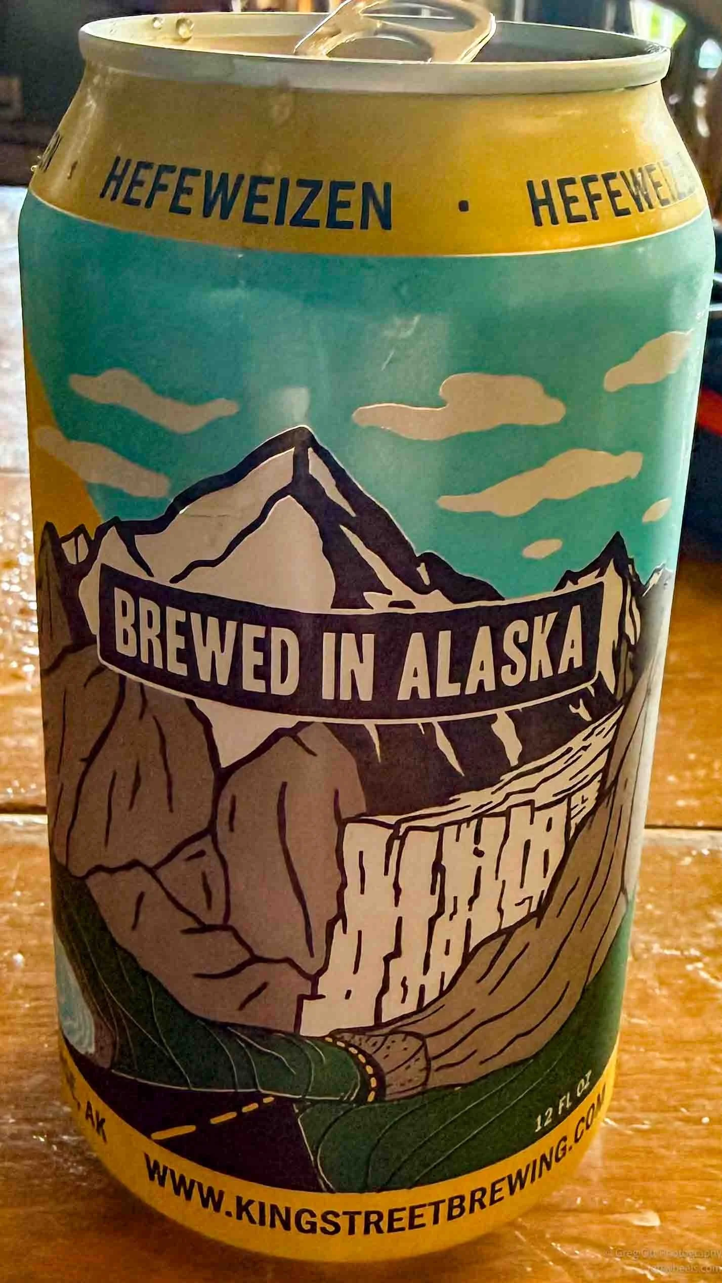
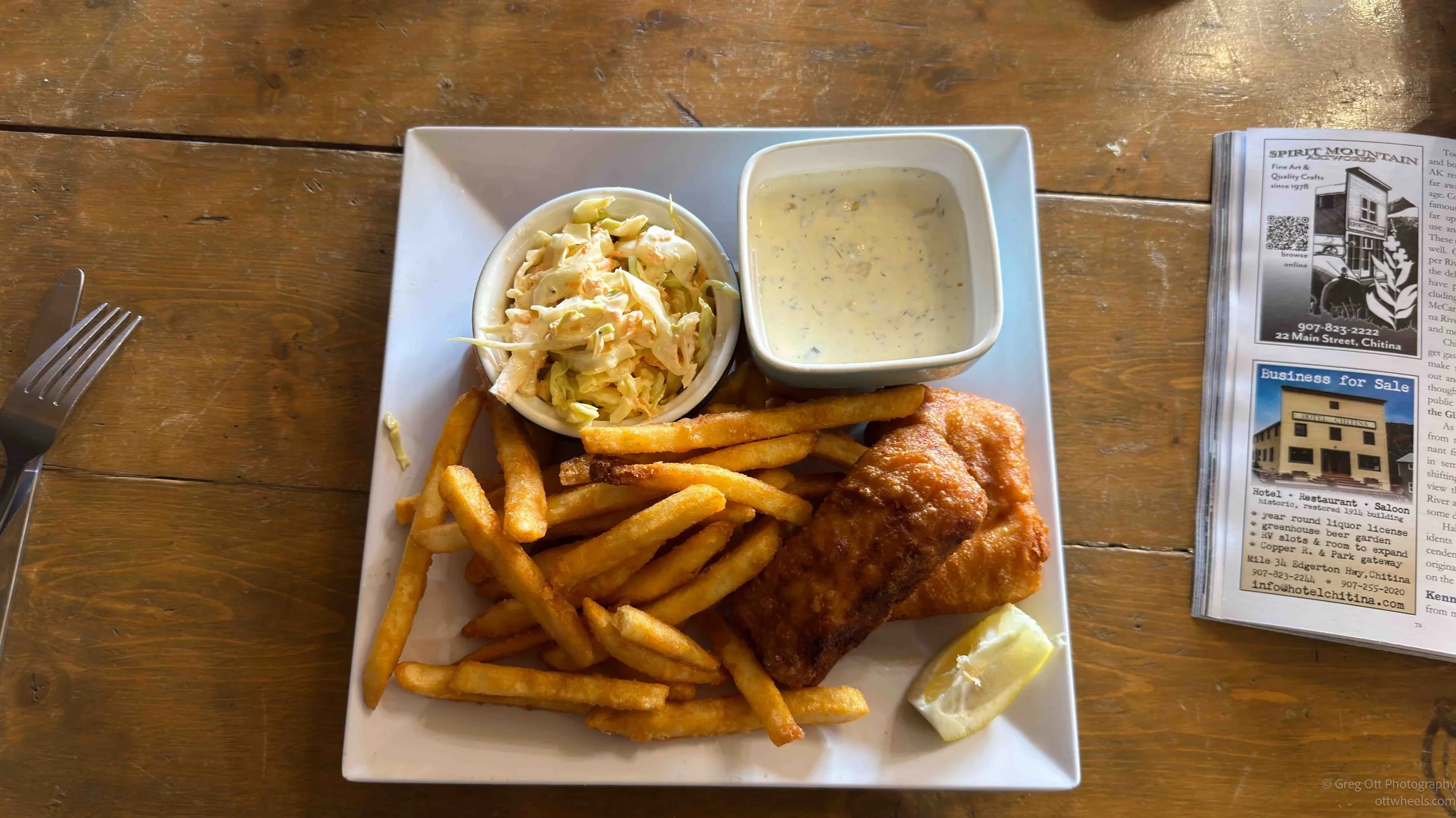
I ordered the locally caught halibut with fries, no salt, and an Alaskan Hefeweizen. The food was delicious, and the beer did not really taste like a Hefeweizen. There was a group of 12 Germans sitting at a table at the other end of the room. At the bar was a guy wearing a German soccer jersey, and I had just met a German engineer and his family at the tour office. He worked for Airbus in Alabama. I was told a lot of Germans come here and stay for several days at a time.
After dinner, I walked across the street to the grocery store. I had 15 minutes before the bus was scheduled to leave at 7:35, so I went in to pick up some supplies, as they call them here. When I came out at 7:29, the bus was gone. I looked up the street and started running. I reached the bus yelling, “Wait!” Juan waved his hand. His wife had left early. She smiled and apologized. All good. Just a little more workout.
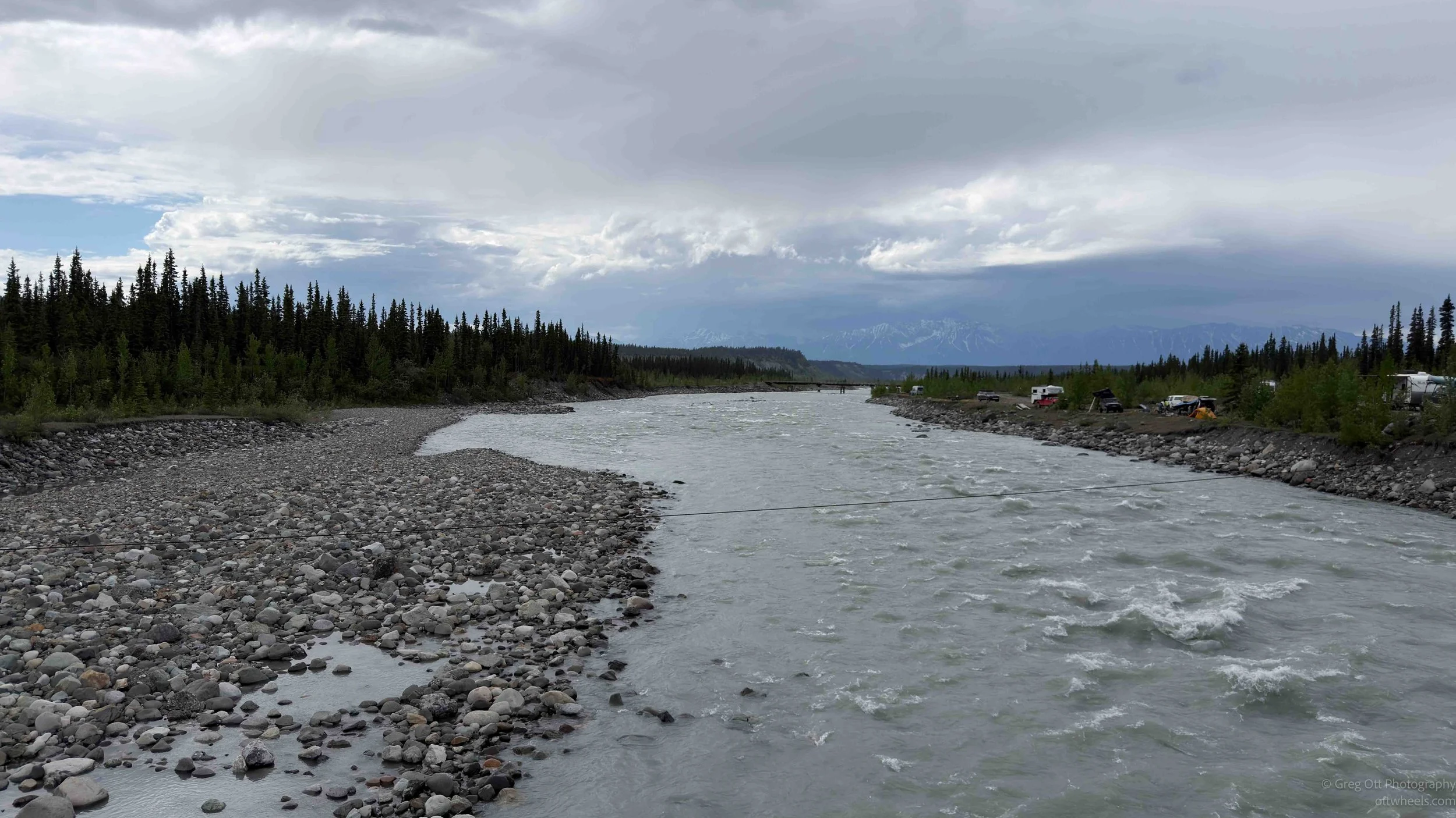
We were dropped off at the footbridge around 8 p.m. The sky was clear, so I walked back to the van, grabbed another lens and battery, and returned to the bridge to photograph the mountains. About ten people were standing on the bridge with their phones raised, all capturing the view in front of us.

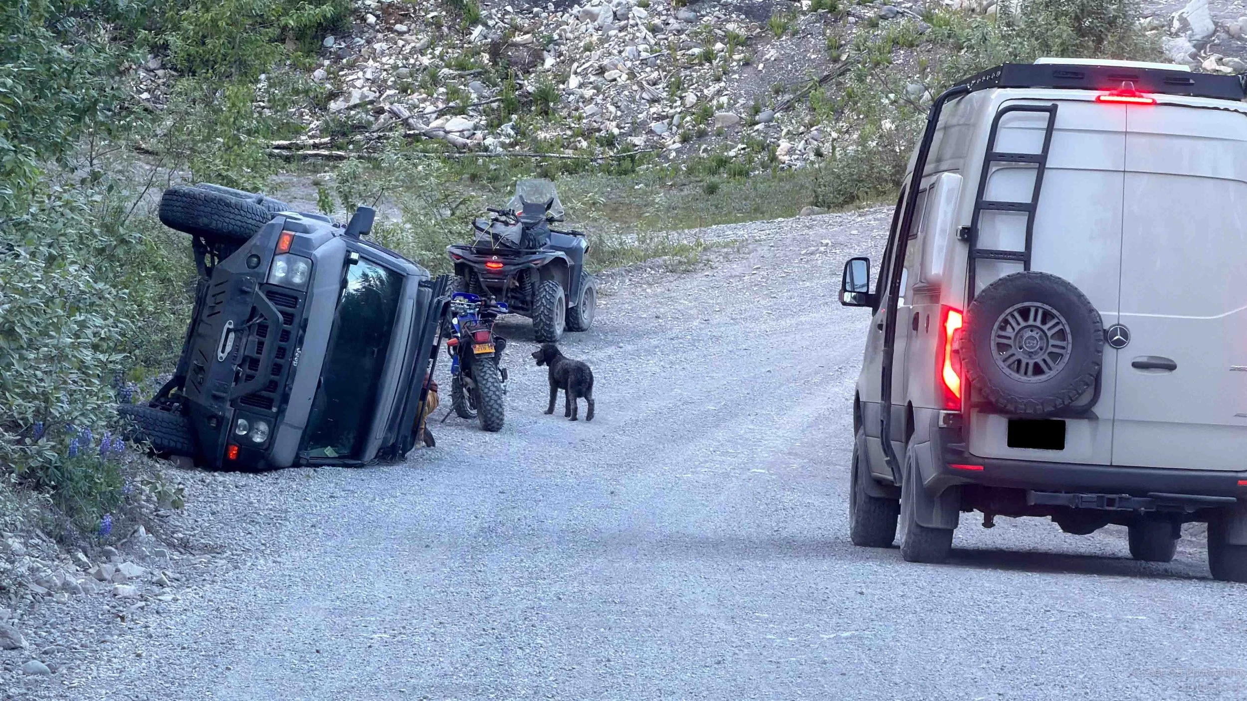
Back at the van, I decided to drive to the bridge rest stop where I had stayed the night before. About five minutes later, coming down the hill, I saw a Jeep on its side. I pulled up beside it. One of the guys on a quad bike I had seen earlier was taking gas cans off the Jeep. I rolled down the window and asked if he needed help.
He told me they had flipped the Jeep because they were driving way too fast. “Why don’t people drive the speed limit?” he asked rhetorically. He said he was taking the gas cans off because he did not want fuel leaking into his drinking water below. The people in the Jeep had left with someone else shortly after the wreck. I asked again if I could help with anything. “No, I’m good, man,” he said.
The next two hours were less eventful. The only thing I had to do was stop and wipe down the windshield with a non-scratch pad. Bugs build up on the glass, and it becomes almost impossible to see when the sun is trying to set, assuming it ever really does up here.
It was 10:45 when I pulled in. The area was quiet, and I had seen only one other car the entire drive back. I was in bed by 11, relaxed, watching something, and glad the day had somehow worked despite almost none of it going according to plan.