Spruce Knob & Seneca Rocks
I woke in the Monongahela National Forest after a night of light rain. The air was cool and still, wrapped in fog that hung low over the valley. I skipped breakfast and was back on the road a little after eight. The dirt track wound along the lake, barely wide enough for one vehicle, with pickups and campers tucked into the trees. I passed fishermen casting from the shore and caught a glimpse of a lone kayaker gliding through the mist. Trucks coming the other way eased into pullouts to let me pass—there was no room for error on that road.


Spruce Knob
My destination that morning was Spruce Knob, the highest point in West Virginia. The paved road up was narrow and twisting—the kind of drive that keeps you alert. Near the top, I stopped for photos as the sun broke through fast-moving clouds, the wind strong enough to push against me. At the summit, I parked in the large national forest lot and walked the three-quarter-mile loop trail. The air was damp and cool, and the spruce trees made the place feel almost alpine. From the stone observation tower, the view stretched across rolling ridges that faded into the horizon.
Spruce Knob rises 4,863 feet above sea level and became part of the Monongahela National Forest in 1920. It was designated a national recreation area in 1965 to preserve its highland landscape and unique ecosystem, where red spruce and northern plants thrive far south of their normal range. Today, it’s a favorite spot for hikers, campers, and stargazers, with some of the darkest skies in the eastern United States.
After about an hour at the top, I started back down. More vehicles were coming up now, and I had to ease onto the shoulder each time—sometimes with a thirty-foot drop just a few feet away. When I finally reached the bottom, I could breathe again. Next stop: Seneca Rocks, thirty minutes away.


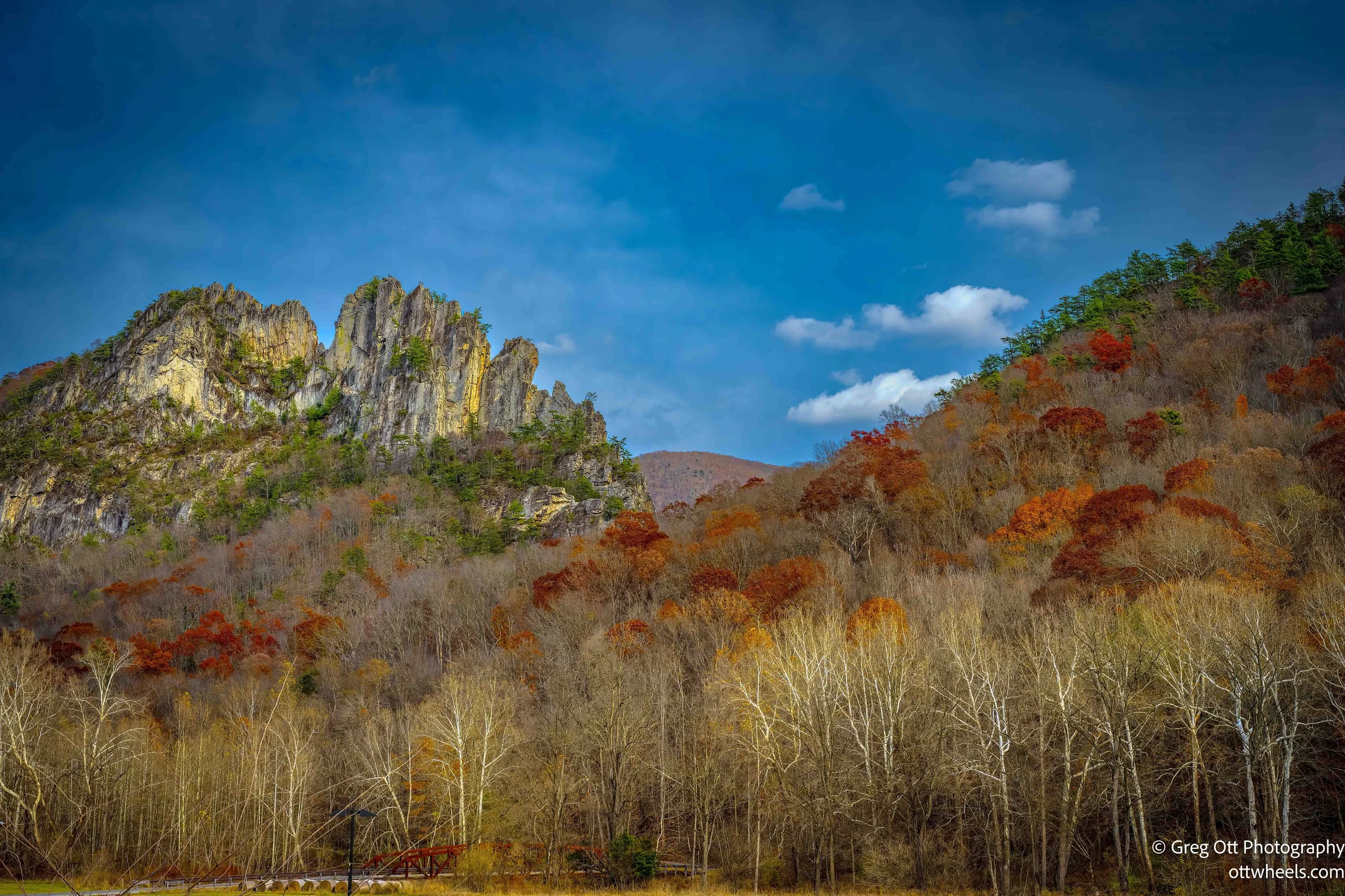
Seneca Rocks
Seneca Rocks rises sharply from the valley floor, a jagged spine of white and gray quartzite formed over 400 million years ago. These rocks were once layers of sand at the bottom of an ancient sea. Over time, the sand hardened into sandstone and was later uplifted, tilted, and exposed by erosion as the Appalachian Mountains formed. What remains today is the sheer, vertical fin of rock that draws climbers, hikers, and geologists from across the country. It’s one of the most recognizable landmarks in West Virginia, a striking monument to the power of geologic time.
The site is managed by the U.S. Forest Service as part of the Spruce Knob–Seneca Rocks National Recreation Area, established in 1965. The Seneca Rocks Discovery Center, at the base of the formation, was built to educate visitors about the area’s geology, ecology, and cultural history. It offers ranger-led programs, seasonal exhibits, and interpretive hikes that explore everything from climbing routes to trout streams. When it’s open, it’s a lively hub—but like many federal facilities, it can close during government shutdowns, something I found out the hard way.
The center was closed when I arrived, a printed note taped to the door explaining the shutdown. Two women approached as I was reading it. “It’s closed because of the shutdown,” I said. One threw up her hands. “You’d think I would have thought of that. I’m a federal employee.” We ended up talking about the economic fallout in rural towns like this, where tourism and federal programs keep things running—and where miners struggling with black lung disease are still waiting for proper support. They were meeting the mother of one of the women to hike up to Seneca Rocks.
I moved the van to the lower parking lot, grabbed my camera gear, and promptly headed half a mile up the wrong trail. AllTrails corrected me, and soon I was on the right one—the Seneca Rocks Trail, a steady uphill climb of long switchbacks and steep wooden steps. Blue interpretive plaques along the way explained the area’s history, geology, and ecology. At the trailhead, families debated who would stay behind and who would make the climb. A quarter of the way up, people were already sitting to catch their breath. About halfway up, I caught sight of the two women and their mom from earlier. “How in the world did you beat me up here?” I asked. They laughed and said they’d driven to the closer lot. The mom, resting on a bench, smiled and said, “There’s no keeping up with these two.” I wished her well and said, “Slow and steady.”


The view from the summit was worth every step—sweeping ridges and valleys stretching in all directions. The observation deck was packed with people: families, hikers, and one enthusiastic man shouting about how “incredible” and “tremendous” the view was between drags of a joint. A large Mexican family—sixteen strong—was trying to get everyone in a photo, and strangers jumped in to help. When the crowd thinned, I took a few photos of my own, then found a flat rock to rest on.
I had a snack and some electrolytes as a few dogs came over to investigate. One lost interest quickly when it realized I wasn’t sharing food. Another stayed for a bit, leaning against my leg until its owner tugged it away with a cheerful, “Have a good hike down.” The descent was easy, though I passed a woman later seen far ahead of me near the base—she’d clearly cut off-trail. Despite the posted signs warning about erosion, some people still miss the message. By the time I reached the van, the afternoon light had shifted, and the rocks above glowed in the late sun—bright, sheer, and timeless.


I thought I’d have time for a short bike ride and headed toward Elkins. It was warm enough to get one in, but a Kroger supermarket caught my eye. I hadn’t seen a real supermarket in a week, and I was running low on almost everything. What I thought would be a quick stop turned into a long one—but it felt good to restock. Once again, I had the wrong directions for the trailhead and realized it would be getting dark if I tried even a short ride.
Instead, I searched for a place to stay overnight and found a spot outside town at a trailhead that allowed tent camping. I drove three miles up the mountain on a narrow dirt road, and the site was empty.