Chiricahua National Monument AZ
I woke on the 23rd beside a small park on the outskirts of Bisbee, Arizona. People were already out walking their dogs before work. Everyone said good morning. I noticed one other truck with a camper insert parked about 100 feet down the street. Quiet spot. Good energy. I was headed to Chiricahua National Monument, about 90 minutes away. It felt like a spring day — clear skies, sun out, light breeze. I took my time getting there and stopped a few times along the way. I was still thinking about maybe doing some astro photography that night.
I pulled into the Visitor Center around 10:00 a.m. A sign said the main lot was full and to use the lower overflow. Just as I started to turn, someone pulled out and I grabbed the space. The center itself is fairly small and it was busy. The staff were extremely helpful, handing out maps and answering questions they’ve clearly answered thousands of times. I stepped up to ask about hiking options and a ranger immediately handed me a brochure. A woman next to me, there with her mom, asked if she could listen in because she assumed I’d be asking the same questions she had. Three others joined. It turned into a small group Q&A session. We were told the Echo Canyon lot usually fills by 11:00 a.m. and that the road to the top is narrow — vehicles over 24 feet aren’t allowed. It was originally built for Model Ts.
I drove to the Echo Canyon parking lot. It was full. I continued about half a mile to the Massai Point lot. For some reason, I just didn’t feel like hiking right then. Maybe it was the weather. Sunny. Blue skies. Breeze coming through the van. I opened the side door and basically camped in the parking lot with a direct view of the rock formations. I got a lot of writing done, made a late lunch, and read more about the area. I spent the entire afternoon on top of the mountain. The ranger had told me earlier that the campground was fully booked, but said I could park just outside the park near a large mailbox in a pull-off area if I needed to.
By the time I checked online again for a last-minute cancellation, it was nearly 7:00 p.m. and already dark. No luck. I drove the 30 minutes down to the mailbox spot. Three vans and a truck were already there. I couldn’t find anything perfectly level, so I pulled in beside a red Promaster with Utah plates. I made dinner, did a little more writing, and set things up for the Echo Canyon hike the next morning.
On the 24th, around 8:00 a.m., I heard vehicles pulling out. I drove straight into the Echo Canyon lot and grabbed the first open space. The red van from last night was two spots away. By 9:00 a.m., I was on the trail. The couple from the red van were a few hundred feet ahead. It was another beautiful day. I moved slowly — stopping for photos, talking with people passing by, just taking it all in. Everyone seemed to be in a good mood. After crossing paths with the red van couple for the third time, I introduced myself. Sierre and Alex were from Utah. Alex had built out their van in two months. I told him I was impressed — mine took 18 months. We passed each other several more times. All of us were stopping constantly — climbing up rocks, sitting on cliff edges in the sun, taking photos.
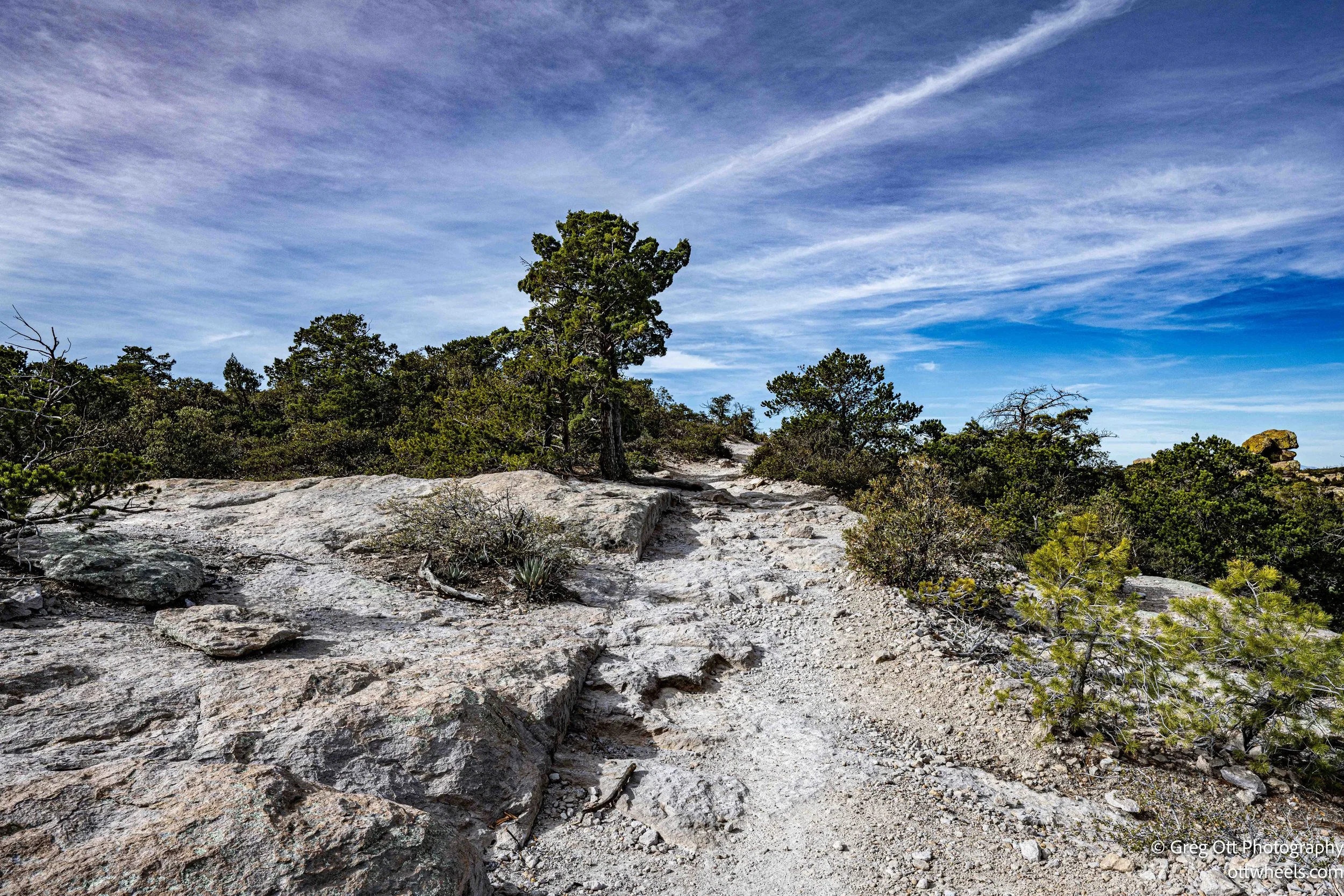
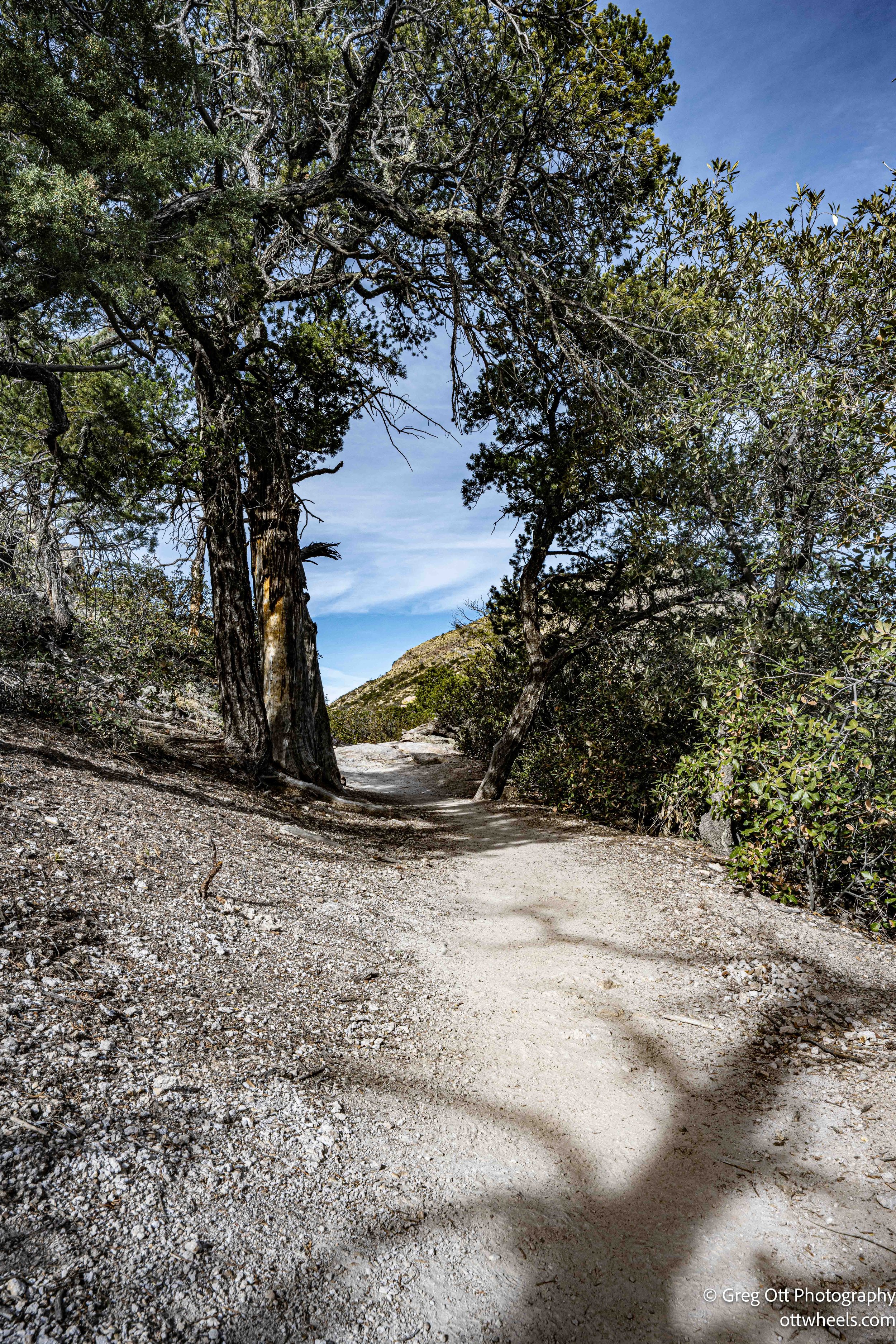
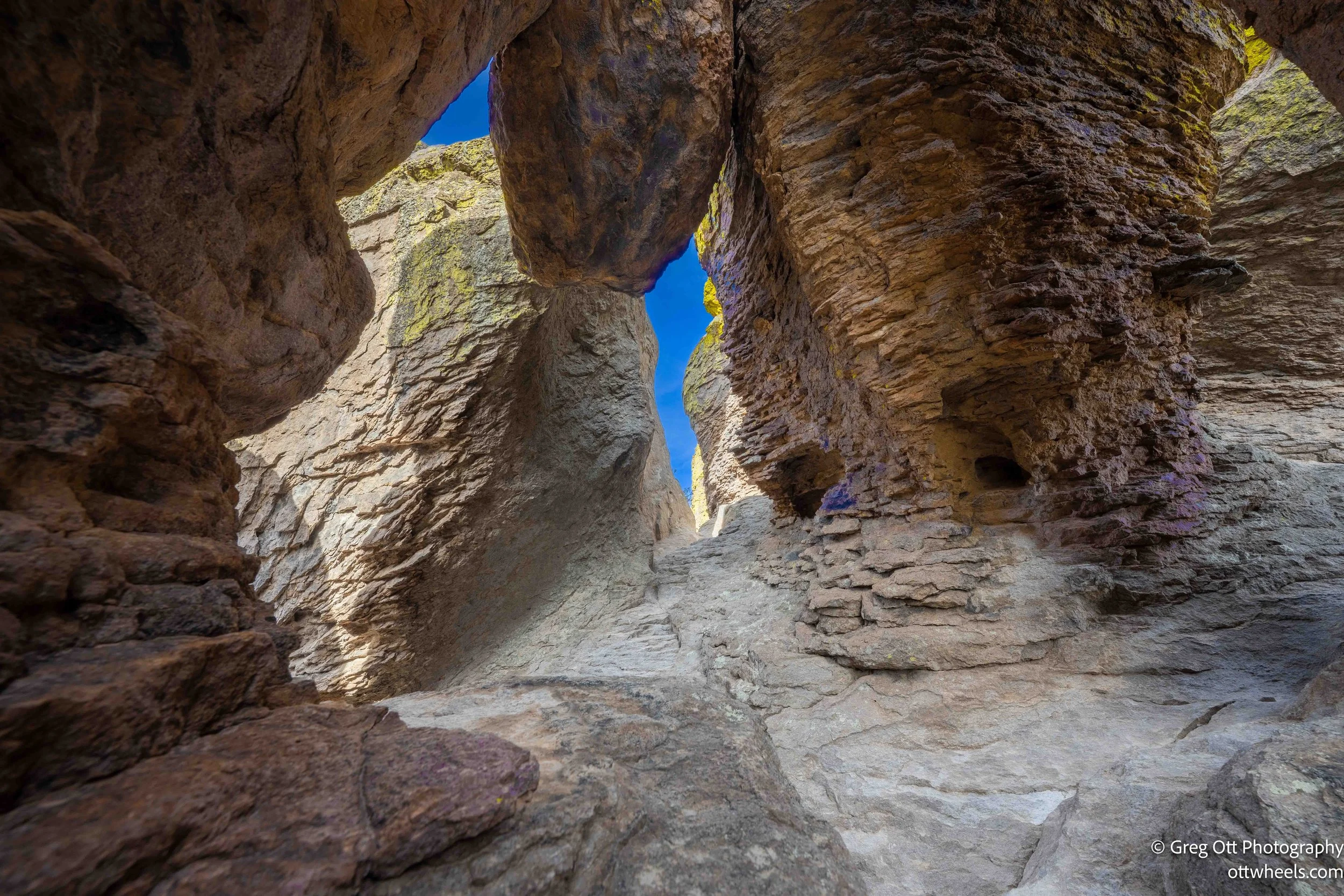
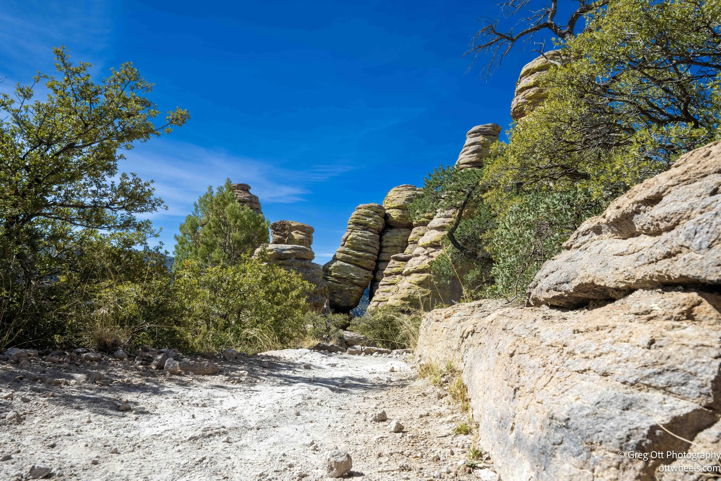
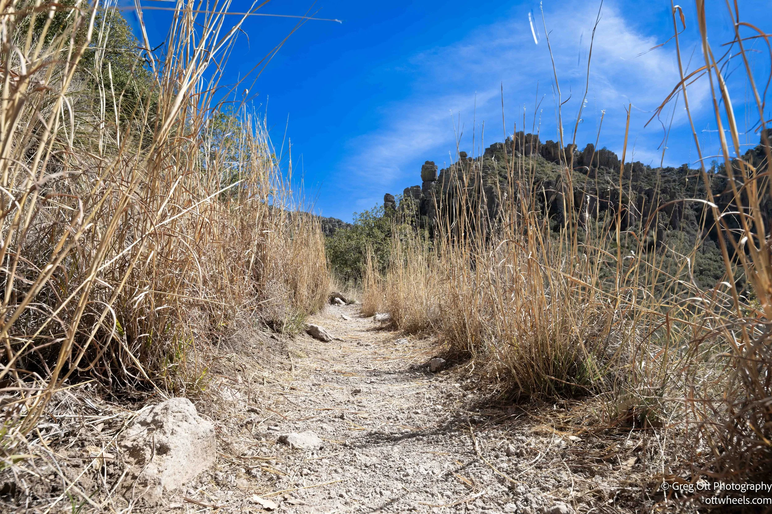
Echo Canyon in Chiricahua National Monument feels different from the moment you step onto the trail. I hiked the Grotto, Hailstone, and Ed Riggs trails as a loop, dropping into the lower section where the canyon narrows and the rock walls begin to crowd in. At the very lowest point, water was running through the canyon floor — not deep, but enough to form a shallow pool across the trail. Just as I reached it, a group of six riders came through on horseback. I stepped off onto the narrow edge of the trail to give them room. The first horse paused, looked directly at me, then leaned forward and rubbed its forehead against my arm before continuing through the water. It was one of those quiet trail moments you can’t plan.

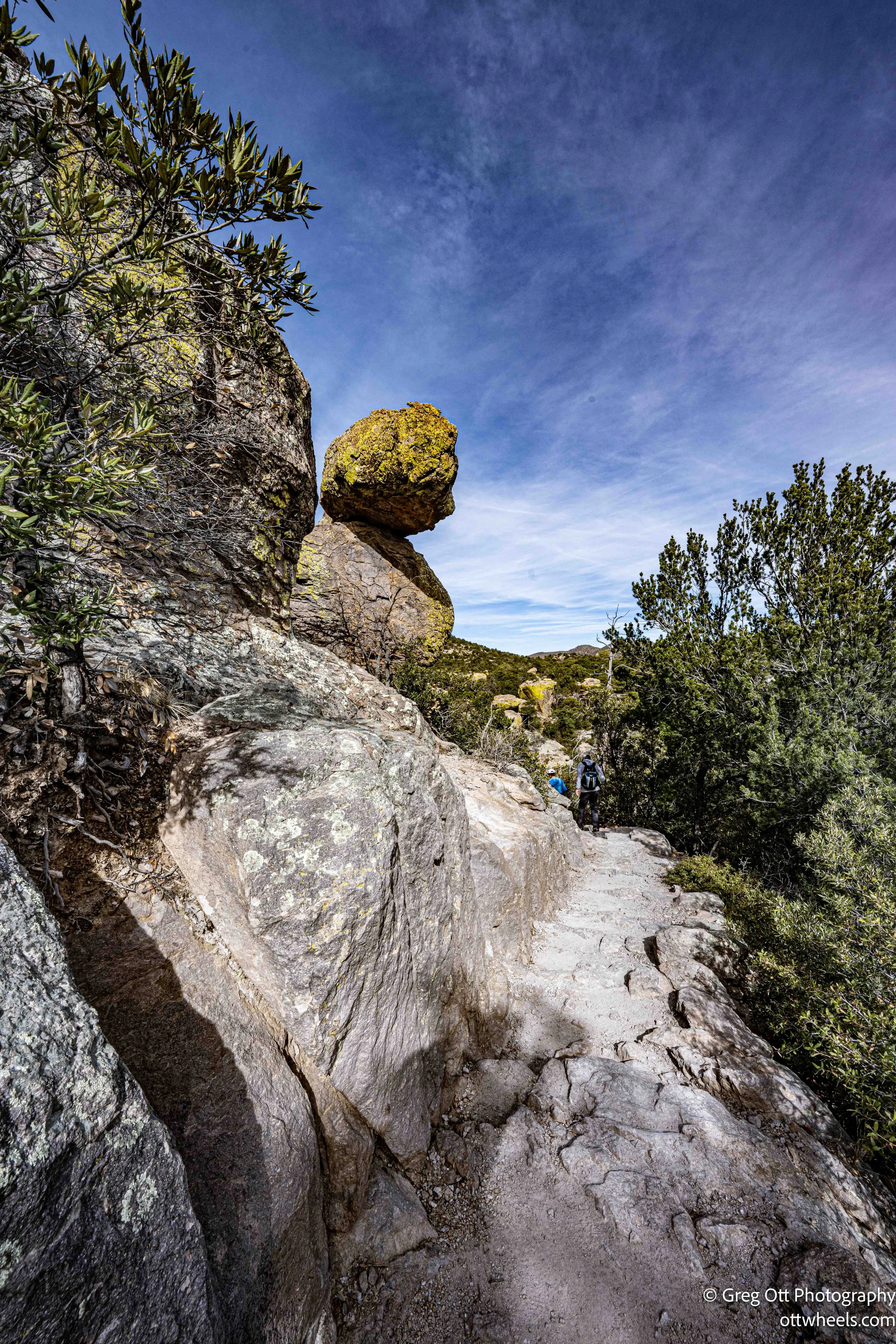
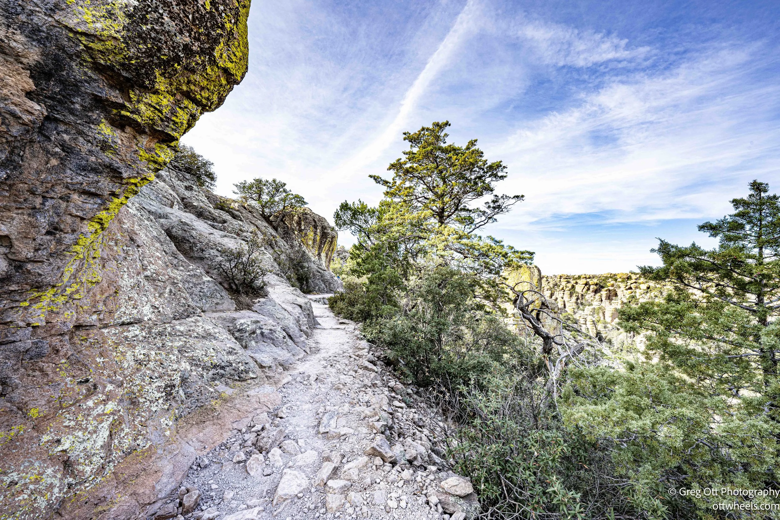

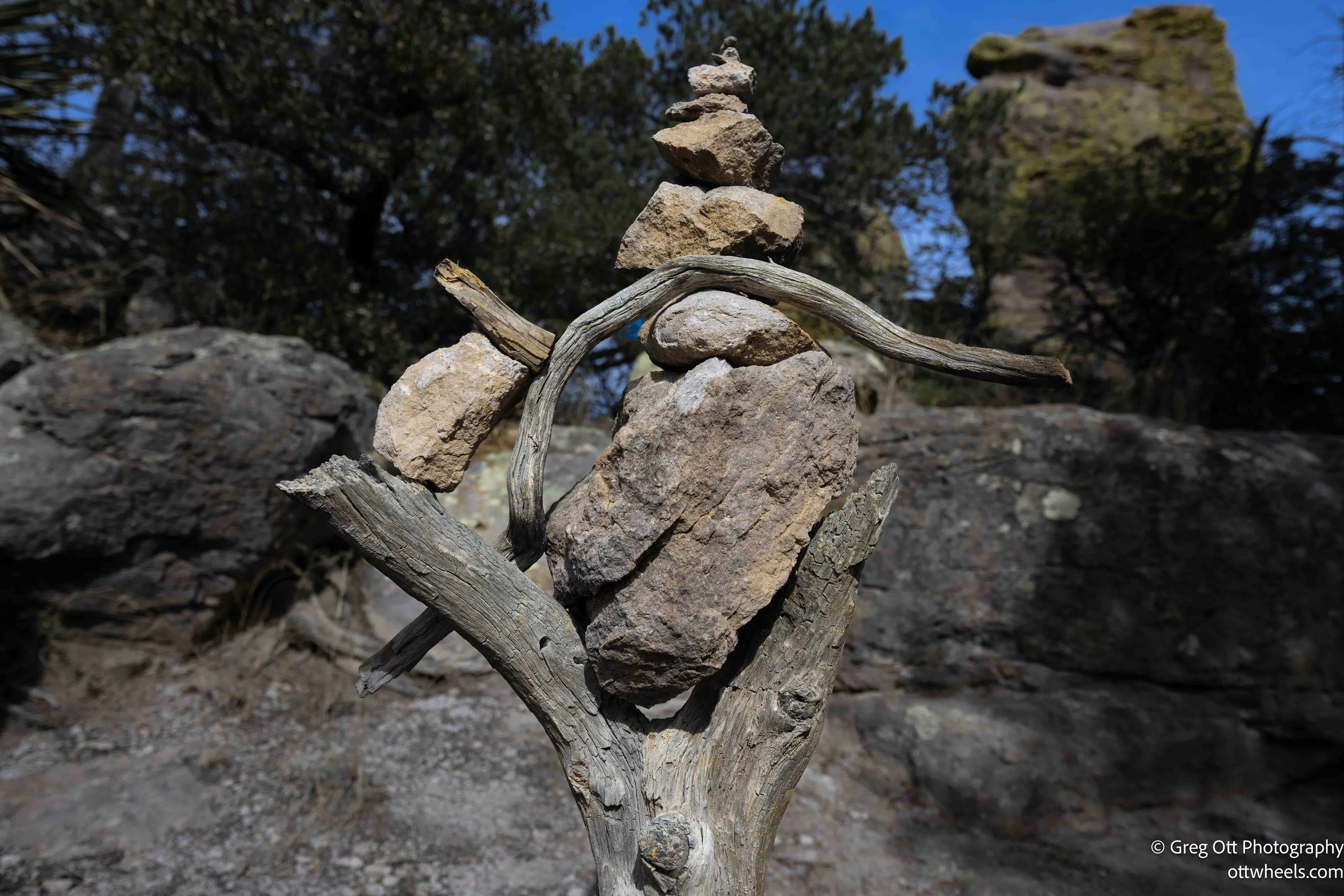
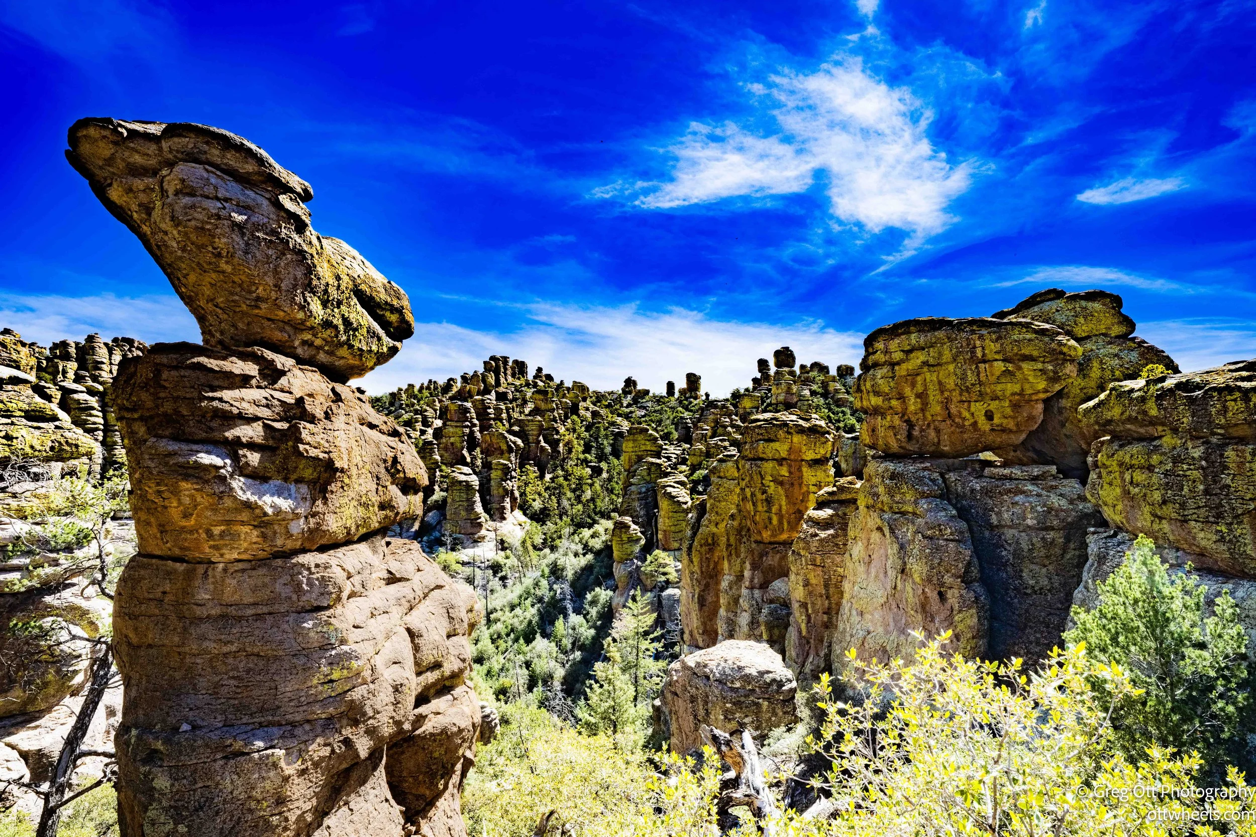
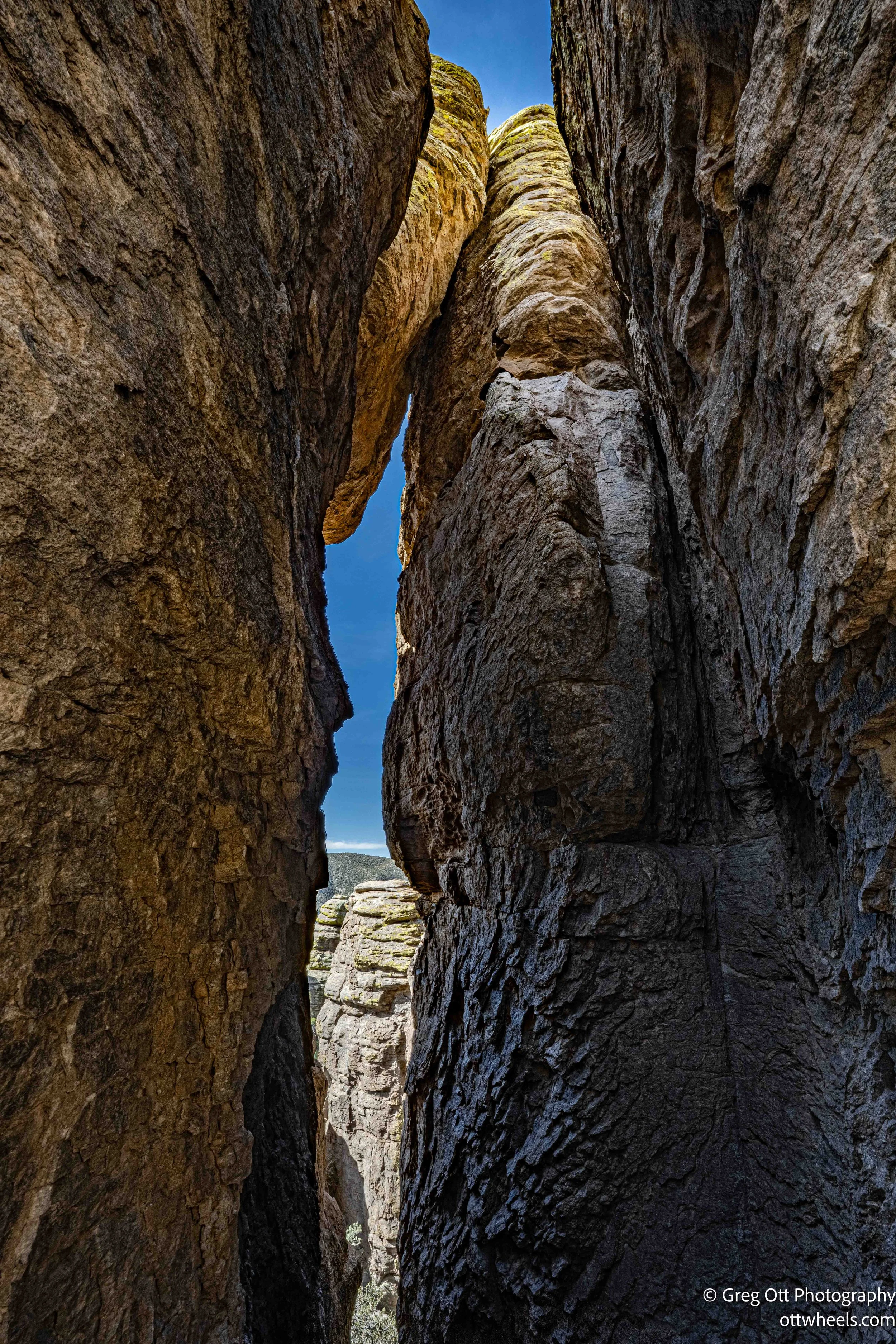
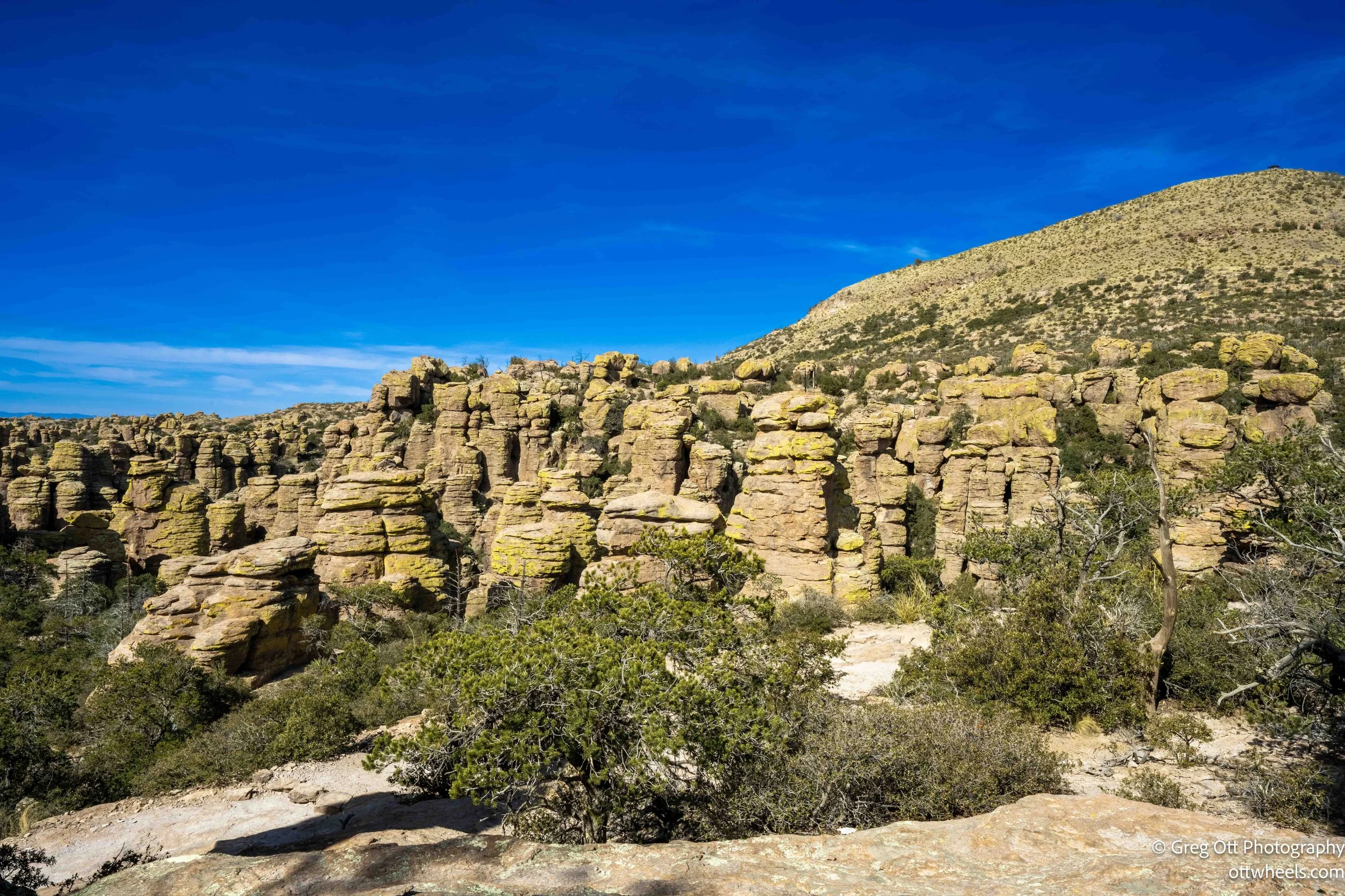
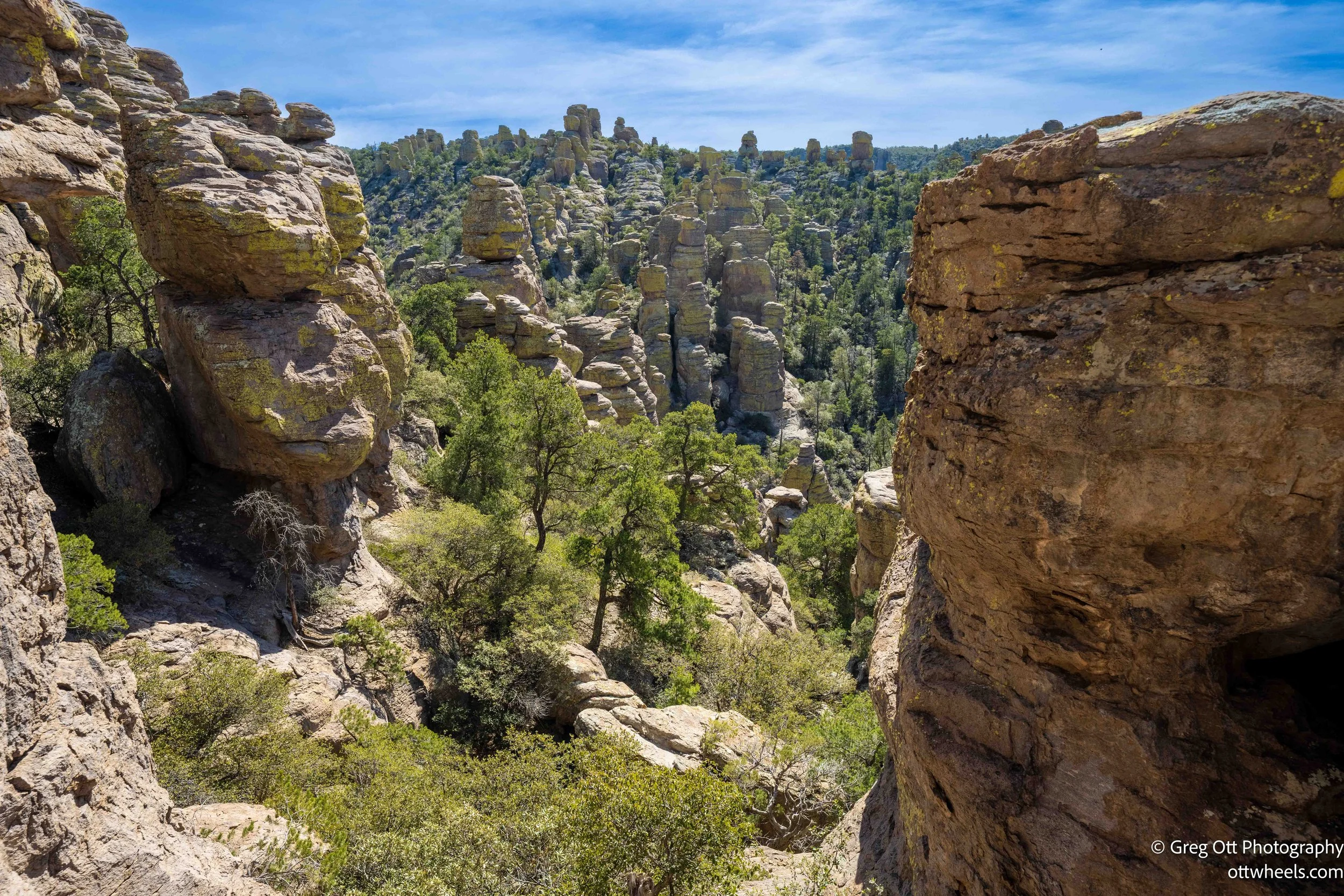
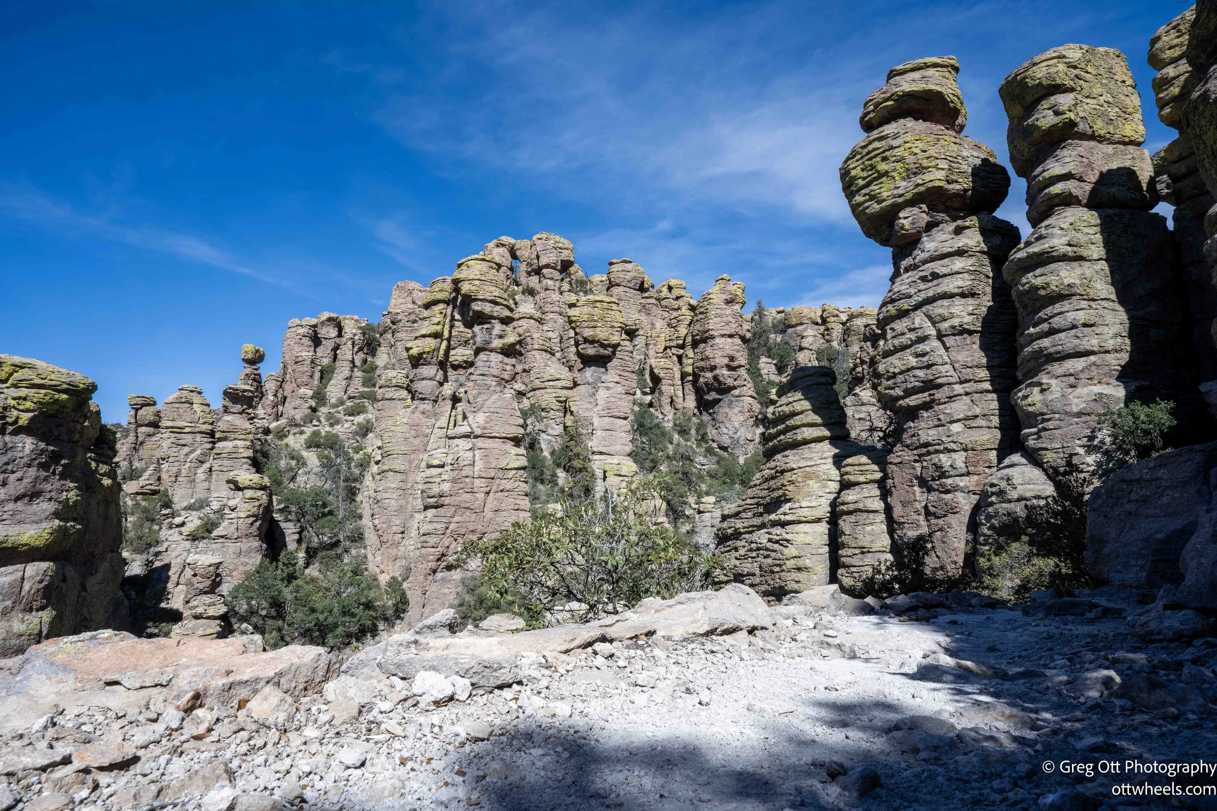
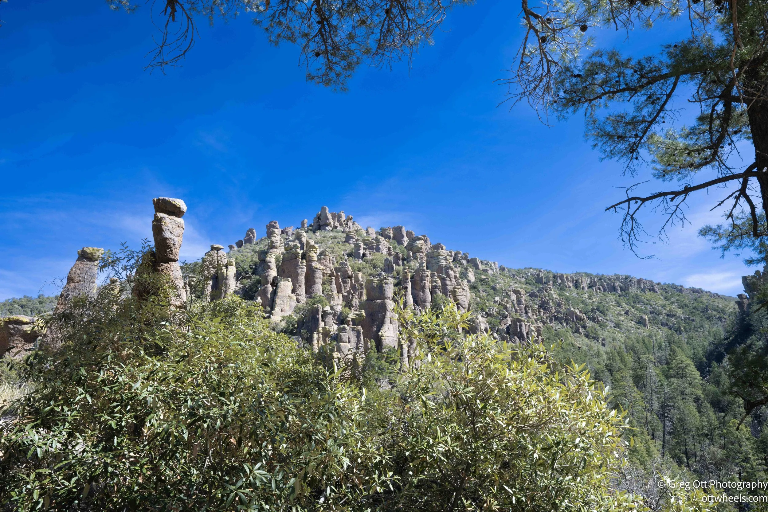
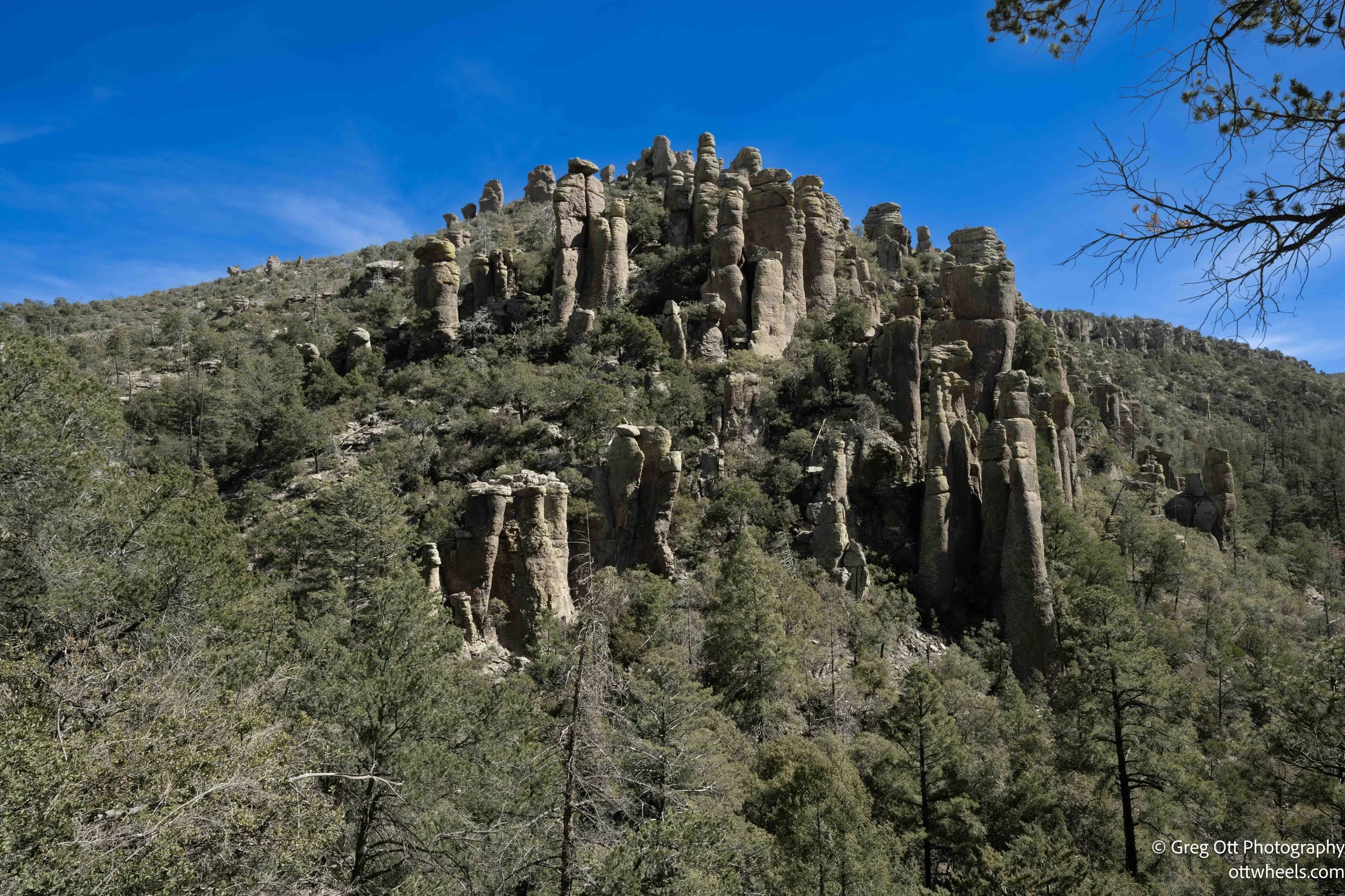
The rock formations in Echo Canyon are astonishing. Massive rhyolite columns rise straight out of the canyon floor, fractured and stacked in ways that seem impossible. At one bend in the trail, I noticed a plant that had been cut cleanly at a “Y,” and some artistic type hiker had clearly decided to channel their inner Andy Goldsworthy — the British land artist known for arranging leaves, stones, and sticks into temporary works that look like they just happened naturally. This little sculpture wasn’t quite museum-level, but I appreciated the effort. Even out here, surrounded by 27-million-year-old volcanic rock doing its own sculpting, someone felt the need to add their contribution.


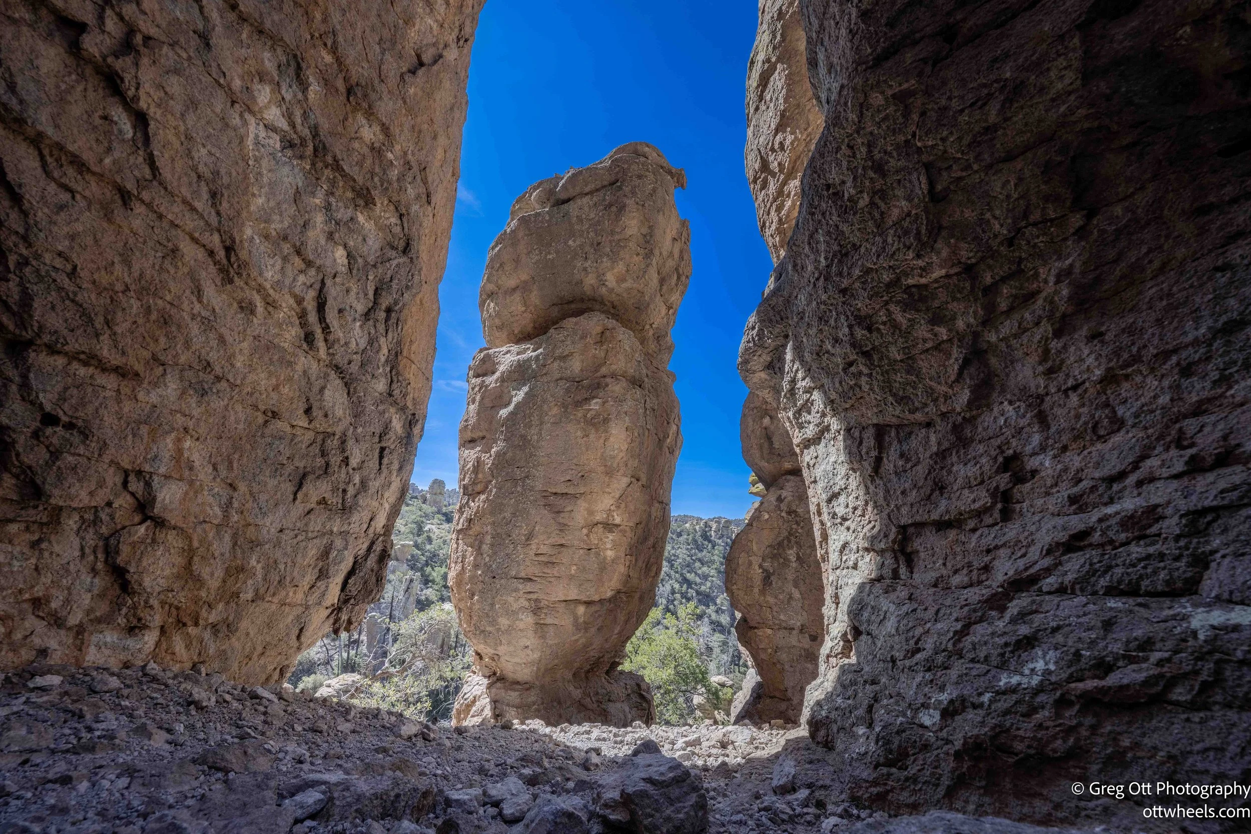
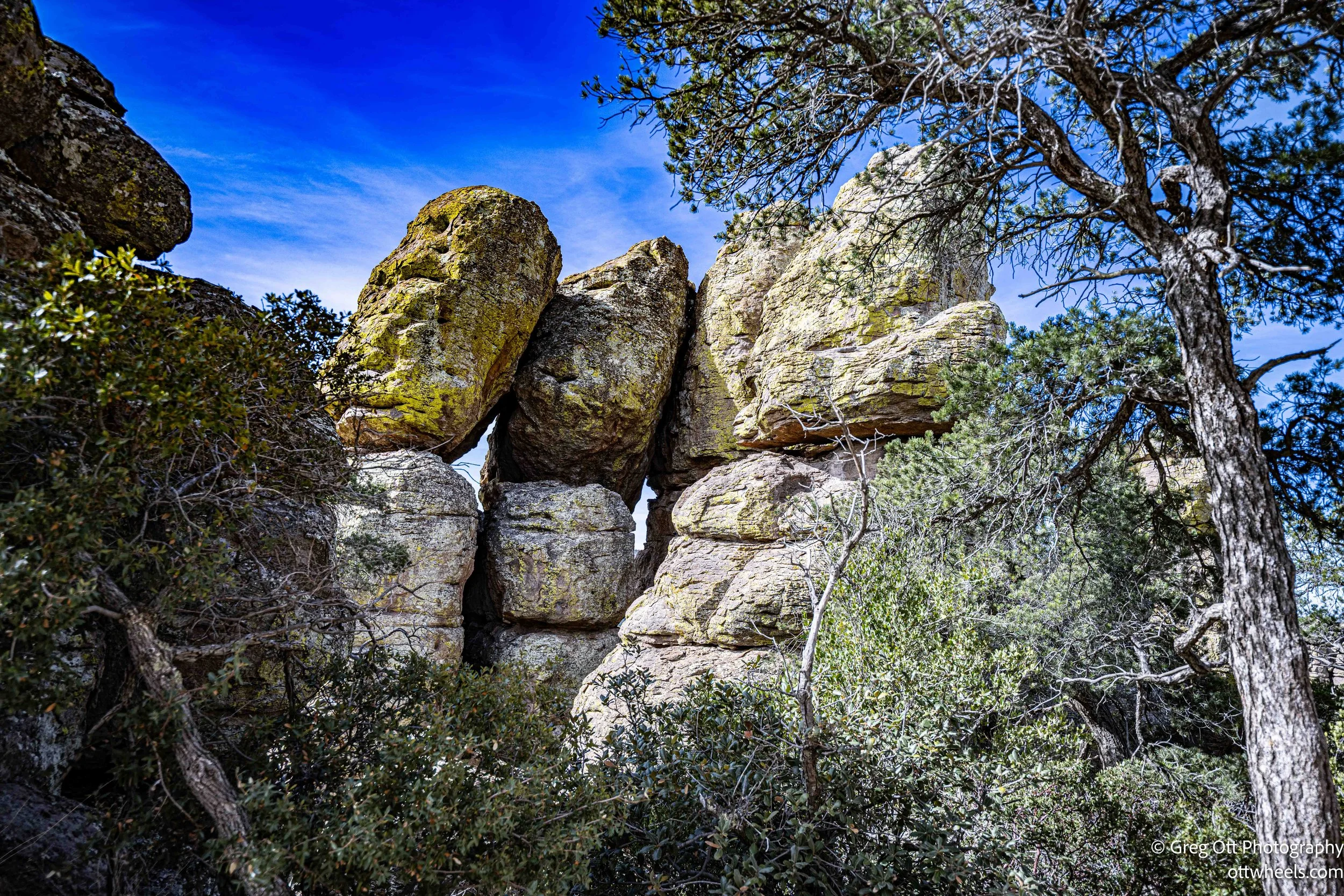
There are grottos tucked into the cliffs and house-sized boulders wedged between even larger ones, suspended overhead like they were set there by hand. In several places I walked directly beneath enormous rocks that appear to be balanced by nothing more than friction and time. The scale is hard to grasp until you’re underneath them, looking up at thousands of tons of stone resting on narrow contact points. It feels both solid and temporary at the same time.
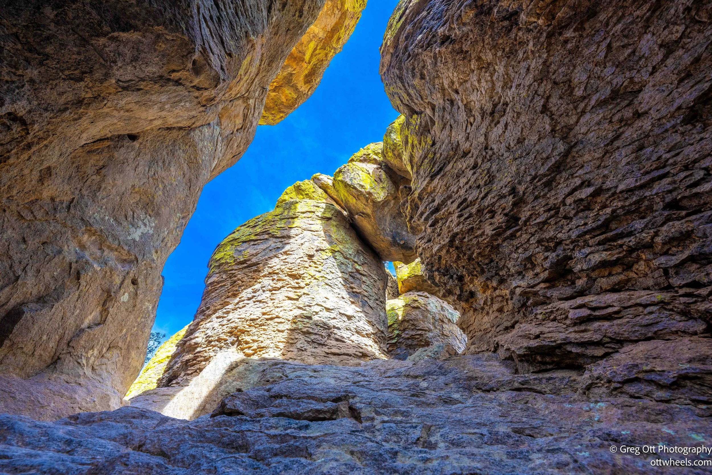

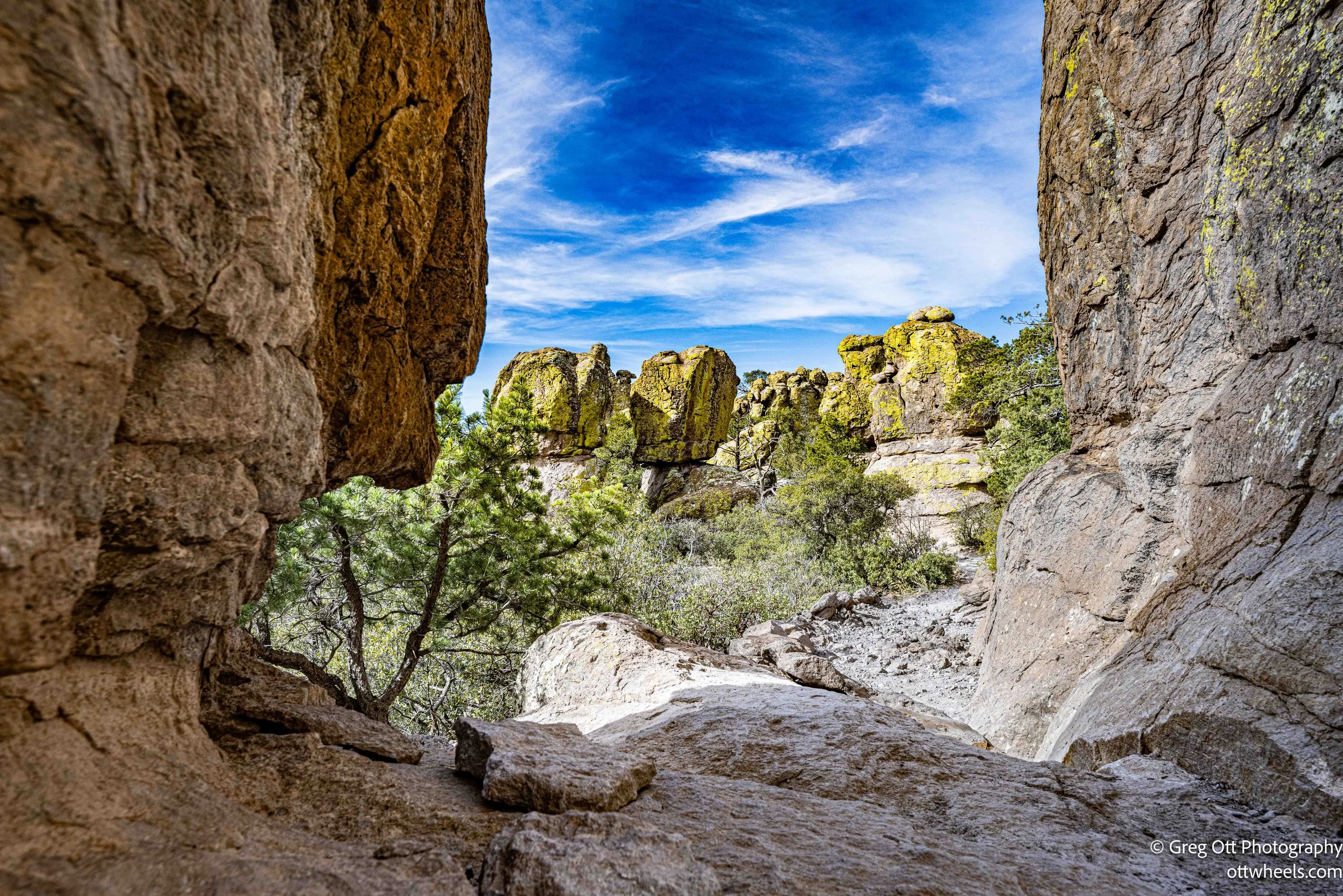

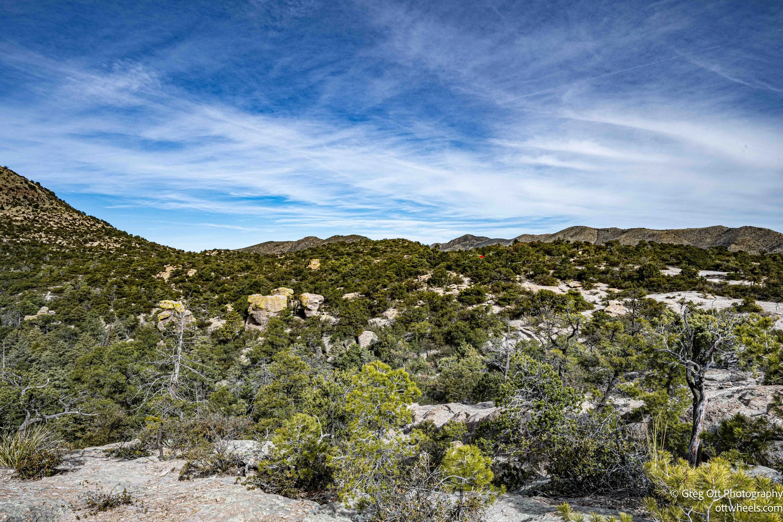
What surprised me was how quickly the landscape shifts. One minute you’re surrounded by sheer walls of stone and narrow passageways; the next, the canyon opens and you’re walking among pine trees. The higher elevations bring shade and a softness that contrasts with the jagged rock spires below. Green lichen spreads across many of the rock faces, tinting the gray and tan stone with muted greens. From a distance it changes the color of the mountain itself. Up close, it adds texture and detail — another layer in a place already filled with them.
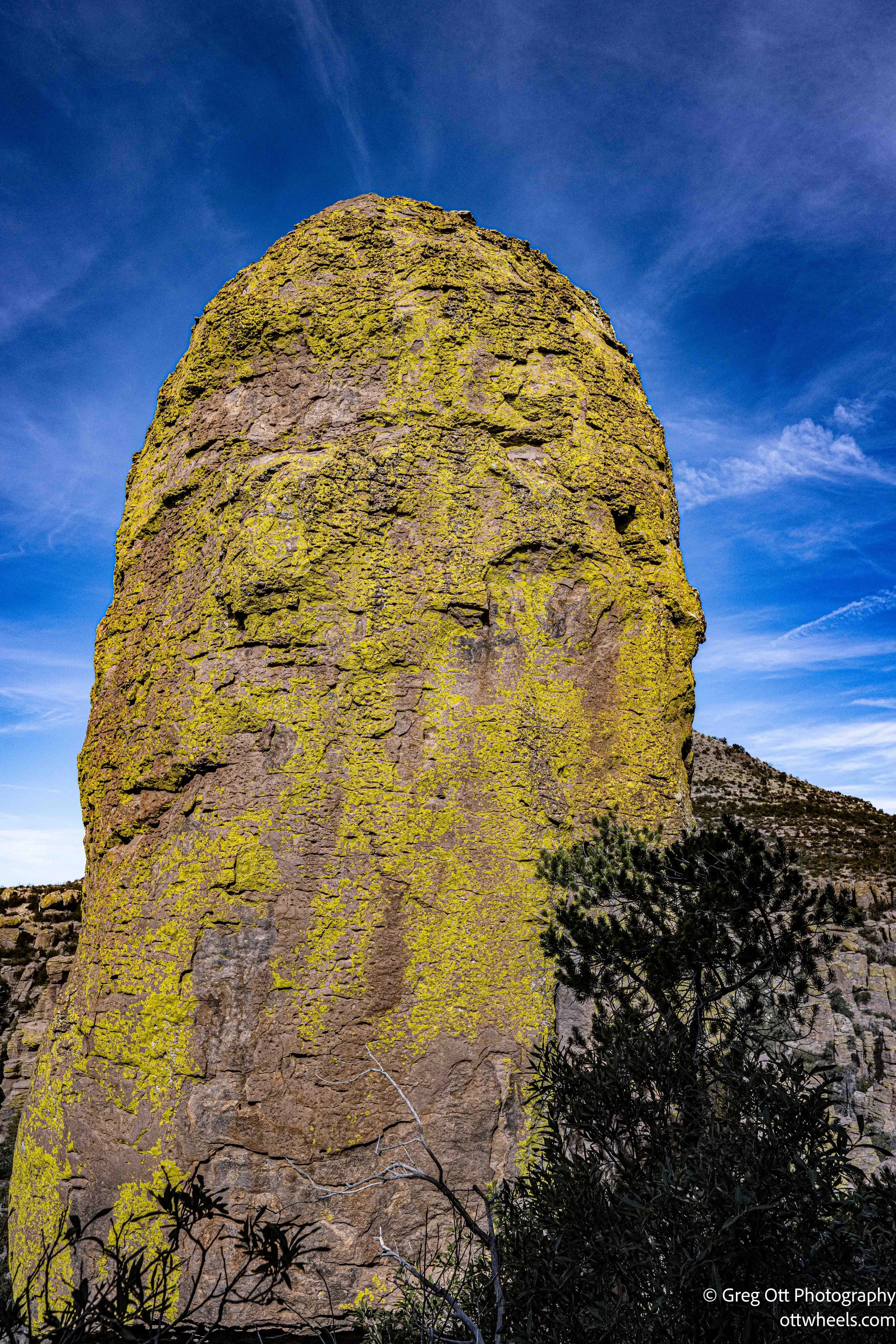
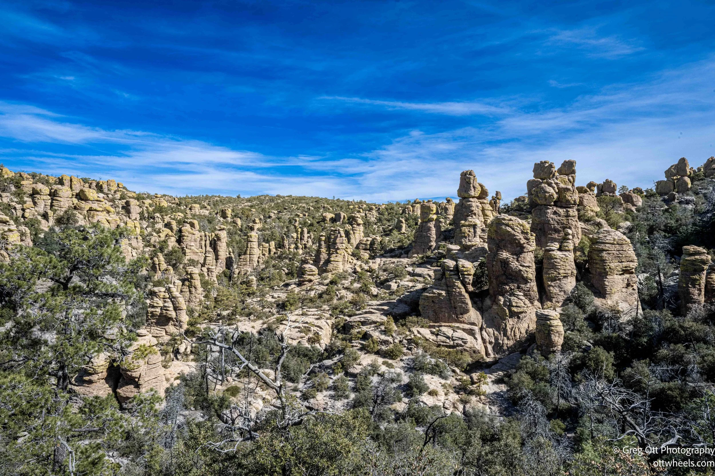

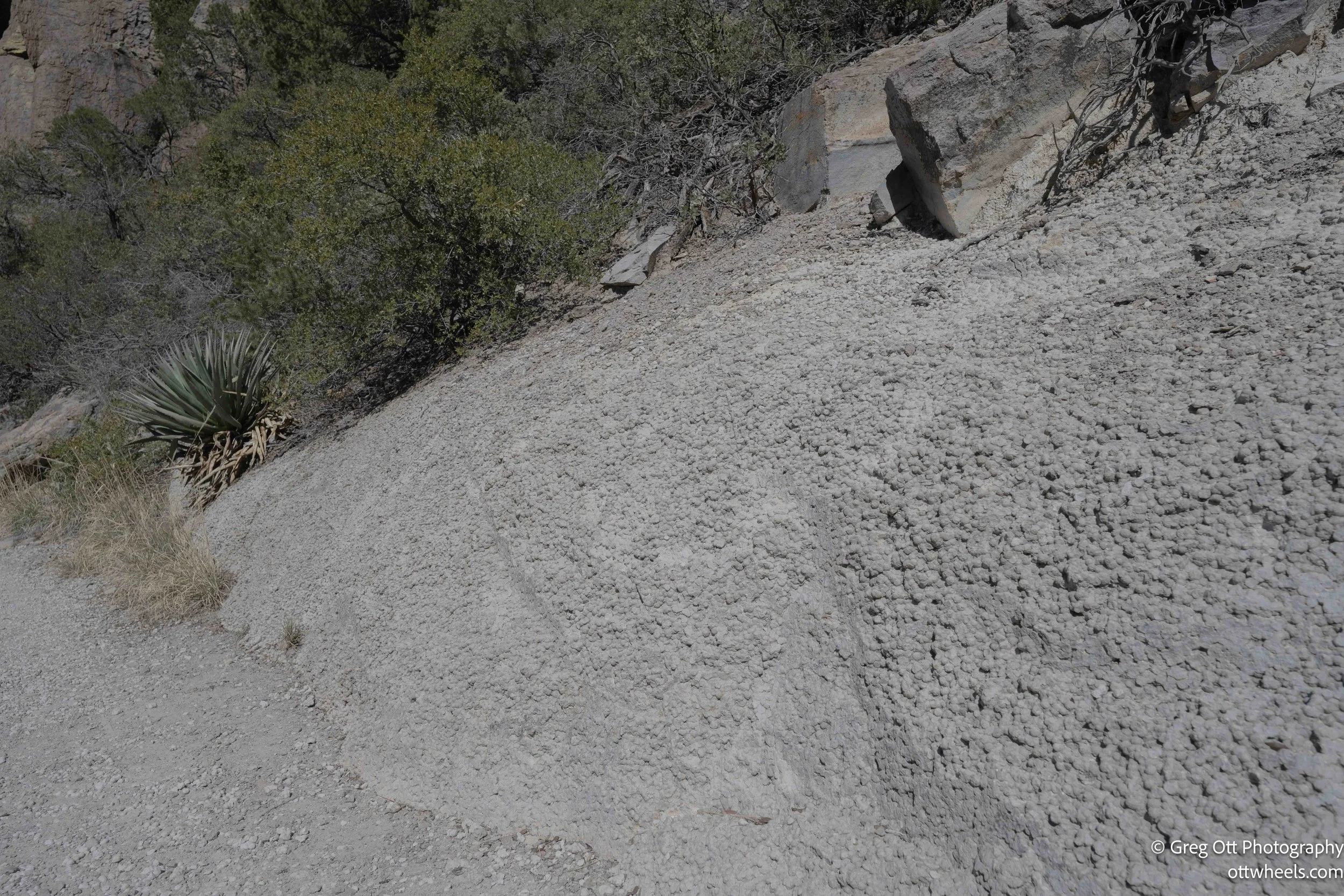
These formations began nearly 27 million years ago when a massive volcanic eruption blanketed the region in ash. That ash welded into rhyolite tuff, and over millions of years water, freeze-thaw cycles, and gravity carved it into the spires, hoodoos, and balanced rocks that define the monument today. Along one stretch of trail, I noticed something different: a small exposed section of calcium carbonate concretions — rounded stone balls embedded in lighter material, almost like rough cement. The trail had been cut through it, and it was obvious that erosion had stripped away the surrounding soil, revealing this pocket of hardened mineral deposits. It appeared only in that one short section, a reminder that even in a landscape dominated by volcanic rock, there are small geologic surprises waiting beside the path.
AllTrails listed it as a two-hour moderate hike. I missed one turn and added about three-quarters of a mile. According to the app, I was moving for a little over two hours, but the total time on the trail was close to four. I had stopped constantly — for views, for conversations, for photos, for no reason at all other than it felt good to sit there. I thoroughly enjoyed every section of that trail.
Back at the van, I unpacked and put everything away, made a light lunch, and then took a one-hour nap. The side door was open and I had one of the roof fans pushing air out the back. It was quiet. Relaxing. Exactly what I needed after that hike. I spent a couple more hours processing images and writing.
Around 5:30 p.m., I gathered the trash and recycling and dropped them in the park containers. There were only two vehicles left — mine and the red van. Sierre and Alex were pulling out. They stopped, rolled down their windows, and we talked for a few minutes before wishing each other great travels.
I considered staying for star photos, but clouds were moving in. I still had energy — probably from the nap — so I decided to head toward Benson, about 90 minutes away. When I reached the turnoff for one of the suggested spots, there was a cow fence covered in twinkling purple LED lights. One gate was open, but a large sign read: “Private Property – Do Not Enter.” That seemed clear enough. iOverlander2 wasn’t giving me anything promising, so I switched to AllStays and found a Walmart nearby with solid reviews. That worked perfectly since I had a list of things to pick up anyway. The Walmart worked out well.