Hurricane, Utah to Lone Rock
I left Hurricane, Utah, on Saturday after Christmas, eager to finally start my Utah loop. The lack of snow at the ski resorts had already forced a rethink, so instead of chasing turns I pointed the van toward the southeastern part of the state. Before leaving town, I topped off the tank and made one last stop at Bonrue for a latté and a chocolate croissant—an easy ritual before a long drive.
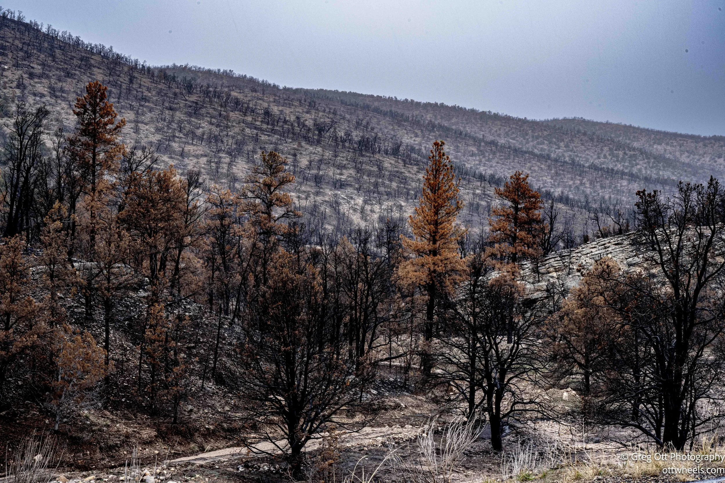
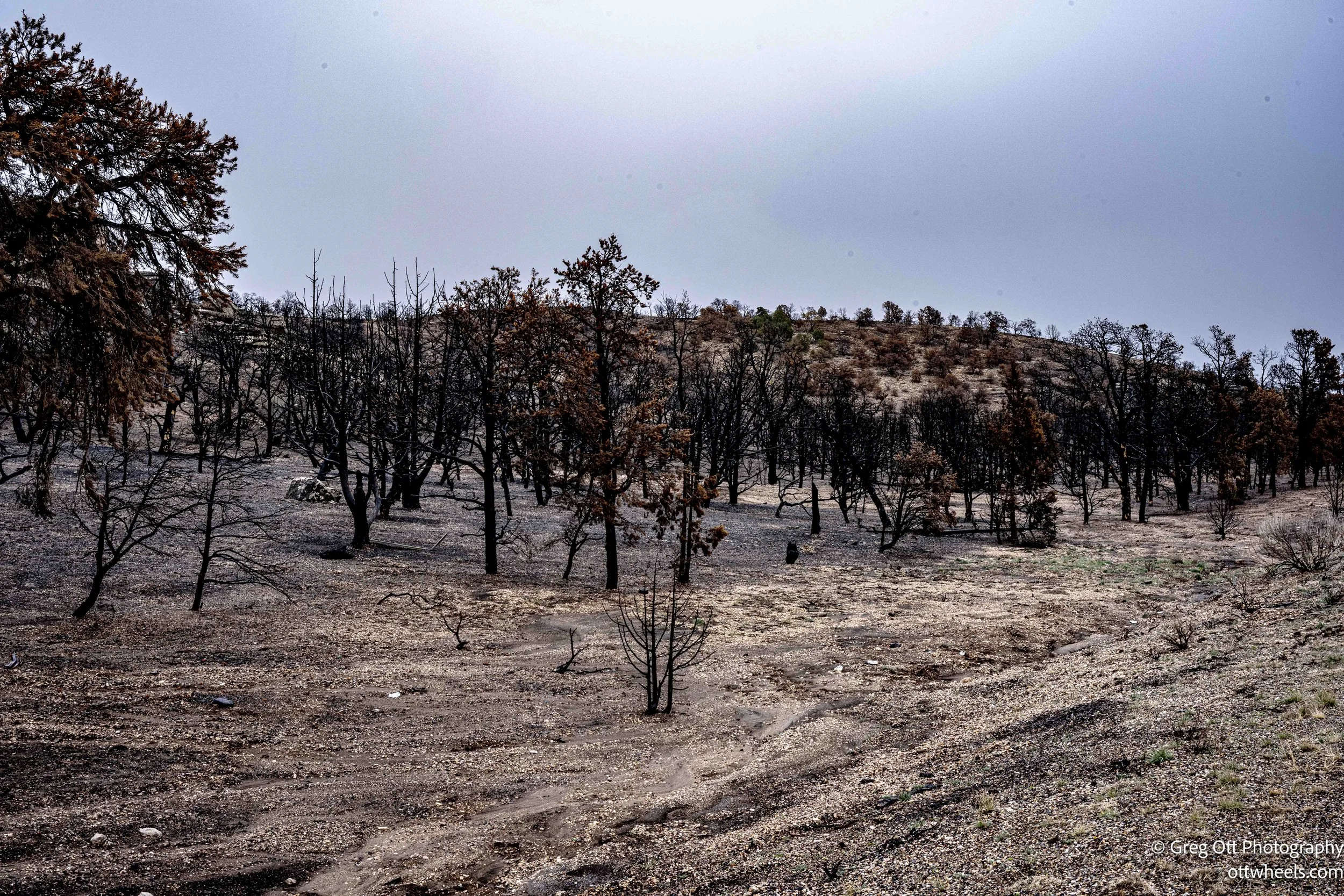
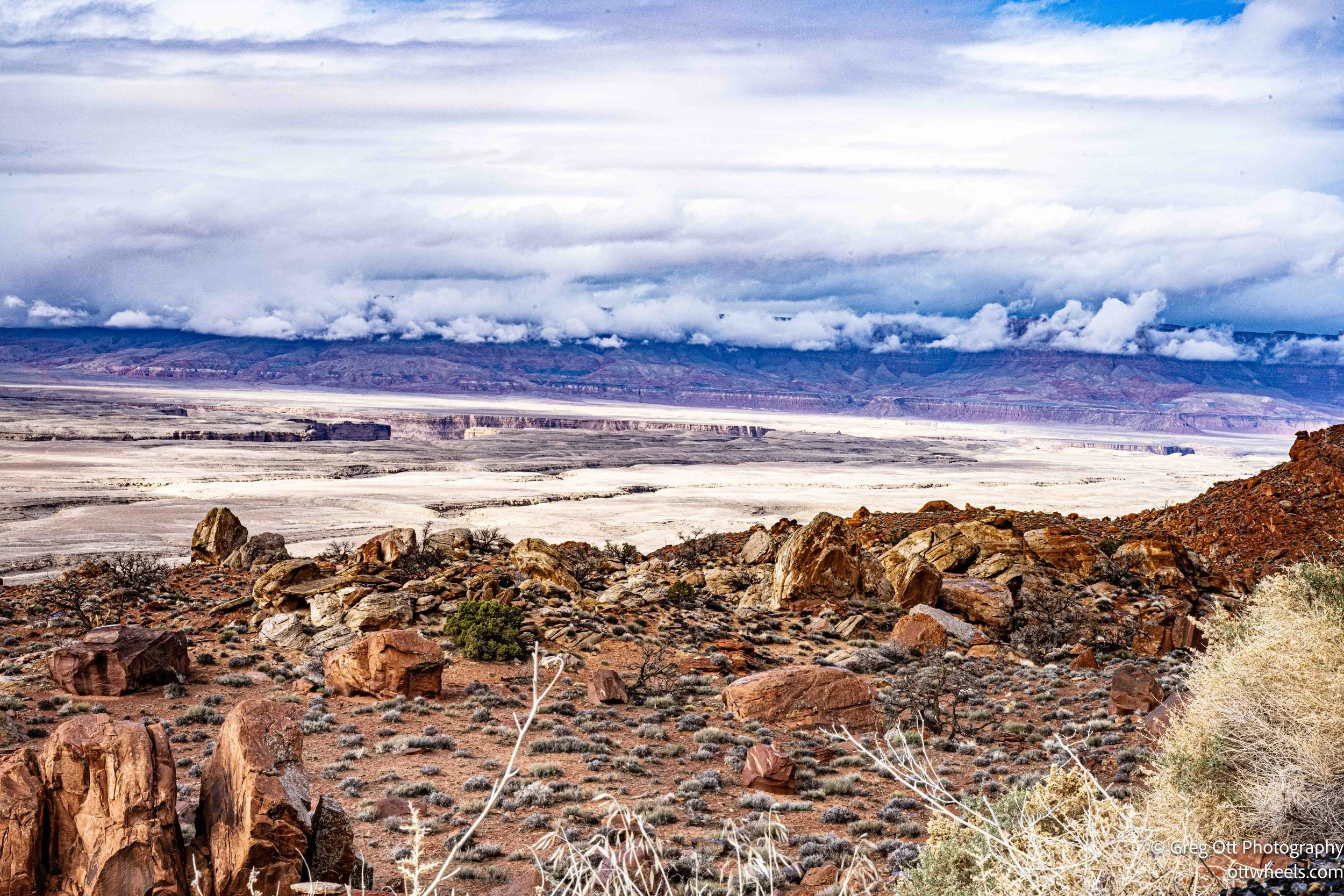
The fastest route to Lone Rock took me out of Hurricane on UT-59, which quietly becomes AZ-389 after crossing into Arizona, skirting the Zion tunnel and cutting across the Kaibab Indian Reservation. It is an easy road to underestimate—wide, mostly flat, and smooth—but before long it begins to climb. The drive rolls up onto the Kaibab Plateau, part of the Kaibab National Forest, where large sections of burned forest tell a clear story. Standing dead trees, thinned canopies, and open sightlines point to major fires like the Warm Fire and the Mangum Fire. The loss of dense forest changes how the land feels. Instead of closing in, the landscape opens outward, making the scale of the plateau and the distance traveled more apparent. Driving through the burned forest gave me an eerie feeling—the standing dead trees, thinned canopy, and long, silent sightlines made the landscape feel unsettled. Something horrible had happened here.

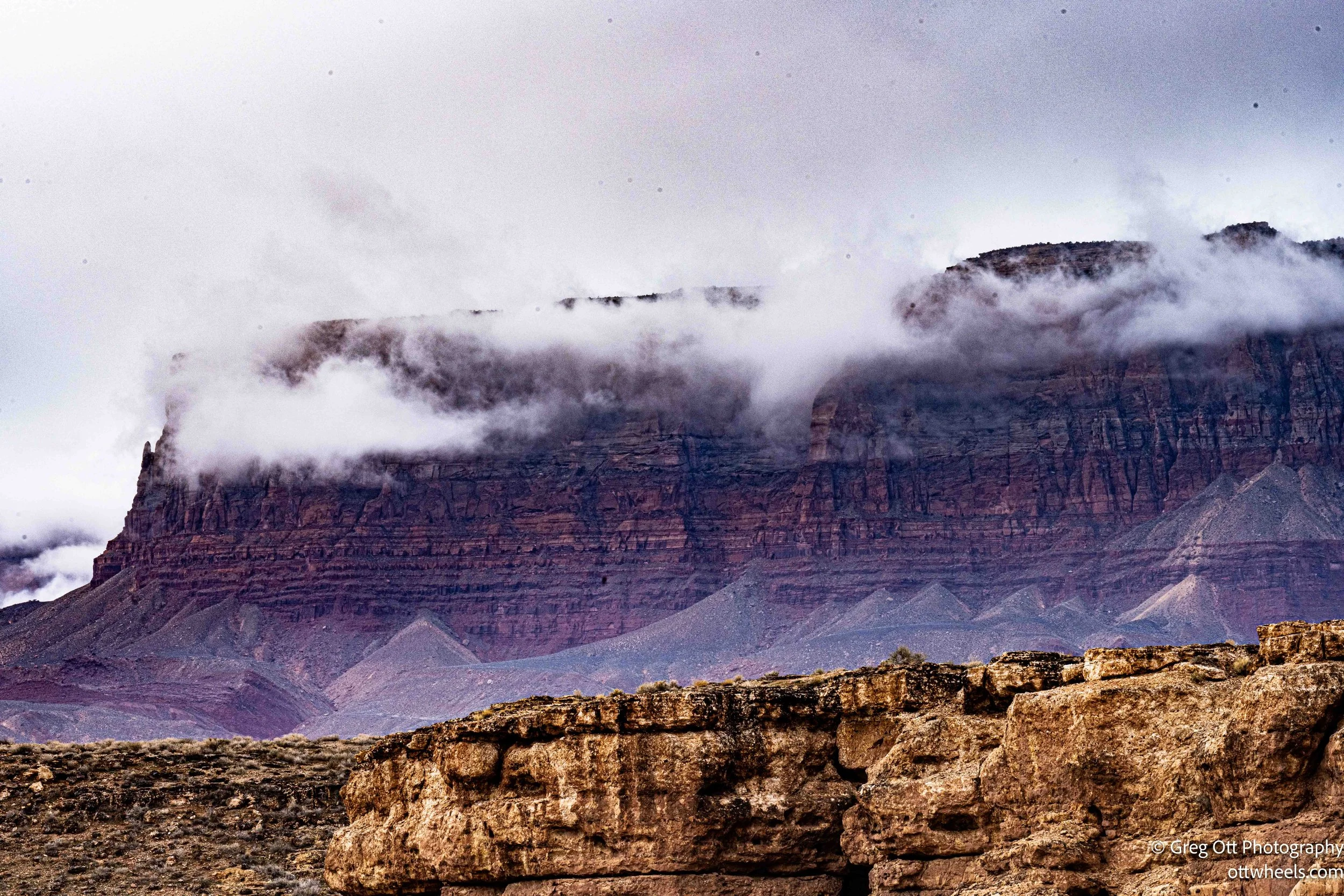
From the plateau, I picked up US-89A and began a long, steady descent that feels like dropping off the edge of the high country. There is no named pass here, but the road tightens, the grade steepens, and the views open dramatically. Pull-offs along the way look out over House Rock Valley toward the Vermilion Cliffs, their layered sandstone more visible because the burned forest no longer blocks the view. It is one of those stretches where the road quietly demands attention while rewarding it at the same time.


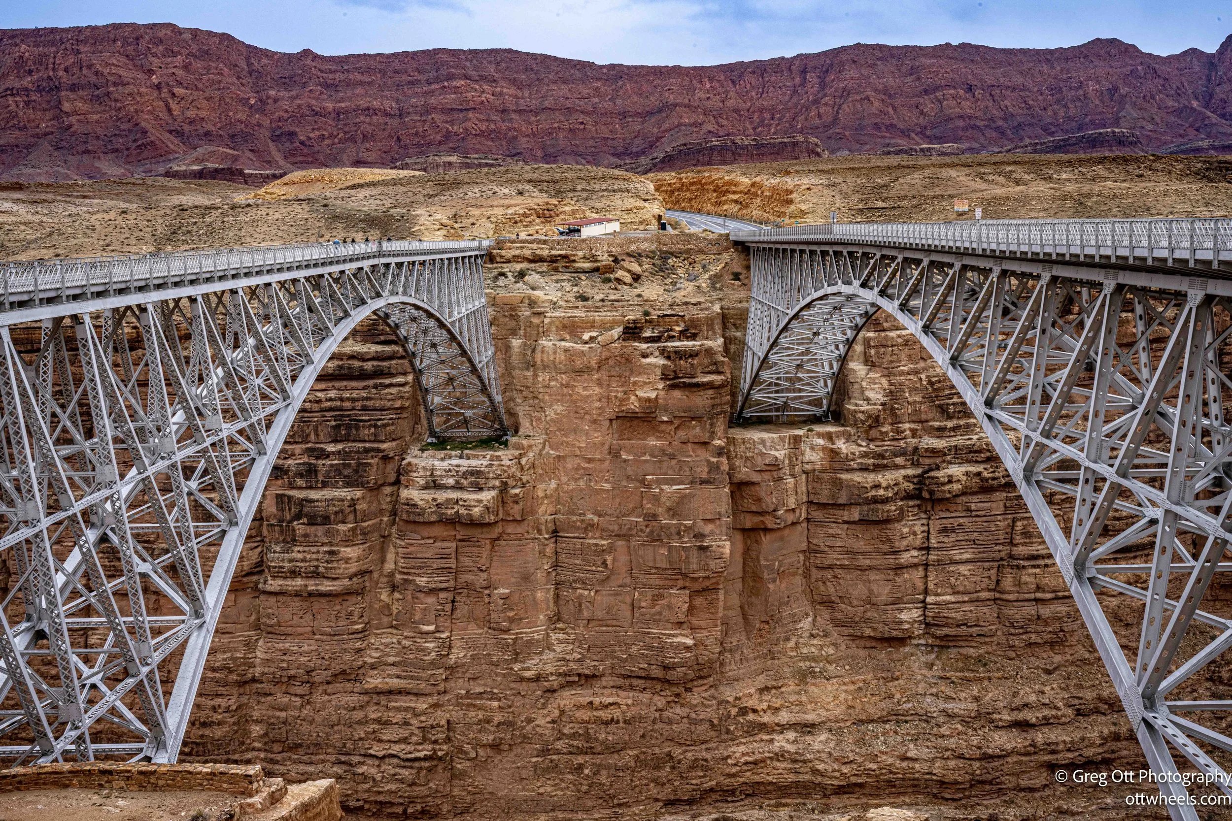
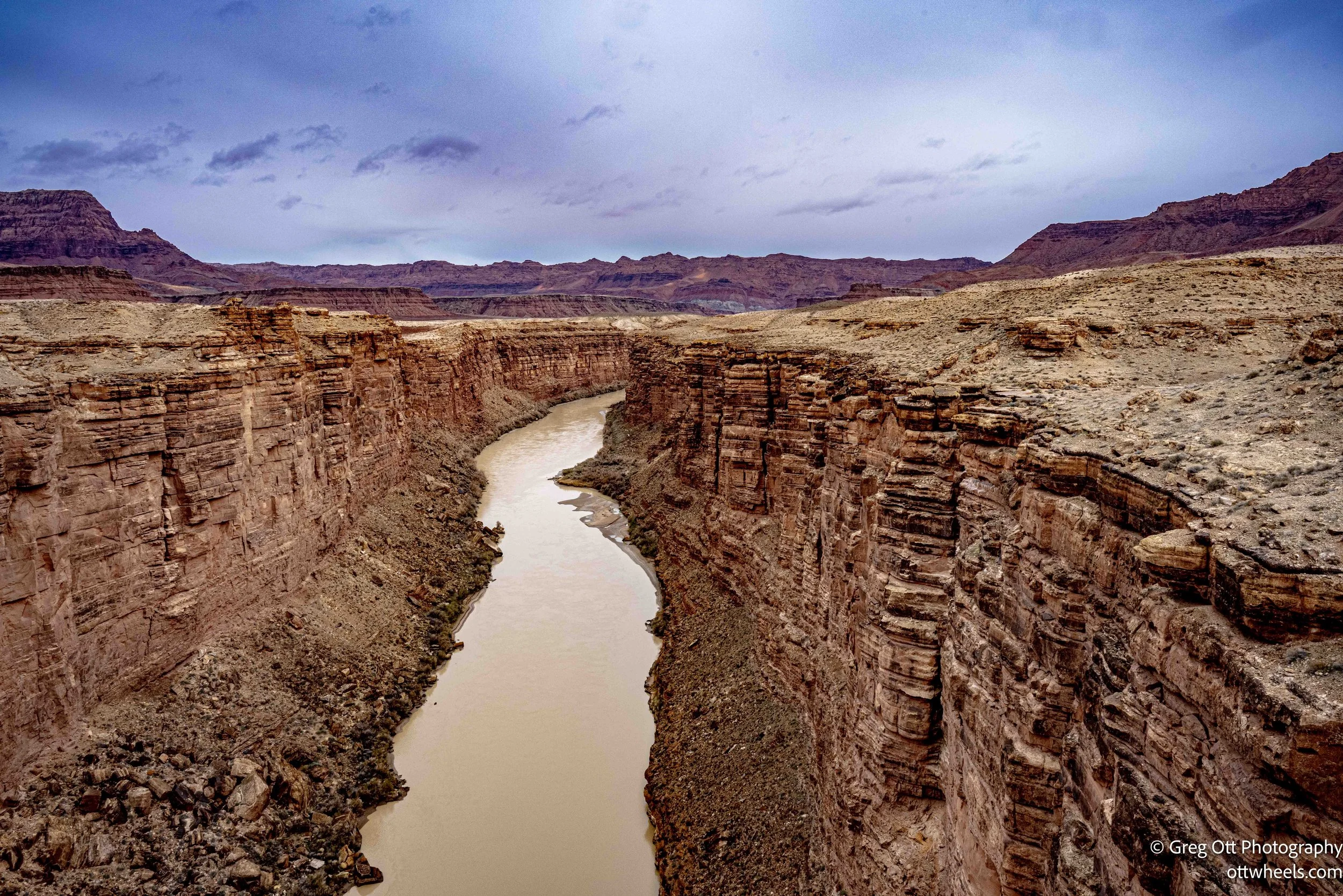
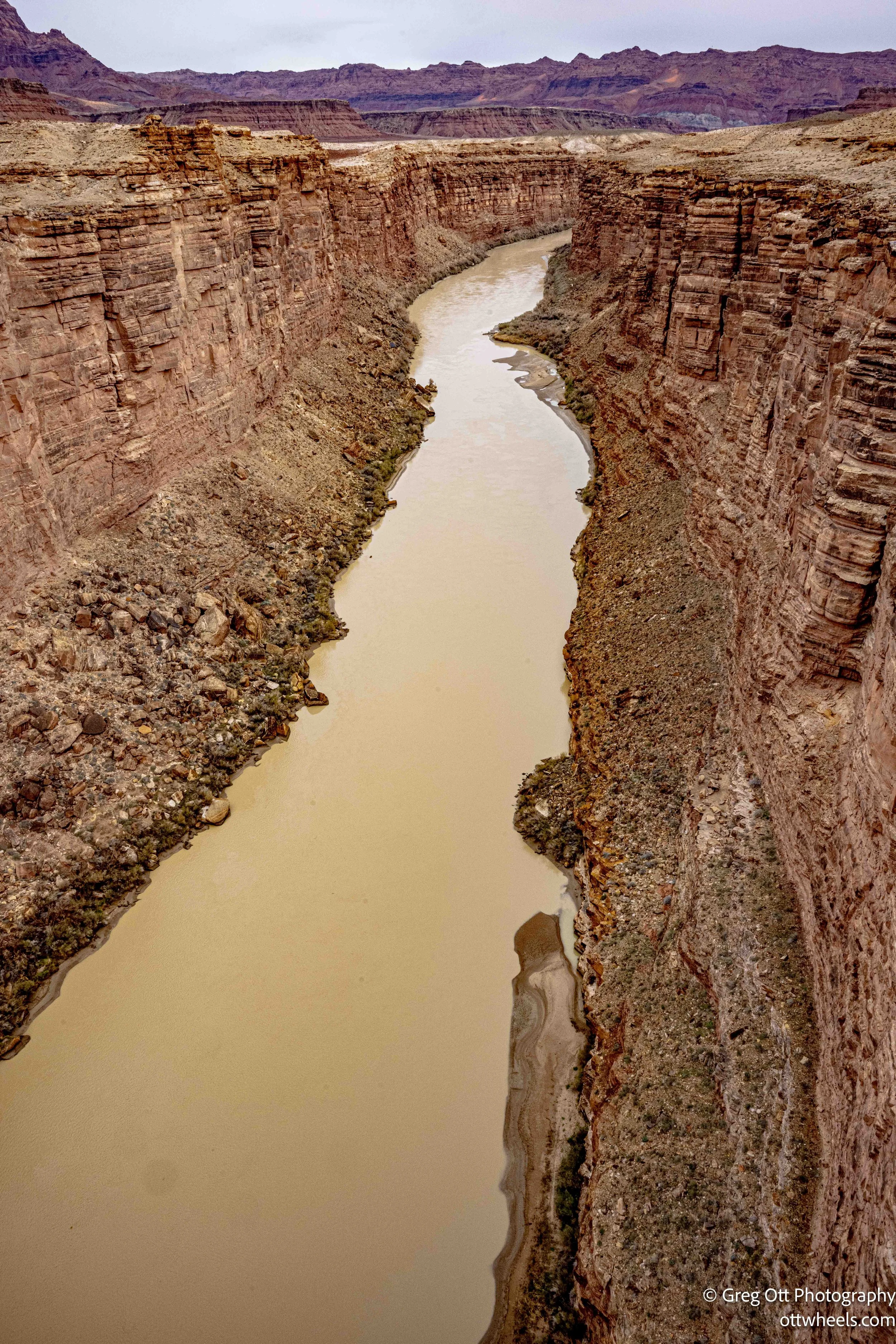
Continuing south, US-89A drops into Lee’s Ferry, the only practical place where the Colorado River can be crossed by road for hundreds of miles. The crossing is marked by the Navajo Bridge—actually two bridges spanning Marble Canyon. The original steel arch bridge opened in 1929 and now serves as a pedestrian crossing, while the newer bridge, completed in 1995, carries vehicle traffic.
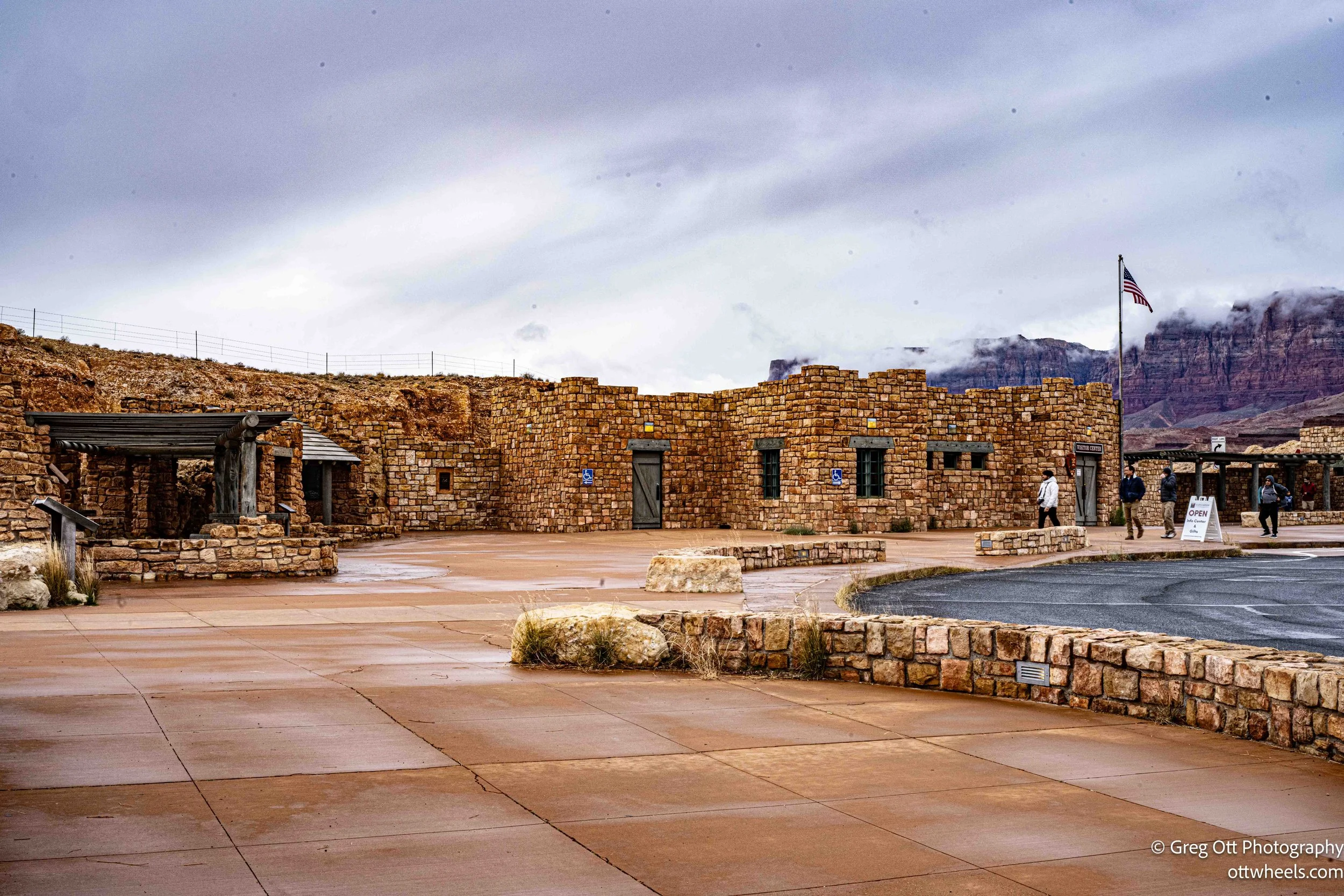
I pulled over and walked the old bridge, stopping to look down at the river far below. Here the Colorado feels narrow and controlled, moving deliberately through stone before beginning its long run toward the Grand Canyon. This is also the traditional dividing line between the Upper and Lower Colorado River Basins, a distinction that still matters for water use and management across the Southwest. Below the bridge, Lee’s Ferry acts more as a gateway than a destination, and the visitor center helps place the crossing in its historical and geological context. Standing there, it is easy to understand why this bend in the road has mattered for so long.
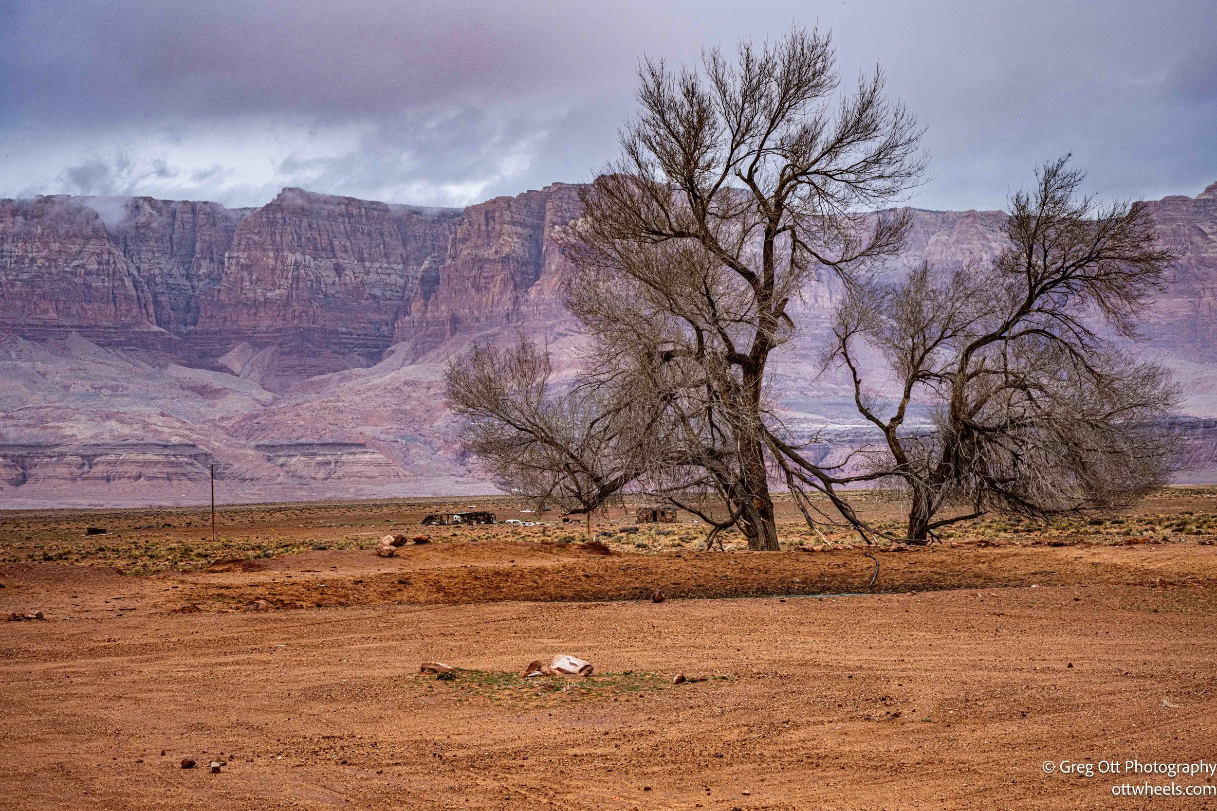
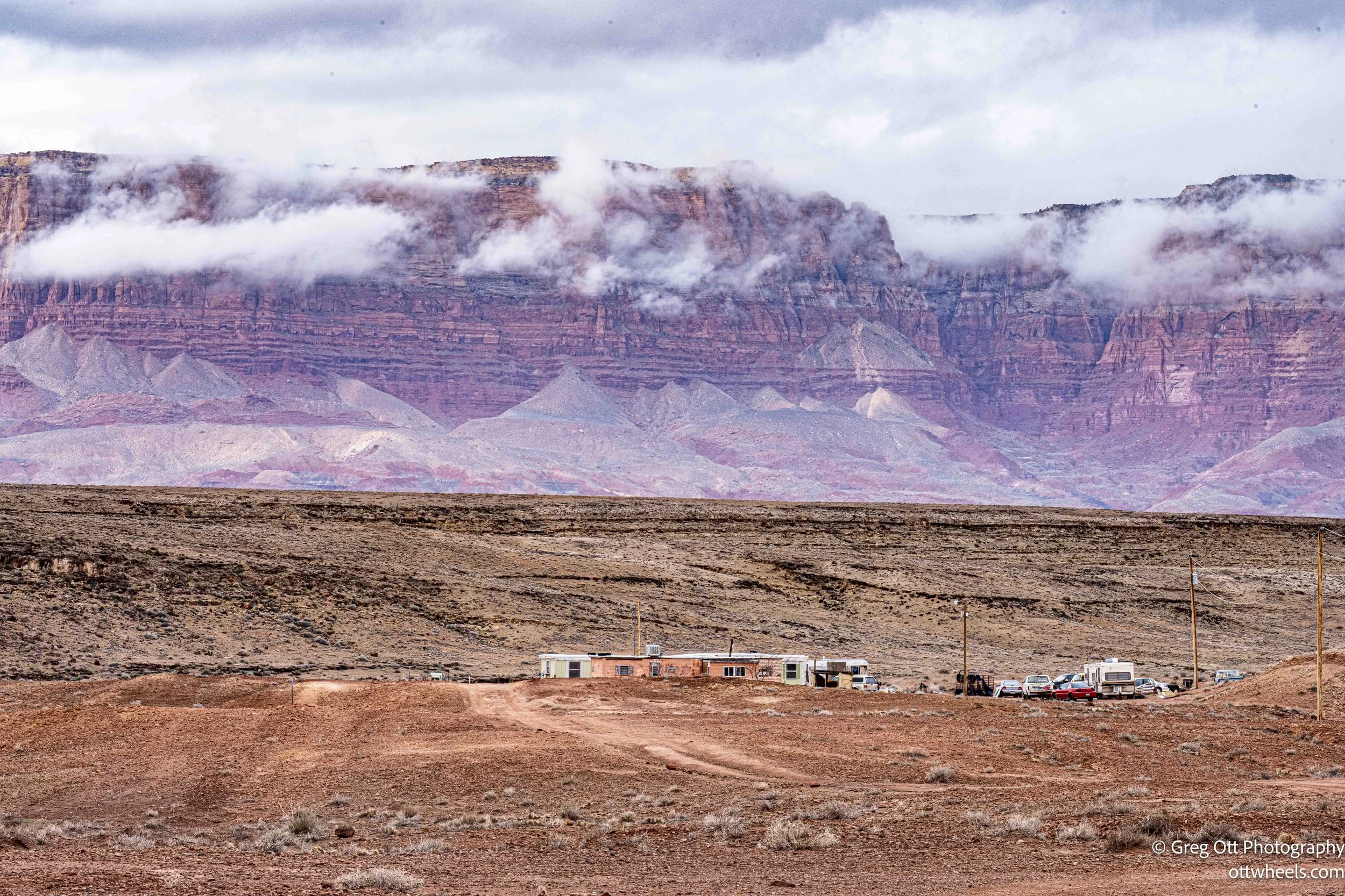
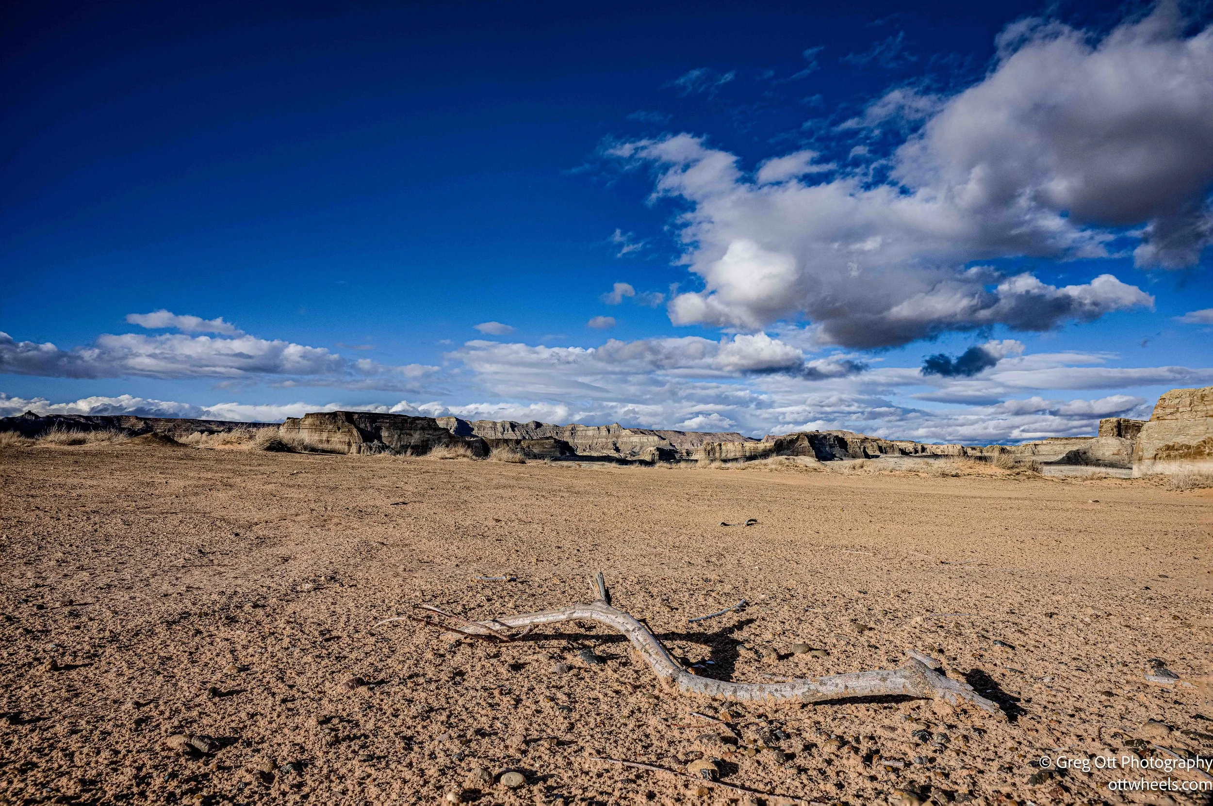
South of Lee’s Ferry, US-89A enters the broad open country alongside Vermilion Cliffs National Monument in Arizona. I did not stop, but the landscape does not require one. The road runs near the monument boundary, with wide valleys, long horizons, and sandstone walls stacked in bands of red, orange, and pale white. This is not dramatic geology in a single moment. It works slowly, mile after mile. The cliffs rise gradually, the colors shift with the light, and the scale reveals itself over distance rather than spectacle. The area is best known for The Wave, a place that has been on my list for years, but access is limited and tightly controlled—and it is in Arizona, not Utah—so it stayed on the list for another trip.
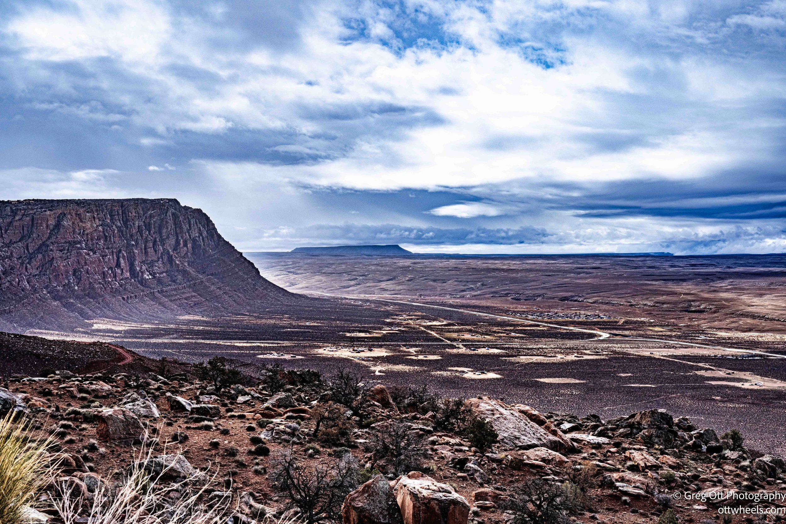
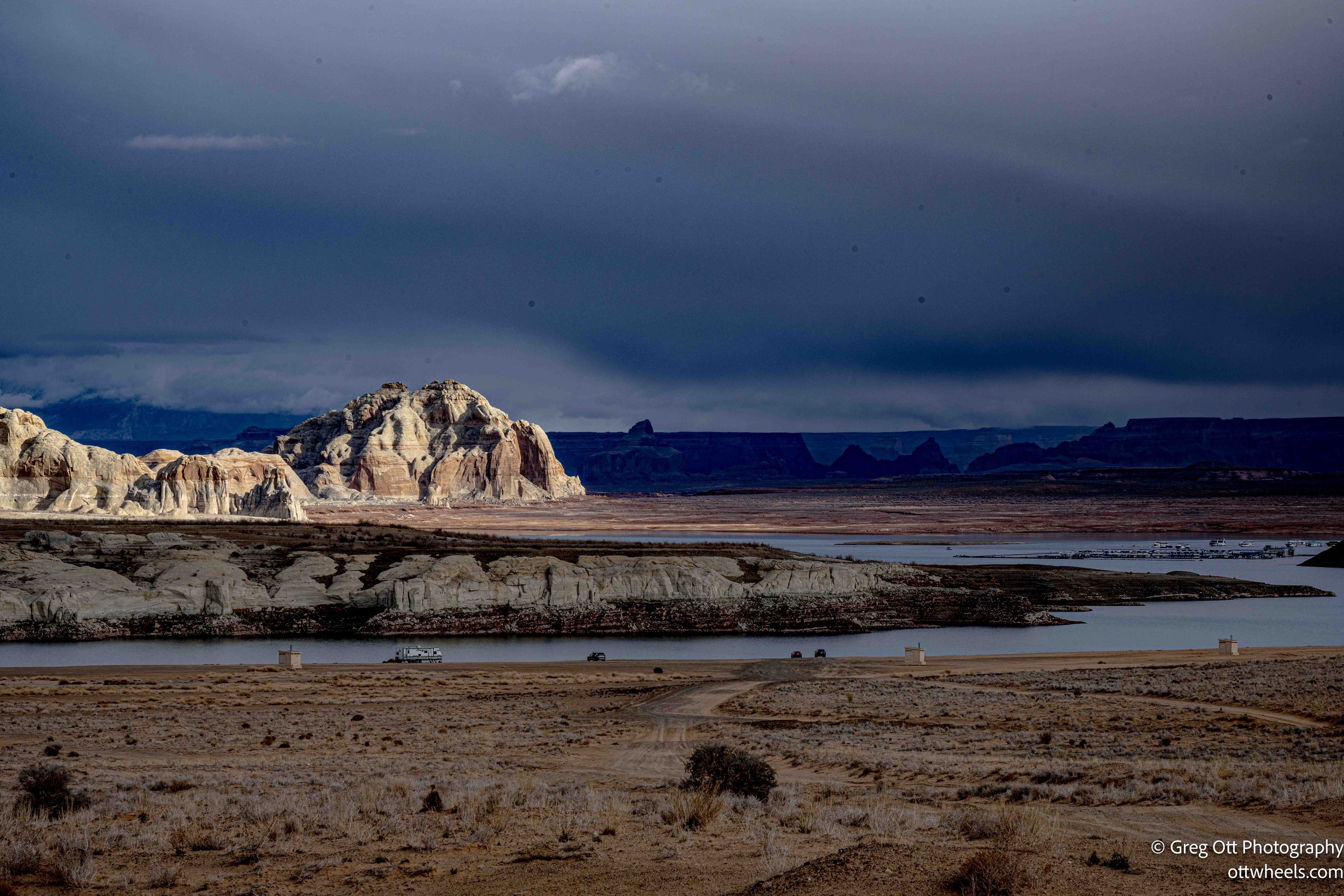
At the junction with US-89, I turned east toward Page, Arizona. Page is as practical as it is scenic, built originally to support construction of Glen Canyon Dam and now serving as a hub for Lake Powell and the surrounding canyon country. I stopped for groceries and fuel, then continued north. Lone Rock was only eight miles away.
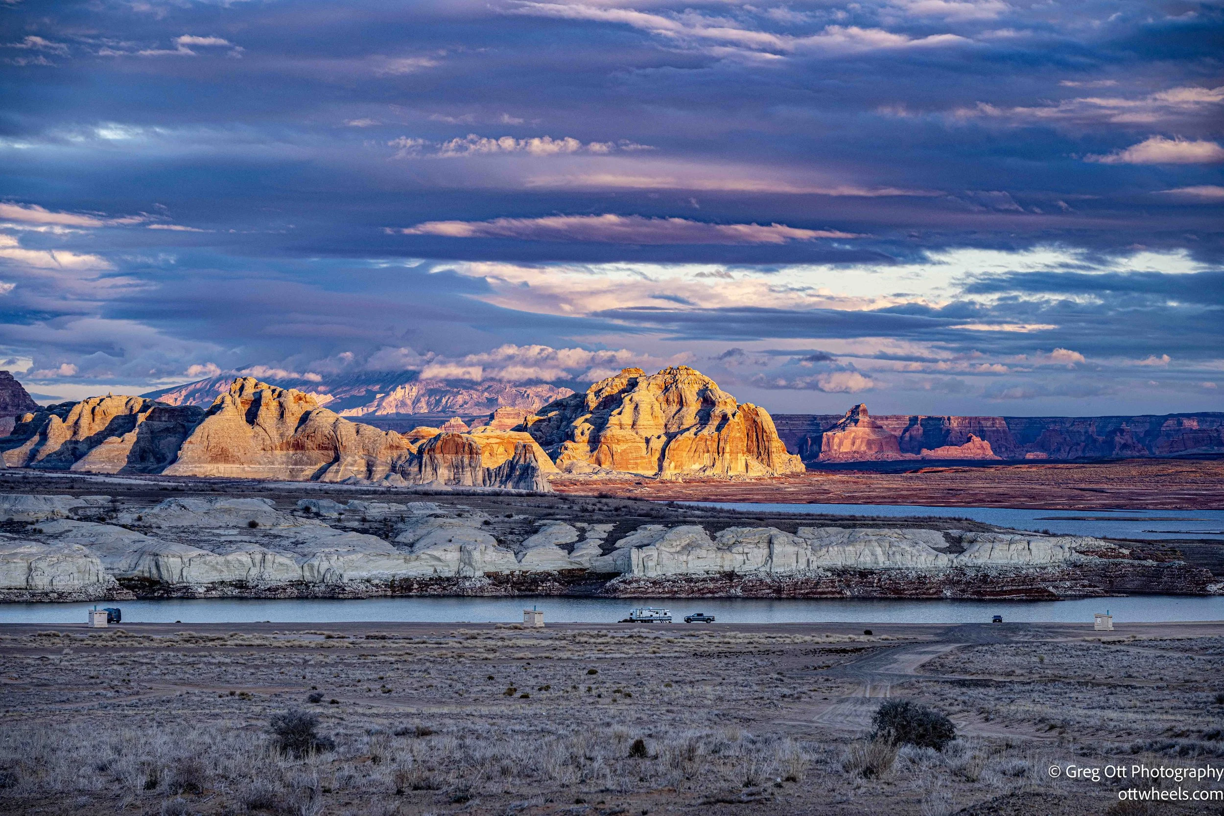
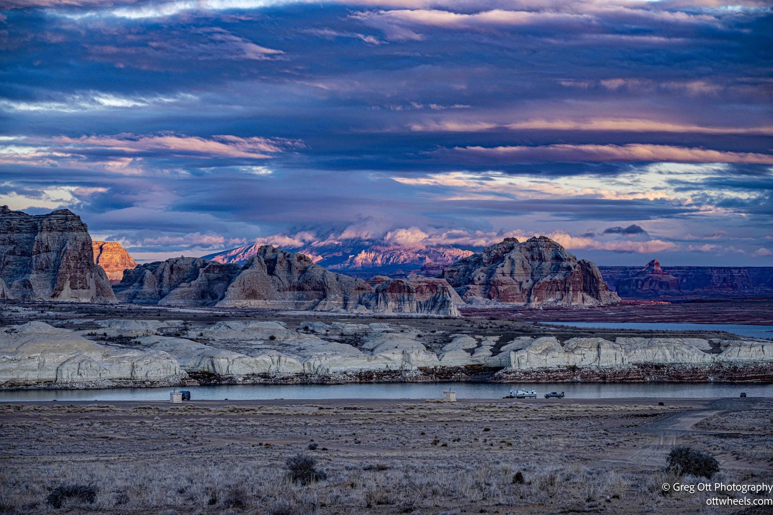
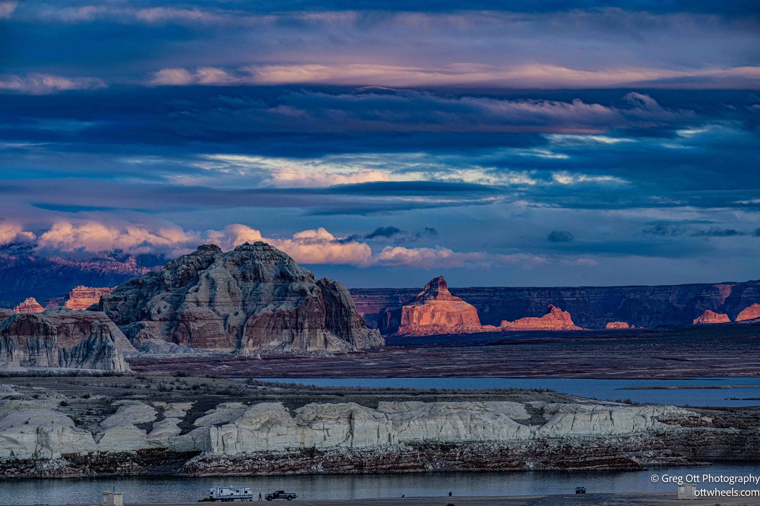
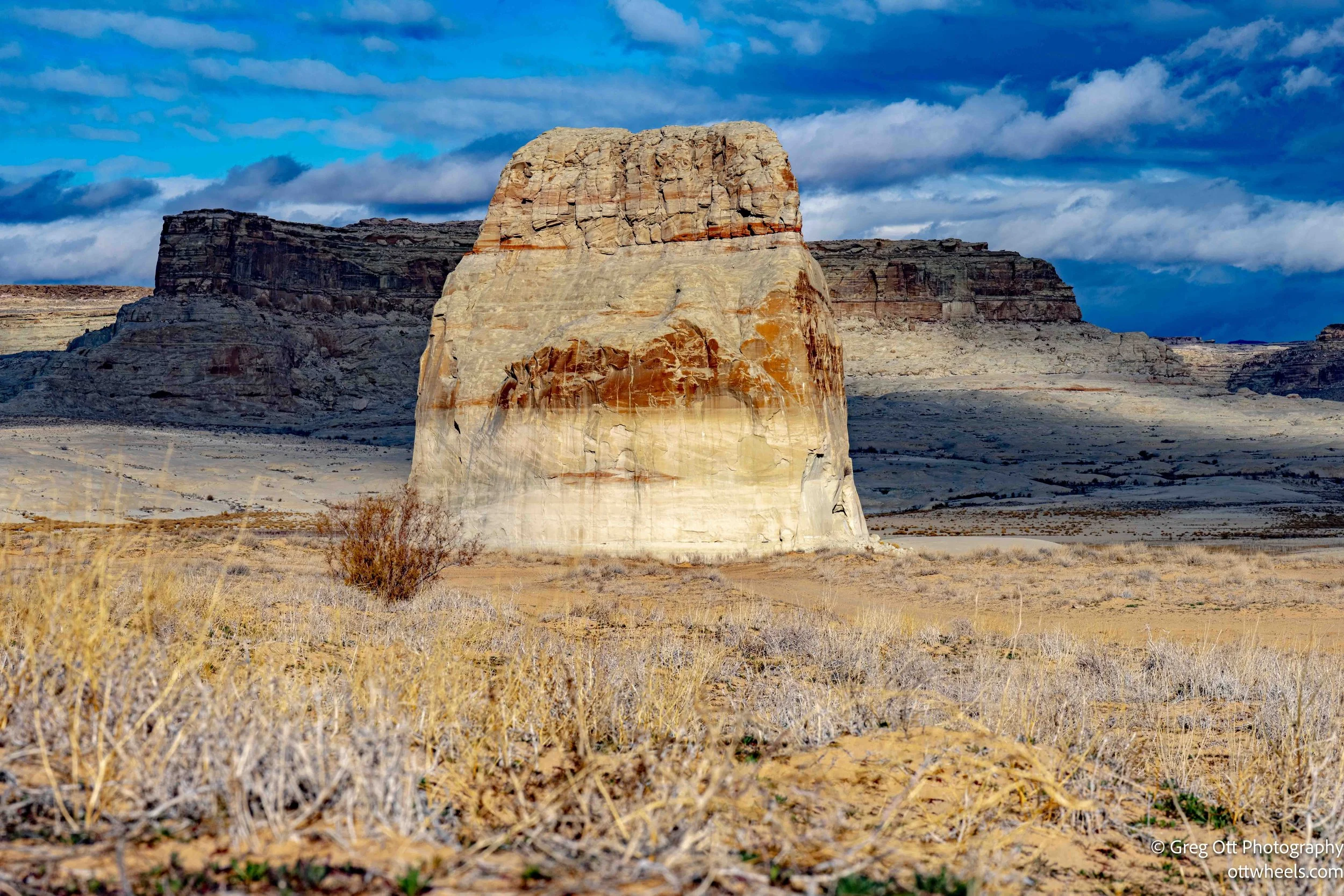
Lone Rock rises directly from the shoreline of Lake Powell, just inside Utah, a massive sandstone monolith standing alone against open desert and water. Under normal conditions it is surrounded by the lake, but the low water levels change everything. I walked down the sandy hill toward the new shoreline, the rock closer now but the absence impossible to ignore. The exposed sandstone walls and the empty space above the waterline make the missing volume of Lake Powell unmistakable—not something you measure in feet, but something you feel in scale. The old water line is still visible on the rock, high about the base below.
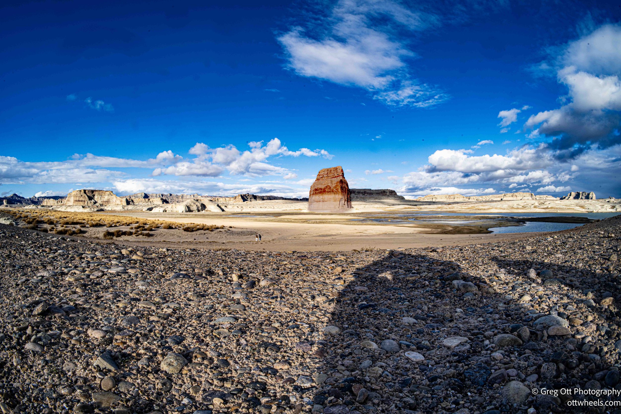
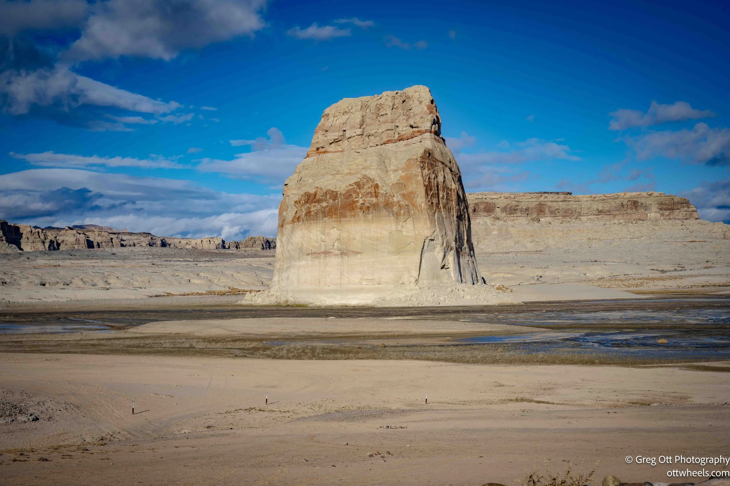
I lingered near a parking area that was likely once near the water, now nearly half a mile away, and watched the sun drop and light up the rock at sunset. As darkness settled in, I drove back up the hill to the campsite. No one else was there. It was completely quiet.