Waterfalls, Shipwrecks, and Wandering the Shores of Munising
I pulled out of the casino parking lot around 10 AM, headed toward Munising, MI. I stopped for gas just up the street and accidentally cut off a guy in a truck. He’d been sitting way off to the side, nowhere near the pumps, so I didn’t realize he was waiting. A woman was doing a weird, awkward U-turn in the middle of the station — no idea why, since she could’ve just pulled out straight and turned onto the road. He pulled up beside me, shouting and flipping me off, totally losing his mind. That’s when I figured out he was waiting for her to clear out before pulling in. I backed up, got out, and apologized. He cooled down right away. “I’ll take this one — you go ahead,” he said.
Munising
I made it to the visitor center in Munising, but it felt more like a kitschy gift shop than an information hub. A woman sat behind the counter ready to hand out maps, sell tours, and pitch t-shirts. I asked about outdoor things to do — I got the sense she was thinking, Yeah, just like everyone else, it’s all online. She didn’t say that, of course, but she handed me a local map stuffed with ads, circled two kayaking companies, and pointed out the waterfalls and lighthouses within an hour’s drive.
I drove to Pictured Rocks Kayaking and booked a five-hour trip — two hours on the water for tomorrow at 3 p.m. I left to explore some waterfalls and the Au Sable Light Station. Distances out here are deceiving; I can’t do 55 mph with all the twists and narrow roads. A lot of the turns are posted at 40 mph, so it takes longer than you’d think.
Alger Falls

My first stop was Alger Falls — just ten minutes from the info center. I’d driven right by it on my way in and didn’t even notice it. It’s right along the road, and as I pulled over, I saw a three-foot deep erosion hole — if I’d parked in that, the van would have tipped and rolled down the hill. I took my time trying to find a good vantage point, but it was muddy and crowded with people who’d clearly chosen this spot because it didn’t require much walking. Folks were trying to scramble up a slick, muddy slope in flip-flops — they weren’t having much luck. I ended up with a few so-so shots of the falls.
Next up was the Au Sable Light Station, about an hour northwest along Lake Superior. On the way, I stopped at Pictured Rocks Trading Company for some ice cream — a swirl of caramel, chocolate, and banana. I’d asked for two scoops but told the woman to stop after the first one. “Yeah, our portions are pretty big,” she laughed. I ate it in the shade, watching people check in to the nearby log cabins.
Au Sabre Light Station
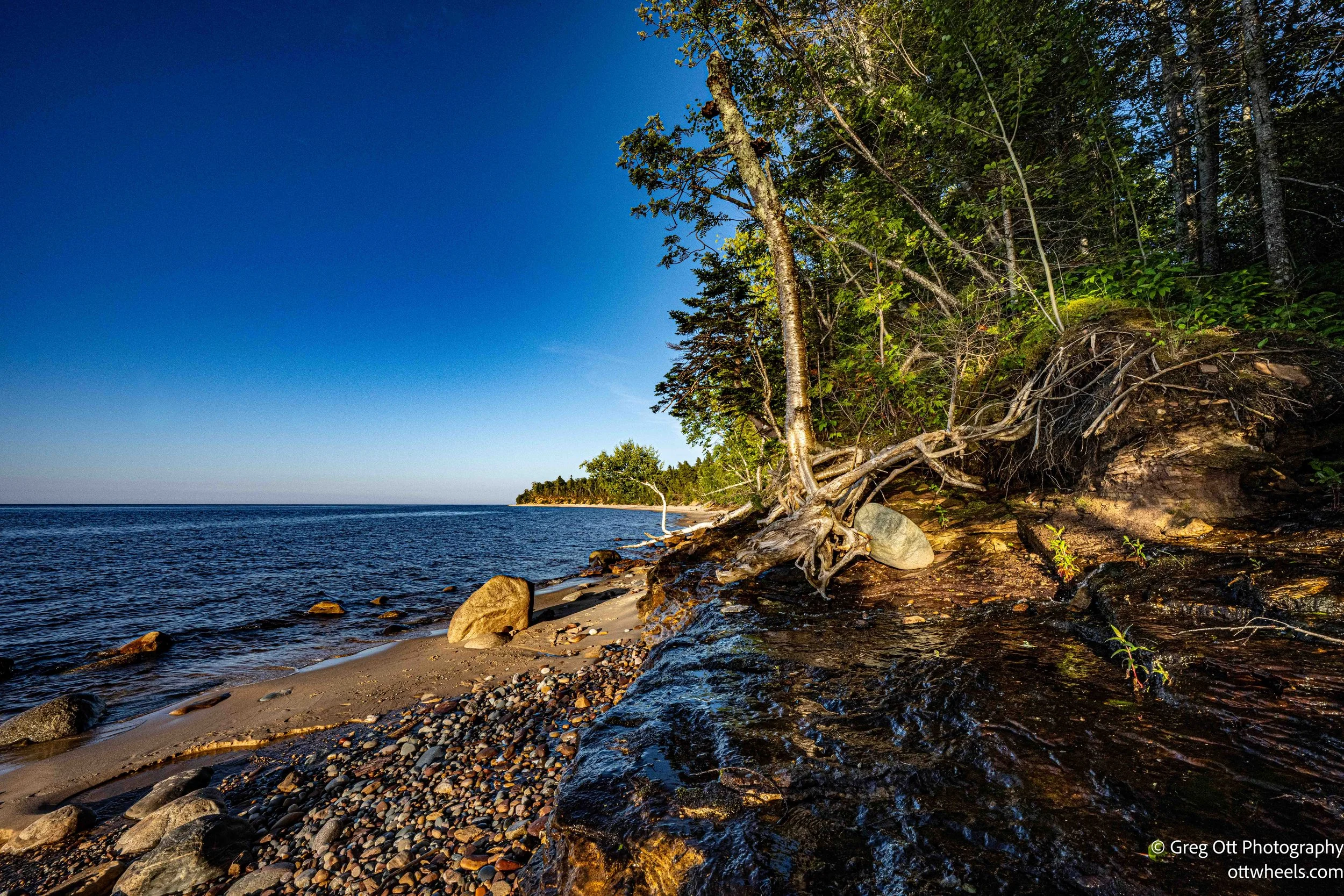
I got to Hurricane River Campground, parked at the trailhead, and geared up for the hike out to the lighthouse. The map mentioned “Shipwrecks on the Beach” — I was excited to get some photos. The trail to the light station was about a mile and a half, and I hauled all my camera gear since I didn’t know which lens or filter I’d need. I was feeling pretty good, and the extra 20-plus pounds didn’t weigh me down much.
There was a sign pointing toward the beach: Shipwreck. I walked out there but didn’t see anything that looked like a shipwreck. A man about my age stood nearby, so I asked him if he knew where it was. He didn’t — turns out he and his wife have a second home here. They’re from Lansing and have been coming for years. He hikes the trail a few times a week but had never seen a shipwreck.
I gave up on the shipwreck for the moment and hiked on to the lighthouse / ight station. I’m still not sure what makes a light station different from a lighthouse — they look the same to me. I spent a while photographing the tower and the surrounding buildings.


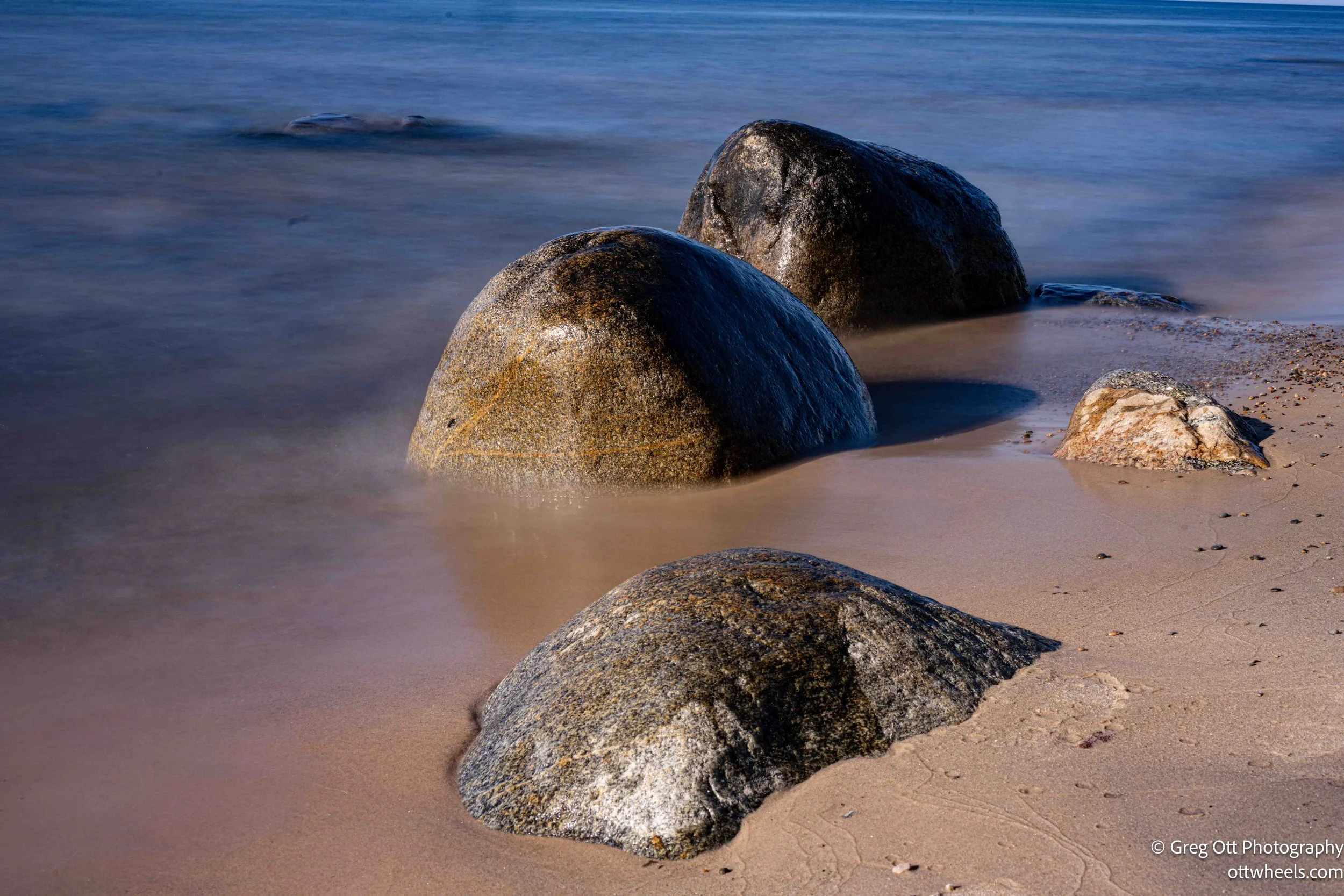
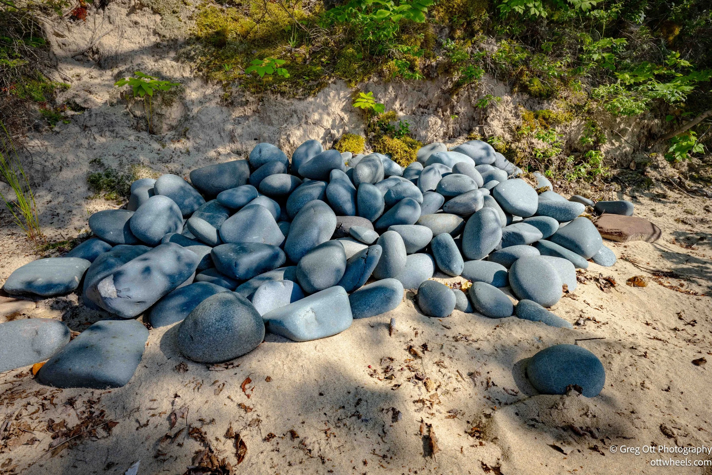
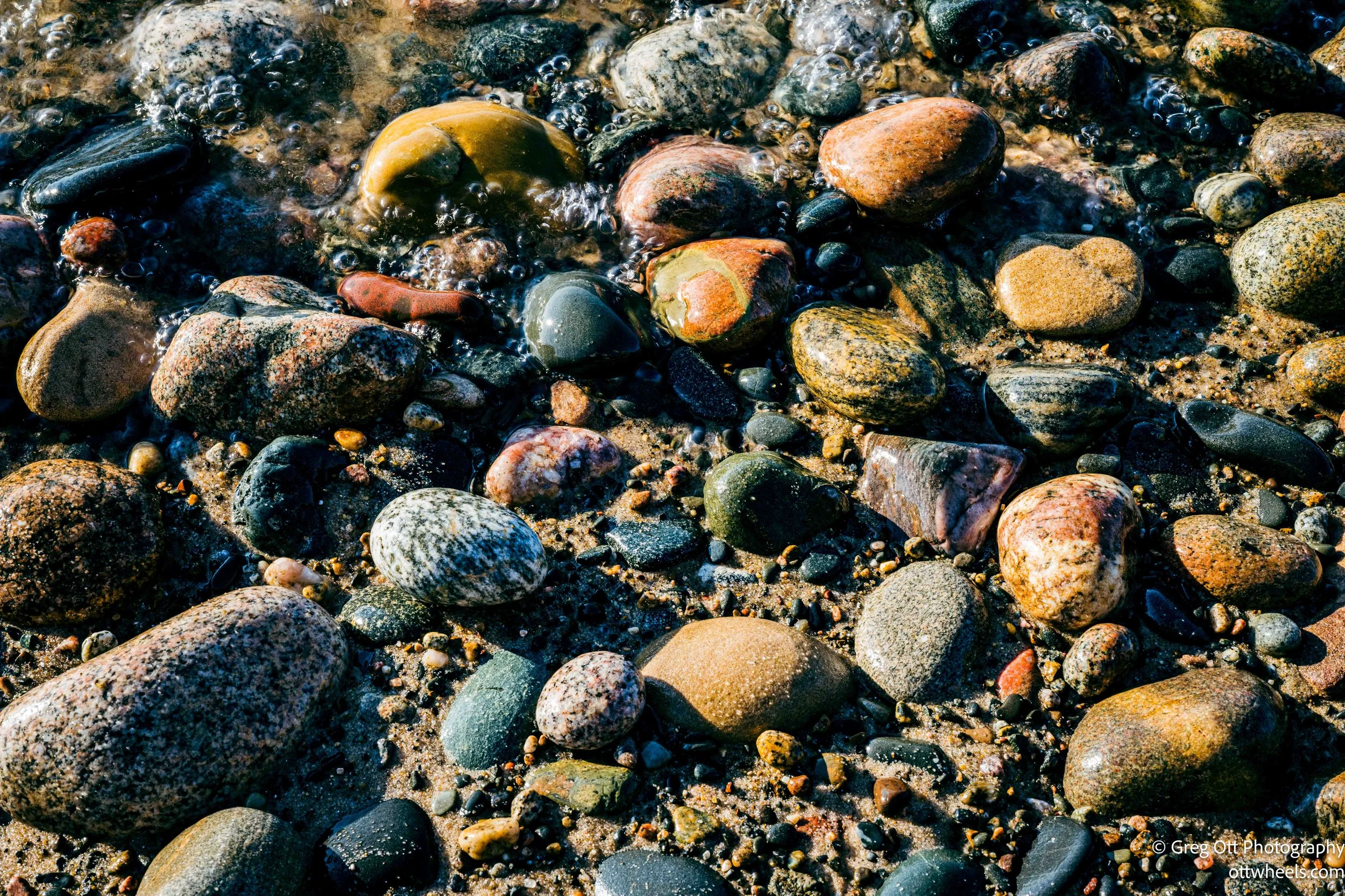
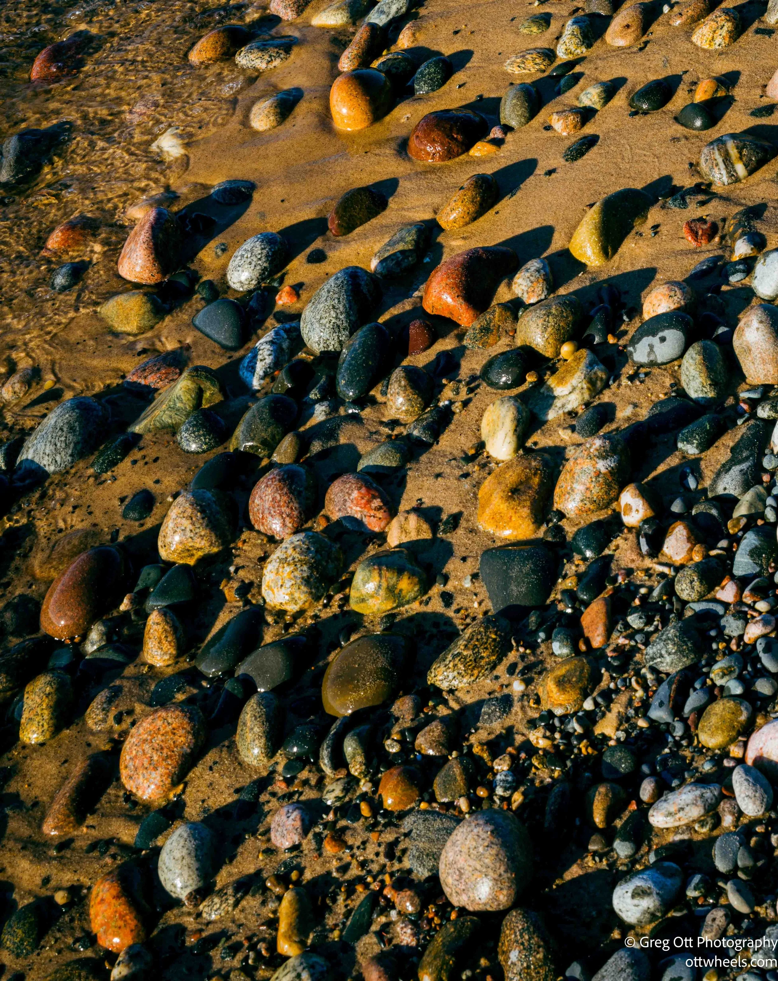
After that, I went back down to the beach, determined to find those shipwrecks near Painted Rocks. I spent a lot of time just photographing rocks. I’ve heard there are mussels and other Shellfish in Lake Superior, but I still haven’t seen a single shell wash up. These beaches are rugged, mostly empty, and I’ve barely seen any houses on the shore. I had the place to myself for a while.

A little farther down the beach, I came across a young woman sitting alone, gazing out at the lake. She was from Australia and working a two-week gig as a camp counselor nearby. She’d been to the States before — so far, she’d seen ten states. She really liked Montana and was fascinated by the farming in Iowa, Kansas, and Nebraska. Her family farms back in Australia, so she was curious. When her job ends, she’s planning to travel around New England for a month. She hadn’t seen any sign of shipwrecks either.
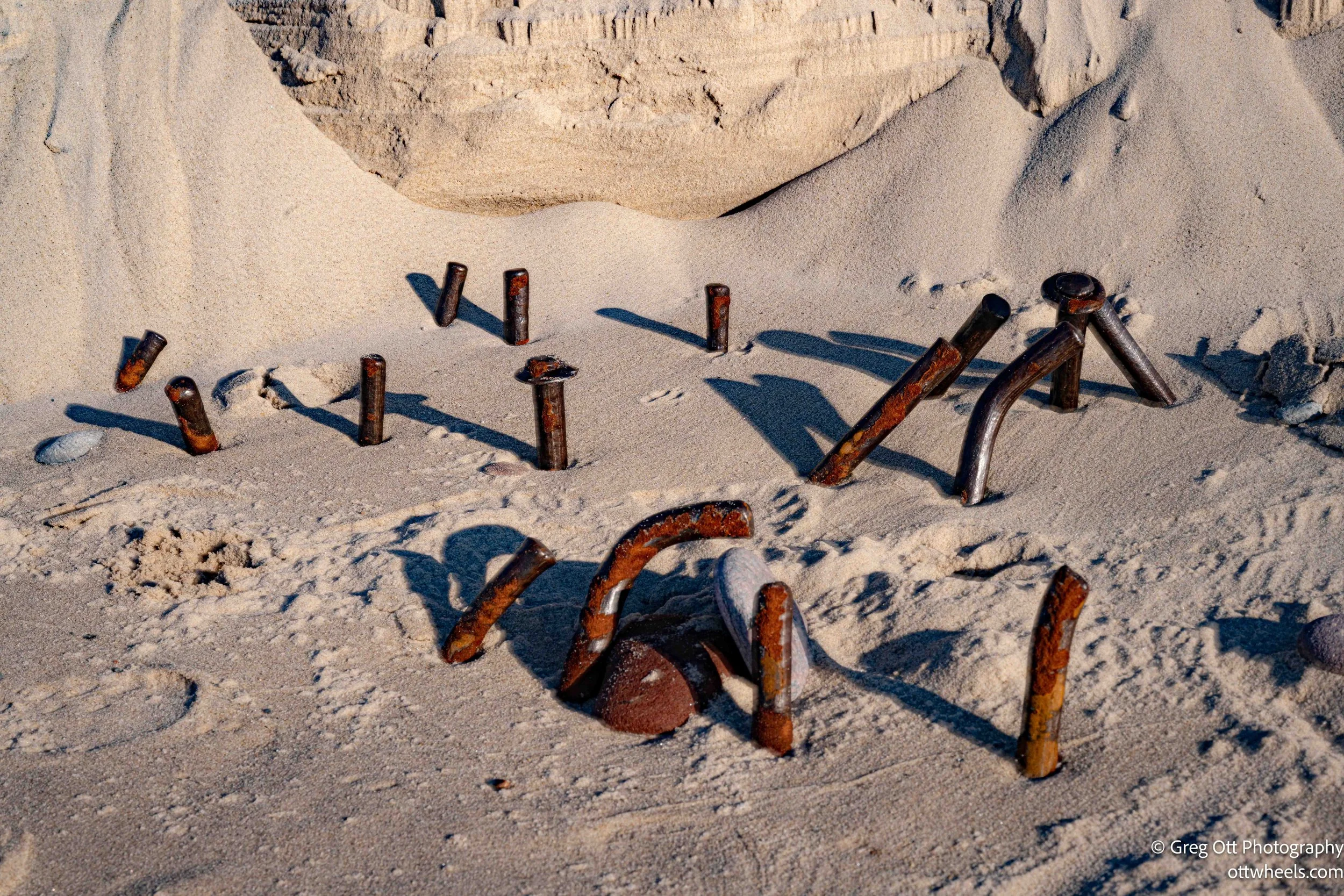
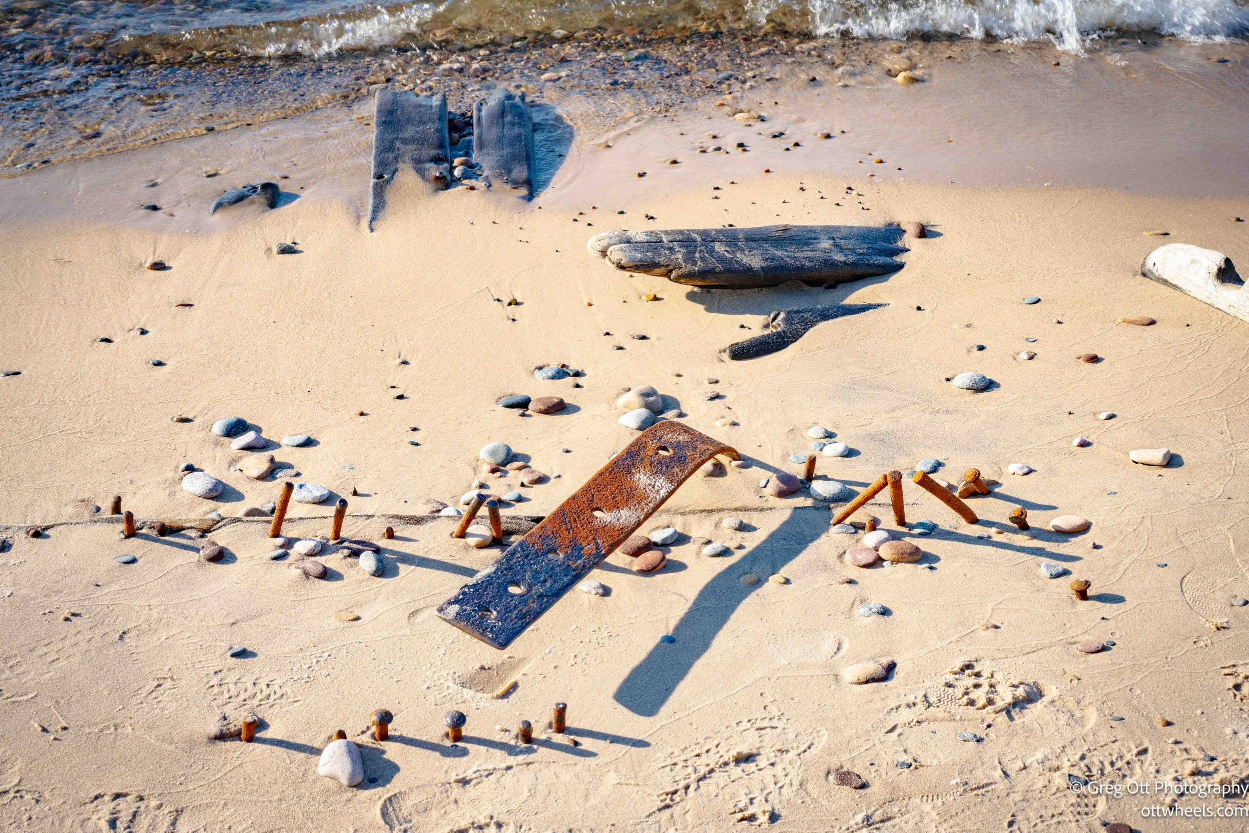
About a hundred yards down the beach, I realized I was standing right on top of one (the Sitka, ) — what I’d thought was driftwood jammed in the sand turned out to be an actual shipwreck. I spent a good while there getting shots of the old timbers.
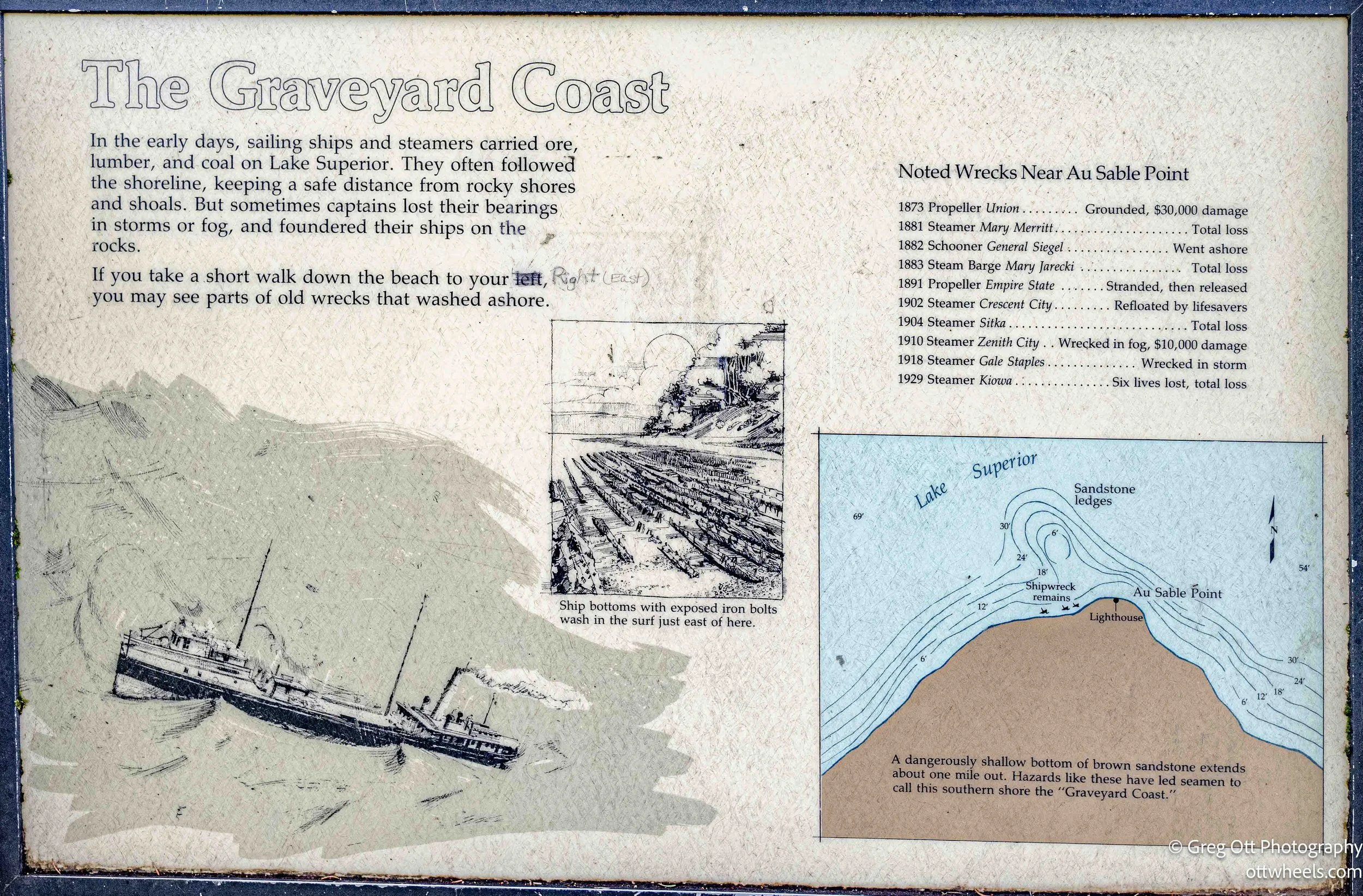
With some research, I realized there are several shipwrecks scattered along the beach near the Au Sable Light Station, reminders of just how treacherous this stretch of Lake Superior can be. The Mary Jarecki, a wooden steam barge, ran aground in the fog back in 1883; its hull timbers still peek through the sand. The Sitka, a wooden steamer that caught fire and wrecked in 1904, leaves scattered remains you can sometimes spot right at the water’s edge. A bit farther along, pieces of the Gale Staples, a schooner-barge lost in a 1918 storm, can still be found if you know where to look, I didn’t.


I wandered down the beach for the next hour. The sun was dropping low, the light turned soft and golden, and the shadows stretched long. I was all alone, soaking up the peace and the shifting colors. I found more rocks and things to photograph.
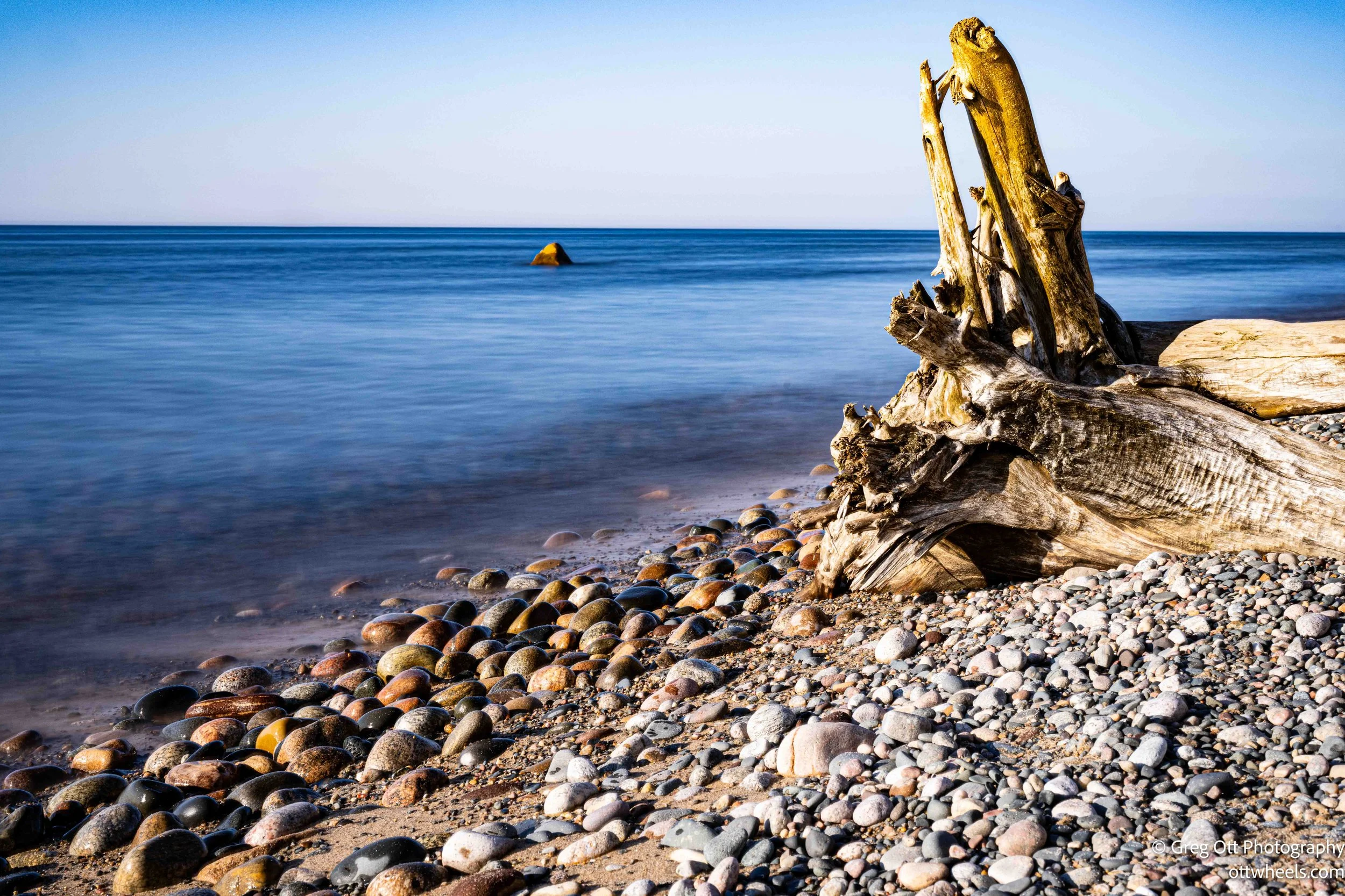

I spotted another shipwreck (The Mary Jarecki) farther along and even found a set of steps leading back to the trail. I sat on a rock, just watching the waves and the slow fade of the light. It felt good to be still.

As night was approaching, I realized I needed to leave this little paradise.Eventually, I made my way back to the trail and headed for the van.


I eventually the van around 9:45 p.m. I still didn’t have a place to sleep, and for some reason, my GPS had stopped working. I wanted to stay close to the kayaking spot, so I drove back toward Munising. I stopped at five campgrounds — every single one was full. The GPS finally came back online, but every free camping spot I found had a “No Overnight Camping” sign posted. By 11:15, I was out of steam.
Hiawatha National Forest
I had two choices: the casino lot in Munising or a spot in the Hiawatha National Forest, about 30 minutes away. I had coordinates for a site in the forest. When I got there, I saw a small green school bus already parked. There was plenty of room for another vehicle, so I turned around and backed in quietly, hoping I hadn’t disturbed anyone.
It didn’t take long for me to drift off to sleep.