Turkey Run, Hiking, and Covered Bridges
I forgot to set my alarm for an early morning hike and ended up sleeping over ten hours. So, I guess my body had some opinions about my schedule.
Walter, my Harvest Host, had given me a beautifully detailed map of Parke County—three state parks, 40 covered bridges, all clearly marked. Unfortunately, I read “Bridge 4” as “Bridge 14” and punched in the wrong one. That turned out to be one of the worst bridges to choose: farther away, painfully remote, and down miles of gravel road that shook everything in the van. One drawer is definitely getting re-aligned. A two-hour detour for a solidly mediocre bridge.


As you drive through this part of the country, you pass small towns with a single flashing red light and stop signs at quiet intersections. Just beyond the center, the buildings fade and the landscape opens into wide, flat farmland. Corn and soybeans stretch for miles in every direction—a steady, familiar rhythm that defines the area.


From there, I headed north to Turkey Run State Park, arriving around noon on a hot, humid Saturday. Everyone in the area had the same idea: go to a state park and try to chill out. They only take cash at the gate, so I had to swing by the office to pay my $9 out-of-state fee. The two massive, sunbaked parking lots near the entrance were nearly full, and the thought of baking in the van wasn’t appealing. I saw a picnic area a mile deeper into the park and drove that way instead—shaded, cooler, and much more pleasant. I found a good spot, pulled up AllTrails, and picked an almost 3-mile loop that crossed several trail paths.
The trails were packed. Families trying to have fun. A few meltdowns in progress. People who looked like they hadn’t walked more than two blocks in a year trying to tackle miles of steep terrain with no water. Kids staging quiet revolts about being taken away from their screens. And occasionally, a young couple just enjoying each other and the trail—proof that peace is still possible.
Sugar Creek—more of a small river, really—runs through the park. On a 90+ degree day, floating down it made the most sense, and the tubers and kayakers looked significantly happier than the hikers. One guy had a dog in his canoe that barked nonstop. The guy tried to quiet him by smacking the side of the canoe with his paddle, which nearly knocked him into the water—twice. The dog, of course, remained unfazed.


Signs clearly said “No Swimming,” which seemed to encourage people more than deter them. A guy behind me, probably 20, laughed as he walked past a sign and said, “This is my generation—we ignore the rules.” Then came the high-fives.
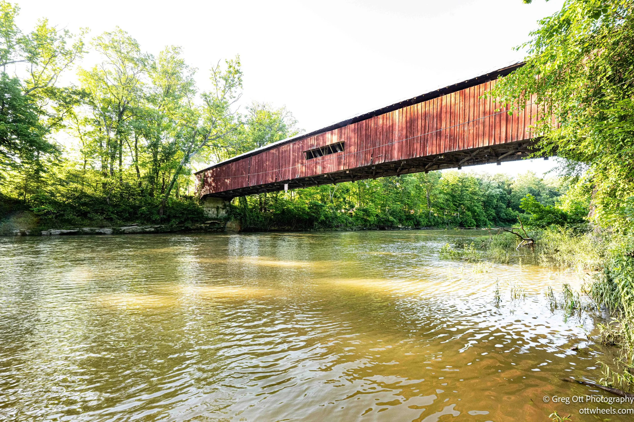
The hike itself was stunning. The park felt like a hidden canyon system, full of towering rock formations shaped by time and water. I crossed the suspension bridge swaying over Sugar Creek, wandered through the iconic covered bridge, and stopped to read about a landfill reclamation project—once damaged land slowly coming back to life.


The recent rain made things slippery. Steep sections were helped by stone or wooden steps, but the mud didn’t play nice. I had to watch every step to avoid a wipeout. I also found myself pausing often to admire the trees—some tall and regal, others gnarled and twisted, all part of this timeless forest.

Lusk Earth Fill
In the mid-1800s, John Lusk, who owned the land that would later become Turkey Run State Park, undertook a major earth-moving project now known as the Lusk Earth Fill. The county had agreed to build a public road to the area, and Lusk assumed it would cross a deep ravine on his property, so he spent years constructing a large earth fill by hand to support the future road. The first version washed out in heavy rains, but he rebuilt it with improved materials and drainage. In the end, the county did build the road—but routed it slightly upstream and constructed a covered bridge over Sugar Creek instead. Lusk’s earth fill was never used for its intended purpose, but it still stands today as a quiet reminder of 19th-century effort, planning, and an unfortunate misalignment of expectations.
The recent rain made things slippery. Steep sections were helped by stone or wooden steps, but the mud didn’t play nice. I had to watch every step to avoid a wipeout. I also found myself pausing often to admire the trees—some tall and regal, others gnarled and twisted, all part of this timeless forest.


Back at the van, I was drenched. I wiped down, turned on the fans, and chilled for an hour before making a simple dinner: corn on the cob (too hot to handle) and a salad.
Later, I went bridge hunting again and visited seven more. Near Rockville, there’s a point where three covered bridges—Leatherwood Station, Marshall, and Beeson—are all close together. To get to the Marshall bridge, I had to cross Leatherwood Station, but I was well over the posted weight limit and decided not to tempt fate. The bridge lives another day.

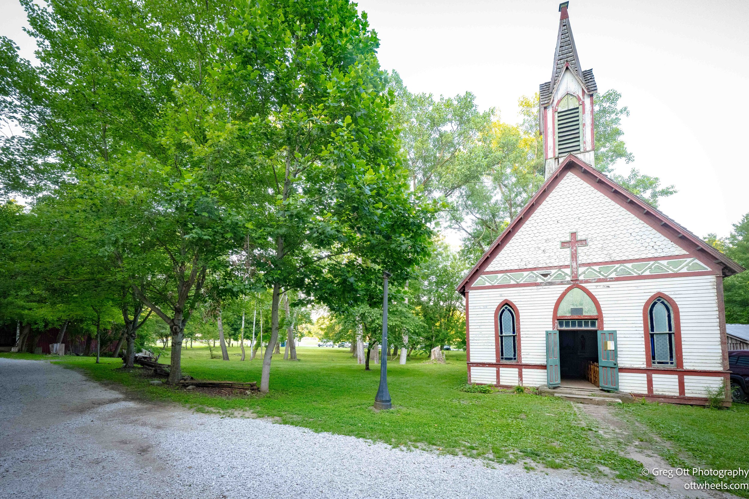
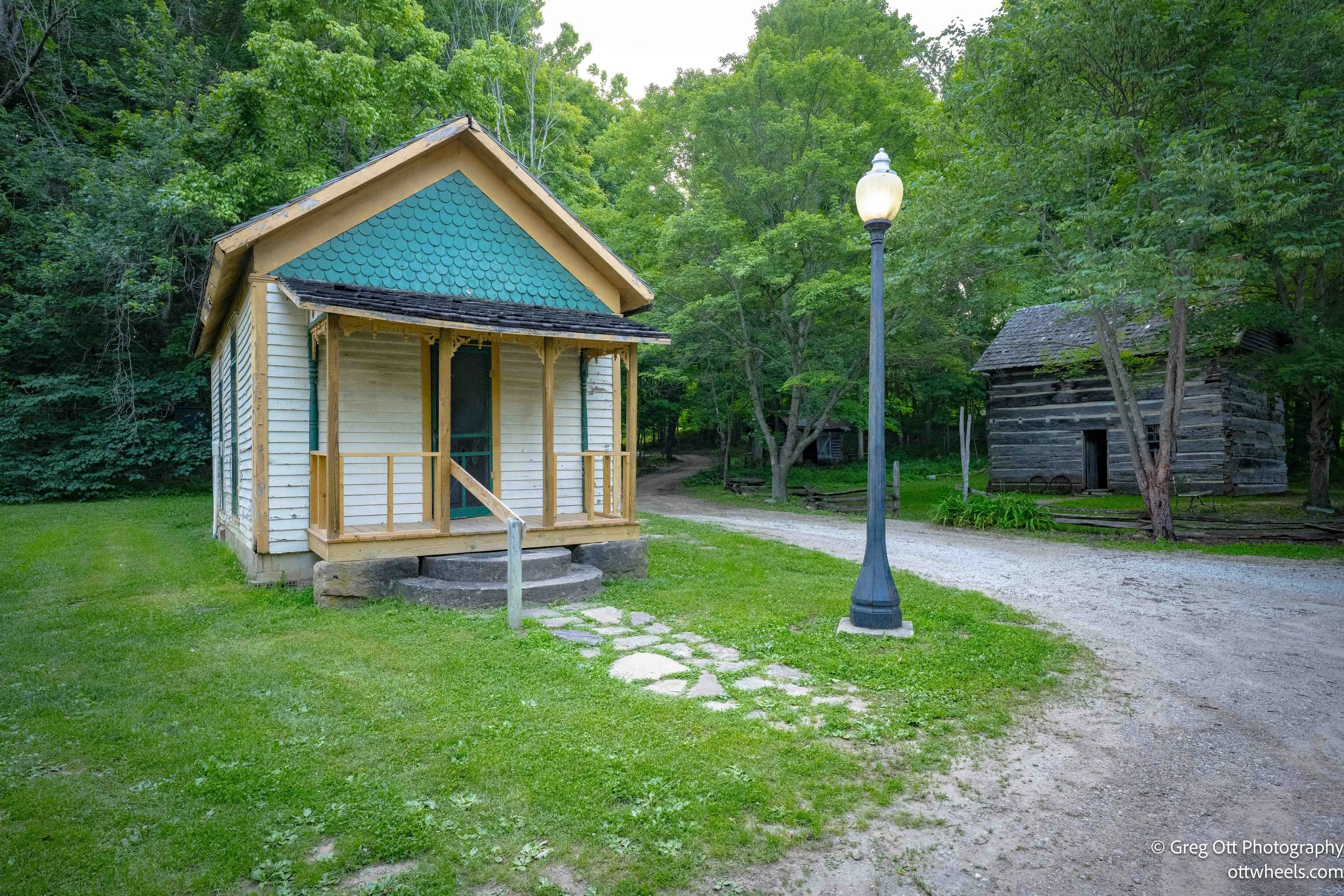
Marshall and Beeson are part of a little historic town called Billie Creek. After crossing Beeson, I found myself walking behind two people and asked if they knew anything about the place. The woman barely acknowledged me, but the man—dressed in full period clothing—turned around and told me the town was closed after 5 p.m. I apologized, noting the lack of signage. He agreed, then asked the woman if I could pass through anyway. She gave me a dismissive wave that I took as a reluctant yes.


Turns out the buildings had been relocated from across Indiana to preserve them. I took a few photos and left, feeling like I had trespassed on sacred ground. On the way back, I noticed a ticket booth—off to the side, with no real signage or funneling. One of those places where you just have to know.

After spending hours chasing down covered bridges, it hit me—photographing covered bridges is a lot like trying to capture the perfect lighthouse photo. It sounds romantic and timeless in theory, but in practice? It’s mostly a test of patience, persistence, and dumb luck. You need the right angle, the right light, and ideally, a moment where the bridge looks just a little more magical than the last five you shot. None of that happens at noon, under a sun that’s doing its best impression of a stadium spotlight. Harsh shadows, blown highlights, and a bridge that—if we’re being honest—looks exactly like the one you saw 40 minutes ago. Still, I kept at it, hoping one of them would surprise me, or at least give me a decent excuse to stretch my legs and pretend I was working on something profound.
On the way out, I swung by a grocery store in Rockville. Dollar General, Country Dollar, and Kirby Foods came up. Kirby had fresh produce and… lots of processed food. I grabbed what I could, but didn’t find everything I needed.
As the sun began to set, I raced back to the farm, hoping to catch a photo of the big orange fireball dipping behind endless rows of corn. A hot day, a long one, but in its own way—pretty great.