Theodore Roosevelt National Park (North Unit)
The sky was a perfect deep blue as I finished breakfast. I’d spotted the trailhead the night before and decided to ride about five miles out and back. For context, the full Maah Daah Hey Trail stretches 144 miles, running through the National Grasslands and linking all the way down to the South Unit of Theodore Roosevelt National Park. Hardcore riders tackle the whole thing on mountain bikes, camping along the way.
Maah Daah Hey Trail
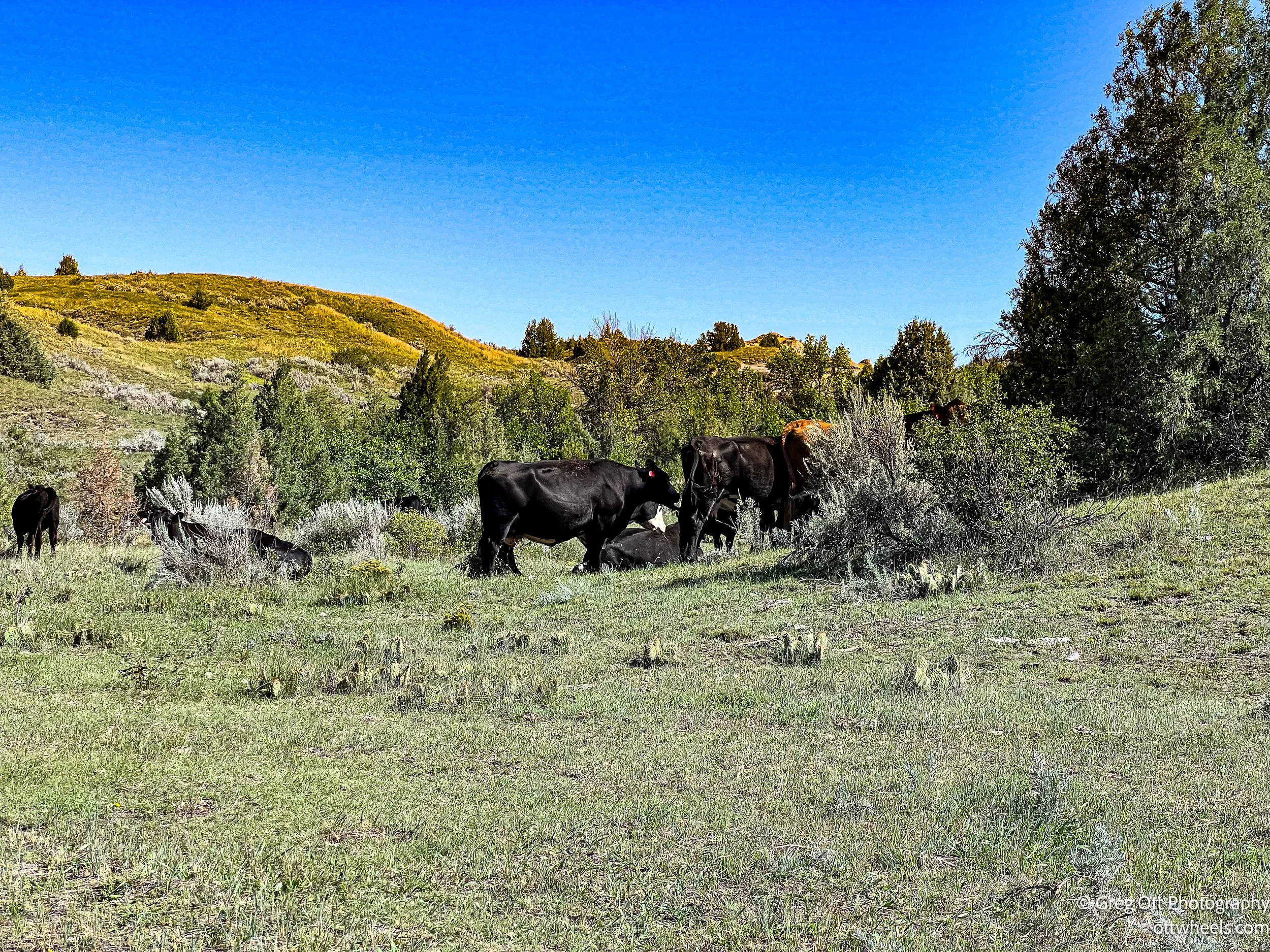
From the start, the trail climbed steeply out of the park. Years of bike traffic and erosion had carved deep ruts, and I found myself navigating narrow gullies and rocky pitches. I stopped often for photos—the distant buttes, the river winding below, and the prairie vegetation all around. A few sections were so rutted I had to get off and walk. At one point, a cow sat squarely across the trail, staring me down. I’ve been charged before when calves were nearby, so I eased around carefully, keeping an eye on her. She stayed put, and I pedaled on, dodging cow patties along the way.
Eventually I reached a fork. My route went straight, but a caution sign warned of a ravine dropping off into the distance. Off to the left, I saw women with children walking a gentler path uphill. I followed them and learned they were locals who regularly bring their kids out for hikes. They told me the trail looped back to the campground, and it turned out to be a far smoother ride for my gravel bike. A few steep climbs, but the erosion was minimal. At the top, I could see my van off in the distance, and from there it was an easy downhill back.
Later, I relaxed at camp until the host stopped by. He’d been looking into why I couldn’t book more than one night through the app, but I told him I’d already sorted it by reserving another night that morning. He stayed to chat for nearly an hour. A former Marine helicopter crew chief, he was now living with severe back injuries. Doctors had wanted to operate on multiple levels of his spine last December, but instead someone suggested yoga. Since then he’s been practicing yoga, Tai Chi, and Qigong. His eyes lit up as he told me it changed everything—not that the pain was gone, but it was manageable. Before, he said he wasn’t sure he had a reason to live. Now, movement and breathwork have given him one.


Theodore Roosevelt National Park
I stayed at the CCC Campground just outside the North Unit of Theodore Roosevelt National Park, right along the Little Missouri River. It’s a simple, first-come-first-served spot with vault toilets and picnic tables, but the setting makes it worth it. The campground is part of the Little Missouri National Grassland, the largest National Grassland in the country at more than a million acres. These “National Prairies,” managed by the U.S. Forest Service, protect huge stretches of open grassland, badlands, and river breaks while still allowing for grazing and recreation.
Theodore Roosevelt National Park was established in 1947, long after Roosevelt’s time in the Badlands. He first came here in 1883 to hunt bison, but it was tragedy that brought him back. In 1884, both his wife and his mother died on the same day. Roosevelt returned to the Badlands to grieve and ended up ranching here for several years. Those years shaped his conservation philosophy, which later influenced his presidency—creating national parks, forests, and wildlife refuges on a scale the country had never seen before. The park that bears his name now protects about 70,000 acres of this rugged country, split into three units: the South Unit near Medora, the smaller Elkhorn Ranch Unit where Roosevelt’s ranch once stood, and the more remote North Unit near Watford City.
North Unit
I’m writing this days after I saw both the North and South units. The North Unit feels different than the rest. It’s more dramatic, less crowded, and in many ways more like the landscape Roosevelt would have known. Sheer canyon walls, twisting ridges, and the Little Missouri cutting through the middle give it a wilder edge. The park road stretches just 14 miles one way, but it packs a lot into those miles.
Mile 0-2: Entrance, rolling badlands, wildlife sightings
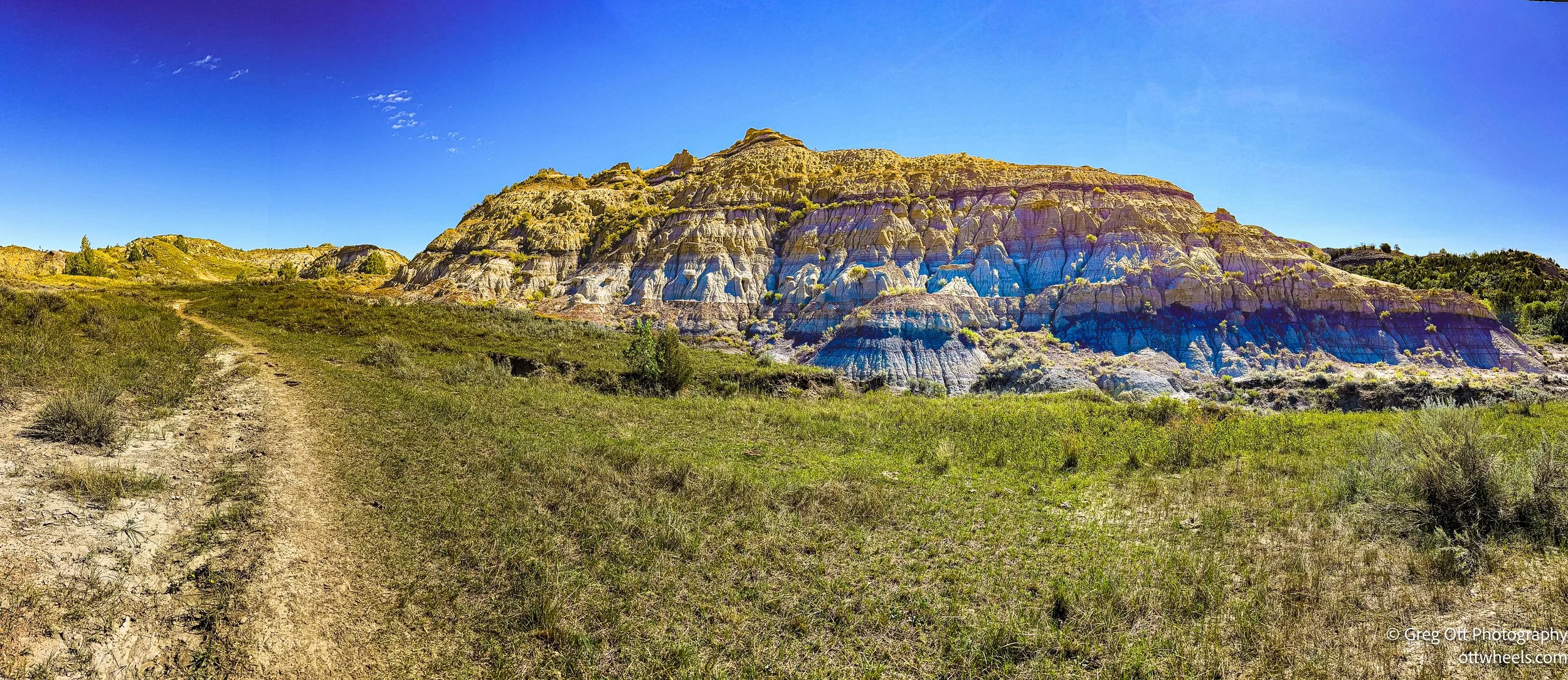
In the first couple of miles (0–2), the road pulled me quickly into the heart of the badlands. Striped buttes and broken ridges rose up from the prairie, and the landscape immediately felt rugged and remote. Rolling hills gave way to eroded cliffs, and I settled into the drive, taking in the shifting colors of the rock and soil.


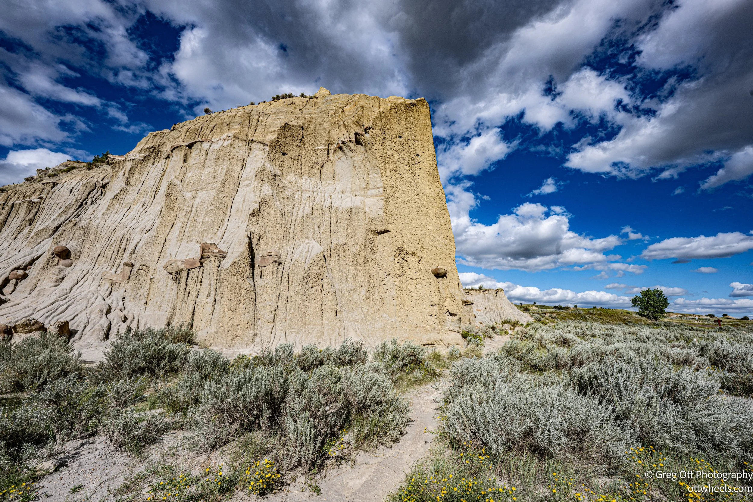
Slump Block Formations
Slump blocks are massive chunks of rock that once broke away from the cliffs and slid down to where they sit now. In this case, the Little Missouri River undercut the base of the cliff, leaving a huge section unsupported until it finally gave way. The block dropped more or less intact, rotated as it slid, and came to rest at the bottom. Over time, rain and erosion widened the gap between the cliff and the block, leaving the big separation you see today.
You can actually match the layers and striations on the slump block with the cliff face above to see exactly where it used to be attached. It’s like lining up a puzzle piece that fell out of place. Once you see it, it’s easy to imagine the scale of what slid off and how far it traveled. And once you notice one, it makes you start looking for other slump blocks scattered across the valley.

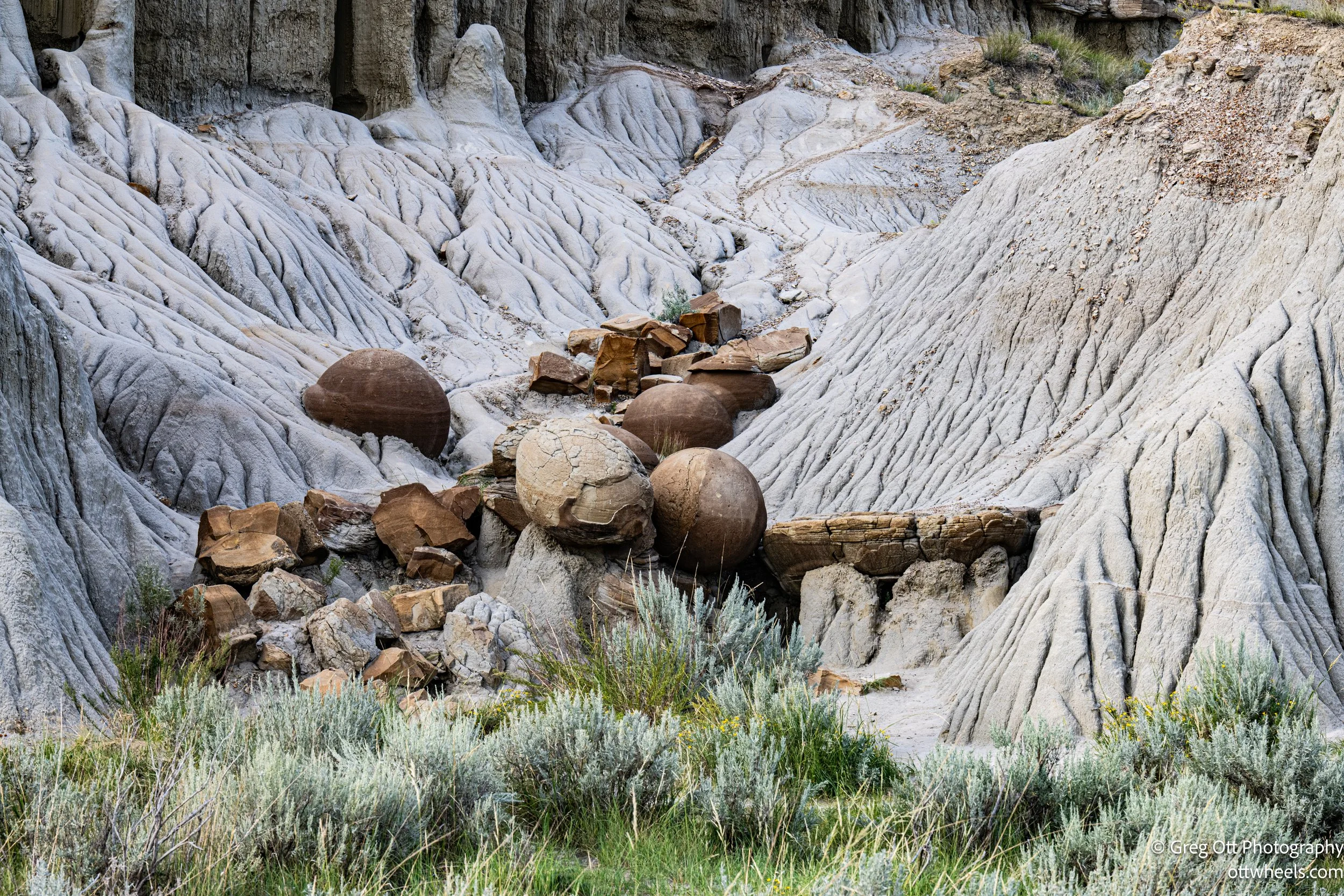
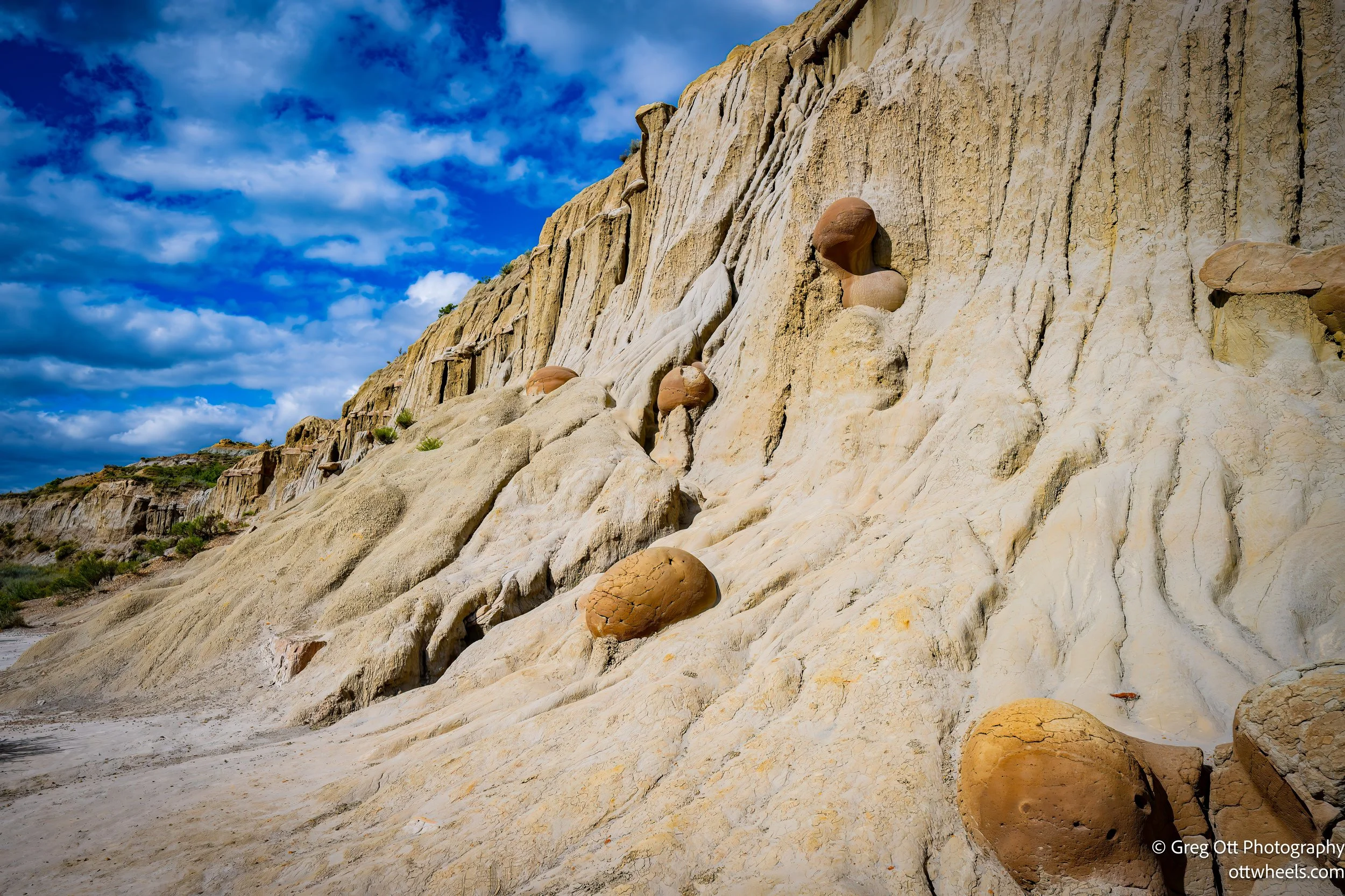
Mile 5: Cannonball Concretions pull-out
The Cannonball Concretions were one of my favorite parts of the North Unit. These perfectly round rock formations look like someone scattered giant marbles across the hills. In reality, they were shaped over millions of years by erosion. They’re odd and out of place against the jagged backdrop, which makes them worth the short stop.
Geologists don’t fully agree on exactly how they formed, but the general process is understood. A concretion is a hard, rounded mass of mineral matter that develops inside softer rock. In this case, millions of years ago, mineral-rich groundwater seeped into sandstone and began cementing grains together around some sort of nucleus—maybe a fossil, a piece of organic matter, or just the right chemical conditions. The cementing spread outward evenly in all directions, producing those nearly perfect spheres.
What makes these Cannonballs unusual is their size and uniform shape, which are both rare in concretions. Most are irregular, but here they came out strikingly round and massive. Over time, erosion removed the softer sandstone around them, leaving the tougher spheres behind, scattered across the hillsides. It was interesting seeing them up close.

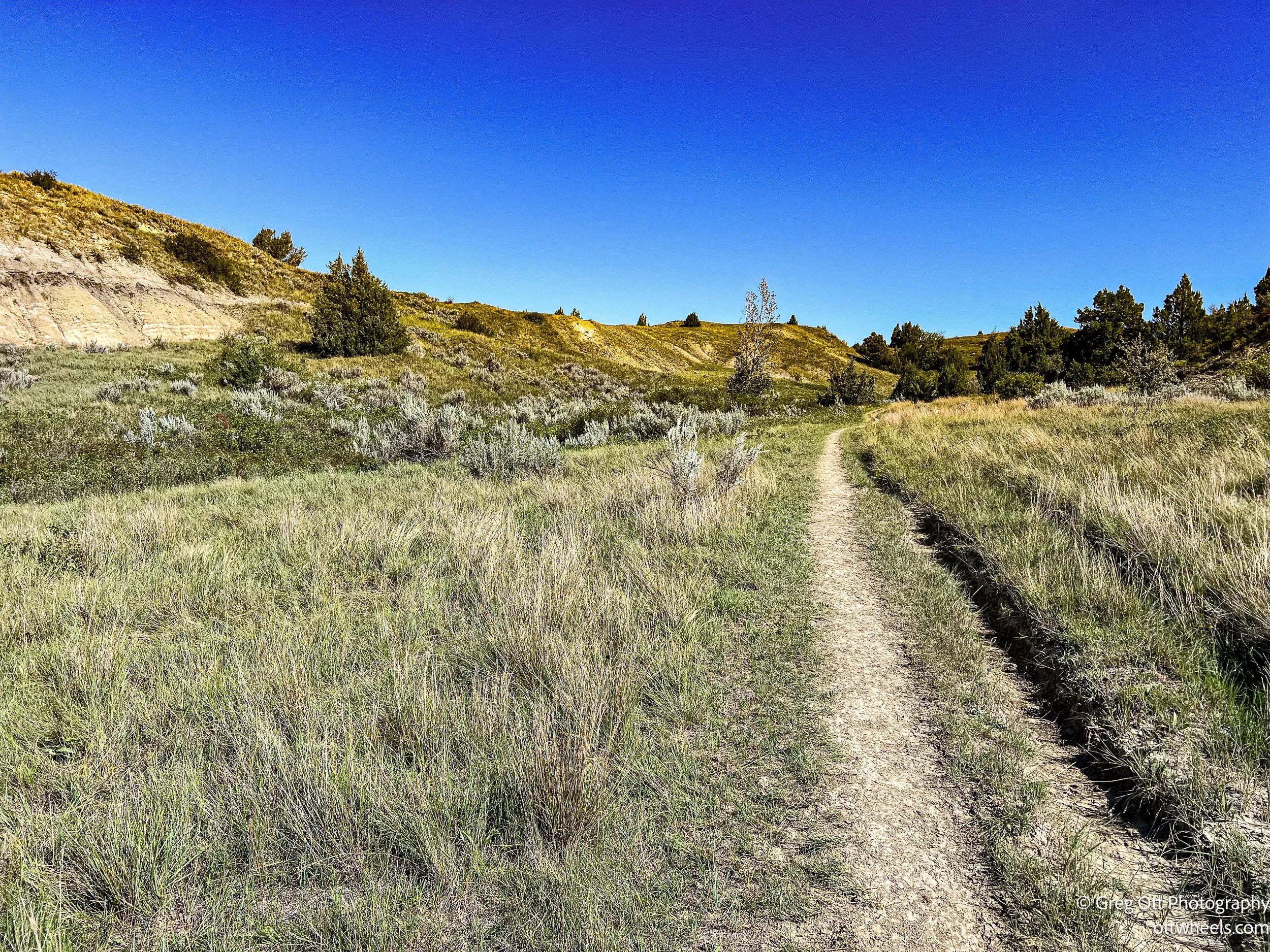
Long X Trail
The Long X Trail was once part of a major cattle route in the late 1800s, used by ranchers driving herds north from Texas through the badlands. They came for the open grazing in the Dakota Territory and to ship cattle east by rail once the herds reached the northern lines. Named after the Long X Ranch, the trail carried thousands of cattle across this rugged country before the open range days ended. Today, it’s a 10-mile backcountry trail inside the North Unit of Theodore Roosevelt National Park, connecting Juniper Campground to Oxbow Overlook. Hikers and horseback riders now follow the same route, trading cattle drives for sweeping views of buttes, coulees, and the Little Missouri River.


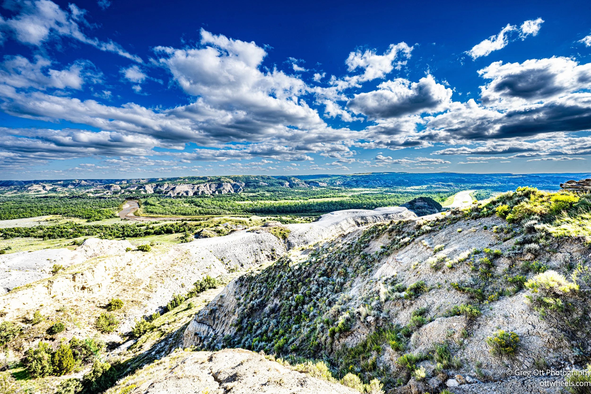
Mile 7: River Bend Overlook with valley vista
By about mile 7, the climb out of the valley brought me to River Bend Overlook. It’s one of those stops you can’t just drive past. From the stone shelter, the Little Missouri River stretched far below, looping across the valley floor. I stood for a while just tracing the bends with my eyes, trying to take in how much the river has carved out of this country over time.


Mile 8-13: Rim drive through mixed terrain and solitude
From there, the road followed the rim of the badlands, mile after mile. The views opened up across plateaus and deep valleys, the kind of country that feels both empty and endless. The quiet was almost complete—just the wind and the crunch of gravel when I pulled off to take photos.

Mile 14: Oxbow Overlook—river bend panorama
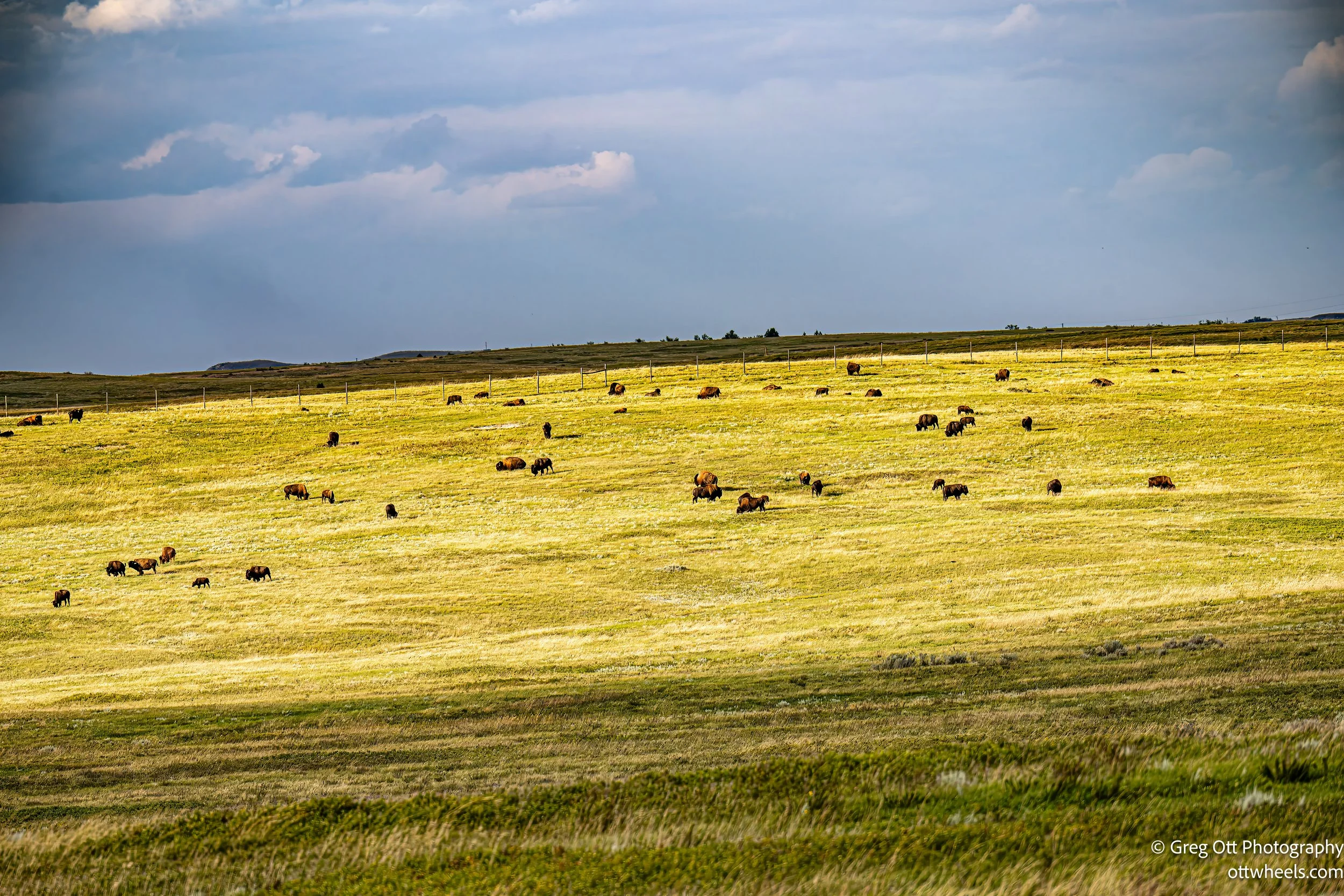
It wasn’t until a few miles before the end that I spotted animals. A herd of bison grazed near the rim, their massive shapes moving slowly across the grass. It set the stage for the final stop at mile 14: Oxbow Overlook. The Little Missouri makes a sharp oxbow bend here, curving like a giant horseshoe across the plain. The big open view, with bison still in sight, was the perfect way to wrap up the drive before heading back toward camp.


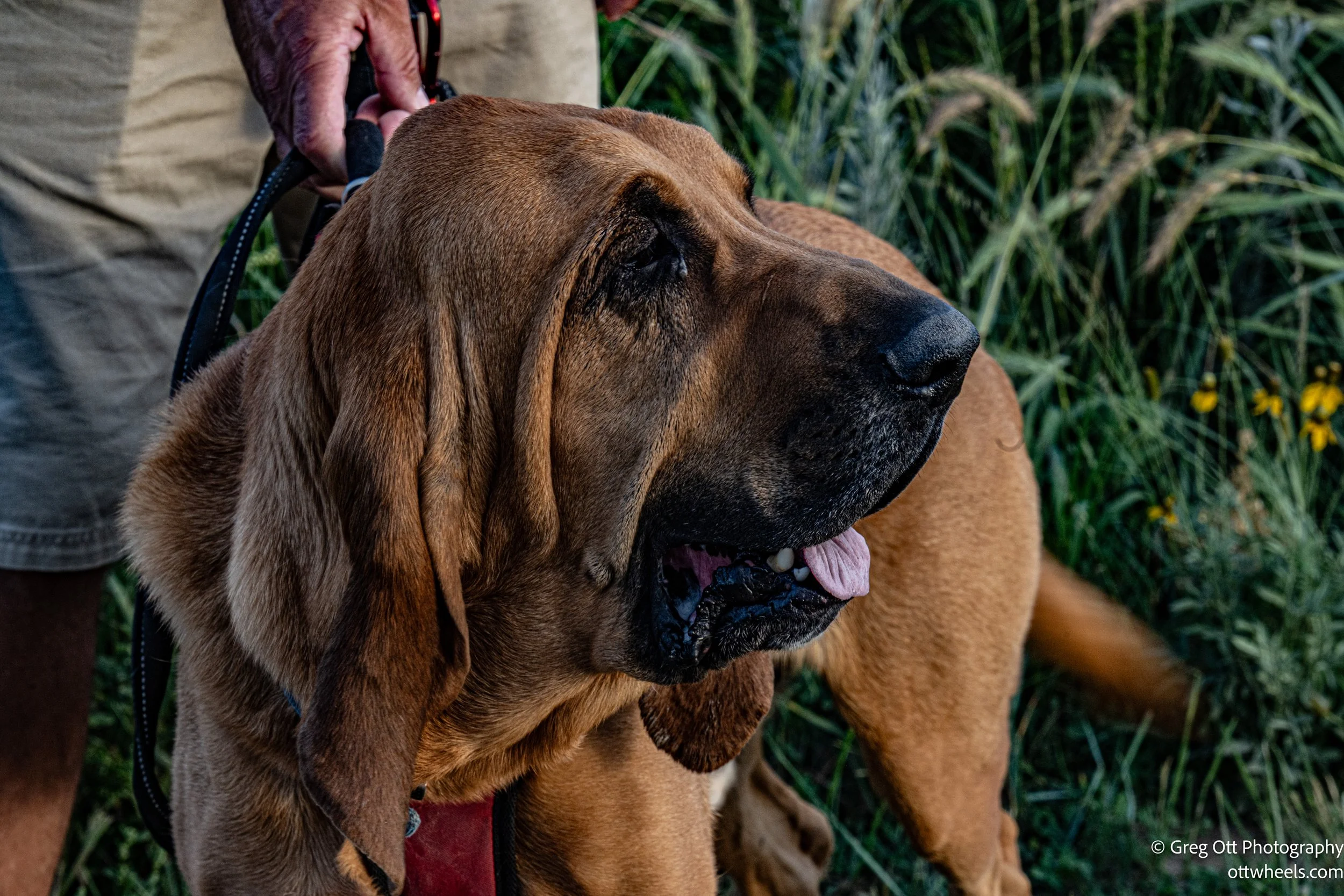
As I returned to the campground, Gene, the camp host, was walking his bloodhound. We got to talking, and he told me all about the dog’s incredible sense of smell. A Bloodhound can have more than 250 million scent receptors in its nose, compared to our five million. Gene explained how the long ears and loose skin actually help trap scent particles and funnel them toward the nostrils, giving the dog even more to work with. He said his hound could pick up a scents that were days old and follow them for miles without losing focus.
The campsite is a very quiet area and I made dinner, left the side door opened and watched as the sun set over the mountains. It was a very nice ending to a fascinating day in nature.